Downloaded 399 times


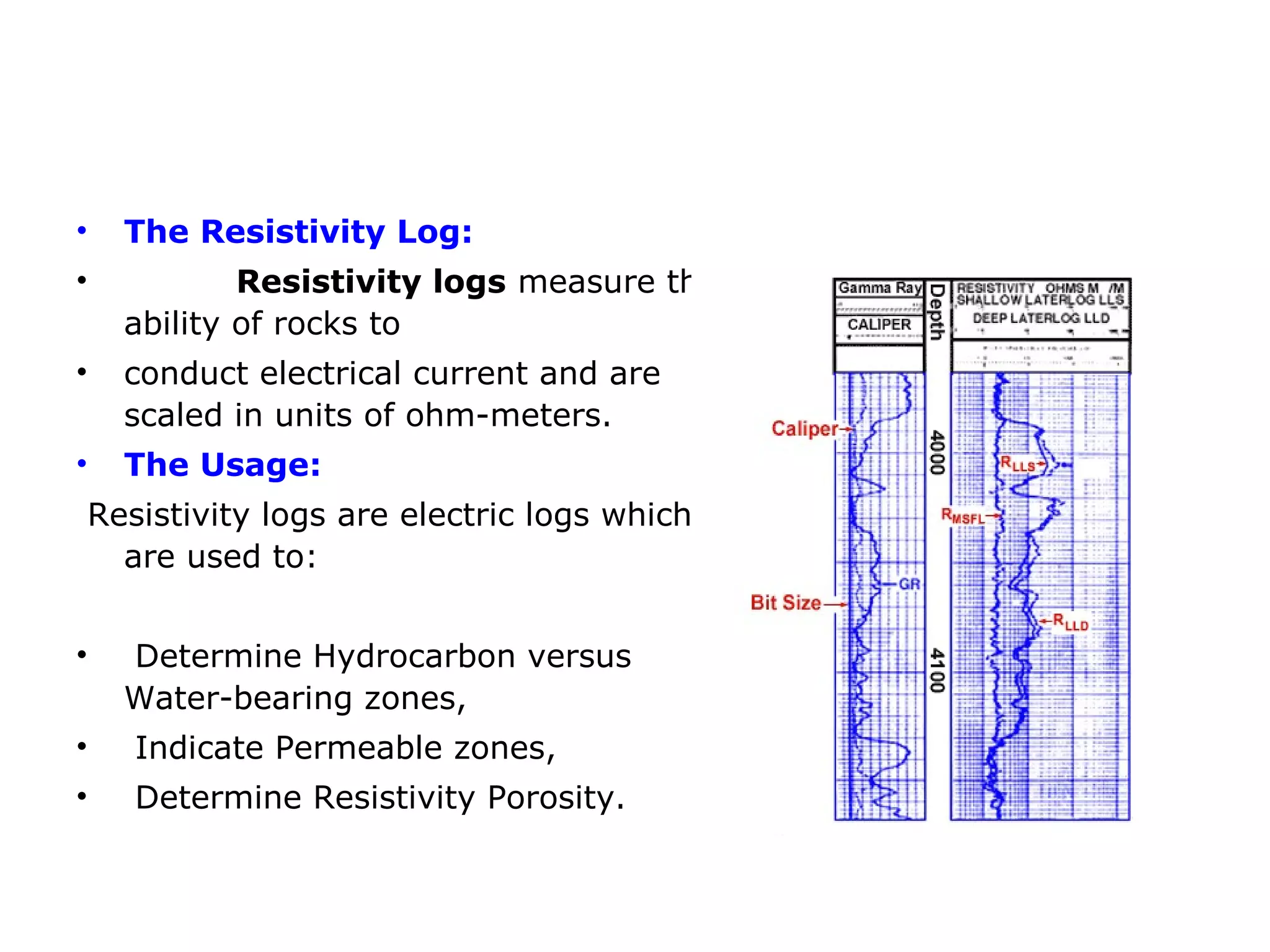


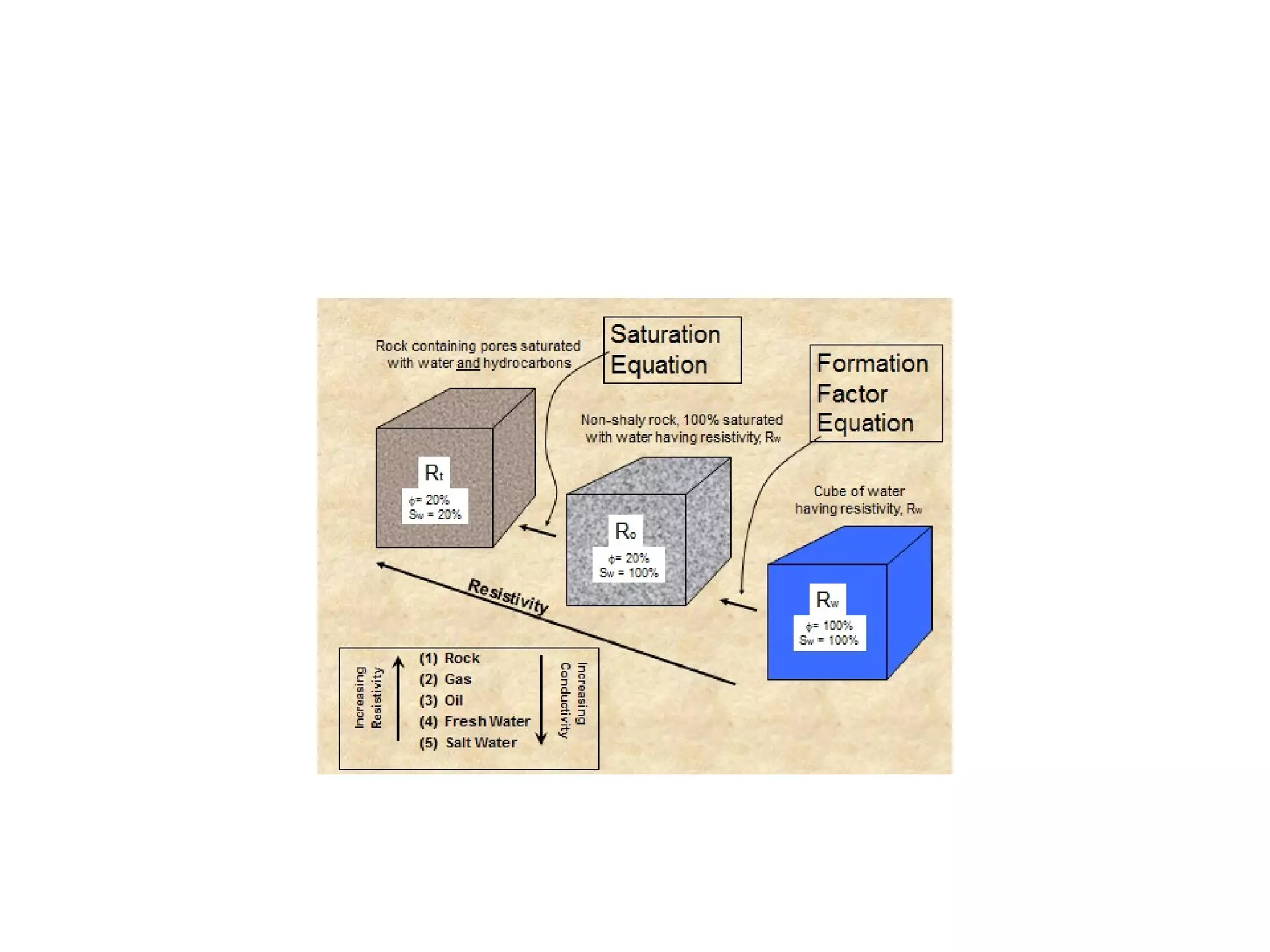
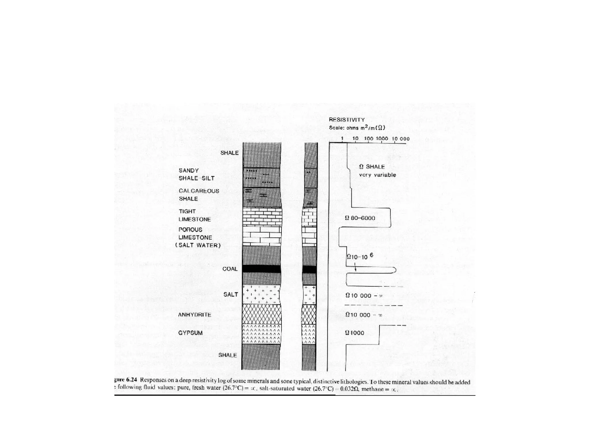


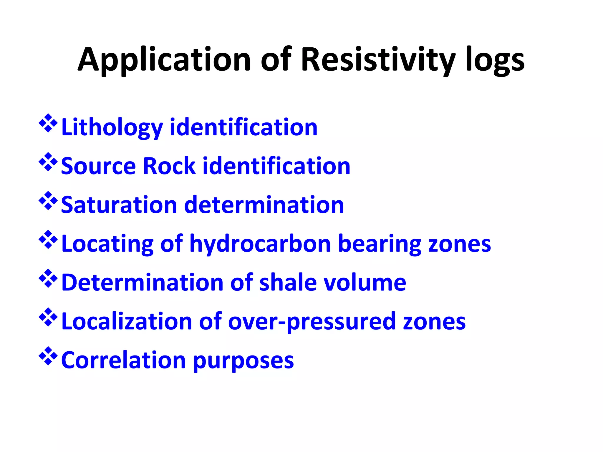


The resistivity log measures the ability of rock formations to conduct electricity. Higher resistivity indicates water-bearing zones while lower resistivity corresponds to hydrocarbon-bearing zones. Resistivity is dependent on factors like porosity, fluid salinity, and lithology. Resistivity logs are used to identify hydrocarbon zones, permeable layers, and estimate porosity. Log interpretation provides values for parameters like porosity, water saturation, and lithology which can then be used to calculate reserves and map reservoir characteristics.


