Downloaded 2,607 times


![Types of Well Logging
Logs can be classified into several types under
different category
Permeability and lithology Logs
• Gamma Ray log
• Self Potential [SP] log
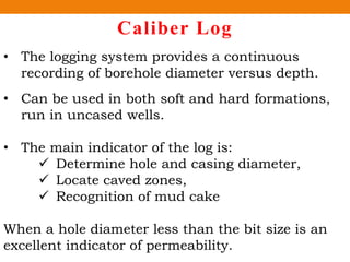
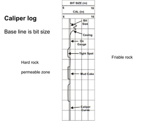
• Caliber log
Porosity Logs
• Density log
• Sonic log
• Neutron log
Electrical Logs
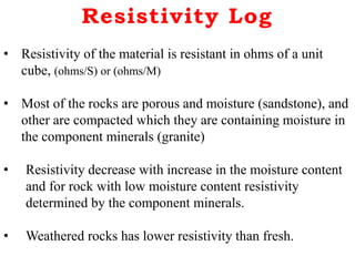
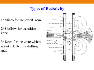
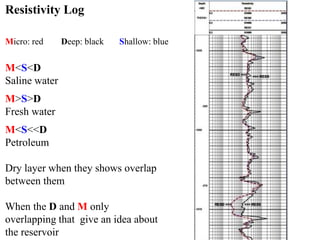
• Resistivity Log](https://image.slidesharecdn.com/welllogging-161102162140/85/Well-logging-5-320.jpg)


The document discusses the petrophysical properties of rocks, focusing on characteristics like porosity, permeability, and electrical conductivity. It explains various well logging methods used to gather data on rock properties during drilling, including gamma ray logs, resistivity logs, and sonic logs. Emphasizing the importance of combining multiple log types for accurate determination of lithology and hydrocarbon content, it concludes with references for further reading.


