Downloaded 17 times
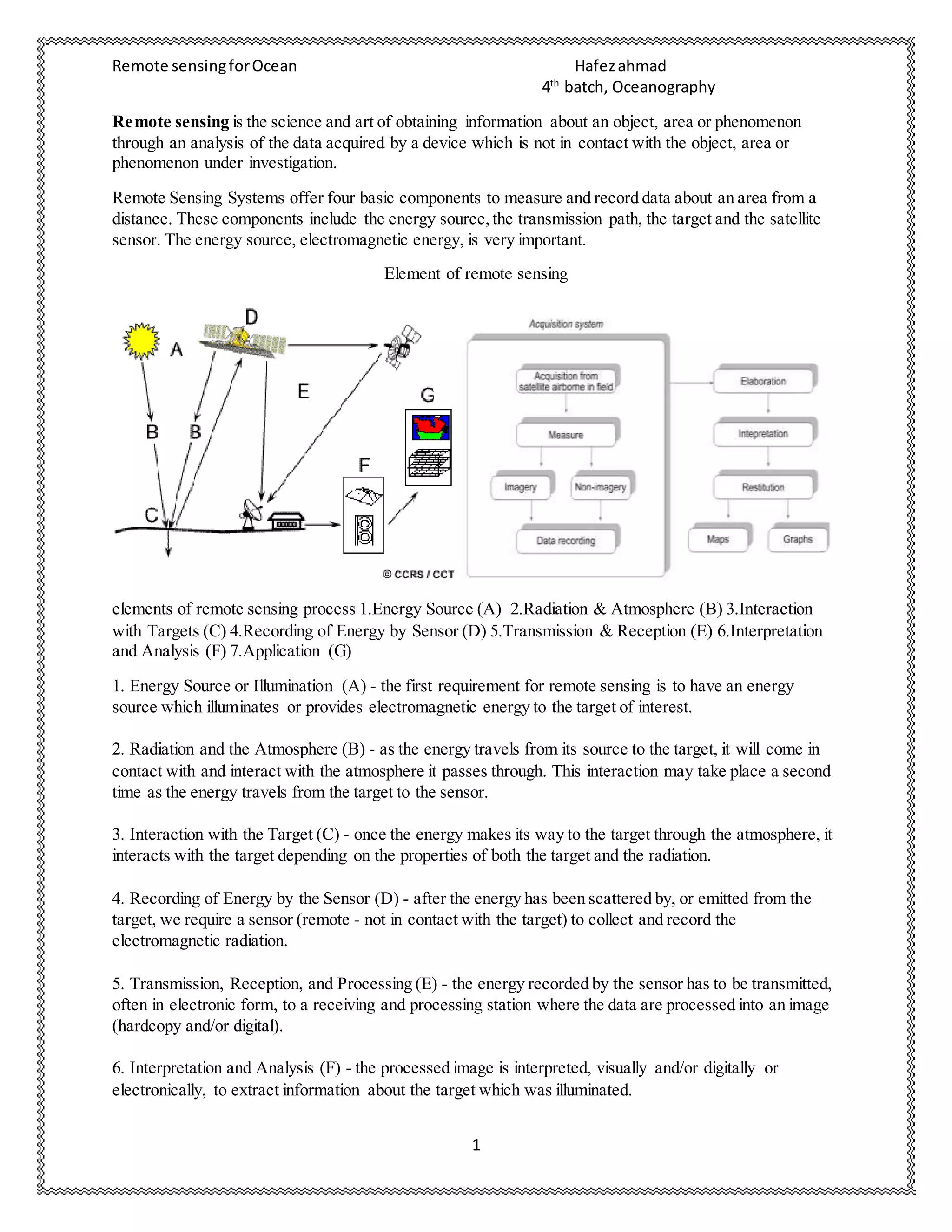


1. Remote sensing involves obtaining information about an object or area through analysis of sensor data without physical contact. It has four basic components: an energy source, transmission path, target, and sensor. 2. The remote sensing process has seven elements: energy source, atmosphere, target interaction, sensor recording, transmission, interpretation, and application. Different sensors and techniques are used for passive and active remote sensing. 3. Remote sensing data can be used with GIS for applications like land use mapping, change detection, natural resource management, and hazard assessment. When combined with geospatial analysis and modeling capabilities, remote sensing and GIS are powerful tools for studying the coastal zone.


