Public Realm
•
0 likes•735 views

The document discusses various types of public realm spaces, including corporate spaces, domestic spaces, consumption spaces, civic spaces, and in-between spaces. It provides examples and characteristics of each type. Corporate spaces include office parks and shopping malls, dominated by surrounding corporations. Domestic spaces are near residential areas for neighbors to socialize. Consumption spaces feature retail and markets. Civic spaces represent a city's history through monuments. In-between spaces are residual areas that can be integrated or derelict. Good public realms consider streetscapes, built form, and urban design to invite various uses through continuous pedestrian routes and active spaces.

Recommended
More Related Content
What's hot
What's hot (20)
Similar to Public Realm
Similar to Public Realm (20)
More from Mitiksha Jain
Recently uploaded
Recently uploaded (20)
Public Realm
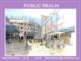
- 1. PUBLIC REALM Subject: Urban Planning Sem: 09 Group 05 Bhagwan Mahavir College of Architecture, Surat
- 2. PUBLIC REALM • Public realm is all areas of the urban fabric to which the public have access. It is where physical interaction takes place between people. It therefore, includes buildings and their design, streets, squares and parks, from signage and street furniture to the microclimate • Public space/realm is defined as space that is shared communally by the public. • Public space is intimately linked to the ideas of universal access, the common ground, and shared amenities. • Examples include parks, plazas, pedestrian pathways, and streets, indoor spaces such as atriums, shopping centres, and community centres. • The public realm belongs to everyone. It comprises public urban spaces and other outdoor places that require no key to access them and are available, without charge for everyone to use. • Public spaces should not be seen in isolation but in the context of its adjacent buildings, their uses and its location in a wider network of public and private space. • The three key elements that influence the public realm are: • The buildings that enclose and define the space; • The space itself; and • The people that inhabit the public realm and the way • they use the space.
- 3. AIM OF PUBLIC REALM • Essentially the public realm is a place for individuals to come together as a community and experience the place • This can occur in such a way where the user of the public realm is either directly or indirectly participating in the public life • Public space is integral to the concept of liveability and the social, economic and environmental viability of communities • Planning and design of the public realm often excludes the end user thereby creating inappropriate and meaningless spaces. • An analysis of form and function through use, access and perception is useful in terms of planning for a liveable environment that is valued by the local and surrounding communities
- 4. THERE ARE FIVE IDENTIFIED TYPES OF PUBLIC SPACES • CORPORATE SPACES • DOMESTIC SPACES • CONSUMPTION SPACES • CIVIC SPACES • IN-BETWEEN SPACES
- 5. CORPORATE SPACES • Corporate spaces are usually privately owned spaces characterised by the corporate entities which bound them. • These spaces are predominantly used by workers of the surrounding corporations, but may host other user groups temporarily. Distinguishing characteristics: • Corporate spaces are commonly created by commercial developers. • They are used primarily by office workers for meeting colleagues, smoking and lunch breaks. • Impressive architecture, high quality materials, and Public art. • Visible security and effective maintenance of the space • Promotion of retail & commercial activities Examples: • Hotel lobbies/foyers, Shopping mall, food court, Airport terminal, office park square, university squares etc.
- 6. Challenges: • Un-integrated spaces can appear to create a level of conflict and competition between permanent fixed retail and informal market vendors in stalls. • Providing shelter or shade to create a more comfortable pedestrian experience. • Provision of site amenities, landscaping and street furniture for pedestrians • Flexibility and adaptability of the space • Contextual relationships of the space and the site • Commercialisation / homogenisation and exclusivity of space. CORPORATE SPACES • Omnipresent security intimidate and portray a feeling of unwelcome towards visitors of corporate spaces. • Extended use of space not always encouraged due to dominant ownership. • Due to Branding, corporate spaces frequently use similar design styles and materials. This can lead to homogeneity. • Visual accessibility is not always visible.
- 7. CORPORATE SPACES • Corporate spaces should provide a safe area that has enough capacity to accommodate the extremes of pedestrian traffic. • Adequate lighting and security • Corporate spaces should provide a comfortable area that is welcoming, inviting and inclusive. • landscaping and public art • Well established management regime • Use of high quality materials • Provision of retail space and branding Design requirements • Vibrancy, safety and comfort • Provision of furniture and shade • Accessibility, Diversity, Flexible and adaptive • Shopping units and food courts • Passive and active recreation. • Creating a ‘transitionary zone’ between the retail venues and the public realm helps increase the active frontage • Effective pedestrian circulation and stall groupings.
- 8. • Architects: 3deluxe • Location: Kaunas, Lithuania • Area: 30000m² • Year: 2020 V-Plaza • This is certainly the new now in Kaunas, a city in Lithuania which, with the help of 3deluxe, has brought to life a future- oriented architectural concept that sets new impulses and is geared towards the communicative needs of a young and dynamic generation. • The history-steeped “Unity Square” with its impressive buildings from different eras has been redesigned to reflect the innovative spirit of a country considered to be a pioneer of digitization. • The extraordinary design sets off the extensive façades to bright and cheerful effect, creates modern workspaces, and uses organically shaped green spaces, curved pathways, seating levels, and the latest technology to transform the space into inspiring terrain with an urban ambiance.
- 9. The real challenge was to preserve cultural heritage while creating space for social transformation. And the solution was innovative architecture that caters to the needs of today’s society: bright, friendly, open, and connecting.
- 10. DOMESTIC SPACES • Domestic spaces are public open spaces in close proximity to a cluster of homes and residential developments, domestic squares offer a space for both formal and informal social activity. • A local environment for people of all ages to play, to relax, to enjoy the sun, to meet their neighbours Distinguishing characteristics: • Predominantly characterised by the residential uses that surround them. • A space were residents involve in many recreational or relaxation activities. • Defines a neighbourhood scale and identity in the context of working environments • Provides a degree of intimacy and seclusion within the dense and bustling urban fabric. Examples: • Balconies and terraces, courtyards, community parks,
- 11. Challenges • Failure to achieve balance of actives • Intimacy, safety and comfort • Natural surveillance • Sense of Ownership • Poor maintenance Design requirements • Engagement: Creating Responsive Spaces • Inclusive & Sustainable Spaces • Use of different materials is an important tool for defining spaces and pathways. • Designation of primary and secondary movement corridors through the square and clustering of activity types • Provision of intimacy, furniture and shade • Accessibility, Flexible and adaptive. DOMESTIC SPACES
- 12. Hyperlane Linear Sky Park • Architects: ASPECT Studios • Location: Chengdu, China • Area: 1300 m² • Year: 2020 • Hyperlane is a 2.4km multi-level linear sky park, youth culture and lifestyle destination at the heart of the Sichuan Conservatory of Music University in Chengdu. It establishes a vibrant and fun youth, music and life orientated linear space, linking the local transportation hub with the university community and campus in Chengdu. • The Urban Gallery, the Initial phase of the project has recently opened. Hyperlane is invested, built, and operated by the core team that once operated Chengdu Taikoo Li project. The overall planning and design intents to create high standards and high-quality design.60% of the commercial products is self- sustaining, adheres to the long-term business philosophy, provides professional support, and realizes long-term commercial value.
- 13. The Urban Gallery The Urban Gallery was the first phase of the Hyperlane project and a sociality orientated, pocket place for the community to come together. Defined by the simple notion of ‘community and connection’, the Hyperlane Urban Social Gallery is a bold, vibrant youth- oriented point of identity that reflects the artistic and creative culture of the district.
- 14. CONSUMPTION SPACES • Consumption spaces are public open spaces, part of the public realm where ‘consumption’ activities are predominant. • Often a combination of fixed retail, informal trade and mobile temporary stalls. They are by essence places where people meet, trade, recreate and exchange. Distinguishing characteristics: • Three main spatial typologies have been identified: • The corridor shape is usually characterized by a linear continuity of the shop frontages and a relatively narrow width between the building frontages. • The square shape is a typical square surrounded mainly by retail venues at the ground floor. • The crossing of streets very probably generated by the “natural” meeting occurring at such places. • Presence of shops, stalls and external seating
- 15. Nest Experience • Architects: Tinker • Location: Vevey, Switzerland • Year: 2016 • Area: 6626 m2 • The Swiss Concept Consult Architects renovated the industrial heritage site and covered it with a magnificent glass roof and steel construction. Underneath, Tinker designed a large, floating, organic world made up of white, flowing forms and containing a dozen playful exhibits.
- 16. The big idea behind nest was simply to become more transparent and engage in an honest and involved dialogue about what the company stands for. Visitors will receive an interactive and personal look behind the scenes. They will accompany the enterprise on a journey through the past, present and future. Nestlé displays its diversity across five different zones, with ‘care, enjoy, improve & share’ as the motif.
- 17. CIVIC SPACES • Civic spaces are an essential component of the city’s suite of open spaces and broader public realm. • They help characterise the city or town’s history, and acts as vital spaces for people to interact with political leaders. Distinguishing characteristics: • A forecourt to civic buildings, often with at least one frontage addressing the main entrance or façade. • A setting for monuments, statues and other memorials or public art installations. • Designed for pedestrians and adaptable to cater for civic events and meetings. • High quality materials & finishes. • Grand, symbolic and of national and local significance.
- 18. Challenges: • Exclusionary, isolated, impermeable, inaccessible and over managed space Design requirements • Symbolic: reflect the history and character of the community. • bring the community together and act as a centre. • Adaptable: Flexible to changing time and various seasonal uses. • Inclusive: People from all walks of life should be able to relate to and enjoy using the space. • Accessible: Encourage movement to and/or through the space and pedestrian friendly • High quality: Design, materials, art work, sculpture and finishes contribute to a consistent and legible urban environment. Trafalgar square, London CIVIC SPACES
- 19. IN-BETWEEN SPACES • In-between spaces are the residual elements of the city, which evolve out of an ever- changing urban fabric. • in-between spaces present flexible environments, which offer potential locations for diverse and unexpected activities and future developments. Distinguishing characteristics: • In-between spaces can be divided into three categories: • the good, the bad, and the ugly. • Good in-between spaces are those, which have become successfully integrated with their surroundings physically and/or functionally; minimizing internal conflicts • Bad in-between spaces are those that have failed to meet their full potential, despite having been incorporated into the planning process. • Ugly in-between spaces refer to spaces in the urban environment that have been forgotten and fallen into dereliction.
- 20. Challenges • Isolated and unutilised • Dangerous, unfriendly and uncomfortable • Awkward shapes and layouts • Cluttered, dirty and not maintained Design requirements • Provide a sense of identity in a space can be encouraged and controlled by surrounding buildings, culture, history and urban furniture. • Natural surveillance and safety • A diversity and flexibility of land uses, providing varying uses overtime (days, week, seasons, etc.) • Aesthetic elements such as vegetation, which enhances the time spent in the space • Include some memorable functions and designed spaces: coffee shop, skate ramp, playground. IN-BETWEEN SPACES
- 21. 300 Ivy Street • Architects: David Baker Architects • Location: 300 Ivy Street, San Francisco, United States • Year: 2014 • The design was developed as a balance of inside and out: equally addressing the needs of residents for high- quality, modern, peaceful homes with the needs of the community for vibrant retail, a place for pedestrians, and a texture and scale that respects the surrounding buildings. • By moving the trees into planters between the street parking, pulling the building a few feet back from the property line, and lifting the first living floor off street level via indoor stoops, the design widened the sidewalk for pedestrians and buffered the townhouses from the fully public realm.
- 22. The neighborhood-inspired pattern of bays creates unique edges for the units, adding interest. The rooftop has an outdoor entertaining kitchen, a lavish protea garden, and a patio for lounging. A perimeter of bamboo defines the common space, which is lined with planters available to residents for gardening. An emphasis on the corner bays creates a gateway feeling as the busy one-way traffic approaches the heart of Hayes Valley.
- 23. URBAN SPACES in Surat International business center Nanpura corporate buildings Diamond bourse COPORATE SPACES
- 24. DOMESTIC SPACES Joggers park Sarathana park Jyotindra dave garden CONSUMPTION SPACES Night bazar Mall serving as consumption space URBAN SPACES in Surat
- 25. CIVIC SPACES IN-BETWEEN SPACES Indoor stadium Dumas beach Prime shoppers Panas gam garden URBAN SPACES in Surat
- 26. CHARACTERISTICS OF A GOOD PUBLIC REALM Streetscape • Streets are delightful and offer attractions and rewards: reasons to walk and explore. • Sidewalks are comfortable, with room to pass and pause, and places to rest. • Streets and public spaces invite a range of uses; not just necessary ones, but optional and spontaneous ones as well. • Pedestrian routes are continuous and have options. • Streets and public spaces are used well and have value; there are no empty or neglected places. • The street network provides for multiple modes of transportation and promotes walking and biking.
- 27. Built Form • The built form has an immense impact on the character of the space and its success in a neighbourhood. • The design of the built form can be categorised into three components, base, middle and top: • The Base should contribute to the quality of the public realm, having active frontages, awnings, lighting and high quality materials; • The Middle should compliment the architectural features of the base and the top by including windows and a material typology that is visually cohesive with the base and top • The Top consists of the roof and cornice treatment for smaller buildings and on larger buildings this also includes the mechanical penthouse. CHARACTERISTICS OF A GOOD PUBLIC REALM
- 28. URBAN DESIGN As a focus on physical improvement of public environment.
- 29. • A successful city cannot operate efficiently in isolation from its environment. It must balance social, economic and environmental needs. • Poor urban designing and management can have grave results for the urban economy, the environment and society. • A well-managed urban environment is a key to economic development and poverty. • As our built environment expands, it is imperative that land development activities not compromise the long term quality of our environment. • Nature is very important for humans to survive and thrive, was provided by the natural world around us. • Due to the development of suburb areas into new urban cities ,cities are comparatively nature-poor. • And with inhabitants living busy lives, there are fears that people are increasingly disconnected through an extinction of experience from the natural world in both quality and quantity. INTRODUCTION
- 30. • In land use planning, urban open space is open space areas for "parks," "greenspaces," and other open areas. • The terms "urban open space" can describe many types of open areas. • Urban open space is a natural and cultural resource, synonymous with neither 'unused land' nor 'park and recreation areas." OPEN SPACES
- 31. • Open space is any open piece of land that is undeveloped (has no buildings or other built structures) and is accessible to the public. • Open space can include: • Green space (land that is partly or completely covered with grass, trees, shrubs, or other vegetation). Green space includes parks, community gardens. • Schoolyards • Playgrounds • Public seating areas
- 32. • Preserve natural beauty. • Improve ugliness. • Buffer unpleasent view and disturbing space. • Buffer between conflicting land use. • Two common types of land-use conflicts in urban areas are Residential industrial or residential-transport land-use • conflicts. • These can cause noise, air and water pollution. • Apart from the noise and gases released by factories, pollution is also caused by the vehicles which carry materials to and from factories, which can cause incessant noises and smoke. • Heavy road traffic also causes traffic congestion, affecting many nearby residents. • In addition to factories, the presence of main roads also • affects residents, causing the same problems as above. • Visual relief from manmade cityscape. OPEN SPACE RESIDENTS ROAD TRAFFIC BENEFIT OF OPEN SPACES
- 33. • URBAN SPACE is actual physical enclosure or its strong articulation by urban forms. e.g. In a plaza, we must be sufficiently enclosed on all sides so that our attention focuses on the space as an entity. • ‘Urban Space’ –Public Spaces within cities, created through arrangement of buildings and other built elements. • Related to concept of ‘Public Realm --Public Spaces, available for free use. • Focus of ‘Urban Activity’. All types of spaces between buildings in the town which include paths squares- gardens – parks. URBAN SPACES
- 34. They provide space needed for recreation. They give form and shape to the city. Functional importance IMPORTANCE OF URBAN SPACES Social importance They create chances for interaction between people. They preserve natural beauty.
- 35. They provide places for economic activities. Economic importance IMPORTANCE OF URBAN SPACES
- 36. • “Urban place" means any place to which the public or a substantial group of the public has access and includes, but is not limited to, streets, highways, and the common areas of schools, hospitals, apartment houses, office buildings, transport facilities, and shops. • A space with activity is know as place. • Urban Place is a 200,000+ square foot community made for living, learning, shopping, working and dining. • Urban design involves the arrangement and design of buildings, public spaces, transport systems, services, and amenities. URBAN PLACES Urban design is about making connections between people and places, movement and urban form, nature and the built fabric.
- 37. • Administrative centres – headquarters for government offices • Industrial Nelson heat tracing cable TYPICAL FUNCTION OF URBAN CITY Government communication headquarter Transport – ports, railway junctions, airline hubs Markets – places where agricultural products made in the surrounding area can be sold.
- 38. Residential Financial – headquarters of major banks, insurance companies etc. TYPICAL FUNCTION OF URBAN CITY
- 39. • INTERNAL 'PUBLIC’ PLACE or public institutions such as libraries, museums, town halls, hospitals and post offices. 1. EXTERNAL PLACE 2. INTERNAL PLACE • EXTERNAL PUBLIC PLACE as pieces of land that lie between private landholdings such as public squares, streets, parks, stretches of coastline, rivers. Open spaces lie between the private landholdings. TYPES OF URBAN PLACE
- 40. URBAN SPACE OPEN SPACE URBAN PLACE (EXTERNAL) URBAN PLACE (INTERNAL)
- 41. Gopi talav , Surat EXTRNAL URBAN SPACE Pal walkway, Surat Canal corridor, Vesu, Surat
- 42. PATHS Definition: The streets, sidewalks, trails, and other channels in which people travel. • They organize the mobility. Pattern of street network is what defines a city and makes it unique. Characteristics of Paths • They are defined by their physical dimension, size, shape and character of the buildings that line them. • They range from grand avenues to intimate small paths. KEVIN LYNCH’S 5 ELEMENTS OF CITY PLANNING NODES Definition: A common point where two or more roads meet to form a junction or square. The strategic focus points for orientations of squares and junctions. Importance: • To increase the perception of an active, urban corridor and to encourage more walking. • Strengthen the emphasis on alternative mode use in the corridor. • Contribute to the overall vibrancy, safety, and desirability of the area.
- 43. EDGES Definition: They are boundaries between two phases,Bodies of water (such as an ocean, river, or lake),Landforms (such as mountains and hills),Manmade structures (such as buildings, railroad tracks, walls, or highways). Characteristics of edges: Acts in a space by stopping it, more or less penetrable, or they may be seams, lines along which two regions are related and joined together. Street edges need to be oriented and/or adjusted for maximum light on the space between buildings, and not just for interior penetration, in order to encourage active street life. Edges that are seen from building to street
- 44. DISTRICTS Definition: Areas characterized by common characteristics, these are the medium to large areas, which have some common identifying character. Characteristics: • Distinctive physical characteristics might include ‘thematic continuities’, such as texture, space,form, detail, symbol ,function and building. • The presence of these and other similar attributes reinforce a district’s fabric, cohesiveness, and identity. • Good planning makes for liveable neighbourhoods, a safe and healthy community, and a sustainable economy. LANDMARKS • Definition: external points of orientation, easily identified objects– towers, spires, hills are distant and are typically seen from many angles and from distance, over the top of smaller elements. • Other landmarks – sculptures, signs and trees are primarily local being visible only in restricted localities and from certain approaches. • Importance: Functionally prominent structures have a major influence on the aesthetics of their immediate urban landscape; location, function of open spaces and landscape furniture.
- 45. Urban Design involves the design and coordination of all that makes up cities and towns: • BUILDINGS • PUBLIC SPACES • STREETS • TRANSPORT • LANDSCAPE ELEMENTS OF URBAN DESIGN
- 46. BUILDING IDENTIFICATION: • Buildings are the most pronounced elements of urban design. • They shape and articulate space by forming the street walls of the city. • Well-designed buildings and groups of buildings work together to create a sense of place. CHARACTERISTICS: • Variation in building height, volume and the way in which buildings are grouped together. • Contour • Facade Design-main doors • /openings, other fenestration, material, etc.
- 47. ROLES: • Height & Contour define sense of enclosure and visibility. • Openings lead to spatial structuring. • Facade Designs animate & personalize urban space. • Building forms are guided by specific uses of buildings. • As they have an impact on the streetscape, it is important that their forms respond to their surroundings. EXAMPLES: • Developments along Orchard Road, however, have shopping podiums with high-rise towers set further away from the road. This gives a sense of openness to the tree-lined pedestrian mall, that has become a signature feature of Orchard Road.
- 48. IDENTIFICATION: • Great public spaces are the living room of the city - the place where people come together to enjoy the city and each other. • Public spaces make high quality life in the city possible - they form the stage and backdrop to the drama of life. • Public spaces range from grand central plazas and squares, to small, local neighborhood parks. PUBLIC SPACES
- 49. CHARACTERISTICS: • Promotes human contact and social activities. • Is safe, welcoming, and accommodating for all users. • Has design and architectural features that are visually interesting. • Promotes community involvement. • Reflects the local culture or history. • Relates well to bordering uses. • Is well maintained. • Has a unique or special character. EXAMPLE: • Parks like Gardens by the Bay and the plaza in front of Cathay Building and School of the Arts (SOTA) provide respite in our high-rise city environment.
- 50. STREETS IDENTIFICATION: • These are the connections between spaces and places, as well as being spaces themselves. • Other pedestrian networks include pedestrian malls, promenades, covered walkways. • and link-ways, through-block links and overhead linkages. CHARACTERISTICS: • They are defined by their physical dimension and character as well as the size, scale, and character of the buildings that line them. • The pattern of the street network is part of what defines a city and what makes each city unique. • Well-connected pedestrian networks to allow people to move easily and comfortably within the city, and facilitate the use of public transportation. • It connects open spaces, points of interest and parks, and can be at different levels, allowing you to appreciate the city from different perspectives. EXAMPLE: • Walking to the Esplanade from City Hall MRT takes only about 15 minutes via the City Link underground pedestrian network. The link-way is also lined with shopping and dining options.
- 51. TRANSPORT IDENTIFICATION: • Transport systems connect the parts of cities and help shape them, enable movement throughout the city. • They include road, rail, bicycle, and pedestrian networks, and together form the total movement system of a city. • The best cities are the ones that elevate the experience of the pedestrian while minimizing the dominance of the private automobile. CHARACTERISTICS: • The balance of these various transport systems is what helps define the quality and character of cities, and makes them either friendly or hostile to pedestrians.
- 52. • The location of car parks and drop-off points affect the way vehicles navigate their way around the city. • It also influences how pedestrians experience the city. • It is important to separate pedestrians from vehicular traffic to avoid causing danger and conflict to pedestrians. EXAMPLE: • The drop-off point at Mandarin Gallery used to be located in front of the buildings along the main Orchard Road pedestrian mall. This mix of vehicular and pedestrian traffic was not ideal, and caused disruptions to pedestrians. After Mandarin Gallery was refurbished , the drop-off point was relocated to the side, along Orchard Link. This opened up the front of the development for activity generating uses and also provides pedestrians with a safer and more pleasant environment.
- 53. LANDSCAPE IDENTIFICATION: • It is the green part of the city that weaves throughout, in the form of urban parks, street trees, plants, flowers, and water in many forms. • Green spaces in cities range from grand parks to small intimate pocket parks. • The landscape helps define the character and beauty of a city and creates soft, contrasting spaces and elements. CHARACTERISTICS: • Levels, Flat or Sloping Pattern • Surface texture ROLE • Level moulds scale, give directionality, focus, emphasis. • Texture suggests (supports / prohibits) nature of activity – pedestrian, vehicular / slow, fast • Pattern moulds movement paths, gives direction • Landscape plays an important role in our urban design, and developments are encouraged to provide greenery (on the ground or skyrise) in the city. • EXAMPLE: • The sky terraces at Parkroyal Hotel at Pickering Street allow hotel guests to enjoy greenery at new ‘heights’.
- 54. Questions: 1. What do you mean by Public Realm? What are the key elements of it? 2. What are the types of public spaces? 3. What do you mean by ‘Urban places’? Types of it? 4. How does urban spaces affect urban design? 5. What are the elements of Urban design?
- 55. BY Mitiksha Jain Rutva Devani Janvi Patel Madhvi Patel Dhruvin Kachchadiya Palak Shah GUIDED BY Dhruvita Mahida Nirav Khandwala Pooja Dhariawala