Downloaded 947 times


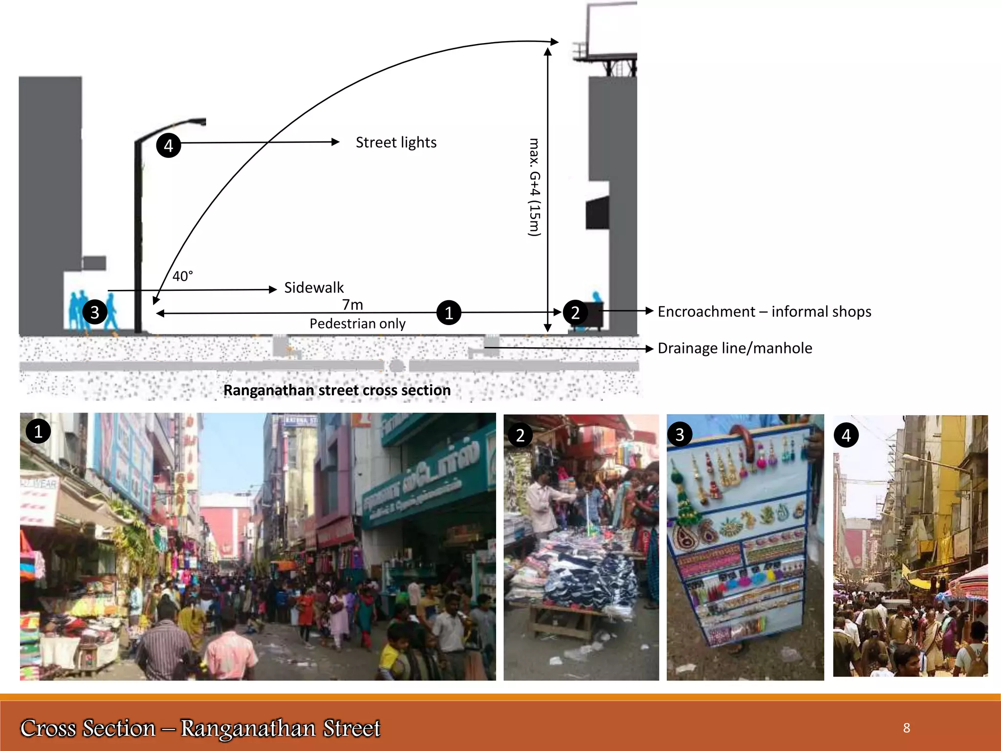


This document provides information about Ranganathan Street in Chennai, India. It describes the history and location of the street, which has been a major commercial area since the 1920s. The street is home to many small shops and vendors selling goods like clothing, jewelry, produce, and electronics. It is very crowded throughout the year, but especially during festivals like Deepavali. The document includes maps and diagrams showing land use, building heights, connectivity, street cross-sections, and more. It also discusses issues like lack of parking, sidewalk encroachment, and improper infrastructure that contribute to the street's congestion.