Presentation on horizontal differences of Temperature
•
15 likes•11,559 views

Horizontal Distribution & Differences of Temperature discusses how several factors influence the horizontal and latitudinal distribution of temperatures around the Earth. Some of the key factors discussed include: 1. Latitudinal variations in solar radiation, which causes temperatures to decrease with increasing latitude away from the equator. 2. The mosaic of land and ocean surfaces, which disrupts the strict latitudinal zonation of temperatures. Proximity to oceans moderates temperatures. 3. Altitude, with temperatures decreasing about 6.5°C for every 1000m increase in elevation due to thinner air. 4. Cloud cover, which influences the difference between day and night temperatures through absorption and reflection of radiation.

Recommended
More Related Content
What's hot
What's hot (20)
Viewers also liked
Viewers also liked (20)
Similar to Presentation on horizontal differences of Temperature
Similar to Presentation on horizontal differences of Temperature (20)
More from Islamic University of Bangladesh
More from Islamic University of Bangladesh (15)
Recently uploaded
Recently uploaded (20)
Presentation on horizontal differences of Temperature
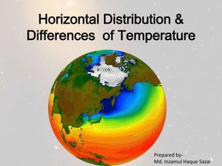
- 1. Horizontal Distribution & Differences of Temperature Prepared byMd. Inzamul Haque Sazal
- 2. If the Earth was a homogeneous body without the present land/ocean distribution, its temperature distribution would be strictly latitudinal. However, the Earth is more complex than this, being composed of a mosaic of land and water. This mosaic causes latitudinal (horizontal) zonation of temperature to be disrupted spatially.
- 3. • Isotherms – maps, connect lines of equal temperature
- 6. Principal Controls on Temperature1. 2. 3. 4. 5. 6. 7. 8. 9. Latitudinal variations in net radiation Wind and Ocean Currents Altitude Cloud cover Maritime effect Continental effect Aspect Length of the day(Seasonal Variation) Topography Local effects-soil, vegetation etc.
- 7. Latitudinal Variations • Latitude is the distance (measured in degrees) to the north and south of the Equator. • The further away the location is from the equator, the smaller the angle at which the sun's rays strike the earth. • Away from the equator, the angle of incidence of the sun's ray is less than90deg, thus solar radiation is spread over a larger area. Therefore less intense heating takes place, causing temperature to become lower. • The smaller the angle of incidence of the sun's rays, the greater the distance through the atmosphere the rays have to pass. More heat is absorbed by the atmosphere or reflected back into outer space, which results in less heat reaching the Earth's surface
- 8. ALTITUDE • Altitude is the height of a point above the sea level. • Temperature decreases by 6.5 deg C for every increase in 1,000m increase in altitude • The air at high altitudes is thin. At higher altitudes, the air is made up of a smaller concentration of gas, dust and water vapor than the dense air at sea level. Thin air is unable to absorb heat as effectively as the dense air at sea level because it has a smaller concentration of gases to trap heat. Thus places at higher altitudes have a lower temperature
- 9. Cloud cover • Tropical areas with dense cloud cover, due to high humidity in the air, experience a smaller difference in day and night temperatures. Temperate areas with less cloud cover, due to low humidity in the air, experience a larger difference in day and night temperatures. • During the day, in tropical areas with more cloud cover, clouds absorb incoming solar insolation from the Sun. Clouds also reflect part of the incoming solar radiation back into outer space. Thus less solar radiation reaches the earth's surface and the heating effect is less intense, lowering daytime temperatures. • However, during the day in temperate places with less cloud cover, the lack of cloud cover allows large amounts of solar radiation to reach the Earth's surface in the day, causing the temperature of the ground to rise quickly, raising daytime temperatures. • At night, in places with more cloud cover, clouds reflect heat radiated by the ground back to the earth's surface, preventing heat from escaping into outer space. This keeps the temperature of the ground high at night. • At night, in places with few clouds, the lack of cloud cover allows heat from the earth to escape into outer space easily, leading to a sharp drop in temperature of the ground, lowering night time temperatures.
- 10. Maritime Effect and Continental Effect • An inland location is further away from the sea, while a coastal location is close to the sea. • The land heats up and cools down more quickly than the sea. • During the summer, the air over the land heats up quickly, while the air over the sea remains relatively cool because the sea gains heat much slower than the land. Onshore winds blow cooler air towards the land, lowering the summer temperatures of the areas along the coast. • During winter, the air over the sea remains relatively warm compared to the air over the land because the sea loses heat slower than the land. The onshore winds blow warmer air towards the land, raising the winter temperatures of the coastal areas. • As a result of the maritime effect, the coastal areas are likely to experience cooler summers and warmer winters. Hence, there is a smaller difference between summer and winter temperatures. • As a result of the continental effect, the sea does not influence the temperatures of places inland. Instead, these places are likely to experience warmer summers and colder winters and hence have a large difference between summer and winter temperatures.
- 12. Winds and ocean currents • Wind is the horizontal movement of air from a region of high pressure to a region of low pressure. • Ocean currents modify the temperature of the winds, which blow over them. Prevailing winds blowing inland from the sea help to moderate the temperature of adjacent land masses. • A wind, which has blown over a cold ocean current, will have its temperature lowered. Cold ocean currents originate from the Poles and lower the temperature of the winds, thus lowering the temperature of the coastal countries they pass through. Amount of rain in those coastal areas decreases. • A wind, which has blown over a warm ocean current, will have its temperature raised. Warm ocean currents carry water from the tropics to the poles and raise the temperature of the winds, thus warming the coasts they pass through. Amount of rain in those coastal areas increases.
- 13. Aspect • Aspect refers to the position of a mountain slope in relation to the direction of the Sun's rays. • The effect of aspect on temperature is more marked in temperate latitudes. In tropical latitudes, the angle of the mid day sun is high. The effect of aspect on temperature is less noticeable. • In the northern hemisphere, the south-facing slopes are warmer than the north-facing slopes. This is because south-facing slopes receive more direct solar energy and are protected from polar cold winds. The sun's rays reach them at a steeper angle, so the heat is distributed over a smaller area. • In the southern hemisphere, the north-facing slopes are warmer than the south-facing slopes. This is because north-facing slopes receive more direct solar energy and are protected from polar cold winds. The sun's rays reach them at a steeper angle, so heat is distributed over a smaller area.
- 14. Length of day(Seasonal Variation) • Temperatures generally increase with the length of day. • In June (northern hemisphere summer, southern hemisphere winter), the length of the day increases from the equatorial to the polar latitudes in the northern hemisphere but decreases from the equatorial to the polar latitudes in the southern hemisphere. • In December (northern hemisphere winter, southern hemisphere summer),the length of day decreases from the equatorial to the polar latitudes in the northern hemisphere but decreases from the equatorial to the polar latitudes in the southern hemisphere. • As the number of hours of daylight increases, the season changes to summer, resulting in higher temperatures. As the number of hours of daylight decreases the season changes to winter, resulting in lower temperatures.
- 15. Seasonal variation of surface radiation
- 16. Effect of Latent Heat flux on Horizontal Distribution of Temperature Latent heat flux is the global movement of latent heat energy through circulations of air and water. Atmospheric circulation moves latent heat energy vertically and horizontally to cooler locations where it is condensed as rain or is deposited as snow releasing the heat energy stored within it. Large quantities of radiation energy are transferred into the Earth's tropical oceans. Radiant energy enters these water bodies at the surface when absorbed radiation is converted into heat energy. The warmed surface water is then transferred downward into the water column by conduction and convection. Horizontal transfer of this heat energy from the equator to the poles is accomplished by ocean currents
- 17. Seasonal variation of surface temperature budget
- 18. HORIZONTAL DISTRIBUTION OF AVG. TEMPERATURE IN THE OCEAN FLOOR
- 19. HORIZONTAL DISTRIBUTION OF SURFACE TEMPERATURE