SlideShare a Scribd company logo
1 of 10
Download to read offline
Prepared By: Amira Abdallah Youssef
Level 3 – Civil Eng. Department – faculty of Engineering
Supervision: Dr. Mona Fouad Kaisar
GIS , Photogrammetry and Remote Sensing Professor,
Vice Dean of the Faculty of Science for Community service
And Environmental development
2017
Applications of Photogrammetry &
Remote Sensing in Engineering
Content of Report
1. Introduction.
2. Photogrammetry & Remote Sensing Applications in
Engineering with illustrating photographs.
3. An application of Photogrammetry in details (Government
national massive projects for development of Lands)
4. An Example of Government Urban Planning and Development
(Suez canal area Development Project)
‫للتنمي‬ ‫العمالقة‬ ‫القومية‬ ‫المشاريع‬‫ة‬-‫السويس‬ ‫قناة‬ ‫محور‬ ‫تنمية‬ ‫مشروع‬
5. References
1.Introduction
 Photogrammetry & Remote Sensing became one of the most important types of
science for Engineers in many ways and methods to apply in various fields,
especially in civil engineering applications.
 In this report, I shall pay attention to these applications and discuss one of them in
details (Suez Canal area development Project) which is of a great importance for
our beloved home, Egypt.
2.Applications of Photogrammetry & Remote Sensing in
Engineering
2.1 Engineering Projects Planning
- Choosing road positions and determining best
tracks of tunnels and their depths.
- Choosing sites of new urban development
(which will be discussed in details)
- Pipelines routing.
- Highways designs.
- Dams and water structures positions
planning.
2.2 Planning Traffic & transportation
Engineering
- Management of traffic system.
- Detecting traffic problems causes for solving
them accurately.
- Underground and railway tracks Positioning.
2.3 Engineering material resources
- Finding Resources of Building
materials (Limestone – Marble –
Quartz sand and gravel).
- Petroleum and Natural gas
exploration.
2.4 Prediction of future hazards
- Studying stability & rocks slopes.
- Determining the motion of sand and its direction.
- Prediction of gravity flooding over cites.
2.5 Architectural applications
- The recording of historic buildings and
monuments to produce elevation
drawings and sections normally at scales
of 1:20, 1:50 and 1:100.
- Urban Planning.
urban planning
Recording of historic buildings
2.6 Mechanical Engineering Applications
- Ship building.
- Aircraft manufacture.
- Chemical plant surveys.
- Tunnel profiling.
2.7 Agricultural Engineering
- Collecting data about soil nature and resources of water.
- Defining areas that can be used for agricultural use.
2.8 Water supply projects & Shoreline Protection
- Detecting water resources for water supply projects.
- Water quality monitoring.
- Coastal management & protection.
- Shoreline mapping & erosion analysis.
Coastal management
Now as mentioned before, One of the most important applications of Photogrammetry
and Remote Sensing is Urban planning over wide areas which governments use to develop
manage the development of lands , A great example of this is Suez Canal area development
project that will be discussed in details .
3. An application of Photogrammetry (Government national massive
projects for development of Lands)
- Photogrammetry and remote sensing are two sources of inputs for GIS or
Geographic Information System, which is a very useful tool in Urban Planning
and Land Use Planning LUP projects.
- Governments use land-use planning to manage the development of land.
The role that photogrammetry and remote sensing play in these massive projects appears
as the first step of Action plans. Photogrammetry provide Engineers with Essential aerial
photographs to produce
maps that are used later in
urban planning .
Aerial Photographs
& satallite
photographs
Maps and
sketching for area
coverage
Planning drawinngs
for whole area
1. satallite Image
2. Planning sketch
4. An Example of Government Urban Planning and Development (Suez
canal area Development Project)
Aim of Project and Study area
- The Suez Canal Corridor Area Project (Arabic: ‫السويس‬ ‫قناة‬ ‫محور‬ ‫تطوير‬ ‫وع‬ ‫ر‬‫مش‬‎‎) is a mega
project in Egypt that was launched on 5 August 2014 by President Abdel Fattah el-
Sisi. The project's aim is to increase the role of the Suez Canal region in
international trading and to develop the three canal cities: Suez, Ismailia, and Port
Said.
- The project involves:
1- Building a new city (new Ismailia city), an industrial zone, fish farms,
completing the technology valley.
2- Building seven new tunnels between Sinai and Ismailia and Port Said.
3- Improving five existing ports
4- Digging a new canal parallel to the Suez Canal.
- The new canal will increase the canal capacity by allowing ships to sail into both
directions at the same time for a greater proportion of the canal. The project will
transfer the canal cities into an important trading center globally. It will also build
new centers on the Suez Canal for logistic and ship services.
1. New cities
Improving existing Ports
Dredging New canal
References
1- https://en.wikipedia.org/wiki/Suez_Canal_Area_Develop
ment_Project
2- http://www.scoop.it/t/geography-
education/?tag=sprawl
3- http://www.suezcanal.gov.eg/English/About/SuezCanal/
Pages/NewSuezCanal.aspx
4- http://www.claffie.com/060527.html
5- http://www.themeparx.com/six-flags-dubai/?page=2
6- Photogrammetry & Remote Sensing by Dr Mona Kaisar

More Related Content

What's hot

What's hot (20)

IMAGE INTERPRETATION TECHNIQUES of survey
IMAGE INTERPRETATION TECHNIQUES of surveyIMAGE INTERPRETATION TECHNIQUES of survey
IMAGE INTERPRETATION TECHNIQUES of survey
 
Gps surveying
Gps surveyingGps surveying
Gps surveying
 
Visual Interpretation
Visual InterpretationVisual Interpretation
Visual Interpretation
 
Projections and coordinate system
Projections and coordinate systemProjections and coordinate system
Projections and coordinate system
 
Ems interaction with the atmosphere
Ems  interaction with the atmosphereEms  interaction with the atmosphere
Ems interaction with the atmosphere
 
Coordinate systems, datum & map projections
Coordinate systems, datum & map projectionsCoordinate systems, datum & map projections
Coordinate systems, datum & map projections
 
Stereoscopic Parallax
Stereoscopic ParallaxStereoscopic Parallax
Stereoscopic Parallax
 
Photogrammetry
PhotogrammetryPhotogrammetry
Photogrammetry
 
Distortions and displacement on aerial photograph
Distortions and displacement on aerial photographDistortions and displacement on aerial photograph
Distortions and displacement on aerial photograph
 
Artificial recharge of groundwater
Artificial recharge of groundwaterArtificial recharge of groundwater
Artificial recharge of groundwater
 
1 remote sensing
1 remote sensing1 remote sensing
1 remote sensing
 
Image enhancement technique digital image analysis, in remote sensing ,P K MANI
Image enhancement technique  digital image analysis, in remote sensing ,P K MANIImage enhancement technique  digital image analysis, in remote sensing ,P K MANI
Image enhancement technique digital image analysis, in remote sensing ,P K MANI
 
GIS Map Projection
GIS Map ProjectionGIS Map Projection
GIS Map Projection
 
Application of Remote Sensing and GIS in Urban Planning
Application of Remote Sensing and GIS in Urban PlanningApplication of Remote Sensing and GIS in Urban Planning
Application of Remote Sensing and GIS in Urban Planning
 
Iirs overview -Remote sensing and GIS application in Water Resources Management
Iirs overview -Remote sensing and GIS application in Water Resources ManagementIirs overview -Remote sensing and GIS application in Water Resources Management
Iirs overview -Remote sensing and GIS application in Water Resources Management
 
Digital photogrammetry
Digital photogrammetryDigital photogrammetry
Digital photogrammetry
 
Application of remote sensing and gis for groundwater
Application of remote sensing and gis for groundwaterApplication of remote sensing and gis for groundwater
Application of remote sensing and gis for groundwater
 
Classification of triangulation
Classification of triangulationClassification of triangulation
Classification of triangulation
 
Digital photogrammetry software.pptx
Digital photogrammetry software.pptxDigital photogrammetry software.pptx
Digital photogrammetry software.pptx
 
Computation of Area and volume
Computation of Area and volume Computation of Area and volume
Computation of Area and volume
 

Similar to Photogrammetry & Remote Sensing applications in Engineering

Final Report, Hi7
Final Report, Hi7Final Report, Hi7
Final Report, Hi7
Mike White
 
1-HASSAN HALHOUL's CV 2016-(1)
1-HASSAN HALHOUL's CV 2016-(1)1-HASSAN HALHOUL's CV 2016-(1)
1-HASSAN HALHOUL's CV 2016-(1)
Hassan Halhoul
 
06 presentation civil-engineering_consultrans
06 presentation civil-engineering_consultrans06 presentation civil-engineering_consultrans
06 presentation civil-engineering_consultrans
Consultrans, S.A.
 

Similar to Photogrammetry & Remote Sensing applications in Engineering (20)

Introduction to civil engineering.pptx
Introduction to civil engineering.pptxIntroduction to civil engineering.pptx
Introduction to civil engineering.pptx
 
CVupdatedNF
CVupdatedNFCVupdatedNF
CVupdatedNF
 
Sample Airport / Aviation Projects (2015 - 2020)
Sample Airport / Aviation Projects (2015 - 2020)Sample Airport / Aviation Projects (2015 - 2020)
Sample Airport / Aviation Projects (2015 - 2020)
 
civil engineers project work .docx
civil engineers project work .docxcivil engineers project work .docx
civil engineers project work .docx
 
updated Curriculum -osama[1]
updated Curriculum -osama[1]updated Curriculum -osama[1]
updated Curriculum -osama[1]
 
Civil Engineering by Engr. Shahzaib Farooq
Civil Engineering by Engr. Shahzaib FarooqCivil Engineering by Engr. Shahzaib Farooq
Civil Engineering by Engr. Shahzaib Farooq
 
Magazine 2
Magazine 2Magazine 2
Magazine 2
 
Amaljit - Work Report 2016
Amaljit - Work Report 2016Amaljit - Work Report 2016
Amaljit - Work Report 2016
 
Introduction to Civil Engg. Unit-I.pdf
Introduction to Civil Engg. Unit-I.pdfIntroduction to Civil Engg. Unit-I.pdf
Introduction to Civil Engg. Unit-I.pdf
 
cv Updated M.Anwar
cv Updated M.Anwarcv Updated M.Anwar
cv Updated M.Anwar
 
basic civil unit 1.pptx
basic civil  unit 1.pptxbasic civil  unit 1.pptx
basic civil unit 1.pptx
 
Final Report, Hi7
Final Report, Hi7Final Report, Hi7
Final Report, Hi7
 
1-HASSAN HALHOUL's CV 2016-(1)
1-HASSAN HALHOUL's CV 2016-(1)1-HASSAN HALHOUL's CV 2016-(1)
1-HASSAN HALHOUL's CV 2016-(1)
 
project final year civil
project final year civilproject final year civil
project final year civil
 
Scope of civil engineering,Role of civil Engineer in Society
Scope of civil engineering,Role of civil Engineer in SocietyScope of civil engineering,Role of civil Engineer in Society
Scope of civil engineering,Role of civil Engineer in Society
 
Major project report of diploma civil engineering at mamts gothatar to jorpat...
Major project report of diploma civil engineering at mamts gothatar to jorpat...Major project report of diploma civil engineering at mamts gothatar to jorpat...
Major project report of diploma civil engineering at mamts gothatar to jorpat...
 
My cv (en.)
My cv (en.)My cv (en.)
My cv (en.)
 
06 presentation civil-engineering_consultrans
06 presentation civil-engineering_consultrans06 presentation civil-engineering_consultrans
06 presentation civil-engineering_consultrans
 
Unit 5
Unit 5Unit 5
Unit 5
 
Project report on CC road
Project report on CC roadProject report on CC road
Project report on CC road
 

More from Amira Abdallah

More from Amira Abdallah (9)

Plasco Building Collapse by fire
Plasco Building Collapse by firePlasco Building Collapse by fire
Plasco Building Collapse by fire
 
The dome of the rock (Qubbat Al-sakhra) structural system and load transfer
The dome of the rock (Qubbat Al-sakhra) structural system and load transferThe dome of the rock (Qubbat Al-sakhra) structural system and load transfer
The dome of the rock (Qubbat Al-sakhra) structural system and load transfer
 
Natural rocks in Civil engineering
Natural rocks in Civil engineeringNatural rocks in Civil engineering
Natural rocks in Civil engineering
 
Methods of population studies
Methods of population studiesMethods of population studies
Methods of population studies
 
Hydrographic Surveying
Hydrographic SurveyingHydrographic Surveying
Hydrographic Surveying
 
Centrifugal & Reciprocating Pumps
Centrifugal & Reciprocating Pumps Centrifugal & Reciprocating Pumps
Centrifugal & Reciprocating Pumps
 
Paintings (Exterior & Interior) and wall papers
Paintings (Exterior & Interior) and wall papersPaintings (Exterior & Interior) and wall papers
Paintings (Exterior & Interior) and wall papers
 
Geology - clay minerals and geotechnical problems
Geology - clay minerals and geotechnical problemsGeology - clay minerals and geotechnical problems
Geology - clay minerals and geotechnical problems
 
Permeability and durability of concrete
Permeability and durability of concretePermeability and durability of concrete
Permeability and durability of concrete
 

Recently uploaded

1_Introduction + EAM Vocabulary + how to navigate in EAM.pdf
1_Introduction + EAM Vocabulary + how to navigate in EAM.pdf1_Introduction + EAM Vocabulary + how to navigate in EAM.pdf
1_Introduction + EAM Vocabulary + how to navigate in EAM.pdf
AldoGarca30
 
Digital Communication Essentials: DPCM, DM, and ADM .pptx
Digital Communication Essentials: DPCM, DM, and ADM .pptxDigital Communication Essentials: DPCM, DM, and ADM .pptx
Digital Communication Essentials: DPCM, DM, and ADM .pptx
pritamlangde
 
Integrated Test Rig For HTFE-25 - Neometrix
Integrated Test Rig For HTFE-25 - NeometrixIntegrated Test Rig For HTFE-25 - Neometrix
Integrated Test Rig For HTFE-25 - Neometrix
Neometrix_Engineering_Pvt_Ltd
 
Hospital management system project report.pdf
Hospital management system project report.pdfHospital management system project report.pdf
Hospital management system project report.pdf
Kamal Acharya
 
Kuwait City MTP kit ((+919101817206)) Buy Abortion Pills Kuwait
Kuwait City MTP kit ((+919101817206)) Buy Abortion Pills KuwaitKuwait City MTP kit ((+919101817206)) Buy Abortion Pills Kuwait
Kuwait City MTP kit ((+919101817206)) Buy Abortion Pills Kuwait
jaanualu31
 

Recently uploaded (20)

Signal Processing and Linear System Analysis
Signal Processing and Linear System AnalysisSignal Processing and Linear System Analysis
Signal Processing and Linear System Analysis
 
Path loss model, OKUMURA Model, Hata Model
Path loss model, OKUMURA Model, Hata ModelPath loss model, OKUMURA Model, Hata Model
Path loss model, OKUMURA Model, Hata Model
 
AIRCANVAS[1].pdf mini project for btech students
AIRCANVAS[1].pdf mini project for btech studentsAIRCANVAS[1].pdf mini project for btech students
AIRCANVAS[1].pdf mini project for btech students
 
Unit 4_Part 1 CSE2001 Exception Handling and Function Template and Class Temp...
Unit 4_Part 1 CSE2001 Exception Handling and Function Template and Class Temp...Unit 4_Part 1 CSE2001 Exception Handling and Function Template and Class Temp...
Unit 4_Part 1 CSE2001 Exception Handling and Function Template and Class Temp...
 
Computer Graphics Introduction To Curves
Computer Graphics Introduction To CurvesComputer Graphics Introduction To Curves
Computer Graphics Introduction To Curves
 
COST-EFFETIVE and Energy Efficient BUILDINGS ptx
COST-EFFETIVE  and Energy Efficient BUILDINGS ptxCOST-EFFETIVE  and Energy Efficient BUILDINGS ptx
COST-EFFETIVE and Energy Efficient BUILDINGS ptx
 
Linux Systems Programming: Inter Process Communication (IPC) using Pipes
Linux Systems Programming: Inter Process Communication (IPC) using PipesLinux Systems Programming: Inter Process Communication (IPC) using Pipes
Linux Systems Programming: Inter Process Communication (IPC) using Pipes
 
1_Introduction + EAM Vocabulary + how to navigate in EAM.pdf
1_Introduction + EAM Vocabulary + how to navigate in EAM.pdf1_Introduction + EAM Vocabulary + how to navigate in EAM.pdf
1_Introduction + EAM Vocabulary + how to navigate in EAM.pdf
 
Introduction to Serverless with AWS Lambda
Introduction to Serverless with AWS LambdaIntroduction to Serverless with AWS Lambda
Introduction to Serverless with AWS Lambda
 
Basic Electronics for diploma students as per technical education Kerala Syll...
Basic Electronics for diploma students as per technical education Kerala Syll...Basic Electronics for diploma students as per technical education Kerala Syll...
Basic Electronics for diploma students as per technical education Kerala Syll...
 
Digital Communication Essentials: DPCM, DM, and ADM .pptx
Digital Communication Essentials: DPCM, DM, and ADM .pptxDigital Communication Essentials: DPCM, DM, and ADM .pptx
Digital Communication Essentials: DPCM, DM, and ADM .pptx
 
Integrated Test Rig For HTFE-25 - Neometrix
Integrated Test Rig For HTFE-25 - NeometrixIntegrated Test Rig For HTFE-25 - Neometrix
Integrated Test Rig For HTFE-25 - Neometrix
 
Augmented Reality (AR) with Augin Software.pptx
Augmented Reality (AR) with Augin Software.pptxAugmented Reality (AR) with Augin Software.pptx
Augmented Reality (AR) with Augin Software.pptx
 
Hospital management system project report.pdf
Hospital management system project report.pdfHospital management system project report.pdf
Hospital management system project report.pdf
 
Kuwait City MTP kit ((+919101817206)) Buy Abortion Pills Kuwait
Kuwait City MTP kit ((+919101817206)) Buy Abortion Pills KuwaitKuwait City MTP kit ((+919101817206)) Buy Abortion Pills Kuwait
Kuwait City MTP kit ((+919101817206)) Buy Abortion Pills Kuwait
 
PE 459 LECTURE 2- natural gas basic concepts and properties
PE 459 LECTURE 2- natural gas basic concepts and propertiesPE 459 LECTURE 2- natural gas basic concepts and properties
PE 459 LECTURE 2- natural gas basic concepts and properties
 
Introduction to Data Visualization,Matplotlib.pdf
Introduction to Data Visualization,Matplotlib.pdfIntroduction to Data Visualization,Matplotlib.pdf
Introduction to Data Visualization,Matplotlib.pdf
 
HAND TOOLS USED AT ELECTRONICS WORK PRESENTED BY KOUSTAV SARKAR
HAND TOOLS USED AT ELECTRONICS WORK PRESENTED BY KOUSTAV SARKARHAND TOOLS USED AT ELECTRONICS WORK PRESENTED BY KOUSTAV SARKAR
HAND TOOLS USED AT ELECTRONICS WORK PRESENTED BY KOUSTAV SARKAR
 
Memory Interfacing of 8086 with DMA 8257
Memory Interfacing of 8086 with DMA 8257Memory Interfacing of 8086 with DMA 8257
Memory Interfacing of 8086 with DMA 8257
 
Online electricity billing project report..pdf
Online electricity billing project report..pdfOnline electricity billing project report..pdf
Online electricity billing project report..pdf
 

Photogrammetry & Remote Sensing applications in Engineering

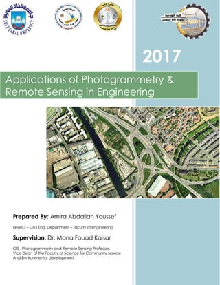
  • 1. Prepared By: Amira Abdallah Youssef Level 3 – Civil Eng. Department – faculty of Engineering Supervision: Dr. Mona Fouad Kaisar GIS , Photogrammetry and Remote Sensing Professor, Vice Dean of the Faculty of Science for Community service And Environmental development 2017 Applications of Photogrammetry & Remote Sensing in Engineering
  • 2. Content of Report 1. Introduction. 2. Photogrammetry & Remote Sensing Applications in Engineering with illustrating photographs. 3. An application of Photogrammetry in details (Government national massive projects for development of Lands) 4. An Example of Government Urban Planning and Development (Suez canal area Development Project) ‫للتنمي‬ ‫العمالقة‬ ‫القومية‬ ‫المشاريع‬‫ة‬-‫السويس‬ ‫قناة‬ ‫محور‬ ‫تنمية‬ ‫مشروع‬ 5. References
  • 3. 1.Introduction  Photogrammetry & Remote Sensing became one of the most important types of science for Engineers in many ways and methods to apply in various fields, especially in civil engineering applications.  In this report, I shall pay attention to these applications and discuss one of them in details (Suez Canal area development Project) which is of a great importance for our beloved home, Egypt. 2.Applications of Photogrammetry & Remote Sensing in Engineering 2.1 Engineering Projects Planning - Choosing road positions and determining best tracks of tunnels and their depths. - Choosing sites of new urban development (which will be discussed in details) - Pipelines routing. - Highways designs. - Dams and water structures positions planning. 2.2 Planning Traffic & transportation Engineering - Management of traffic system. - Detecting traffic problems causes for solving them accurately. - Underground and railway tracks Positioning.
  • 4. 2.3 Engineering material resources - Finding Resources of Building materials (Limestone – Marble – Quartz sand and gravel). - Petroleum and Natural gas exploration. 2.4 Prediction of future hazards - Studying stability & rocks slopes. - Determining the motion of sand and its direction. - Prediction of gravity flooding over cites. 2.5 Architectural applications - The recording of historic buildings and monuments to produce elevation drawings and sections normally at scales of 1:20, 1:50 and 1:100. - Urban Planning. urban planning Recording of historic buildings
  • 5. 2.6 Mechanical Engineering Applications - Ship building. - Aircraft manufacture. - Chemical plant surveys. - Tunnel profiling. 2.7 Agricultural Engineering - Collecting data about soil nature and resources of water. - Defining areas that can be used for agricultural use. 2.8 Water supply projects & Shoreline Protection - Detecting water resources for water supply projects. - Water quality monitoring. - Coastal management & protection. - Shoreline mapping & erosion analysis. Coastal management
  • 6. Now as mentioned before, One of the most important applications of Photogrammetry and Remote Sensing is Urban planning over wide areas which governments use to develop manage the development of lands , A great example of this is Suez Canal area development project that will be discussed in details . 3. An application of Photogrammetry (Government national massive projects for development of Lands) - Photogrammetry and remote sensing are two sources of inputs for GIS or Geographic Information System, which is a very useful tool in Urban Planning and Land Use Planning LUP projects. - Governments use land-use planning to manage the development of land. The role that photogrammetry and remote sensing play in these massive projects appears as the first step of Action plans. Photogrammetry provide Engineers with Essential aerial photographs to produce maps that are used later in urban planning . Aerial Photographs & satallite photographs Maps and sketching for area coverage Planning drawinngs for whole area
  • 7. 1. satallite Image 2. Planning sketch
  • 8. 4. An Example of Government Urban Planning and Development (Suez canal area Development Project) Aim of Project and Study area - The Suez Canal Corridor Area Project (Arabic: ‫السويس‬ ‫قناة‬ ‫محور‬ ‫تطوير‬ ‫وع‬ ‫ر‬‫مش‬‎‎) is a mega project in Egypt that was launched on 5 August 2014 by President Abdel Fattah el- Sisi. The project's aim is to increase the role of the Suez Canal region in international trading and to develop the three canal cities: Suez, Ismailia, and Port Said. - The project involves: 1- Building a new city (new Ismailia city), an industrial zone, fish farms, completing the technology valley. 2- Building seven new tunnels between Sinai and Ismailia and Port Said. 3- Improving five existing ports 4- Digging a new canal parallel to the Suez Canal. - The new canal will increase the canal capacity by allowing ships to sail into both directions at the same time for a greater proportion of the canal. The project will transfer the canal cities into an important trading center globally. It will also build new centers on the Suez Canal for logistic and ship services. 1. New cities
  • 10. References 1- https://en.wikipedia.org/wiki/Suez_Canal_Area_Develop ment_Project 2- http://www.scoop.it/t/geography- education/?tag=sprawl 3- http://www.suezcanal.gov.eg/English/About/SuezCanal/ Pages/NewSuezCanal.aspx 4- http://www.claffie.com/060527.html 5- http://www.themeparx.com/six-flags-dubai/?page=2 6- Photogrammetry & Remote Sensing by Dr Mona Kaisar