SlideShare a Scribd company logo
Basic Civil Engineering
( Subject Code: 1150CE101 )
Lecture Slides
By
Department of Civil Engineering
Vel Tech Rangarajan Dr. Sagunthala R&D Institute of Science and Technology
1
Syllabus
UNIT I: Building Materials
Introduction – Civil Engineering – Materials – Bricks – Composition – Classifications – Properties – Uses – Stone – Classification of
Rocks – Quarrying – Dressing – Properties – Uses – Timber – Properties – Uses – Plywood –Cement – Grades – Types – Properties –
Uses – Steel – Types – Mild Steel – Medium Steel – Hard Steel –Properties – Uses – Market Forms – Concrete – Grade designation –
Properties – Uses – Advancements in Concrete – Pre-stressed Concrete – Pre fabricated concrete.
UNIT II: Building Components
Building – Selection of site – Classification – Components – Foundations – Functions – Classifications – Bearing Capacity – Flooring –
Requirements – Selection – Types – Cement concrete marble – Terrazzo floorings – Roof – Types and requirements.
UNIT III: Planning Aspects and Regulations
Building types and design criteria – Space standards for residential, commercial and institutional categories – Building by-laws
applicable for approval by the local governing body – Development control rules for Chennai Metropolitan Area. Basic guidelines for
earthquake resistant structures.
UNIT IV: Water Supply and Sanitary Systems
Water supply – Objectives – Quantity/Quality of water –Sources – Standards of drinking water – Distribution system –Sewage –
Classification – Technical terms – Septic tank – Components and functions – layout of external services –water supply – Sewage
disposal – water supply and plumbing layout for a residential building.
UNIT V: Surveying and Transportation
Surveying – Objectives – Classification – Principles of Survey – Transportation – Classification – Cross section and components of
road – Classification of roads – Railway – Cross section and components of permanent way – Functions – Water way – Docks and
Harbors – Classification - Components – Bridges – Components of bridges.
2
Unit V: Surveying and Transportation
Surveying – Objectives – Classification – Principles of Survey – Transportation –
Classification – Cross section and components of road – Classification of roads –
Railway – Cross section and components of permanent way – Functions – Water
way – Docks and Harbors – Classification - Components – Bridges – Components
of bridges.
3
Surveying
Definition: Surveying is an art of determining the relative positions of points
on, above or beneath the surface of the earth by means of direct (or) indirect
measurements of distance, direction and elevation.
• Survey is performed to prepare a map of relative positions on surface of the
earth. It shows the natural feature of a country such as towns, villages, roads,
railways, etc.
• They may also include details of different engineering works such as bridge,
canal, dam, etc.
• Before commencement of any major engineering project, survey is carried
out to determine the location of site and its surrounding.
4
Surveying
Objectives of Surveying:
• To collect field data;
• To prepare plan or map of the area surveyed;
• To analyze and to calculate the field parameters for setting out operation of actual engineering works.
• To set out field parameters at the site for further engineering works.
5
Surveying
Principles of Surveying:
(i) Location of a point by measurement from two
points of reference
According to this principle, the relative position
of a point to be surveyed should be located by
measurement from at least two points of reference, the
positions of which have already been fixed.
If P and Q are the two reference points on the
ground, any other point, such as R, can be located by
any of the direct methods shown in the above figures.
6
Surveying
Principles of Surveying:
(ii) Working from Whole to Part:
According to this principle, it is always desirable
to carryout survey work from whole to part.
• This means, when an area is to be surveyed, first a
system of control points is to be established
covering the whole area with very high precision.
• Then minor details are located by less precise
methods.
• The idea of working this way is to prevent the
accumulation of errors and to control and localize
minor errors which, otherwise, would expand to
greater magnitudes if the reverse process is
followed, thus making the work uncontrolled at
the end. 7
Surveying
Classification of Surveying:
Surveys may be classified based on the Nature of survey, Object of survey and Instruments used.
(i) Classification based on Nature of Survey:
Topographical Survey: They are carried out determine the position of natural features of a region such as rivers,
streams, hills etc. and artificial features such as roads and canals. The purpose of such surveys is to prepare maps and
such maps of are called topo-sheets.
Hydrographic Survey: Hydro-graphic survey is carried out to determine M.S.L. (Mean Sea Level), water spread area,
depth of water bodies, velocity of flow in streams, cross-section area of flow etc.
Astronomical Survey: The Astronomical Survey is carried out to determine the absolute location of any point on the
surface of earth. The survey consists of making observations to heavenly bodies such as stars.
8
Surveying
Engineering Survey: This type of survey is undertaken whenever sufficient data is to be collected for the purpose of
planning and designing engineering works such as roads, bridges and reservoirs.
Archeological Survey: This type of survey is carried out to gather information about sites that are important from
archeological considerations and for unearthing relics of antiquity.
Photographic Survey: In this type of survey, information is collected by taking photographs from selected points using
a camera.
Aerial Survey: In this type of survey data about large tracks of land is collected by taking photographs from an aero-
plane.
Reconnaissance Survey: In this type of survey, data is collected by marking physical observation and some
measurements using simple survey instruments.
9
Surveying
(ii) Classification based on Objective of Survey:
Engineering Survey: These are carried out for the determination of quantities which will be useful for the designing of
engineering works.
Military or Defense Survey: These are carried out for the preparation of maps of important military areas.
Geological Survey: These are carried out to ascertain the composition of the earth’s crust.
Mine Survey: These are conducted for exploring the mineral wealth below the earth surface.
Archeological Survey: These are executed to prepare maps of ancient cultures.
10
Surveying
(iii) Classification based on Instruments
Used:
Chain Survey
Compass Survey
Plane Table Survey
Theodolite Survey
Tacheometric Survey
Photographic Survey
11
Transportation
Transportation contributes to the economic, industrial, social and cultural development of any country.
• Transportation is vital for the economic development of any region since every commodity produced,
whether it is food, clothing, agricultural products, industrial products or medicine needs transportation at
all stages from production to distribution.
• Transportation Engineering is the science of safe and efficient movement of people and goods. It’s a sub-
discipline of civil engineering.
Classification of Transport:
(i) Roadways or Highways
(ii) Railways
(iii) Waterways
(iv) Airways
12
Roadways – Cross section
Typical cross section of a
road would consist the
following layers:
(i) Sub soil
(ii) Sub grade
(iii) Base course
(iv) Surface course
(wearing)
13
Roadways – Cross section
(i)Sub soil:
It refers to the natural soil or prepared soil on which the loads coming on the road are ultimately
transferred. Hence the Sub Soil should be prepared by compacting it properly by rollers.
(ii) Sub grade:
This layer gives support to the road structure. This should remain dry and stable throughout the year.
Much attention should be given in preparing the sub grade. This layer consists of disintegrated rocks mixed
with gravel.
(iii) Base course:
This layer is constructed in one or two layers consisting of stones mixed with gravel. Bigger stones are
used at the bottom. At the top level, smaller stones mixed with cohesive soil or cement are provided and
thoroughly compacted.
(iv) Surface / wearing course:
It is the topmost layer of the carriage way. It takes the loads directly. This layer is either made of
flexible materials (bitumen or coal tar mixed with stones) or a rigid material (concrete). This layer should
be moderately rough to provide good grip for the vehicles. The top surface of the wearing course is
provided a lateral slope (camber), to drain off the rain water from the road surface quickly and effectively.
14
Roadways – Components
The components of roadway would
consist of following:
(i) Pavement or carriage way
(ii) Shoulders
(iii) Kerb
(iv) Footpath
(v) Parking lane
(vi) Fencing
15
Roadways – Components
(i) Pavement / Carriage way:
It refers to the path over which the vehicles and other traffic can move lawfully. It also includes the path
way and other related structures like bridges, flyovers, underpasses which make road traveling easier.
Hence, the width of the pavement for a single lane road becomes 3.8mts. In case of multi lane traffic,
the width of each lane should be at least 3.5mts.
(ii) Shoulders:
The width of a road is always extended beyond the road on both sides by a width of at least 2 to 5 mts.
This space acts as a space for moving away any broken down vehicles or parking vehicles in an emergency.
(iii) Kerb:
Within the city limits, to separate the pavements from the footpath, a raised stone (kerb) is provided at
the edge of the pavement. The height of the kerb is normally 15 to 20 cms.
16
Roadways – Components
(iv) Footpath:
Apart from vehicles, the pedestrians should also be provided some space for moving at the edge of the
roads. Footpaths should be provided essentially everywhere. The footpath may be in level with the road
surface or slightly raised higher than the road surface.
(v) Parking Lanes:
These are usually provided or reserved on the road edges within a city limit for allowing the vehicles to
be parked conveniently. The parking lanes are distinctively separated by white colour strips so that moving
vehicles do not enter parking lanes.
(vi) Fencing:
Whenever a highway or an expressway passes through urban areas, fencing is provided all along the
road to prevent the cattle and people from entering the traffic zone.
17
Roadways – Classifications
As per Nagpur Road Plan, Roads are classified as follows:
(i) National highways
(ii) State highways
(iii) District highways
(i) Major district roads
(ii) Other district roads
(iv) Village roads
Purposes of Road Classification:
• To plan a road network for efficient and safe traffic operation.
• To know the clear information of a particular root in a country.
18
Roadways – Classifications
(i) National highways:
• These are the important roads of the country. They connect state capitals, ports and foreign highways.
• They also include roads of military importance.
• They are financed by Central government.
(ii) State highways:
• These are the important roads of a state. They connect important cities and district head quarters in the
state, national highways & state highways of neighboring states.
• They are financed by state government roads and buildings department regarding construction and
maintenance.
19
Roadways – Classifications
(iii) District Roads:
• These are the roads within a district. They are financed by Zillaparishads with the help of grants given
by state government.
• Major District Roads are the roads connecting the district heads.
• Quarters, taluk head quarters and other important town in the district production and market centers with
each other and with state & national highways & railways.
• Other District Roads are the district roads of less importance.
(iv) Village Roads:
• They connect villages with each other and to the nearest district road.
• They are financed by panchayats with the help of Zillaparishads and state government.
20
Railways – Cross section & Components
Permanent Way:
The finished or completed track of a railway line is commonly known as the Permanent way. The
permanent way consists of following components:
(i) Rail
(ii) Sleeper
(iii) Ballast
(iv) Formation
21
Permanent way - Functions
(i) Rail:
• To bear the stresses developed due to heavy vertical loads,
lateral and braking forces, and thermal stresses.
• To provide a hard and smooth surface for the passage of
heavy moving loads with a minimum friction between the
steel rails and steel wheels.
• To transmit load to the sleepers and consequently to reduce
pressure on ballast and formation.
(ii) Sleeper:
Sleepers provides transverse ties on which rails are laid. It
serves as a transverse member in the permanent way. Their
functions are:
• To support the rails firmly and evenly
• To maintain the gauge of the track correctly
• To distribute the weight coming on the rails over a
sufficiently large area of the ballast
• To act as an elastic medium between the rails and the
ballast and to absorb the vibrations of the trains 22
Permanent way - Functions
(iii) Ballast:
Ballast is a granular and gritty material placed and packed below and around sleepers.
• Holds sleepers in position and prevents lateral and longitudinal movement.
• Transfer and distribute load from sleepers to large area of formation
• Imparts elasticity and resilience to track for getting proper riding comfort.
• Provides effective drainage to track
• Act as a medium for provision of super elevation in curves of railway tracks.
(iv) Formation:
Sub-grade is naturally occurring soil. It is prepared to support the components of a railway track such
as ballast, sleepers and rails. This prepared surface is also termed as formation. Formations could be in
embankment levels or cuttings. The sub-grade supports railway track from beneath.
23
Water ways
Harbor is a protected inlet or branch of a sea where ships can anchor. Harbor engineering is concerned
with planning, construction and maintenance of infrastructure for efficient performance of harbors.
24
Water ways – Definition of Terms
Harbor:
• A harbor, in primary sense is a place of refugee or rest. It is a place where safety and hospitality is to be
found. Harbors offer protection to vessels from violent seas. It refers to sheltered sheet of water where
vessels are anchored.
Port:
• The term ‘port’ is used to indicate a harbor where terminal facilities such as stores, landing of passengers
and cargo, etc. are added to it.
• This distinction is used to mark the jurisdiction between, the State and Central Government. The port is
under the State Government and the Harbor is under the Central Government.
Docks:
• Docks are the enclosed area for berthing of vessels to facilitate loading and unloading of cargo and
embarkation and disembarkation of passengers or for repairs, renovations, fueling, oiling, painting and
watering of vessels. 25
Water ways – Classification of Harbor
Based on Geographical existence, harbors are classified as follows:
(i) Natural Harbor
(ii) Semi Artificial / Protected Harbor
(iii) Artificial Harbor
(i) Natural Harbor:
• Natural formations affording safe discharge facilities for ships on sea coasts, in the form of creeks and
basins are called natural harbors.
• The factors such as local geographical features, growth of population, development of the area, etc. have
made the natural harbors big and attractive.
• E.x: Sydney, Melbourne and Bombay
26
Water ways – Classification of Harbor
27
Water ways – Classification of Harbor
28
Natural Harbor Semi Natural / Semi Artificial / Protected Harbor Artificial Harbor
Water ways – Classification of Harbor
(ii) Semi-Artificial / Protected Harbor:
• Protected harbors are partly natural and partly artificial.
• Artificial construction of break waters or entrance moles may supplement existing natural features.
• They give protection from wave action to vessels, using or entering harbors.
• Ex: Cape Town, Vishakhapatnam.
(iii) Artificial Harbor:
• Artificial harbors have to be created where there are little or no pronounced natural features.
Breakwaters are constructed on an almost open coastline.
• Ex: Madras.
29
Water ways – Classification of Harbor
30
Water ways – Components of Harbor
Every harbor should be designed with the following essential components under consideration:
(i) Area for free movements and depth
(ii) Harbor entrance
(iii) Entrance channel
(iv) Light house
(v) Parking, loading and unloading space
(i) Area for free movements and depth:
• It is required to obtain a large area of deep water to give shelter from winds and waves.
• Area depends upon the class of harbor, maximum number of vessels to be accommodated
simultaneously and size of the greatest vessel likely to use the harbor.
• Modern vessels are around 300m long and about 30m wide.
31
Water ways – Components of Harbor
(ii) Harbor Entrance:
• Harbor entrance must be wide enough to give access for shipping. However, they should be sited so as to
exclude waves and its impacts as far as possible.
(iii) Entrance Channel:
• Entrance channel in harbors are akin to runways in airports.
• The basic principle should be that the depth should be adequate to permit largest commercial vessels that
frequently use harbors, without undue delay or hazard.
(iv) Light House:
• Light house is a massive structure, normally built of masonry or reinforced concrete.
• It is a tall tower on a high pedestal. In an ideal planning of harbor, the light house should be in alignment with
the central line of entrance channel.
(v) Parking, Loading and Unloading Space:
• Along with railway track and approach roads, sufficient parking and loading and unloading of inland transport
carriers should be provided on port side.
32
Bridges
• A bridge is a structure built to span physical
obstacles without closing the way underneath such
as body of water, valley or road for the purpose of
providing passage over the obstacle.
• Based on various factors such as function,
material, structure, etc. different types of bridges
are there.
• Elements of a bridge will vary with respect to each
type of bridge.
33
Components of Concrete Bridge
(i) Pile - A concrete post that is driven into the ground to act as a leg or support for the new bridge. It is
driven into the ground using a pile-driver. The pile-driver is a machine that acts similar to a hammer hitting
a nail and drives the pile into the ground.
(ii) Cap - The cap sits on top of a group of piles and will help disperse pressure to the piles below.
(iii) Bent - This is the combination of the cap and the pile. Together, with other bents, act as supports for the
entire bridge.
34
Components of Concrete Bridge
(iv) Girders - Girders are like the arms of the bridge. They extend from bent to bent and support the bridge
decking. They also help disperse pressure to the bents.
(v) Decking - The decking is what we would consider the road surface of the bridge. It rests on the girders
which are supported by the bents that are made up of caps and piles.
35

More Related Content

What's hot

Chapter 2 Road geometrics
Chapter 2 Road geometricsChapter 2 Road geometrics
Chapter 2 Road geometrics
KHUSHBU SHAH
 
Highway engineering PPT
Highway engineering PPTHighway engineering PPT
Highway engineering PPT
Kavin Raval
 
2.2 HIGHWAY TRANSPORTATION : HIGHWAY GEOMETRIC DESIGN (TRE) 3150611 GTU
2.2 HIGHWAY TRANSPORTATION : HIGHWAY GEOMETRIC DESIGN (TRE) 3150611 GTU2.2 HIGHWAY TRANSPORTATION : HIGHWAY GEOMETRIC DESIGN (TRE) 3150611 GTU
2.2 HIGHWAY TRANSPORTATION : HIGHWAY GEOMETRIC DESIGN (TRE) 3150611 GTU
VATSAL PATEL
 
Chapter 1 Introduction to road
Chapter 1 Introduction to roadChapter 1 Introduction to road
Chapter 1 Introduction to road
KHUSHBU SHAH
 
Highway Alignment
Highway AlignmentHighway Alignment
Highway Alignment
AkshathaBhandary
 
Geometric design of highway
Geometric design of highwayGeometric design of highway
Geometric design of highway
Junaid Jamadar
 
Geometric Design of highway
Geometric Design of highway Geometric Design of highway
Geometric Design of highway
RAMPRASAD KUMAWAT
 
Location survey for the Rural and urban areas
Location survey for the Rural and urban areasLocation survey for the Rural and urban areas
Location survey for the Rural and urban areas
Rana Ibrahim
 
Highway presentation
Highway presentationHighway presentation
Highway presentation
Gaurav Baviskar
 
Highway geometric design
Highway geometric designHighway geometric design
Highway geometric design
Shehzadkhan Munshi
 
Geometric design of highway
Geometric design of  highwayGeometric design of  highway
Geometric design of highway
PratikShinde113
 
Introduction to transportation engineering
Introduction to transportation engineeringIntroduction to transportation engineering
Introduction to transportation engineering
Civil Zone
 
Introduction, alignment & surveys
Introduction, alignment & surveysIntroduction, alignment & surveys
Introduction, alignment & surveys
GARRE RAVI KUMAR
 
Highway
HighwayHighway
Highway
beerappa143
 
Highway Design - Techniques for proper Planning and Execution .
Highway Design - Techniques for proper Planning and Execution . Highway Design - Techniques for proper Planning and Execution .
Highway Design - Techniques for proper Planning and Execution .
gunjatetm
 
Highway design
Highway designHighway design
Highway design
Sabin Shaji
 
Transportation engineering 2
Transportation engineering   2Transportation engineering   2
Transportation engineering 2
R VIJAYAKUMAR
 
Highway geometric design
Highway geometric designHighway geometric design
Highway geometric designkhaledalshami93
 
Geological challenges & ecological effects of highway construction
Geological challenges & ecological effects of highway constructionGeological challenges & ecological effects of highway construction
Geological challenges & ecological effects of highway construction
Abhinav Anand
 

What's hot (20)

Chapter 2 Road geometrics
Chapter 2 Road geometricsChapter 2 Road geometrics
Chapter 2 Road geometrics
 
Highway engineering PPT
Highway engineering PPTHighway engineering PPT
Highway engineering PPT
 
2.2 HIGHWAY TRANSPORTATION : HIGHWAY GEOMETRIC DESIGN (TRE) 3150611 GTU
2.2 HIGHWAY TRANSPORTATION : HIGHWAY GEOMETRIC DESIGN (TRE) 3150611 GTU2.2 HIGHWAY TRANSPORTATION : HIGHWAY GEOMETRIC DESIGN (TRE) 3150611 GTU
2.2 HIGHWAY TRANSPORTATION : HIGHWAY GEOMETRIC DESIGN (TRE) 3150611 GTU
 
Chapter 1 Introduction to road
Chapter 1 Introduction to roadChapter 1 Introduction to road
Chapter 1 Introduction to road
 
Highway Alignment
Highway AlignmentHighway Alignment
Highway Alignment
 
Geometric design of highway
Geometric design of highwayGeometric design of highway
Geometric design of highway
 
Geometric Design of highway
Geometric Design of highway Geometric Design of highway
Geometric Design of highway
 
Location survey for the Rural and urban areas
Location survey for the Rural and urban areasLocation survey for the Rural and urban areas
Location survey for the Rural and urban areas
 
Highway presentation
Highway presentationHighway presentation
Highway presentation
 
Highway geometric design
Highway geometric designHighway geometric design
Highway geometric design
 
Geometric design of highway
Geometric design of  highwayGeometric design of  highway
Geometric design of highway
 
Road
RoadRoad
Road
 
Introduction to transportation engineering
Introduction to transportation engineeringIntroduction to transportation engineering
Introduction to transportation engineering
 
Introduction, alignment & surveys
Introduction, alignment & surveysIntroduction, alignment & surveys
Introduction, alignment & surveys
 
Highway
HighwayHighway
Highway
 
Highway Design - Techniques for proper Planning and Execution .
Highway Design - Techniques for proper Planning and Execution . Highway Design - Techniques for proper Planning and Execution .
Highway Design - Techniques for proper Planning and Execution .
 
Highway design
Highway designHighway design
Highway design
 
Transportation engineering 2
Transportation engineering   2Transportation engineering   2
Transportation engineering 2
 
Highway geometric design
Highway geometric designHighway geometric design
Highway geometric design
 
Geological challenges & ecological effects of highway construction
Geological challenges & ecological effects of highway constructionGeological challenges & ecological effects of highway construction
Geological challenges & ecological effects of highway construction
 

Similar to Unit 5

Introduction to Hydraulics "Engineering is your job"
Introduction to Hydraulics "Engineering is your job"Introduction to Hydraulics "Engineering is your job"
Introduction to Hydraulics "Engineering is your job"
Dr. Ezzat Elsayed Gomaa
 
Summer training
Summer  trainingSummer  training
Summer training
Dr. Ezzat Elsayed Gomaa
 
Introduction to surveying
Introduction to surveyingIntroduction to surveying
Introduction to surveying
Mir Zafarullah
 
Lecture 7
Lecture 7Lecture 7
Indian Railways Surveying (RECT, PECT and FLS)
Indian Railways Surveying (RECT, PECT and FLS)Indian Railways Surveying (RECT, PECT and FLS)
Indian Railways Surveying (RECT, PECT and FLS)
Saksham Bhutani
 
Alignment Survey | Track Alignment | Civil TechMate
Alignment Survey | Track Alignment | Civil TechMateAlignment Survey | Track Alignment | Civil TechMate
Alignment Survey | Track Alignment | Civil TechMate
Civil TechMate
 
Design Methodology for Feasible Railway Alignment
Design Methodology for Feasible Railway AlignmentDesign Methodology for Feasible Railway Alignment
Design Methodology for Feasible Railway Alignment
IRJET Journal
 
2 - Route Surveys and Location.pptx
2 - Route Surveys and Location.pptx2 - Route Surveys and Location.pptx
2 - Route Surveys and Location.pptx
natan82253
 
Terrain Evaluation with Landuse Planning
Terrain Evaluation with Landuse PlanningTerrain Evaluation with Landuse Planning
Terrain Evaluation with Landuse Planning
pankaj kumar
 
Survey lecture-notes
Survey lecture-notesSurvey lecture-notes
Survey lecture-notes
DeepshikhaJain13
 
Basic Civil and Environmental Engineering
Basic Civil and Environmental Engineering Basic Civil and Environmental Engineering
Basic Civil and Environmental Engineering
Tushar Sonawane
 
Engineering survey
Engineering surveyEngineering survey
Engineering survey
Priya Sarita Mane
 
12.1. Horizontal and vertical control (1).pptx
12.1.  Horizontal and vertical control (1).pptx12.1.  Horizontal and vertical control (1).pptx
12.1. Horizontal and vertical control (1).pptx
SaddoAjmal
 
Design & Construction of B.I.T. Driveway (As per rural specification)
Design & Construction of B.I.T. Driveway (As per rural specification)Design & Construction of B.I.T. Driveway (As per rural specification)
Design & Construction of B.I.T. Driveway (As per rural specification)
IJERA Editor
 
Surveys & alignment of Railway Engineering
Surveys & alignment of Railway EngineeringSurveys & alignment of Railway Engineering
Surveys & alignment of Railway Engineering
Latif Hyder Wadho
 
Introduction to Civil Engineering
Introduction to Civil EngineeringIntroduction to Civil Engineering
Introduction to Civil Engineering
Dr. Ezzat Elsayed Gomaa
 
1. ii Highway Alignment,, Engineering Survey and feasibility study.pdf
1. ii Highway Alignment,, Engineering Survey and feasibility study.pdf1. ii Highway Alignment,, Engineering Survey and feasibility study.pdf
1. ii Highway Alignment,, Engineering Survey and feasibility study.pdf
Er. Bam Bhandari
 
Branches in civil engg
Branches in civil enggBranches in civil engg
Branches in civil engg
Dr. Nitin Naik
 
Civil Engineering by Engr. Shahzaib Farooq
Civil Engineering by Engr. Shahzaib FarooqCivil Engineering by Engr. Shahzaib Farooq
Civil Engineering by Engr. Shahzaib Farooq
Shahzaibfarooq111
 
Unit 5
Unit 5Unit 5

Similar to Unit 5 (20)

Introduction to Hydraulics "Engineering is your job"
Introduction to Hydraulics "Engineering is your job"Introduction to Hydraulics "Engineering is your job"
Introduction to Hydraulics "Engineering is your job"
 
Summer training
Summer  trainingSummer  training
Summer training
 
Introduction to surveying
Introduction to surveyingIntroduction to surveying
Introduction to surveying
 
Lecture 7
Lecture 7Lecture 7
Lecture 7
 
Indian Railways Surveying (RECT, PECT and FLS)
Indian Railways Surveying (RECT, PECT and FLS)Indian Railways Surveying (RECT, PECT and FLS)
Indian Railways Surveying (RECT, PECT and FLS)
 
Alignment Survey | Track Alignment | Civil TechMate
Alignment Survey | Track Alignment | Civil TechMateAlignment Survey | Track Alignment | Civil TechMate
Alignment Survey | Track Alignment | Civil TechMate
 
Design Methodology for Feasible Railway Alignment
Design Methodology for Feasible Railway AlignmentDesign Methodology for Feasible Railway Alignment
Design Methodology for Feasible Railway Alignment
 
2 - Route Surveys and Location.pptx
2 - Route Surveys and Location.pptx2 - Route Surveys and Location.pptx
2 - Route Surveys and Location.pptx
 
Terrain Evaluation with Landuse Planning
Terrain Evaluation with Landuse PlanningTerrain Evaluation with Landuse Planning
Terrain Evaluation with Landuse Planning
 
Survey lecture-notes
Survey lecture-notesSurvey lecture-notes
Survey lecture-notes
 
Basic Civil and Environmental Engineering
Basic Civil and Environmental Engineering Basic Civil and Environmental Engineering
Basic Civil and Environmental Engineering
 
Engineering survey
Engineering surveyEngineering survey
Engineering survey
 
12.1. Horizontal and vertical control (1).pptx
12.1.  Horizontal and vertical control (1).pptx12.1.  Horizontal and vertical control (1).pptx
12.1. Horizontal and vertical control (1).pptx
 
Design & Construction of B.I.T. Driveway (As per rural specification)
Design & Construction of B.I.T. Driveway (As per rural specification)Design & Construction of B.I.T. Driveway (As per rural specification)
Design & Construction of B.I.T. Driveway (As per rural specification)
 
Surveys & alignment of Railway Engineering
Surveys & alignment of Railway EngineeringSurveys & alignment of Railway Engineering
Surveys & alignment of Railway Engineering
 
Introduction to Civil Engineering
Introduction to Civil EngineeringIntroduction to Civil Engineering
Introduction to Civil Engineering
 
1. ii Highway Alignment,, Engineering Survey and feasibility study.pdf
1. ii Highway Alignment,, Engineering Survey and feasibility study.pdf1. ii Highway Alignment,, Engineering Survey and feasibility study.pdf
1. ii Highway Alignment,, Engineering Survey and feasibility study.pdf
 
Branches in civil engg
Branches in civil enggBranches in civil engg
Branches in civil engg
 
Civil Engineering by Engr. Shahzaib Farooq
Civil Engineering by Engr. Shahzaib FarooqCivil Engineering by Engr. Shahzaib Farooq
Civil Engineering by Engr. Shahzaib Farooq
 
Unit 5
Unit 5Unit 5
Unit 5
 

Recently uploaded

CFD Simulation of By-pass Flow in a HRSG module by R&R Consult.pptx
CFD Simulation of By-pass Flow in a HRSG module by R&R Consult.pptxCFD Simulation of By-pass Flow in a HRSG module by R&R Consult.pptx
CFD Simulation of By-pass Flow in a HRSG module by R&R Consult.pptx
R&R Consult
 
power quality voltage fluctuation UNIT - I.pptx
power quality voltage fluctuation UNIT - I.pptxpower quality voltage fluctuation UNIT - I.pptx
power quality voltage fluctuation UNIT - I.pptx
ViniHema
 
AKS UNIVERSITY Satna Final Year Project By OM Hardaha.pdf
AKS UNIVERSITY Satna Final Year Project By OM Hardaha.pdfAKS UNIVERSITY Satna Final Year Project By OM Hardaha.pdf
AKS UNIVERSITY Satna Final Year Project By OM Hardaha.pdf
SamSarthak3
 
Final project report on grocery store management system..pdf
Final project report on grocery store management system..pdfFinal project report on grocery store management system..pdf
Final project report on grocery store management system..pdf
Kamal Acharya
 
Railway Signalling Principles Edition 3.pdf
Railway Signalling Principles Edition 3.pdfRailway Signalling Principles Edition 3.pdf
Railway Signalling Principles Edition 3.pdf
TeeVichai
 
addressing modes in computer architecture
addressing modes  in computer architectureaddressing modes  in computer architecture
addressing modes in computer architecture
ShahidSultan24
 
Democratizing Fuzzing at Scale by Abhishek Arya
Democratizing Fuzzing at Scale by Abhishek AryaDemocratizing Fuzzing at Scale by Abhishek Arya
Democratizing Fuzzing at Scale by Abhishek Arya
abh.arya
 
Design and Analysis of Algorithms-DP,Backtracking,Graphs,B&B
Design and Analysis of Algorithms-DP,Backtracking,Graphs,B&BDesign and Analysis of Algorithms-DP,Backtracking,Graphs,B&B
Design and Analysis of Algorithms-DP,Backtracking,Graphs,B&B
Sreedhar Chowdam
 
ASME IX(9) 2007 Full Version .pdf
ASME IX(9)  2007 Full Version       .pdfASME IX(9)  2007 Full Version       .pdf
ASME IX(9) 2007 Full Version .pdf
AhmedHussein950959
 
J.Yang, ICLR 2024, MLILAB, KAIST AI.pdf
J.Yang,  ICLR 2024, MLILAB, KAIST AI.pdfJ.Yang,  ICLR 2024, MLILAB, KAIST AI.pdf
J.Yang, ICLR 2024, MLILAB, KAIST AI.pdf
MLILAB
 
road safety engineering r s e unit 3.pdf
road safety engineering  r s e unit 3.pdfroad safety engineering  r s e unit 3.pdf
road safety engineering r s e unit 3.pdf
VENKATESHvenky89705
 
Gen AI Study Jams _ For the GDSC Leads in India.pdf
Gen AI Study Jams _ For the GDSC Leads in India.pdfGen AI Study Jams _ For the GDSC Leads in India.pdf
Gen AI Study Jams _ For the GDSC Leads in India.pdf
gdsczhcet
 
Industrial Training at Shahjalal Fertilizer Company Limited (SFCL)
Industrial Training at Shahjalal Fertilizer Company Limited (SFCL)Industrial Training at Shahjalal Fertilizer Company Limited (SFCL)
Industrial Training at Shahjalal Fertilizer Company Limited (SFCL)
MdTanvirMahtab2
 
CME397 Surface Engineering- Professional Elective
CME397 Surface Engineering- Professional ElectiveCME397 Surface Engineering- Professional Elective
CME397 Surface Engineering- Professional Elective
karthi keyan
 
Hybrid optimization of pumped hydro system and solar- Engr. Abdul-Azeez.pdf
Hybrid optimization of pumped hydro system and solar- Engr. Abdul-Azeez.pdfHybrid optimization of pumped hydro system and solar- Engr. Abdul-Azeez.pdf
Hybrid optimization of pumped hydro system and solar- Engr. Abdul-Azeez.pdf
fxintegritypublishin
 
NO1 Uk best vashikaran specialist in delhi vashikaran baba near me online vas...
NO1 Uk best vashikaran specialist in delhi vashikaran baba near me online vas...NO1 Uk best vashikaran specialist in delhi vashikaran baba near me online vas...
NO1 Uk best vashikaran specialist in delhi vashikaran baba near me online vas...
Amil Baba Dawood bangali
 
Standard Reomte Control Interface - Neometrix
Standard Reomte Control Interface - NeometrixStandard Reomte Control Interface - Neometrix
Standard Reomte Control Interface - Neometrix
Neometrix_Engineering_Pvt_Ltd
 
Automobile Management System Project Report.pdf
Automobile Management System Project Report.pdfAutomobile Management System Project Report.pdf
Automobile Management System Project Report.pdf
Kamal Acharya
 
Cosmetic shop management system project report.pdf
Cosmetic shop management system project report.pdfCosmetic shop management system project report.pdf
Cosmetic shop management system project report.pdf
Kamal Acharya
 
TECHNICAL TRAINING MANUAL GENERAL FAMILIARIZATION COURSE
TECHNICAL TRAINING MANUAL   GENERAL FAMILIARIZATION COURSETECHNICAL TRAINING MANUAL   GENERAL FAMILIARIZATION COURSE
TECHNICAL TRAINING MANUAL GENERAL FAMILIARIZATION COURSE
DuvanRamosGarzon1
 

Recently uploaded (20)

CFD Simulation of By-pass Flow in a HRSG module by R&R Consult.pptx
CFD Simulation of By-pass Flow in a HRSG module by R&R Consult.pptxCFD Simulation of By-pass Flow in a HRSG module by R&R Consult.pptx
CFD Simulation of By-pass Flow in a HRSG module by R&R Consult.pptx
 
power quality voltage fluctuation UNIT - I.pptx
power quality voltage fluctuation UNIT - I.pptxpower quality voltage fluctuation UNIT - I.pptx
power quality voltage fluctuation UNIT - I.pptx
 
AKS UNIVERSITY Satna Final Year Project By OM Hardaha.pdf
AKS UNIVERSITY Satna Final Year Project By OM Hardaha.pdfAKS UNIVERSITY Satna Final Year Project By OM Hardaha.pdf
AKS UNIVERSITY Satna Final Year Project By OM Hardaha.pdf
 
Final project report on grocery store management system..pdf
Final project report on grocery store management system..pdfFinal project report on grocery store management system..pdf
Final project report on grocery store management system..pdf
 
Railway Signalling Principles Edition 3.pdf
Railway Signalling Principles Edition 3.pdfRailway Signalling Principles Edition 3.pdf
Railway Signalling Principles Edition 3.pdf
 
addressing modes in computer architecture
addressing modes  in computer architectureaddressing modes  in computer architecture
addressing modes in computer architecture
 
Democratizing Fuzzing at Scale by Abhishek Arya
Democratizing Fuzzing at Scale by Abhishek AryaDemocratizing Fuzzing at Scale by Abhishek Arya
Democratizing Fuzzing at Scale by Abhishek Arya
 
Design and Analysis of Algorithms-DP,Backtracking,Graphs,B&B
Design and Analysis of Algorithms-DP,Backtracking,Graphs,B&BDesign and Analysis of Algorithms-DP,Backtracking,Graphs,B&B
Design and Analysis of Algorithms-DP,Backtracking,Graphs,B&B
 
ASME IX(9) 2007 Full Version .pdf
ASME IX(9)  2007 Full Version       .pdfASME IX(9)  2007 Full Version       .pdf
ASME IX(9) 2007 Full Version .pdf
 
J.Yang, ICLR 2024, MLILAB, KAIST AI.pdf
J.Yang,  ICLR 2024, MLILAB, KAIST AI.pdfJ.Yang,  ICLR 2024, MLILAB, KAIST AI.pdf
J.Yang, ICLR 2024, MLILAB, KAIST AI.pdf
 
road safety engineering r s e unit 3.pdf
road safety engineering  r s e unit 3.pdfroad safety engineering  r s e unit 3.pdf
road safety engineering r s e unit 3.pdf
 
Gen AI Study Jams _ For the GDSC Leads in India.pdf
Gen AI Study Jams _ For the GDSC Leads in India.pdfGen AI Study Jams _ For the GDSC Leads in India.pdf
Gen AI Study Jams _ For the GDSC Leads in India.pdf
 
Industrial Training at Shahjalal Fertilizer Company Limited (SFCL)
Industrial Training at Shahjalal Fertilizer Company Limited (SFCL)Industrial Training at Shahjalal Fertilizer Company Limited (SFCL)
Industrial Training at Shahjalal Fertilizer Company Limited (SFCL)
 
CME397 Surface Engineering- Professional Elective
CME397 Surface Engineering- Professional ElectiveCME397 Surface Engineering- Professional Elective
CME397 Surface Engineering- Professional Elective
 
Hybrid optimization of pumped hydro system and solar- Engr. Abdul-Azeez.pdf
Hybrid optimization of pumped hydro system and solar- Engr. Abdul-Azeez.pdfHybrid optimization of pumped hydro system and solar- Engr. Abdul-Azeez.pdf
Hybrid optimization of pumped hydro system and solar- Engr. Abdul-Azeez.pdf
 
NO1 Uk best vashikaran specialist in delhi vashikaran baba near me online vas...
NO1 Uk best vashikaran specialist in delhi vashikaran baba near me online vas...NO1 Uk best vashikaran specialist in delhi vashikaran baba near me online vas...
NO1 Uk best vashikaran specialist in delhi vashikaran baba near me online vas...
 
Standard Reomte Control Interface - Neometrix
Standard Reomte Control Interface - NeometrixStandard Reomte Control Interface - Neometrix
Standard Reomte Control Interface - Neometrix
 
Automobile Management System Project Report.pdf
Automobile Management System Project Report.pdfAutomobile Management System Project Report.pdf
Automobile Management System Project Report.pdf
 
Cosmetic shop management system project report.pdf
Cosmetic shop management system project report.pdfCosmetic shop management system project report.pdf
Cosmetic shop management system project report.pdf
 
TECHNICAL TRAINING MANUAL GENERAL FAMILIARIZATION COURSE
TECHNICAL TRAINING MANUAL   GENERAL FAMILIARIZATION COURSETECHNICAL TRAINING MANUAL   GENERAL FAMILIARIZATION COURSE
TECHNICAL TRAINING MANUAL GENERAL FAMILIARIZATION COURSE
 

Unit 5

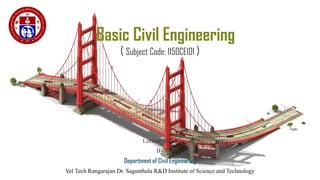
  • 1. Basic Civil Engineering ( Subject Code: 1150CE101 ) Lecture Slides By Department of Civil Engineering Vel Tech Rangarajan Dr. Sagunthala R&D Institute of Science and Technology 1
  • 2. Syllabus UNIT I: Building Materials Introduction – Civil Engineering – Materials – Bricks – Composition – Classifications – Properties – Uses – Stone – Classification of Rocks – Quarrying – Dressing – Properties – Uses – Timber – Properties – Uses – Plywood –Cement – Grades – Types – Properties – Uses – Steel – Types – Mild Steel – Medium Steel – Hard Steel –Properties – Uses – Market Forms – Concrete – Grade designation – Properties – Uses – Advancements in Concrete – Pre-stressed Concrete – Pre fabricated concrete. UNIT II: Building Components Building – Selection of site – Classification – Components – Foundations – Functions – Classifications – Bearing Capacity – Flooring – Requirements – Selection – Types – Cement concrete marble – Terrazzo floorings – Roof – Types and requirements. UNIT III: Planning Aspects and Regulations Building types and design criteria – Space standards for residential, commercial and institutional categories – Building by-laws applicable for approval by the local governing body – Development control rules for Chennai Metropolitan Area. Basic guidelines for earthquake resistant structures. UNIT IV: Water Supply and Sanitary Systems Water supply – Objectives – Quantity/Quality of water –Sources – Standards of drinking water – Distribution system –Sewage – Classification – Technical terms – Septic tank – Components and functions – layout of external services –water supply – Sewage disposal – water supply and plumbing layout for a residential building. UNIT V: Surveying and Transportation Surveying – Objectives – Classification – Principles of Survey – Transportation – Classification – Cross section and components of road – Classification of roads – Railway – Cross section and components of permanent way – Functions – Water way – Docks and Harbors – Classification - Components – Bridges – Components of bridges. 2
  • 3. Unit V: Surveying and Transportation Surveying – Objectives – Classification – Principles of Survey – Transportation – Classification – Cross section and components of road – Classification of roads – Railway – Cross section and components of permanent way – Functions – Water way – Docks and Harbors – Classification - Components – Bridges – Components of bridges. 3
  • 4. Surveying Definition: Surveying is an art of determining the relative positions of points on, above or beneath the surface of the earth by means of direct (or) indirect measurements of distance, direction and elevation. • Survey is performed to prepare a map of relative positions on surface of the earth. It shows the natural feature of a country such as towns, villages, roads, railways, etc. • They may also include details of different engineering works such as bridge, canal, dam, etc. • Before commencement of any major engineering project, survey is carried out to determine the location of site and its surrounding. 4
  • 5. Surveying Objectives of Surveying: • To collect field data; • To prepare plan or map of the area surveyed; • To analyze and to calculate the field parameters for setting out operation of actual engineering works. • To set out field parameters at the site for further engineering works. 5
  • 6. Surveying Principles of Surveying: (i) Location of a point by measurement from two points of reference According to this principle, the relative position of a point to be surveyed should be located by measurement from at least two points of reference, the positions of which have already been fixed. If P and Q are the two reference points on the ground, any other point, such as R, can be located by any of the direct methods shown in the above figures. 6
  • 7. Surveying Principles of Surveying: (ii) Working from Whole to Part: According to this principle, it is always desirable to carryout survey work from whole to part. • This means, when an area is to be surveyed, first a system of control points is to be established covering the whole area with very high precision. • Then minor details are located by less precise methods. • The idea of working this way is to prevent the accumulation of errors and to control and localize minor errors which, otherwise, would expand to greater magnitudes if the reverse process is followed, thus making the work uncontrolled at the end. 7
  • 8. Surveying Classification of Surveying: Surveys may be classified based on the Nature of survey, Object of survey and Instruments used. (i) Classification based on Nature of Survey: Topographical Survey: They are carried out determine the position of natural features of a region such as rivers, streams, hills etc. and artificial features such as roads and canals. The purpose of such surveys is to prepare maps and such maps of are called topo-sheets. Hydrographic Survey: Hydro-graphic survey is carried out to determine M.S.L. (Mean Sea Level), water spread area, depth of water bodies, velocity of flow in streams, cross-section area of flow etc. Astronomical Survey: The Astronomical Survey is carried out to determine the absolute location of any point on the surface of earth. The survey consists of making observations to heavenly bodies such as stars. 8
  • 9. Surveying Engineering Survey: This type of survey is undertaken whenever sufficient data is to be collected for the purpose of planning and designing engineering works such as roads, bridges and reservoirs. Archeological Survey: This type of survey is carried out to gather information about sites that are important from archeological considerations and for unearthing relics of antiquity. Photographic Survey: In this type of survey, information is collected by taking photographs from selected points using a camera. Aerial Survey: In this type of survey data about large tracks of land is collected by taking photographs from an aero- plane. Reconnaissance Survey: In this type of survey, data is collected by marking physical observation and some measurements using simple survey instruments. 9
  • 10. Surveying (ii) Classification based on Objective of Survey: Engineering Survey: These are carried out for the determination of quantities which will be useful for the designing of engineering works. Military or Defense Survey: These are carried out for the preparation of maps of important military areas. Geological Survey: These are carried out to ascertain the composition of the earth’s crust. Mine Survey: These are conducted for exploring the mineral wealth below the earth surface. Archeological Survey: These are executed to prepare maps of ancient cultures. 10
  • 11. Surveying (iii) Classification based on Instruments Used: Chain Survey Compass Survey Plane Table Survey Theodolite Survey Tacheometric Survey Photographic Survey 11
  • 12. Transportation Transportation contributes to the economic, industrial, social and cultural development of any country. • Transportation is vital for the economic development of any region since every commodity produced, whether it is food, clothing, agricultural products, industrial products or medicine needs transportation at all stages from production to distribution. • Transportation Engineering is the science of safe and efficient movement of people and goods. It’s a sub- discipline of civil engineering. Classification of Transport: (i) Roadways or Highways (ii) Railways (iii) Waterways (iv) Airways 12
  • 13. Roadways – Cross section Typical cross section of a road would consist the following layers: (i) Sub soil (ii) Sub grade (iii) Base course (iv) Surface course (wearing) 13
  • 14. Roadways – Cross section (i)Sub soil: It refers to the natural soil or prepared soil on which the loads coming on the road are ultimately transferred. Hence the Sub Soil should be prepared by compacting it properly by rollers. (ii) Sub grade: This layer gives support to the road structure. This should remain dry and stable throughout the year. Much attention should be given in preparing the sub grade. This layer consists of disintegrated rocks mixed with gravel. (iii) Base course: This layer is constructed in one or two layers consisting of stones mixed with gravel. Bigger stones are used at the bottom. At the top level, smaller stones mixed with cohesive soil or cement are provided and thoroughly compacted. (iv) Surface / wearing course: It is the topmost layer of the carriage way. It takes the loads directly. This layer is either made of flexible materials (bitumen or coal tar mixed with stones) or a rigid material (concrete). This layer should be moderately rough to provide good grip for the vehicles. The top surface of the wearing course is provided a lateral slope (camber), to drain off the rain water from the road surface quickly and effectively. 14
  • 15. Roadways – Components The components of roadway would consist of following: (i) Pavement or carriage way (ii) Shoulders (iii) Kerb (iv) Footpath (v) Parking lane (vi) Fencing 15
  • 16. Roadways – Components (i) Pavement / Carriage way: It refers to the path over which the vehicles and other traffic can move lawfully. It also includes the path way and other related structures like bridges, flyovers, underpasses which make road traveling easier. Hence, the width of the pavement for a single lane road becomes 3.8mts. In case of multi lane traffic, the width of each lane should be at least 3.5mts. (ii) Shoulders: The width of a road is always extended beyond the road on both sides by a width of at least 2 to 5 mts. This space acts as a space for moving away any broken down vehicles or parking vehicles in an emergency. (iii) Kerb: Within the city limits, to separate the pavements from the footpath, a raised stone (kerb) is provided at the edge of the pavement. The height of the kerb is normally 15 to 20 cms. 16
  • 17. Roadways – Components (iv) Footpath: Apart from vehicles, the pedestrians should also be provided some space for moving at the edge of the roads. Footpaths should be provided essentially everywhere. The footpath may be in level with the road surface or slightly raised higher than the road surface. (v) Parking Lanes: These are usually provided or reserved on the road edges within a city limit for allowing the vehicles to be parked conveniently. The parking lanes are distinctively separated by white colour strips so that moving vehicles do not enter parking lanes. (vi) Fencing: Whenever a highway or an expressway passes through urban areas, fencing is provided all along the road to prevent the cattle and people from entering the traffic zone. 17
  • 18. Roadways – Classifications As per Nagpur Road Plan, Roads are classified as follows: (i) National highways (ii) State highways (iii) District highways (i) Major district roads (ii) Other district roads (iv) Village roads Purposes of Road Classification: • To plan a road network for efficient and safe traffic operation. • To know the clear information of a particular root in a country. 18
  • 19. Roadways – Classifications (i) National highways: • These are the important roads of the country. They connect state capitals, ports and foreign highways. • They also include roads of military importance. • They are financed by Central government. (ii) State highways: • These are the important roads of a state. They connect important cities and district head quarters in the state, national highways & state highways of neighboring states. • They are financed by state government roads and buildings department regarding construction and maintenance. 19
  • 20. Roadways – Classifications (iii) District Roads: • These are the roads within a district. They are financed by Zillaparishads with the help of grants given by state government. • Major District Roads are the roads connecting the district heads. • Quarters, taluk head quarters and other important town in the district production and market centers with each other and with state & national highways & railways. • Other District Roads are the district roads of less importance. (iv) Village Roads: • They connect villages with each other and to the nearest district road. • They are financed by panchayats with the help of Zillaparishads and state government. 20
  • 21. Railways – Cross section & Components Permanent Way: The finished or completed track of a railway line is commonly known as the Permanent way. The permanent way consists of following components: (i) Rail (ii) Sleeper (iii) Ballast (iv) Formation 21
  • 22. Permanent way - Functions (i) Rail: • To bear the stresses developed due to heavy vertical loads, lateral and braking forces, and thermal stresses. • To provide a hard and smooth surface for the passage of heavy moving loads with a minimum friction between the steel rails and steel wheels. • To transmit load to the sleepers and consequently to reduce pressure on ballast and formation. (ii) Sleeper: Sleepers provides transverse ties on which rails are laid. It serves as a transverse member in the permanent way. Their functions are: • To support the rails firmly and evenly • To maintain the gauge of the track correctly • To distribute the weight coming on the rails over a sufficiently large area of the ballast • To act as an elastic medium between the rails and the ballast and to absorb the vibrations of the trains 22
  • 23. Permanent way - Functions (iii) Ballast: Ballast is a granular and gritty material placed and packed below and around sleepers. • Holds sleepers in position and prevents lateral and longitudinal movement. • Transfer and distribute load from sleepers to large area of formation • Imparts elasticity and resilience to track for getting proper riding comfort. • Provides effective drainage to track • Act as a medium for provision of super elevation in curves of railway tracks. (iv) Formation: Sub-grade is naturally occurring soil. It is prepared to support the components of a railway track such as ballast, sleepers and rails. This prepared surface is also termed as formation. Formations could be in embankment levels or cuttings. The sub-grade supports railway track from beneath. 23
  • 24. Water ways Harbor is a protected inlet or branch of a sea where ships can anchor. Harbor engineering is concerned with planning, construction and maintenance of infrastructure for efficient performance of harbors. 24
  • 25. Water ways – Definition of Terms Harbor: • A harbor, in primary sense is a place of refugee or rest. It is a place where safety and hospitality is to be found. Harbors offer protection to vessels from violent seas. It refers to sheltered sheet of water where vessels are anchored. Port: • The term ‘port’ is used to indicate a harbor where terminal facilities such as stores, landing of passengers and cargo, etc. are added to it. • This distinction is used to mark the jurisdiction between, the State and Central Government. The port is under the State Government and the Harbor is under the Central Government. Docks: • Docks are the enclosed area for berthing of vessels to facilitate loading and unloading of cargo and embarkation and disembarkation of passengers or for repairs, renovations, fueling, oiling, painting and watering of vessels. 25
  • 26. Water ways – Classification of Harbor Based on Geographical existence, harbors are classified as follows: (i) Natural Harbor (ii) Semi Artificial / Protected Harbor (iii) Artificial Harbor (i) Natural Harbor: • Natural formations affording safe discharge facilities for ships on sea coasts, in the form of creeks and basins are called natural harbors. • The factors such as local geographical features, growth of population, development of the area, etc. have made the natural harbors big and attractive. • E.x: Sydney, Melbourne and Bombay 26
  • 27. Water ways – Classification of Harbor 27
  • 28. Water ways – Classification of Harbor 28 Natural Harbor Semi Natural / Semi Artificial / Protected Harbor Artificial Harbor
  • 29. Water ways – Classification of Harbor (ii) Semi-Artificial / Protected Harbor: • Protected harbors are partly natural and partly artificial. • Artificial construction of break waters or entrance moles may supplement existing natural features. • They give protection from wave action to vessels, using or entering harbors. • Ex: Cape Town, Vishakhapatnam. (iii) Artificial Harbor: • Artificial harbors have to be created where there are little or no pronounced natural features. Breakwaters are constructed on an almost open coastline. • Ex: Madras. 29
  • 30. Water ways – Classification of Harbor 30
  • 31. Water ways – Components of Harbor Every harbor should be designed with the following essential components under consideration: (i) Area for free movements and depth (ii) Harbor entrance (iii) Entrance channel (iv) Light house (v) Parking, loading and unloading space (i) Area for free movements and depth: • It is required to obtain a large area of deep water to give shelter from winds and waves. • Area depends upon the class of harbor, maximum number of vessels to be accommodated simultaneously and size of the greatest vessel likely to use the harbor. • Modern vessels are around 300m long and about 30m wide. 31
  • 32. Water ways – Components of Harbor (ii) Harbor Entrance: • Harbor entrance must be wide enough to give access for shipping. However, they should be sited so as to exclude waves and its impacts as far as possible. (iii) Entrance Channel: • Entrance channel in harbors are akin to runways in airports. • The basic principle should be that the depth should be adequate to permit largest commercial vessels that frequently use harbors, without undue delay or hazard. (iv) Light House: • Light house is a massive structure, normally built of masonry or reinforced concrete. • It is a tall tower on a high pedestal. In an ideal planning of harbor, the light house should be in alignment with the central line of entrance channel. (v) Parking, Loading and Unloading Space: • Along with railway track and approach roads, sufficient parking and loading and unloading of inland transport carriers should be provided on port side. 32
  • 33. Bridges • A bridge is a structure built to span physical obstacles without closing the way underneath such as body of water, valley or road for the purpose of providing passage over the obstacle. • Based on various factors such as function, material, structure, etc. different types of bridges are there. • Elements of a bridge will vary with respect to each type of bridge. 33
  • 34. Components of Concrete Bridge (i) Pile - A concrete post that is driven into the ground to act as a leg or support for the new bridge. It is driven into the ground using a pile-driver. The pile-driver is a machine that acts similar to a hammer hitting a nail and drives the pile into the ground. (ii) Cap - The cap sits on top of a group of piles and will help disperse pressure to the piles below. (iii) Bent - This is the combination of the cap and the pile. Together, with other bents, act as supports for the entire bridge. 34
  • 35. Components of Concrete Bridge (iv) Girders - Girders are like the arms of the bridge. They extend from bent to bent and support the bridge decking. They also help disperse pressure to the bents. (v) Decking - The decking is what we would consider the road surface of the bridge. It rests on the girders which are supported by the bents that are made up of caps and piles. 35