This document provides a summary and analysis of the original Grandpont redevelopment scheme designed by Michael White. It begins with an introduction to the site located in Oxford, England and an analysis of the site which identifies strengths, weaknesses, opportunities and threats. The original design scheme is then critically evaluated based on responsive environments, morphology, townscape and imageability. Some key weaknesses identified include large building blocks, lack of variety, and separation of cars and pedestrians. The document proposes 14 design actions to address issues in the original scheme by improving access points, defining private and public spaces, and allocating active and inactive edges. The amended design scheme will seek to improve on the original by employing urban design theories analyzed throughout the document.
Do not include any personal information as all posted material on this site is considered to be part of a public record as defined by section 27 of the Municipal Freedom of Information and Protection of Privacy Act.
We reserve the right to remove inappropriate comments. Please see Terms of Use for City of Toronto Social Media Sites at http://www.toronto.ca/e-updates/termsofuse.htm.
The TOD Study presented yesterday looked carefully at land use and transportation patterns, and then suggested the general contours for a reshaped downtown. Six potential development clusters were identified, including: the North Avenue Gateway (between Memorial Circle and I-95), the Central Corridor (between I-95 and the Metro-North tracks), Crossroads (the heart of the downtown, near the intersection of Huguenot and North), the West Gateway (where Huguenot and Main meet near Pintard), the East Gateway (around Echo Bay and Faneuil Park), and the I-95 Gateway (near the end of Palmer Avenue.)
GROWING THROUGH TRANSIT: a plan for transit oriented development in downtown ...John-Mark Palacios
Student TOD proposal at Florida Atlantic University. Suggests redevelopment of a different site than that chosen by Fort Lauderdale for All Aboard Florida and Tri-Rail Coastal Link.
Research on Linking between Bridges and Existing Road Network of Mountainous ...IJERA Editor
Because of the complex topography of mountainous city, there is usually large difference between bridge and existing road network in elevation. In order to realize rapid traffic of vehicles, reasonable interchange ramp can be designed to realize rapid dividing of vehicles at bridgehead. This paper mainly introduces a typical interchange at bridgehead — Caiyuanba Interchange, located in Chongqing, a mountainous city, explains difficulties encountered in engineering design and realizes rapid dividing of vehicles by designing reasonable interchange at bridgehead, so as to accumulate certain experience in the construction of interchange at bridgehead.
Do not include any personal information as all posted material on this site is considered to be part of a public record as defined by section 27 of the Municipal Freedom of Information and Protection of Privacy Act.
We reserve the right to remove inappropriate comments. Please see Terms of Use for City of Toronto Social Media Sites at http://www.toronto.ca/e-updates/termsofuse.htm.
Study to evaluate bicycle and pedestrian connectivity along the A1A/US 1 Corridor between SE 17th St. and Dania Beach Blvd., through the Fort Lauderdale/Hollywood International Airport and Port Everglades, an area notorious for being hazardous to bicycle travel.
Metrolinx invites you to participate in a Mobility Hub Workshop for the Mount Dennis area that will help identify community opportunities to shape the future vision for the area. Have your say at thecrosstown.ca.
The New Jersey Department of Transportation instituted a “Complete Streets” policy in 2009, joining a handful of other states that have adopted policies to plan, design and build state roads that are accessible to all users, not just cars. More than a dozen New Jersey local governments have followed suit, implementing policies that apply to local roads and streets. The city of Hoboken has been an early leader, becoming one of the first municipalities on the East Coast with a public bike repair facility and has doubled the number of bike racks near transit and striped its first “buffered” bike lane. Jersey City also has a Complete Streets policy and the city’s Route 440 boulevard project may serve as a valuable case study in renovating state highway corridors. Complete Streets policies have multiple benefits and have recently been identified as an obesity prevention tool by Shaping New Jersey and the New Jersey Partnership for Healthy Kids.
Transit Oriented Development is the exciting fast growing trend in creating vibrant, livable, sustainable communities. Also known as TOD, it's the creation of compact, walkable, pedestrian-oriented, mixed-use communities centered around high quality train systems.
transit oriented development california
transit oriented development principles
examples of transit oriented development
transit oriented development abstract
transit oriented development case studies
transit oriented development hawaii
transit oriented development seattle
transit oriented development benefits
Planning station environs_proposed_future_slidesinchicoreontrack
Inchicore on Track's presentation at the ABP Oral Hearing in March 2011, in relation to the Dart Underground coming Above ground in Inchicore. Chapter 3: Planning, Station and Environs and Proposed Future Development
Brian Canin, President of Canin Associates, discusses ongoing research into a model for Transit Ready Design based in Central Florida including Restoration, a major development project that is expected to include a project funded streetcar line.
A presentation on the philosophy of Site Responsive Design delivered to planners and members at Winchester City Council as part of their urban design training.
A highly successful and sustained campaign in which the University used the launch of its economic impact report to secure widespread public support during a period of campus redevelopment. The campaign won the Heist Gold Award for best Public Relations Campaign 2011.
No matter if you just have colleagues or organize people as a team lead or senior developer: There are some mechanics that apply to any mentally healthy human being and that have to be taken into consideration when you want to achieve good results as a team. This talk tries to give you a easy but valid introduction to some scientific findings about the nuts and bolts of brains and souls of the biggest investment your company probably has made: your teams.
Locative Media And Responsive EnvironmentsJeff Watson
This presentation explores the evolution and trajectory of ubiquitous computing technologies that enable designers to embed media artifacts and computational systems in physical space. By placing custom bar code glyphs, GPS/Google Earth markers, sensor systems or other smart-phone-readable triggers in physical locations, designers can create hyperlinks connecting real-world objects or places with a wide variety of media -- from video, audio and text content to dynamic data feeds and opportunities for interactions with both human and non-human agencies. Crucially, however, this layering practice does not stop at the level of the hyperlink or the traditional notion of Augmented Reality. Rather, designers are beginning to perceive opportunities for embedding responsive computational power in physical space, enabling environments to track, profile and communicate with their inhabitants, providing customized, adaptive and anticipatory user experiences.
the Community Access Project sings out the concerns of people with physical and sensory disabilities in these Public Comments to MassDOT. Three recommendations, with photos, are included.
Do not include any personal information as all posted material on this site is considered to be part of a public record as defined by section 27 of the Municipal Freedom of Information and Protection of Privacy Act.
We reserve the right to remove inappropriate comments. Please see Terms of Use for City of Toronto Social Media Sites at http://www.toronto.ca/e-updates/termsofuse.htm.
This report considers the notion of ‘urban inclusion,’ focussing particularly on the potential for inclusion through the participation or meaningful involvement of local people in decisions related to transformation within their neighbourhoods and/or wider districts. The aim is to design a strategy for community involvement relating to the development of an area that forms part of the larger site developed between 2006 and 2012 for London’s Olympic Games. Our small site, known as Rick Roberts Way, lies within the London Borough of Newham, along the eastern edge of the Lea Valley and to the south of the main Olympic Park.
Developing the strategy will involve engaging with theory relating to inclusion and participation, and with debates relating to participatory practice in plans for urban change in London and elsewhere and specific techniques for promoting participation in urban design.
Suburban Train Station as Community Hub: Proposal for Carseldine Stationlinda carroli
I've been working on this study of a local train station in support of Transit Oriented Development. In it, I propose that community infrastructure (e.g. community spaces and offices for non-profit organisations) and design for sustainability should be provided at train stations. If more parking is required then those structures can and should also accommodate community uses.
I have also posted this to Live Local as my first experiment. Live Local is an online social networking place to share stories and ideas about improving your community. I will be blogging about this venture for Placed.
http://www.livelocal.org.au/experiment/126/precinct-study-carseldine-train-station
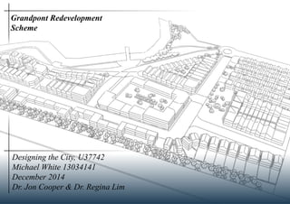
1. Designing the City, U37742
Michael White 13034141
December 2014
Dr. Jon Cooper & Dr. Regina Lim
Grandpont Redevelopment
Scheme
2. 2
Contents
Introduction to Report 2
Introduction to Site 3
Site Analysis - Key Points Raised 4
Preliminary Design Scheme
Critical Evaluation 5 - 7
Revising Design Actions 8
Amended Design Scheme
Design Evolution 9
Final Design 10-11
Final Design Concepts 12
Amended Design Analysis
Responsive Environments 13
Morphology 14-15
Townscape 16
Imageability 17
Comparison and Conclusion 18
Conclusion 19
Reflective Statement 19
Bibliography 19
Introduction to the Report
This project will be assessing the current implications, success and potential of the Grandpont site, located west of Oxford City Centre. The report
will employ and seek to analyse the already created [Original] Grandpont Scheme, developed for Hand-in 1, 2 & 3.
The Original Grandpont Scheme used aerial imagery, SWOT analysis, traffic analysis, land use and morphological layers to create and a valid final
opinion and argument for the implications of Grandpont as a site, both within itself and the surrounding area. The Original Scheme researched and
assessed the success and failures of relevant case studies which could relate to the site of Grandpont. From this, a final design concept followed, in-
cluding final design actions to directly address concerns and points raised from the site analysis.
This Amended Scheme will seek to analyse and correct the Original Scheme by the employment of skills taught throughout the semester, including:
- Responsive Environments
- Morphological Layers
- Townscape
- Imageability.
Which will be combined in order to assess which factors improves and disproves a potential site, likewise to Grandpont.
Consequently, a revised design evolution will be completed in order to create a Final Grandpont Scheme, which will be analysed and cross-referenced
to the above skills and the Original Grandpont Scheme.
Fig 1: Surrounding area to Grandpont in
need of regeneration. Source: Author
Fig 2: Edges of site subject to much
deteriotation. Source: Author
Fig 3: River flooding is a major concern.
Source: Author
3. 3
Introduction to the Site
Grandpont is a site within Oxford, England, located to the South-West of
the City Centre. The site is south of the existing Oxford Train Station and
lays parrallel to trains travelling in- and outbound into Oxford. The River
Thames runs around the north of the site, causing the site to be isolated
from the City Centre and likewise producing a lack of access points onto
the site. The existing access points consist of a footbridge to the north of
the site and a bridge for motor vehicles located a large distance east of the
site. The site was previously used for gas works up until the 1970s until the
area has since become stripped and left as a Nature Reserve for the use of
the public.
1) As seen by the map above, it can now be highlighted how close the
train track is to the site, measuring a decibel reading of: 94dB when
the reading is taken around 7 metres from the track, whilst the readings
measured 75dB in the eastern open field, Therefore, land use for the site,
must be considered.
2) Directly parrellel to the site, houses developed in the late 1960s are
present, whereby the nature is very council-developed style, with at-
tempted open areas for community use, such as ball games.
3) To the south of the site, a large open field for recreational uses are lo-
cated. This includes dog walking and use for children. This factor must
be strongly considered for Grandpont. However, placing houses close to
the dark, open areas would in turn increase the nature surveillance of the
area.
4) Located close to the site are expensive houses that have recently un-
dergone gentrification work to, in turn, increase the value of properties.
1) The Grandpont site is located south of Oxford City Centre, being ap-
proximately 0.8 miles away from the train station. There is a strong oppor-
tunity to redevelop the train station.
2) There are vast quantities of open space and the site is not designated as
Town Green however the land on the site ahs been contaminated.
3) To the north of the site, Jericho and Summertown are located. Both of
these disticts within Oxford are high end communities where houses are
both aesthetically pleasing and expensive. Therefore Grandpont, will need
to deliver the aesthetic reputation and match, if not increase the communit
strength.
4) The river acts as an excellent opportunity for the Grandpont site. It pass-
es around the border of the site.
Fig 4: Entrance sign for Grandpont is not destinct and does not resemble a
new area from the surrounding estate. Source: Author
Fig 5: The existing landmark present in the centre of Grandpont and exhib-
its minimal destinction. Source: Author
Fig 6: Aerial map showing the location of the site in relation to the City of
Oxford, including the river, Town Centre and Jericho. Source: Google
5. 4
Strengths Weaknesses
S1 - Flat Land
S2 - First School
S3 - Proximity to City Centre
S4 - Car Park
S5 - Surrounding house values
S6 - Trees value opportunities
S7 - River - visual appearance
W1 - Lack of access onto site
W2 - Visually intrusive hous-
ing
W3 - Areas of degredation
and misuse
W4 - Risk of flooding
W5 - Low light pockets on
the site
W6 - Train implications -
noise, safety and physical
barrier
Opportunities Threats
O1 - Train Station Redevelopment
O2 - Keep and enhance trees on the
site
O3 - Bridge enhancing possibility
and access for pedestrians
O4 - River could increase the value
of properties
O5 - Carless Community
T1 - Train - noise and vibra-
tions
T2 - River reduces access
onto the site
T3 - Flooding risk associated
with the river
Key Points Raised
This sheet shows the key points raised from the Initial Design Scheme and Proposals
1) Access Points and Roads
Access into the site is near impossible for a car. Vehicles must travel East
of the site, then drive southbound before heading back around to the West
in order to reach the site. A very prominent weakness and barrier. Howev-
er, as seen in the map above. there are 7 access points for pedestrians and
non-motor vehicles, which could be used to my advantage.
Fig 7: Access Roads on the site of Grandpont. Souce: Author
2) Infrastructure
The shaded areas are commercial/non-residential uses such as the train-
line whilst the outlined blocks are residential housing estates and devel-
opments. On the site, it is evident to see how Grandpont is on the edge of
development, whereby onwards from the site, development is non-existent
and the greenbelt starts.
Fig 8: Surrounding infrastructure on the site (shaded). Source: Author
3) Desire Paths / Roads
The map above shows the existing roads (black) and the calculated desire
paths created from use of pedestrians. From this analysis, it is evident that
the desire paths are very different from the existing roads created for the
use of the public. They also state how points/features of interest cause peo-
ple to leave the main track in order to investigate
Fig 9: Desire paths (red) and roads (black) on the site. Source Author
4) Blue Networks and Flooding
As seen above in the two corresponding maps, flooding and existing water
is a key issue. The presence of flooding on the site may be minimum, but its
the concern with the surrounding area. In reference to the map on the left,
it is evident that flooding stretches across many of the surrounding lands.
This makes access onto the site, as well as safety for children, a major
concern.
Fig 10: Risks of flooding on the site.
Maps.environment-agency.gov.uk
5) Green Networks
Green networks existing on the site currently are the strongest attribute.
Green networks are evident on the site and around the site, which increases
the feel of the area and acts as a rural retreat away from the city a near 0.5
miles away. Therefore, it must be stated that green networks upon the site
must be kept.
Fig 11:The green networks existing in and around the site. Source: AuthorFig 10: Blue networks present.
Source: Author
7. Preliminary Design Scheme
Critical Evaluation
5
Responsive Environments
Responsive Environments is the “ideas that the built environment should
provide its users a democratic setting, maximising the degree of choice
available to them. This suggests that a responsive place is one in which
is flexible to the surrounding streets and sites, as well as offer permeable
spaces for users to use. From this, we can see that the Preliminary Design
Scheme consists of:
- Permeability: This scheme in fact offers many different ways through the
site, whereby the user can navigate through the site if one pleases or can
travel around the site via the northern route which connects the north-west
corner to the east of the site without any interaction with the site. There is
minimal segregation of buildings as the buildings are located on the routes.
Access into the blocks are strong as access points surround the perimeter
blocks. However, one thing that could be acknowledged is the largeness of
the blocks, making the users having to navigate around the buildings within
the site.
The sheets below shows a further, visual analysis of the design.
Morphology
Morphology states how measurements and character can determine the
success and viability of a site. In this scheme, we can see:
- There is arguably many active edges, however it must be considered which
areas realistically will be subject to larger amounts of footfall. Therefore,
the revised scheme should allow for allocations of designated inactive edg-
es.
- The traffic nature is difficult to determine due to the nature of the carless
community, yet from external research, it can be suggested cars and pe-
destrians should not be seperated, incorporating the possibility of shared
space.
The sheets below shows a further, visual analysis of the design.
Townscape
Townscape is the analysis of streets, spaces and areas through the concept
of serial vision, proposed by Gordon Cullen, which states how each area
or section of a site interacts with its surroundings the subsequent section.
It is the strength of interactions within a site. From the previous analysis
(see Hi5), the strongest features that should be included in the revised
scheme include:
- Netting and truncation, taking advantage of the Oxford scenes to the
distance whilst encapturing the strength within the site.
- Closed Vistas, lowering the building details and details in order for a far
more vital street.
- Pinpointing / focal points need to be included as the success of the City
Centre is due to destinction of the ‘dreaming spires’
- Encloses need to be incorporated as they offer many advantages to spac-
es.
The sheets below shows a further, visual analysis of the design.
Imageability
Imageability is the analysis of the legibility of a site, as seen in Hi6 with
the relevant analysis of Oxford City Centre by using Kevin Lynch’s con-
cepts.
- The paths / routes within the site are understandable and legible, how-
ever there is no defined beginning, middle and end to the routes as each
said route is short. This allows permeability but a lack of legibility and
character for users. Arguably, there are too many choices in navigation,
as each route leads to unnecessary and undesired locations.
The sheets below shows a further, visual analysis of the design.
Fig 12: Final, original Grandpont Scheme. Source: Author
8. 6
- Variety: The variety on the site cannot be visualised from this scheme,
but DA2 states the buildings located to the west of the site, neighbouring
the trainline will be commercial / office developments. The below report
should analyse the implications and success rates of shops and commer-
cial use buildings below residential developments to allow for variable
street networks and uses.
- Robustness: This site does not offer many different opportunities for
different purposes, as the buildings are currently allocated as primarily
residential with minimal variety or open space.
- Legibility: The nature of the carless streets suggest that the users will
struggle to comprehend the routes as the car and pedestrian access points
are completely seperate. This must be researched and amended in the
report below.
- The blocks are very large, with small streets between each block, suggest-
ing how many of the roads are very well connected. This is due to the grid
nature, as is evident and successful within American cities.
- The traffic nature is difficult to determine due to the nature of the carless
community, yet from external research, it can be suggested cars and pe-
destrians should not be seperated, incorporating the possibility of shared
space.
- The dimensions must be reduced in order to allow for a clarification from
private and public space.
- There is arguably many active edges, however it must be considered which
areas realistically will be subject to larger amounts of footfall. Therefore,
the revised scheme should allow for allocations of designated inactive edg-
es.
- Due to the buildings being that of a perimeter block nature, it can be
suggested that the fronts and backs are a strong attribute within this site. A
perimeter block nature should be kept for the revised scheme.
- The dimensions must be reduced in order to allow for a clarification from
private and public space.
Perimeter blocks on the site
Office / Commercial developments
Narrow roads present within the site
Active Edges
Backs Fronts
Responsive Environments Morphology
Fig 13: Responsive Environments Analysis. Source: Author Fig 14: Morphological Analysis. Source: Author Fig 15: Morphological Analysis Continued. Source: Author
9. 7
Above shows the factors that currently exist on the Grandpont scheme, of which include:
- Deflection: As seen in the blue, deflection has been exhibited on many of the road corners due to the 45
degree angle. This will entice users to explore and increase the safety one feels, something that must be kept
for the revised scheme.
- Block housing is following on from perimeter blocks, therefore having two advantages within the site. How-
ever, the perimeter block dimensions need to be increased and amended.
- Defined spaces often act as a landmark, suggesting that the amended scheme should use open spaces to its
advantage by enhancing them as opposed to creating another landmark.
- The nodes within the site are one of the strongest features. Being that of a carless communities, each node
exhibits much open space, offering enclosures and defined space to the user, as seen on the map. The defined
space should be kept for the revised scheme.
- Edges are prominent within this site, whereby the strongest feature evident is the river. The site is also sur-
rounded by a trainline and the small river to the south of the site. Within the site, there is minimal and must be
enhanced.
- Landmarks were seen as the strongest feature within Hi6, however the above original scheme shows no land-
marks. Hi6 stated how user would map the routes and legibility of a city based on the locations of landmarks,
suggesting how the revised scheme must include more landmarks to define the character of the site and increase
legibility.
- Districts are captured strongly within this scheme due to the seperation of residential and office sections.
Here and Thereness
Block Housing
Defined Sapces
Deflection
Edges
Residential District
Commercial District
Nodes
Townscape Imageability
Fig 16: Townscape Analysis. Source: Author
Fig 17: Imageability Analysis. Source: Author
10. Preliminary Design Scheme
Revising Design Actions
8
Design Actions for Original Scheme
Design Ac-
tion
Description Links to urban
theories
DA1 Carpark moved adjacent to trainline Respon.
DA2 Commercial developments located
adjacent to trainline
Respon.
DA3 Shared space south of site Imageability.
DA4 Enhancing of current access points Respon.
DA5 Terraced housing south of site Morph. & Image.
DA6 Houses developed into water to
avoid soil corrosion
Responsive Envi-
ronments.
DA7 Mixed tenure blocks evident on site Respon.
DA8 Open space/square in the centre Town, Morph,
Image.
DA9 Streets to be narrow and lined with
trees
Morph. & Image.
DA10 Narrow streets and lack of front
gardens
Morph. & Image.
DA11 Most blocks to be perimeter blocks Morph. & Image.
DA12 Open space east of site Town, Respon,
Image
DA13 Development east of the site Morphology
DA14 Connecting path from north to east Town, & Morph.
Design Action Description Addresses
DA1 Enhance and improve the existing access points onto the site to allow pedestrians through or
around the site and improve choice for the user
Morphology, Responsive., O3,
W1, W3, W4.
DA2 Fronts and backs to be defined to allow a definition of private and public space Morphology.
DA3 Allocate spaces for inactive and active edges, purposely aiming for a large majority of active
spaces. To use inactive spaces in private, residential areas
Morphology, Imageability
DA4 Traffic nature to be mixed and incorporated within the site, including areas of pedestrianisa-
tion
Oxford City Council, Morpholo-
gy, Imageability
DA5 Density target = 100 people/ha, equalling 40 dwellings per hectare Morphology, Imageability
DA6 Block size target = 100 x 80m (100x100m max.) Morphology, Imageability
DA7 Streets to vary in size, being narrow for pedestrians and wider for primary roads and on street
parking
Morphology, Imageability
DA8 Housing to be similar character to surrounding area Imageability, W2, W3
DA9 Local amenities to be included within the site to reduce the possibility of car use Responsive., Imageability
DA10 Shared space to be used within the site O5, Townscape
DA11 River and its surroundings to be enhanced and improved S7, W3, W4, O4, T2, T3, Image.
DA12 Train noise and vibrations to be mitigated by the construction of non-residential developments Imageability, W6, T1
DA13 Use trees and greenery and encapture the existing character of the space - include open spaces Imageability, S6, W5, O2,
DA14 Develop new landmarks Imageability, Responsive.
DA15 Allow for pockets of netting and truncation, improving hereness and thereness Townscape
DA16 Create spaces that define the area, improving defined spaces from Gordon Cullen Townscape, Imageability, S1
DA17 Mixed Tenure and use throughout the site Imageability, Townscape
DA18 Connecting paths from north to east Morphology, Imageability, W1,
W3
DA19 Defined districts to be in place, seperating each area, as opposed to combining each district Imageability
DA20 Variety of space uses to be included by reducing block size and shape implications Imageability, Morphology, Re-
spon.
DA20 Keep aspects of deflection within the design Townscape
Design Actions for Revised Scheme
Design Actions for Original Scheme
The above design actions are that which were implicated for the original
design scheme, accumulated and evident within Hand in 1 & 2.
There is a strong connection to responsive environments due to the impor-
tance of permeability and routes located as priority in the design evolution
of the site (see Hand In 1).
Therefore, the above design actions have been amended to include the ex-
plored criteria to achieve a more conservative and sound design scheme
which relates to far more criteria.
Design Actions for Revised Scheme
Therefore, the amended design actions that will be in place for the revised Grandpont scheme are seen above. The above design actions need to
be followed throughout the evolution of the site, whereby each action needs to be cross referenced to allow for a maximum possibility of design
soundness.
Each design action is written in reference to the factors that have arisen for imageability, responsive environments, morphology and townscape.
Design Objective
Considering the above, a final design objective has been created which must be followed throughout the evolution of the revised scheme:
The design objective for the revised Grandpont Scheme is to deliver a site which allows for many activities and places to stay, as opposed to
live. The site must be suitable for families and attend to the recent demographic shift of young single occupants, including that of students for
Oxford University.
12. Amended Design Scheme
Final Design Evolution
This page shows the amended scheme block and road evolution, taking into consideration the
abovementioned methods and design actions. The final image will be taken forward for the final design.
9
Design Stage 1
Above shows the first stage of design, connecting all of
the existing access points onto the site together. Here we
see, likewise to the Original Scheme, how a small square
is naturally created, creating a defined space in response
to Townscape.
However, the street nature leaves minimal space for real-
istic buildings to be designed due to the sharp corners and
very small block sizes. Therefore, a much more general,
but still synced design stage must be carried forward.
Design Stage 2
Therefore, the roads have been generalised to form a
much more realistic and useable about of spaces.
This stage creates a Americanised grid-like street pattern
to the south of the site, leaving perfect block sizes for
perimeter blocks and rows of terraced houses, similar to
the surrounding area.
To the north of the site, the block sizes increase, suggest-
ing a potential for more mixed plots, such as housing and
flats. However, the block sizes are too large.
Design Stage 3
This design encapsulates the main points from the previ-
ous stages, including the grid nature to the south of the
site and the reduction in the block sizes.
The design shows green space parallel to the river in or-
der to preserve the currently present beauty of the site,
increasing the chance for planning permission and re-
ducing the chances of opposition.
However, the central block is too large in order to create
a successful and active perimeter block.
Design Stage 4
Considering the previous stages, a final design has
been produced which will be taken forward for the
final design.
To the west of the site, there is enough room for of-
fices and residential shared plots. To the north, more
affluent properties will be located due to the advan-
tage of the views across the river.
The large block from the previous stage has been re-
duced in order to create much more successful streets
and active edges.
Fig 18: Access points connected. Source: Author Fig 19: Structure is based around access. Source: Au-
thor
Fig 20: Paths created for large, useable blocks to be
added Source: Author
Fig 21: Final Design layout to be taken forward. Source:
Author
N N N N
0 100 0 100 0 100 0 100
13. 10
Amended Design Scheme
Final Design
Fig 22: Final, plan view of Grandpont, developed on Sketchup. Source: Author
0 100
N
Grandpont Bridge
Public Square
Trainline
Tree Buffer
More Affluent
Estates
Perimeter
Block
Chimney Pot
Park Styled
Housing
Public Square
River Thames or Isis
Flats with Communal
Spaces
Affluent Perimeter
Blocks
Green, open public park
Houses and Flat Development
with communal square
Offices to let
Shared Space
14. 11
Amended Design Scheme
Final Design
Fig 23: Final, 3D perspective view of Grandpont, developed on Sketchup. Source: Author
Houses orientated towards the river to
enhance river quality, DA11.
Road and walkway to under existing train
bridge for future developments, DA1
Existing bridge is enhanced and improved
by developing entrance, DA1
Trees and vegetation is used extensively
throughout the site, DA13.
Housing of similar nature and character to
surrounding, victorian terraced housing, DA8.
Retail and apartments to be located
together, surrounding a communal
square, DA17
Housing to the south is orientated and
tilted towards the landscapes
Train noise isolated by tree buffer
and office properties, DA12
Roundabout added to improve access
to existing road networks, DA1
Chimney Pot Park concept to act as af-
fordable housing within the site, DA17
North and East is connected via a public
footpath and seperate vehicle road, DA18
Controlled access within the shared space between
set times, giving priority to pedestrians, DA4.
15. 12
Amended Design Scheme
Final Design Concepts
DA8
DA11
DA2
DA20
Housing similar to sur-
rounding area
River edge and visuals
to be enhanced and
improved
Fronts and backs to be
clearly defined
Block and perimeter
block to be reduced
Train noise to be re-
duced and mitigatedDA19
Districts to be added and
defined within the site
DA9
Local amenities to be
located within the site
to reduce car use
DA17
Mixed tenure
within the
site
DA8
Housing to be similar to
surrounding area
DA21Deflection to be used
within the site
DA14
A landmark to be em-
ployed within the site
DA7
Narrow roads for pe-
destrian use
DA4
Mixed traffic nature
within the site
DA17
Mixed tenure within the
site
DA7
Narrow pedestrian
roads
DA10
Shared space to be used
within the site
0 100
N
Fig 24: Busy, pedestrian street. Source:
The-world-tour.blogspot.co.uk
Fig 25: Pedestrian Street Source: Author Fig 26: Pedestrian street.
Source: Pedestrian Design
Guide
Fig 27: Main Access Vehicle Road Source:
Author
Fig 28: Chimney Pot
Park. Source: Urbans-
plash.co.uk
Fig 29: Chimney PP Concept. Source: Urbans-
plash.co.uk
Fig 30: Chimney PP against other properties
Source: Author
Fig 31: Norham Manor.Source:
Search.savills.com
Fig 32: Norham Manor Styled Housing within
Grandpont. Source: Author
Fig 33: Concept of Perimeter
Block. Source: Dezeen
Fig 34: Retail and housing in
use. Source: Flickriver.com
Fig 35: Flats and retail perimeter block. Source:
Author
Fig 36: Single storey offices.
Source: Flickriver.com
DA12
Fig 37: Office district to buffer train noise.
Source: Author
Fig 38: Victorian Houses.
Source: Getty Images
Fig 39: High End
Housing. Source:
Author
Fig 40: Public Square.
Source: Dirtywahter
17. Amended Design Scheme
Responsive Environments Analysis
This sheet will analyse the new and amended design scheme in relation to the principles of Responsive
Environments
13
Perimeter Blocks and Structure
Permeability is the concept that has been considered most highly within
the redesign of the project. The street network above was based around
the morphology and dimensions of the ideal perimeter block (100m x 80m
max.), addressing DA6, block size.
Retailers set their store locations on a 400m walking distance, hence the
retail has been located within the centre of the site. Due to the permeability
of the perimeter block, the walking distance is reduced, increases the legi-
bility for residents with and around the site.
Perimeter blocks, as evident within the amended design, offers fronts and
backs and a strong sense of natural surveillance.
Road Network
The road network has been considered highly from the previous scheme,
taking the concept of a carless community further. Within this design
scheme, roads have been allocated uses for different people, as seen in the
above image which seperates the cars from pedestrians working from the
left.
The blue symbolises shared space, allowing for controlled access for vehi-
cles, hence making the roads maneavable as well as still useable, for uses
such as emergency services. This concept addresses DA10, shared space
and DA4, mixed traffic nature. The roads have connected the north and
east, addressing DA18, improving the current lack of legibility present on
the site.
Active and Inactive Edges
The previous design offered minimal inactive edges throughout the site, a
positive that was attempted to be taken further. The above design shows
how the inactive edges have been mitigated by the use of edges, whereby
the inactive edges pose no concern by the lack of access to the user.
The use of perimeter blocks within the site allow for full, 360 degree sur-
veillance, reducing the impact of inactive edges, addressing DA3, active
and inactive edges.
Pedestrian path ways and access roads may suffer from inactive activity
within the night, hence the roads have been narrowed to increase natural
surveillance and safety on the site, addressing DA7, narrow roads.
0 100
N
0 100
N
0 100
N
Fig 41: Perimeter Blocks. Source: Author Fig 42. Road Heirarchy. Source: Author Fig 43. Active Edges. Source: Author
Perimeter Blocks Vehicle Roads
Shared Space
Pedestrian Roads
Active Edges
Inactive Edges
18. Amended Design Scheme
Morphology Analysis
This sheet will analyse the new and amended design scheme in relation to the principles of Morphology
14
Density
The site block nature and size has strongly considered DA5, which targets
a density of 100 people/ha, 40 dwellings/ha. As seen above, the map has
been divided into 100m² squares.
Each square exhibits different amounts of dwellings, suggesting mixed ten-
ure within the site, addressing DA17, mixed tenure. The density results in
an average of 38.8 dwellings/ha, very close to the target. Such a result leads
to a density of 93.2 people/ha (38.8*2.4), strong enough to support a good
bus service.
The density allows for a strong community to be developed, as well as
constantly surveyed streets by the activity present.
Fronts and Backs
The fronts and backs have been considered highly from the original design
scheme, removing the lack of clarification. The use of legible and defined
perimeter blocks forms a strong base which clarifies the fronts and backs.
Above shows how the amended design clarifies the fronts and backs, ad-
dressing DA2, fronts and backs. Sucessfully, the backs are out of access
to the typical user, allowing access to only the owning occupants of the
dwellings.
There is a lack of clarification of fronts however, due to the lack of front
gardens and the concept of Chimey Pot Park, which gives priority to vehi-
cles, as seen in the magnified image above.
Building Uses
Building uses have been located in order to create districts, a concept that
will be explored further in the below pages. The difference in building
uses addresses DA17, mixed tenure.
To the left of the site, as seen in red, offices have been located below af-
fordable flats. The employment of such a concept will mitigate the noise
and vibration of the adjacent train, addressing DA12, train noise.
The centre of the site (purple) exhibits retail activity which is located
below increased value rents. This addresses DA9, local amenities.
The surrounding areas are designated for houses, addressing DA17.
41
25
37
52
34
44
0 100
N
0 100
N
0 100
N
Fig 44. Density, 6 squares. Source: Author Fig 45. Fronts and Backs. Source: Author Fig 46. Building Uses. Source: Author
1 hectare
Backs
Fronts
Office
Residential
Retail
19. Amended Design Scheme
Morphology Analysis
This sheet will analyse the new and amended design scheme in relation to the principles of Morphology
15
Street Breakdown and Character
The street and house character will be based off the surrounding area, be-
ing that of victorian, three-storey terraced housing, resulting in the houses
being adjoined and uniform in style, addressing DA8, similar styled hous-
ing. Below shows the street breakdown for the road located to the south
of the site, which will allow for mixed use, addressing DA4, mixed traffic
nature. The below street breakdown shows the safety for pedestrians from
the space as well as room for street parking.
Above shows the street breakdown of the road located to the centre of site,
which will be controlled access for vehicles, allowing priority for pedes-
trians. This concept addresses DA’s 4, 7 narrow pedestrian roads and 10,
shared space. The employment of said concept will allow for constant nat-
ural sureillance from the bordering houses and constant use by pedestrians
and vehicles.
74.8m
37.1m
10.0m
16.5m
252.2m
69.9m
69.8m
99.3m
204m
75.2m
71.9m
14.2m
55.3m
82.7m
26.0m
8m
77.6m
67.2m
89.5m
63.7m
50.0m
106.3m
9.93m
33.7m
69.8m
48.4m
68.8m
Dimensions
129m
418m
204m
The above shows the dimensions of the blocks within the site.
The block, plots ands buildings have been designed in relation
to Norham Manor, which states the strengths of large block
design. Considering the above, each block has been designed
with garden space for every house, as well as shared commu-
nal spaces for flats. Previous analysis’(Morphology), states the
importance of open space for every resident.
The block dimensions use the measurements from DA6, block
size 100m x 80m, achieving this or below. Above the target
layer will decrease natural surveillance and safety within the
site.
The size of the houses have been considered as well, ranging
from 6m to 10m, employed within the south west estate.
0 100
N
Fig 47. Dimension Breakdown of the site. Source: Author
Fig 48. Street Breakdown. Source: Streetmix.net
Fig 49. Street Breakdown. Source: Streetmix.net
20. Amended Design Scheme
Townscape Analysis
This sheet will analyse the new and amended design scheme in relation to the principles of Townscape
16
Enclosure
The yellow shows the enclosure within the site, being that of a communal
open space for the surrounding flats, in turn increasing community strength.
Deflection
Deflection is minimal within the site, being a weakness that has not been
fully utilised, yet pockets and examples are still evident, addressing DA21
Narrows
Narrows located within the site cause the user to understand more detail is
located through the pathway, as is exhibited above.
Truncation
Truncation states how designs, buildings and features are improved by dis-
tance and framing. This is seen above, suggesting an improvement to the
original design and addressing DA15, netting and truncation.
Punctuation
Punctuation states the break in roads cause the users to not become bored,
as seen minimally once in the pink above.
Focal Point
Focal points are not fully utilised but are still minimal. This further sug-
gests how the final design does not satisfy townscape fully.
Block House
The concept of block houses is curved, uniform causes residents and users
to be directed, as seen in the blue which utilises the 45 degree corners.
Defined Spaces
Spaces that are open and create public spaces can be seen as defined spaces
due to the viscosity they deliver, making users remember where to meet,
addressing DA16, defined spaces.
Hereness and Thereness
Hereness and thereness is minimal within the site, except the link between
the two defined space.
0 100
N
0 100
N
0 100
N
Fig 50. Enclosures, Deflection and Narrows.
Source: Author
Fig 51. Truncation, Punctuation, Focal Points.
Source: Author
Fig 52. Defined Spaces, Hereness and There-
ness and Block Houses. Source: Author
Narrows
Enclosure
Deflection
Truncation
Punctuation
Focal Point
Block Housing
Here and There
Defined Space
21. Amended Design Scheme
Imageability Analysis
This sheet will analyse the new and amended design scheme in relation to the principles of Imageability
17
Districts
Districts are highly considered within the amending of the Grandpont
scheme. As seen above, the site has been broken down into clear districts,
including office and retail sectors for a local economy, addressing DA19,
districts.
Districts are fully utilised by the use of mixed tenure, further addressing
DA17, mixed tenure. This is reached by the employment of flats located
above shop and offices. Such an implication causes the office district to
have constant natural surveillance and active edges, as opposed to 9 - 5 sur-
veillance which was evident within the previous, orginal scheme, further
addressing DA3, active and inactive edges.
Nodes
Nodes and junctions are clearly defined and evident within the site, with
one strong node for pedestrians and one strong node for vehicles, suggest-
ing a strong seperation between users heirarchy. Each node has many routes
spidering from the centre, suggesting large options of choice.
Edges
Edges are minimally employed within the site, sugggesting a lack of detail
within the new site which focuses primarily on the design and structure.
However, the site is surrounded by a very useful edge, including that of the
river and the trainline, which acts as a barrier to the users. This has been
used to the sites advantage, as it flows traffic in a fluid, consistent manner.
Routes
Routes within the site are legible, permeable and easy to use due to the
choice of access point and maneavability within the site. This suggests how
the site of Grandpont has improved from the previous design, as cars are
now allowed fully within the site as well as a simple and understandable
breakdown of road types, such as primary and secondary. This addresses
DA11, river to be ehanced, due to the route now bordering the rivers edge,
in turn gentrifying the existing walkway.
Landmarks
It is seen above how there are no landmarks which define the area as a
whole, but as seen above, defined open spaces could act as DA14.
0 100
N
0 100
N
0 100
N
Fig 53. Districts within Grandpont. Source: Au-
thor
Fig 54. Nodes and Edges within Grandpont.
Source: Author
Fig 55. Routes within Grandpont. Source: Au-
thor
Retail
Office
Residential
Edges
Nodes
Vehicle Routes
Pedestrian Routes
22. Comparison and Conclusion
This sheet will analyse the new and amended design scheme in relation to the principles of Imageability
18
When comparing the evolution from the Original Scheme to the Amended
Scheme, one must consider the execution via the new skills developed,
including that of morphology, imagebility and townscape.
Below shows which Design Actions have been addressed (Green), and
which ones are present but could be further improved (Red)
DA1: Existing Access Points improved
DA2: Fronts and Backs defined
DA3: Active and Inactive Edges
DA4: Mixed Traffic Nature
DA5: Density Target: 100 people/ha, 40 dwellings/ha
DA6: Block size maximum: 100M x 80m
DA7: Narrow pedestrian roads
DA8: Housing similar character and nature to surrounding area
DA9: Local amenities within the site
DA10: Shared Space
DA11: River to be enhanced
DA12: Train noise and vibration to be reduced
DA13: Trees and open space to be employed within the site
DA14: At least one landmark to be employed within the site
DA15: Netting and truncation within the site
DA16: Defined Spaces
DA17: Mixed tenure throughout the site
DA18: Pathways connecting the existing North to the East
DA19: Districts to be clearly defined
DA20: Block size to be reduced from previous design
DA21: Deflection to be employed to increase safety
From the above, it can be seen that each design action is at least present,
suggesting a strong improvement from the original design. The original
design based much of its design from responsive environments, hence its
successful perimeter block which offer full natural surveillance. However,
as seen in the above analysis (page 5), the original design remained with
many concerns regarding morphology, imageability and townscape, such
as the narrow, unrealistic streets.
The amended design, seen right, addresses the problems arisen from such
an analysis to form design actions, consequently to lead onto design im-
plications within the final design. As seen in the 2nd above analysis, (page
13), the new design offers a stronger, final product which addresses the ke
concepts raised from the methodology.
0 100
N
0 100
N
Fig 56. Original Design Scheme. Source: Author Fig 57. Amended Design Scheme. Source: Author
23. Reflective Statement
19
Bentley, I. (1985). Responsive environments. London: Architectural Press.
Cullen, G. (1961). Townscape. New York: Reinhold Pub. Corp.
Dezeen, (2011). West 57th by BIG - Dezeen. [Online] Available at: http://www.dezeen.com/2011/02/08/west-57th-by-big/ [Accessed 11 Dec. 2014].
dirtywahter, (2014). Creating Successful Public Space. [Online] Available at: https://dirtywahter.wordpress.com/2014/05/01/creating-successful-pub-
lic-space/ [Accessed 9 Dec. 2014].
Flickriver.com, (2013). Flickriver: Most interesting photos. [Online] Available at: http://www.flickriver.com/photos/tags/bromptonroad/interesting/ [Ac-
cessed 9 Dec. 2014].
Getty Images, (2014). Victorian And Georgian Houses Lead To Priory Gate At The East End Lincoln Cathedral Lincoln City Centre England Stock
Photo 130124465. [Online] Available at: http://www.gettyimages.co.uk/detail/photo/victorian-and-georgian-houses-lead-to-high-res-stock-photogra-
phy/130124465 [Accessed 9 Dec. 2014].
Lynch, K. (1960). The Image of the City. Cambridge, Mass.: MIT Press.
Maps.environment-agency.gov.uk, (2014). Environment Agency - What’s in your backyard?. [Online] Available at: http://maps.environment-agency.gov.
uk/ [Accessed 8 Dec. 2014].
Pedestrian Design Guide. (1998). Portland. Portland: Office of Transportation.
Search.savills.com, (n.d.). Savills, Norham Road, Oxford, OX2 6SF, Property for sale. [Online] Available at: http://search.savills.com/property-detail/
gblhchlac130093 [Accessed 11 Dec. 2014].
Senscient.com, (2014). Contact Us. [Online] Available at: http://www.senscient.com/contact_us.html [Accessed 10 Dec. 2014].
Streetmix.net, (2014). Streetmix. [Online] Available at: http://www.streetmix.net/-/187761 [Accessed 8 Dec. 2014].
Cover Photo: Author, Sketchup.
The-world-tour.blogspot.co.uk, (2011). October 2011 - Travel. [Online] Available at: http://the-world-tour.blogspot.co.uk/2011_10_01_archive.html [Ac-
cessed 11 Dec. 2014].
Urbansplash.co.uk, (2011). Chimney Pot Park, Salford - Project Information. [Online] Available at: http://www.urbansplash.co.uk/residential/chimney-
pot-park [Accessed 3 Dec. 2014].
Urbansplash.co.uk, (2011). Urban Splash Property Photography. [Online] Available at: http://www.urbansplash.co.uk/gallery/chimney-pot-park [Accessed
3 Dec. 2014].
Bibliography
This evolution process has enabled the skills that are needed within suc-
cessful and existing streets which are modelled within many new streets, to
be employed within a real world site.
A greater understanding has been developed regarding which concepts are
the strongest together and which elements, such as perimeter blocks, nodes
and districts add the greatest effect to such a project.
Conclusion
The above design analysis has resulted in a design concept for Grandpont
which is balanced, legible, varied and realistically reasonable, developed
from the understanding of morphology.
Fundamental improvements have been developed to enhance the quality of
the existing land with maximum possible opportunities for planning per-
mission due to the mixed tenure and concepts employed collectively. The
park is still present on the site, suggesting how any opposition from plan-
ning permission could be reduced. The design concept will improve the
surrounding area, due to the similar nature of the cracked window theory,
which states one window will cause the rest of the windows, increasing
exponetially. This concept could be applied for Grandpont, whilst the win-
dow symbolises the sites. The surrounding sites will inevitaly improve due
to the economic demand and regeneration pressure of inner city, brownfield
sites.
Thus, it can be stated the location, implication and design of the Amended
Grandpont Scheme improves the surrounding area as well as the site itself,
suggesting the success of said Scheme.
![2
Contents
Introduction to Report 2
Introduction to Site 3
Site Analysis - Key Points Raised 4
Preliminary Design Scheme
Critical Evaluation 5 - 7
Revising Design Actions 8
Amended Design Scheme
Design Evolution 9
Final Design 10-11
Final Design Concepts 12
Amended Design Analysis
Responsive Environments 13
Morphology 14-15
Townscape 16
Imageability 17
Comparison and Conclusion 18
Conclusion 19
Reflective Statement 19
Bibliography 19
Introduction to the Report
This project will be assessing the current implications, success and potential of the Grandpont site, located west of Oxford City Centre. The report
will employ and seek to analyse the already created [Original] Grandpont Scheme, developed for Hand-in 1, 2 & 3.
The Original Grandpont Scheme used aerial imagery, SWOT analysis, traffic analysis, land use and morphological layers to create and a valid final
opinion and argument for the implications of Grandpont as a site, both within itself and the surrounding area. The Original Scheme researched and
assessed the success and failures of relevant case studies which could relate to the site of Grandpont. From this, a final design concept followed, in-
cluding final design actions to directly address concerns and points raised from the site analysis.
This Amended Scheme will seek to analyse and correct the Original Scheme by the employment of skills taught throughout the semester, including:
- Responsive Environments
- Morphological Layers
- Townscape
- Imageability.
Which will be combined in order to assess which factors improves and disproves a potential site, likewise to Grandpont.
Consequently, a revised design evolution will be completed in order to create a Final Grandpont Scheme, which will be analysed and cross-referenced
to the above skills and the Original Grandpont Scheme.
Fig 1: Surrounding area to Grandpont in
need of regeneration. Source: Author
Fig 2: Edges of site subject to much
deteriotation. Source: Author
Fig 3: River flooding is a major concern.
Source: Author](data:image/gif;base64,R0lGODlhAQABAIAAAAAAAP///yH5BAEAAAAALAAAAAABAAEAAAIBRAA7)