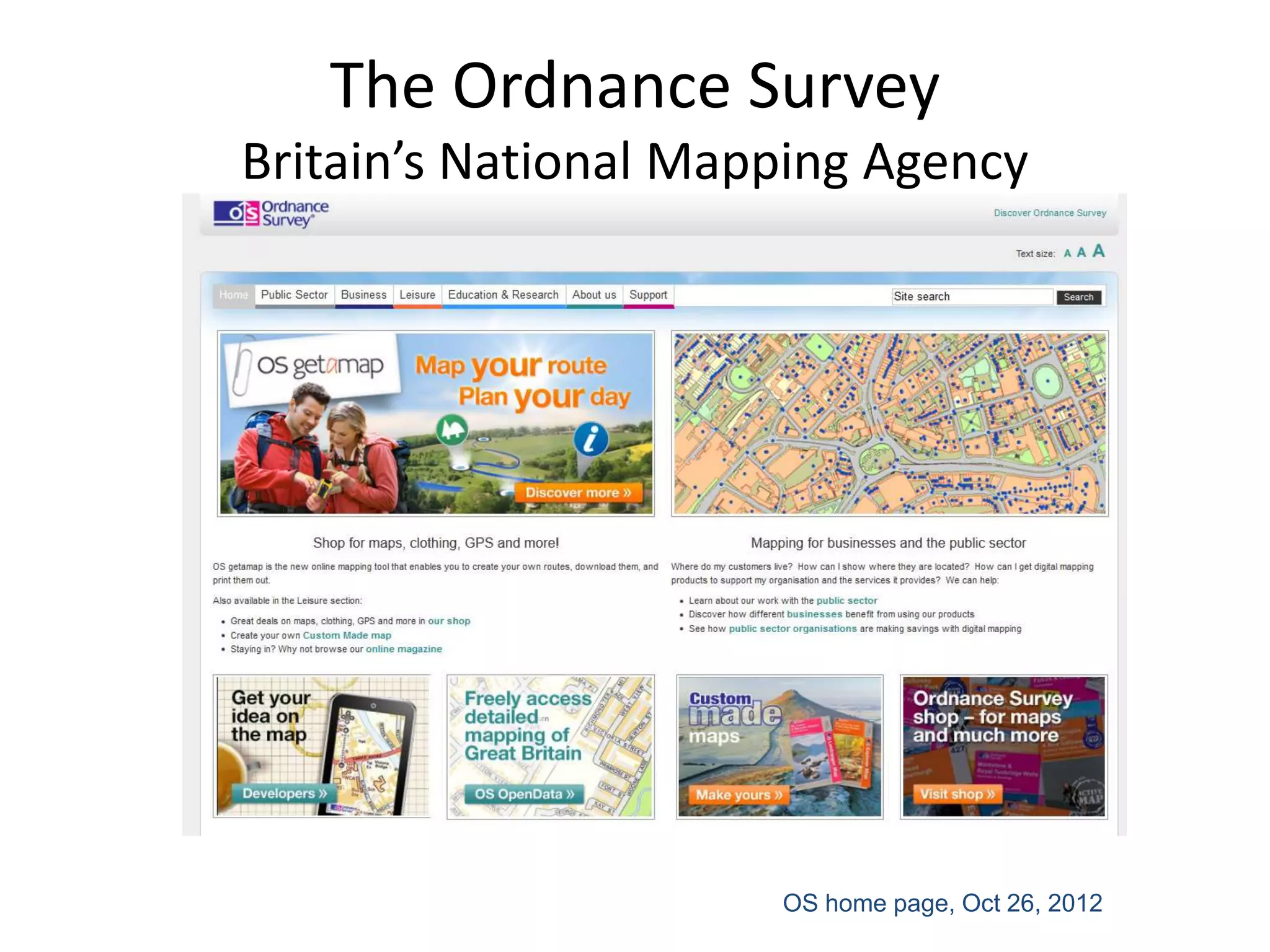
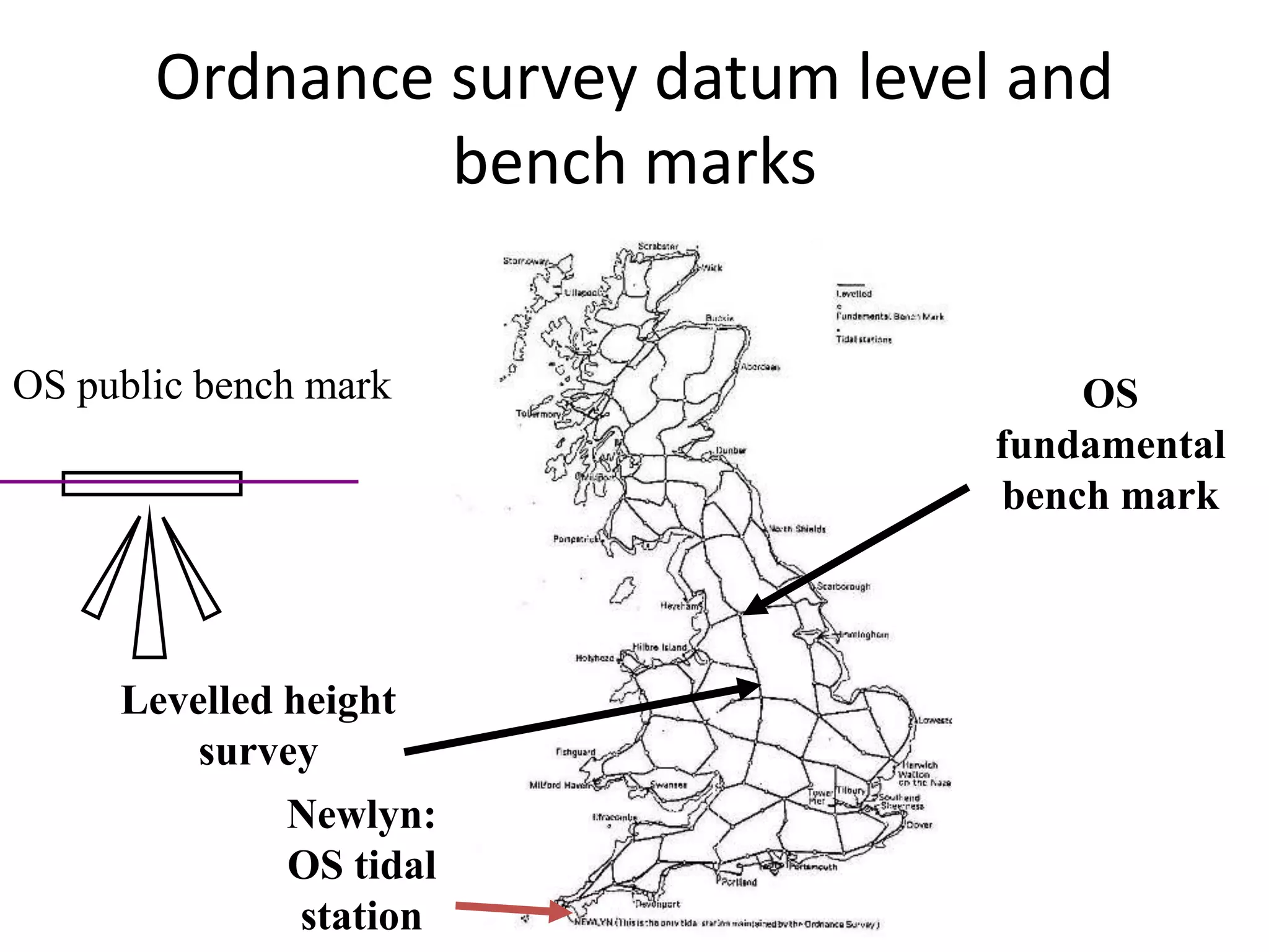
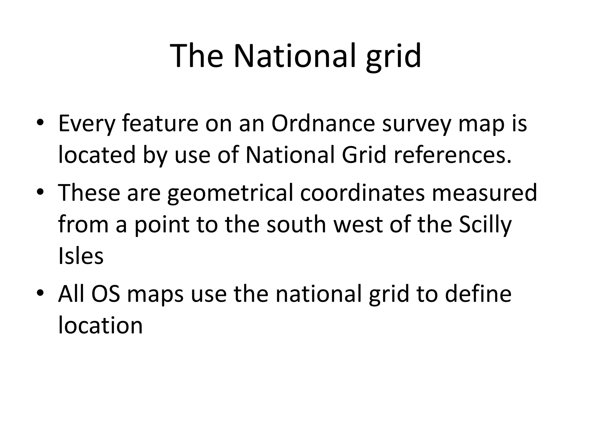
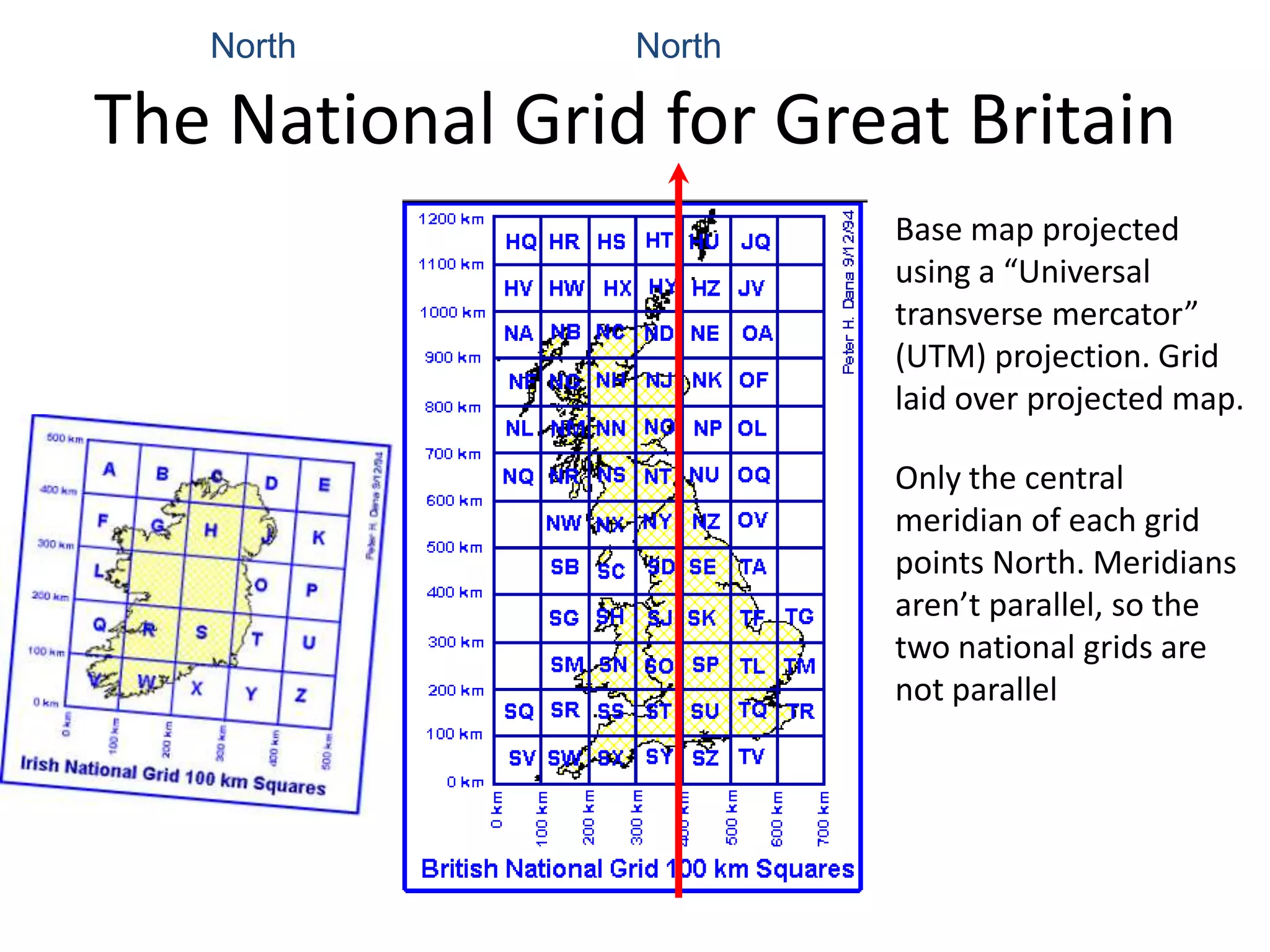
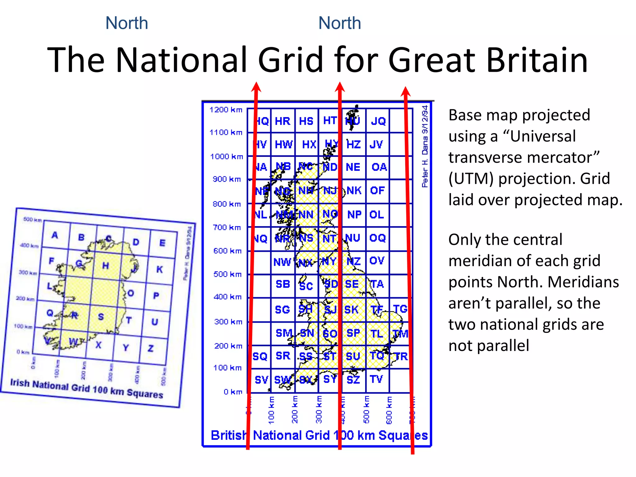
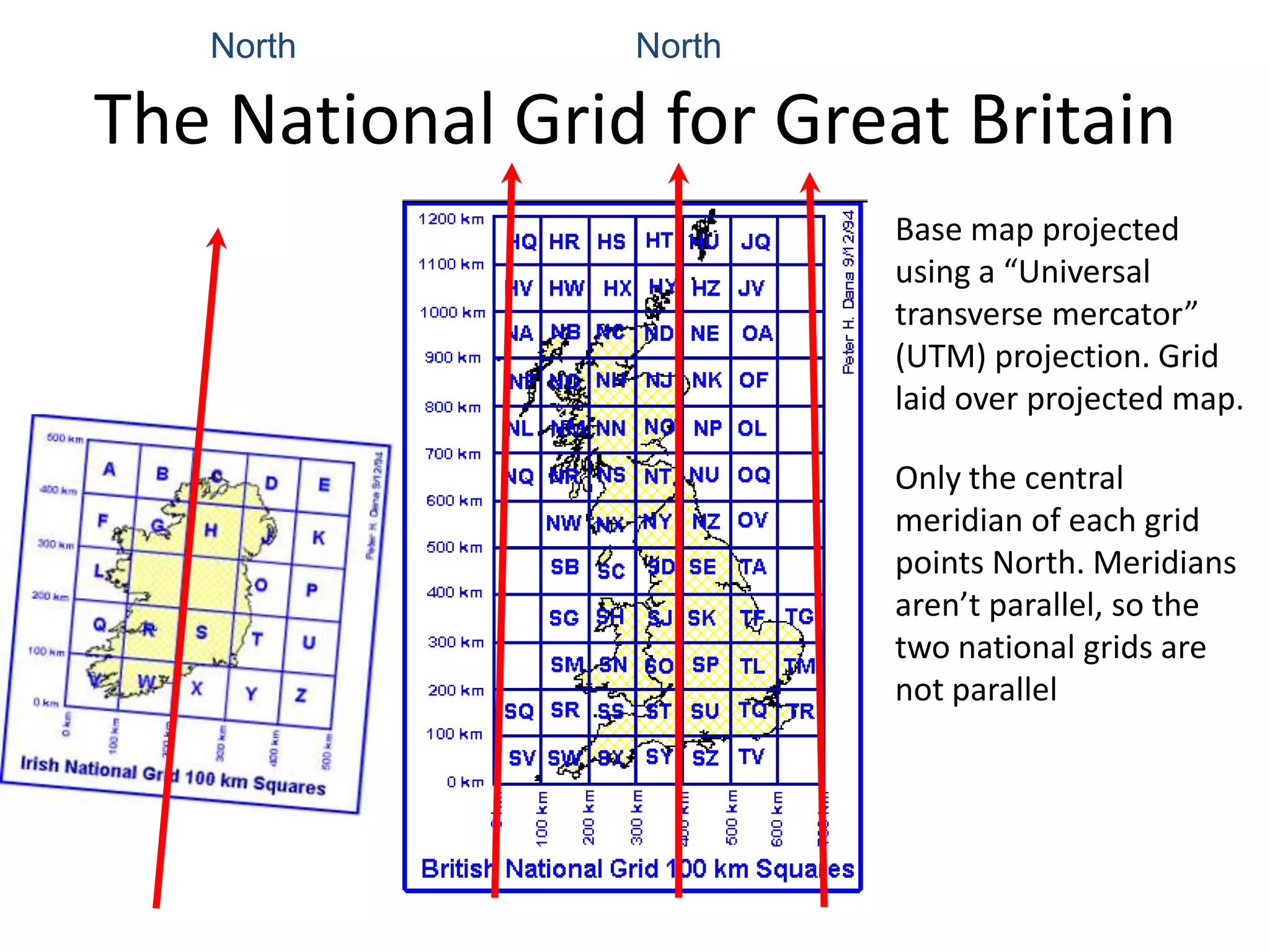
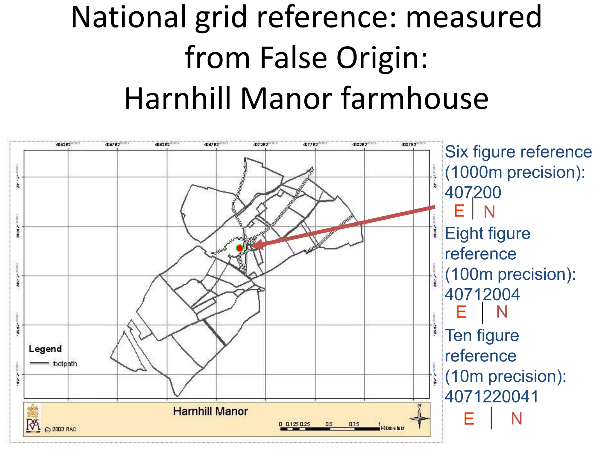
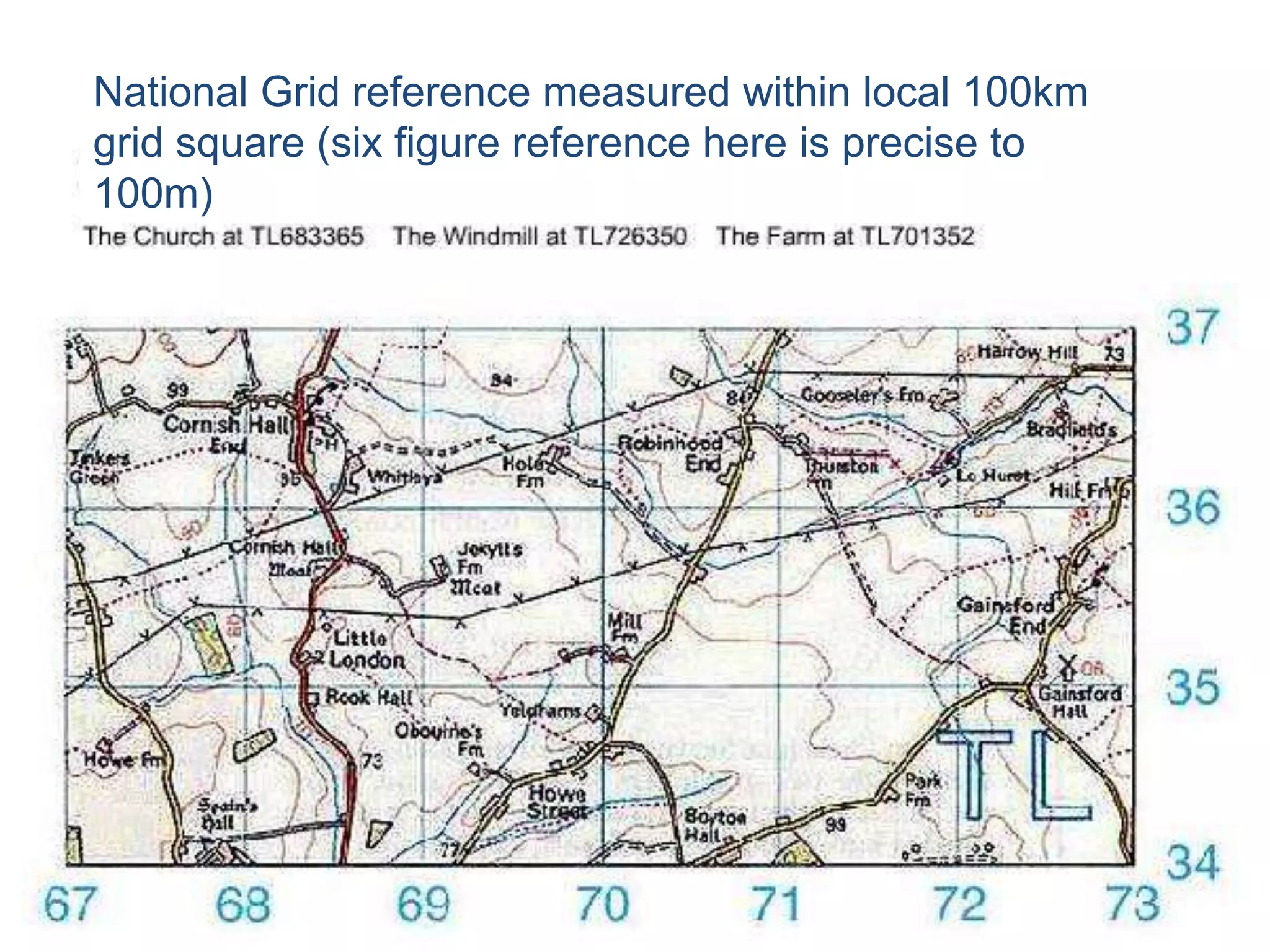
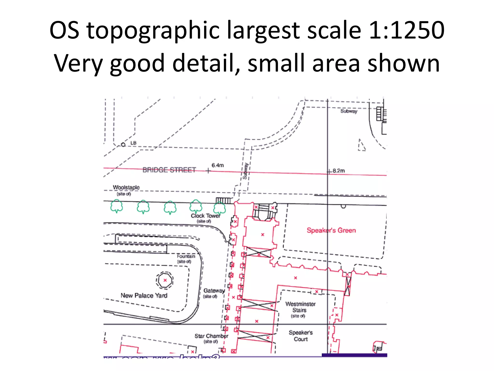
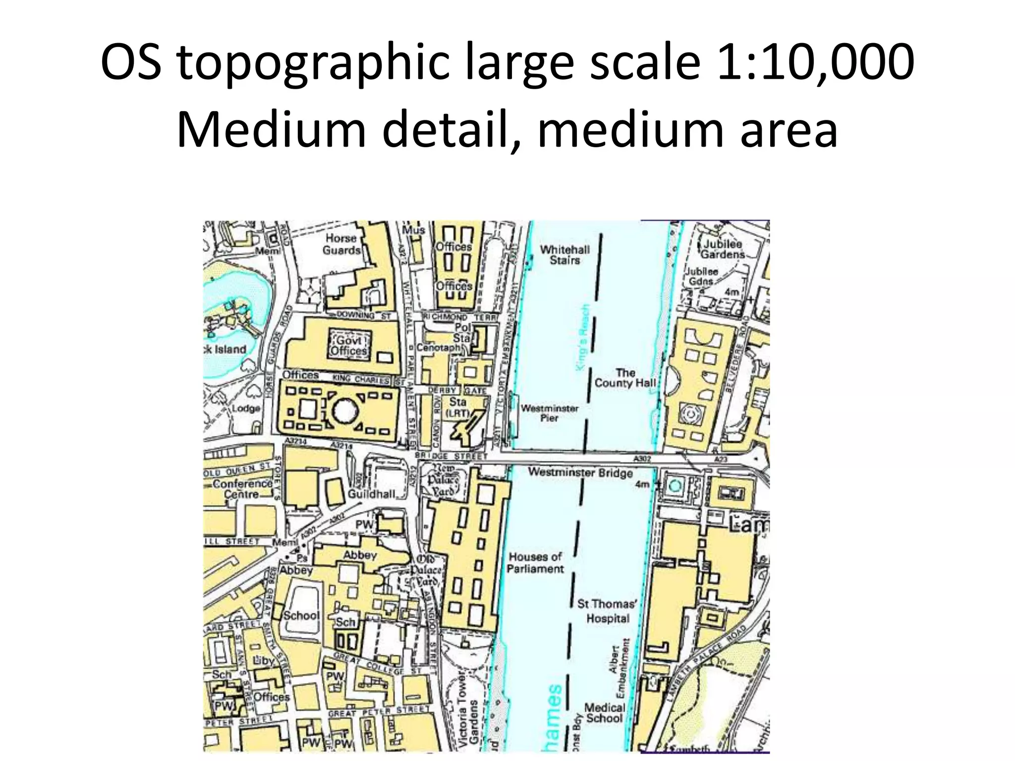
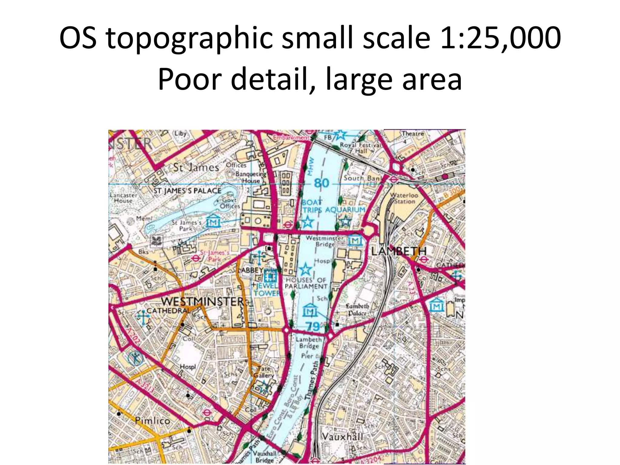
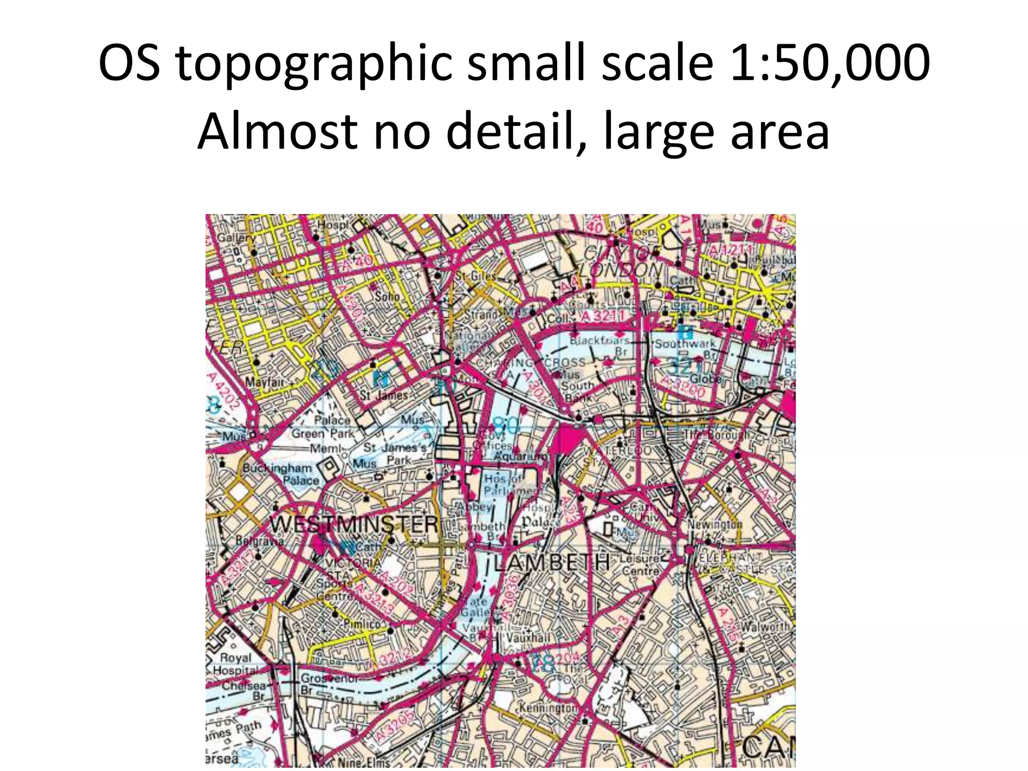
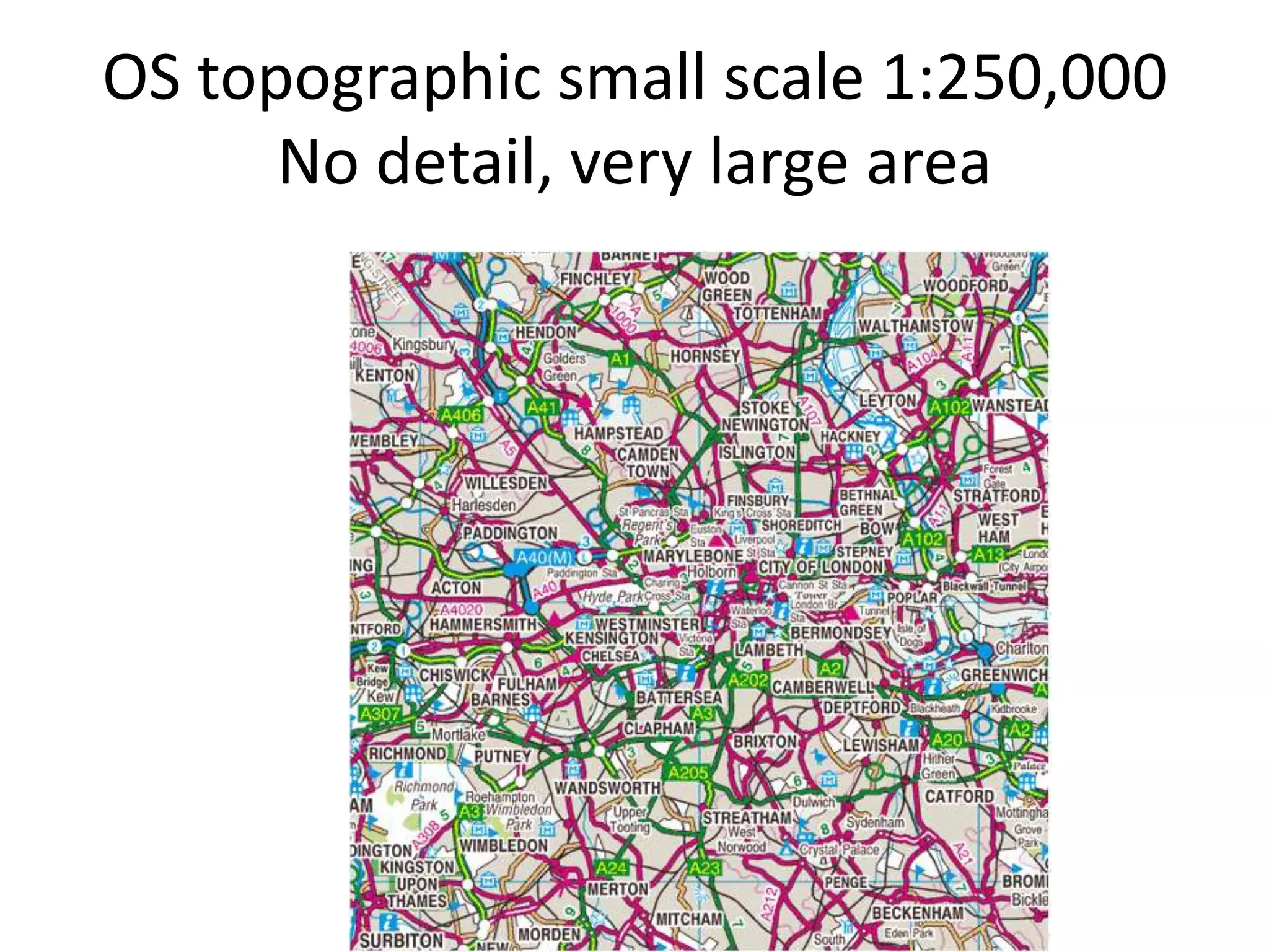
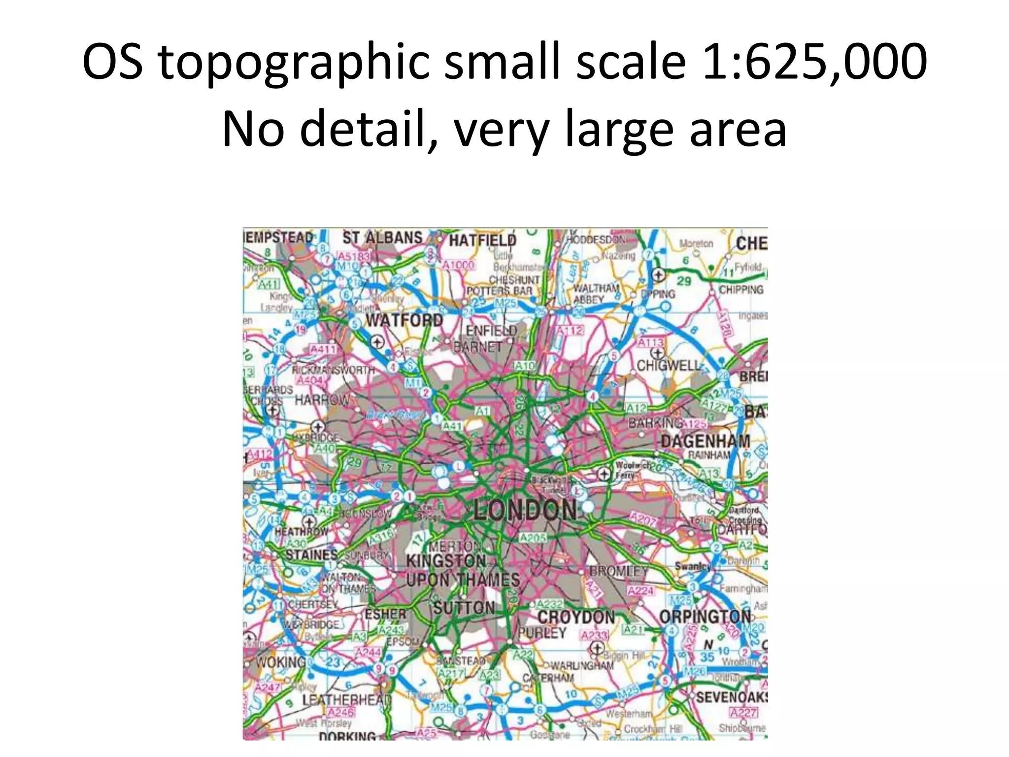
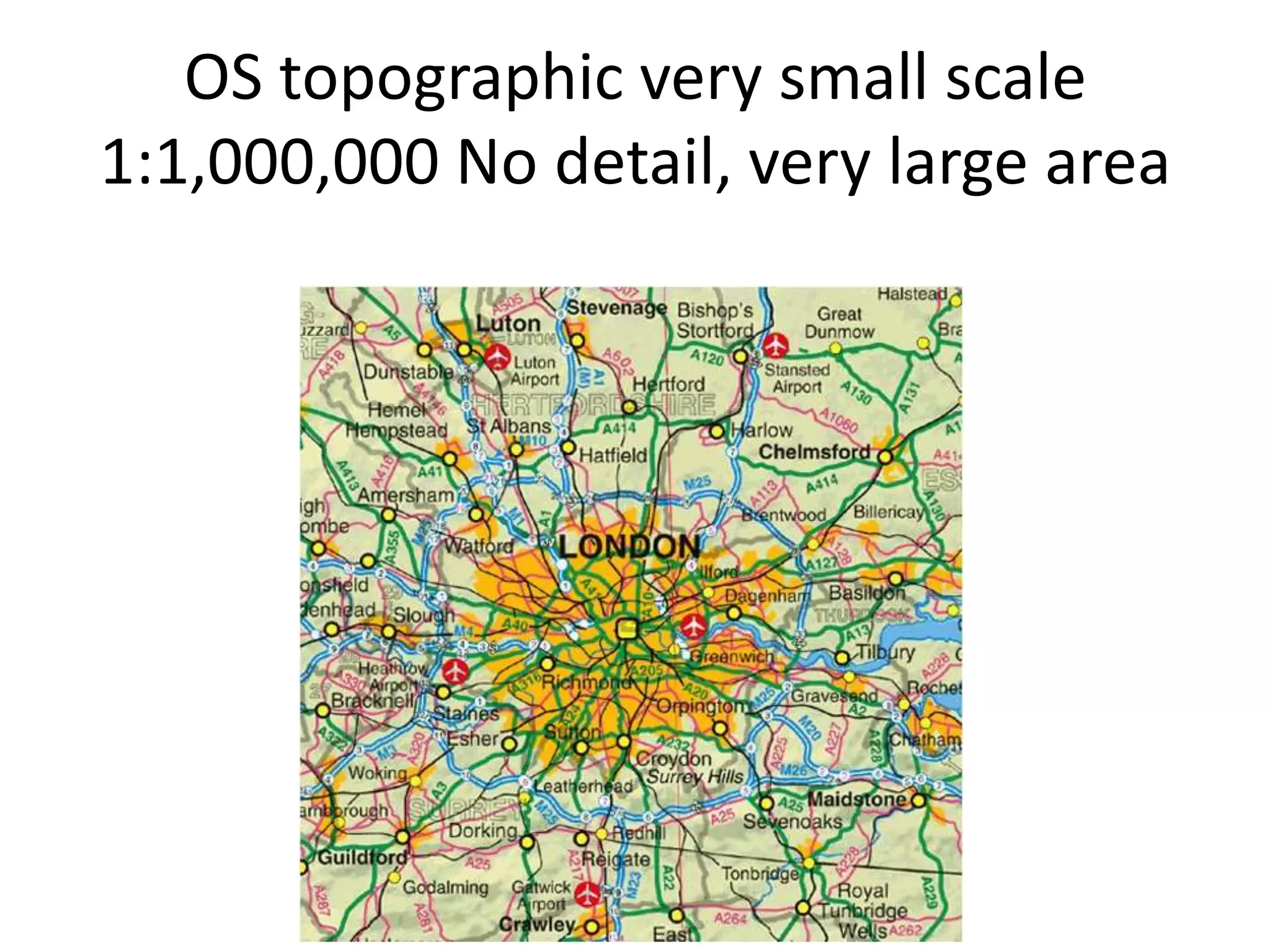
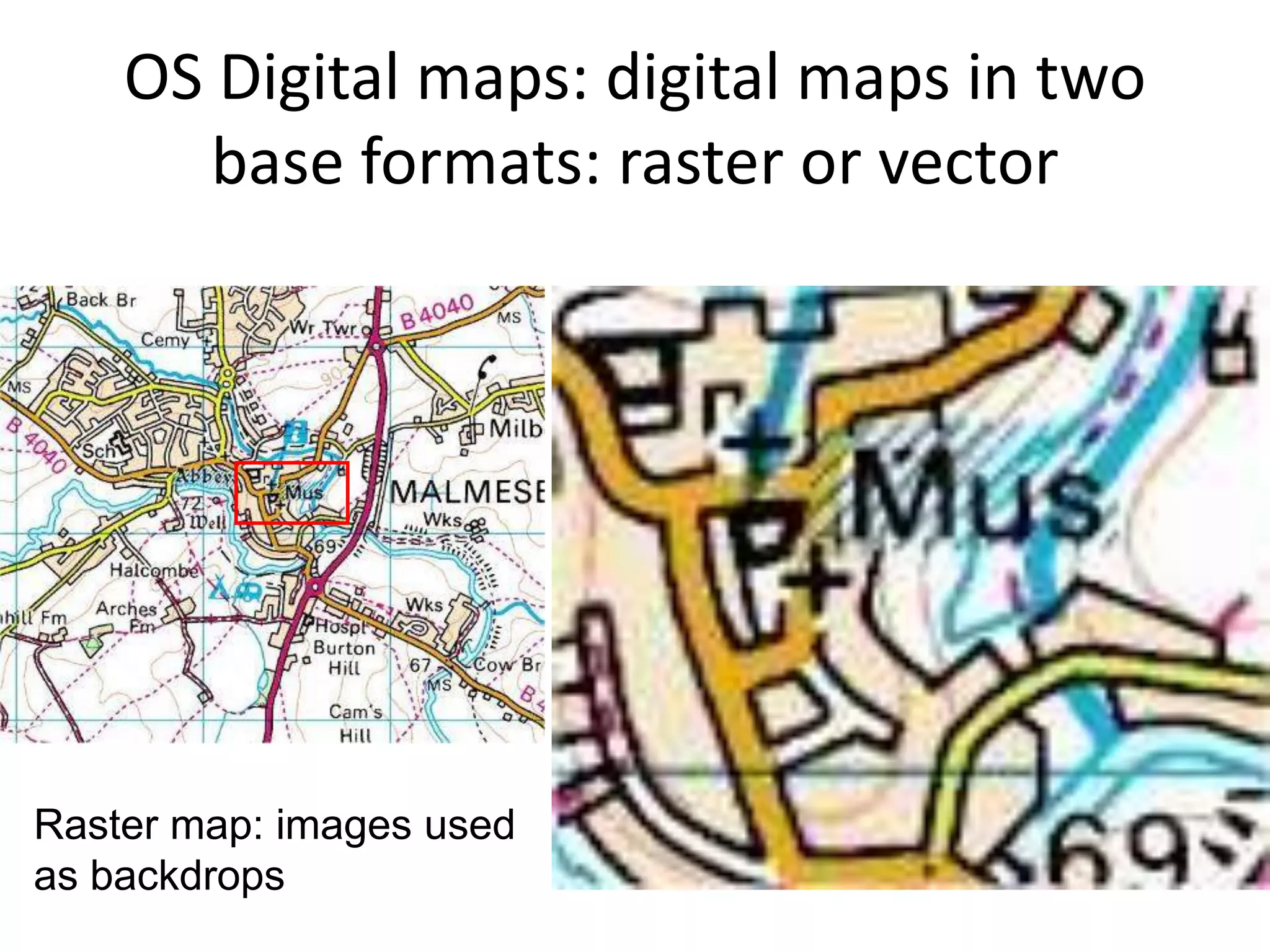
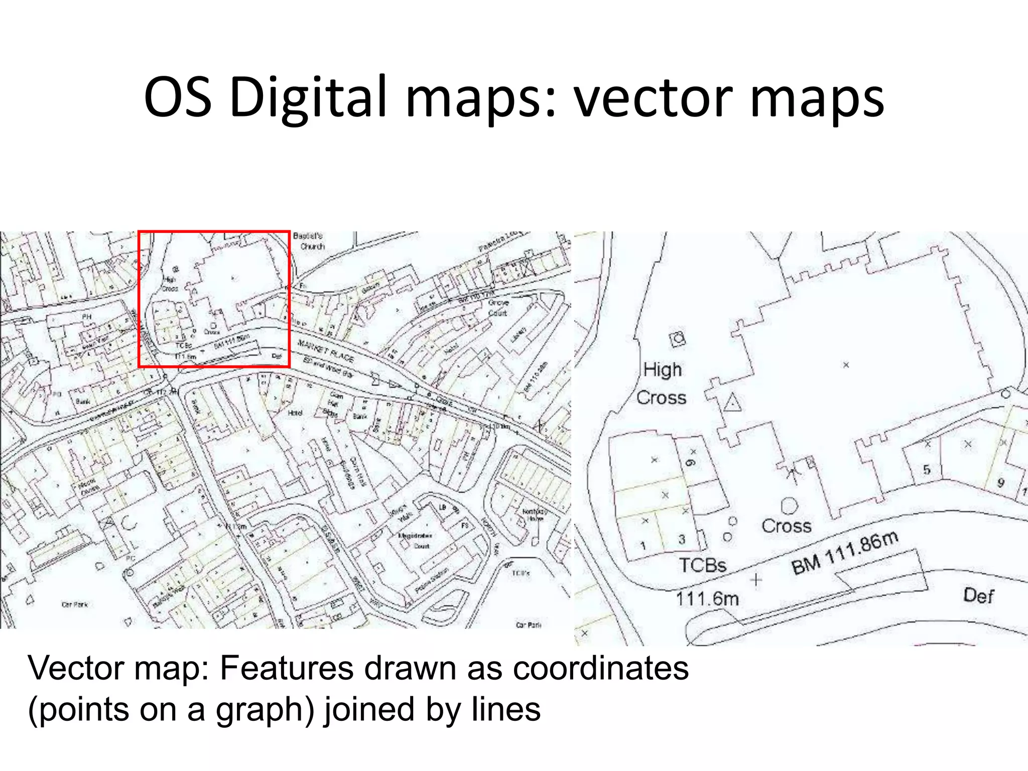
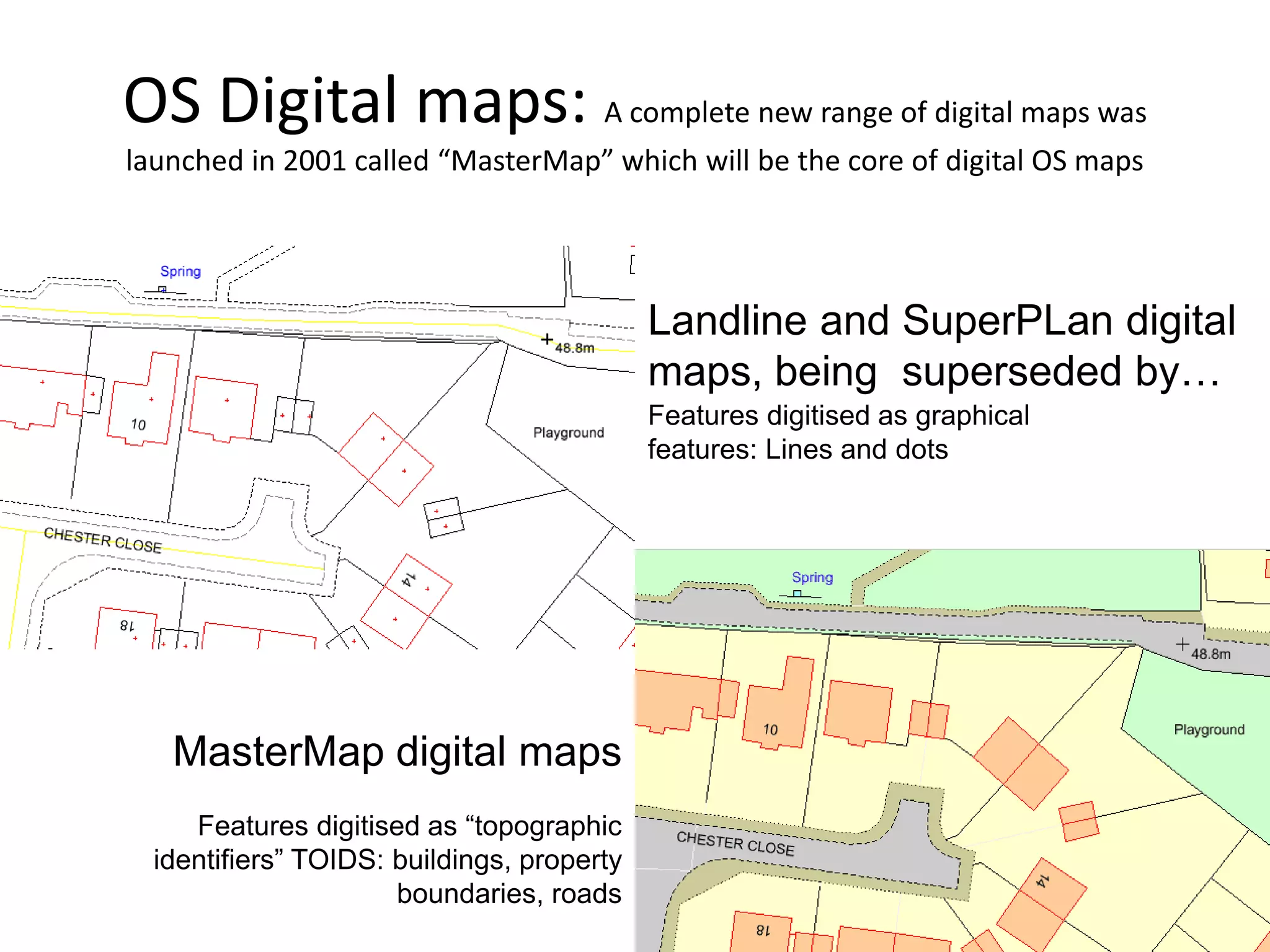
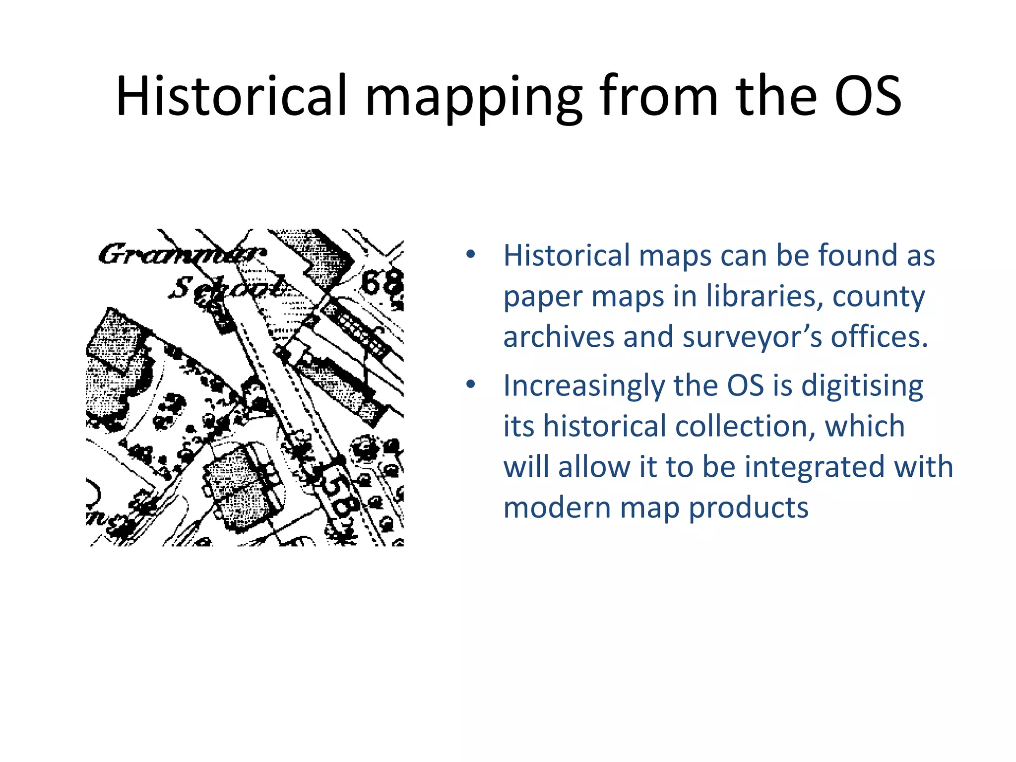
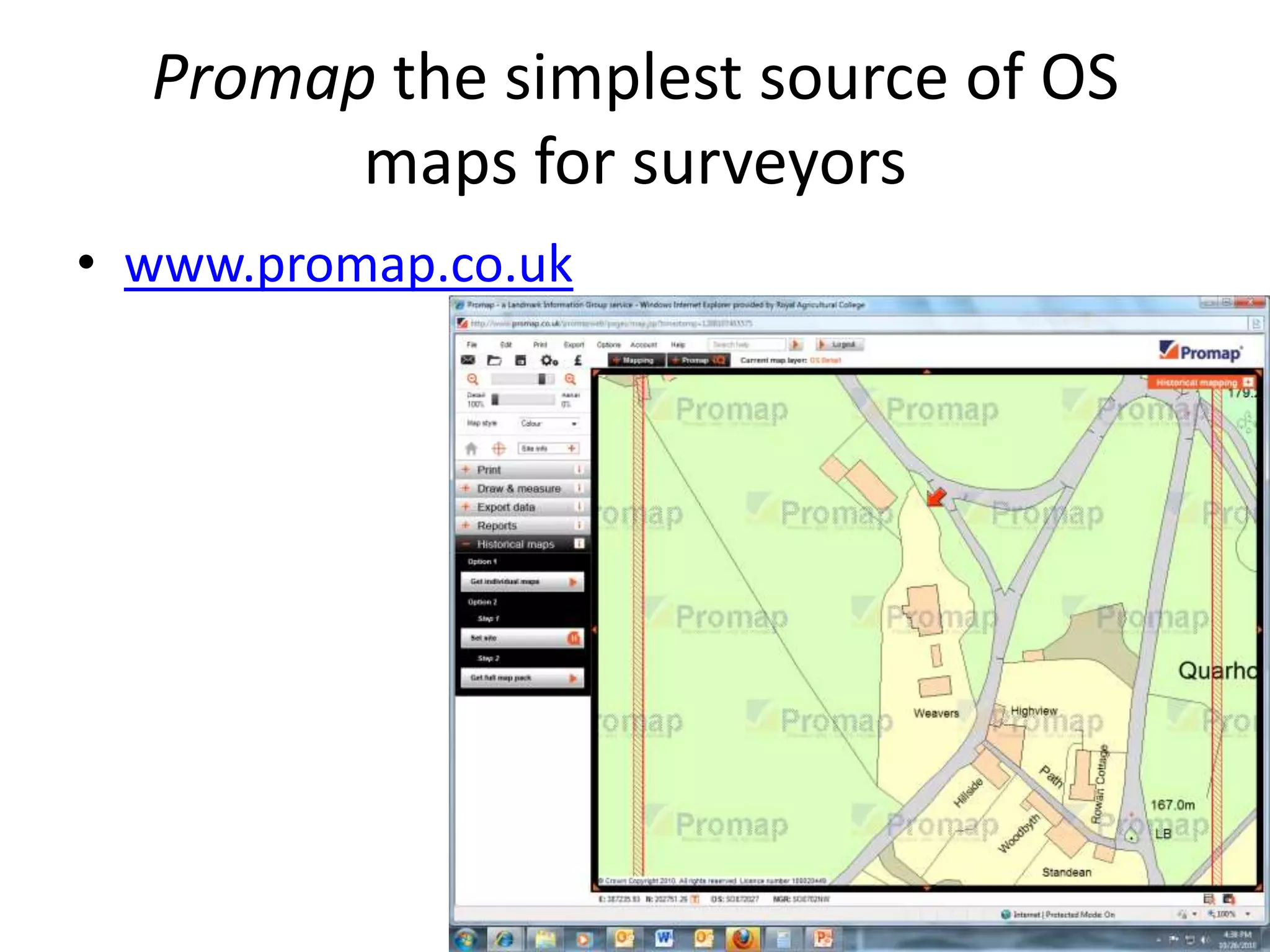
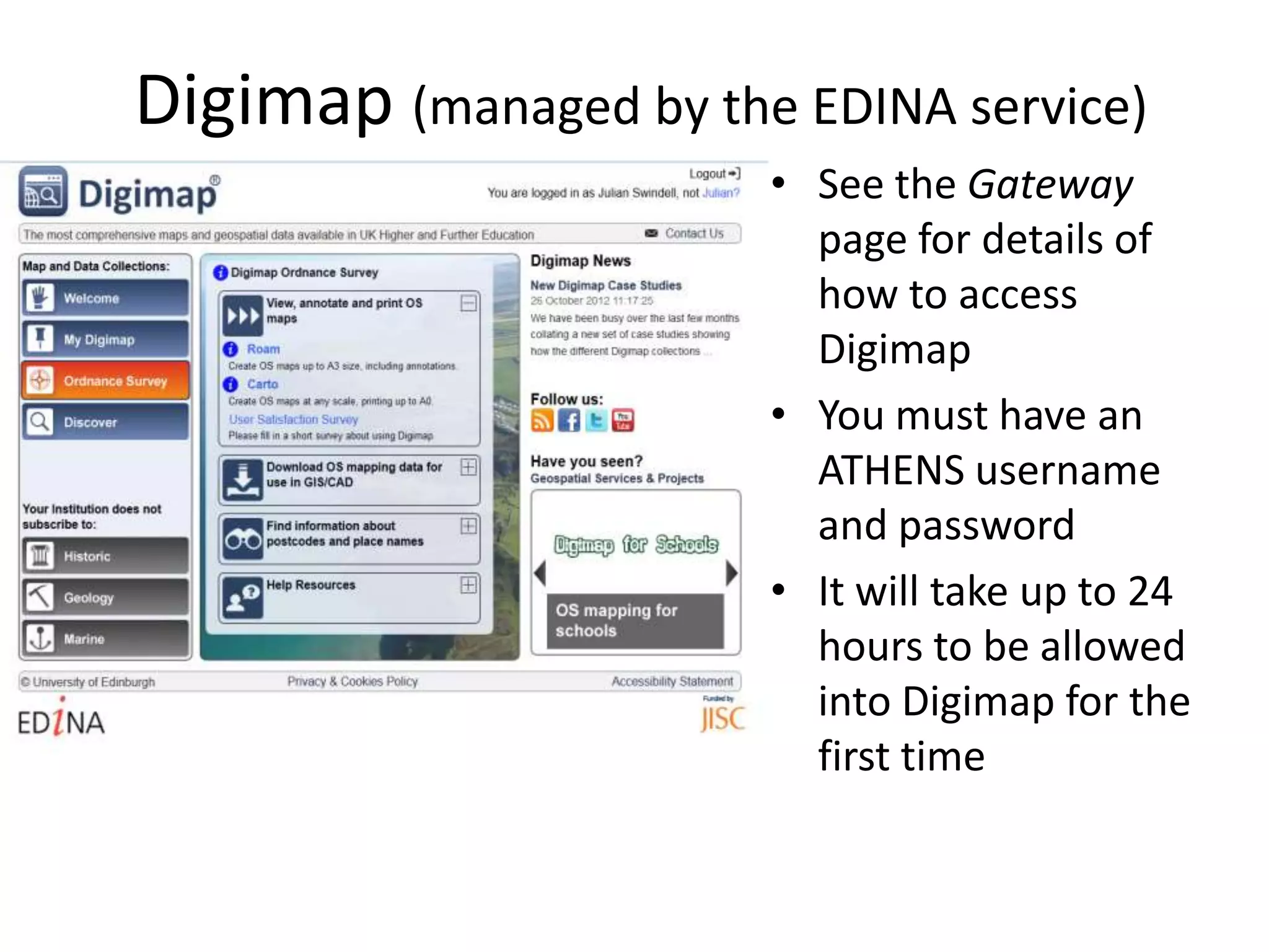
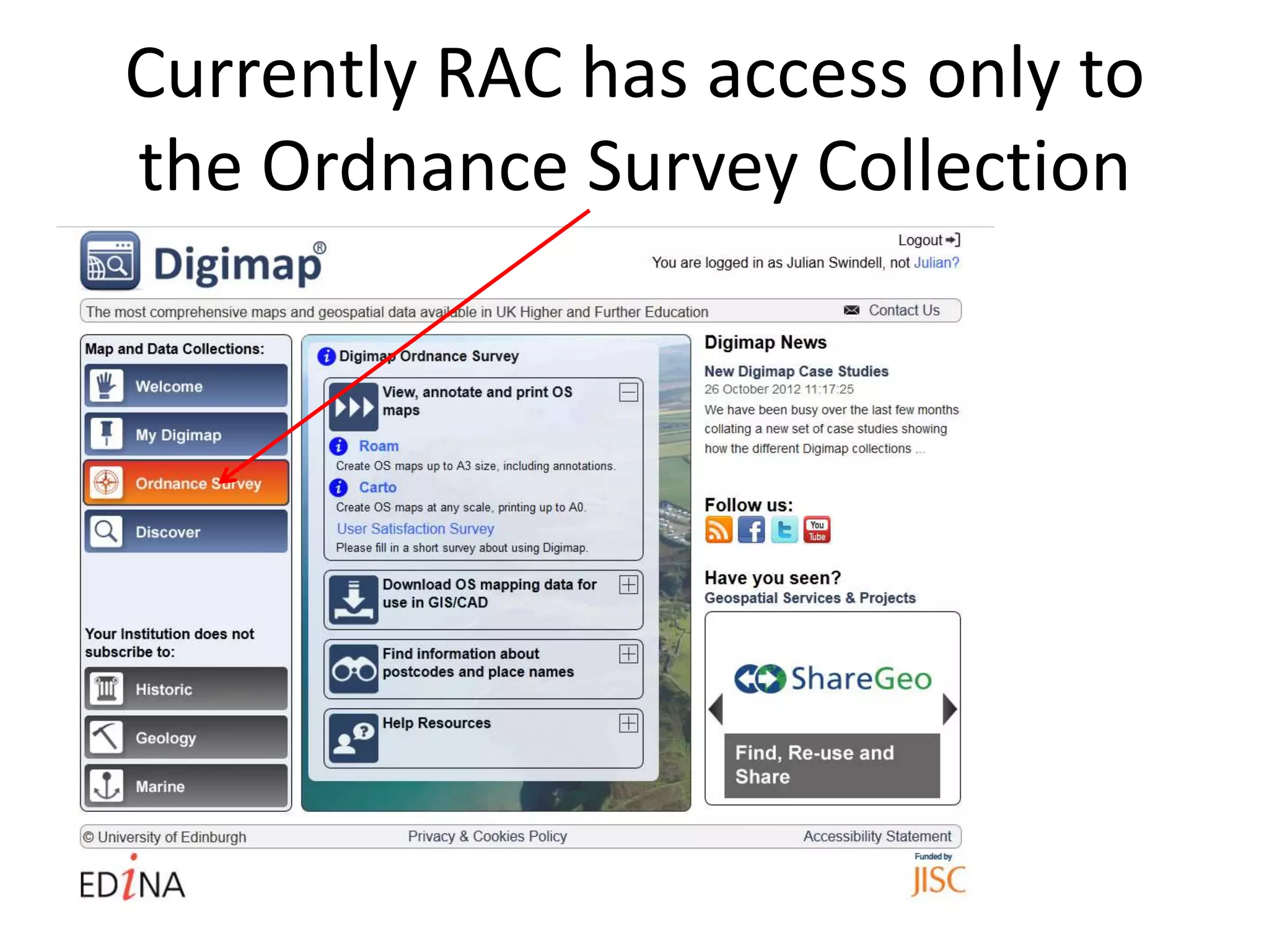
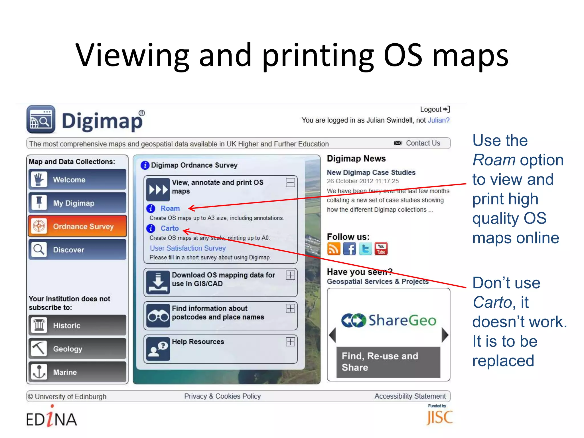
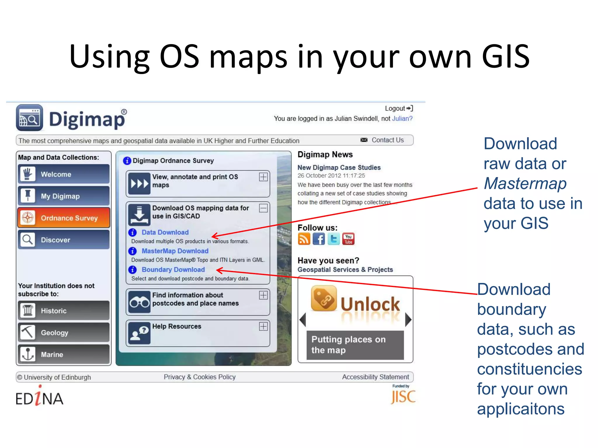
The Ordnance Survey is Britain's national mapping agency. It is responsible for accurately surveying Great Britain and creating digital and paper maps. The Ordnance Survey publishes maps at various scales from large detailed scales of 1:1,250 to small scales with little detail like 1:1,000,000. All maps use the National Grid reference system to define locations. The agency also digitizes historical maps and makes maps and data available online through services like Digimap for educational use.


![Vibe Coding vs. Spec-Driven Development [Free Meetup]](https://cdn.slidesharecdn.com/ss_thumbnails/vibecodingvsspecdrivendevelopment-251209105622-43f455e7-thumbnail.jpg?width=640&height=640&fit=bounds)
