Downloaded 159 times

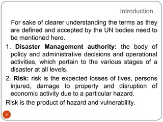
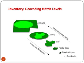
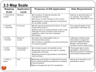
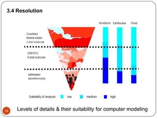
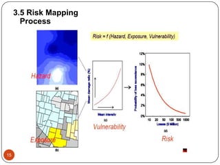
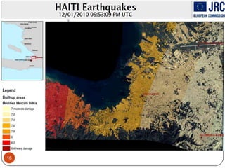
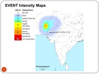
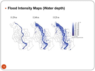
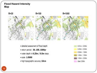

This document discusses disaster risk assessment and micro-zoning for preparedness. It defines key terms like risk, vulnerability, mitigation and preparedness. It describes how mitigation includes long-term measures to reduce risk, while preparedness consists of short-term activities. The document outlines the process of risk mapping, which involves combining hazard, exposure and vulnerability maps. It discusses approaches for mapping event intensity, exposure, and risk, as well as challenges in seismic hazard evaluation.