This document discusses several methods for flood abatement:
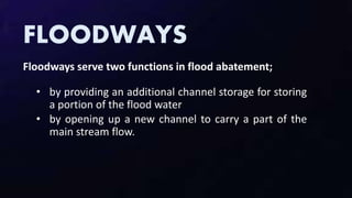
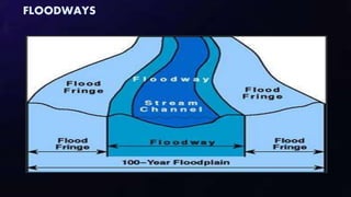
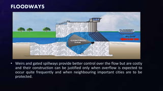
- Floodways provide additional channel storage and carry part of the main stream flow to reduce flooding. Agriculture is allowed but not extensive development. Weirs and gated spillways provide better control but are costly.
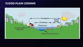
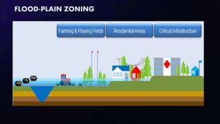
- Flood-plain zoning restricts development in flood zones to reduce risks and costs of flooding.
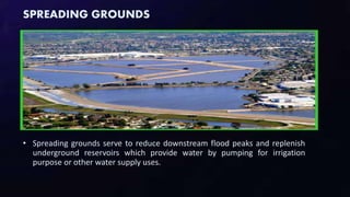
- Spreading grounds divert flood flows into flat lands that can absorb water, reducing downstream flooding while replenishing groundwater supplies.
- Improved vegetation cover significantly reduces small floods.