Mehrauli Mahipalpur Road Widening project is being executed in New Delhi. It is an example of an urban development project that is planned and being executed without consideration of environmental issues and community participation. It is leading to wastage of tax payers money. Such projects require Technical, Administrative and Financial audit.
Sawai Jai Singh II established the city of Jaipur in 1727, moving the capital from the congested hill town of Amber. Jaipur was planned according to Hindu texts on city planning, with a grid layout divided into nine wards by main streets oriented along the cardinal directions. This layout aligned with the site's geography, incorporating existing roads and a natural ridge line. The new capital strengthened the region's defenses and economy by its strategic location and planned design.
The document provides information about the Mattuthavani Bus Terminus in Madurai, India. It summarizes that the bus terminus was constructed in 1999 and rebuilt in 2003 to accommodate increased traffic. It has 8 platforms with 12 bays each that are used by multiple state transport services. The 18-acre facility has amenities like an information center, food stalls, and restrooms. Buses, autos, and motorcycles each have designated parking areas. The building uses materials like concrete, granite, and bitumen and has features such as a compound wall, staircase, and railings.
The Kashmere Gate ISBT in Delhi is the oldest and largest bus terminal in India, serving buses from Delhi and six surrounding states. Located in North Delhi near the Red Fort, the ISBT underwent renovations to become a modern, airport-like facility with amenities like an air conditioned waiting lounge, food court, and glass elevator. The redeveloped terminal provides state-of-the-art conveniences for passengers like WiFi, LCD screens, CCTV, and clean public facilities.
Bus Terminal-Bachelor thesis project 2006 Hassan Raza
This document discusses a bus terminal design project from 2006. The main entrance aims to balance the overall form and provide a focal point. The main entrance's function is differentiated through changes in color and scale. Accommodations for overnight travelers and admin offices are located on the second level of the terminal building.
Amanora town centre pune presentation - 02.09.15Shadab Khan
Amanora Town Centre is a 1.2 million square foot shopping mall located in Pune, India. It has over 250 stores and 20 anchor tenants, including Big Bazaar, INOX, and Marks & Spencer. The shopping center has been operating since 2012 and receives around 45,000 visitors daily on average. Amanora Town Centre has received several awards for being one of the best shopping malls in India.
The document discusses how a collaborative workspace could contribute to the identity of a site in Chow Kit, Kuala Lumpur. It provides background on the historical development of Chow Kit from the 1980s to present. It then analyzes the site context, including land uses, building types, views, and movement patterns. Key challenges are the repetitive building types and coarse urban grain. Opportunities include providing job opportunities and networking for a diverse group of users. A collaborative workspace could help bridge societal segregation by providing a mixed-use space for different professional and socioeconomic groups.
Interstate bus terminal - Library Study & Case Study, by 4th-year students of bachelors of architecture, Indo Global college of architecture affiliated with I.K.GUJRAL PUNJAB TECHNICAL UNIVERSITY.
TRANSIT TERMINAL DESIGN - INTRODUCTION, Terminal Characteristics, Functional Attributes, CIRCULATION, DESIGN, SERVICES.
CASE STUDY - ISBT-Sector 43 Chandigarh
Bus terminal+commercial complex+isbt+india ppt showkiranightly
Here are the key details about the site:
- The site is located at Verka Chowk in Mohali, at the beginning of the Chandigarh-Kharar Road (NH 21).
- It has superior access from Chandigarh and Mohali due to its frontage on three sides.
- The site is surrounded by the industrial area of Mohali, which houses prominent businesses like Ranbaxy and Dell.
- The Chandigarh-Kharar Road provides direct connectivity to Chandigarh and other cities in Punjab, Haryana and Himachal Pradesh.
- This strategic location with high inter-state traffic makes it ideal for a transit bus terminal and
Nachiket group is one of the best organic Waste Converter supplier and manufacturer in pune. It is the best organic Waste Converter, food waste converter and waste converter machine contractor in pune.
https://nachiketgroup.com/organic-waste-convertors-2/
The document describes the Central Bus Station in Vadodara, Gujarat, India. It provides details about the site, building layout and design, facilities, and services. The bus terminal covers an area of 22,325 sqm and handles over 800 buses and 28,000-35,000 passengers daily. It incorporates a shopping mall along with platforms, parking, ticket counters, waiting areas, shops, and other passenger amenities. The design aims to separate bus and passenger traffic flows. Services include security checkpoints, firefighting systems, and provisions for physically disabled access throughout most of the building.
The document provides information about the Haat Beat music complex project in Janakpuri, New Delhi, India designed by Archohm Consults architects. The 16,000 sqm complex was commissioned in 2014 by the Delhi Tourism and Transportation Development Corporation to create a cultural center focused on music. It includes an 800-capacity indoor auditorium, 800-capacity outdoor amphitheater, exhibition hall, music museum, music store, workshop space, food court, and shops. Bamboo, indigenous stone, steel, and tensile canopies were used as materials. The complex was designed with barrier-free access for disabled visitors.
Conservation is not just a result of few years but work and dedication of centuries. With every good, there certainly follows bad but focusing on the positives and addressing the bad is what drives us to the future; in this case the future for our past.
This document provides information about two case studies - Sarojini Nagar Market in Delhi, India and Camden Market in London. Sarojini Nagar Market is a popular destination for shopping clothes and fabrics at affordable prices. It is located in south Delhi and is easily accessible via metro. Camden Market started in the 1970s with a few stalls and has now grown significantly. It offers a variety of goods including clothing, home furnishings, gifts and food. Both markets are well-known public spaces that attract large crowds and play an important role in their communities.
This document provides floor plans for the KSRTC terminal in Calicut, Kerala. The ground floor is for parking of commercial vehicles and buses, with space for a bus terminal, waiting area, and ticket counter. The first floor continues as a bus terminal with parking for 40 buses. The second floor contains a restaurant, hall, and dining area. The upper floors from fourth to ninth floors have a typical floor plan, while the tenth and eleventh floors are also detailed in the plans.
Hello Friends,
I have made this PPT on the district 'Nagpur' in the state of Maharshtra. You can refer this information for making your projects at your school.
Good Luck!
Mehdipatnam is a major area in Hyderabad, India located 3.82 km2, providing connectivity to key areas. It has a mixed land use character with major bus stops, commercial areas, and activity generators like Rythu Bazaar. At the macro level, Mehdipatnam acts as a transit hub with a heavy traffic route and over 7,200 bus trips passing through the bus terminal daily. However, it faces problems like unorganized bus stops and traffic delays. The micro level analysis focuses on a triangular portion containing the bus stop, Rythu Bazaar, and military area, identifying strengths, weaknesses, and land use breakdown.
The document discusses the Palm Jumeirah project in Dubai which constructed an artificial island in the shape of a palm tree to increase beachfront property. It faced challenges with foundation work in the sea and addressing stagnant water. The palm island consists of a trunk and 17 fronds for residential and commercial space connected by roads and a monorail system. The project demonstrates Dubai's urban development strategy to transition its economy through ambitious infrastructure projects.
India habitat centre observations by architect studentShailja km
The document provides a summary of a student's visit to the India Habitat Center in New Delhi. Some key details:
1. The India Habitat Center is located in Jorbagh and functions as a "city within a city" with various facilities.
2. The student toured the Habitat Library, Visual Arts Gallery, and met with the General Manager who described the building's design and sustainable features.
3. The General Manager discussed the building management system, fire safety systems, and future plans to add more sustainable elements like solar panels.
The Ved Tranzcube Plaza in Vadodara, Gujarat is a 5-story bus terminal and commercial complex built under a public-private partnership. It handles over 800 buses and 28,000-35,000 passengers daily. The complex includes a central bus terminal, 400 retail shops, a food court, a 7-screen movie theater, and a 100-room budget hotel. It was designed with separate entry and exit points, segregated passenger movement, and separate parking for different vehicles.
LIBRARY STUDY, 8TH SEM, COLLEGE OF ARCHITECTURE, BHADDAL,
concourse, hierarchy of bus terminals, i.s.b.t. design, introduction, layout, planning criteria, sizes, space requirements, types of vehicular movement
Jaipur, the capital of Rajasthan, was founded in 1727 by Maharaja Sawai Jai Singh II. It has a population of over 3 million today. Jaipur is known as the "Pink City" due to its distinctive pink-colored buildings. It was planned according to the Shilpa Shastra, with a grid layout of nine blocks divided by wide thoroughfares, and included public squares and markets. This strategic town planning makes Jaipur one of the first planned cities in India.
Jan Gehl is an urbanist from Denmark known for his work transforming cities to prioritize people over cars. Some key points:
- Gehl received his masters in architecture in 1960 and studied public spaces, publishing his influential book "Life Between Buildings" in 1971.
- He helped transform Copenhagen from a car-dominated city to a pedestrian-focused city from the 1960s-2000s through projects like pedestrian streets and public squares.
- Gehl's work influenced cities worldwide, including studies for London and projects with New York City to improve streets for walking and cycling.
- He expresses that cities should aim to become more livable, sustainable and healthy for their residents.
The document presents several design approaches for a landscape architecture and urban design project along Haloul Road based on traditional Bedouin weaving patterns called Al Sadu. Six Al Sadu patterns are shown that could inspire the public realm design. The approaches include organic, jewelry, and grid concepts that apply the patterns to sidewalks, roads, furnishings and other elements. Concept diagrams illustrate how the patterns could structure a roundabout, bike lanes, walkways and landscaping along the road.
Madurai is an important city in Tamil Nadu known as the "Athens of the East" and "Temple City". It was originally the capital of the Pandyan Kingdom and has a long history dating back to the 3rd century BC. The city developed around the Meenakshi Temple complex located at its center, following the traditional Indian town planning system of concentric streets leading to the temple. Over time the city boundaries expanded through different periods of rule. The historic core still maintains the traditional street pattern and settlement hierarchy centered around the temple.
Study of city evolution- temple town Madurai Sulthan Ahamed
Madurai, located in Tamil Nadu, India, is an ancient city with a long history as the capital of the Pandyan Kingdom. Known as the "Athens of the East," the city evolved around the Meenakshi Amman Temple complex located at its center. Madurai was carefully planned according to traditional Indian principles with concentric streets radiating outward from the temple. Lower castes lived farther from the temple core. Today, Madurai remains an important economic, cultural, and transportation hub of Tamil Nadu renowned for its vibrant cultural life and traditions.
Gandhinagar was established in the 1960s as the new capital of Gujarat after its separation from Bombay state (now Maharashtra). It was designed by two architects who drew inspiration from Chandigarh, with a grid street pattern and superimposed networks for vehicles and pedestrians. The city is named after Mahatma Gandhi and contains numerous statues in his honor. It has a tropical climate and experiences hot summers, monsoon rains, and mild winters. Key landmarks include the Akshardham Temple, GIFT City Tower, and Adalaj Stepwell. The city's growth began around the capital complex and expanded outward to surrounding villages.
This document provides information about establishing a center for well-being based on principles of yoga, ayurveda, naturopathy, and other mind-body practices. Key elements of the proposed center include treatment units for ayurveda and naturopathy, spaces for yoga, meditation, workshops, counseling, and recreation. Case studies of existing wellness centers demonstrate principles like isolation from urban areas, separation of public and treatment spaces, and use of nature and courtyards. A proposed site on land near the Godavari River in Nashik, India is analyzed for its climate, vegetation, soil, accessibility, and development potential. Concepts for the new center emphasize simplicity, use of courtyards, and perme
This document discusses a traffic analysis project on Gomti Nagar in Lucknow, India with respect to pedestrian facilities. It provides background on traffic studies and their purpose in evaluating transportation systems. It also outlines different types of traffic counts and analysis methods, including manual counts, cordon counts, screen line counts, intersection counts, and pedestrian counts. The document describes the project timeline and concludes that future transportation investments in the area must be strategically coordinated with land use plans to maximize benefits.
This document summarizes the results of a traffic study conducted at Shahid Tajuddin Ahmed Avenue in Dhaka, Bangladesh. Traffic was counted manually in 15-minute intervals between 8:15-9:30 AM on a weekday. Over 2000 passenger car units (PCUs) were recorded in each direction, with cars comprising over 60% of the traffic stream. The average service flow rates were 1727 PCUs/hour from Flyover to Shatrasta and 1992 PCUs/hour in the opposite direction. The directional distribution was found to be 46% from Flyover to Shatrasta and 54% in the other direction.
The document discusses a study on the pros and cons of road widening. It aims to analyze the impact of road widening on local residents and the environment. The study finds that while road widening provides benefits like reduced travel times and boosted property values, it also has negative effects like increased dust, removal of trees, and impacts on wildlife habitats. The document concludes that road widening projects have both favorable and unfavorable impacts locally and environmentally, so authorities should aim to minimize negative effects and complete projects in a timely manner.
This presentation highlights highway pavement widening practices in the Bryan District. Prepared by Darlene Goehl. Please remember to cite this research if the information you find here is used.
Best practices by for Flexible Pavement Structure Widening Projects. Prepared by Maria Burton and Manuel Trevino. Please remember to cite this research if the information you find here is used.
This document summarizes the design of a proposed highway project in Bijapur, Karnataka. It includes the location details, survey methods used, components designed like pavement thickness, horizontal curves, vertical curves, and a box culvert. The design considers the longitudinal profile, cross-sections, and block contouring. Calculations are shown for pavement thickness, horizontal curve elements like radius, length, super elevation, extra widening, and sight distances. Vertical curve length is designed based on stopping and overtaking sight distances. Earthwork quantities of cutting and filling are also provided.
Best practices for Flexible Pavement Structure Widening projects with focus given to pavement widening equipment. Prepared by Mike Murphy and Maria Burton. Please remember to cite this research if the information you find here is used.
The document discusses the reasons for and methods of calculating the widening of pavements on horizontal curves. There are two types of widening: mechanical widening to account for vehicle off-tracking due to rigid wheel bases, and psychological widening to allow for greater driver maneuverability at higher speeds. Mechanical widening is calculated based on number of lanes, vehicle wheel base length, and curve radius. Psychological widening is also based on design speed and curve radius. The total widening is the sum of mechanical and psychological widening. Tables from the Indian Road Congress provide extra width recommendations for single and double lane pavements on curves.
This document discusses different types of rigid concrete pavements, including precast prestressed, joint plain, joint reinforced, continuously reinforced, ultra-thin, and roller compacted pavements. It also describes common failure modes such as cracking, joint deficiencies, and rutting. The pavement design method in South Africa uses a computer simulation program to facilitate decision making. Proper construction practices for concrete roads include surface preparation, concrete mixing and placement, and sawing joints.
This document provides information about road construction and maintenance. It lists group members and contents before discussing the introduction, classification, materials, machinery, and maintenance of roads. Key points include the types of roads and their financing, materials used like asphalt and aggregates, and machinery such as compactors, pavers, and planers. Maintenance methods are described as replacing pavement layers through hot or cold paving of thin layers.
This document summarizes the construction of a 6.5 km private road located in Ranipur, Haridwar, India. It describes the various layers that make up the roadway, including earthwork, granular sub-base, wet mix macadam, bituminous macadam, bituminous concrete, and finishing touches like kerbs and shoulders. The layers are constructed in sequential order, with careful compaction and mixing of aggregates and binders at each stage to support vehicular traffic on the carriageway. Proper camber is built into the road surface to allow for water drainage off the sides of the paved area.
This document discusses different types of road classifications based on weather conditions, materials used, location, and traffic volume. It also outlines the phases of highway planning which include assessing road length needs, preparing master plans, and conducting economic, financial, traffic, and engineering studies. The preparation of highway alignments and different types of pavement structures used in road construction are described as well.
El documento compara la novela clásica Orgullo y Prejuicio de Jane Austen con su adaptación moderna Orgullo y Prejuicio y Zombis. Ambas historias siguen a las hermanas Bennet y sus relaciones románticas con los solteros locales, aunque la versión moderna añade el elemento de una invasión de zombis. El documento resume las tramas, los lugares, las fechas de publicación, los autores y los protagonistas de ambas obras.
The document provides an overview of public works departments and concrete road construction in India. It discusses that the Public Works Department in Uttar Pradesh pioneered construction and established agencies like the State Bridge Corporation. It also describes the types of pavements used in India, including flexible pavements made of bitumen and rigid concrete pavements. The document outlines the basic process of constructing concrete roads, from site preparation to mixing, placing, and curing concrete before opening the road to traffic.
The Top Skills That Can Get You Hired in 2017LinkedIn
We analyzed all the recruiting activity on LinkedIn this year and identified the Top Skills employers seek. Starting Oct 24, learn these skills and much more for free during the Week of Learning.
#AlwaysBeLearning https://learning.linkedin.com/week-of-learning
This document is a summer training report submitted by Ravi Gupta for his Bachelor of Technology degree in Civil Engineering. The report provides an overview of the Public Works Department in Uttar Pradesh and discusses the construction of cement concrete pavement. It describes the different types of pavements and materials used in concrete pavement construction, including cement, sand, aggregate, and minerals. The report outlines the procedures for constructing concrete pavement, from preparing the subgrade to placing, curing and protecting the concrete. It also includes cost analysis and conclusions from the summer training project observing concrete pavement construction.
1. The document reports on a survey of earthen roads, culverts, and small bridges constructed as part of a project in Muzaffargarh and Rajanpur districts of Punjab province in Pakistan to improve socioeconomic conditions after devastating 2010 floods.
2. Site visits and interviews were conducted in 3 union councils to evaluate the quality and impact of the infrastructure work. In some areas, reconstruction efforts were inadequate, while in others, roads improved access but had issues like improper compaction.
3. Overall, the selection process prioritized the donor and vendor over the community, and record keeping on project changes and replacements was insufficient. Coordination between implementing partners and vendors/beneficiaries was also ineffective at times
The document summarizes a survey report on earthen roads, culverts, and small bridges constructed as part of a project in South Punjab, Pakistan. It finds that while some reconstructed roads and culverts improved access, others were poorly constructed and left villagers dissatisfied. In some villages, little to no reconstruction work was actually completed despite being included in project records. Overall, the selection process prioritized donor and vendor interests over communities, and there was little technical oversight of road construction quality.
The Yonge Street North Secondary Plan pertains to lands along Yonge Street north of Hendon Avenue and Bishop Avenue in North York, Ontario. It is divided into five sub-areas with different development intensities. The plan aims to intensify development around transit stations through mixed-use and transit-oriented development. It incorporates design ideas like sustainability, community engagement, and improving the public realm. The transportation plan prioritizes walking, cycling, and public transit by improving connectivity and infrastructure to support mobility. Building heights range from 4 to 50 stories depending on the sub-area, transitioning to lower heights farther from major intersections.
This public event presented design concepts for the preferred trail alignment of the East Don Trail project. Attendees could view panels and presentations about the design concepts and provide feedback. The design concepts were developed by dividing the preferred alignment into segments and considering constraints like topography, trees, and infrastructure. Options were evaluated based on criteria such as environmental impacts, safety, accessibility, and costs. Feedback from the event will be used to select a preliminary preferred design concept.
The document discusses guidelines for preparing detailed project reports (DPRs) for rural road projects in Madhya Pradesh. It provides details on conducting social and environmental safeguard assessments during the project preparation phase, including using transect walks for community participation. Emphasis is placed on incorporating social screening, obtaining community input, and addressing road safety, gender participation, environmental protection, and other safeguard issues in the DPR preparation process.
Roadway element design for the Rural area in India.Mayank Panchal
Rural road connectivity its key component of a rural development by promoting access to economic and social services, Increased agricultural incomes, productive employment opportunities, poverty reduction.
provide all weather road connectivity, design of pavement, proposed minor bridge and highway junction point included intersection and end point.
The document provides a progress update on the Atlanta BeltLine project as of March 27, 2013. It discusses the 20-year strategic plan to develop transit, trails, parks and other program components along a 22-mile loop surrounding Atlanta. It summarizes the implementation plan phases, ongoing environmental assessments for transit, construction updates on trails and bridges, design progress for various trail sections, and volunteer opportunities.
This document summarizes a student project on developing a highway networking system in India. It discusses connecting various cities and villages to boost economic development. The project focuses on a 55km stretch of National Highway 222 from Murbad to Malshej Ghat in Maharashtra. It describes the existing conditions including road geometry, drainage, rock conditions and the need for quality improvements. It also discusses various modern soil stabilization techniques needed for subgrade stability. The conclusion is that developing the highway networking system would increase safety and capacity while decreasing travel times and potentially reducing maintenance costs after implementing soil and rock stabilization methods.
This webinar was hosted on May 27th, 2015 from 3 - 4 pm (IST) by Rajeev Malagi, Project Associate, EMBARQ India and Noor Mansoor, Commissioner, Hubli Dharwad Municipal Corporation (HDMC).
Navanagar is a mix-use area located between the twin cities of Hubli-Dharwad in Karnataka. It is predominantly a residential area dotted with - heritage sites, natural features, government buildings, educational institutions, commercial centers and transport hubs. EMBARQ India in collaboration with Directorate of Urban Land Transport (DULT), Hubli-Dharwad BRTS Company Ltd. (HDBRTSCL) and HDMC has worked on a transit oriented development (TOD) project here. The project has looked at creating a pedestrian neighbourhood around the proposed Navanagar Bus Rapid Transit System (BRTS) stop. It aims at implementing steps to increase safer access to the roads, and improve public spaces.
This webinar highlighted the role played by EMBARQ India at different stages of the project (documentation, design and implementation), along with the stakeholder interactions at various stages and their decisions which have shaped the project.
Related Research - http://embarqindiahub.org/publications/safe-access-manual-safe-access-mass-transit-stations-indian-cities
Upcoming Webinars - http://embarqindiahub.org/e-learning/webinars
As the population of Lahore is increasing day by day and its central hub is getting densely populated, people are demanding for new neighborhoods with self-contained facilities. Therefore new neighborhoods are being developed outside the main city with self-contained facilities. This report is about a neighborhood design of an area in Shadira, Lahore with detailed features and facilities including residential houses, market, shopping centers, parks and open spaces, streets and public buildings.
This presentation summarizes the results of a roadway condition survey conducted along the route from Panthapath to Russell Square in Dhaka, Bangladesh. The survey assessed various aspects of the road's geometric, operating, and surface conditions. It was found that the road width varied and was not uniform, intersections were in need of signal upgrades, the median and channels were in poor condition, street lighting and signs/markings needed improvement, and there were issues with blocked footpaths and illegal parking reducing the effective roadway width. Recommendations included conducting regular maintenance, improving signs and markings, clearing obstructions, restricting certain turns and providing better pedestrian facilities.
The proposed development at Nethermayne will include 725 new homes at a density of 32 dwellings per hectare spread across 22 hectares of residential land. It will also include a 2.1 hectare primary school site, over 16 hectares of public open space, and a local center with 622 square meters of retail space. The development will be constructed in phases from 2014 to 2026 with initial access provided via Dry Street and later phases accessing through an upgraded Nethermayne roundabout. Concerns about the development include increased traffic through the existing Dry Street village and impacts to protected open spaces.
This document summarizes the scope and progress of a multi-use pathway, wetlands trail boardwalk, and pavement rehabilitation project along Fairpoint Drive and Shoreline Loop in an unnamed city. It includes 3 elements: a 4-mile multi-use pathway, a boardwalk through wetlands between a park and neighborhoods, and repaving 1.3 miles of road. The project has completed conceptual design, received public input at workshops, and aims to increase safety, connectivity and access between areas while rehabilitating existing infrastructure. Bidding and construction are planned for 2020.
The document provides information on several architectural projects including a hotel, apartment, housing prototype, play school, and office/residence. It includes pages from each project covering the year, location, contributions, objectives, ideas, challenges, and briefs. It also includes technical drawings such as site plans, floor plans, sections and elevations. The second half of the document focuses on a site analysis and concept development for redesigning density housing in Nerul, Mumbai. It outlines the objective, idea, challenges and brief for this project and includes diagrams showing the zoning and programming of spaces.
CBSE Class X-Geo(7) : Lifelines of National Economy Chapter in an easy and simple way, for everyone to understand. For all students and who have have slow pace also.
Transportation and communication networks are vital lifelines for a country's economy and development. They are compared to the veins and arteries that circulate goods, resources, and people throughout a nation. India's principal modes of transportation include roads, railways, waterways, pipelines and airways. Roads are the most extensive network but suffer from inadequate infrastructure, poor condition and congestion in many areas. Railways form the bulk of freight and passenger traffic but the network is unevenly distributed and many tracks are old and need repairs. Improving transportation and communication systems through continued investment and modernization is essential for further integrating India's economy and society.
This document provides an analysis of a site located in Greater Noida, Uttar Pradesh for potential development. It includes details on the site location and context, physical characteristics of the land such as topography and climate, existing infrastructure and transportation access, and surrounding land uses. The goal of the site analysis is to understand all relevant factors that could impact the design and incorporate them into a successful plan.
Fairgrounds Roadway Widening Public Hearing (March 17, 2015)City of Midland
The purpose of this hearing was to present the planned improvements to Fairgrounds Road from State Loop (SL) 250 to Pecan Avenue in the City of Midland, Midland County, Texas, and to receive public comment. Displays will be available for viewing at 6:00 p.m. with the formal hearing commencing at 7:00 p.m.
The existing facility consists of one 12-foot travel lane in each direction with no shoulders. The existing right-of-way (ROW) width varies from approximately 62 feet south of Wadley Avenue to 77 feet historically used for the roadway north of Wadley Avenue.
The proposed project would widen Fairgrounds Road from two lanes to five lanes. South of Wadley Avenue, Fairgrounds Road would consist of one 11-foot lane and one 14-foot shared use lane in each direction and an 11-foot continuous center left-turn lane. There would be five-foot wide sidewalks on each side of the roadway. North of Wadley Avenue, Fairgrounds Road would consist of two 12-foot lanes in each direction with a 12-foot continuous center left-turn lane. An eight-foot bike/pedestrian trail would be constructed on the west side of the roadway. The length of the proposed project is approximately 1.5 miles. The proposed typical ROW width would vary from approximately 80 feet south of Wadley Avenue to approximately 129.5 feet north of Wadley Avenue. The proposed improvements would require approximately 11.4 acres of additional ROW, of which, 10.9 acres are already owned by the City of Midland. The proposed project would not result in any residential relocations or commercial displacements. Information about the tentative schedule for ROW acquisition and construction may be obtained from the City of Midland.
As part of this project, the City of Midland is considering a Section 4(f) de minimis impact determination for impacts to F.T. Hogan Park (Hogan Park). An approximate 10.9 acre strip of land generally located east of Hogan Park Golf Course from Wadley Avenue to Loop 250 would be required for permanent incorporation into the proposed transportation facility. A Section 4(f) de minimis finding means that the proposed project would not adversely affect the activities, features, or attributes that qualify Hogan Park for protection under Section 4(f). The City of Midland and TxDOT will consider comments received during this Public Hearing before making a final Section 4(f) de minimis determination.
The document proposes developing Thrissur Railway Station in India to accommodate increasing passenger traffic. It outlines objectives to develop a fourth platform with amenities and a foot overbridge to reduce walking. A budget of 2 crore rupees over 10 months is estimated. Developments would provide necessary facilities for comfort and reduce walking for passengers accessing buses.
Similar to Mehrauli mahipalpur road widening project (20)
How To Cultivate Community Affinity Throughout The Generosity JourneyAggregage
This session will dive into how to create rich generosity experiences that foster long-lasting relationships. You’ll walk away with actionable insights to redefine how you engage with your supporters — emphasizing trust, engagement, and community!
AHMR is an interdisciplinary peer-reviewed online journal created to encourage and facilitate the study of all aspects (socio-economic, political, legislative and developmental) of Human Mobility in Africa. Through the publication of original research, policy discussions and evidence research papers AHMR provides a comprehensive forum devoted exclusively to the analysis of contemporaneous trends, migration patterns and some of the most important migration-related issues.
Bharat Mata - History of Indian culture.pdfBharat Mata
Bharat Mata Channel is an initiative towards keeping the culture of this country alive. Our effort is to spread the knowledge of Indian history, culture, religion and Vedas to the masses.
karnataka housing board schemes . all schemesnarinav14
The Karnataka government, along with the central government’s Pradhan Mantri Awas Yojana (PMAY), offers various housing schemes to cater to the diverse needs of citizens across the state. This article provides a comprehensive overview of the major housing schemes available in the Karnataka housing board for both urban and rural areas in 2024.
UN WOD 2024 will take us on a journey of discovery through the ocean's vastness, tapping into the wisdom and expertise of global policy-makers, scientists, managers, thought leaders, and artists to awaken new depths of understanding, compassion, collaboration and commitment for the ocean and all it sustains. The program will expand our perspectives and appreciation for our blue planet, build new foundations for our relationship to the ocean, and ignite a wave of action toward necessary change.
Combined Illegal, Unregulated and Unreported (IUU) Vessel List.Christina Parmionova
The best available, up-to-date information on all fishing and related vessels that appear on the illegal, unregulated, and unreported (IUU) fishing vessel lists published by Regional Fisheries Management Organisations (RFMOs) and related organisations. The aim of the site is to improve the effectiveness of the original IUU lists as a tool for a wide variety of stakeholders to better understand and combat illegal fishing and broader fisheries crime.
To date, the following regional organisations maintain or share lists of vessels that have been found to carry out or support IUU fishing within their own or adjacent convention areas and/or species of competence:
Commission for the Conservation of Antarctic Marine Living Resources (CCAMLR)
Commission for the Conservation of Southern Bluefin Tuna (CCSBT)
General Fisheries Commission for the Mediterranean (GFCM)
Inter-American Tropical Tuna Commission (IATTC)
International Commission for the Conservation of Atlantic Tunas (ICCAT)
Indian Ocean Tuna Commission (IOTC)
Northwest Atlantic Fisheries Organisation (NAFO)
North East Atlantic Fisheries Commission (NEAFC)
North Pacific Fisheries Commission (NPFC)
South East Atlantic Fisheries Organisation (SEAFO)
South Pacific Regional Fisheries Management Organisation (SPRFMO)
Southern Indian Ocean Fisheries Agreement (SIOFA)
Western and Central Pacific Fisheries Commission (WCPFC)
The Combined IUU Fishing Vessel List merges all these sources into one list that provides a single reference point to identify whether a vessel is currently IUU listed. Vessels that have been IUU listed in the past and subsequently delisted (for example because of a change in ownership, or because the vessel is no longer in service) are also retained on the site, so that the site contains a full historic record of IUU listed fishing vessels.
Unlike the IUU lists published on individual RFMO websites, which may update vessel details infrequently or not at all, the Combined IUU Fishing Vessel List is kept up to date with the best available information regarding changes to vessel identity, flag state, ownership, location, and operations.
The Antyodaya Saral Haryana Portal is a pioneering initiative by the Government of Haryana aimed at providing citizens with seamless access to a wide range of government services
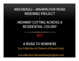
1. Eco Collective of Citizens of Vasant Kunj
ecocollectivecitizensofvkunj@gmail.com
MAEHRAULI – MAHIPALPUR ROAD
WIDENING PROJECT
-
HIGHWAY CUTTING ACROSS A
RESIDENTIAL COLONY
BUT
A ROAD TO NOWHERE
2. Mehrauli Mahipalpur Road being widened from approx. 23 m
metaled road to 75 m ROW road
• Phase I – Andheria Mor to Fortis Hospital (approx. 2.2 km)
• Phase II – Fortis Hospital to Ryan School (approx. 3.3 km)
• Phase III – Ryan school to Shiv Murti at NH 8 – cutting
across the ridge area
6. • This road is the main spine road of Vasant Kunj
• There are residential sectors that are inter-dependent with social
facilities on both sides of road
• Vasant Kunj has approx. eighteen schools and three hospitals.
• Population stratification is such that considerable segment of
citizens are senior citizens and young families with small children.
8. ROAD PLANNING PROCESS TIMELINE HIGHLIGHTS
• 24th Working Group II B Meeting dated 27th Oct. 2010
• Proposal discussed and in principle approval. List of land to be
acquired, land acquisition, necessary statutory approvals to be
taken was to be done by NHAI.
• This indicates that this 75 m ROW road was conceptualized as a
part of the network of highways to relieve the traffic on highways.
NHAI’s mandate is for highways. Why was a highway planned
cutting across an urban residential area?
Information source: Approved drawing – PWD/012
9. ROAD PLANNING PROCESS TIMELINE HIGHLIGHTS
• 34th Working Group II B Meeting dated 17th Feb. 2012
• DPR of the project to be prepared by DIMTS
• This new link road is not a Master Plan / Zonal Plan road.
However this new link as a relief road would provide an
important link connecting Gurgaon / Dwarka with South Delhi.
• When this road was proposed it was not a Master Plan road. But
all along in residents’ interactions with government authorities
they were told that it was a Master Plan road. The above
definition also puts it in a category of Primary collector and
should not be more than 40 m ROW. Why not use highways,
proposed 100 m ROW road parallel to this road and Mehrauli
Gurgaon road for this purpose.
Information source: Approved drawing – PWD/012
10. ROAD PLANNING PROCESS TIMELINE HIGHLIGHTS
• 42nd Working Group II B Meeting dated 18th Feb. 2013
• instead of finalizing the cross-section of this road, a detailed road
development plan as per street guidelines of UTTIPEC to be prepared with 2-
3 options.
• To resolve the matter, tree cutting and clearing of sites may be stopped and a
meeting may be called in the office of Secretary PWD where all stakeholders
be called.
• Prepare Stage III detail plan as per format for submission for further
discussion in the WG and final approval by the Governing Body based on the
recommendations of WG
• Work is apparently happening just with single line drawings. Detailed drawings,
services plan, detailed cross sections if prepared are not available for the public.
• Where is the Stage III detail plan? If that has not been done why Phase I has
been taken up?
Information source: Approved drawing – PWD/012
11. ROAD PLANNING PROCESS TIMELINE HIGHLIGHTS
• 43rd Governing Body Meeting dated 10th May 2013
• The Zonal development plan 75 m ROW may be reduced based
on a comprehensive review of network and feasibility check for
the entire network.
• The detailed intersection design of Andheria Mor and Aruna Asaf
Ali Road to be prepared.
• Phase II and III proposal of the corridor to be proposed and
finalized based on the comprehensive network plan of the area.
• Is comprehensive review of network and feasibility check for the
entire network done? Public does not have access to it.
• Is Phase II and III proposal finalized based on comprehensive
network plan of the area? Public does not have access to it.
Information source: Approved drawing – PWD/012
12. On drawings intersection between Aruna Asaf Ali Road and the road being
widened.
Truncated 75 m
ROW. How would it
be taken further
ahead?
Why is construction
being done with such
drawings?
13. ROAD PLANNING PROCESS TIMELINE HIGHLIGHTS
• 44th Governing Body Meeting dated 22nd Aug. 2013
• Submission made by PWD agreed by the Governing Body - ‘The
Zonal plan of 75 m ROW may be maintained by providing green
strips on both sides of development with the ROW as per the
conceptual plan presented in the meeting and a comprehensive
network plan and feasibility check for the entire corridor to be
made.’
• Where is the Comprehensive network plan and Feasibility Check for
the entire corridor? Consolidated Green belts are also not being
provided.
Information source: Approved drawing – PWD/012
15. DECEMBER 2012 - APRIL, 2013
• PWD initiates reclaiming 75 m ROW from Chattarpur side.
• Work not initiated on initial approx. 1km stretch from Andheria
Mor. That stretch has farmhouses and nurseries on both sides.
• Bulldozers start working to demolish boundary walls of the starting
sectors of Vasant Kunj after farmhouses and nurseries.
• Frantic cutting of trees
• Residents try to find the reason for this sudden activity
• Residents number trees
• Residents contact RWAs for knowing the administrative status
and are informed that Road Widening project has started and
RWAs had been informed.
16. DECEMBER 2012 - APRIL, 2013
• Residents meet LG, CM and other administrative nodal authorities
but face apathy.
• Concerned residents try to create awareness through peace
marches, leaflets, public meeting.
• Public view is divided and RWAs of some sectors apparently aid
PWD demolitions
• Residents resist political parties efforts to politicize the issue
• Residents try to interact with PWD and nodal body UTTIPEC to
have participatory planning process.
17. DECEMBER 2012 – APRIL, 2013
• Residents try to get project information through RTIs, but no
conclusive information obtained.
• Residents meet lawyers to understand legal route.
• Sector DII residents file a case in court against demolition of the
fence of their sector and get stay
• Sector DIII residents file a case as the road alignment consumes
the land originally shown by DDA on drawings as sector land
• A green activist files case in NGT regarding cutting of trees
without clearance from Forest Department and gets stay for the
project
• Cases are filed by other establishments along the road alignment
29. MAY 2013 – MARCH 2014
• Despite court stay, sporadic construction activity going on
• More trees are cut
• PWD Chief’s office apparently unaware of above events
• Frantic activity in March 2014, whole carpeted width opened up for
traffic and one major traffic light junction deactivated
• Stay on cutting of trees is vacated and permission granted for cutting
of +800 trees for widening road of about 2 km of stretch. +200 trees
had already been cut without permission from Forest department.
• Order given to do compensatory plantation of 1000 trees and
transplantation of +100 trees.
30. APRIL 2014 – MARCH 2015
• Cutting of trees starts at frantic pace.
• Residents approach Appellate Authority regarding the issue that
trees even other than marked trees being cut and for raising the
issue that transplantation of trees has not been successful, but no
action taken.
• Residents file case in High court and stay granted for cutting of
more trees.
• But work going on.
• High court appoints Sunita Narain of CSE as the Amicus Curiae
for the case
33. Such mounds of malba lying
along the road make this whole
area susceptible for bronchial
problems.
Malba being deposited in the
median. Can any greenery
grow or survive in this malba?
33
Photographs – Feb, 2015
34. 34
MUZ stretch being made on either side of road. But, as per MOM of 44th
Governing Body Meeting dated 22nd Aug., 2013 (As shown on drawings), PWD
had got the road width changed back to 75 m ROW with the assurance that on
both sides would be Green Belt. But on drawings it is shown as MUZ and is
being executed like that. Then where will compensatory plantation of trees be
done and where would be the Green buffer from traffic on 75 m wide road.
Photographs – Feb, 2015
35. Water pipeline
blocking the path.
Clear view in the
side photograph.
An MUZ to nowhere…. Alongwith water
pipeline there is an electricity pole which is
precariously unbalanced now. Without
shifting utilities why civil work has been
going on at fast speed working day and
night?
Why such waste of public money?
35
Photographs – Feb, 2015
36. Lanes being made to nowhere…..
Lanes are being made, kerb stones
are being laid but these are abutting
the farmhouse walls or nurseries
where land has not been acquired.
Farmhouse
wall
Farmhouse
wall
Farmhouse
wall
36
Photographs – Feb, 2015
39. Bus stop
was here
February 2014
February 2015
In 2014 Bus stop was broken, but now it has been demolished.
Some other bus stops have also been demolished. This causes
lot of inconvenience to public including senior citizens, children
etc.
39
40. February 2014
February 2015
Bad quality work and trees damaged. How can a storm water
drain of such quality function effectively?
40
41. Open drains and cables are safety hazards for pedestrians
41
Photographs – Feb, 2015
42. February 2014
February 2015
Road stretch and
storm water drain
to nowhere…….
As the
transmission tower
has not been
shifted
Open manholes
are safety hazard
42
43. Dividers have been broken at
different places. Vehicles turn
from there causing traffic jams
and increasing chance of
accidents.
43
Photographs – Feb, 2015
44. The Funnel effect while
approaching Aruna Asaf Ali
road intersection. Traffic
moving in MUZ area made
open to public.
44
Photographs – Feb, 2015
45. Bad detailing or no thought
given to detailing – but the
focus is on doing kerb stone
work – at present required or
not
45
Photographs – Feb, 2015
46. Exposed tree roots and trees getting
damaged by acidic content of garbage – Are
these trees counted as being saved?
46
Photographs – Feb, 2015
51. ROAD WIDTH GUIDELINES - UTTIPEC
• Arterial Roads – Primary Roads
• Vehicular routes carrying heavy volumes of traffic will generally have
free/stable flow conditions with controlled access.
• Recommended ROW in existing urban areas is 60-80 m and minimum
80 m in the proposed Urban extension
• Present ring road and outer ring road to be converted to access
controlled arterial roads.
• Arterial Roads – Other Primary Roads
• Vehicular routes carrying heavy volumes of traffic.
• Recommended ROW in existing urban area is 45-60 m and minimum 60
m in the proposed urban extension.
Ref. Street Design Guidelines “… for equitable distribution of Road Space” – NUTP
Revision 1: Nov. 2010
52. ROAD WIDTH GUIDELINES - UTTIPEC
• Sub - Arterial Roads – Primary Collector
• Roads connecting major arterial roads and inter-residential
collectors.
• Recommended ROW in existing urban areas is 30-40 m and
minimum 45 m in the proposed Urban extension
Ref. Street Design Guidelines “… for equitable distribution of Road Space” – NUTP
Revision 1: Nov. 2010
53. As per these guidelines, this road can be categorized as Primary
Collector Road and recommended ROW is 30 – 40 m.
Then why is this road being widened to 75 m ROW – WIDER
THAN RING ROAD OR OUTER RING ROAD
54. GLARING REVELATIONS TILL THIS POINT
• Focus only on Phase I. No comprehensive plan for all three
phases.
• Work on Phase I started but land acquisition for more than 20% of
initial stretch on Phase I not initiated. That stretch has farmhouses
and nurseries.
• Order for cutting 810 trees came in August 2014 while the
alignment and broad design were approved in Nov, 2014.
• Probably trees that are not even marked for cutting are being cut.
• The trees that are not cut are being tarred on all sides. How would
these trees survive?
• Shifting of utilities not done even till this stage and tarring of road
being done.
55. How can work be awarded without approvals, preparation of
drawings and land acquisition for the project
Why isn’t there a comprehensive time schedule and development
plan for all three phases
Why isn’t public the main stakeholder consulted on development
projects and why don’t they have access to information on PWD
website
How can work be started in the middle of road alignment
56. Development needs to inclusive with respect for environment and
requirements of people
Public money should not be wasted in name of development
There has to be a system of making planning and executing
authorities accountable for the project outcomes
PWD, UTTIPEC, NGT, Forest Department….pls look into
concerns of the public
57. Thank You
Pls. sign the petition on http://www.change.org/p/minister-of-urban-development-mr-
vankaiah-naidu-chief-minister-of-delhi-mr-arvind-kejriwal-stop-the-mehrauli-
mahipalpur-road-widening-project-and-conduct-its-technical-financial-and-
administrative-audit