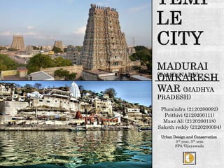
TEMPLE TOWN - Madurai and Omkareswar, India
•Download as PPTX, PDF•
31 likes•24,294 views

Note: (Animated content) see the slide in slide show only for more content

Recommended
More Related Content
What's hot
What's hot (20)
Viewers also liked
Viewers also liked (18)
Similar to TEMPLE TOWN - Madurai and Omkareswar, India
Similar to TEMPLE TOWN - Madurai and Omkareswar, India (20)
More from School of Planning and Architecture
Recently uploaded
Recently uploaded (20)
TEMPLE TOWN - Madurai and Omkareswar, India
- 1. Phanindra (2120200092) Prithivi (2120200111) Maaz Ali (2120200118) Saketh reddy (2120200094) Urban Design and Conservation 1 3rd year, 5th sem SPA-Vijayawada
- 2. 2 ATHENS OF THE EAST
- 3. Madurai is administrative headquarters of Madurai District. The capital of the Pandyan kingdom was initially Korkai, around 600 BCE and was later moved to Koodal ie, Madurai during the reign of Nedunj Cheliyan. The district is bounded on the north by Dindigul district on the east by Sivaganga on the west by Theni district and on the south by Virthunagar District. LOCATION 3
- 4. MADURAI , popularly known as the Temple city, also called as ATHENS OF THE EAST, City of Junction, City of Jasmine, CITY THAT NEVER SLEEPS and City of four junctions. Madurai is third major economic, industrial, commercial, political centre and a major transportation hub for the southern Tamilnadu. The city is renowned for tourism, festivals and vibrant cultural life in general and is considered to be the states cultural capital. The rich and vibrant natural and cultural landscape with different linguistic and cultural groups coexisting together in its UNIQUE CUSTOMS, TRADITIONS, AND ART FORMS make it a classical example of an urban environment wherein diversity becomes the source of strength rather than conflicts. INTRODUCTION 4
- 5. Madurai has a long and well recorded history. As early as the 3rd century BC, Megasthenes visited, the city being referred to as "Methora". Madurai has been described as the seat of the Pandyan Dynasty. The capital of the Pandyan kingdom was initially Korkai, around 600 BCE and was later moved to Koodal ie, Madurai during the reign of Nedunj Cheliyan. The city was home to the third and last Tamil Sangam between 300 BCE and 200 CE. Spatial growth pattern of the city 5
- 6. 1 2 Pandayan Time 12 century Vijayanagara Time 16 century 3 4 Colonial Period Present Situation Evolution of city 6
- 8. The old city of Madurai is considered to be designed according to the Rajdhani plan, described in Manasara, one of the Shilpasastra, and has the fivefold concentric rectangular formation with Meenakshi- Sundareshwara Temple at a very centre point. The city was a well planned one with bazaars and many broad streets with high and luxurious mansions on both sides. The city was built around the temple complex as the focal point with a combination of a concentric street pattern. TRADITIONAL PLANNING STRATEGIES 8
- 9. The streets concentric to the temple complex formed the major streets viz., Chithirai Streets, Avani Moola Streets and Masi Streets. The next order of streets is perpendicular to the above streets and lead to the temple entrances. The developments within and beyond these streets are on an irregular pattern. A definite hierarchy of street pattern was adopted with the width of the Streets decreasing as they branched out, ending up in stone paved streets and lanes - the width of some being just 0.60 m. The entire city was enclosed within the fort walls and surrounded by a moat. The fort walls have been razed down and the moat filled up to form the present day Veli Streets. Street Pattern 9
- 10. The settlement pattern of Madurai is planned according to the ancient system of town planning which is based on caste and occupational hierarchies. The map shows the present settelemnt pattern and its relavance with the ancient town planning system. Ancient south indian temple towns are designed by placing the temple complex at the centre with concentric rectangle pattern of streets around. This can be seen in another southern temple town srirangam also. SETTLEMENT PATTERN 10
- 11. In Madurai, Meenakshi Amman Temple is at the center. Royal Palaces, Brahmins and Priests at the first concentric rectangle.Traders, Kishatriyas and Vaishnavaites on the second rectangle. The lower caste Sudras and immigrants zoarashitrains in the third rectangle. Ancient Town Planning System 11
- 13. SAREE WAVING STONE SCULPTURES Housing Typology – Arts And Craft 13
- 14. SWOT Analysis 14 SWOT….. STRENGTH: Conservation The city represents a rare Mandala concept of traditional Planning systems,. Declared as heritage city under JnNURM scheme. City is known for its veneration factor (pilgrimage tourism). Economic perspectives The city is also commercial and official headquarters of the region drawing around 2.5lacs floating population per day. According to Census 2001, the urban workforce participation rate(WPR) (percentage of main and marginal workers to the total population) is 34.18 percent (including 1.35 percent marginal workers). Nearly 92% of the work forces are employed in tertiary sector (tourism and related industries).
- 15. WEAKNESS: Conservation: Lack of information base for the heritage properties and historical layers pose a great difficulty in managing the heritage property. Lack of awareness of the heritage properties is another main cause for its deterioration. Urban environment: Degradation of River Vaigai,Girudumal River and other water channels in the city. Location of Non compatible uses such as whole sale vegetable markets,hardware shops,sanitary wares etc within the historic precinct.These activities attract more number of vehicles inside the historic area. SWOT Analysis
- 16. 16 OPPORTUNITIES: Tourism and Economic perspectives: With the availability of good connectivity,highliteracy it can attract more investors and tourists in the region. The local arts from across the region can be show cased for attracting the tourist and local people. Capacity to attract many tourists as it is rich in heritage and culture. High Literacy rates with many educational institutions in the region. Proposed projects in pipeline: City is initiating reforms such as shifting of whole sale markets,Egovernance and other projects under JnNURM scheme. The projects in BSUP clearly indicate the unemployment factor in the city.The heritage aspects/strength can be used as a lever for the face lift of the people. SWOT Analysis
- 17. 17 THREAT Conservation: Lack of repair and maintenance of heritage buildings can lead to rapid deterioration of built fabric in the core city. Continued negligence of heritage are as can also lead to loss in tourism revenues SWOT Analysis
- 18. A temple city 18
- 19. Omkareshwar Temple Location of Omkareshwar Temple 19 Madhya Pradesh
- 20. • First settlement at Amareswar temple- The earlier nucles • During the same time the Omkareshwar temple and sidhwarkut ( by Bhojadeva of paramaras) • Settlements started to increase around the temple and along the road connecting it. Evolution 20
- 21. • The king constructed 8 most importance temples at which the settlements started to grow • The major growth is around the Omkareswar jyotirling. Location of Temples 21
- 22. • The Former heir in 1165 A.D constructed wall around which is spatially located just behind the Omkareswar temple. • The settlement growth around these temples is inorganic in nature. Constructions and City form 22
- 23. No Building around the temple must not be higher than that of the temple and the kings fort. The caves constructed must be far away from the fort wall and must be at the river bank. The ghat steps of the omkareswar and Amareshwar temple were aligned. The Social structure of the omkareswar is strictly followed as such brahmins,ksatriyas,vysyas and kshudras. Principles 23
- 24. 24 Vysyas Brahmins Kshatriyas shudras The Bilalas the other class of people who are tribal origin used to live at the Amareshwar temple STREET PATTERN & SOCIAL STRUCTURE AT OMKARESWAR TEMPLE
- 25. • The Town fabric around Omkareswar temple is heavily effected with the myths of the people. • No person is allowed to leave the premises or the fort wall and construct near the caves. • The town structure is organic in nature sporadic and scattered. The city fabric around Omkareshwar 25
- 26. Amareswara temple is the start of the settlements also can be called as the primary nucles. After the construction of Brahma and Vishnu temples the whole place which is called amareshwar is divded intlo Brahmapuri and Vishnupuri, This led to the seperation of the Socila class of the people with brahmins who worship Vishnu and who worship Brahma. Along with these there are Bhilalis who worship hindu gods without any difference. Similarly there are Brahmins ,Kshatriyas and Sudras and Vysyas here also. Around Amareshwar temple 26
- 27. • Due to many social issues there is an Organic growth in the town which led to a very disturbed form of a town fabric. • Other than Social issues, the street pattern connects the temples very well. • The Ghats are also well connected. The street pattern and reasons for growth 27
- 28. heritage development plan.pdf Ancient and medieval town planning in India by Prabhakar v. begde studyofcityevolution-Madurai.pdf Reference 28