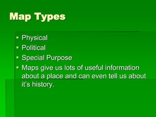
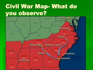
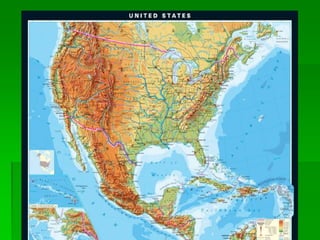
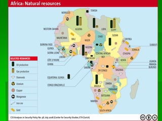
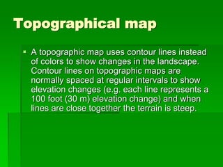
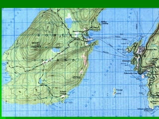
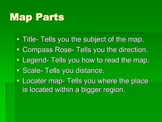
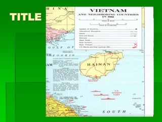
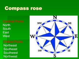
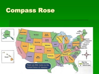
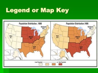
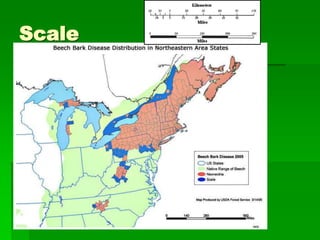
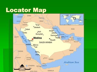
Maps 6th Grade 
I.O. I will identify the different types 
of maps and determine how we use 
them to gain historical and 
geographic knowledge. 
Entry slip - Have you ever used a 
map before? Why did you use it?
Maps 8th Grade 
 L.O. I will identify the different types and 
parts of maps and determine how we use 
them to gain historical and geographic 
knowledge. 
 Entry slip – What are differences 
between a Physical Map, Political Map, 
and Special Purpose Map?
Map Types 
 Physical 
 Political 
 Special Purpose 
 Maps give us lots of useful information 
about a place and can even tell us about 
it’s history.
Civil War Map- What do 
you observe?
Physical Map 
 A physical map is one that shows the physical 
landscape features( land and water) of a place. 
They generally show things like mountains, 
rivers and lakes and water is always shown 
with blue. Mountains and elevation changes 
are usually shown with different colors and 
shades to show relief. Normally on physical 
maps green shows lower elevations while 
browns show high elevations.
Political map 
 A political map does not show physical 
features. It instead focuses solely on the state 
and national boundaries of a place. They also 
include the locations of cities - both large and 
small, depending on the detail of the map. A 
common type of political map would be one 
showing the 50 U.S. states and their borders 
along with the United States' north and south 
international borders
Special Purpose 
 Can include maps about one specific 
topic. 
 Climate 
 Resources 
 Population 
 Historical 
 Elevation (topography)
Topographical map 
 A topographic map uses contour lines instead 
of colors to show changes in the landscape. 
Contour lines on topographic maps are 
normally spaced at regular intervals to show 
elevation changes (e.g. each line represents a 
100 foot (30 m) elevation change) and when 
lines are close together the terrain is steep.
Map Parts 
 Title- Tells you the subject of the map. 
 Compass Rose- Tells you the direction. 
 Legend- Tells you how to read the map. 
 Scale- Tells you distance. 
 Locater map- Tells you where the place 
is located within a bigger region.
TITLE
Compass rose 
Cardinal Points 
North 
South 
East 
West 
Ordinal Points 
Northeast 
Southeast 
Southwest 
Northwest
Compass Rose
Legend or Map Key
Scale
Locator Map
Group Work
Exit Slip 
 How can understanding maps help us 
understand geography?

Maps

  • 1.
    Maps 6th Grade I.O. I will identify the different types of maps and determine how we use them to gain historical and geographic knowledge. Entry slip - Have you ever used a map before? Why did you use it?
  • 2.
    Maps 8th Grade  L.O. I will identify the different types and parts of maps and determine how we use them to gain historical and geographic knowledge.  Entry slip – What are differences between a Physical Map, Political Map, and Special Purpose Map?
  • 3.
    Map Types Physical  Political  Special Purpose  Maps give us lots of useful information about a place and can even tell us about it’s history.
  • 4.
    Civil War Map-What do you observe?
  • 5.
    Physical Map A physical map is one that shows the physical landscape features( land and water) of a place. They generally show things like mountains, rivers and lakes and water is always shown with blue. Mountains and elevation changes are usually shown with different colors and shades to show relief. Normally on physical maps green shows lower elevations while browns show high elevations.
  • 7.
    Political map A political map does not show physical features. It instead focuses solely on the state and national boundaries of a place. They also include the locations of cities - both large and small, depending on the detail of the map. A common type of political map would be one showing the 50 U.S. states and their borders along with the United States' north and south international borders
  • 9.
    Special Purpose Can include maps about one specific topic.  Climate  Resources  Population  Historical  Elevation (topography)
  • 11.
    Topographical map A topographic map uses contour lines instead of colors to show changes in the landscape. Contour lines on topographic maps are normally spaced at regular intervals to show elevation changes (e.g. each line represents a 100 foot (30 m) elevation change) and when lines are close together the terrain is steep.
  • 13.
    Map Parts Title- Tells you the subject of the map.  Compass Rose- Tells you the direction.  Legend- Tells you how to read the map.  Scale- Tells you distance.  Locater map- Tells you where the place is located within a bigger region.
  • 14.
  • 15.
    Compass rose CardinalPoints North South East West Ordinal Points Northeast Southeast Southwest Northwest
  • 16.
  • 17.
  • 18.
  • 19.
  • 20.
  • 22.
    Exit Slip How can understanding maps help us understand geography?