Download as PDF, PPTX

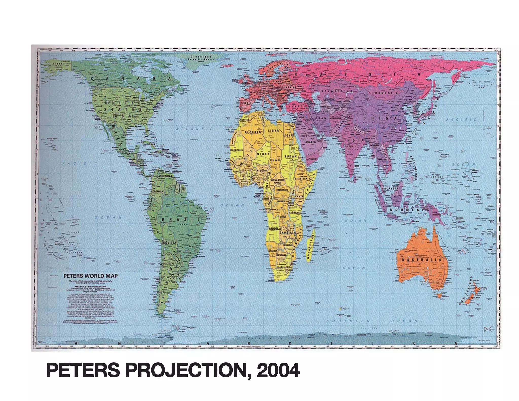
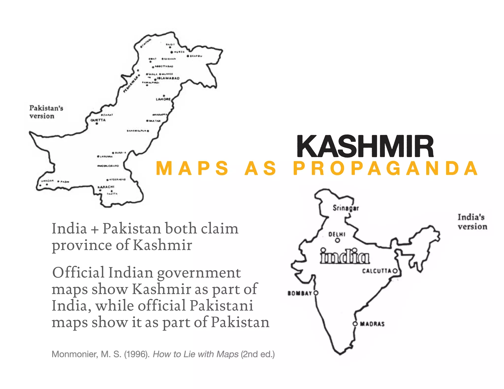
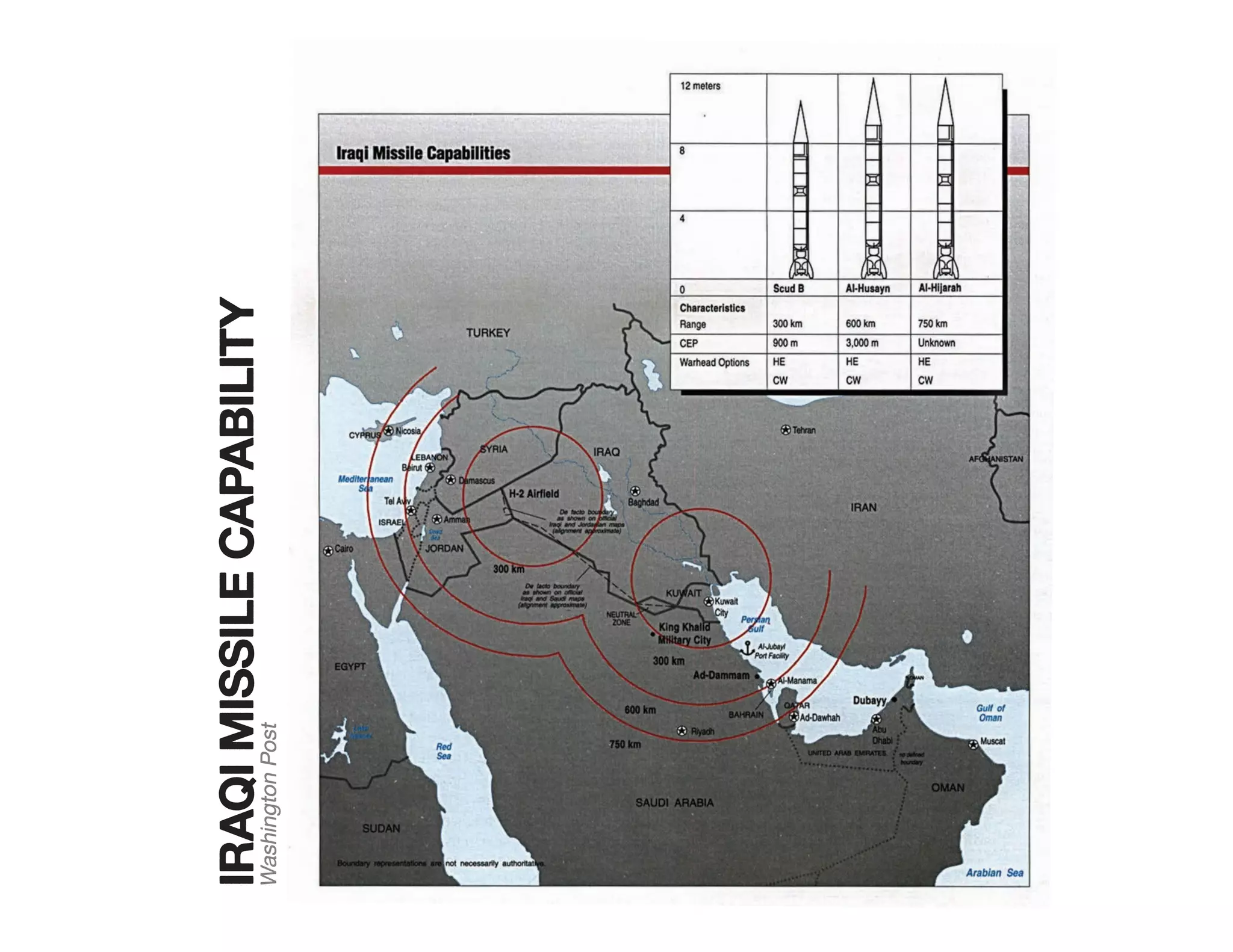
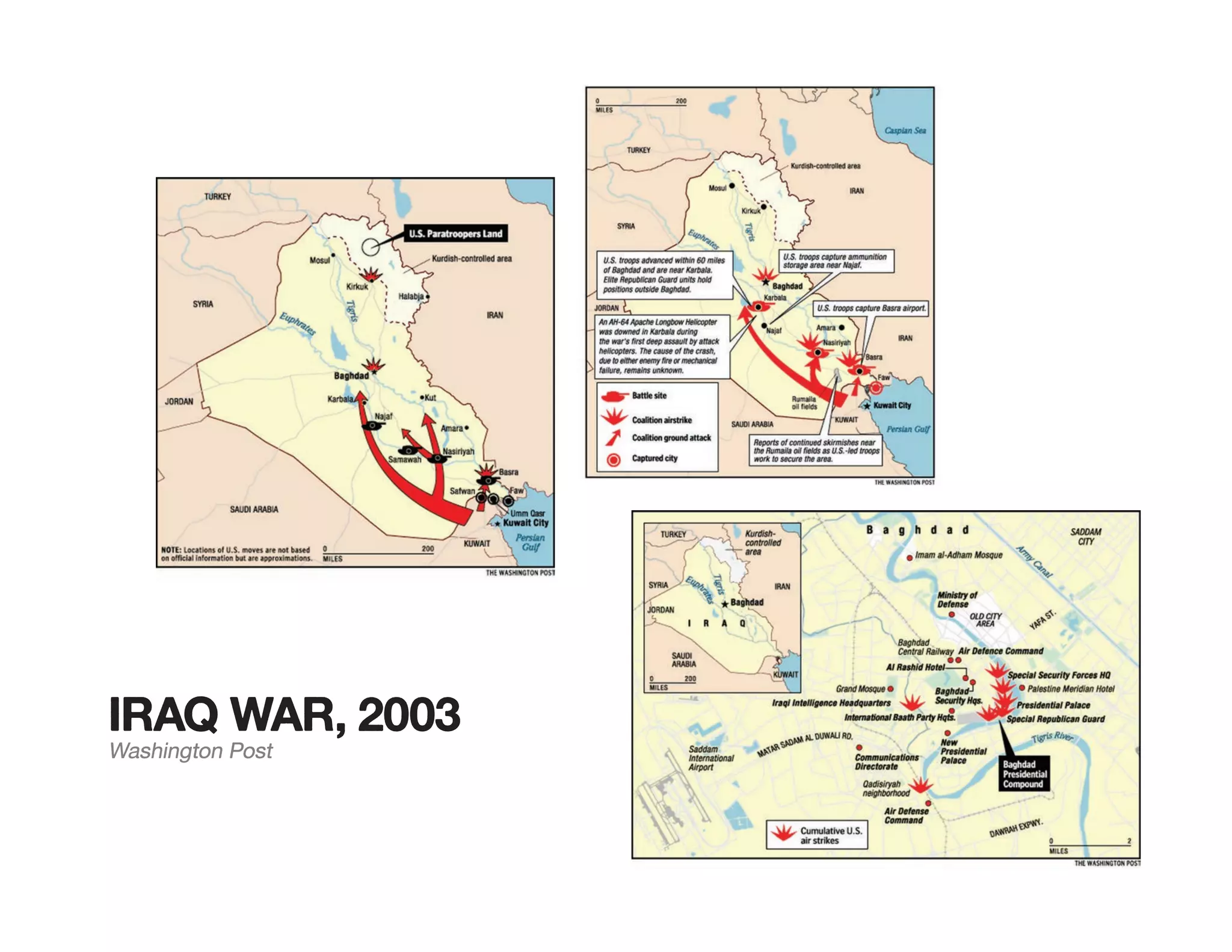
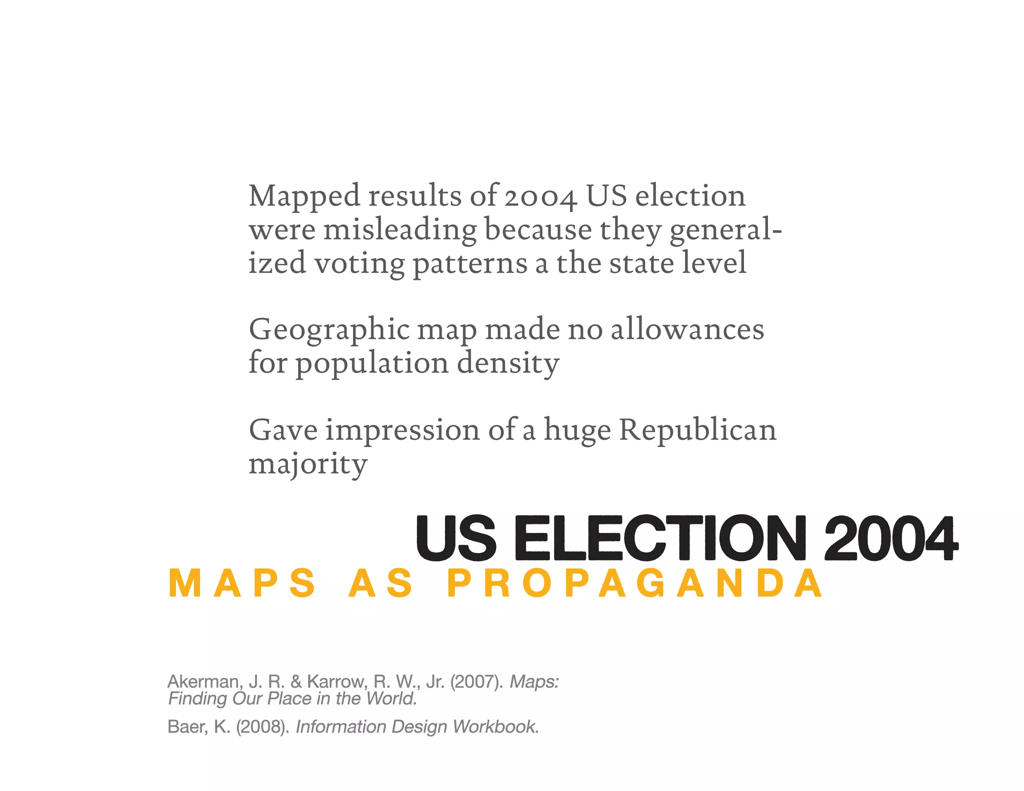
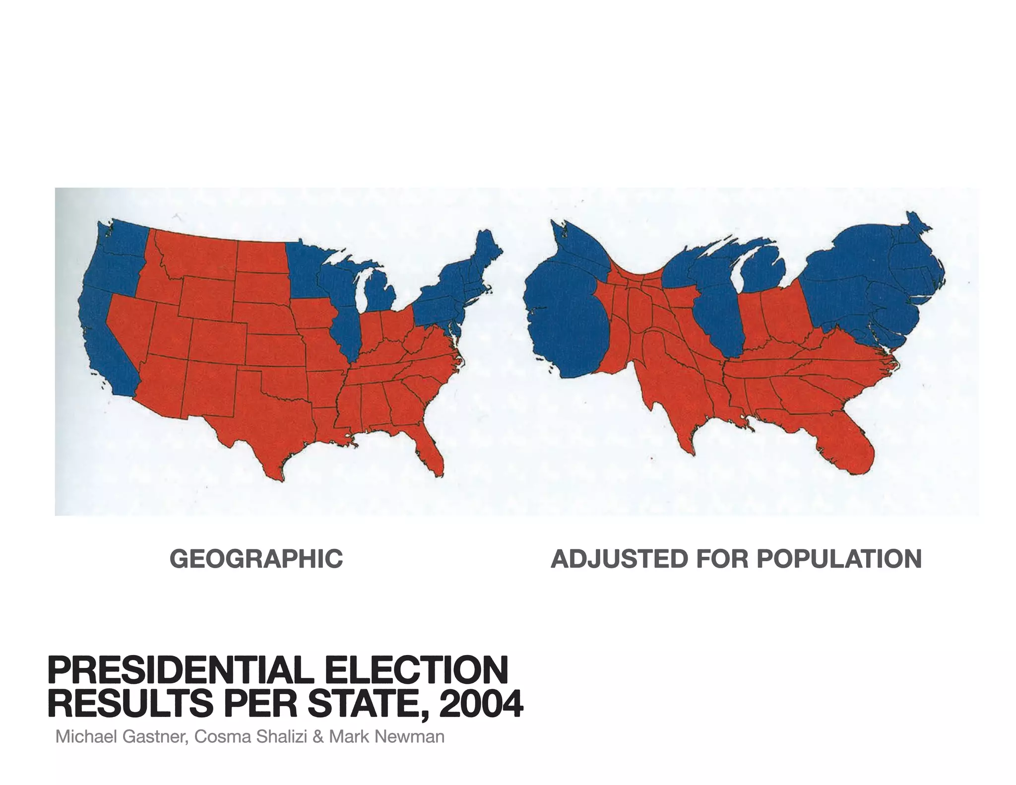
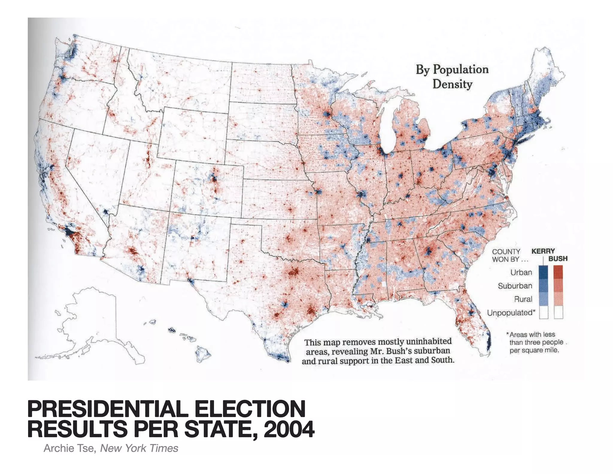
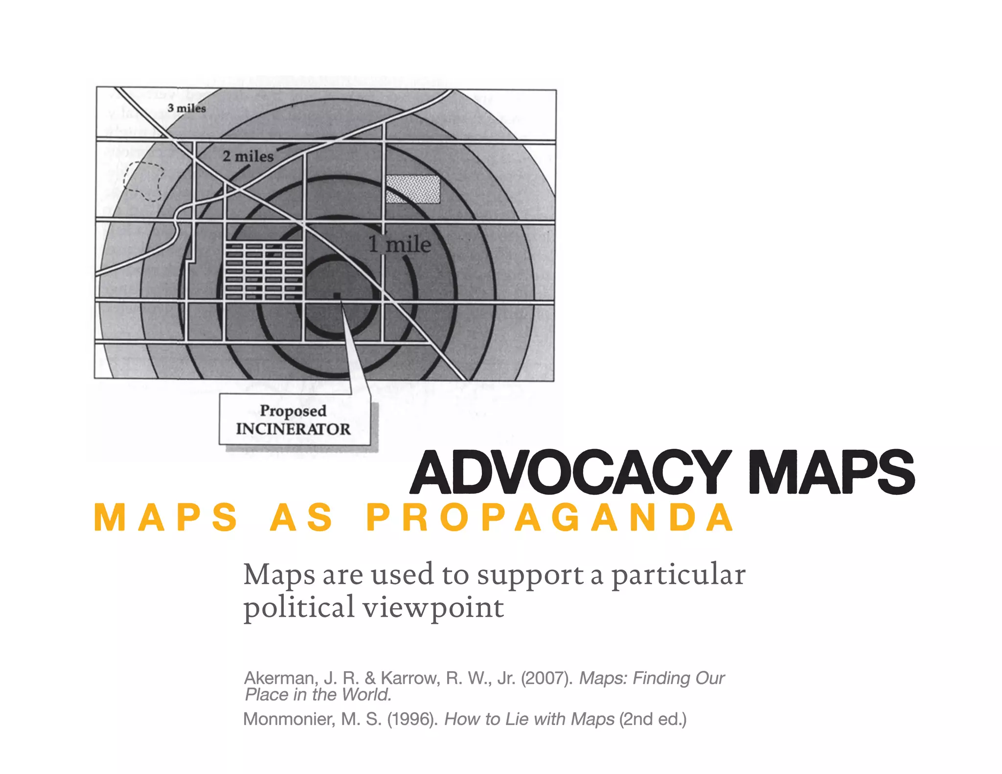
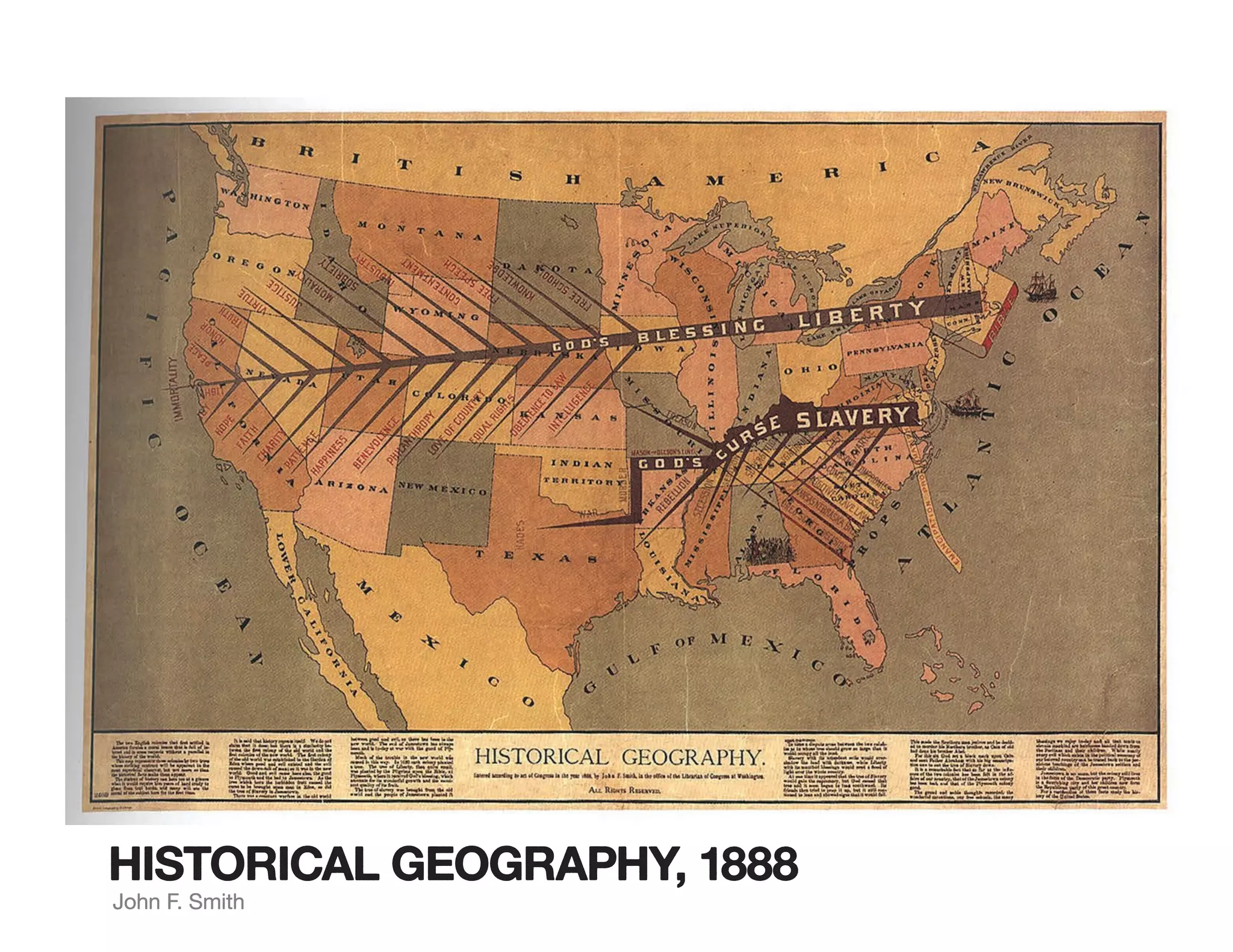
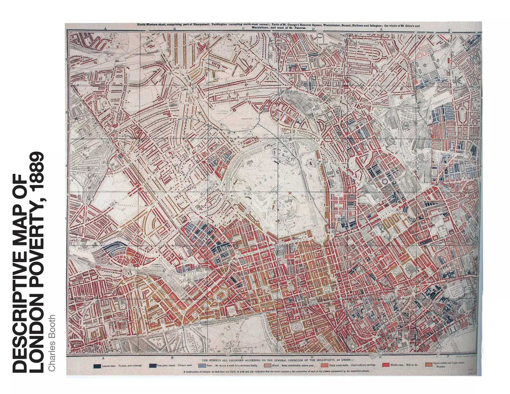
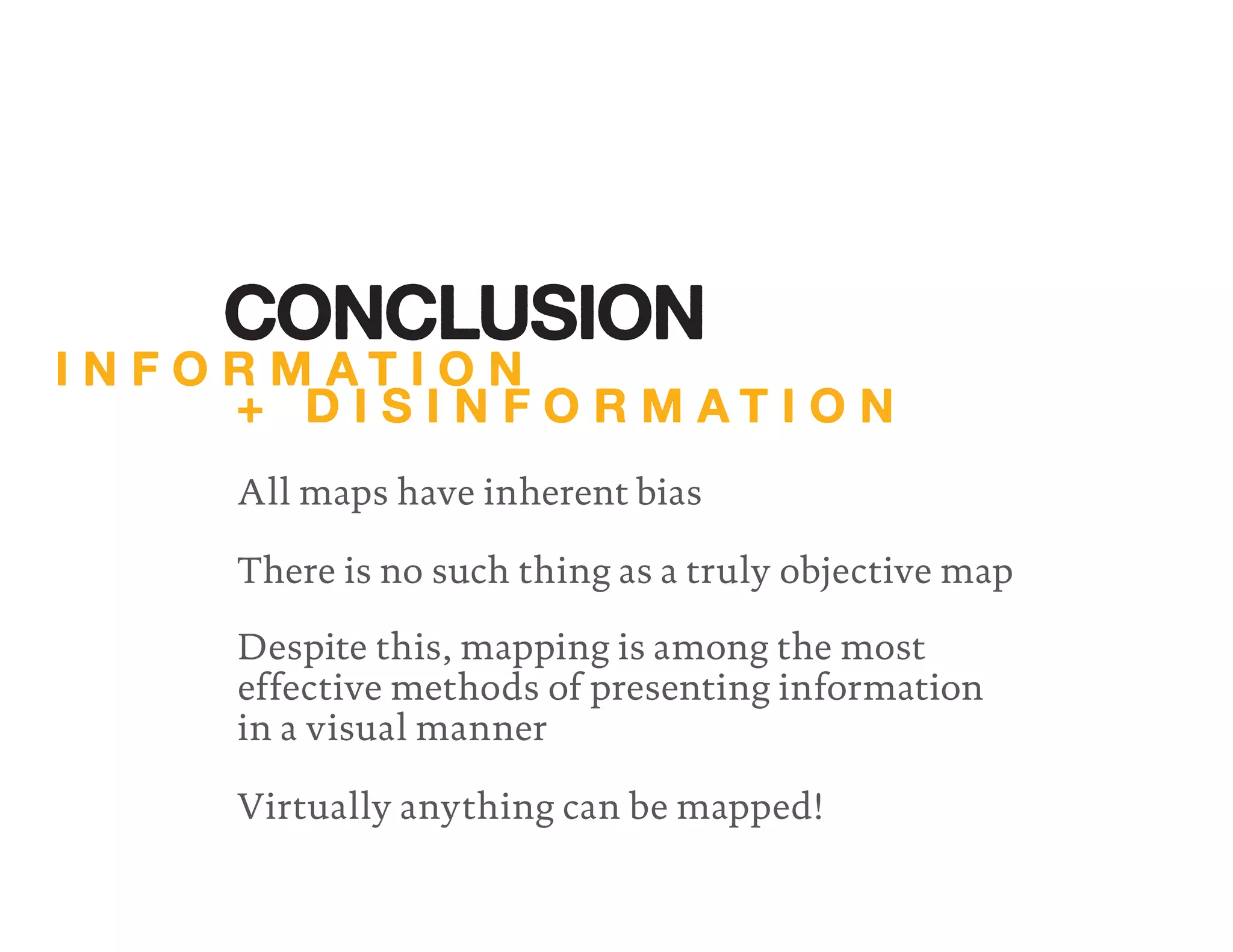

The document discusses key concepts related to maps and mapping. It addresses how maps answer fundamental questions about location and navigation by representing places in the real world. The document also examines different types of maps, including cognitive maps, strip maps, projections like Mercator and Peters, and thematic maps. Finally, it explores how maps can be used for propaganda or to advocate particular viewpoints.


