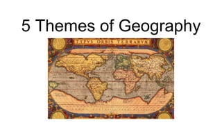
The document outlines the 5 themes of geography: location, place, human-environment interaction, movement, and region. It provides examples for each theme, such as how latitude and longitude are used to determine absolute location, how physical and political maps differ in what they show, and how human characteristics have impacted the city of Jerusalem. It also includes sample test questions assessing understanding of the themes.
To understand geography, it is a prerequisite to know its creators, their philosophy, aim and methods. These are really interesting and enrich our vision.
To understand geography, it is a prerequisite to know its creators, their philosophy, aim and methods. These are really interesting and enrich our vision.
This article is talking about the importance of maps. It tells us the history and usage of map. After reading the map, you will learn how important the maps is in our daily life. It brings us much convenience.
AP Human Geography: Unit 1 - Introduction to GeographyDaniel Eiland
Here is the Advanced Placement Human Geography Unit1 Powerpoint I will be using to teach my classes this year. It includes the sections "Introduction to Geography", "Tools Geographers Use", and "The Five Themes of Geography". You can find the guided notes for this presentation here: http://www.slideshare.net/deilands/ap-human-geography-unit-1-13583828
Nothing can entirely replace careful field observations in the study of a geomorphic problem, but numerous aid can add to their effectiveness s, reduce the amount of field work for many problems, make possible a more effective planning of the field program, and add support to the conclusions drawn. These aids are what may be called the "tools" of the geomorphologist, although their use is by no means restricted to him. Topographic maps, geologic maps, block diagrams, aerial photographs, soil map, and climatic data are the most commonly used tools in geomorphic studies.
Physical Geography Lecture 01 - What Is Geography 092616angelaorr
Introduction to Physical Geography. What is Geography? 5 Fundamental spatial concepts of Geography. Geography is holistic. Subdivisions of Geography. Systems science. Earth's 4 spheres. Review.
Role of Remote Sensing(RS) and Geographical Information System (GIS) in Geogr...Prof Ashis Sarkar
since1970s, there has been a sharp rise in Global Resource Information System (gris) facilitated by satellites/satellite-aided geodetic, cartographic and geostatistical methods. This enormous information base needs an entirely new methods of analysis and interpretation. Hence, emerged an entirely new branch of learning and methodology, “geoinformatics”.
What is Geophagy?
Themes of Geography
Traditions of Geography
Tools of Geography.
• MAPS
• ATLAS
• GLOBE
• AERIAL PHOTOGRAPHS
• SATELLITE PHOTOGRAPHS
• INFORMATION GRAPHICS
• GEOGRAPHIC INFORMATION SYSTEM
The Mother of All Sciences: Geography As A Holistic Homeschool Frameworkangelaorr
The Mother of All Sciences: Geography As A Holistic Homeschool Framework. Presented at the Homeschool Association of California (HSC) Adventures in Homeschooling Conference, Aug. 2, 2014.
Data analysis in geography simply concerns the methodology for collecting, analyzing, and presenting data. It frequently involves the application of statistical techniques useful in several ways ― first, these help summarize the findings of studies (example: total rainfall during a period in a state), second, these help understanding of the phenomenon under study (example: rainfall is more in the southern districts), third, these help forecast the state of variables (example: draught is likely during the next year), fourth, these help evaluate performance of certain activity (example: more rainfall means more rice production), fifth, these help decision making (example: finding out the best location for a H.S. School), sixth, they also help to establish whether relationships between the characteristics of a set of observations are genuine or not, and finally, certainly all these can show that the results of the analysis make a valuable contribution to the body of geographical knowledge.
Statistical techniques and procedures are applied in all fields of academic research; wherever data are collected and summarized or wherever any numerical information is analyzed or research is conducted, statistics are needed for sound analysis and interpretation of results. Geographers primarily use statistics in the following ways: to describe and summarize spatial data, to make generalizations concerning complex spatial patterns, to estimate the probability of outcomes for an event at a given location, to use samples of geographic data to infer characteristics for a larger set of geographic data (population), to determine if the magnitude or frequency of some phenomenon differs from one location to another, and to learn whether an actual spatial pattern matches some expected pattern.
Synthetic Fiber Construction in lab .pptxPavel ( NSTU)
Synthetic fiber production is a fascinating and complex field that blends chemistry, engineering, and environmental science. By understanding these aspects, students can gain a comprehensive view of synthetic fiber production, its impact on society and the environment, and the potential for future innovations. Synthetic fibers play a crucial role in modern society, impacting various aspects of daily life, industry, and the environment. ynthetic fibers are integral to modern life, offering a range of benefits from cost-effectiveness and versatility to innovative applications and performance characteristics. While they pose environmental challenges, ongoing research and development aim to create more sustainable and eco-friendly alternatives. Understanding the importance of synthetic fibers helps in appreciating their role in the economy, industry, and daily life, while also emphasizing the need for sustainable practices and innovation.
2024.06.01 Introducing a competency framework for languag learning materials ...Sandy Millin
http://sandymillin.wordpress.com/iateflwebinar2024
Published classroom materials form the basis of syllabuses, drive teacher professional development, and have a potentially huge influence on learners, teachers and education systems. All teachers also create their own materials, whether a few sentences on a blackboard, a highly-structured fully-realised online course, or anything in between. Despite this, the knowledge and skills needed to create effective language learning materials are rarely part of teacher training, and are mostly learnt by trial and error.
Knowledge and skills frameworks, generally called competency frameworks, for ELT teachers, trainers and managers have existed for a few years now. However, until I created one for my MA dissertation, there wasn’t one drawing together what we need to know and do to be able to effectively produce language learning materials.
This webinar will introduce you to my framework, highlighting the key competencies I identified from my research. It will also show how anybody involved in language teaching (any language, not just English!), teacher training, managing schools or developing language learning materials can benefit from using the framework.
Ethnobotany and Ethnopharmacology:
Ethnobotany in herbal drug evaluation,
Impact of Ethnobotany in traditional medicine,
New development in herbals,
Bio-prospecting tools for drug discovery,
Role of Ethnopharmacology in drug evaluation,
Reverse Pharmacology.
Welcome to TechSoup New Member Orientation and Q&A (May 2024).pdfTechSoup
In this webinar you will learn how your organization can access TechSoup's wide variety of product discount and donation programs. From hardware to software, we'll give you a tour of the tools available to help your nonprofit with productivity, collaboration, financial management, donor tracking, security, and more.
Palestine last event orientationfvgnh .pptxRaedMohamed3
An EFL lesson about the current events in Palestine. It is intended to be for intermediate students who wish to increase their listening skills through a short lesson in power point.
How to Split Bills in the Odoo 17 POS ModuleCeline George
Bills have a main role in point of sale procedure. It will help to track sales, handling payments and giving receipts to customers. Bill splitting also has an important role in POS. For example, If some friends come together for dinner and if they want to divide the bill then it is possible by POS bill splitting. This slide will show how to split bills in odoo 17 POS.
2. Location: Absolute Location
● How do you determine absolute location?
● What would knowing the latitude of a place be helpful in determining? Longitude?
3. Location: relative Location
● Using the map, identify places that are close to Greece.
● How is the Greek statue (right) similar to the Egyptian statue (left)? Why?
6. Regents Question: based on the previous slide
What does a topographic map show?
(1) climate regions
(2) patterns of trade
(3) ethnic distributions
(4) physical features
8. Human Environment Interaction
● Be sure to recognize that “our” interaction with the environment has been
both positive and negative.
9. Movement
● Based on the maps, how has the movement of Bantu speaking people affected the
development of the African continent? African Languages Map - the Present
10. Regents Practice
Which geographic theme is
the focus of this map?
(1) Regions: How They Form
and Change
(2) Movement: Humans
Interacting on Earth
(3) Location: Position on the
Earth’s Surface
(4) Place: Physical and
Human Characteristics