Downloaded 103 times

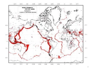
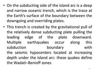
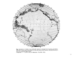
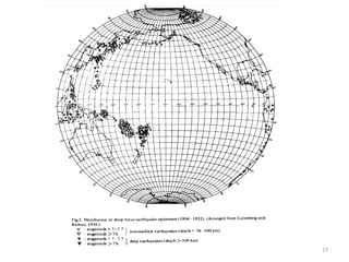
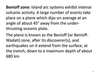
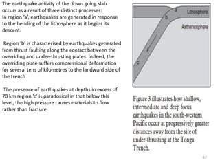
![• A Wadati–Benioff zone (also Benioff–Wadati zone or Benioff
zone or Benioff seismic zone) is a planar zone of seismicity
corresponding with the down-going slab in
a subduction zone. Differential motion along the zone produces
numerous earthquakes, the foci of which may be as deep as about
670 kilometres. The term was named for the
two seismologists, Hugo Benioff of the California Institute of
Technology and Kiyoo Wadati of the Japan Meteorological Agency,
who independently discovered the zones.
• Wadati–Benioff zone earthquakes develop beneath volcanic island
arcs and continental margins above active subduction
zones.[3] They can be produced by slip along the subduction thrust
fault or slip on faults within the downgoing plate, as a result of
bending and extension as the plate is pulled into the
mantle.[4] The deep-focus earthquakes along the zone allow
seismologists to map the three-dimensional surface of a subducting
slab of oceanic crust and mantle.
18](https://image.slidesharecdn.com/islandarc-171026071147/85/Island-arc-18-320.jpg)
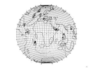
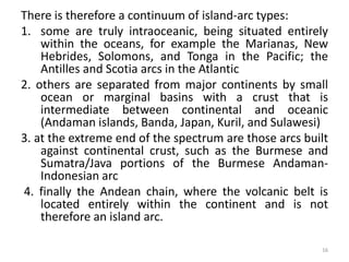
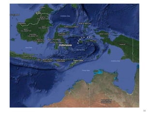
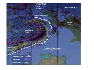
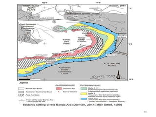
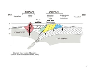
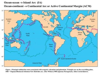
![Banda Arc
• The Banda Arc (main arc, Inner, and Outer) is a set
of island arcs that exist in eastern Indonesia. It
manifests the collision of a continent and an intra-
oceanic island arc. The presently active arc is located
on what appears to be oceanic crust whereas the
associated subduction trench is underlain
by continental crust.[1] The convergence of the Indo-
Australian plates and Eurasiaand resulted in the
formation of the Sunda and Banda island arcs. The
transitional zone between the arcs is located south
of Flores Island and is characterized by the change in
the tectonic regime along the boundary
37](https://image.slidesharecdn.com/islandarc-171026071147/85/Island-arc-37-320.jpg)
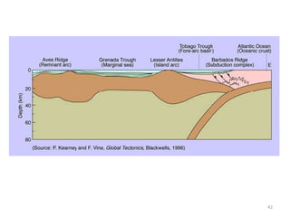
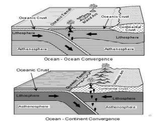
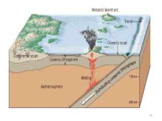
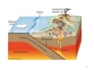

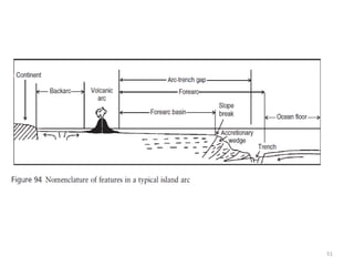
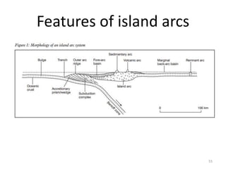
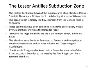
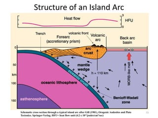
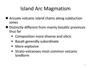
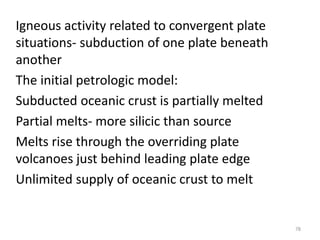

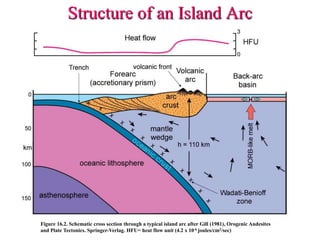
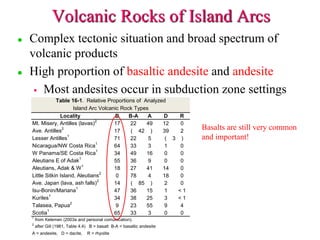
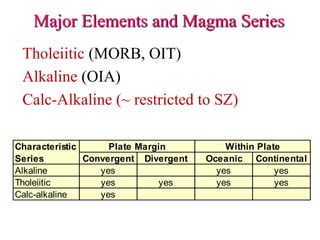
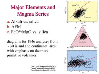

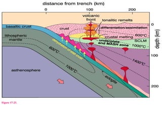

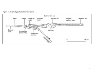
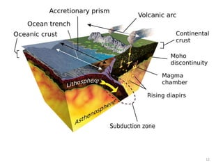
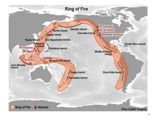
- Island arcs form along boundaries where one tectonic plate subducts beneath another. They are typically curved chains of volcanoes located parallel to and near the boundary. - Key characteristics of island arcs include active volcanism and seismicity, deep ocean trenches on the subducting side, and magma generation as the subducting plate undergoes partial melting. - True island arcs are separated from surrounding land by water, while volcanic arcs can be situated on continents but share the same tectonic setting of subduction zone volcanism. Major examples discussed are those surrounding the Pacific Ocean.


