Downloaded 273 times
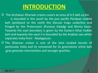
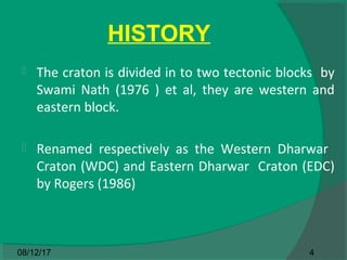
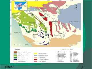
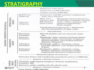
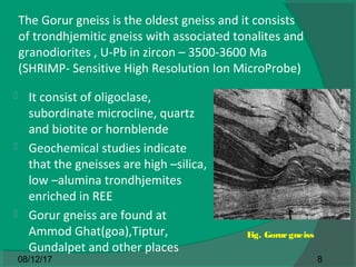


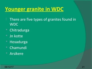

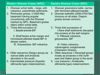


The document discusses the Western Dharwar Craton located in peninsular India. It is bounded by mobile belts and contains various rock groups like the Sargur, Bababudan, and Chitradurga groups. The oldest rocks are the Gorur gneisses dated to 3500-3600 million years ago. Younger granites and schist belts containing ultramafic and mafic rocks cut across the craton. The economic deposits in the area include magnesite, iron, chromium, vanadium, and copper-nickel ores. The craton shows increasing metamorphic grade from greenschist in the north to amphibolite and granulite facies in the south.


