The document provides an overview of how the Global Positioning System works using 24 satellites orbiting the Earth to transmit location and distance data to GPS receivers, it also describes how the International Federation of Red Cross and Red Crescent Societies can use GPS for mapping, navigation, and storing waypoints to help with activities like field assessments and finding routes. GPS is generally accurate to within 10 meters but can have some errors from factors like atmospheric delays, multipath signals, and clock inaccuracies.
GPS helps us identify exact location of a place/feature in the globe. Now-a-days we can carry out survey, enter data and process data. GPS is very helpful in soil survey
The Global Positioning System is a satellite-based radio navigation system for determination of precise position and time, using radio signals from the satellites, in real-time or in post-processing mode.
Global positioning system_Surveying, Civil EngineeringA Makwana
(GPS) technology is a great boon to anyone who has the need to navigate either great or small distances.
The Global Positioning System (GPS) is a burgeoning technology, which provides unequalled accuracy and flexibility of positioning for navigation, surveying and GIS data capture.
The Presentation on "Global Positioning System" gives an insight on the segment of GPS, how the positioning system works, its advantages and disadvantages, applications and new innovations in the field.
Disclaimer: None of the information in the above Presentation is authored by me. They references for the information used is the internet, news articles and books.
Group presentation done on GPS technology it covers
1.Introduction -History,Background
2.What is GPS - Technology, infrastructure
3.How GPS Works - Theory,Mathematical explanation
4.Applications of GPS
5.Drawbacks of GPS
6.Future Development
#References are added to the note section of the slides.
Global Positioning System (GPS) is a satellite based navigation system that can provide people who use it with their exact position on Earth, tell them how to get to another location, how fast they are moving, where they have been, how far they have gone, what time it is. GPS was originally designed to help the U.S. military with finding the accurate location of their soldiers, vehicles, planes and ships around the world. Now, GPS is used in cellular phones, navigation and map making.
Space segmentsGPS satellites fly in medium Earth orbit (MEO) at an altitude of approximately 20,200 km (12,550 miles). Each satellite circles the Earth twice a day.The satellites in the GPS constellation are arranged into six equally-spaced orbital planes surrounding the Earth. Each plane contains four "slots" occupied by baseline satellites. This 24-slot arrangement ensures users can view at least four satellites from virtually any point on the planet.
The control segment
The control segment of the GPS system consists of a worldwide network of tracking stations.
The master control station (MCS) located in the United States at Colorado Springs, Colorado.
The primary task of the operational control segment is tracking the GPS satellites in order to determine and predict satellite locations, system integrity, behavior of the satellite atomic clocks, atmospheric data, the satellite almanac, and other considerations.
The User segment
The user segment includes all military and civilian users. With a GPS receiver connected to a GPS antenna, a user can receive the GPS signals, which can be used to determine his or her position anywhere in the world. GPS is currently available to all users worldwide at no direct charge.
How it work?When a GPS receiver is first turned on, it downloads orbit information from all the satellites called an almanac.Once this information is downloaded, it is stored in the receiver’s memory for future use. The GPS receiver calculates the distance from each satellite to the receiver by using the distance formula: distance = velocity x time.The receiver determines position by using triangulation. When it receives signals from at least three satellites the receiver should be able to calculate its approximate position (a 2D position). The receiver needs at least four or more satellites to calculate a more accurate 3D position. The position can be reported in latitude/longitude.
The two GPS codes are;-
Coarse acquisition (or C/A-code)
Precision (or P-code).
The C/A-code is modulated onto the L1 carrier only, while the P-code is modulated onto both the L1 and the L2 carriers. This modulation is called biphase modulation, because the carrier phase is shifted by 180° when the code value changes from zero to one or from one to zero.
Source of GPS error
Satellite clock errors: Caused by slight discrepancies in each satellite’s four atomic clocks. Errors are monitored and corrected by the Master Control Station.
Orbit errors:Satellite orbits.
Mengenal Gerakan Palang Merah dan Bulan Sabit Merah Internasional.
Jadi tidak ada hubungan antara lambang dengan Agama. Palang Merah dan Bulan sabit merah itu Netral.
Accelerate your Kubernetes clusters with Varnish CachingThijs Feryn
A presentation about the usage and availability of Varnish on Kubernetes. This talk explores the capabilities of Varnish caching and shows how to use the Varnish Helm chart to deploy it to Kubernetes.
This presentation was delivered at K8SUG Singapore. See https://feryn.eu/presentations/accelerate-your-kubernetes-clusters-with-varnish-caching-k8sug-singapore-28-2024 for more details.
Dev Dives: Train smarter, not harder – active learning and UiPath LLMs for do...UiPathCommunity
💥 Speed, accuracy, and scaling – discover the superpowers of GenAI in action with UiPath Document Understanding and Communications Mining™:
See how to accelerate model training and optimize model performance with active learning
Learn about the latest enhancements to out-of-the-box document processing – with little to no training required
Get an exclusive demo of the new family of UiPath LLMs – GenAI models specialized for processing different types of documents and messages
This is a hands-on session specifically designed for automation developers and AI enthusiasts seeking to enhance their knowledge in leveraging the latest intelligent document processing capabilities offered by UiPath.
Speakers:
👨🏫 Andras Palfi, Senior Product Manager, UiPath
👩🏫 Lenka Dulovicova, Product Program Manager, UiPath
Transcript: Selling digital books in 2024: Insights from industry leaders - T...BookNet Canada
The publishing industry has been selling digital audiobooks and ebooks for over a decade and has found its groove. What’s changed? What has stayed the same? Where do we go from here? Join a group of leading sales peers from across the industry for a conversation about the lessons learned since the popularization of digital books, best practices, digital book supply chain management, and more.
Link to video recording: https://bnctechforum.ca/sessions/selling-digital-books-in-2024-insights-from-industry-leaders/
Presented by BookNet Canada on May 28, 2024, with support from the Department of Canadian Heritage.
The Art of the Pitch: WordPress Relationships and SalesLaura Byrne
Clients don’t know what they don’t know. What web solutions are right for them? How does WordPress come into the picture? How do you make sure you understand scope and timeline? What do you do if sometime changes?
All these questions and more will be explored as we talk about matching clients’ needs with what your agency offers without pulling teeth or pulling your hair out. Practical tips, and strategies for successful relationship building that leads to closing the deal.
LF Energy Webinar: Electrical Grid Modelling and Simulation Through PowSyBl -...DanBrown980551
Do you want to learn how to model and simulate an electrical network from scratch in under an hour?
Then welcome to this PowSyBl workshop, hosted by Rte, the French Transmission System Operator (TSO)!
During the webinar, you will discover the PowSyBl ecosystem as well as handle and study an electrical network through an interactive Python notebook.
PowSyBl is an open source project hosted by LF Energy, which offers a comprehensive set of features for electrical grid modelling and simulation. Among other advanced features, PowSyBl provides:
- A fully editable and extendable library for grid component modelling;
- Visualization tools to display your network;
- Grid simulation tools, such as power flows, security analyses (with or without remedial actions) and sensitivity analyses;
The framework is mostly written in Java, with a Python binding so that Python developers can access PowSyBl functionalities as well.
What you will learn during the webinar:
- For beginners: discover PowSyBl's functionalities through a quick general presentation and the notebook, without needing any expert coding skills;
- For advanced developers: master the skills to efficiently apply PowSyBl functionalities to your real-world scenarios.
Kubernetes & AI - Beauty and the Beast !?! @KCD Istanbul 2024Tobias Schneck
As AI technology is pushing into IT I was wondering myself, as an “infrastructure container kubernetes guy”, how get this fancy AI technology get managed from an infrastructure operational view? Is it possible to apply our lovely cloud native principals as well? What benefit’s both technologies could bring to each other?
Let me take this questions and provide you a short journey through existing deployment models and use cases for AI software. On practical examples, we discuss what cloud/on-premise strategy we may need for applying it to our own infrastructure to get it to work from an enterprise perspective. I want to give an overview about infrastructure requirements and technologies, what could be beneficial or limiting your AI use cases in an enterprise environment. An interactive Demo will give you some insides, what approaches I got already working for real.
UiPath Test Automation using UiPath Test Suite series, part 4DianaGray10
Welcome to UiPath Test Automation using UiPath Test Suite series part 4. In this session, we will cover Test Manager overview along with SAP heatmap.
The UiPath Test Manager overview with SAP heatmap webinar offers a concise yet comprehensive exploration of the role of a Test Manager within SAP environments, coupled with the utilization of heatmaps for effective testing strategies.
Participants will gain insights into the responsibilities, challenges, and best practices associated with test management in SAP projects. Additionally, the webinar delves into the significance of heatmaps as a visual aid for identifying testing priorities, areas of risk, and resource allocation within SAP landscapes. Through this session, attendees can expect to enhance their understanding of test management principles while learning practical approaches to optimize testing processes in SAP environments using heatmap visualization techniques
What will you get from this session?
1. Insights into SAP testing best practices
2. Heatmap utilization for testing
3. Optimization of testing processes
4. Demo
Topics covered:
Execution from the test manager
Orchestrator execution result
Defect reporting
SAP heatmap example with demo
Speaker:
Deepak Rai, Automation Practice Lead, Boundaryless Group and UiPath MVP
Software Delivery At the Speed of AI: Inflectra Invests In AI-Powered QualityInflectra
In this insightful webinar, Inflectra explores how artificial intelligence (AI) is transforming software development and testing. Discover how AI-powered tools are revolutionizing every stage of the software development lifecycle (SDLC), from design and prototyping to testing, deployment, and monitoring.
Learn about:
• The Future of Testing: How AI is shifting testing towards verification, analysis, and higher-level skills, while reducing repetitive tasks.
• Test Automation: How AI-powered test case generation, optimization, and self-healing tests are making testing more efficient and effective.
• Visual Testing: Explore the emerging capabilities of AI in visual testing and how it's set to revolutionize UI verification.
• Inflectra's AI Solutions: See demonstrations of Inflectra's cutting-edge AI tools like the ChatGPT plugin and Azure Open AI platform, designed to streamline your testing process.
Whether you're a developer, tester, or QA professional, this webinar will give you valuable insights into how AI is shaping the future of software delivery.
"Impact of front-end architecture on development cost", Viktor TurskyiFwdays
I have heard many times that architecture is not important for the front-end. Also, many times I have seen how developers implement features on the front-end just following the standard rules for a framework and think that this is enough to successfully launch the project, and then the project fails. How to prevent this and what approach to choose? I have launched dozens of complex projects and during the talk we will analyze which approaches have worked for me and which have not.
JMeter webinar - integration with InfluxDB and GrafanaRTTS
Watch this recorded webinar about real-time monitoring of application performance. See how to integrate Apache JMeter, the open-source leader in performance testing, with InfluxDB, the open-source time-series database, and Grafana, the open-source analytics and visualization application.
In this webinar, we will review the benefits of leveraging InfluxDB and Grafana when executing load tests and demonstrate how these tools are used to visualize performance metrics.
Length: 30 minutes
Session Overview
-------------------------------------------
During this webinar, we will cover the following topics while demonstrating the integrations of JMeter, InfluxDB and Grafana:
- What out-of-the-box solutions are available for real-time monitoring JMeter tests?
- What are the benefits of integrating InfluxDB and Grafana into the load testing stack?
- Which features are provided by Grafana?
- Demonstration of InfluxDB and Grafana using a practice web application
To view the webinar recording, go to:
https://www.rttsweb.com/jmeter-integration-webinar
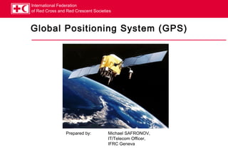
1. International Federation
of Red Cross and Red Crescent Societies
Global Positioning System (GPS)
Prepared by: Michael SAFRONOV,
IT/Telecom Officer,
IFRC Geneva
2. International Federation
of Red Cross and Red Crescent Societies
GPS Basics
The 24 satellites that make up the GPS space segment are orbiting the
Earth about 20,000 km above us. They are constantly moving, making two
complete orbits in less than 24 hours.
The location accuracy is anywhere from 1 to 100 meters depending on the
type of equipment used.
The GPS is owned and operated by the U.S. Department of Defence, but is
available for general use around the world.
GPS works in any weather conditions, anywhere in the world, 24 hours a
day.
There are no subscription fees or setup charges to use GPS.
3. International Federation
of Red Cross and Red Crescent Societies
How GPS works (1)
A GPS receiver needs to know where the satellites are (location), and how
far they are (distance).
A GPS satellite is emitting specially modulated signals which pass to GPS
receiver the needed data:
Location is determined by “almanac” data, which contains approximate locations of
satellites, and “ephemeris” data, which is fed from ground control and contains the exact
location. Ephemeris data takes into account orbit imperfectness and other factors.
Distance is determined by the GPS receiver by decoding a special timecode in the satellite
signal, and knowing the speed of radio wave propagation (approx. 300,000 km/h)
Okay, we know where and how far a satellite is, now what?
4. International Federation
of Red Cross and Red Crescent Societies
How GPS works (2)
A calculation method called “trilateration” is used.
3D trilateration.swf
5. International Federation
of Red Cross and Red Crescent Societies
Practical use of GPS (1)
FACT can use GPS for these purposes:
Mapping
Navigation
One of the most used features of a GPS unit is the ability to
store “waypoints”, or coordinates of locations. For
example, a field assessment team finds a well in a village,
which can be used as source of drinking water – the
coordinates of the well can be memorized in the GPS unit.
A typical GPS unit (Garmin eTrex Legend pictured) can
store 1,000 waypoints with unique names.
Another useful capability is “tracking”, or recording of the
path you have travelled. This helps to find your way back.
Waypoints and tracks can then be uploaded to a PC with
mapping software, and/or sent to Geneva for mapping.
6. International Federation
of Red Cross and Red Crescent Societies
Practical use of GPS (2)
GPS is not perfectly accurate, measurement errors can be a result of
several factors:
Radio signal delays in the atmosphere
Multi-path reception, when receiver gets the signal directly from satellite, plus a
reflection of it from a neighbouring mountain or building.
Receiver clock is not perfect.
Numbers of satellites “visible” to receiver – generally the more, the better.
Intentional degradation of satellite signal – GPS is owned by US DoD, so they can
degrade the precision of satellite signal when and where felt necessary.
Typically, one can expect GPS accuracy in the range of 3-12 m
outdoors. Most receivers will not work indoors at all.
7. International Federation
of Red Cross and Red Crescent Societies
Mapping basics (1)
Earth is not a perfect sphere, it is an ellipsoid. This fact alone can give
positioning error of hundreds of meters, which is not acceptable in many
cases.
In geodesy, a datum is a reference point on surface against which position
measurements are made, plus an associated model of the shape of the
Earth.
Historically, many countries have been developing their own approximations
of Earth’s shape (reference ellipsoid) andthe
For FACT, we use the WGS84 datum, coordinates grid.
latest standard of the World Geodetic
System.
There are also a few formats of presenting
the coordinates, we use the classic
latitude/longitude in degrees, minutes and
seconds, e.g.:
E 6°12’59”
N 46°22’21”
8. International Federation
of Red Cross and Red Crescent Societies
Mapping basics (2)
Map datum is important when paper maps are used.
If you’re using the standard WGS84 datum in GPS, and try to map the
obtained coordinates on a paper map created for a different datum (e.g. US
NAD83), the error can be few hundred meters!
Paper maps usually have an indication in which datum they are created.
Garmin eTrex GPS can be configured for about 100 different datum, if
needed.
When sending coordinates to Operations Support Dept. in Geneva, always
use:
WGS 84 datum
Latitude/longitude as Deg°Min’Sec” (e.g. E 6°12’59”/N 46°22’21”)
9. International Federation
of Red Cross and Red Crescent Societies
Mapping basics (3)
Practical Demonstration of Garmin eTrex Legend and use of MapSource.