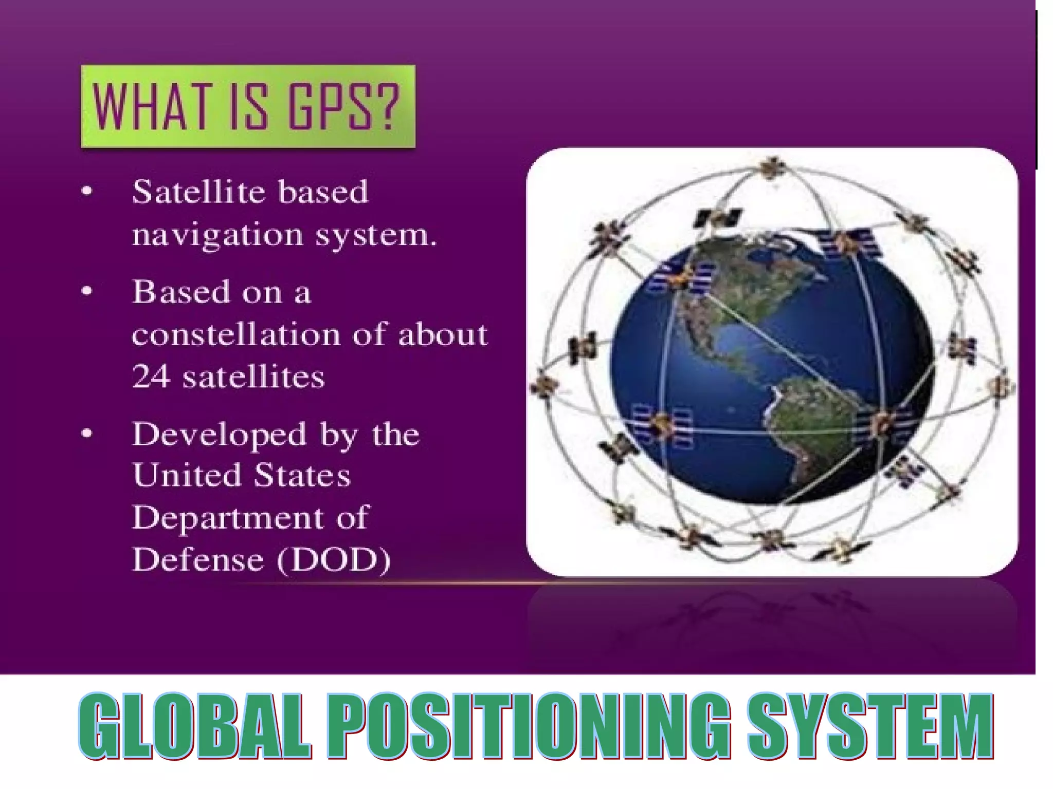
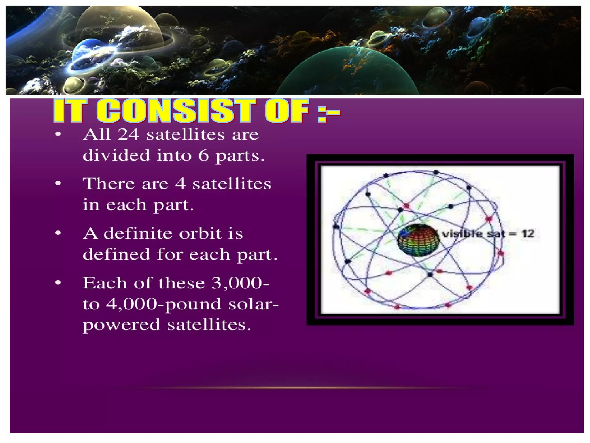
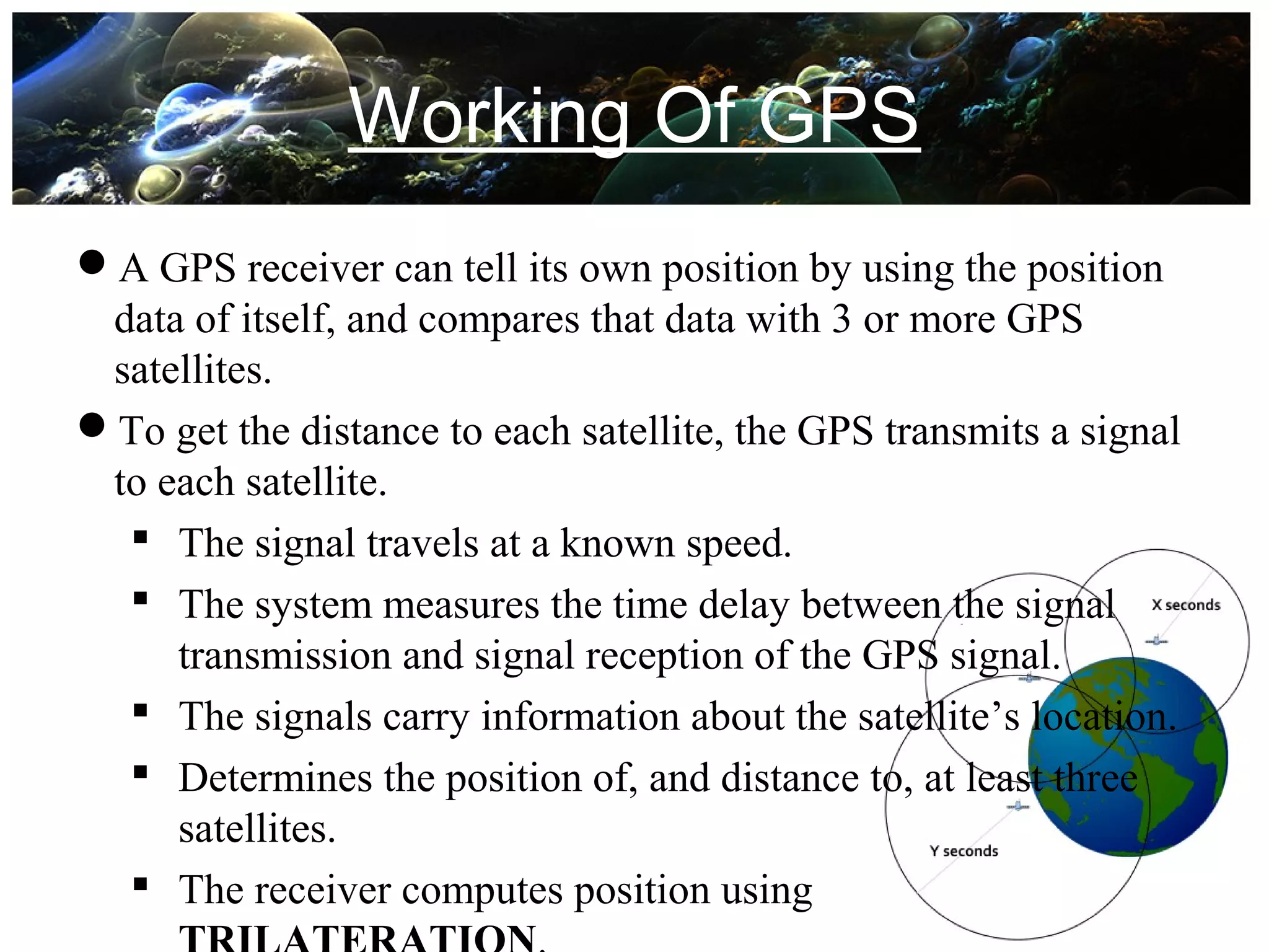
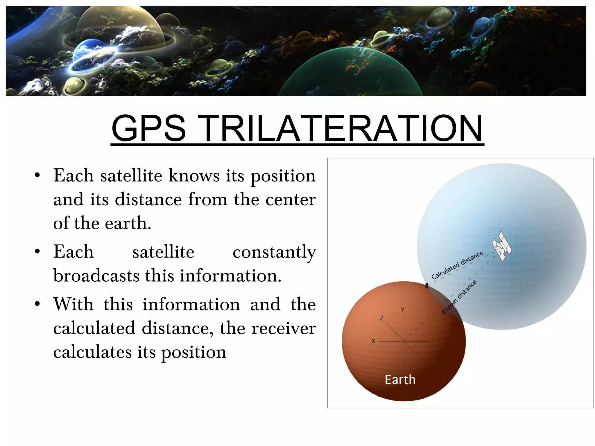
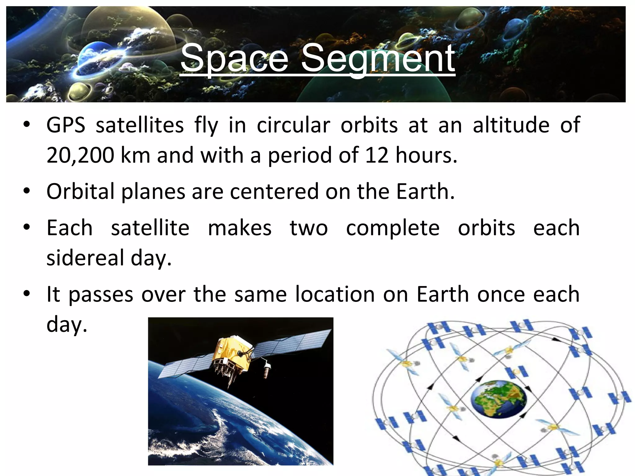
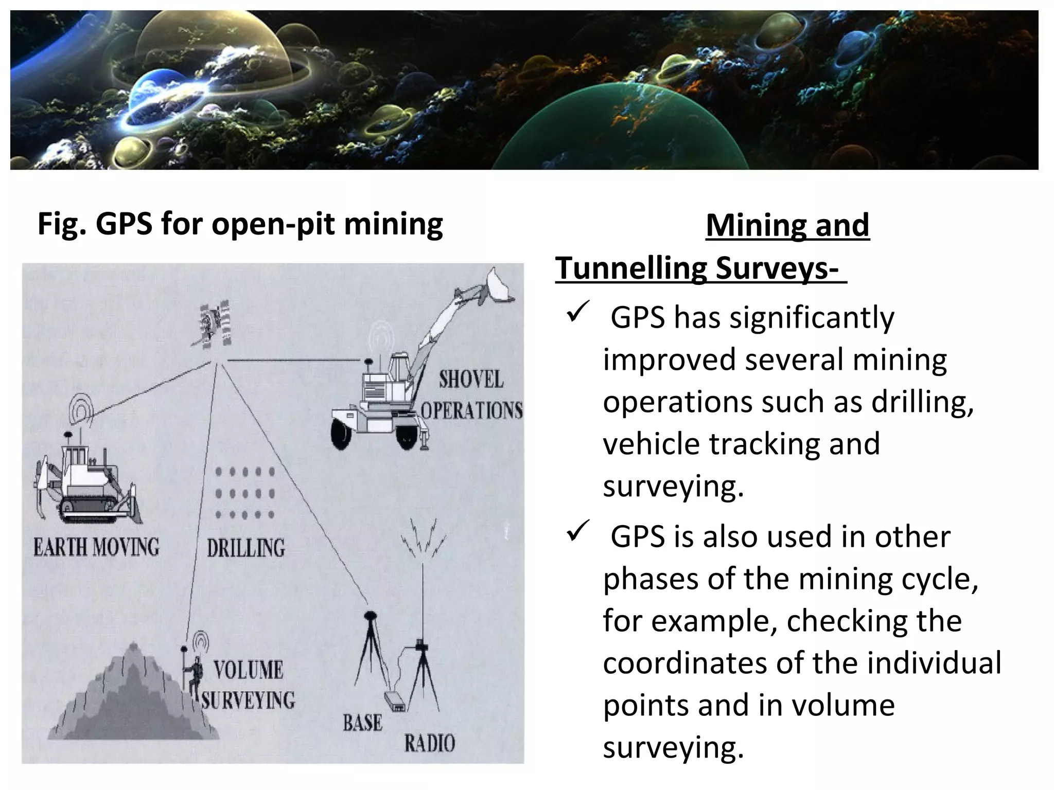
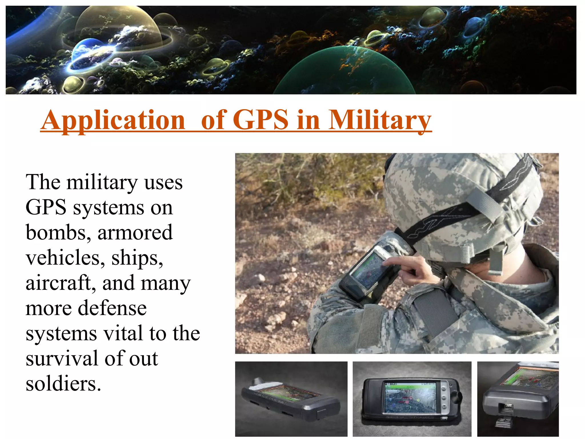
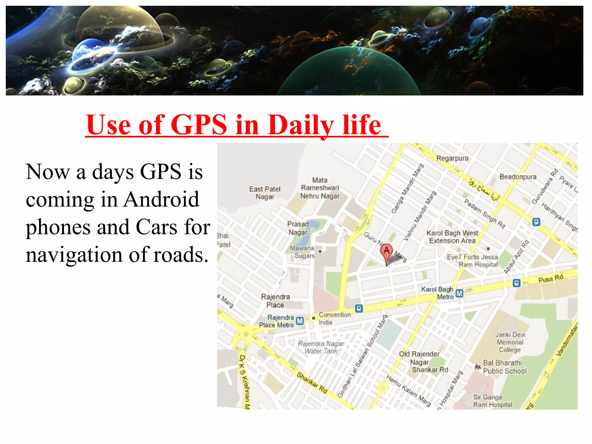
Global PositioningGlobal Positioning
SystemSystem
Presented by:
Harvendra singh
IFTM UNIVERSITY
MORADABAD
Global Positioning System
• What is GPS?
• History of GPS
• Working of GPS
• Components of GPS
• Error of Sources
• Applications
History of GPS
 1959 The Navy built the first real satellite navigation system,
which it called TRANSIT.
 1974 The branches of the military, after having worked on a
GPS system for the past 11 years, launch the first satellite of a
proposed 24-satellite GPS system called NAVSTAR.
 1978-1985 The military launches 11 more test satellites into
space to test the NAVSTAR system, which by then was called
simply "the GPS System".
 2012 At present, the Air Force manages a constellation of 31
operational GPS satellites, plus three decommissioned
satellites that can be reactivated if needed.
Working Of GPS
A GPS receiver can tell its own position by using the position
data of itself, and compares that data with 3 or more GPS
satellites.
To get the distance to each satellite, the GPS transmits a signal
to each satellite.
 The signal travels at a known speed.
 The system measures the time delay between the signal
transmission and signal reception of the GPS signal.
 The signals carry information about the satellite’s location.
 Determines the position of, and distance to, at least three
satellites.
 The receiver computes position using
GPS TRILATERATION
• Each satellite knows its position
and its distance from the center
of the earth.
• Each satellite constantly
broadcasts this information.
• With this information and the
calculated distance, the receiver
calculates its position
8
Components of the GPS
S p a c e S e g m e n t C o n t r o l S e g m e n t U s e r S e g m e n t
G P S
Space Segment
• GPS satellites fly in circular orbits at an altitude of
20,200 km and with a period of 12 hours.
• Orbital planes are centered on the Earth.
• Each satellite makes two complete orbits each
sidereal day.
• It passes over the same location on Earth once each
day.
Control Segment
• The Control Segment consists of 3 entities:
– Master Control Station
– Monitor Stations
– Ground Antennas
User Segment
• The user's GPS receiver is the User Segment of the
GPS system.
• They include a display for showing location and
speed information to the user.
• A receiver is often described by its number of
channels this signifies how many satellites it can
monitor simultaneously.
Error Sources in GPS
• 95% due to hardware ,environment and atmosphere
• Intentional signal degradation
– Selective availability
– Anti spoofing
 GPS for Construction Industry- The ability of GPS to
provide real-time sub-metre and centimetre level
accuracy has significantly changed the construction
industry.
In road construction and
earth moving,GPS, combined
with wireless communication
and computer systems,
is installed on board the
earth-moving machine.
Fig. GPS for open-pit mining Mining and
Tunnelling Surveys-
 GPS has significantly
improved several mining
operations such as drilling,
vehicle tracking and
surveying.
 GPS is also used in other
phases of the mining cycle,
for example, checking the
coordinates of the individual
points and in volume
surveying.
Application of GPS in Military
The military uses
GPS systems on
bombs, armored
vehicles, ships,
aircraft, and many
more defense
systems vital to the
survival of out
soldiers.
Use of GPS in Daily life
Now a days GPS is
coming in Android
phones and Cars for
navigation of roads.
Advantages
• It helps to survey with many times greater Precision.
• It helps to complete a Survey with lesser time and
thus helps to cut down the Completion Period.
• It Reduces the Difficulty of taking manual
measurements to great extent.
• With GPS there is a very less chances of error. And
this error may come only due to the Instrument
malfunction.
Disadvantages
• The main Disadvantage is that, it requires high initial
investments.
• To conduct such High End Survey works and to
operate such Electronic Equipments much skilled
persons are required.
Presentation on GPS by Harvendra Singh

Presentation on GPS by Harvendra Singh

  • 1.
    Global PositioningGlobal Positioning SystemSystem Presentedby: Harvendra singh IFTM UNIVERSITY MORADABAD
  • 2.
    Global Positioning System •What is GPS? • History of GPS • Working of GPS • Components of GPS • Error of Sources • Applications
  • 5.
    History of GPS 1959 The Navy built the first real satellite navigation system, which it called TRANSIT.  1974 The branches of the military, after having worked on a GPS system for the past 11 years, launch the first satellite of a proposed 24-satellite GPS system called NAVSTAR.  1978-1985 The military launches 11 more test satellites into space to test the NAVSTAR system, which by then was called simply "the GPS System".  2012 At present, the Air Force manages a constellation of 31 operational GPS satellites, plus three decommissioned satellites that can be reactivated if needed.
  • 6.
    Working Of GPS AGPS receiver can tell its own position by using the position data of itself, and compares that data with 3 or more GPS satellites. To get the distance to each satellite, the GPS transmits a signal to each satellite.  The signal travels at a known speed.  The system measures the time delay between the signal transmission and signal reception of the GPS signal.  The signals carry information about the satellite’s location.  Determines the position of, and distance to, at least three satellites.  The receiver computes position using
  • 7.
    GPS TRILATERATION • Eachsatellite knows its position and its distance from the center of the earth. • Each satellite constantly broadcasts this information. • With this information and the calculated distance, the receiver calculates its position
  • 8.
    8 Components of theGPS S p a c e S e g m e n t C o n t r o l S e g m e n t U s e r S e g m e n t G P S
  • 9.
    Space Segment • GPSsatellites fly in circular orbits at an altitude of 20,200 km and with a period of 12 hours. • Orbital planes are centered on the Earth. • Each satellite makes two complete orbits each sidereal day. • It passes over the same location on Earth once each day.
  • 10.
    Control Segment • TheControl Segment consists of 3 entities: – Master Control Station – Monitor Stations – Ground Antennas
  • 11.
    User Segment • Theuser's GPS receiver is the User Segment of the GPS system. • They include a display for showing location and speed information to the user. • A receiver is often described by its number of channels this signifies how many satellites it can monitor simultaneously.
  • 12.
    Error Sources inGPS • 95% due to hardware ,environment and atmosphere • Intentional signal degradation – Selective availability – Anti spoofing
  • 13.
     GPS forConstruction Industry- The ability of GPS to provide real-time sub-metre and centimetre level accuracy has significantly changed the construction industry. In road construction and earth moving,GPS, combined with wireless communication and computer systems, is installed on board the earth-moving machine.
  • 14.
    Fig. GPS foropen-pit mining Mining and Tunnelling Surveys-  GPS has significantly improved several mining operations such as drilling, vehicle tracking and surveying.  GPS is also used in other phases of the mining cycle, for example, checking the coordinates of the individual points and in volume surveying.
  • 15.
    Application of GPSin Military The military uses GPS systems on bombs, armored vehicles, ships, aircraft, and many more defense systems vital to the survival of out soldiers.
  • 16.
    Use of GPSin Daily life Now a days GPS is coming in Android phones and Cars for navigation of roads.
  • 17.
    Advantages • It helpsto survey with many times greater Precision. • It helps to complete a Survey with lesser time and thus helps to cut down the Completion Period. • It Reduces the Difficulty of taking manual measurements to great extent. • With GPS there is a very less chances of error. And this error may come only due to the Instrument malfunction.
  • 18.
    Disadvantages • The mainDisadvantage is that, it requires high initial investments. • To conduct such High End Survey works and to operate such Electronic Equipments much skilled persons are required.