Downloaded 400 times

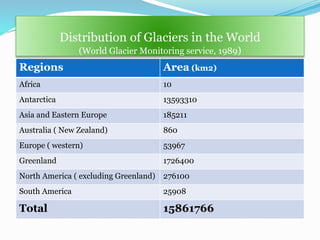
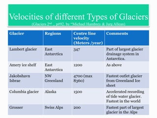
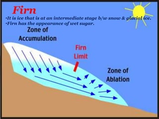
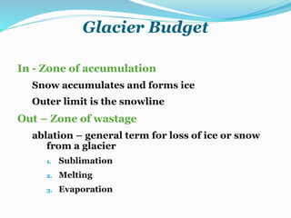
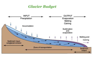
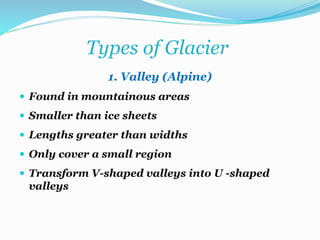
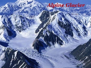
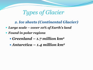
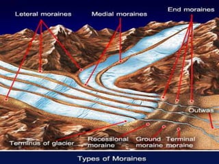
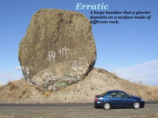
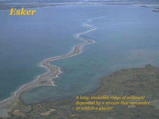

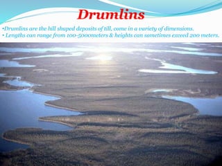

This document provides an overview of glaciers, including their formation, movement, and important terminology. It describes the key parts of a glacier, including the accumulation and ablation zones. The document also discusses different types of glaciers and their varying speeds of movement. Finally, it covers the erosional and depositional landforms created by glaciers, such as moraines, eskers, and drumlins.


![Chapter 12 graphics- glaciers (1) [Autosaved].ppt](https://cdn.slidesharecdn.com/ss_thumbnails/chapter12graphics-glaciers1autosaved-230303182549-de7c9ed7-thumbnail.jpg?width=640&height=640&fit=bounds)


