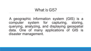
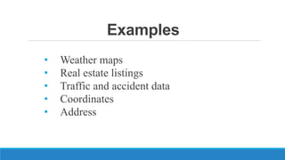
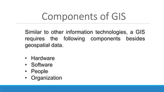
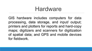
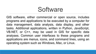
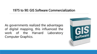
3. What is GIS?
A geographic information system (GIS) is a
computer system for capturing, storing,
querying, analyzing, and displaying geospatial
data. One of many applications of GIS is
disaster management.
4. In the aftermath of the earthquake and tsunami, GIS
played an important role in helping responders and
emergency managers to conduct rescue operations, map
severely damaged areas and infrastructure, prioritize
medical needs, and locate temporary shelters. GIS was also
linked with social media such as Twitter, YouTube, and
Flicker so that people could follow events in near real time
and view map overlays of streets, satellite imagery, and
topography.
5. Hurricane Irene formed over the warm water of
the Caribbean on August 21, 2011, and in the
following week, it moved along a path through the
United States East Coast and as far north as Atlantic
Canada. Unlike the Great East Japan Earthquake,
which happened so quickly, Hurricane Irene allowed
government agencies and organizations to develop
GIS data sets, applications, and analysis before it
arrived in their areas.
6. Online hurricane trackers were set up by news
media such as MSNBC and CNN, as well as by
companies such as Esri and Yahoo. And GIS data
resources were provided by the National Oceanic and
Atmospheric Administration (NOAA) on forecast track,
wind field, wind speed, and storm surge, and by the
Federal Emergency Management Agency (FEMA) on
disaster response and recovery efforts.
7. GIS played an essential role in integrating data
from different sources to provide geographic
information that proved to be critical for relief
operations. GIS is the core of geospatial technology,
which is related to a number of fields including remote
sensing, Global Positioning System (GPS),
cartography, surveying, geostatistics, Web mapping,
programming, database management, and graphics
design.
8. For many years, geospatial technology has
been considered a high growth job sector in the
United States, with substantial numbers of new
jobs projected in GIS and its related fields.
10. Spatial data
Can be referred to as geographic data or
geospatial data. Spatial data provides the
information that identifies the location of
features and boundaries on Earth. Spatial data
can be processed and analyzed using
Geographical Information System (GIS) or
Image Processing packages
11. Geospatial data
Is used to indicate data that has a geographic
component to it. This means that the records in a
dataset have locational information tied to them
such as geographic data in the form of:
13. Components of GIS
Similar to other information technologies, a GIS
requires the following components besides
geospatial data.
• Hardware
• Software
• People
• Organization
14. Hardware
GIS hardware includes computers for data
processing, data storage, and input/ output;
printers and plotters for reports and hard-copy
maps; digitizers and scanners for digitization
of spatial data; and GPS and mobile devices
for fieldwork.
15. Software
GIS software, either commercial or open source, includes
programs and applications to be executed by a computer for
data management, data analysis, data display, and other
tasks. Additional applications, written in Python, JavaScript,
VB.NET, or C++, may be used in GIS for specific data
analyses. Common user interfaces to these programs and
applications are menus, icons, and command lines, using an
operating system such as Windows, Mac, or Linux.
17. Organization
GIS operations exist within an organizational
environment; therefore, they must be integrated
into the culture and decision-making processes
of the organization for such matters as the role
and value of GIS, GIS training, data collection
and dissemination, and data standards.
19. Where did GIS begin?
Mapping has revolutionized how we think about
location. Maps are important decision-making tools.
They help us get to places. And they are becoming
more immersed in our everyday lives.
But where did it all begin?
20. Advancements in GIS were the result of several
technologies. Databases, computer mapping, remote
sensing, programming, geography, mathematics,
computer-aided design, and computer science all
played a key role in the development of GIS.
21. Paper Mapping Analysis
with Cholera Clusters
Dr. John Snow used mapping to
illustrate how cases of cholera were
centered around a water pump.
Many people thought the disease
was propagating through the air.
However, this map helped show that
cholera was being spread through
the water.
22. The history of GIS all started in 1854. Cholera hit the city of
London, England. British physician John Snow began mapping
outbreak locations, roads, property boundaries, and water lines.
When he added these features to a map, something interesting
happened:
He saw that Cholera cases were commonly found along the water
line.
23. John Snow’s Cholera map was a major event connecting geography
and public health safety. Not only was this the beginning of spatial
analysis, but it also marked the start of a whole field of study:
Epidemiology – the study of the spread of disease.
To this date, John Snow is known as the father of epidemiology. The
work of John Snow demonstrated that GIS is a problem-solving
tool. He put geographic layers on a paper map and made a life-
saving discovery.
25. Before 1960: The GIS Dark Ages
Computer mapping was in the dark. Nothing has been developed.
All mapping was done on paper or sieve mapping. The technology
wasn’t here for GIS to come to light.
In the 1950s, maps were simple. They had their place in vehicle
routing, new development planning, and locating points of interest.
But none of this was done on computers.
Imagine a world without computer mapping.
26. One option was sieve mapping. Sieve mapping uses
transparent layers on light tables to identify areas of
overlap. But this came with challenges: calculating areas
was next to impossible, data was coarse and often
inaccurate, and measuring distances was cumbersome.
27. With all the issues that came with paper maps, it was no
surprise that cartographers and spatial users wanted to
explore computing options for handling geographic data.
In the history of GIS, this was the main incentive to shift from
paper to computer mapping.
28. 1960 to 75: GIS Pioneering
The early 1960s to 1980s was really the time period of GIS
pioneering. The pieces were coming together with
advancements in technology:
• Map graphics as outputs using line printers.
• Advances in data storage with mainframe computers.
• Recording coordinates as data input.
29. Dr. Roger Tomlinson – the father of GIS.
During Roger Tomlinson’s tenure with the Canadian
government in the 1960s, he initiated, planned, and directed
the development of the Canadian Geographic System (CGIS).
This was a key time in the history of GIS because many consider
CGIS as the roots of Geographic Information Systems. CGIS
was unique because it adopted a layer approach system to map
handling.
30. “Great discoveries and improvements
invariably involve the cooperation of many
minds. I may be given credit for having
blaze the trail of GIS. But when I look at
the subsequent development, I feel the
credit is due to others rather than just
myself.”
— Roger Tomlinson
31. GIS Pioneering – Around the World
The US Census Bureau was an early adopter of some of the
core principles of GIS. It was the pioneering work by the US
Census Bureau that led to the digital input of the 1970
Census using the data format GBF-DIME (Geographic Base
File – Dual Independent Map Encoding).
32. GBF-DIME became a file format that supported digital data
input, error fixing, and even choropleth mapping (thematic
map using color). Using this format, the US Census Bureau
began to digitize Census boundaries, roads, and urban areas.
This was a huge step forward in the history of GIS.
33. At this point in the history of GIS, it was in its pioneering
stage. It was still on its training wheels beginning to be
fostered by only a select few national agencies around the
world.
34. 1975 to 90: GIS Software Commercialization
As governments realized the advantages
of digital mapping, this influenced the
work of the Harvard Laboratory
Computer Graphics.
35. In the mid-1970s, Harvard Laboratory Computer Graphics
developed the first vector GIS called ODYSSEY GIS. This
work led to the next stage of development in GIS –
software commercialization.
36. In the late 1970s, memory size and graphics capabilities
were improving. New computer cartography products
included GIMMS (Geographic Information Making and
Management Systems), MAPICS, SURFACE, GRID, IMGRID,
GEOMAP, and MAP. In the late 1980s, there was an
increasing range of GIS software vendors in this segment
of GIS history.
37. One of these GIS software vendors was Esri – which is
now the largest GIS software company in the world. In
1982, Esri launched ARC/INFO for minicomputers. Then
in 1986, it released PC ARC/INFO for the Intel
microcomputer. Esri is now the world’s leading expert in
GIS software development, and it has played a key role in
the history of GIS.
38. At this point in the history of GIS, it also gained steam
with some of the first conferences and published work.
The first GIS meeting in the UK was in 1975. It included a
small crowd of academics.
The first Esri conference was in 1981 and attracted a
crowd of 18 participants. GIS consultancies started
sprouting.
39. Roger Tomlinson first used the term “Geographic
Information System” in his publication in 1968 “A
Geographic Information System for Regional Planning”.
That was a really lonely time for GIS.
40. Geomatics - the discipline of gathering, storing,
processing, and delivering spatially referenced
information. It encompasses the fields of
surveying, mapping, remote sensing (LiDAR or
HDS Scanning), photogrammetry, hydrography,
global positioning systems (GPS), and
geographic information systems (GIS).
41. 1990 to 2010: User Proliferation
Users are starting to adopt GIS technology in different ways.
Classrooms, businesses, and governments around the world
are starting to harness digital mapping and analysis.
42. All the ingredients were ready for the infiltration of GIS into
society:
• Cheaper, faster, and more powerful computers
• Multiple software options and data availability
• The launch of new satellites and integration of
remote sensing technology
43. 1990 to 2010 was the period in the history of GIS when it really
took off. But advancements in technology have surpassed the
average user. GIS users didn’t know how to take full advantage of
GIS technology. Companies were hesitant to adopt GIS software.
Countries didn’t have access to topographical data.
Topographic data are information about the elevation of the surface
of the Earth.
44. But over time, these issues were laid to rest.
Gradually, the importance of spatial analysis for
decision-making was becoming recognized. Slowly,
classrooms and companies started introducing GIS.
45. Open source is becoming mainstream today. We are
gradually entering an era of open-source GIS software. More
light is shining on QGIS than ever before. Even though, there
will always be a place for commercial GIS software. Software
companies like Esri provide solutions to practically any
spatial problem that exists today. This includes areas such
as artificial intelligence, data collection, and 3D analysis.
2010 to Onward: The Open-Source Explosion
46. QGIS (Quantum Geographic information Systems) -
open-source GIS software allows users to create,
edit, visualize, analyze and published geospatial
information.
47. The history of GIS consists of 3 historic stages:
1. Pioneering and development
2. GIS software commercialization
3. User adoption
GIS Past, Present, and Future
48. Over the years, GIS has evolved from a mapping
system to something much more than that. Generally,
it has followed these key events shaping its path:
The Evolution of GIS in the 21st Century
49. Back in 2000, GIS evolved into a system of
information management. For example, Esri
its proprietary RDBMS geodatabase. This was a game-
changer. Suddenly, the concept of topology and
geometry correctness was fully integrated as early as
2002.
INFORMATION MANAGEMENT:
50. In 2006, GIS shifted focus. While data management still
remained a strong point, more emphasis was placed on
use cases. At this point, integration became a key area
of interest. Through the various GIS applications and
uses, this was the point where GIS became more
mainstream.
GEOGRAPHY:
51. It wasn’t until 2010, that the concept
of geodesign became Esri’s primary vision. Geodesign
rethinks how we inhabit the world, by combining
geography with design. The main idea was that
geodesign shapes our world by putting the needs of
people at the forefront.
GEODESIGN:
52. Although geodesign, geography, and information
management all remain pivotal concepts in GIS, the
focus shifted to the integration of GIS with science in
2016. Simply, the “science of where” is what we do
every day in GIS. It’s about pushing technologies into
the boundaries of science and opening new
possibilities.
SCIENCE OF WHERE:
53. Finally, here is where we are now in 2020 and beyond.
With the Internet of Things (IoT), the world is all
connected in real-time. It’s about the evolution and the
interconnection of technology between people and our
planet. Geography is the glue that relates everything
together.
INTELLIGENT NERVOUS SYSTEM: