Download to read offline
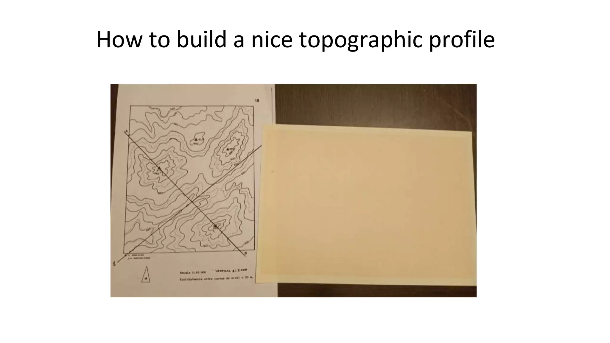


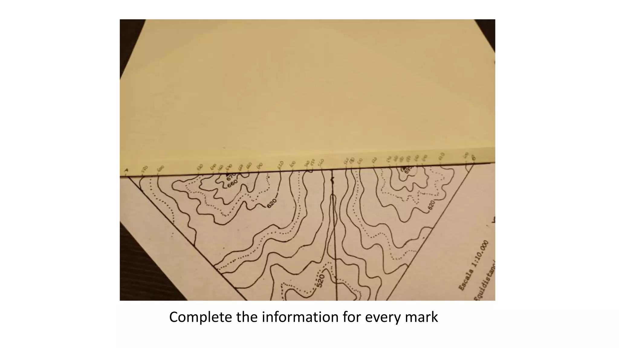


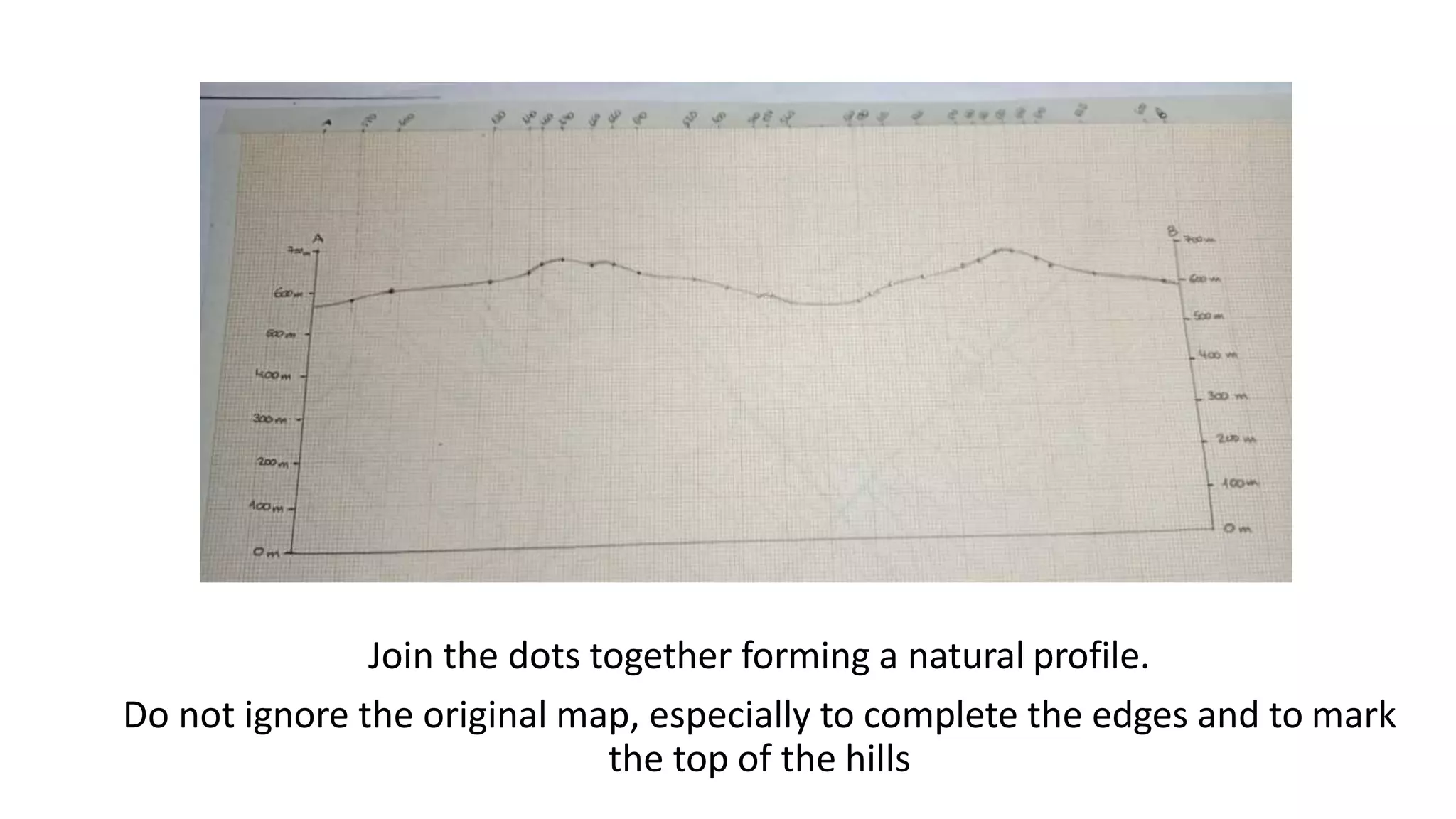
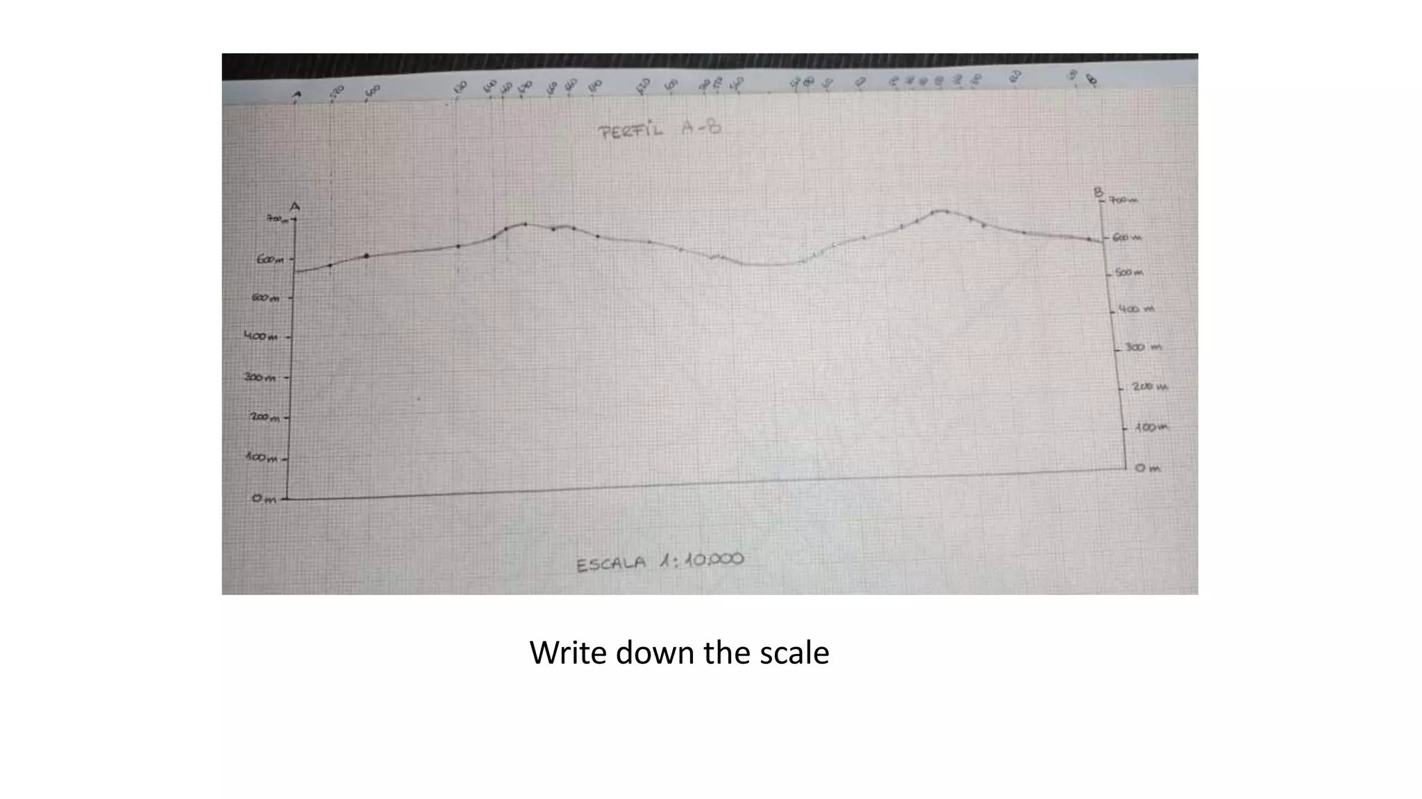
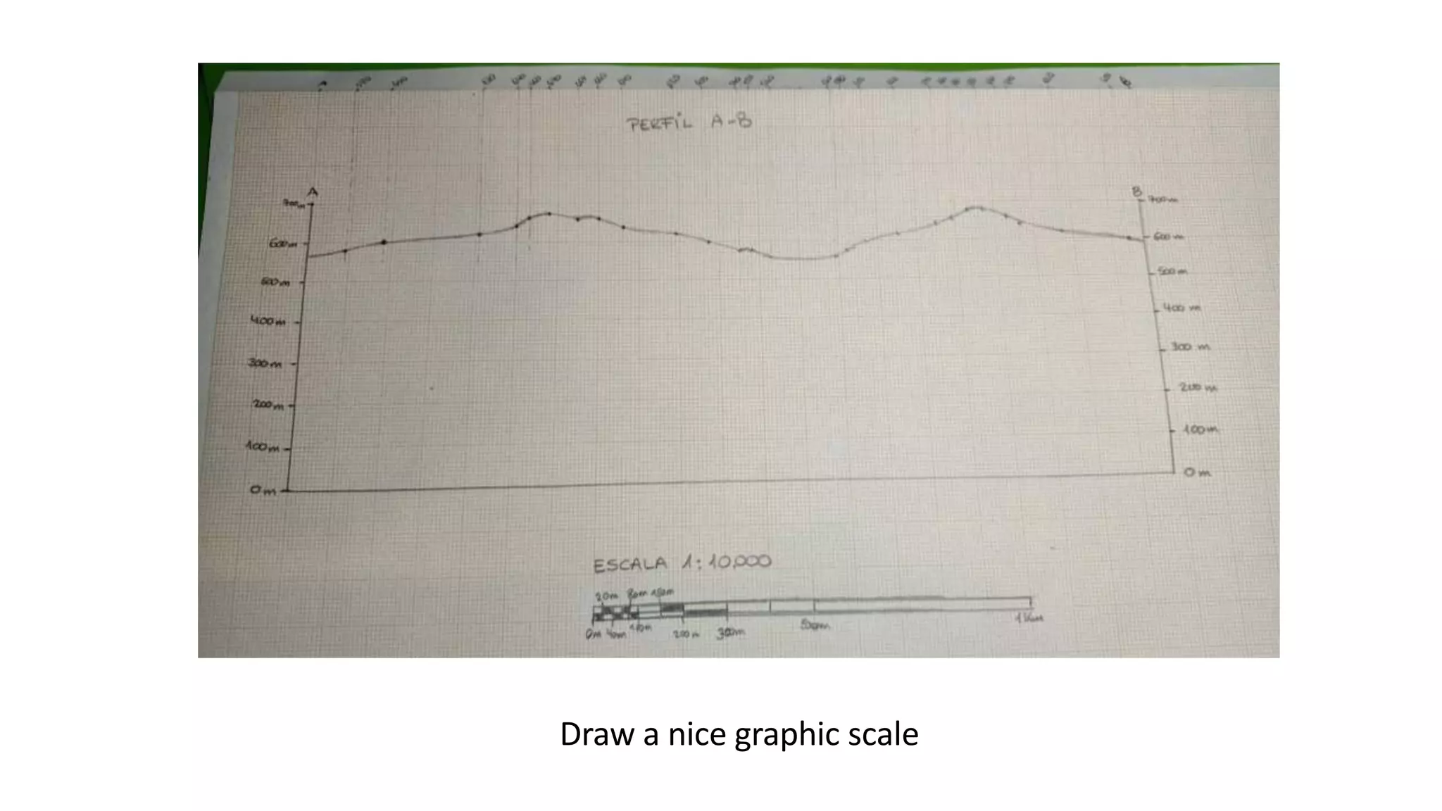
Mark an initial point on graph paper 2 cm from the margin, fix a letter on the map to the graph, and mark the final point. Note contour lines and elevations, then unfold the paper. Use the horizontal scale to size the profile graph, leaving room at the top for the highest elevation and marking points A and B. Plot elevation dots on the graph axis and connect them to form the profile, referencing the original map. Write the scale and add a graphic scale.