Downloaded 570 times

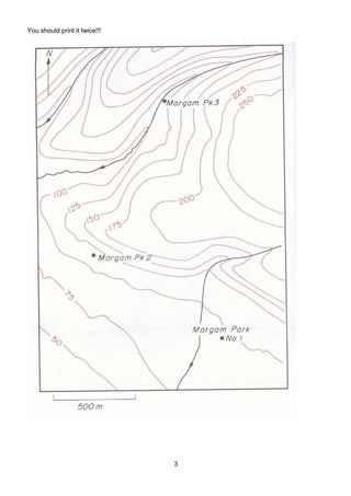
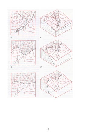
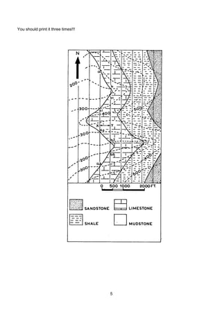
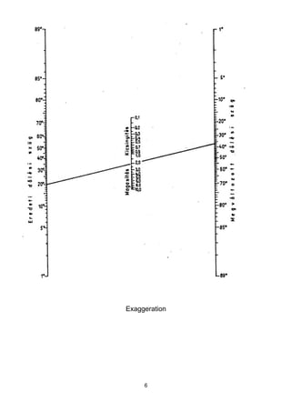
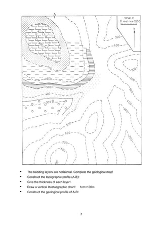

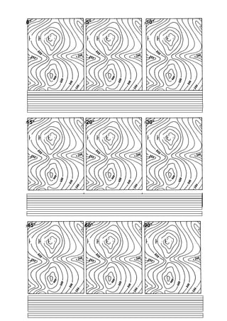
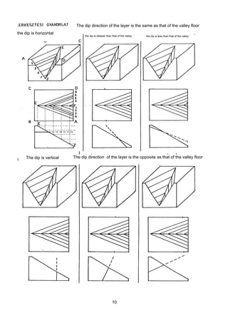
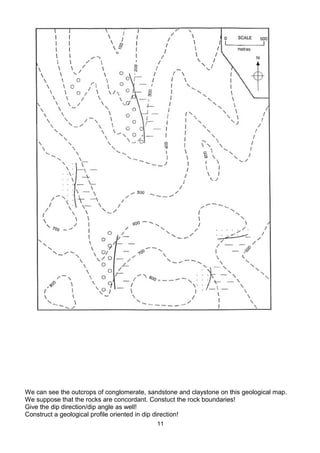

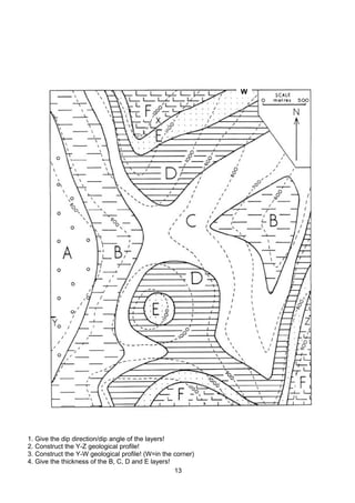
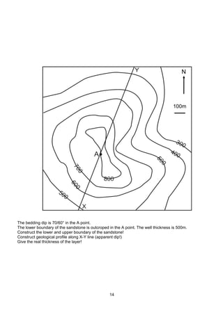


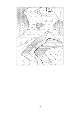
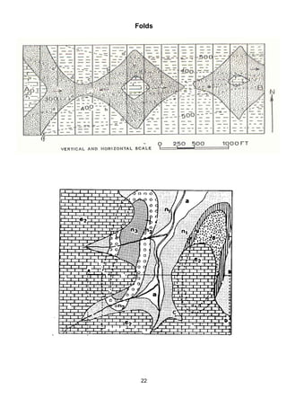
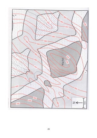


The document provides instructions for exercises involving the construction of geological maps, profiles, and cross sections from figures. It includes directions to print figures, construct geological boundaries and indicate dip direction/angle, draw lithostratigraphic charts and profiles, and interpret structures like folds and faults from the provided illustrations.