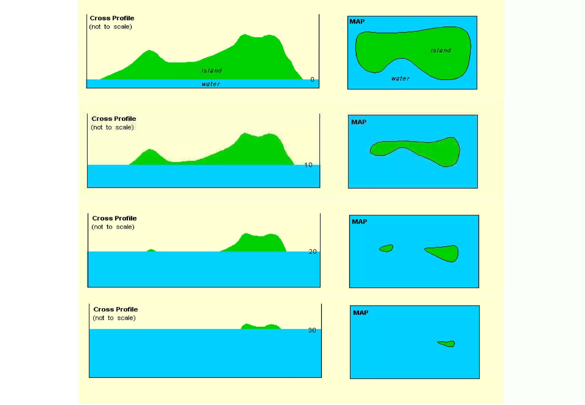
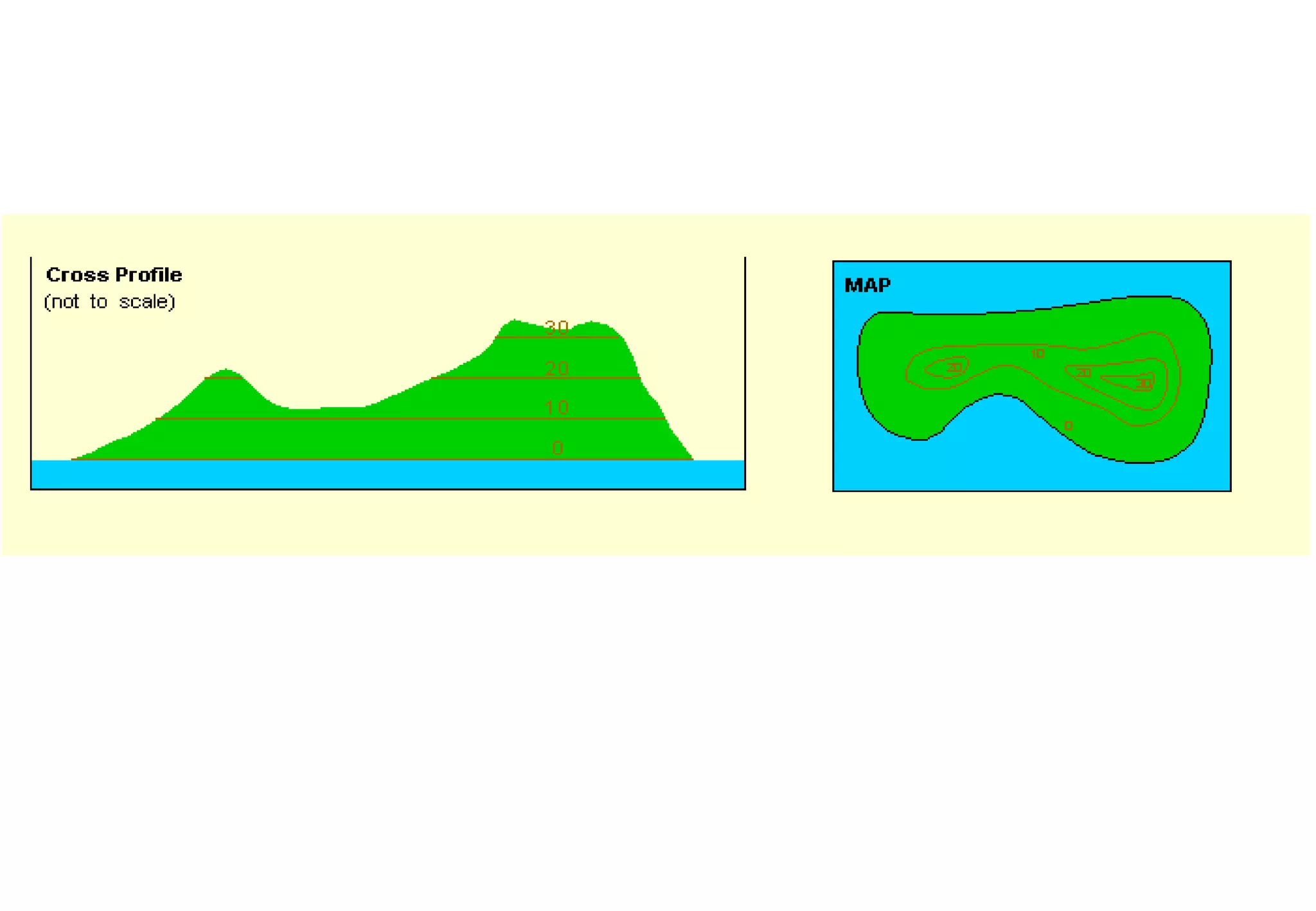
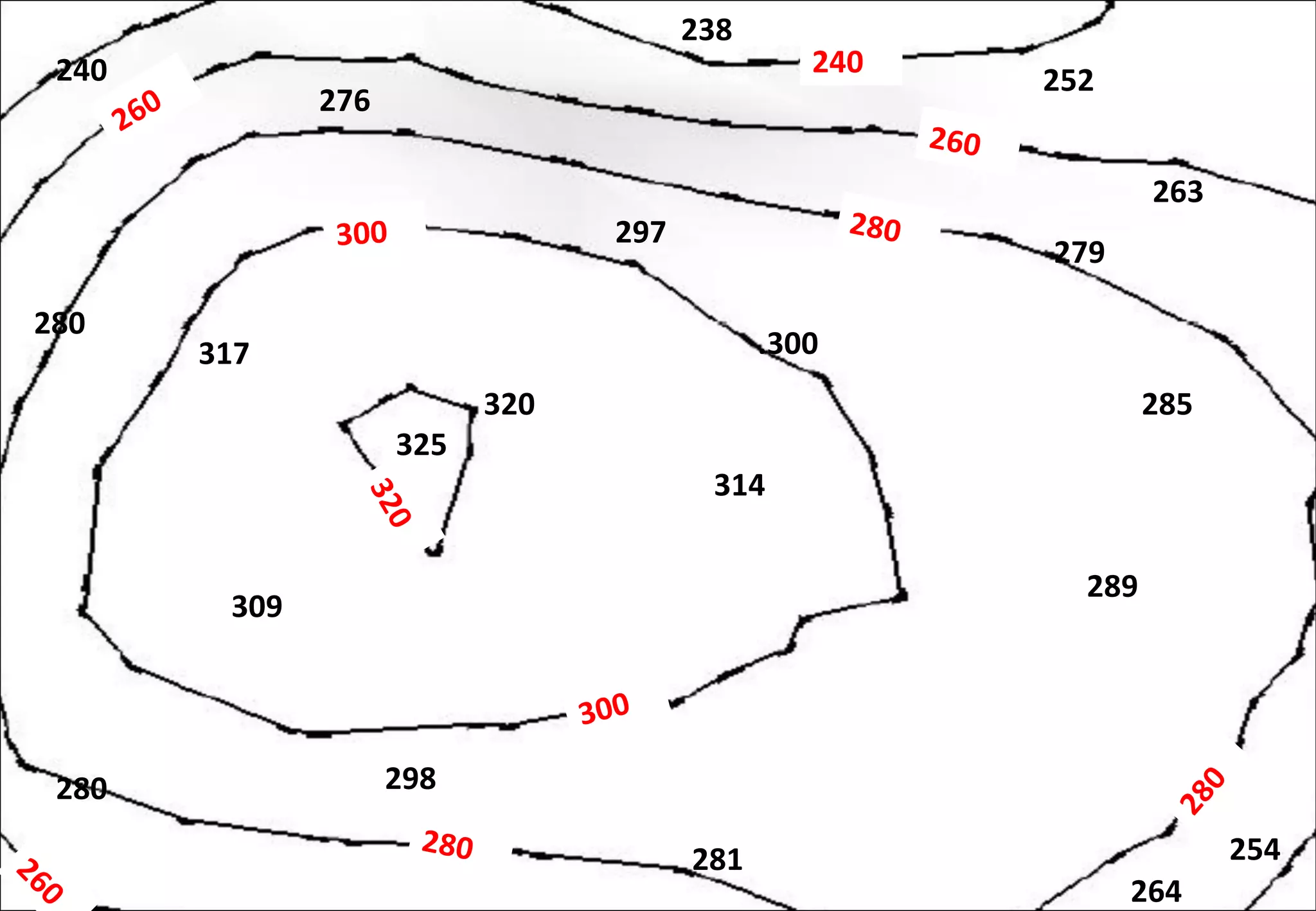
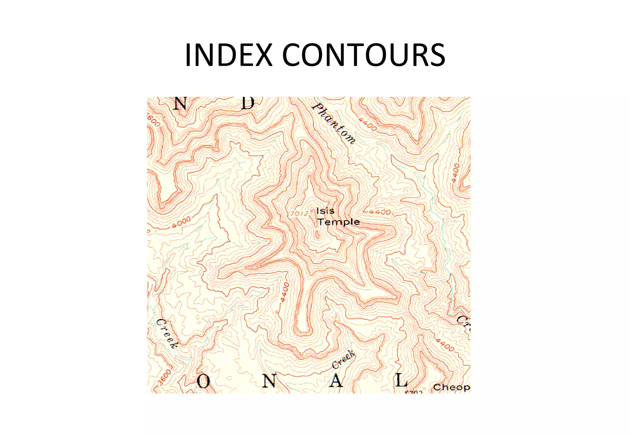
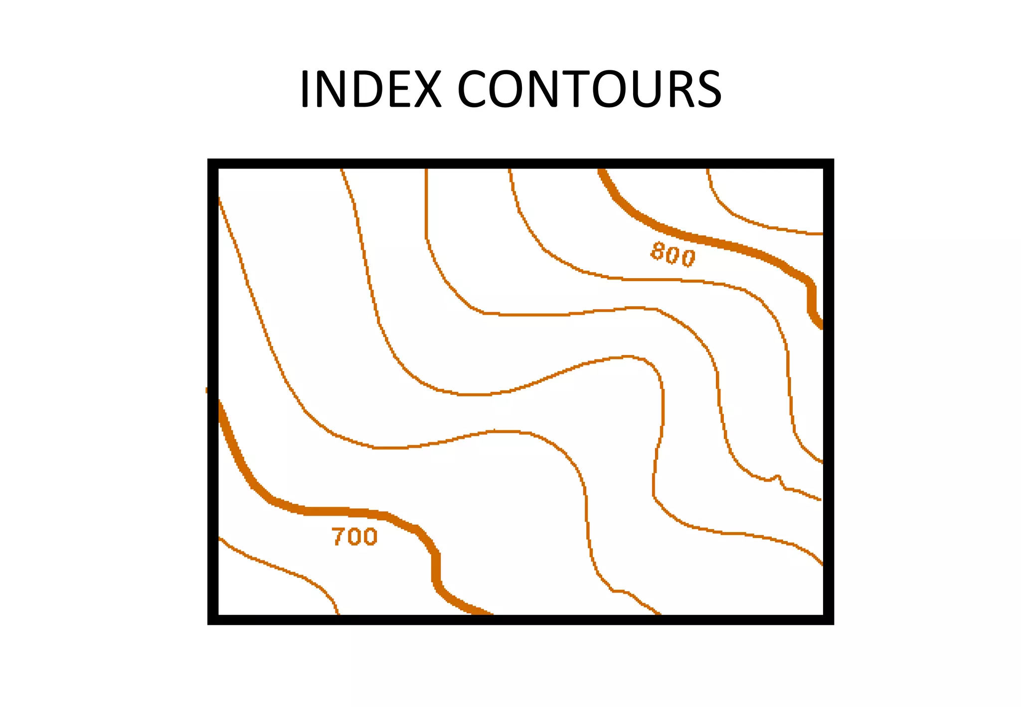
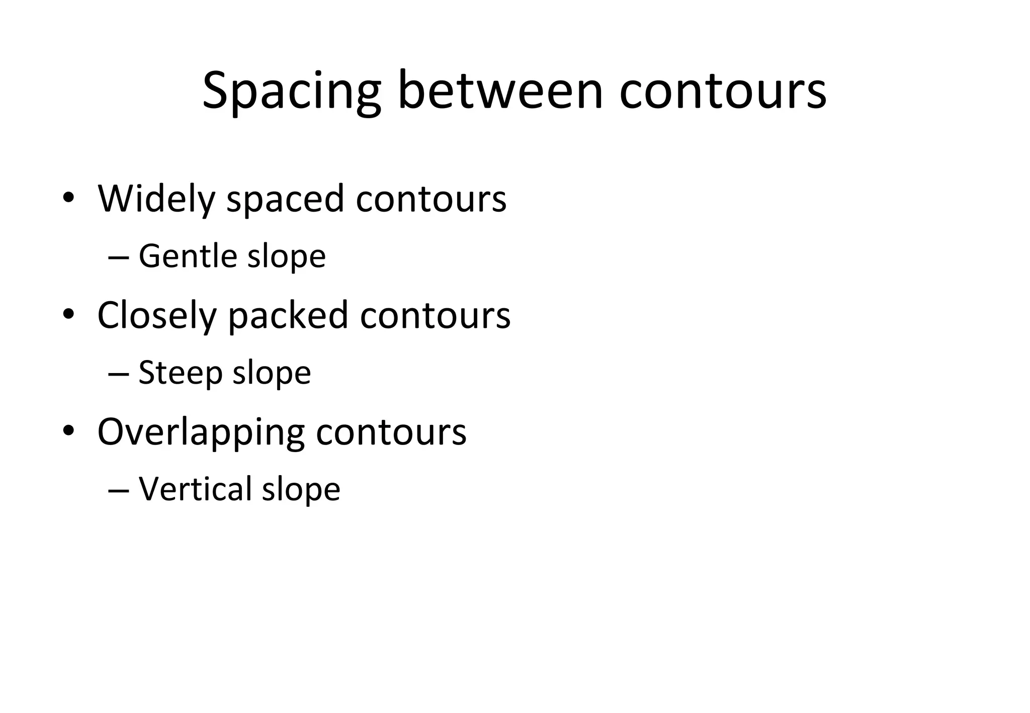
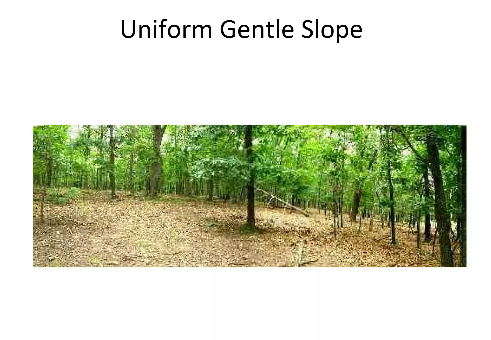
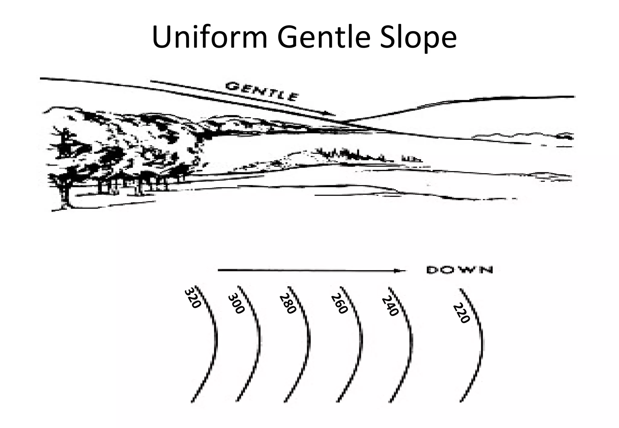
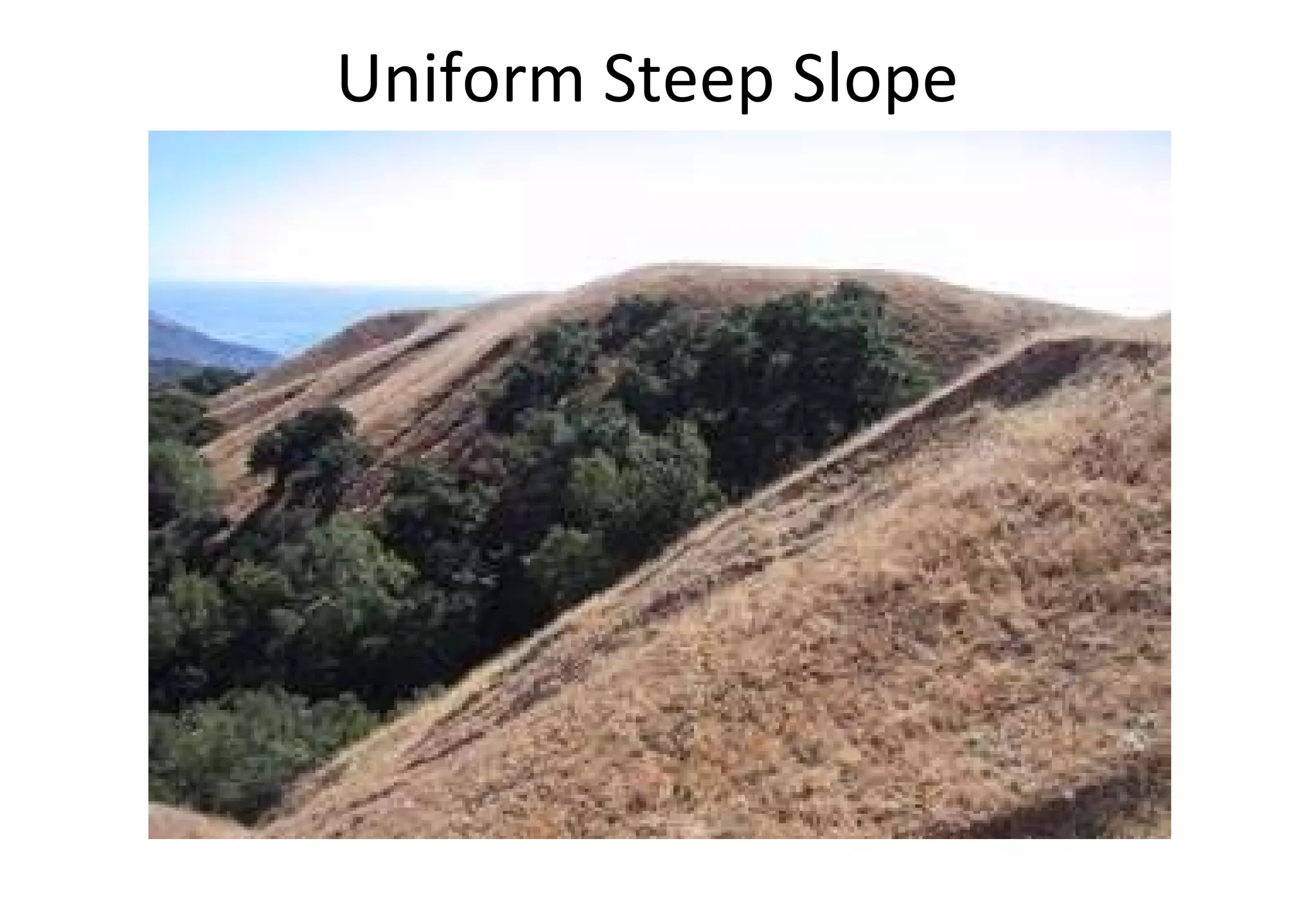
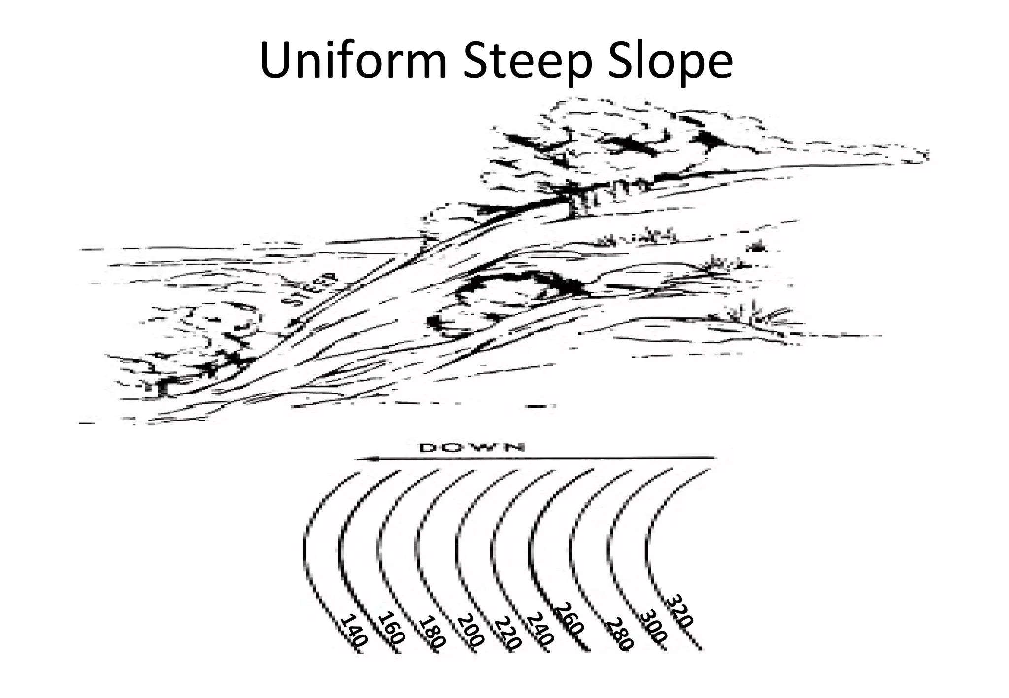
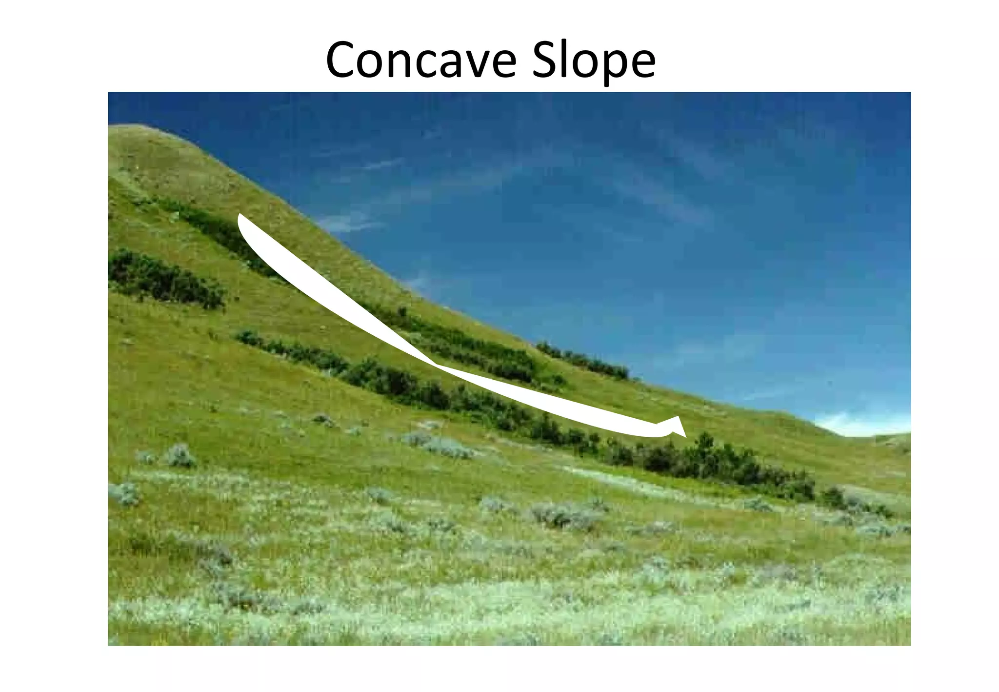
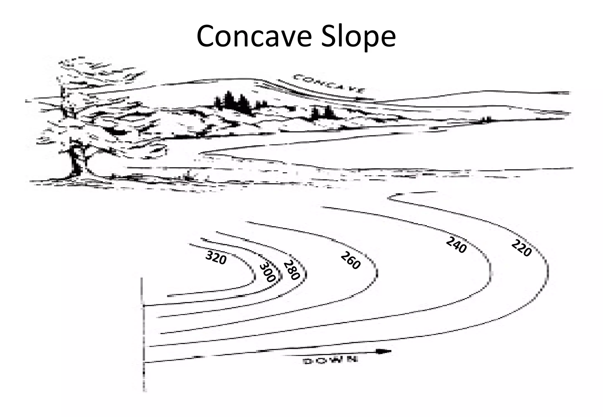
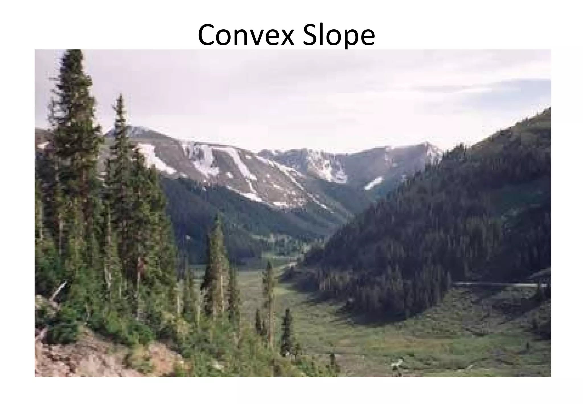
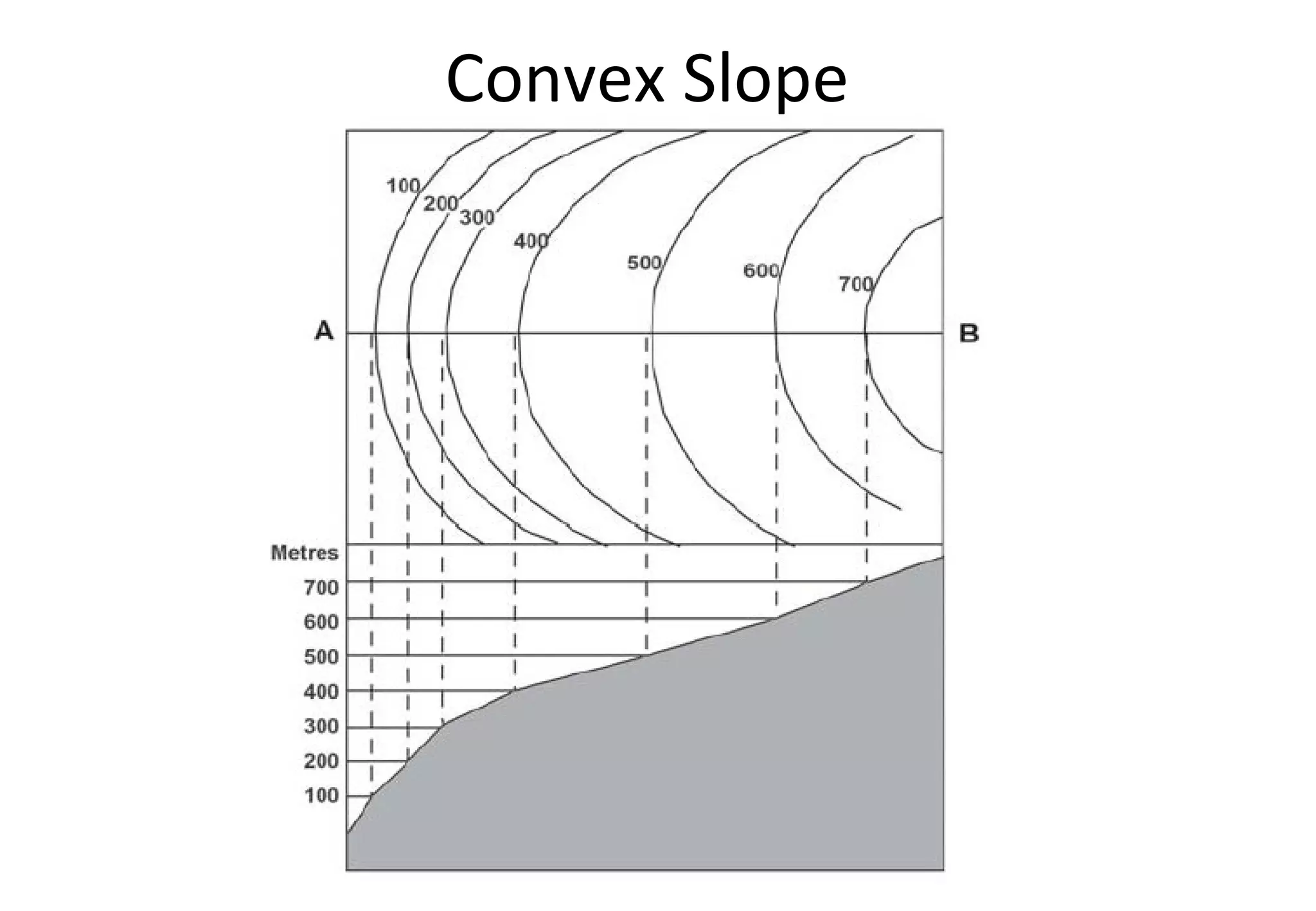
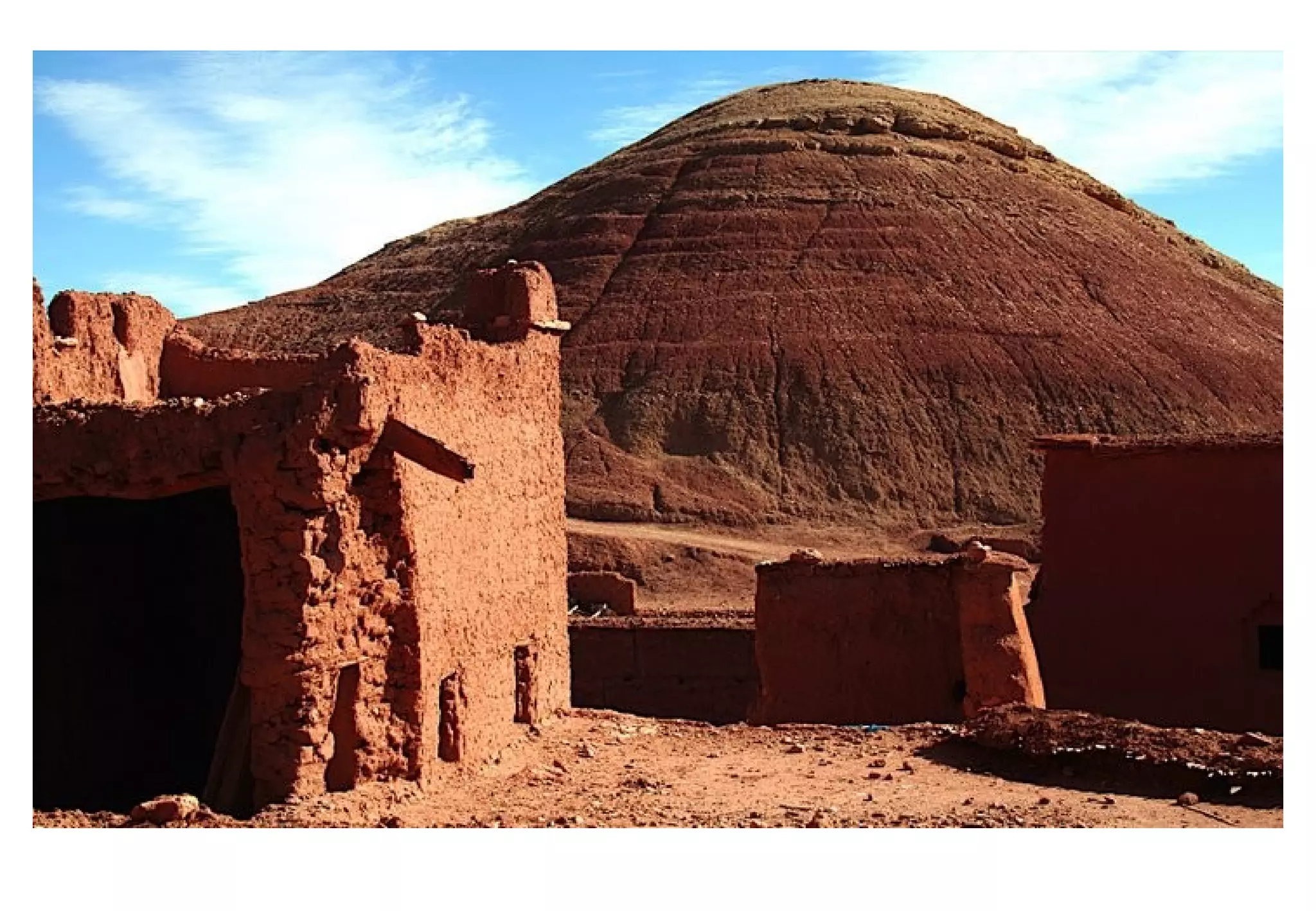
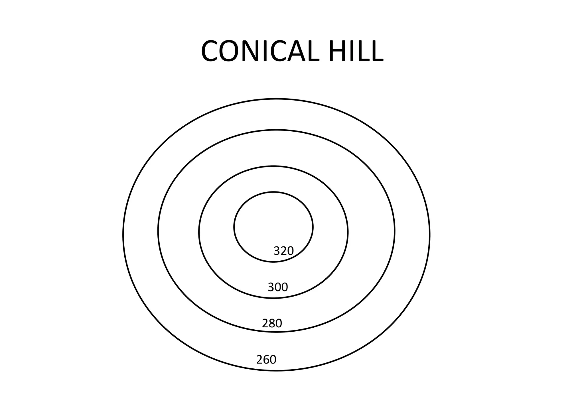
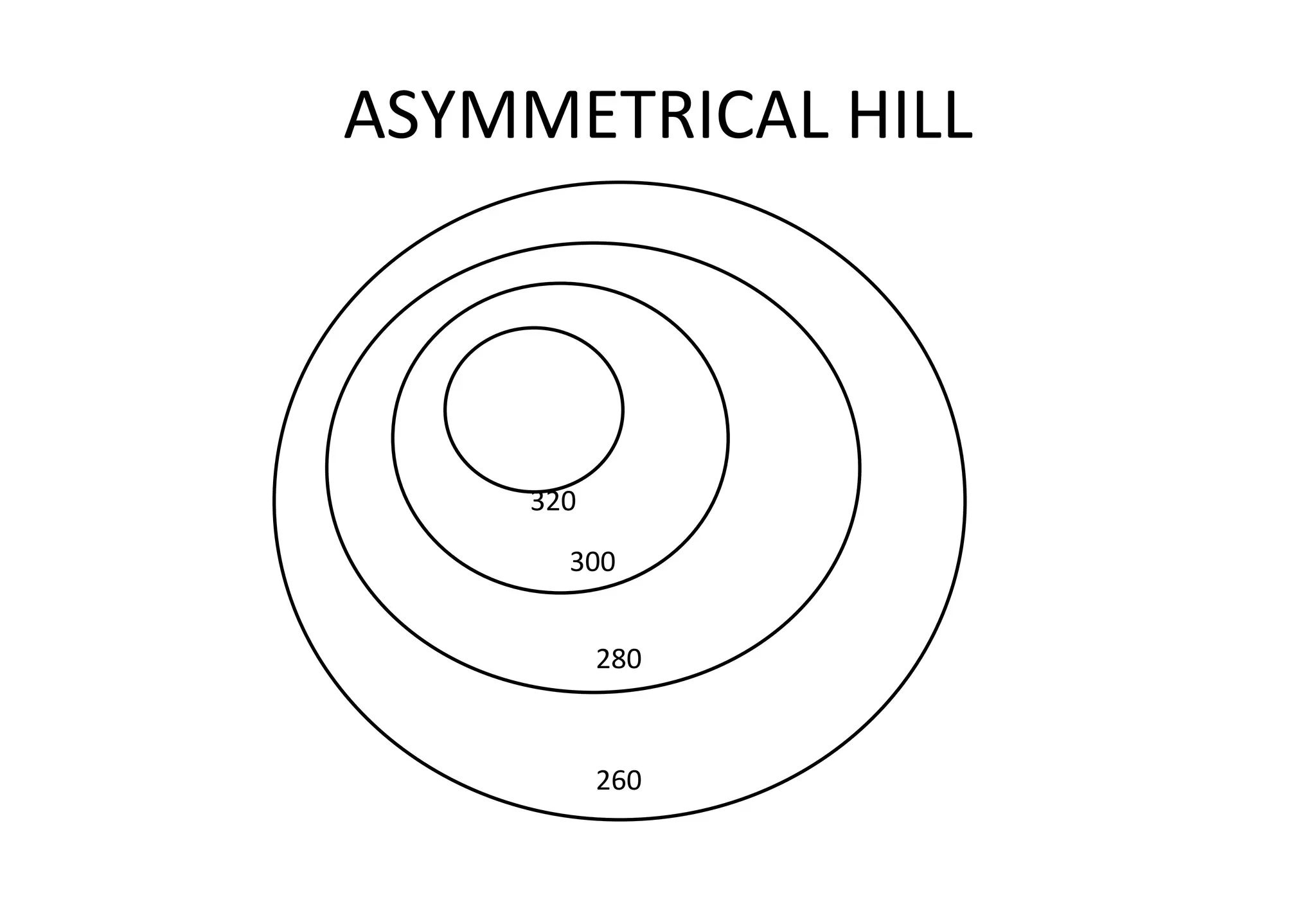
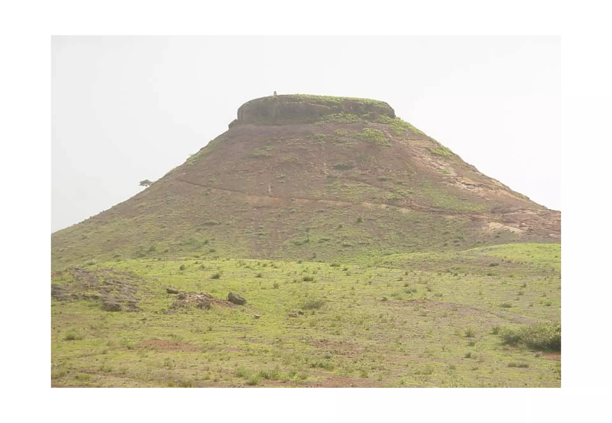
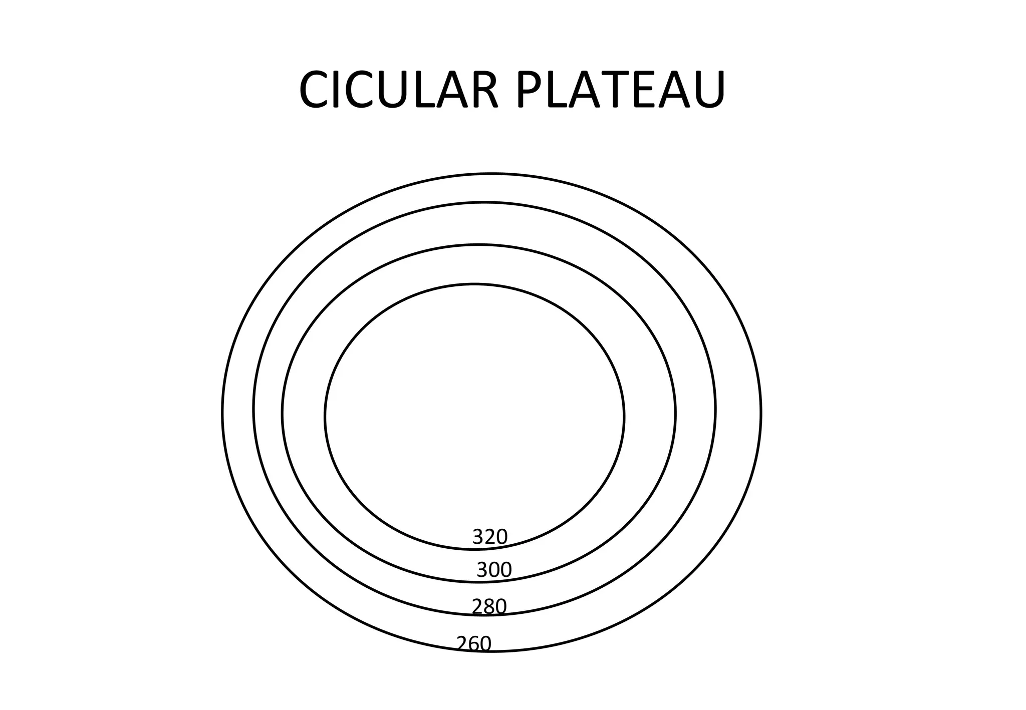
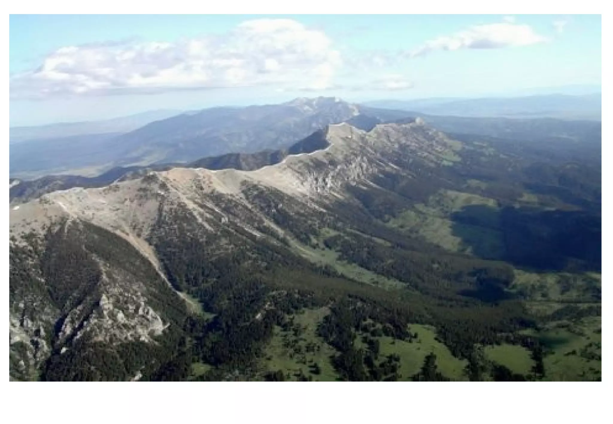
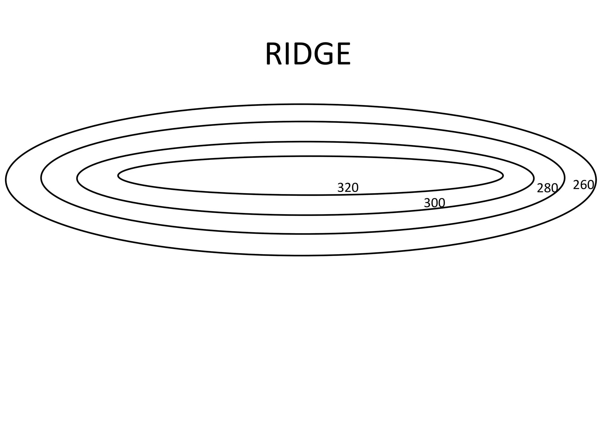
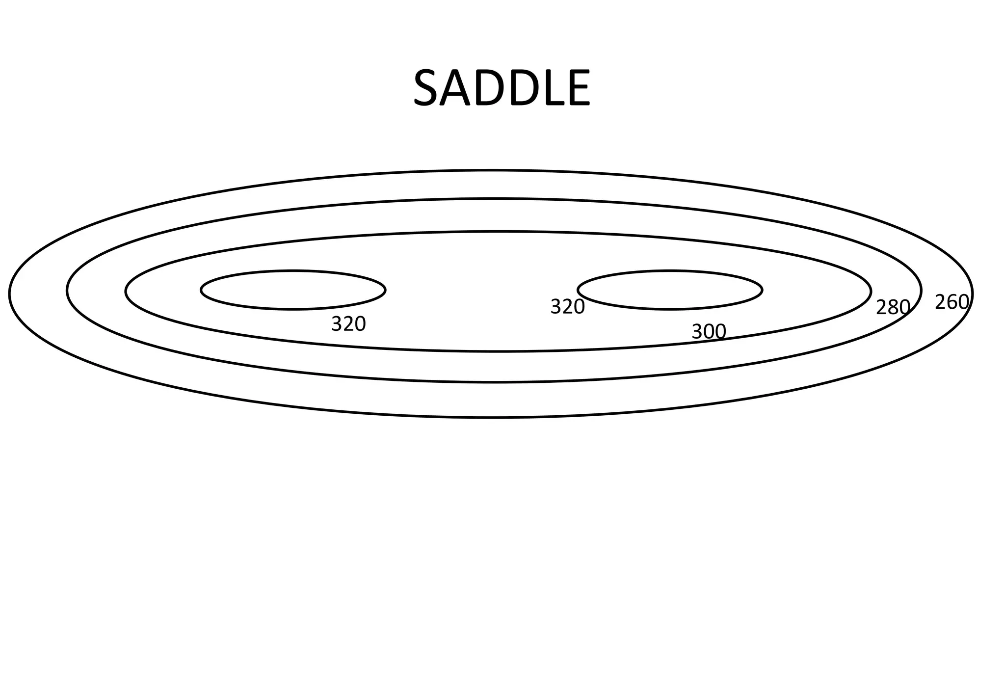
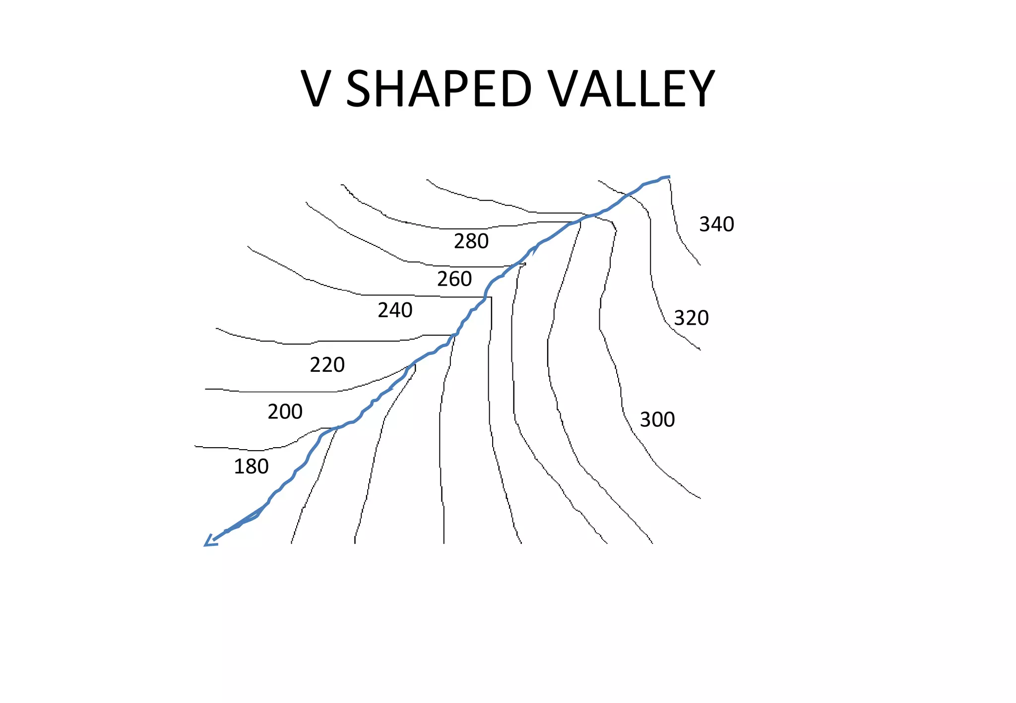
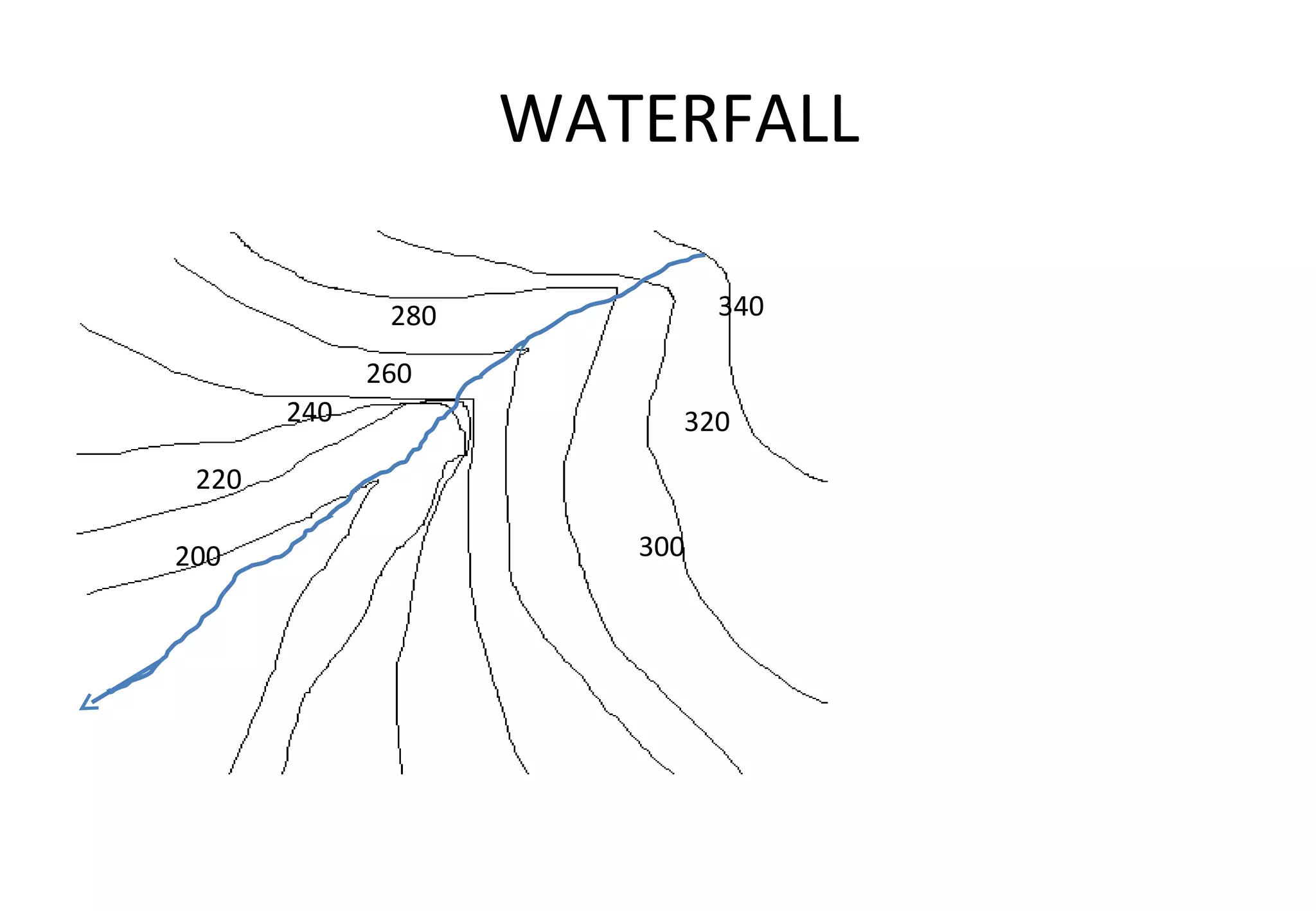
Contours are imaginary lines on a map connecting places of equal altitude. The key characteristics of contours are that all places on a contour line have the same altitude and contours never intersect. The contour interval is the difference between two successive contour values and remains uniform on a map. Closely spaced contours indicate a steep slope while widely spaced contours show a gentle slope. Contour diagrams can be used to visualize the shape of landforms based on the spacing and shape of the contour lines.