This document discusses several theories related to the location and classification of urban settlements:
1. It describes Christaller's central place theory which proposes that settlements are organized in a hierarchical pattern based on their functions and market areas.
2. It also explains Zipf's rank-size rule which observes that the population of a settlement can be predicted based on its rank compared to other settlements.
3. Jefferson's law of the primate city holds that in many countries, the largest city is more than twice as large as the second largest city due to factors like colonialism, centralized government, and rural-urban migration.
Geographic Regions: by definition There three types of regions Formal regions are areas where a certain characteristic is found throughout. Functional regions consist of a central place and the surrounding places affected by it. Perceptual regions are defined by people’s attitudes and feelings about areas. 4.
Rural urban partnership for economic developmentOECD Governance
13th European Week of Regions and Cities, presentation made on 12-15 October in Brussels, Belgium by Paolo Veneri, Economist, Regional Development Policy, OECD.
www.oecd.org/gov/regional-policy/
I’m professional presentation maker . These presentations are for sale for 20$ each, if required you can contact me on my gmail id bestpptmaker@gmail.com and you can also suggest me topics for your required presentations
Rural-urban Partnerships and Quality of Life. OECD OECD Governance
Urban and rural areas are deeply interconnected and, if well-managed, these connections can benefit both places. For more information see http://www.oecd.org/gov/rural-urban-linkages.htm
City region is a term in use since about 1950 by urbanists, economists and urban planners to mean a metropolitan area and hinterland, often having a shared administration. Typically, it denotes a city, conurbation or urban zone with multiple administrative districts, but sharing resources like a central business district , labour market and transport network such that it functions as a single unit.
the concept of city regions
stages of urban development
kcro dmh kansas city mo
liverpool city region
global city region
sheffield city region
cardiff city website
urban development models
gayathrysatheesanslieshare
ciity region ppt
The primary aim of studying settlement geography is to acquaint with the spatial and structural characteristics of human settlements under varied environmental conditions.
The concept of growth foci is one of the indispensable strategies for the regional development, which can be applied for the transformation of socio-economic activities of rural and urban settlements.
The growth foci have been identified with the help of certain indicators of administration, communication, education, health, finance, recreation, market and others.
The Mason Corridor & Our Housing Future: Roger Millar of Smart Growth AmericaFCBR
Roger Millar, VP with Smart Growth America, presentation from FCBR's Smart Growth event focused on creating dialog around the on-boarding of the Mason Corridor and it's likely impacts on housing and livability.
2024.06.01 Introducing a competency framework for languag learning materials ...Sandy Millin
http://sandymillin.wordpress.com/iateflwebinar2024
Published classroom materials form the basis of syllabuses, drive teacher professional development, and have a potentially huge influence on learners, teachers and education systems. All teachers also create their own materials, whether a few sentences on a blackboard, a highly-structured fully-realised online course, or anything in between. Despite this, the knowledge and skills needed to create effective language learning materials are rarely part of teacher training, and are mostly learnt by trial and error.
Knowledge and skills frameworks, generally called competency frameworks, for ELT teachers, trainers and managers have existed for a few years now. However, until I created one for my MA dissertation, there wasn’t one drawing together what we need to know and do to be able to effectively produce language learning materials.
This webinar will introduce you to my framework, highlighting the key competencies I identified from my research. It will also show how anybody involved in language teaching (any language, not just English!), teacher training, managing schools or developing language learning materials can benefit from using the framework.
Unit 8 - Information and Communication Technology (Paper I).pdfThiyagu K
This slides describes the basic concepts of ICT, basics of Email, Emerging Technology and Digital Initiatives in Education. This presentations aligns with the UGC Paper I syllabus.
Model Attribute Check Company Auto PropertyCeline George
In Odoo, the multi-company feature allows you to manage multiple companies within a single Odoo database instance. Each company can have its own configurations while still sharing common resources such as products, customers, and suppliers.
Instructions for Submissions thorugh G- Classroom.pptxJheel Barad
This presentation provides a briefing on how to upload submissions and documents in Google Classroom. It was prepared as part of an orientation for new Sainik School in-service teacher trainees. As a training officer, my goal is to ensure that you are comfortable and proficient with this essential tool for managing assignments and fostering student engagement.
Ethnobotany and Ethnopharmacology:
Ethnobotany in herbal drug evaluation,
Impact of Ethnobotany in traditional medicine,
New development in herbals,
Bio-prospecting tools for drug discovery,
Role of Ethnopharmacology in drug evaluation,
Reverse Pharmacology.
How to Create Map Views in the Odoo 17 ERPCeline George
The map views are useful for providing a geographical representation of data. They allow users to visualize and analyze the data in a more intuitive manner.
Students, digital devices and success - Andreas Schleicher - 27 May 2024..pptxEduSkills OECD
Andreas Schleicher presents at the OECD webinar ‘Digital devices in schools: detrimental distraction or secret to success?’ on 27 May 2024. The presentation was based on findings from PISA 2022 results and the webinar helped launch the PISA in Focus ‘Managing screen time: How to protect and equip students against distraction’ https://www.oecd-ilibrary.org/education/managing-screen-time_7c225af4-en and the OECD Education Policy Perspective ‘Students, digital devices and success’ can be found here - https://oe.cd/il/5yV
The Roman Empire A Historical Colossus.pdfkaushalkr1407
The Roman Empire, a vast and enduring power, stands as one of history's most remarkable civilizations, leaving an indelible imprint on the world. It emerged from the Roman Republic, transitioning into an imperial powerhouse under the leadership of Augustus Caesar in 27 BCE. This transformation marked the beginning of an era defined by unprecedented territorial expansion, architectural marvels, and profound cultural influence.
The empire's roots lie in the city of Rome, founded, according to legend, by Romulus in 753 BCE. Over centuries, Rome evolved from a small settlement to a formidable republic, characterized by a complex political system with elected officials and checks on power. However, internal strife, class conflicts, and military ambitions paved the way for the end of the Republic. Julius Caesar’s dictatorship and subsequent assassination in 44 BCE created a power vacuum, leading to a civil war. Octavian, later Augustus, emerged victorious, heralding the Roman Empire’s birth.
Under Augustus, the empire experienced the Pax Romana, a 200-year period of relative peace and stability. Augustus reformed the military, established efficient administrative systems, and initiated grand construction projects. The empire's borders expanded, encompassing territories from Britain to Egypt and from Spain to the Euphrates. Roman legions, renowned for their discipline and engineering prowess, secured and maintained these vast territories, building roads, fortifications, and cities that facilitated control and integration.
The Roman Empire’s society was hierarchical, with a rigid class system. At the top were the patricians, wealthy elites who held significant political power. Below them were the plebeians, free citizens with limited political influence, and the vast numbers of slaves who formed the backbone of the economy. The family unit was central, governed by the paterfamilias, the male head who held absolute authority.
Culturally, the Romans were eclectic, absorbing and adapting elements from the civilizations they encountered, particularly the Greeks. Roman art, literature, and philosophy reflected this synthesis, creating a rich cultural tapestry. Latin, the Roman language, became the lingua franca of the Western world, influencing numerous modern languages.
Roman architecture and engineering achievements were monumental. They perfected the arch, vault, and dome, constructing enduring structures like the Colosseum, Pantheon, and aqueducts. These engineering marvels not only showcased Roman ingenuity but also served practical purposes, from public entertainment to water supply.
Read| The latest issue of The Challenger is here! We are thrilled to announce that our school paper has qualified for the NATIONAL SCHOOLS PRESS CONFERENCE (NSPC) 2024. Thank you for your unwavering support and trust. Dive into the stories that made us stand out!
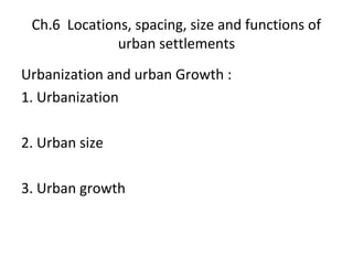
1. Ch.6 Locations, spacing, size and functions of
urban settlements
Urbanization and urban Growth :
1. Urbanization
2. Urban size
3. Urban growth
2. The Present World Pattern of
urbanization
• 1. Highly urbanized regions(over 65%
urbanized)
• Moderately urbanized lands (35% - 65%)
• Less urbanized lands (below 35% urbanized)
3.
4. Settlement Classification
• 1. Types of settlement
• 2. Classification of settlements by size
• 3. Classification of settlements by form
~ Isolated dwelling
~ Hamlet
~ Small Village
~ Large Village
6. 4. Classification of settlements by function
Central place
function
Transport functions
Special function
7. Urban Functions and Locational
Factors
• 1. Commercial functions and locational
factors
~ Route intersections
~ Valley confluences
~ Junction of highland and lowland
~ lowest bridging point on a river
~ Head of estuary
13. 1. Christaller’s Central Place Theory
• It is a theory stating that there was a pattern
to the distribution and location of
settlements of different sizes, and a pattern
in the way in which they provided services to
the inhabitants living within their sphere of
influence.
14. 2. Main aim
• The main aim of central place theory is
to explain the spatial organization of
settlements and hinterlands, in
particular their relative location and size
15. 3. Assumption
• Unbounded uniform plain
• Uniform population distribution
• Central place function
• Consumers minimize travel
• Suppliers act as economic men
• High order/low order centres co-exists
• Uniform consumer income and demand
16. 4. Principles
• Market threshold
• Range of a good
5. Hierarchy of services and central place
~ the comparsion of high order centres and low
order centres
17. • The marketing principle (k=3 network)
• The traffic principle ( k=4 network )
• The administrative principle (k=7network)
18. 5. Application of Christaller’s model
• Southern Germany
• Southern and eastern Australia
• South-west Wisconsin and southern England
19. 6. Criticisms of Christaller’s central place theory
• Isotropic surfaces
• Modern technology
• Population
• Non-service centre
• Overlapping market areas
• Multi-purpose shopping
• Mobility of people
20. • Influence of government and planning
agencies
• Statics theory
• Applicability
• Spacing of settlements
21. Contribution of the central place theory
• Christaller’s theory though hypothetical, theoretical
and unrealistic, is still valuable as it illustrates the
notion that urban networks are orderly systems and
not just random arrangements
• The theory has stimulated work on retailing and
consumer behaviour between settlements ,and
within them,which is useful for town planning and
economic development
22. Zipf’s Rank Size Rule
• 1. Introduction
Zipf’s observed the size and number of
settlements in various countries. He noticed a
common characteristic which has been called
the rank-size rule. Having observed this order
in the real world, he then sought to explain it.
The rank-size rule is an empirical regularity
23. 2. Main aim
• The main aim of the rank-size rule is to find
regularities concerning the characteristics of
settlements in various countries,and to fit a
graphical description to the size distribution
of cities
24. 3. The rank-size rule
• The settlements within a defined area are ranked in
descending order according to the size of their
population
• The size of a particular town can be predicted by
observing its rank and the size of the largest city in
the area
• The town’s population is derived by dividing the
largest city’s population by the town’s rank
25. • Pr P1/r or pr=p1(r )-1
Where p is the population
r is the rank
p1 is the population of the first-ranked
city
pr is the population of the rth ranked city
26. 4. Explanations of the rank-size
rule
• 1. Diversification and unification
• Minimizing costs and maximizing efficiency
27. 5. Present day examples fitting the rule
• Modern American cities comply to a great
extent with the rank-size rule
• Chicago is smaller than expected, but in
general the rule fits
28. 6. Present day examples not fitting the rule
• In Australia, there is a large gap between the
“primate” or largest city and lower ranked
cities. There is a deviation from the ideal
straight rank-size line.This is because in
Australia, the state capitals dominate each
state’s territory
29. 7. Validity of the rank-size rule
• There is no reason why towns and cities
should conform to this rule
• There are problems involved in accurately
delimiting both urban and regional
boundaries when testing the rule
30. 8. Comparison between central place theory and rank-
size rule
• Christaller- functional classes or orders
• Zipf- concerned with ranking urban centres in
descending order of population size
• Central Place theory is deductive while rank-size
rule is generally observed phenomenon is inductive
and empirical
• The central place theory concerned with a regional
scale while rank-size rule is applies to a national
scale
31. Jefferson’s Metropolitan Primacy (Law
of the Primate City)
• 1. Introduction
Mark Jefferson discovered that in many
countries, in terms of population, the
leading city is more than twice as large
as the second city. In 1939, Jefferson
formulated “the law of the primate city”
32. The law of the primate city
• A primate city is one which far out-ranks all
other cities of the country in which it is
located,in terms of population, commercial
activities, industrial output and political
influences
33. 3.Examples of primate city
• The law of the primate city is mainly
applicable to agricultural based, developing
countries.It will show following
characteristics
- small territorial extent
- Relatively high population densities
- Low per capita income
34. • A high degree of dependence upon
agricultural exports
• High rates of population growth
• A former colonial status
35. 4. Factors giving rise to a primate city
• Spread of colonialism
• Strong centralized government
• Economic factors
• Industrial agglomeration
• Rural-urban migration
• Efficiency of modern transport