Download as PDF, PPTX

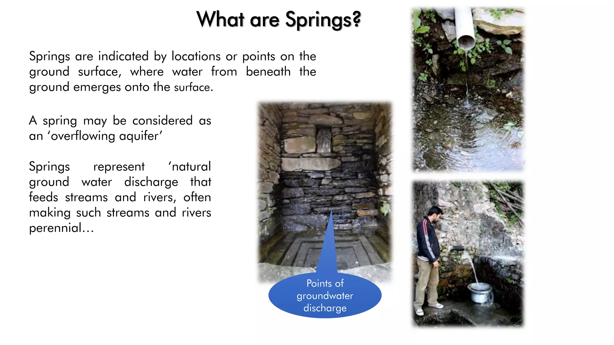
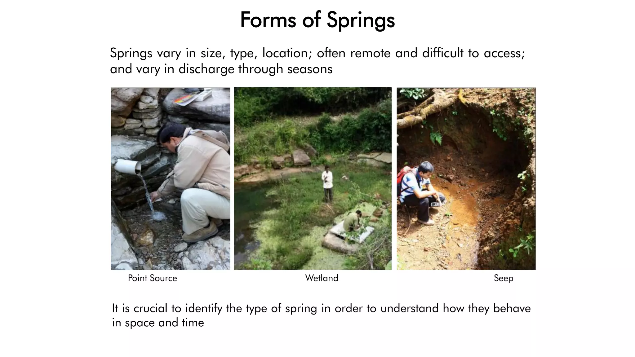
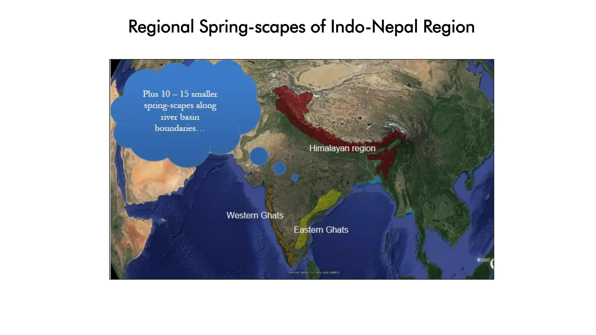

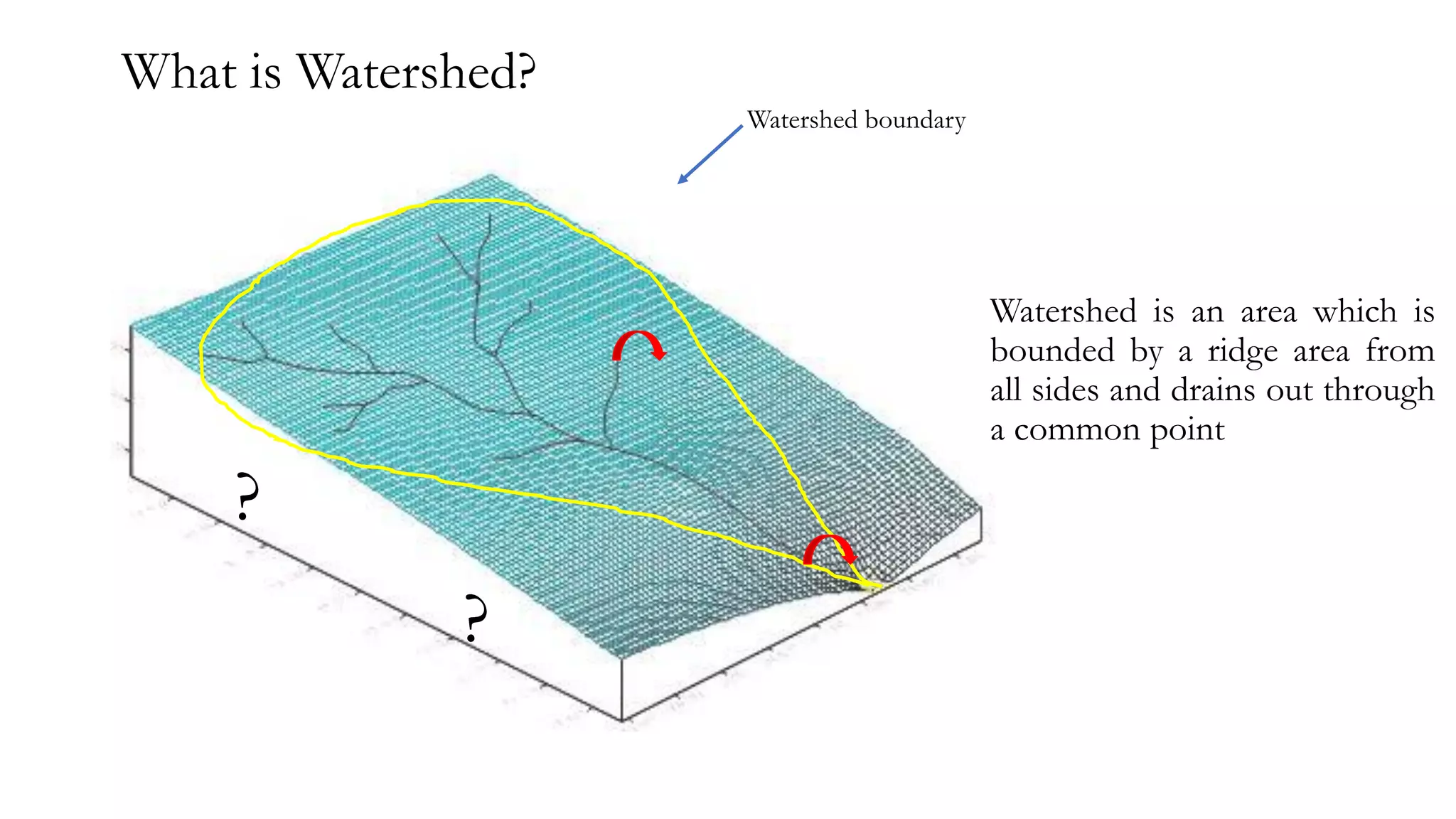
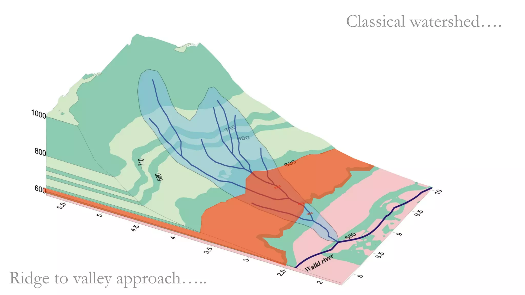
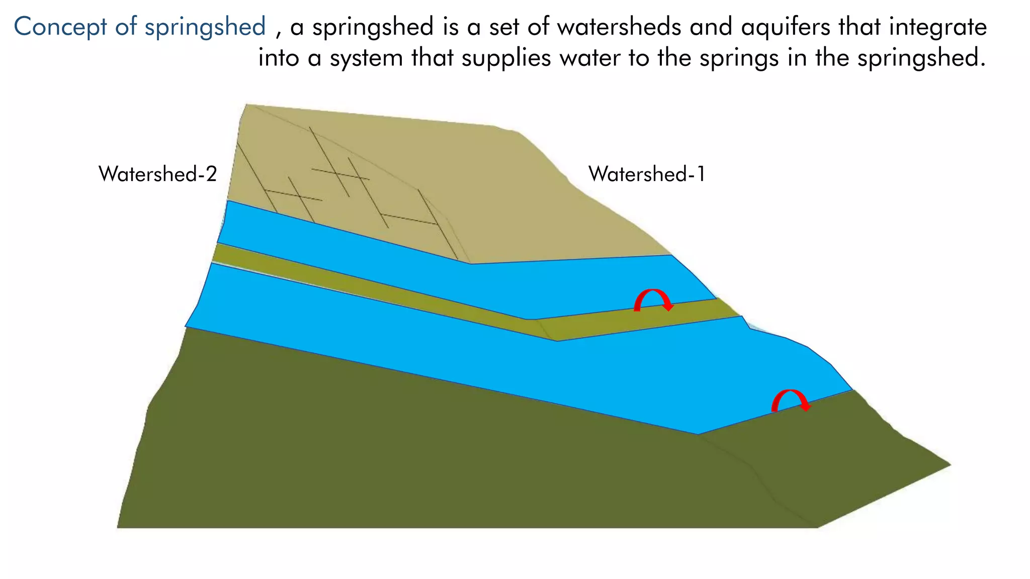
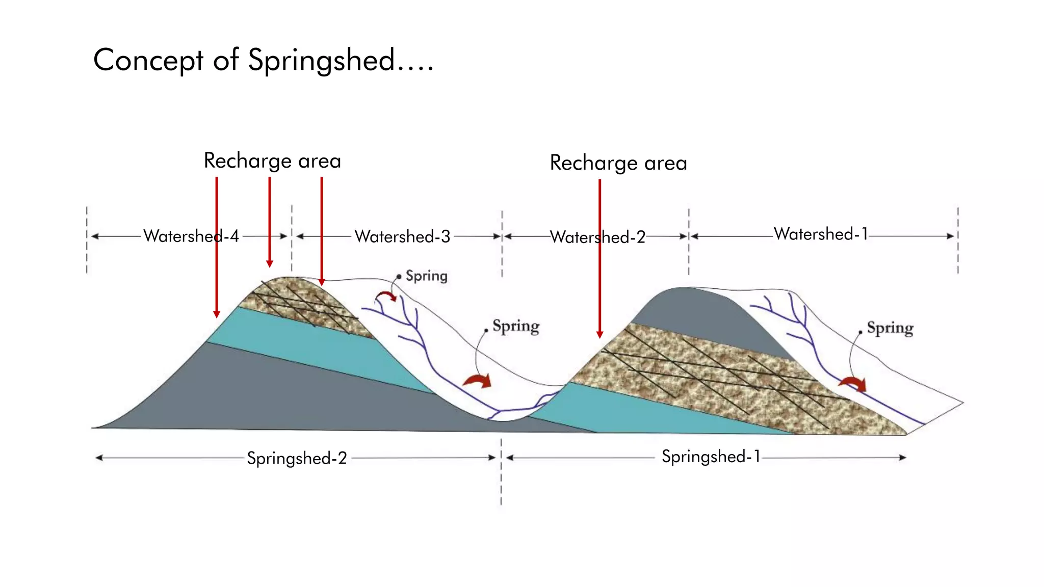
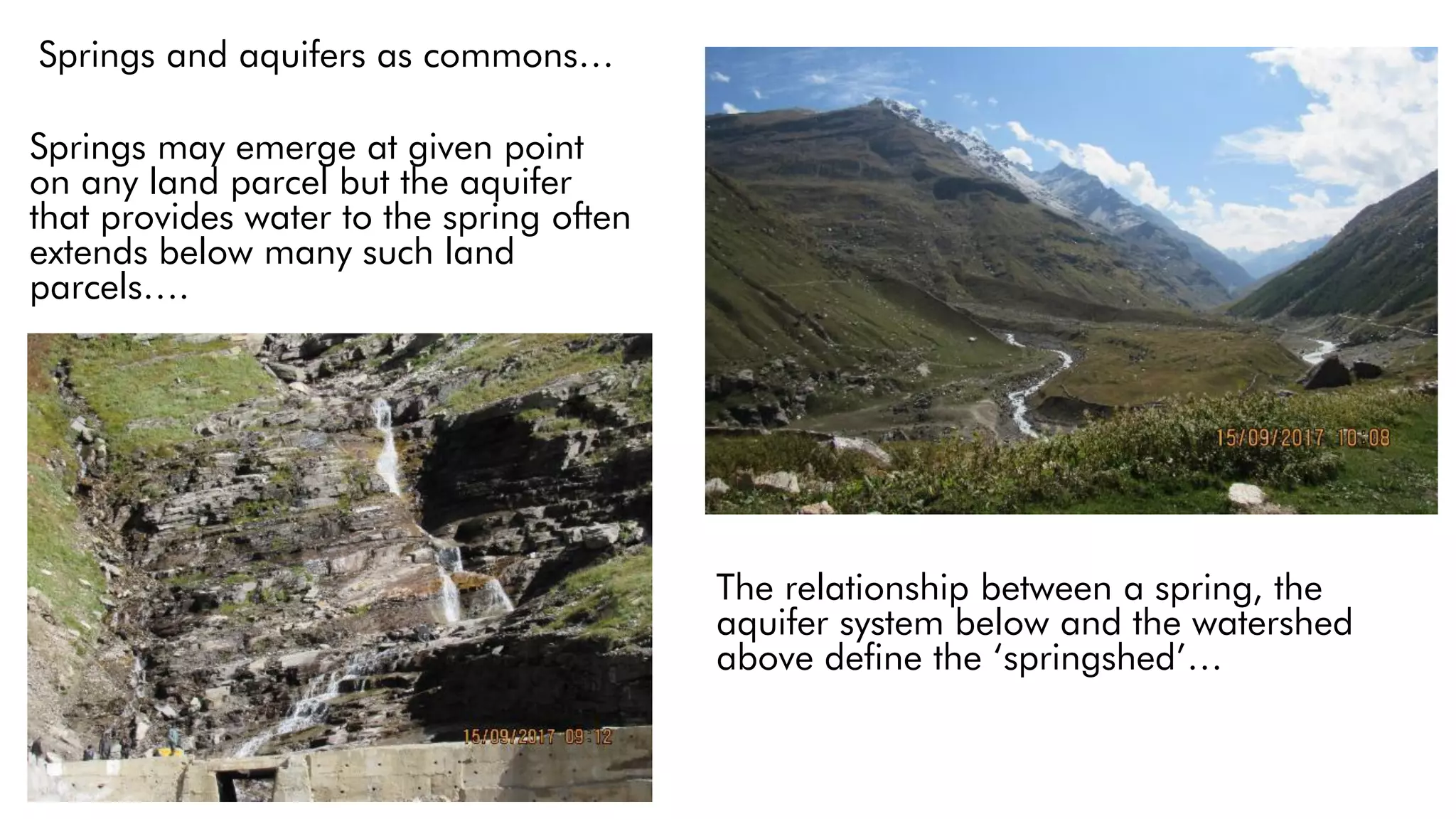
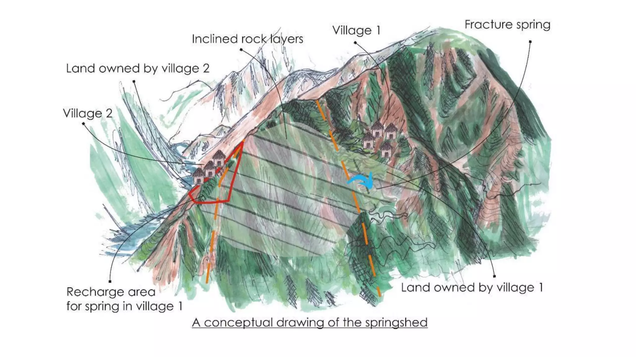
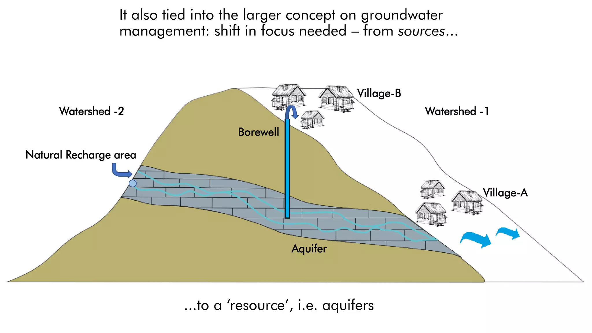
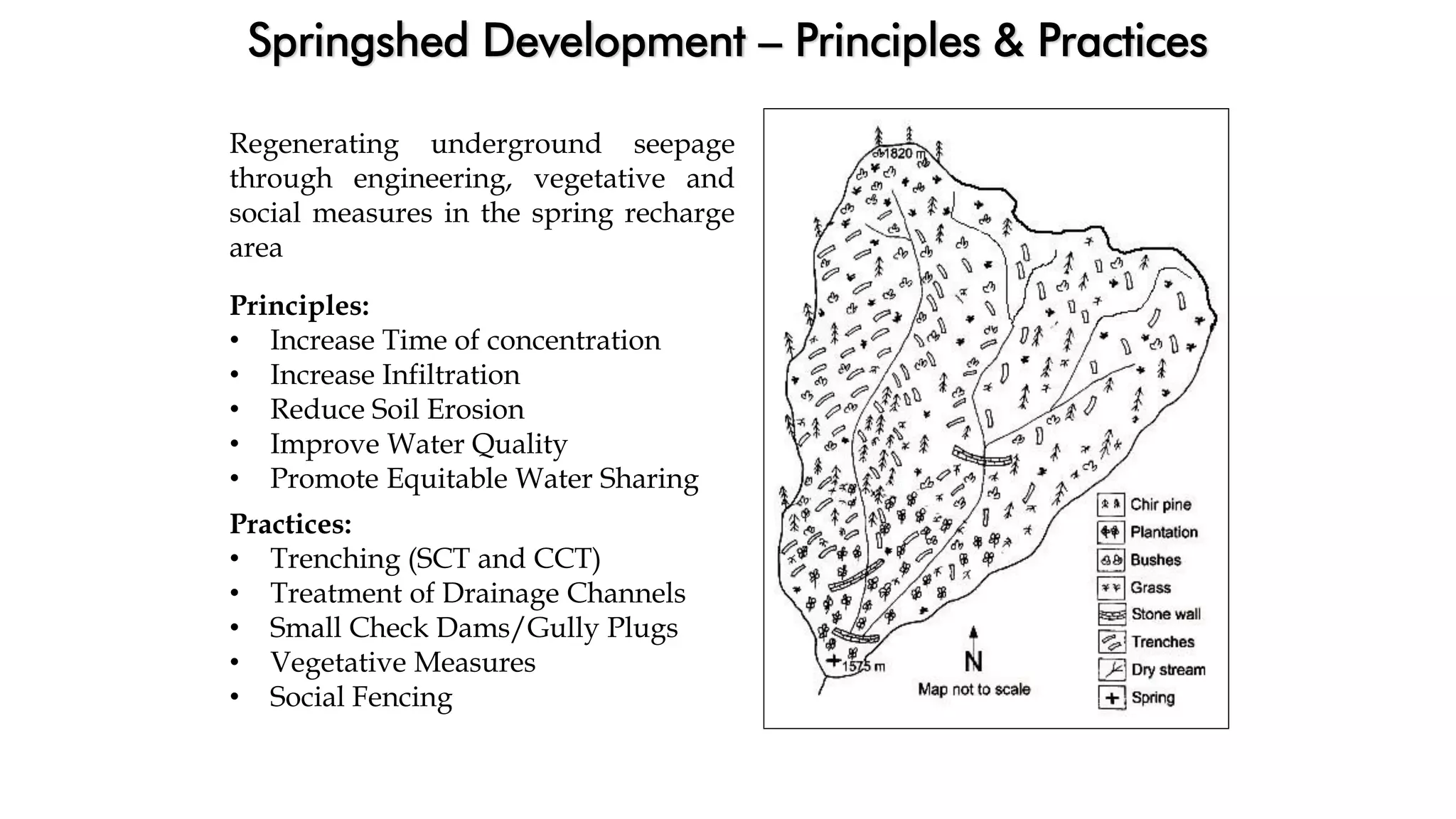
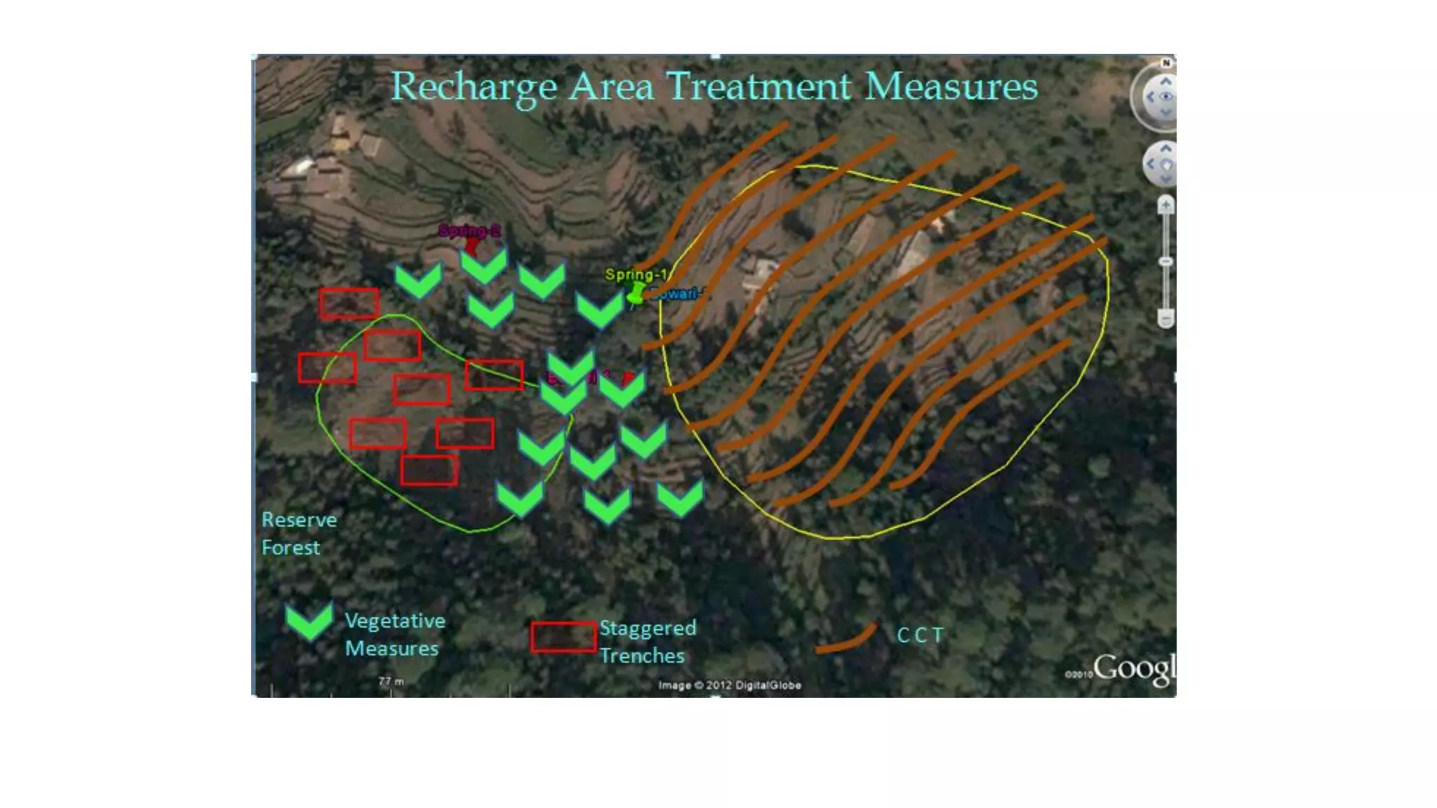
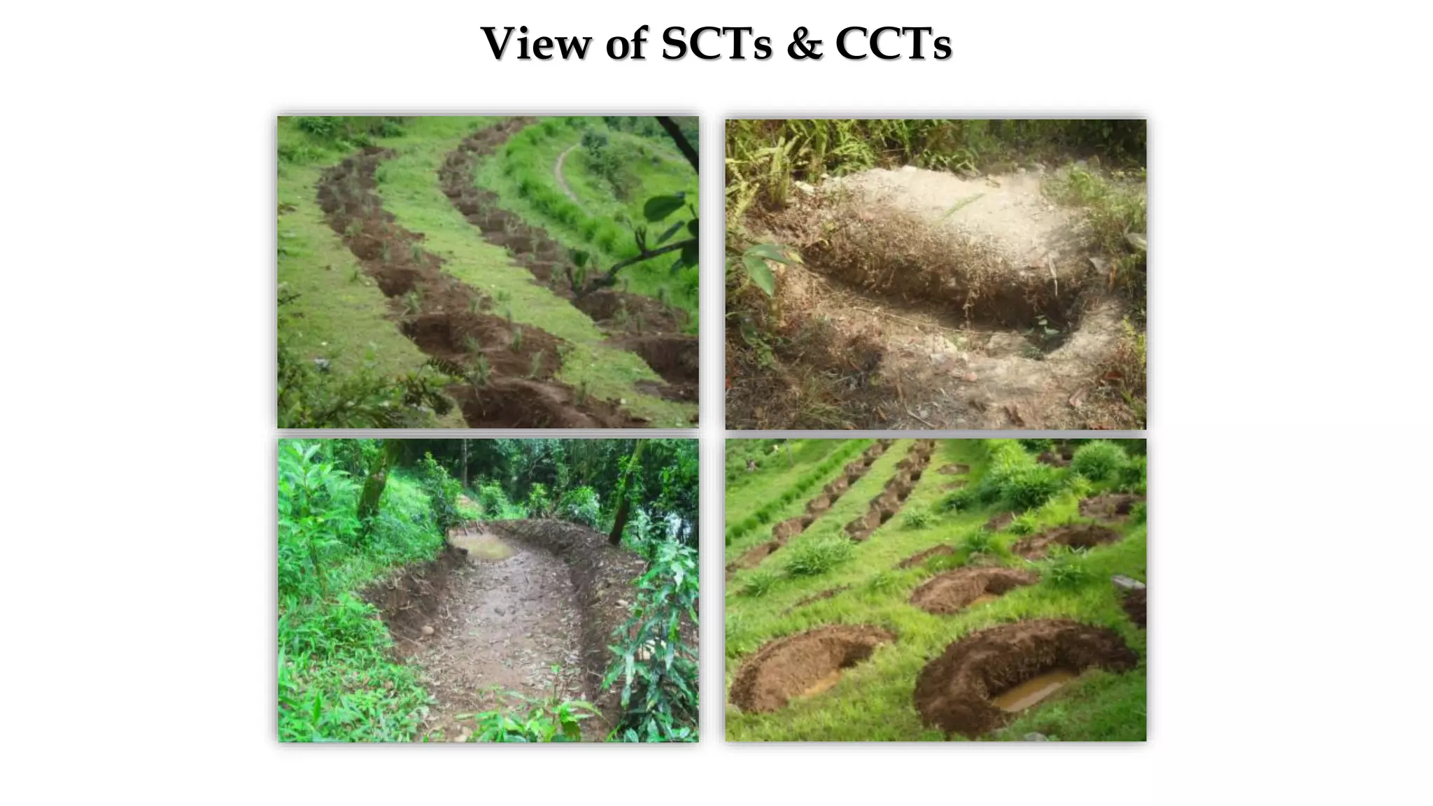
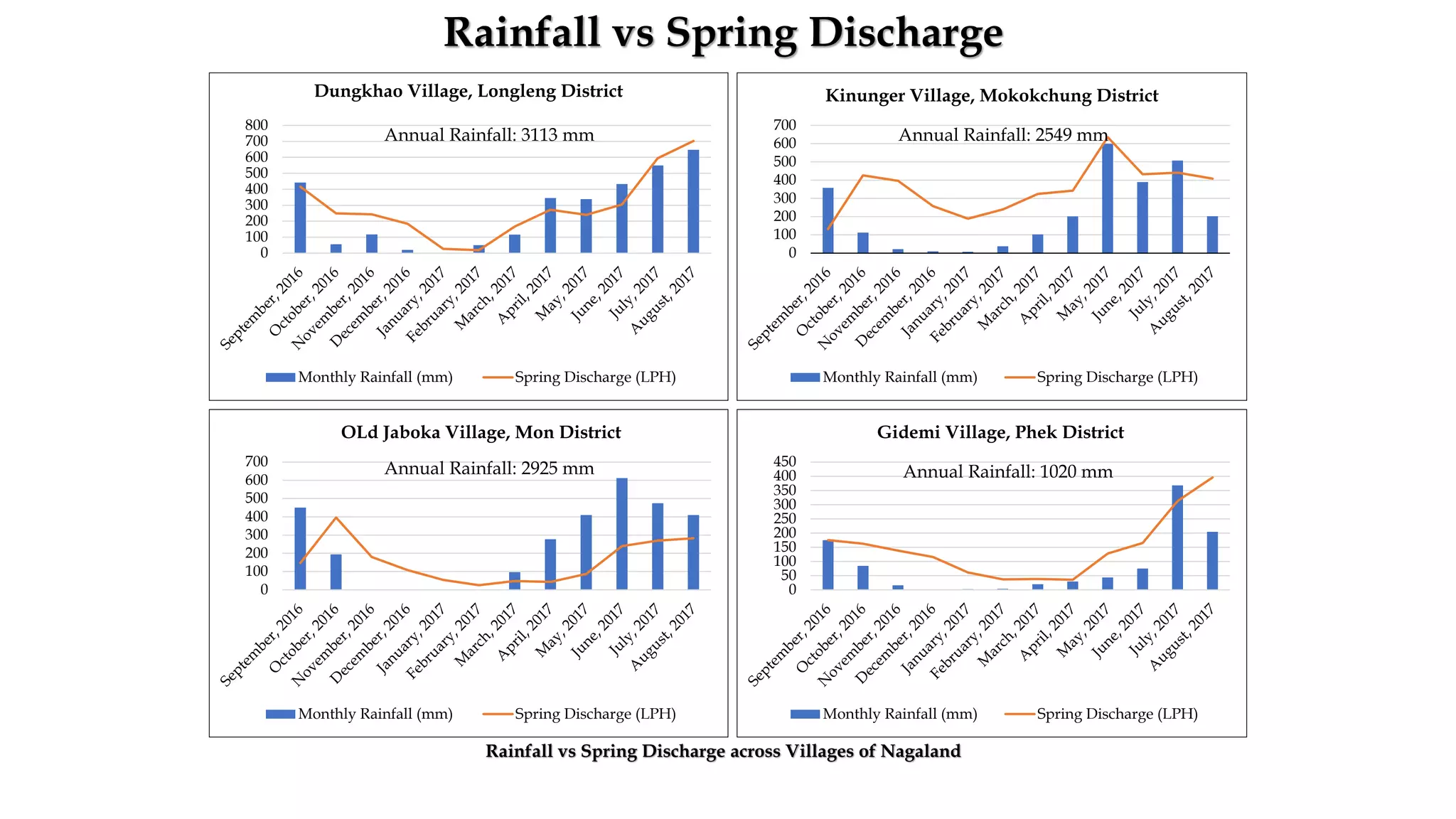
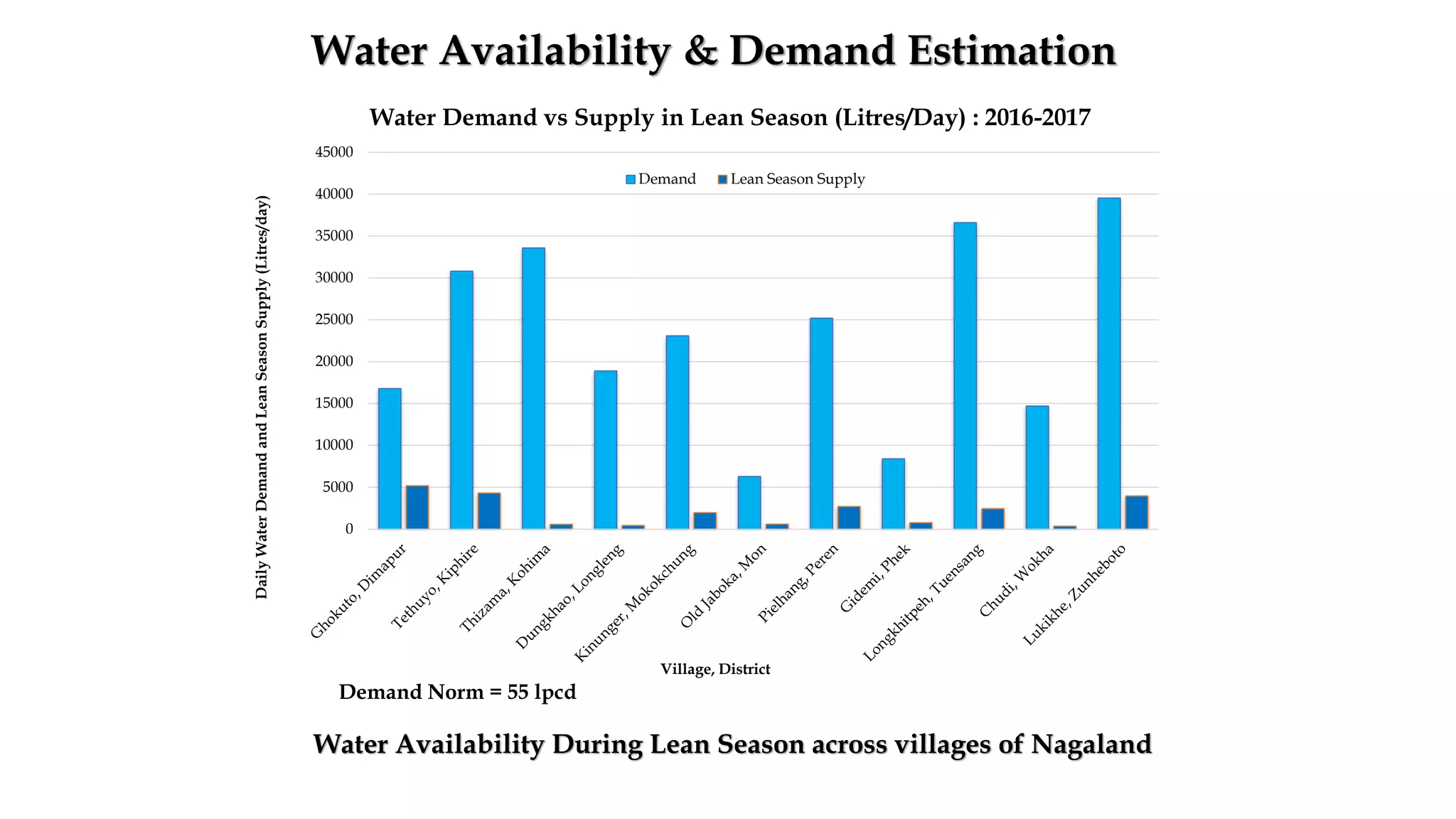
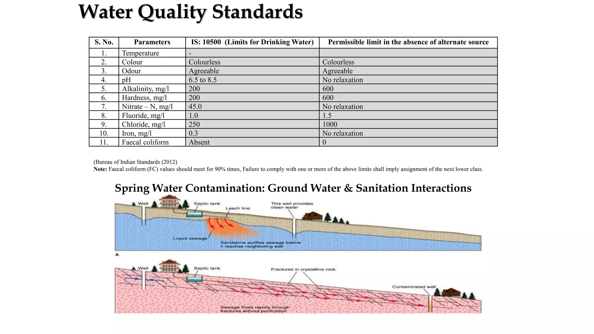
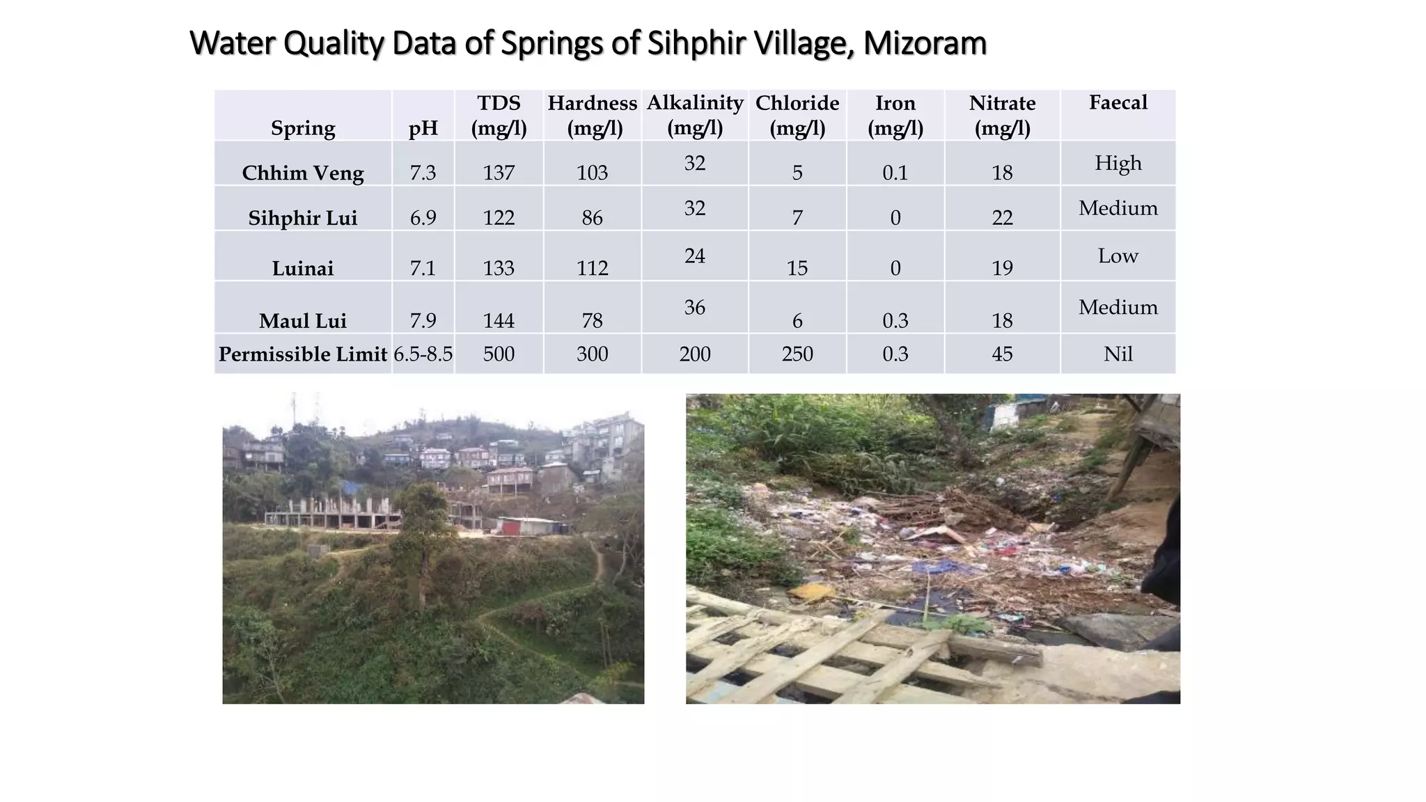
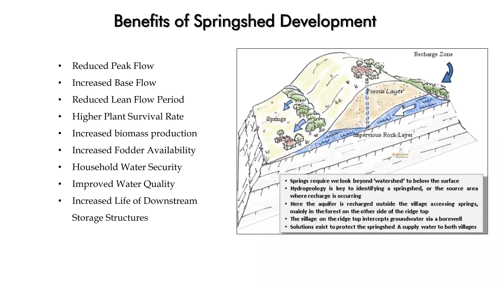

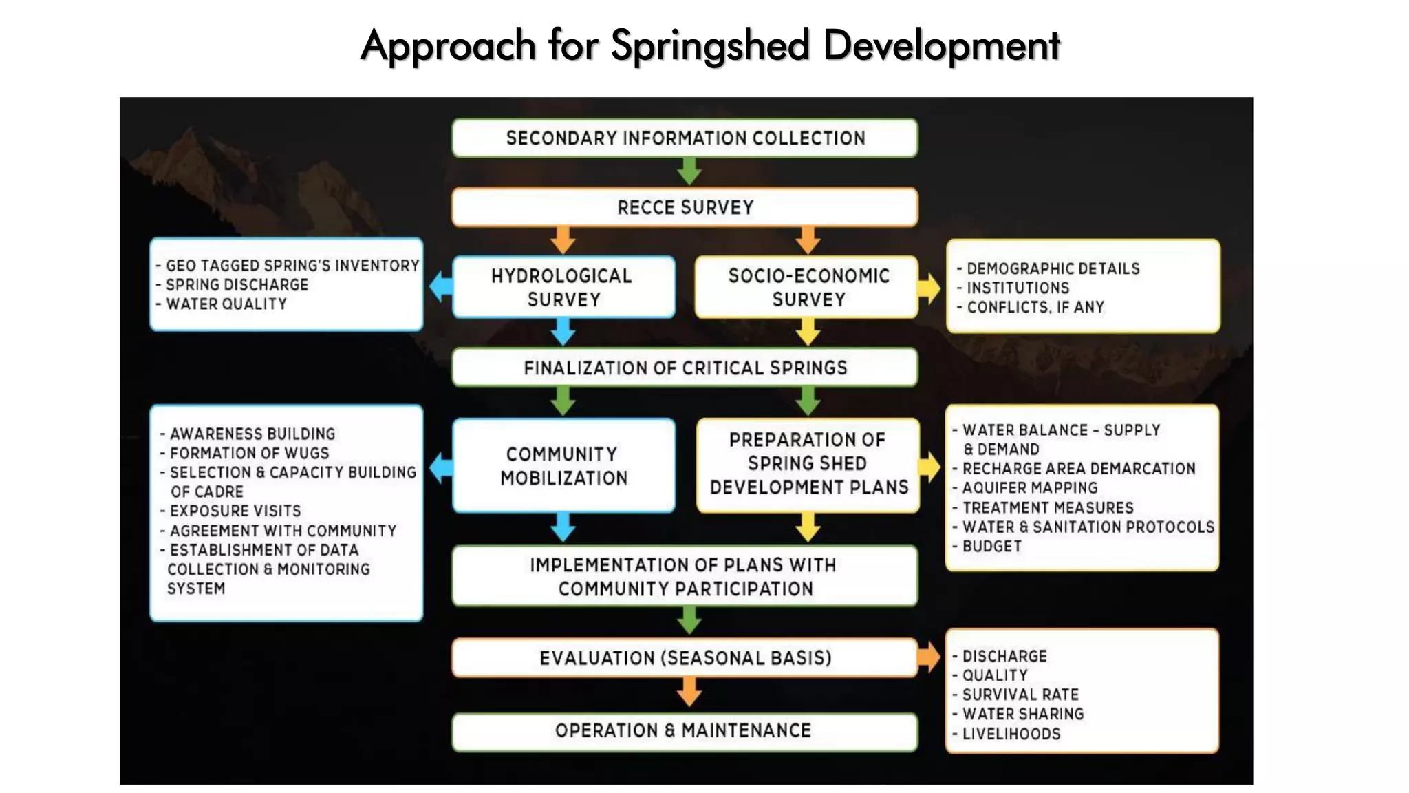
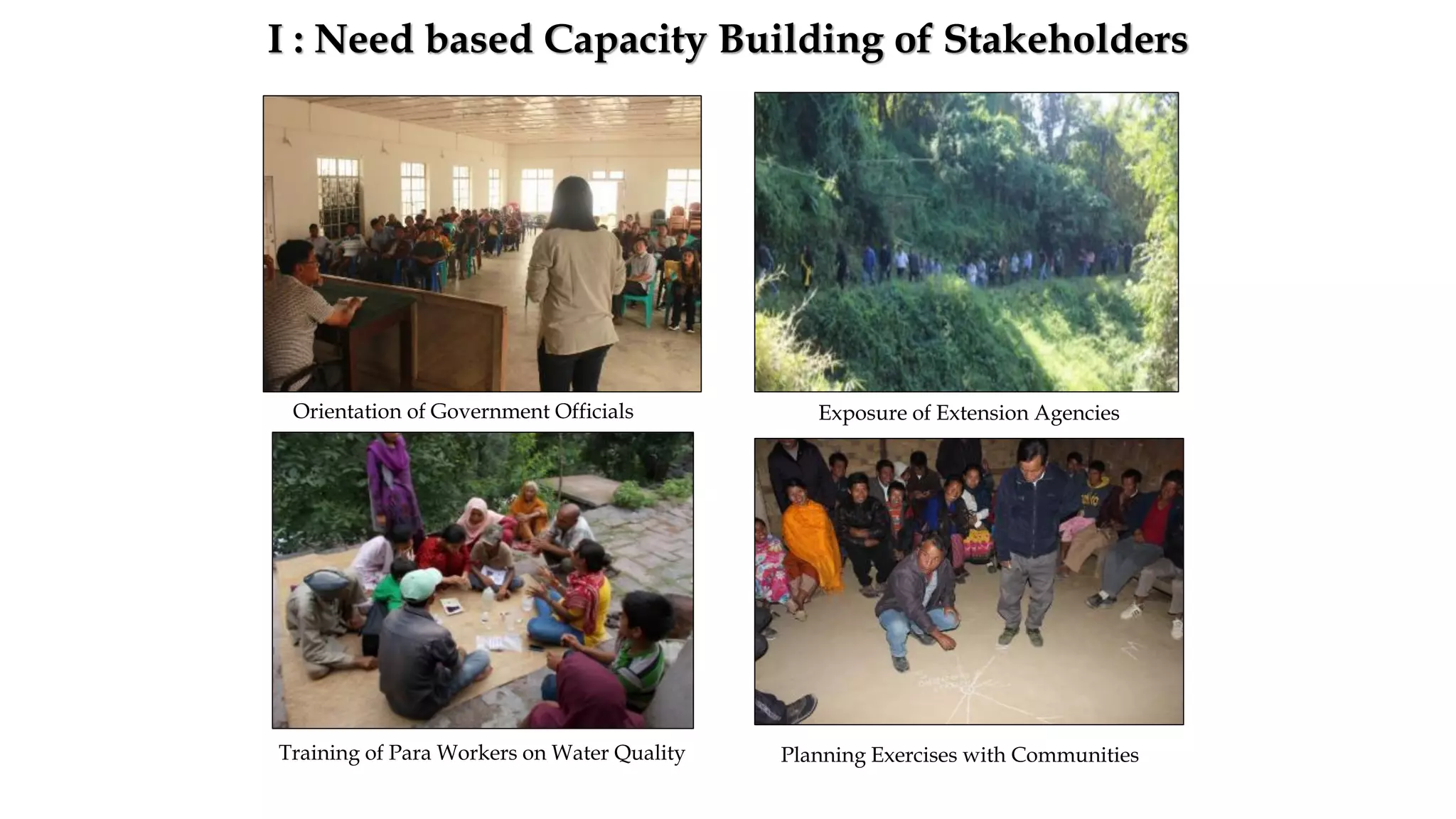
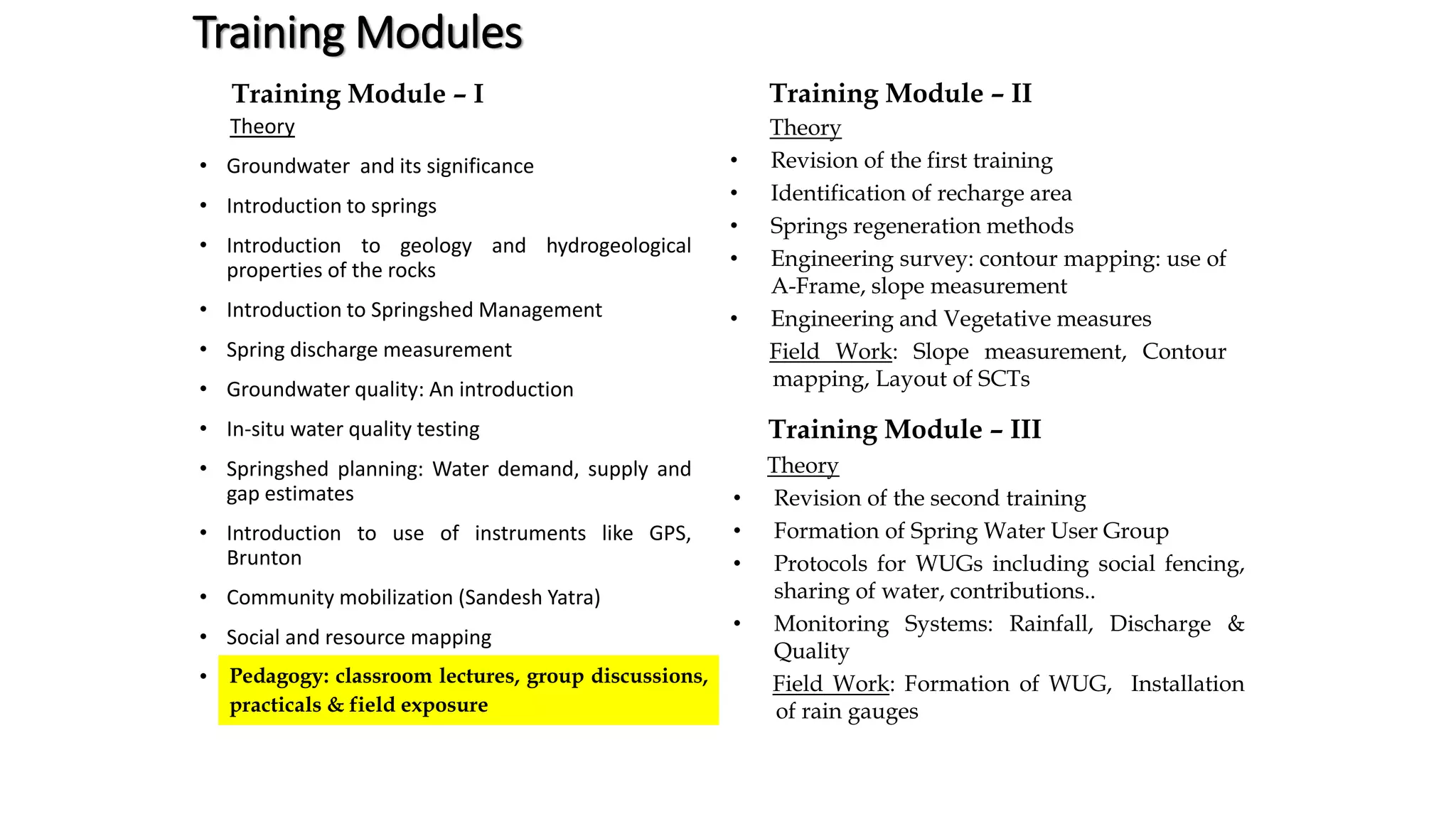
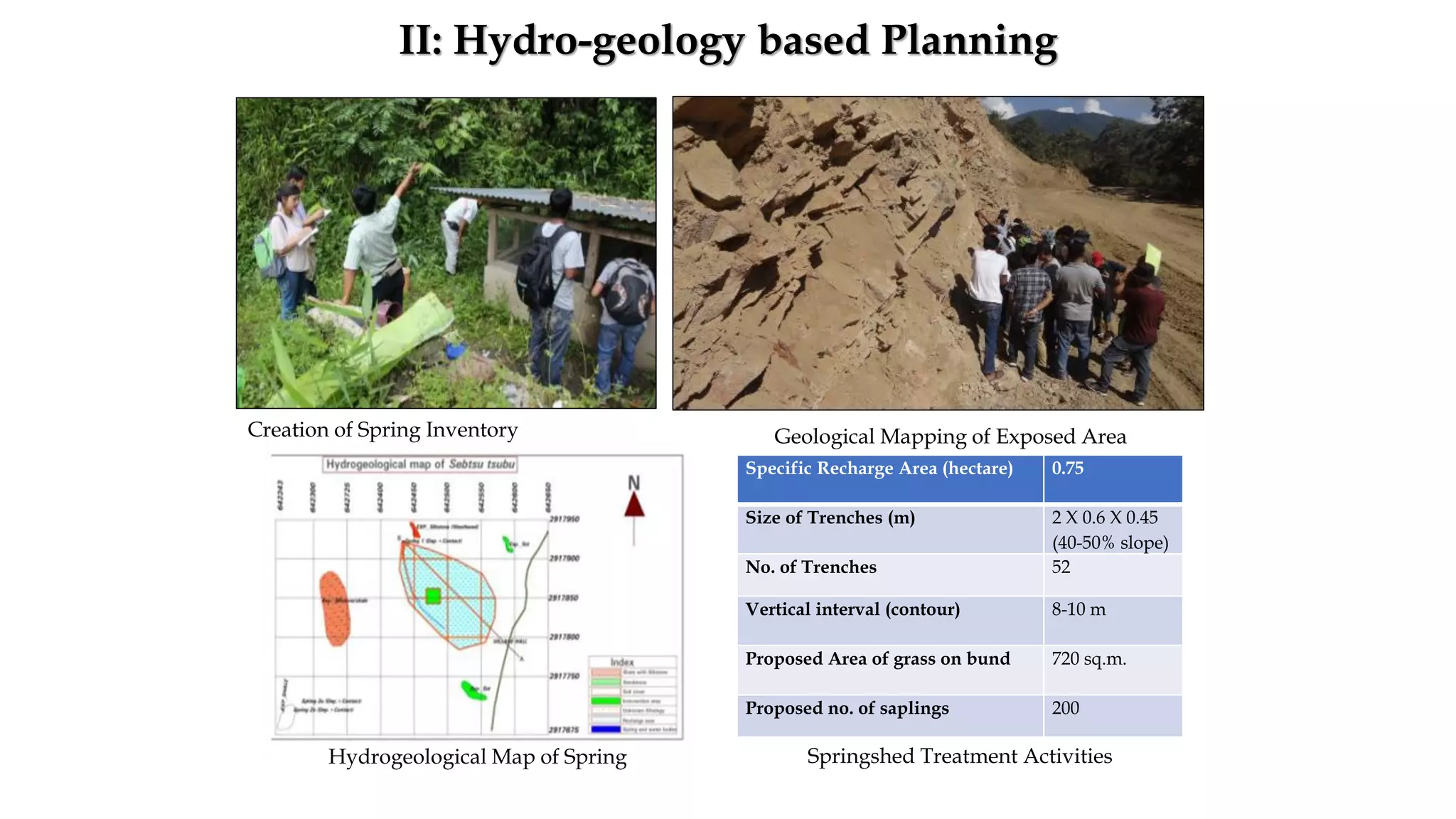
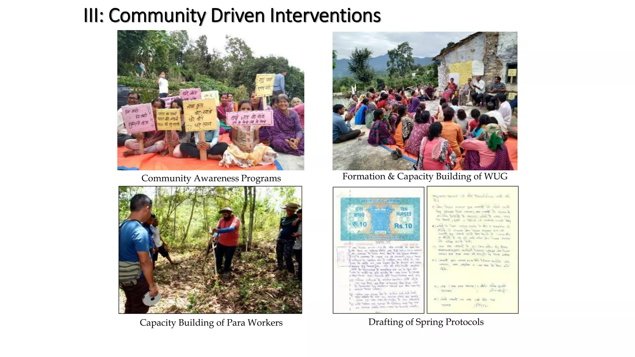
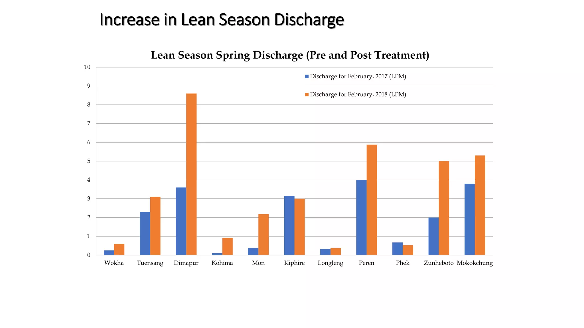

The document discusses the concept of springshed development, focusing on the relationship between springs, aquifers, and watersheds in managing water resources. It outlines principles and practices for enhancing springshed regeneration, including engineering and vegetative measures, while emphasizing community involvement and capacity building for sustainable management. Additionally, it highlights the benefits of springshed development on water security, quality, and biodiversity in the Indo-Nepal region.


