Avlanche
•Download as PPTX, PDF•
4 likes•1,042 views

The following is abstract of types causes effects and human intervention over natural disaster avalanche
Report
Share
Report
Share

Recommended
Avalanche
An avalanche is a mass of snow sliding down a mountain. There are different types including surface avalanches which involve layers of snow with different properties sliding over each other, and full depth avalanches where the entire snow cover from the ground up slides. Avalanches are caused by various environmental factors including heavy snowfall, steep slopes, vibration, warm temperatures and layers of snow and ice building up. They can damage life, property and infrastructure and cause flash flooding, but are also a natural part of mountain ecosystems. Understanding avalanche patterns and avoiding likely start zones are important for preventing danger.
Avalanche
This document discusses avalanches and defines them as rapid flows of snow down sloping surfaces that are triggered in starting zones and form gravity currents. It describes how avalanches occur due to factors like temperature differences between snow layers, evaporation of lower layers, and loss of grip. The anatomy of an avalanche includes the starting zone where snow can fracture and slide, the track path down the slope, and the runout zone where snow comes to a stop. Formation involves terrain angle and slope, snowpack structure with weak layers below slabs, and weather conditions like temperature rises or storms. Types include loose snow, slab, powder, and wet snow avalanches. Effects range from positive like habitat to negative like damage and
Avalanche
An avalanche is a mass of snow, ice, and debris that slides down a mountain. There are four main types of avalanches: loose snow, slab, powder snow, and wet snow. Avalanches are triggered by factors like heavy snowfall, earthquakes, steep slopes, and human activity. They can reach speeds over 130 kph and destroy infrastructure, posing a serious threat to human life and property. Avalanche forecasting requires experienced forecasters collecting snowpack data and using weather models to predict unstable slopes. Control techniques use explosives or structures to divert or trigger avalanches in low-risk areas.
Avalanche
Snow avalanches occur when layers of snow on steep slopes fail and slide rapidly downhill. They are triggered by natural factors like weather and terrain, but human activity is responsible for triggering 95% of avalanches that bury people. Avalanches can be classified by their type of snow, failure mechanism, size, and other morphological characteristics. Proper safety equipment, terrain selection, and group management are important for avoiding avalanche danger.
cyclone
Cyclones are rapidly rotating storm systems that form over warm tropical oceans. They are known as hurricanes in the Atlantic/Northeast Pacific, typhoons in the Northwest Pacific, and tropical cyclones in the South Pacific/Indian Ocean. Cyclones form through the rising of warm, moist air which causes an area of low pressure and draws in surrounding higher pressure air, fueling the storm system through heat release. They can cause extensive damage upon making landfall through strong winds, storm surge, heavy rain, and tornadoes.
Tsunami
This document discusses tsunamis, which are giant waves caused by earthquakes or volcanic eruptions under the sea. Tsunamis can cause massive damage and loss of life by destroying homes and infrastructure. While impossible to prevent, their effects can be minimized through preparation measures like building in safe areas, establishing evacuation routes, and early warning systems. The document outlines dos and don'ts for before, during, and after a tsunami and emphasizes the importance of quickly evacuating coastal areas if a tsunami is detected or warned.
Floods causes & impacts
Flooding can be caused by both physical and human factors. Heavy rainfall, snowmelt, steep drainage basins, and coastal influences can increase flooding risk naturally. Human activities like urbanization, deforestation, and improper infrastructure development exacerbate flooding through reduced infiltration and faster runoff. Flooding can have severe social and economic impacts through property damage, transportation disruptions, and health issues, but may also provide benefits like fertile soils under some circumstances. Risk analysis aims to estimate the probability and potential impacts of flood events.
Landslides
landslides, disaster, landslide hazard zones in India, landslide mitigation, landslide classification
Earthquake
Earthquakes are the shaking, rolling or sudden shock of the earth’s surface. They are the Earth's natural means of releasing stress. Earthquakes can be felt over large areas.
Earthquakes cannot be predicted, although scientists are working on it.
Landslides
PPT on landslides for school presentations or for personal knolwedge.
Comment, like and share!!!!
Do follow!!
Natural disasters
THESE SLIDES WILL HELP YOU TO UNDERSTAND ABOUT DIFFERENT NATURAL DISASTERS AND WHAT CAUSES THEM AND HOW OUR LIVES IS AFFECTED BY THEM
Natural Disasters Topic 11 (Coastal Hazards)
1) Waves are formed by wind pushing across water, causing water particles to move in circular patterns.
2) As waves approach shorelines, they begin to break due to shallow depths and friction between water layers.
3) Shoreline types vary depending on geological factors - erosion-dominated coasts have cliffs and terraces while depositional coasts like deltas and beaches are shaped by sediment deposition.
Disasters (natural/man-made)
This presentation is about disasters and the harm caused by them as well as how to prevent such desasters.
Cylones ppt
Cyclones are intense low pressure areas characterized by very strong circulating winds. They form over warm ocean waters and move with the prevailing winds. When a cyclone makes landfall, it can cause widespread damage from heavy winds, storm surges, and flooding. Proper preparedness and mitigation measures such as constructing cyclone resilient infrastructure, issuing early warnings, and evacuating people to shelters can help reduce loss of life and damage from cyclones.
Hazards & Types Of Disasters
The document defines different types of hazards and disasters. It discusses natural disasters such as earthquakes, tsunamis, volcanic eruptions, landslides, tropical cyclones, floods, storms, mudslides, avalanches, droughts, and wildfires. It also covers technological disasters, environmental disasters, and complex disasters involving terrorism, civil unrest, and refugee problems. The document provides descriptions and examples of each type of hazard and disaster.
Natural hazards
this lesson discuess about causes of natural hazards, impacts of natural hazards, process of naural disaster and types of natural hazards based of different reasons
Landslide disaster management
The document discusses landslide disaster management. It defines landslides and their causes such as changes in slope, load, water content, etc. It identifies landslide hazard areas as those with slopes over 15%, a history of landslides, or erosion. The document outlines the disaster management cycle and approaches to both pre-disaster studies like hazard mapping and post-disaster studies such as damage assessments and stabilization efforts. It recommends various risk reduction measures for land use planning, infrastructure development, and stabilization.
Geography / natural Hazards
This document discusses several types of natural hazards including atmospheric, terrestrial, and aquatic hazards. It provides examples of different types of natural hazards such as tropical cyclones, earthquakes, volcanic eruptions, and tsunamis. It explains key concepts about these hazards such as the definitions of hurricanes, typhoons, and tropical cyclones, different types of volcanic eruptions and lava, and how tsunamis differ from ordinary wind waves in having much longer wavelengths and periods. Images and diagrams are included to illustrate volcanic eruptions, tsunamis, and the damage they can cause.
Flood
Floods are a common natural disaster in India that occur when bodies of water overflow their normal boundaries due to heavy rainfall or snow/ice melt. There are several types of floods including flash floods caused by intense rainfall in mountainous areas, river floods along large rivers, coastal floods due to storm surges and tsunamis, and urban floods when rainfall cannot be absorbed in urban areas. Floods can damage property and infrastructure, spread disease, and disrupt communities but may also provide benefits by recharging groundwater or increasing soil fertility. Prevention methods include coastal defenses, town planning, retaining walls, dams, and increasing vegetation cover. States frequently affected by floods in India include West Bengal, Odisha, Andhra Pradesh,
Cyclone
Cyclones are intense low pressure areas characterized by very strong circulating winds. They develop over warm tropical oceans and are classified as extra-tropical or tropical depending on location. Tropical cyclones bring heavy rainfall, strong winds over 100 km/h, and storm surges which can flood coastal areas. India's east coast is most vulnerable as the Bay of Bengal sees several cyclones each year. Early warning systems and evacuation plans are needed to minimize loss of life and property when cyclones make landfall. Proper construction and site selection above flood levels can strengthen buildings to withstand cyclone winds and rains.
Natural Disasters
The document defines and describes different types of natural disasters:
1. Natural disasters are occurrences that cause damage, loss of life, and deterioration of health on a scale that requires outside assistance. They include meteorological events like cyclones and tornadoes, topographical events like earthquakes and volcanic eruptions, and environmental events.
2. Some of the worst natural disasters in history include the 1970 Bhola cyclone that killed 500,000 people, the 1960 Chile earthquake with a magnitude of 9.5 that killed 6,000, and the 2004 Indian Ocean tsunami that caused 230,210-280,000 deaths.
3. Unusual natural disasters mentioned include firenadoes, which are
Causes, Effects and Precautions against Earthquake
1. Earthquakes are caused by the movement of tectonic plates deep below the Earth's surface. As the plates shift and grind against each other, they release energy in the form of seismic waves.
2. Major earthquakes can cause widespread damage to infrastructure like buildings, bridges and dams, resulting in loss of life and property. They can also trigger secondary hazards such as landslides, tsunamis and fires.
3. Pakistan is prone to earthquakes, with major fault lines running along its western border. Some of the deadliest quakes in the country's history include the 2005 Kashmir earthquake that killed over 80,000 people and the 2013 Balochistan earthquake that killed 825.
coastal erosion
This document discusses coastal erosion and mechanisms. It defines coastal terminology and describes the various agents that affect coastal erosion, including wind, waves, tides, and currents. It also examines the erosional and depositional landforms created by coastal processes, such as headlands, sea stacks, beaches, and barrier islands. Additionally, it covers the concepts of coastal erosion, longshore drift, and coastal deposition. The effects of coastal erosion are also addressed, as well as the importance of understanding coastal dynamics and implementing mitigation strategies to reduce erosion.
CYCLONE
This document discusses different types of cyclones. It describes temperate cyclones as low pressure systems caused by interactions between warm tropical air and cold polar air. They are classified as either dynamic, thermal, or secondary cyclones. Tropical cyclones generally form in tropical areas and are classified based on wind speed as tropical disturbances, depressions, storms, or hurricanes/typhoons. The document provides details on the characteristics and formation of these cyclone types.
Earthquake causes and safety measurements
The document discusses earthquake engineering concepts. It provides information on group members, defines key earthquake terms like focus, epicenter and fault lines. It describes the causes of earthquakes including surface causes, volcanic causes and tectonic plate movement. It explains different types of seismic waves and how the Richter scale is used to measure earthquake magnitudes. Construction techniques to resist earthquakes are also summarized like using shear walls, bracing, dampers, base isolation and light weight materials.
Earthquake
The document discusses earthquakes, including their causes, types of seismic waves produced, measurement on the Richter scale, potential hazards caused by earthquakes like landslides, fires, liquefaction, tsunamis and floods. It also discusses methods of earthquake prediction and safety precautions to take during an earthquake based on one's location.
Natural Hazards, Classification and Analysis
An introduction to the concept of natural hazards,, a look at some of the ways they are classified and information about criteria used to analyze and compare natural hazards for Global Geography 12 at Charles P. Allen High School.
Mitigation of an Earthquake
An earthquake occurred in Indian-controlled Kashmir that registered a magnitude of 5.7 on the Richter scale. Nine people were injured and several buildings were damaged, including two schools and four residential buildings. Cell phone communications were also disrupted. Earthquakes are the result of a sudden release of energy in the Earth's crust that creates seismic waves. Major past earthquakes in India provide a baseline for disaster planning. The Disaster Management Act of 2005 establishes institutions and coordination mechanisms for effective earthquake disaster management at national, state, and district levels.
Cyclones the disaster management project
This document summarizes the impact of Cyclone Aila which struck the Sundarban islands in India and Bangladesh in May 2009. Aila had winds up to 120 kph and caused massive flooding, leaving over 100,000 people homeless without access to food, water or shelter. While NGOs provided relief materials, the government was slow to respond due to political factors. The long term impact on the region was significant. The document also provides details of relief materials distributed by volunteers from various organizations to help those affected by the deadly cyclone.
Disaster management
The document discusses various types of natural and human-induced disasters. It defines a disaster and outlines the disaster management paradigm. It describes key phases of a disaster and provides examples of major natural hazards like earthquakes, cyclones, floods, droughts, and tsunamis. For human-induced disasters, it mentions fires, industrial accidents, bomb blasts, and road accidents. The document also discusses disaster preparedness, response, and mitigation efforts. It outlines precautions for different types of disasters and highlights India's disaster management framework and warning systems.
More Related Content
What's hot
Earthquake
Earthquakes are the shaking, rolling or sudden shock of the earth’s surface. They are the Earth's natural means of releasing stress. Earthquakes can be felt over large areas.
Earthquakes cannot be predicted, although scientists are working on it.
Landslides
PPT on landslides for school presentations or for personal knolwedge.
Comment, like and share!!!!
Do follow!!
Natural disasters
THESE SLIDES WILL HELP YOU TO UNDERSTAND ABOUT DIFFERENT NATURAL DISASTERS AND WHAT CAUSES THEM AND HOW OUR LIVES IS AFFECTED BY THEM
Natural Disasters Topic 11 (Coastal Hazards)
1) Waves are formed by wind pushing across water, causing water particles to move in circular patterns.
2) As waves approach shorelines, they begin to break due to shallow depths and friction between water layers.
3) Shoreline types vary depending on geological factors - erosion-dominated coasts have cliffs and terraces while depositional coasts like deltas and beaches are shaped by sediment deposition.
Disasters (natural/man-made)
This presentation is about disasters and the harm caused by them as well as how to prevent such desasters.
Cylones ppt
Cyclones are intense low pressure areas characterized by very strong circulating winds. They form over warm ocean waters and move with the prevailing winds. When a cyclone makes landfall, it can cause widespread damage from heavy winds, storm surges, and flooding. Proper preparedness and mitigation measures such as constructing cyclone resilient infrastructure, issuing early warnings, and evacuating people to shelters can help reduce loss of life and damage from cyclones.
Hazards & Types Of Disasters
The document defines different types of hazards and disasters. It discusses natural disasters such as earthquakes, tsunamis, volcanic eruptions, landslides, tropical cyclones, floods, storms, mudslides, avalanches, droughts, and wildfires. It also covers technological disasters, environmental disasters, and complex disasters involving terrorism, civil unrest, and refugee problems. The document provides descriptions and examples of each type of hazard and disaster.
Natural hazards
this lesson discuess about causes of natural hazards, impacts of natural hazards, process of naural disaster and types of natural hazards based of different reasons
Landslide disaster management
The document discusses landslide disaster management. It defines landslides and their causes such as changes in slope, load, water content, etc. It identifies landslide hazard areas as those with slopes over 15%, a history of landslides, or erosion. The document outlines the disaster management cycle and approaches to both pre-disaster studies like hazard mapping and post-disaster studies such as damage assessments and stabilization efforts. It recommends various risk reduction measures for land use planning, infrastructure development, and stabilization.
Geography / natural Hazards
This document discusses several types of natural hazards including atmospheric, terrestrial, and aquatic hazards. It provides examples of different types of natural hazards such as tropical cyclones, earthquakes, volcanic eruptions, and tsunamis. It explains key concepts about these hazards such as the definitions of hurricanes, typhoons, and tropical cyclones, different types of volcanic eruptions and lava, and how tsunamis differ from ordinary wind waves in having much longer wavelengths and periods. Images and diagrams are included to illustrate volcanic eruptions, tsunamis, and the damage they can cause.
Flood
Floods are a common natural disaster in India that occur when bodies of water overflow their normal boundaries due to heavy rainfall or snow/ice melt. There are several types of floods including flash floods caused by intense rainfall in mountainous areas, river floods along large rivers, coastal floods due to storm surges and tsunamis, and urban floods when rainfall cannot be absorbed in urban areas. Floods can damage property and infrastructure, spread disease, and disrupt communities but may also provide benefits by recharging groundwater or increasing soil fertility. Prevention methods include coastal defenses, town planning, retaining walls, dams, and increasing vegetation cover. States frequently affected by floods in India include West Bengal, Odisha, Andhra Pradesh,
Cyclone
Cyclones are intense low pressure areas characterized by very strong circulating winds. They develop over warm tropical oceans and are classified as extra-tropical or tropical depending on location. Tropical cyclones bring heavy rainfall, strong winds over 100 km/h, and storm surges which can flood coastal areas. India's east coast is most vulnerable as the Bay of Bengal sees several cyclones each year. Early warning systems and evacuation plans are needed to minimize loss of life and property when cyclones make landfall. Proper construction and site selection above flood levels can strengthen buildings to withstand cyclone winds and rains.
Natural Disasters
The document defines and describes different types of natural disasters:
1. Natural disasters are occurrences that cause damage, loss of life, and deterioration of health on a scale that requires outside assistance. They include meteorological events like cyclones and tornadoes, topographical events like earthquakes and volcanic eruptions, and environmental events.
2. Some of the worst natural disasters in history include the 1970 Bhola cyclone that killed 500,000 people, the 1960 Chile earthquake with a magnitude of 9.5 that killed 6,000, and the 2004 Indian Ocean tsunami that caused 230,210-280,000 deaths.
3. Unusual natural disasters mentioned include firenadoes, which are
Causes, Effects and Precautions against Earthquake
1. Earthquakes are caused by the movement of tectonic plates deep below the Earth's surface. As the plates shift and grind against each other, they release energy in the form of seismic waves.
2. Major earthquakes can cause widespread damage to infrastructure like buildings, bridges and dams, resulting in loss of life and property. They can also trigger secondary hazards such as landslides, tsunamis and fires.
3. Pakistan is prone to earthquakes, with major fault lines running along its western border. Some of the deadliest quakes in the country's history include the 2005 Kashmir earthquake that killed over 80,000 people and the 2013 Balochistan earthquake that killed 825.
coastal erosion
This document discusses coastal erosion and mechanisms. It defines coastal terminology and describes the various agents that affect coastal erosion, including wind, waves, tides, and currents. It also examines the erosional and depositional landforms created by coastal processes, such as headlands, sea stacks, beaches, and barrier islands. Additionally, it covers the concepts of coastal erosion, longshore drift, and coastal deposition. The effects of coastal erosion are also addressed, as well as the importance of understanding coastal dynamics and implementing mitigation strategies to reduce erosion.
CYCLONE
This document discusses different types of cyclones. It describes temperate cyclones as low pressure systems caused by interactions between warm tropical air and cold polar air. They are classified as either dynamic, thermal, or secondary cyclones. Tropical cyclones generally form in tropical areas and are classified based on wind speed as tropical disturbances, depressions, storms, or hurricanes/typhoons. The document provides details on the characteristics and formation of these cyclone types.
Earthquake causes and safety measurements
The document discusses earthquake engineering concepts. It provides information on group members, defines key earthquake terms like focus, epicenter and fault lines. It describes the causes of earthquakes including surface causes, volcanic causes and tectonic plate movement. It explains different types of seismic waves and how the Richter scale is used to measure earthquake magnitudes. Construction techniques to resist earthquakes are also summarized like using shear walls, bracing, dampers, base isolation and light weight materials.
Earthquake
The document discusses earthquakes, including their causes, types of seismic waves produced, measurement on the Richter scale, potential hazards caused by earthquakes like landslides, fires, liquefaction, tsunamis and floods. It also discusses methods of earthquake prediction and safety precautions to take during an earthquake based on one's location.
Natural Hazards, Classification and Analysis
An introduction to the concept of natural hazards,, a look at some of the ways they are classified and information about criteria used to analyze and compare natural hazards for Global Geography 12 at Charles P. Allen High School.
Mitigation of an Earthquake
An earthquake occurred in Indian-controlled Kashmir that registered a magnitude of 5.7 on the Richter scale. Nine people were injured and several buildings were damaged, including two schools and four residential buildings. Cell phone communications were also disrupted. Earthquakes are the result of a sudden release of energy in the Earth's crust that creates seismic waves. Major past earthquakes in India provide a baseline for disaster planning. The Disaster Management Act of 2005 establishes institutions and coordination mechanisms for effective earthquake disaster management at national, state, and district levels.
What's hot (20)
Causes, Effects and Precautions against Earthquake
Causes, Effects and Precautions against Earthquake
Viewers also liked
Cyclones the disaster management project
This document summarizes the impact of Cyclone Aila which struck the Sundarban islands in India and Bangladesh in May 2009. Aila had winds up to 120 kph and caused massive flooding, leaving over 100,000 people homeless without access to food, water or shelter. While NGOs provided relief materials, the government was slow to respond due to political factors. The long term impact on the region was significant. The document also provides details of relief materials distributed by volunteers from various organizations to help those affected by the deadly cyclone.
Disaster management
The document discusses various types of natural and human-induced disasters. It defines a disaster and outlines the disaster management paradigm. It describes key phases of a disaster and provides examples of major natural hazards like earthquakes, cyclones, floods, droughts, and tsunamis. For human-induced disasters, it mentions fires, industrial accidents, bomb blasts, and road accidents. The document also discusses disaster preparedness, response, and mitigation efforts. It outlines precautions for different types of disasters and highlights India's disaster management framework and warning systems.
Flood
This document provides an overview of flooding, including its causes, hazards, and management in India. It begins with an introduction defining flooding as caused by heavy rain or snowmelt that overflows land. It then discusses how flooding starts and ends, why it occurs, and its hazardous environmental effects such as poor soil quality, damaged trees and crops. The document outlines India's flood management approaches including modifying floods, susceptibility, and loss burden. It details structural measures like dams and non-structural measures like flood forecasting. Finally, it proposes future strategies around a focused basin-wise approach, flood plain zoning, central government role, and capacity building.
Action Plan for Cyclone
Disaster Management
The document outlines a 3-phase action plan for cyclone disaster management:
Phase I (Before): Includes establishing early warning systems, forming local committees, stockpiling emergency supplies, and evacuating vulnerable coastal areas.
Phase II (During): Focuses on search and rescue operations led by the army, navy, air force and police. It also involves providing emergency power and transport.
Phase III (After): Covers relief distribution, rescue/disposal operations, restoring infrastructure, and ensuring public health and sanitation in the aftermath. The plan aims to minimize loss of life and property from cyclones in Bangladesh through coordinated preparedness and response across government agencies and local communities.
Methods of flood control
The document discusses methods for flood control, including controlling water levels through dams and check dams, building barriers like levees and flood walls, altering river channels by straightening or widening them, controlling land use around rivers, and using floodways. It provides details on reservoirs, levees, and floodways as specific flood control techniques. Levees are described as earthen embankments built between rivers and protected areas to restrict flood water flow, with considerations for their height and freeboard. The Mississippi River levee system is highlighted as one of the largest in the world.
Flood management m4
1. Flooding in India is primarily caused by heavy rainfall during the monsoon season from June to October, which exceeds the capacity of rivers to contain the flows.
2. Structural flood mitigation measures include embankments, levees, flood walls, channel improvements, and diversion works to contain flood waters. Non-structural measures include flood plain zoning, forecasting, and proofing.
3. Flood damage analysis considers both tangible losses that can be estimated monetarily, such as property and crops, as well as intangible losses which are more difficult to value, like loss of life, health impacts, and social effects.
Presentation on natural disaster - avalanche
This document discusses natural disasters and focuses on avalanches. It defines an avalanche as a rapid movement of snow down a slope due to structural weakness in the snow cover. There are three main types of avalanches: loose avalanches which can occur with little warning; slab avalanches, the most commonly occurring type, often started by human error; and slush avalanches which usually occur later in the season. Avalanches are caused by layers of snow building up strength and then a vibration or temperature change causes the snow to slide down the mountain. Avalanches pose deadly risks by trapping and killing people under the snow and damaging infrastructure.
Cyclone
This document summarizes the effects of two major cyclones in India - the 1999 Odisha super cyclone and Phailin in 2013 - and discusses cyclone disaster management. It describes the devastating impact of the 1999 cyclone, which killed over 100,000 people, and highlights lessons learned about prioritizing prevention and preparedness. For Phailin, nearly 1 million people were successfully evacuated. The document outlines structural and non-structural approaches to cyclone management, including early warning systems, and notes the risks of climate change for increasing cyclone intensity in the future.
Methods Of Flood Control
The document discusses methods of flood control and river management. It describes various causes of flooding such as heavy rain, urbanization, dam collapse, and snow melt. Common flood control techniques include building dams and pumping stations, barriers, altering river channels, and controlling land use near rivers. The Mississippi and Nile Rivers are discussed as examples, noting large levee systems on the Mississippi and the Aswan High Dam on the Nile, which was built to control flooding but caused environmental issues.
Flood Management
This document discusses various methods of flood management and alleviation. It begins by defining floods and describing the major causes of flooding such as heavy rainfall, topography of the catchment area, sedimentation, and obstructions in the river flow. It then categorizes the rivers of India into four regions - Brahmaputra, Ganga, North-West, and Central India Deccan - based on their flood characteristics. The document outlines both structural measures like storage reservoirs, embankments, channel improvement works, and diversion works as well as non-structural measures to control and reduce flood damage.
Viewers also liked (10)
Similar to Avlanche
AVALANCHES
An avalanche is a rapid flow of snow down a sloping surface that is usually triggered by a failure in the snowpack. There are two main types of avalanches - loose snow avalanches which involve snow with little cohesion, and slab avalanches where a cohesive slab slides on a weaker layer. Many factors influence avalanche formation including temperature, wind, vegetation, snowpack characteristics, and terrain. Avalanches can be triggered naturally or artificially and precautions include preventing weak layers from forming through controlled explosions or directing snow placement, while barriers can help mitigate damage.
Snow slips
Snow refers to frozen crystalline water that forms and falls from the atmosphere and accumulates on surfaces. Orographic lifting occurs when air masses are forced up mountainsides, cooling and causing precipitation. Avalanches are rapid flows of snow down slopes that are usually triggered by additional weight from snowfall that exceeds the snowpack's strength. They can be started by a small amount of snow and propagate rapidly, entraining large volumes of snow.
Avalanche Disaster management technology rajuvas bikaner
The document summarizes information about avalanches including:
1. Avalanches occur when a slab of snow fractures and slides rapidly down a sloping surface, gaining speed and power.
2. They are triggered by a combination of factors like snowpack structure, weather events, steep slopes, and human activity which can weaken bonding between snow layers.
3. There are different types of avalanches including loose snow avalanches, slab avalanches, powder snow avalanches, and wet snow avalanches. Mitigation techniques aim to stabilize weak layers in the snowpack and redirect avalanches away from infrastructure and areas with human activity.
Avalances tam 2013-01
An avalanche is a large mass of rock debris or snow that moves rapidly down a mountain slope, sweeping everything in its path. There are three types of avalanches: dry snow avalanches move the fastest, wet snow avalanches move slower, and slab avalanches break off as slabs that split into pieces. Avalanches typically occur in mountainous areas with heavy snowfall between January and March, and can be triggered by vibrations, spring rains, or warm winds. While avalanches rarely damage towns due to occurring in remote high mountain areas, they can destroy forests and buildings in their path as well as claiming human lives, particularly skiers. Various prevention methods are used such as building snow fences
L10 Avalanche
Avalanches are falling masses of snow that can reach speeds of up to 300 kph and contain rocks, soil, or ice. They become hazardous when interacting with people and infrastructure. There are two main types - loose snow avalanches which start from a single point and involve powdery snow, and more deadly slab avalanches where a large slab of ice and snow shears away rapidly downhill. Avalanches are caused by heavy snowfall, steep slopes, tree removal, temperature rises, and human activity like off-piste skiing. They cause deaths, injuries, and property damage, which has increased due to growing winter sports resorts. Ways to reduce impacts include closing prone slopes, issuing warnings,
HUMANITIES YEAR 9: AVALANCHES
Avalanches are masses of snow, ice, and rocks that fall rapidly down a mountainside. They are triggered in 90% of cases by the victim and can reach speeds of 130 km/hr. Avalanches are most common during or within 24 hours of a storm that dumps over 30 cm of fresh snow, as the additional weight can cause weak layers in the snowpack to fracture. If caught in an avalanche, victims should try to get off the sliding snow, swim to clear debris if buried, and punch a hand up to help rescuers locate them, as chances of survival drop quickly after being buried for over 15 minutes.
CAMBRIDGE GEOGRAPHY A2 REVISION - HAZARDOUS ENVIRONMENTS RESULTING FROM MASS ...
CAMBRIDGE GEOGRAPHY A2 REVISION - HAZARDOUS ENVIRONMENTS: HAZARDOUS ENVIRONMENTS RESULTING FROM TECTONIC MOVEMENT. Presentation suitable for Cambridge A2 students. It contains: key terms and definitions, topic summary, additional work and suggested websites.
GEOGRAPHY YEAR 9 AVALANCHES
A comprehensive presentation about avalanches: definition, formation, causes, prevention and examples.
Landslide
This document discusses geological hazards caused by landslides. It defines landslides as the downward sliding of land mass along steep slopes due to gravity. Heavy rains, earthquakes, floods, terrain cutting and droughts are among the main causes. Different types of landslides are described such as rock falls, lahars, earthflows, slope failures, slumps and debris slides. Areas with steep slopes, volcanoes, coasts and river valleys are prone to landslides. Landslides can damage infrastructure and block traffic. Classification, prevention measures and examples of landslide disasters are also summarized.
Physical Causes Lesson 3 Avalanche
Three types of avalanches pose hazards: powder snow avalanches can occur with little warning and speeds up to 300km/hr; wet snow avalanches usually occur later in the season with speeds of 8-25km/hr and can carry a considerable weight of snow; slab avalanches are the most common type, often started by human activity and speeds of 10-150km/hr. Avalanches are caused by weather, snow layer changes from temperature fluctuations, and slopes between 30-45 degrees. Management techniques aim to retain snow or deflect avalanches through controlled triggering, planting trees, and land use planning with hazard zoning.
Natural Disaters
This document discusses various natural disasters including avalanches, floods, earthquakes, tornados, volcanoes, hurricanes, wildfires, tsunamis. It provides brief definitions and descriptions of each type of natural disaster, noting that they can cause significant damage but are natural occurrences beyond full human control. Natural disasters discussed include landslides, storms, seismic events, and fires.
Landslides A Major Threat
This is a very detailed ppt on Lanslides
its causes types effects precautions to be taken
what to do after landslides during landslides.etc
Avalanches
An avalanche is any amount of snow sliding down a mountainside, also called a snowslide. Avalanches occur when a weak layer of snow collapses under weight. There are two main types: surface avalanches which slide over another snow layer, and full-depth avalanches where the entire snow cover slides. After one hour, only one in three avalanche victims buried are found alive. The deadliest avalanches include one in 1970 that killed 80,000 people in Peru and one in 1916 in the Italian-Alps during WWI that killed 10,000 soldiers and was called White Friday.
Disaster management Assignment -Land Slide.pptx
Landslides occur when masses of rock, earth, or debris move down a slope. They are caused by geological, physical, morphological, and anthropogenic factors that contribute to slope instability. Common types of landslides include debris flows, earth flows, debris avalanches, falls, and slumps. Landslides can be triggered by heavy rainfall, earthquakes, erosion, deforestation, and more. They often damage property and infrastructure and can threaten human life. Mitigation approaches include restricting development in high-risk areas, engineering structures to stabilize slopes, monitoring systems, and managing drainage.
Snow Avalanche and its Impacts, Prevention and Challenges
Snow avalanche are a significant hazard in mountainous environments around the world. Snow avalanches pose a significant hazard to human populations and infrastructure in mountainous regions. Avalanche forecasting and hazard reduction methods rely heavily on the evaluation of snowpack information collected in the field. Hence understanding the spatial patterns of snowpack instabilities and their environment determinants is crucial. Avalanche impacts in India, include fatilities, and are summarize for public and residential area like ski areas, roads, and resource industries. Avalanche hazard methods, in which zoning, explosive control, forecasting. Problems of current avalanche hazard is solving these problem is identified with resources industries, backcountry recreation and residential areas. Snow avalanches are a significant natural hazard that impact roads, structures and threaten human lives in mountain terrain. Snow avalanche is not only the snow cover over the mountain side but also the later snowfall intensity. In this case study, we quantify the spatial patterns of the thickness and strength of an observed buried surface hoar layer and test for associations with spatial estimates of incoming radiation during the surface hoar formation period. In India, is attempt using terrain and satellite images and terrain characteristics with meteorology information. Contributory factors in retaining the snowfall a change and snow pack characteristics were rank and assign weightage the avalanche initiate based on the event in the region. Spatial distribution of snow accumulation zone, Snow fall area and snow pack stability assessment criteria was developed. Snowfall, temperature and wind are three factors that quickly change avalanche conditions.
12 s070502 e_erosion and deposition ppt
Erosion is the process by which rock material is detached and transported from one location to another by forces like wind, water, ice or gravity. There are several types of erosion including wind erosion, water erosion, wave erosion, gravitational erosion and glacial erosion. Deposition occurs when the transported material can no longer be carried by the force and settles in a new location. Deposition happens through processes like decreasing wind speed, slowing water flow or melting ice. Erosion and deposition work together to continuously change the landscape over time as material is worn down and rebuilt in other areas.
Tekstong argumentatibo
The document summarizes the key agents of erosion - water, wind, and ice - and their geologic impacts. It describes how each agent transports and deposits sediment, forming characteristic landforms. Water is the most effective agent, shaping landscapes through stream and river erosion. Glaciers also powerfully sculpt terrain, carving U-shaped valleys and leaving behind deposits like moraines. While having less impact, wind still erodes and deposits sand dunes in arid regions. Sediment deposition results in various rock types, with particle size indicating the depositional environment.
L3 Glaciation Processes
The document discusses key glacial processes including freeze-thaw weathering, erosion through plucking and abrasion, and movement and deposition of material. Freeze-thaw weathering occurs as water enters cracks in bedrock and expands during freezing. Erosion removes rock through plucking, where blocks of rock are torn away, and abrasion, where rock fragments scrape bedrock. Glaciers transport material and eventually deposit moraines when melting reduces their ability to carry material further.
Physical Processes
The document describes the process of glacial movement and ice sheet formation. Snow accumulates over thousands of years and is compressed into ice, forming ice sheets. The bottom layer of ice experiences basal melt due to pressure, lubricating the ice and allowing it to slide over bedrock downhill via gravity in a process called basal slip. Ice streams and glaciers carry the ice to coastal regions, where some forms ice shelves that float in deeper waters and calve off icebergs.
Glaciation 3
Ice is a powerful force that shapes the landscape through weathering, erosion, transportation, and deposition of rock material. Freeze-thaw weathering causes cracks in bedrock to enlarge when water freezes and expands. Glacial erosion occurs primarily through plucking, where blocks of rock are torn away from fractures, and abrasion, where rock fragments scrape and gouge the landscape. Rock material is transported and later deposited as moraines when glaciers melt, forming lateral, medial, terminal, and recessional moraines along the sides and at the terminus of the glacier.
Similar to Avlanche (20)
Avalanche Disaster management technology rajuvas bikaner
Avalanche Disaster management technology rajuvas bikaner
CAMBRIDGE GEOGRAPHY A2 REVISION - HAZARDOUS ENVIRONMENTS RESULTING FROM MASS ...
CAMBRIDGE GEOGRAPHY A2 REVISION - HAZARDOUS ENVIRONMENTS RESULTING FROM MASS ...
Snow Avalanche and its Impacts, Prevention and Challenges
Snow Avalanche and its Impacts, Prevention and Challenges
Recently uploaded
一比一原版西澳大学毕业证学历证书如何办理
原版定制【微信:741003700】《西澳大学毕业证学位证成绩单》【微信:741003700】成绩单 、雅思、外壳、留信学历认证永久存档查询,采用学校原版纸张、特殊工艺完全按照原版一比一制作(包括:隐形水印,阴影底纹,钢印LOGO烫金烫银,LOGO烫金烫银复合重叠,文字图案浮雕,激光镭射,紫外荧光,温感,复印防伪)行业标杆!精益求精,诚心合作,真诚制作!多年品质 ,按需精细制作,24小时接单,全套进口原装设备,十五年致力于帮助留学生解决难题,业务范围有加拿大、英国、澳洲、韩国、美国、新加坡,新西兰等学历材料,包您满意。
【业务选择办理准则】
一、工作未确定,回国需先给父母、亲戚朋友看下文凭的情况,办理一份毕业证【Q微信741003700】文凭即可
二、回国进私企、外企、自己做生意的情况,这些单位是不查询毕业证真伪的,而且国内没有渠道去查询国外文凭的真假,也不需要提供真实教育部认证。鉴于此,办理一份毕业证【Q微信741003700】即可
三、进国企,银行,事业单位,考公务员等等,这些单位是必需要提供真实教育部认证的,办理教育部认证所需资料众多且烦琐,所有材料您都必须提供原件,我们凭借丰富的经验,快捷的绿色通道帮您快速整合材料,让您少走弯路。
留信网认证的作用:
1:该专业认证可证明留学生真实身份
2:同时对留学生所学专业登记给予评定
3:国家专业人才认证中心颁发入库证书
4:这个认证书并且可以归档倒地方
5:凡事获得留信网入网的信息将会逐步更新到个人身份内,将在公安局网内查询个人身份证信息后,同步读取人才网入库信息
6:个人职称评审加20分
7:个人信誉贷款加10分
8:在国家人才网主办的国家网络招聘大会中纳入资料,供国家高端企业选择人才
【关于价格问题(保证一手价格)】
我们所定的价格是非常合理的,而且我们现在做得单子大多数都是代理和回头客户介绍的所以一般现在有新的单子 我给客户的都是第一手的代理价格,因为我想坦诚对待大家 不想跟大家在价格方面浪费时间
对于老客户或者被老客户介绍过来的朋友,我们都会适当给一些优惠。
Formulation of aramang baked products enriched with malunggay
The modification of an existing product or the formulation of a new product to fill a newly identified market niche or customer need are both examples of product development. This study generally developed and conducted the formulation of aramang baked products enriched with malunggay conducted by the researchers. Specifically, it answered the acceptability level in terms of taste, texture, flavor, odor, and color also the overall acceptability of enriched aramang baked products. The study used the frequency distribution for evaluators to determine the acceptability of enriched aramang baked products enriched with malunggay. As per sensory evaluation conducted by the researchers, it was proven that aramang baked products enriched with malunggay was acceptable in terms of Odor, Taste, Flavor, Color, and Texture. Based on the results of sensory evaluation of enriched aramang baked products proven that three (3) treatments were all highly acceptable in terms of variable Odor, Taste, Flavor, Color and Textures conducted by the researchers.
原版制作(Newcastle毕业证书)纽卡斯尔大学毕业证在读证明一模一样
学校原件一模一样【微信:741003700 】《(Newcastle毕业证书)纽卡斯尔大学毕业证》【微信:741003700 】学位证,留信认证(真实可查,永久存档)原件一模一样纸张工艺/offer、雅思、外壳等材料/诚信可靠,可直接看成品样本,帮您解决无法毕业带来的各种难题!外壳,原版制作,诚信可靠,可直接看成品样本。行业标杆!精益求精,诚心合作,真诚制作!多年品质 ,按需精细制作,24小时接单,全套进口原装设备。十五年致力于帮助留学生解决难题,包您满意。
本公司拥有海外各大学样板无数,能完美还原。
1:1完美还原海外各大学毕业材料上的工艺:水印,阴影底纹,钢印LOGO烫金烫银,LOGO烫金烫银复合重叠。文字图案浮雕、激光镭射、紫外荧光、温感、复印防伪等防伪工艺。材料咨询办理、认证咨询办理请加学历顾问Q/微741003700
【主营项目】
一.毕业证【q微741003700】成绩单、使馆认证、教育部认证、雅思托福成绩单、学生卡等!
二.真实使馆公证(即留学回国人员证明,不成功不收费)
三.真实教育部学历学位认证(教育部存档!教育部留服网站永久可查)
四.办理各国各大学文凭(一对一专业服务,可全程监控跟踪进度)
如果您处于以下几种情况:
◇在校期间,因各种原因未能顺利毕业……拿不到官方毕业证【q/微741003700】
◇面对父母的压力,希望尽快拿到;
◇不清楚认证流程以及材料该如何准备;
◇回国时间很长,忘记办理;
◇回国马上就要找工作,办给用人单位看;
◇企事业单位必须要求办理的
◇需要报考公务员、购买免税车、落转户口
◇申请留学生创业基金
留信网认证的作用:
1:该专业认证可证明留学生真实身份
2:同时对留学生所学专业登记给予评定
3:国家专业人才认证中心颁发入库证书
4:这个认证书并且可以归档倒地方
5:凡事获得留信网入网的信息将会逐步更新到个人身份内,将在公安局网内查询个人身份证信息后,同步读取人才网入库信息
6:个人职称评审加20分
7:个人信誉贷款加10分
8:在国家人才网主办的国家网络招聘大会中纳入资料,供国家高端企业选择人才
快速办理(Manchester毕业证书)曼彻斯特大学毕业证录取通知书一模一样
学校原件一模一样【微信:741003700 】《(Manchester毕业证书)曼彻斯特大学毕业证》【微信:741003700 】学位证,留信认证(真实可查,永久存档)原件一模一样纸张工艺/offer、雅思、外壳等材料/诚信可靠,可直接看成品样本,帮您解决无法毕业带来的各种难题!外壳,原版制作,诚信可靠,可直接看成品样本。行业标杆!精益求精,诚心合作,真诚制作!多年品质 ,按需精细制作,24小时接单,全套进口原装设备。十五年致力于帮助留学生解决难题,包您满意。
本公司拥有海外各大学样板无数,能完美还原。
1:1完美还原海外各大学毕业材料上的工艺:水印,阴影底纹,钢印LOGO烫金烫银,LOGO烫金烫银复合重叠。文字图案浮雕、激光镭射、紫外荧光、温感、复印防伪等防伪工艺。材料咨询办理、认证咨询办理请加学历顾问Q/微741003700
【主营项目】
一.毕业证【q微741003700】成绩单、使馆认证、教育部认证、雅思托福成绩单、学生卡等!
二.真实使馆公证(即留学回国人员证明,不成功不收费)
三.真实教育部学历学位认证(教育部存档!教育部留服网站永久可查)
四.办理各国各大学文凭(一对一专业服务,可全程监控跟踪进度)
如果您处于以下几种情况:
◇在校期间,因各种原因未能顺利毕业……拿不到官方毕业证【q/微741003700】
◇面对父母的压力,希望尽快拿到;
◇不清楚认证流程以及材料该如何准备;
◇回国时间很长,忘记办理;
◇回国马上就要找工作,办给用人单位看;
◇企事业单位必须要求办理的
◇需要报考公务员、购买免税车、落转户口
◇申请留学生创业基金
留信网认证的作用:
1:该专业认证可证明留学生真实身份
2:同时对留学生所学专业登记给予评定
3:国家专业人才认证中心颁发入库证书
4:这个认证书并且可以归档倒地方
5:凡事获得留信网入网的信息将会逐步更新到个人身份内,将在公安局网内查询个人身份证信息后,同步读取人才网入库信息
6:个人职称评审加20分
7:个人信誉贷款加10分
8:在国家人才网主办的国家网络招聘大会中纳入资料,供国家高端企业选择人才
在线办理(lboro毕业证书)拉夫堡大学毕业证学历证书一模一样
学校原件一模一样【微信:741003700 】《(lboro毕业证书)拉夫堡大学毕业证学历证书》【微信:741003700 】学位证,留信认证(真实可查,永久存档)原件一模一样纸张工艺/offer、雅思、外壳等材料/诚信可靠,可直接看成品样本,帮您解决无法毕业带来的各种难题!外壳,原版制作,诚信可靠,可直接看成品样本。行业标杆!精益求精,诚心合作,真诚制作!多年品质 ,按需精细制作,24小时接单,全套进口原装设备。十五年致力于帮助留学生解决难题,包您满意。
本公司拥有海外各大学样板无数,能完美还原。
1:1完美还原海外各大学毕业材料上的工艺:水印,阴影底纹,钢印LOGO烫金烫银,LOGO烫金烫银复合重叠。文字图案浮雕、激光镭射、紫外荧光、温感、复印防伪等防伪工艺。材料咨询办理、认证咨询办理请加学历顾问Q/微741003700
【主营项目】
一.毕业证【q微741003700】成绩单、使馆认证、教育部认证、雅思托福成绩单、学生卡等!
二.真实使馆公证(即留学回国人员证明,不成功不收费)
三.真实教育部学历学位认证(教育部存档!教育部留服网站永久可查)
四.办理各国各大学文凭(一对一专业服务,可全程监控跟踪进度)
如果您处于以下几种情况:
◇在校期间,因各种原因未能顺利毕业……拿不到官方毕业证【q/微741003700】
◇面对父母的压力,希望尽快拿到;
◇不清楚认证流程以及材料该如何准备;
◇回国时间很长,忘记办理;
◇回国马上就要找工作,办给用人单位看;
◇企事业单位必须要求办理的
◇需要报考公务员、购买免税车、落转户口
◇申请留学生创业基金
留信网认证的作用:
1:该专业认证可证明留学生真实身份
2:同时对留学生所学专业登记给予评定
3:国家专业人才认证中心颁发入库证书
4:这个认证书并且可以归档倒地方
5:凡事获得留信网入网的信息将会逐步更新到个人身份内,将在公安局网内查询个人身份证信息后,同步读取人才网入库信息
6:个人职称评审加20分
7:个人信誉贷款加10分
8:在国家人才网主办的国家网络招聘大会中纳入资料,供国家高端企业选择人才
Monitor indicators of genetic diversity from space using Earth Observation data
Genetic diversity within and among populations is essential for species persistence. While targets and indicators for genetic diversity are captured in the Kunming-Montreal Global Biodiversity Framework, assessing genetic diversity across many species at national and regional scales remains challenging. Parties to the Convention on Biological Diversity (CBD) need accessible tools for reliable and efficient monitoring at relevant scales. Here, we describe how Earth Observation satellites (EO) make essential contributions to enable, accelerate, and improve genetic diversity monitoring and preservation. Specifically, we introduce a workflow integrating EO into existing genetic diversity monitoring strategies and present a set of examples where EO data is or can be integrated to improve assessment, monitoring, and conservation. We describe how available EO data can be integrated in innovative ways to support calculation of the genetic diversity indicators of the GBF monitoring framework and to inform management and monitoring decisions, especially in areas with limited research infrastructure or access. We also describe novel, integrative approaches to improve the indicators that can be implemented with the coming generation of EO data, and new capabilities that will provide unprecedented detail to characterize the changes to Earth’s surface and their implications for biodiversity, on a global scale.
Lessons from operationalizing integrated landscape approaches
Presented by James Reed at "9th Landscape Sustainability Science Forum" on 11 May 2024
Kinetic studies on malachite green dye adsorption from aqueous solutions by A...
Kinetic studies on malachite green dye adsorption from aqueous solutions by A...Open Access Research Paper
Water polluted by dyestuffs compounds is a global threat to health and the environment; accordingly, we prepared a green novel sorbent chemical and Physical system from an algae, chitosan and chitosan nanoparticle and impregnated with algae with chitosan nanocomposite for the sorption of Malachite green dye from water. The algae with chitosan nanocomposite by a simple method and used as a recyclable and effective adsorbent for the removal of malachite green dye from aqueous solutions. Algae, chitosan, chitosan nanoparticle and algae with chitosan nanocomposite were characterized using different physicochemical methods. The functional groups and chemical compounds found in algae, chitosan, chitosan algae, chitosan nanoparticle, and chitosan nanoparticle with algae were identified using FTIR, SEM, and TGADTA/DTG techniques. The optimal adsorption conditions, different dosages, pH and Temperature the amount of algae with chitosan nanocomposite were determined. At optimized conditions and the batch equilibrium studies more than 99% of the dye was removed. The adsorption process data matched well kinetics showed that the reaction order for dye varied with pseudo-first order and pseudo-second order. Furthermore, the maximum adsorption capacity of the algae with chitosan nanocomposite toward malachite green dye reached as high as 15.5mg/g, respectively. Finally, multiple times reusing of algae with chitosan nanocomposite and removing dye from a real wastewater has made it a promising and attractive option for further practical applications.
Download the Latest OSHA 10 Answers PDF : oyetrade.com
Latest OSHA 10 Test Question and Answers PDF for Construction and General Industry Exam.
Download the full set of 390 MCQ type question and answers - https://www.oyetrade.com/OSHA-10-Answers-2021.php
To Help OSHA 10 trainees to pass their pre-test and post-test we have prepared set of 390 question and answers called OSHA 10 Answers in downloadable PDF format. The OSHA 10 Answers question bank is prepared by our in-house highly experienced safety professionals and trainers. The OSHA 10 Answers document consists of 390 MCQ type question and answers updated for year 2024 exams.
原版制作(Manitoba毕业证书)曼尼托巴大学毕业证学位证一模一样
学校原件一模一样【微信:741003700 】《(Manitoba毕业证书)曼尼托巴大学毕业证学位证》【微信:741003700 】学位证,留信认证(真实可查,永久存档)原件一模一样纸张工艺/offer、雅思、外壳等材料/诚信可靠,可直接看成品样本,帮您解决无法毕业带来的各种难题!外壳,原版制作,诚信可靠,可直接看成品样本。行业标杆!精益求精,诚心合作,真诚制作!多年品质 ,按需精细制作,24小时接单,全套进口原装设备。十五年致力于帮助留学生解决难题,包您满意。
本公司拥有海外各大学样板无数,能完美还原。
1:1完美还原海外各大学毕业材料上的工艺:水印,阴影底纹,钢印LOGO烫金烫银,LOGO烫金烫银复合重叠。文字图案浮雕、激光镭射、紫外荧光、温感、复印防伪等防伪工艺。材料咨询办理、认证咨询办理请加学历顾问Q/微741003700
【主营项目】
一.毕业证【q微741003700】成绩单、使馆认证、教育部认证、雅思托福成绩单、学生卡等!
二.真实使馆公证(即留学回国人员证明,不成功不收费)
三.真实教育部学历学位认证(教育部存档!教育部留服网站永久可查)
四.办理各国各大学文凭(一对一专业服务,可全程监控跟踪进度)
如果您处于以下几种情况:
◇在校期间,因各种原因未能顺利毕业……拿不到官方毕业证【q/微741003700】
◇面对父母的压力,希望尽快拿到;
◇不清楚认证流程以及材料该如何准备;
◇回国时间很长,忘记办理;
◇回国马上就要找工作,办给用人单位看;
◇企事业单位必须要求办理的
◇需要报考公务员、购买免税车、落转户口
◇申请留学生创业基金
留信网认证的作用:
1:该专业认证可证明留学生真实身份
2:同时对留学生所学专业登记给予评定
3:国家专业人才认证中心颁发入库证书
4:这个认证书并且可以归档倒地方
5:凡事获得留信网入网的信息将会逐步更新到个人身份内,将在公安局网内查询个人身份证信息后,同步读取人才网入库信息
6:个人职称评审加20分
7:个人信誉贷款加10分
8:在国家人才网主办的国家网络招聘大会中纳入资料,供国家高端企业选择人才
按照学校原版(UAL文凭证书)伦敦艺术大学毕业证快速办理
挂科购买【(UAL毕业证书)伦敦艺术大学毕业证】【176555708微信号】留学假毕业证成绩单、外壳、offer、留信学历认证(永久存档真实可查)采用学校原版纸张、特殊工艺完全按照原版一比一制作(包括:隐形水印,阴影底纹,钢印LOGO烫金烫银,LOGO烫金烫银复合重叠,文字图案浮雕,激光镭射,紫外荧光,温感,复印防伪)行业标杆!精益求精,诚心合作,真诚制作!多年品质 ,按需精细制作,24小时接单,全套进口原装设备,十五年致力于帮助留学生解决难题,业务范围有加拿大、英国、澳洲、韩国、美国、新加坡,新西兰等学历材料,包您满意。
【我们承诺采用的是学校原版纸张(纸质、底色、纹路),我们拥有全套进口原装设备,特殊工艺都是采用不同机器制作,仿真度基本可以达到100%,所有工艺效果都可提前给客户展示,不满意可以根据客户要求进行调整,直到满意为止!】
【业务选择办理准则】
一、工作未确定,回国需先给父母、亲戚朋友看下文凭的情况,办理一份就读学校的毕业证【微信176555708】文凭即可
二、回国进私企、外企、自己做生意的情况,这些单位是不查询毕业证真伪的,而且国内没有渠道去查询国外文凭的真假,也不需要提供真实教育部认证。鉴于此,办理一份毕业证【微信176555708】即可
三、进国企,银行,事业单位,考公务员等等,这些单位是必需要提供真实教育部认证的,办理教育部认证所需资料众多且烦琐,所有材料您都必须提供原件,我们凭借丰富的经验,快捷的绿色通道帮您快速整合材料,让您少走弯路。
留信网认证的作用:
1:该专业认证可证明留学生真实身份
2:同时对留学生所学专业登记给予评定
3:国家专业人才认证中心颁发入库证书
4:这个认证书并且可以归档倒地方
5:凡事获得留信网入网的信息将会逐步更新到个人身份内,将在公安局网内查询个人身份证信息后,同步读取人才网入库信息
6:个人职称评审加20分
7:个人信誉贷款加10分
8:在国家人才网主办的国家网络招聘大会中纳入资料,供国家高端企业选择人才
留信网服务项目:
1、留学生专业人才库服务(留信分析)
2、国(境)学习人员提供就业推荐信服务
3、留学人员区块链存储服务
→ 【关于价格问题(保证一手价格)】
我们所定的价格是非常合理的,而且我们现在做得单子大多数都是代理和回头客户介绍的所以一般现在有新的单子 我给客户的都是第一手的代理价格,因为我想坦诚对待大家 不想跟大家在价格方面浪费时间
对于老客户或者被老客户介绍过来的朋友,我们都会适当给一些优惠。
选择实体注册公司办理,更放心,更安全!我们的承诺:客户在留信官方认证查询网站查询到认证通过结果后付款,不成功不收费!
Optimizing Post Remediation Groundwater Performance with Enhanced Microbiolog...
Results of geophysics and pneumatic injection pilot tests during 2003 – 2007 yielded significant positive results for injection delivery design and contaminant mass treatment, resulting in permanent shut-down of an existing groundwater Pump & Treat system.
Accessible source areas were subsequently removed (2011) by soil excavation and treated with the placement of Emulsified Vegetable Oil EVO and zero-valent iron ZVI to accelerate treatment of impacted groundwater in overburden and weathered fractured bedrock. Post pilot test and post remediation groundwater monitoring has included analyses of CVOCs, organic fatty acids, dissolved gases and QuantArray® -Chlor to quantify key microorganisms (e.g., Dehalococcoides, Dehalobacter, etc.) and functional genes (e.g., vinyl chloride reductase, methane monooxygenase, etc.) to assess potential for reductive dechlorination and aerobic cometabolism of CVOCs.
In 2022, the first commercial application of MetaArray™ was performed at the site. MetaArray™ utilizes statistical analysis, such as principal component analysis and multivariate analysis to provide evidence that reductive dechlorination is active or even that it is slowing. This creates actionable data allowing users to save money by making important site management decisions earlier.
The results of the MetaArray™ analysis’ support vector machine (SVM) identified groundwater monitoring wells with a 80% confidence that were characterized as either Limited for Reductive Decholorination or had a High Reductive Reduction Dechlorination potential. The results of MetaArray™ will be used to further optimize the site’s post remediation monitoring program for monitored natural attenuation.
Evolving Lifecycles with High Resolution Site Characterization (HRSC) and 3-D...
The incorporation of a 3DCSM and completion of HRSC provided a tool for enhanced, data-driven, decisions to support a change in remediation closure strategies. Currently, an approved pilot study has been obtained to shut-down the remediation systems (ISCO, P&T) and conduct a hydraulic study under non-pumping conditions. A separate micro-biological bench scale treatability study was competed that yielded positive results for an emerging innovative technology. As a result, a field pilot study has commenced with results expected in nine-twelve months. With the results of the hydraulic study, field pilot studies and an updated risk assessment leading site monitoring optimization cost lifecycle savings upwards of $15MM towards an alternatively evolved best available technology remediation closure strategy.
一比一原版(Glasgow毕业证)英国格拉斯哥大学毕业证如何办理
原件一模一样【微信:WP101A】【(Glasgow毕业证)英国格拉斯哥大学毕业证学位证成绩单】【微信:WP101A】(留信学历认证永久存档查询)采用学校原版纸张、特殊工艺完全按照原版一比一制作(包括:隐形水印,阴影底纹,钢印LOGO烫金烫银,LOGO烫金烫银复合重叠,文字图案浮雕,激光镭射,紫外荧光,温感,复印防伪)行业标杆!精益求精,诚心合作,真诚制作!多年品质 ,按需精细制作,24小时接单,全套进口原装设备,十五年致力于帮助留学生解决难题,业务范围有加拿大、英国、澳洲、韩国、美国、新加坡,新西兰等学历材料,包您满意。
【业务选择办理准则】
一、工作未确定,回国需先给父母、亲戚朋友看下文凭的情况,办理一份就读学校的毕业证【微信:WP101A】文凭即可
二、回国进私企、外企、自己做生意的情况,这些单位是不查询毕业证真伪的,而且国内没有渠道去查询国外文凭的真假,也不需要提供真实教育部认证。鉴于此,办理一份毕业证【微信:WP101A】即可
三、进国企,银行,事业单位,考公务员等等,这些单位是必需要提供真实教育部认证的,办理教育部认证所需资料众多且烦琐,所有材料您都必须提供原件,我们凭借丰富的经验,快捷的绿色通道帮您快速整合材料,让您少走弯路。
留信网认证的作用:
1:该专业认证可证明留学生真实身份【微信:WP101A】
2:同时对留学生所学专业登记给予评定
3:国家专业人才认证中心颁发入库证书
4:这个认证书并且可以归档倒地方
5:凡事获得留信网入网的信息将会逐步更新到个人身份内,将在公安局网内查询个人身份证信息后,同步读取人才网入库信息
6:个人职称评审加20分
7:个人信誉贷款加10分
8:在国家人才网主办的国家网络招聘大会中纳入资料,供国家高端企业选择人才
→ 【关于价格问题(保证一手价格)
我们所定的价格是非常合理的,而且我们现在做得单子大多数都是代理和回头客户介绍的所以一般现在有新的单子 我给客户的都是第一手的代理价格,因为我想坦诚对待大家 不想跟大家在价格方面浪费时间
对于老客户或者被老客户介绍过来的朋友,我们都会适当给一些优惠。
选择实体注册公司办理,更放心,更安全!我们的承诺:可来公司面谈,可签订合同,会陪同客户一起到教育部认证窗口递交认证材料,客户在教育部官方认证查询网站查询到认证通过结果后付款,不成功不收费!
办理(Glasgow毕业证)英国格拉斯哥大学毕业证学位证【微信:WP101A 】外观非常精致,由特殊纸质材料制成,上面印有校徽、校名、毕业生姓名、专业等信息。
办理(Glasgow毕业证)英国格拉斯哥大学毕业证学位证【微信:WP101A 】格式相对统一,各专业都有相应的模板。通常包括以下部分:
校徽:象征着学校的荣誉和传承。
校名:学校英文全称
授予学位:本部分将注明获得的具体学位名称。
毕业生姓名:这是最重要的信息之一,标志着该证书是由特定人员获得的。
颁发日期:这是毕业正式生效的时间,也代表着毕业生学业的结束。
其他信息:根据不同的专业和学位,可能会有一些特定的信息或章节。
办理(Glasgow毕业证)英国格拉斯哥大学毕业证学位证【微信:WP101A 】价值很高,需要妥善保管。一般来说,应放置在安全、干燥、防潮的地方,避免长时间暴露在阳光下。如需使用,最好使用复印件而不是原件,以免丢失。
综上所述,办理(Glasgow毕业证)英国格拉斯哥大学毕业证学位证【微信:WP101A 】是证明身份和学历的高价值文件。外观简单庄重,格式统一,包括重要的个人信息和发布日期。对持有人来说,妥善保管是非常重要的。
World earth day powe point presentation 2024
Earth Day How has technology changed our life?
Thinkers/Inquiry • How has our ability to think and inquire helped to advance technology?
Vocabulary • Nature Deficit Disorder~ A condition that some people maintain is a spreading affliction especially affecting youth but also their adult counterparts, characterized by an excessive lack of familiarity with the outdoors and the natural world. • Precautionary Principle~ The approach whereby any possible risk associated with the introduction of a new technology is largely avoided, until a full understanding of its impact on health, environment and other areas is available.
What is technology? • Brainstorm a list of technology that you use everyday that your parents or grandparents did not have. • Compare your list with a partner.
Effect Of Temperature On Plants Development.pptx
How change in temperature effect the growth of Plants.
快速办理(Calabria毕业证书)卡拉布里亚大学毕业证在读证明一模一样
原件一模一样【微信:bwp0011】《(Calabria毕业证书)卡拉布里亚大学毕业证》【微信:bwp0011】学位证,留信认证(真实可查,永久存档)原件一模一样纸张工艺/offer、雅思、外壳等材料/诚信可靠,可直接看成品样本,帮您解决无法毕业带来的各种难题!外壳,原版制作,诚信可靠,可直接看成品样本。行业标杆!精益求精,诚心合作,真诚制作!多年品质 ,按需精细制作,24小时接单,全套进口原装设备。十五年致力于帮助留学生解决难题,包您满意。
本公司拥有海外各大学样板无数,能完美还原。
1:1完美还原海外各大学毕业材料上的工艺:水印,阴影底纹,钢印LOGO烫金烫银,LOGO烫金烫银复合重叠。文字图案浮雕、激光镭射、紫外荧光、温感、复印防伪等防伪工艺。材料咨询办理、认证咨询办理请加学历顾问微bwp0011
【主营项目】
一.毕业证【微bwp0011】成绩单、使馆认证、教育部认证、雅思托福成绩单、学生卡等!
二.真实使馆公证(即留学回国人员证明,不成功不收费)
三.真实教育部学历学位认证(教育部存档!教育部留服网站永久可查)
四.办理各国各大学文凭(一对一专业服务,可全程监控跟踪进度)
如果您处于以下几种情况:
◇在校期间,因各种原因未能顺利毕业……拿不到官方毕业证【微bwp0011】
◇面对父母的压力,希望尽快拿到;
◇不清楚认证流程以及材料该如何准备;
◇回国时间很长,忘记办理;
◇回国马上就要找工作,办给用人单位看;
◇企事业单位必须要求办理的
◇需要报考公务员、购买免税车、落转户口
◇申请留学生创业基金
留信网认证的作用:
1:该专业认证可证明留学生真实身份
2:同时对留学生所学专业登记给予评定
3:国家专业人才认证中心颁发入库证书
4:这个认证书并且可以归档倒地方
5:凡事获得留信网入网的信息将会逐步更新到个人身份内,将在公安局网内查询个人身份证信息后,同步读取人才网入库信息
6:个人职称评审加20分
7:个人信誉贷款加10分
8:在国家人才网主办的国家网络招聘大会中纳入资料,供国家高端企业选择人才
Recently uploaded (20)
Formulation of aramang baked products enriched with malunggay
Formulation of aramang baked products enriched with malunggay
Monitor indicators of genetic diversity from space using Earth Observation data
Monitor indicators of genetic diversity from space using Earth Observation data
Lessons from operationalizing integrated landscape approaches
Lessons from operationalizing integrated landscape approaches
Kinetic studies on malachite green dye adsorption from aqueous solutions by A...
Kinetic studies on malachite green dye adsorption from aqueous solutions by A...
Download the Latest OSHA 10 Answers PDF : oyetrade.com
Download the Latest OSHA 10 Answers PDF : oyetrade.com
Optimizing Post Remediation Groundwater Performance with Enhanced Microbiolog...
Optimizing Post Remediation Groundwater Performance with Enhanced Microbiolog...
Evolving Lifecycles with High Resolution Site Characterization (HRSC) and 3-D...
Evolving Lifecycles with High Resolution Site Characterization (HRSC) and 3-D...
world-environment-day-2024-240601103559-14f4c0b4.pptx
world-environment-day-2024-240601103559-14f4c0b4.pptx
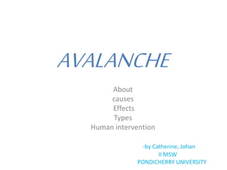
Avlanche
- 1. AVALANCHE About causes Effects Types Human intervention -by Catherine, Johan II MSW PONDICHERRY UNIVERSITY
- 2. ABOUT • An avalanche (also called a snowslide or snowslip) is a rapid flow of snow down a sloping surface. • Avalanches are typically triggered in a starting zone from a mechanical failure in the snow pack when the forces on the snow exceed its strength but sometimes only with gradually widening . • Primarily composed of flowing snow and air, large avalanches have the capability to entrain ice, rocks, trees, and other material on the slope, and are distinct from mudslides , rock slides, and serac collapses on an icefall.
- 4. Loose Snow Avalanche They are common on steep slopes and are seen “after a fresh snowfall”. Since the snow does not have time to settle down fully or has been made loose by sunlight, the snow-pack is not very solid. Such avalanches have a single point of origin, from where they widen as they travel down the slope.
- 6. Slab Avalanche Loose Snow Avalanches in turn could cause a Slab Avalanche, which are characterized by a the fall of a large block of ice down the slopes. Thin slabs cause fairly small amounts of damage, while the thick ones are responsible for many fatalities.
- 7. Powder Avalanche * Powder Snow Avalanches are a mix of the other forms, Loose Snow and Slab. * The bottom half of this avalanche consists of a slab or a dense concentration of snow, ice and air. * Above this is a cloud of powdered snow, which can snowball into a larger avalanche as it progresses down the slope. * The speed attained by this avalanche can cross 190 miles per hour and they can cross large distances.
- 8. Wet Avalanche These are quite dangerous as they travel slowly due to friction, which collects debris from the path fairly easily. The avalanche comprises of water and snow at the beginning, but understanding of avalanches has showed us that it can pick up speed with ease.
- 9. • -A powder snow avalanche in the Himalayas near Mount Everest. • A skier escaping from a falling avalanche -
- 11. Snow Storm & Wind direction The 24 hours after a storm are considered to be the most critical. Wind normally blows from one side of the slope of mountain to another side. While blowing up, it will scour snow off the surface which can overhang a mountain.
- 12. Heavy Snowfall Heavy snowfall is the first, since it deposits snow in unstable during the summer months is the leading cause of wet snow avalanches. areas and puts pressure on the snow-pack.
- 13. Human Activity Humans have contributed to the start of many avalanches in recent years. “Winter sports” that require steep slopes often put pressure on the snow-pack which it cannot deal.
- 14. Vibration and Movements The use of All Terrain Vehicles creates vibrations within the snow that it cannot withstand. The other is construction work done with explosives, which tend to weaken the entire surrounding area.
- 15. Warm Temperature Warm temperatures that can last “several hours” a day can weaken some of the upper layers of snow and cause it to slide down.
- 16. Steep Slopes Layers of snow build up and slide down the mountain at a faster rate as steep slopes can increase the speed of snow.
- 19. Damage to Life & Property A large number of casualties takes place after avalanches hit heavily populated areas. Infrastructure is damaged and the blockage caused, impacts the livelihood of many. People who enjoy skiing, snowboarding and snowmobiling are at a greater risk of losing their lives. A powerful avalanche can even destroy buildings and power supplies can be cut off.
- 20. Flash Floods When an avalanche occurs, it brings down all the debris with it and can cause havoc in low lying areas. Flash floods are seen to happen after avalanches, which is a long term problem many villagers and townspeople have to deal with.
- 21. Economic Impact An avalanche can block anything in its path and even restrict the normal movement of traffic. Various ski resorts depend on tourists to run their business successfully. Ski resorts and other businesses are forced to close until the avalanche decreases and weather conditions become suitable
- 22. HUMAN INTERVENTION(preventive measures)- • 1. Ski Resorts • 2. Fences • 3. Trees • 4. Earth Mounds(artificial changes in land level, typically made from piles of artificially placed or sculpted rocks and soil ) • 5. Snow Nets
- 23. Rescuemeasures- • Search and rescue equipment • Avalanche cords • Beacons -"beepers"/peeps/ avalanche transceivers • Shovels - digging snow pits as part of evaluating the snow pack • Avalung - consists of a mouth piece, a flap valve, an exhaust pipe, and an air collector • Other Equipment's - Emergency Position-Indicating Radio Beacon (EPIRB) or Personal Locating Beacons (PLBs) containing the Global Positioning System (GPS).