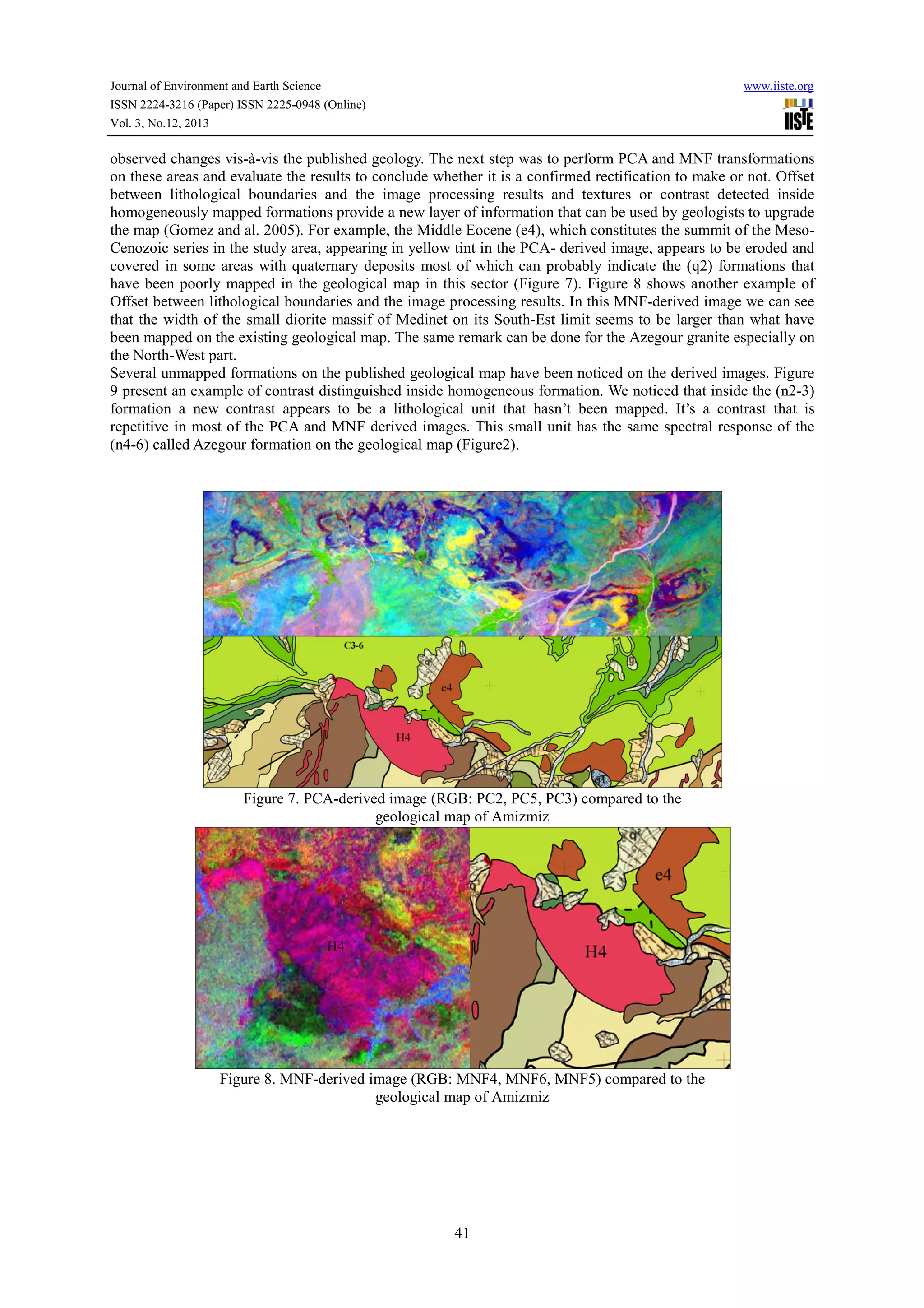
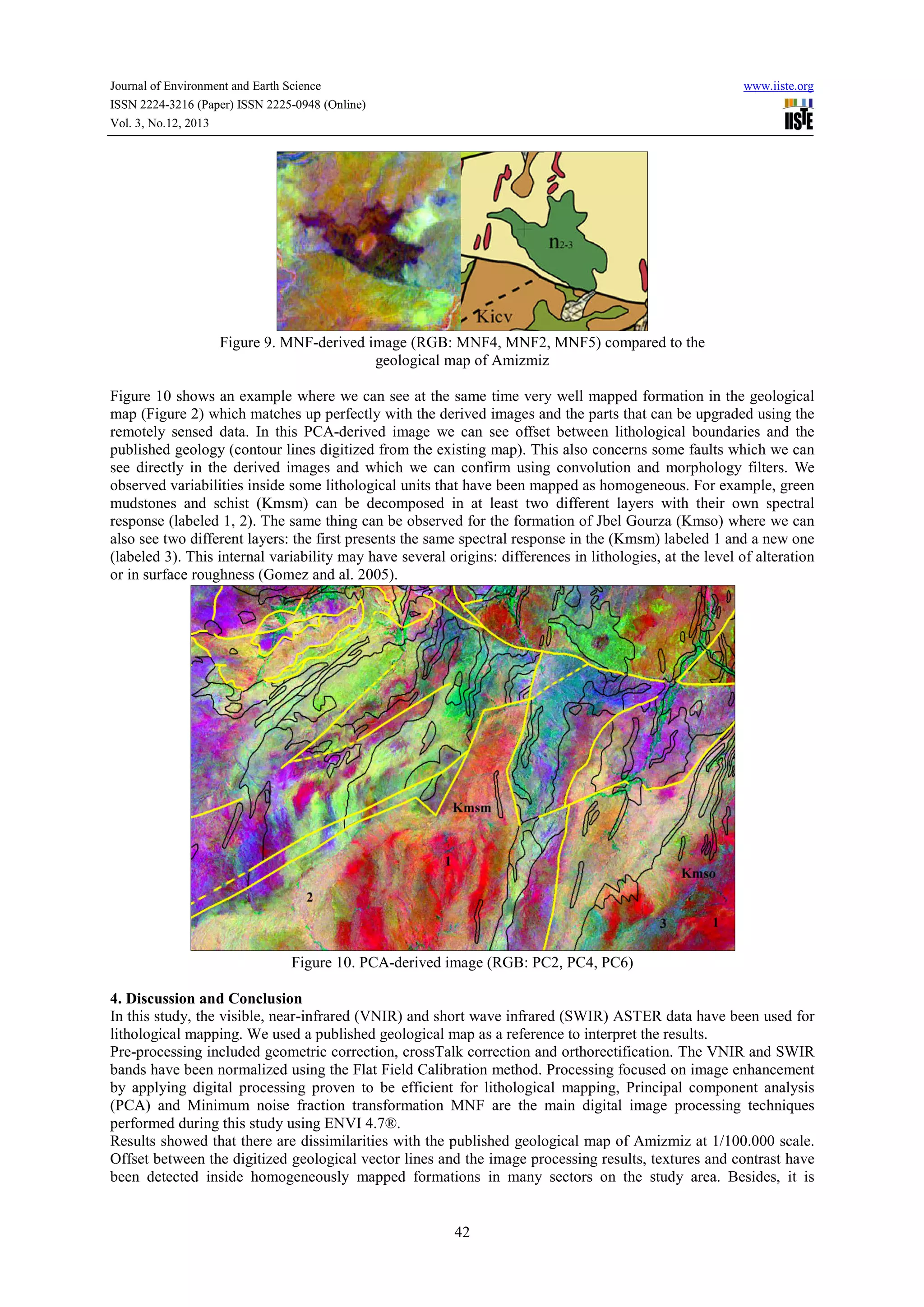
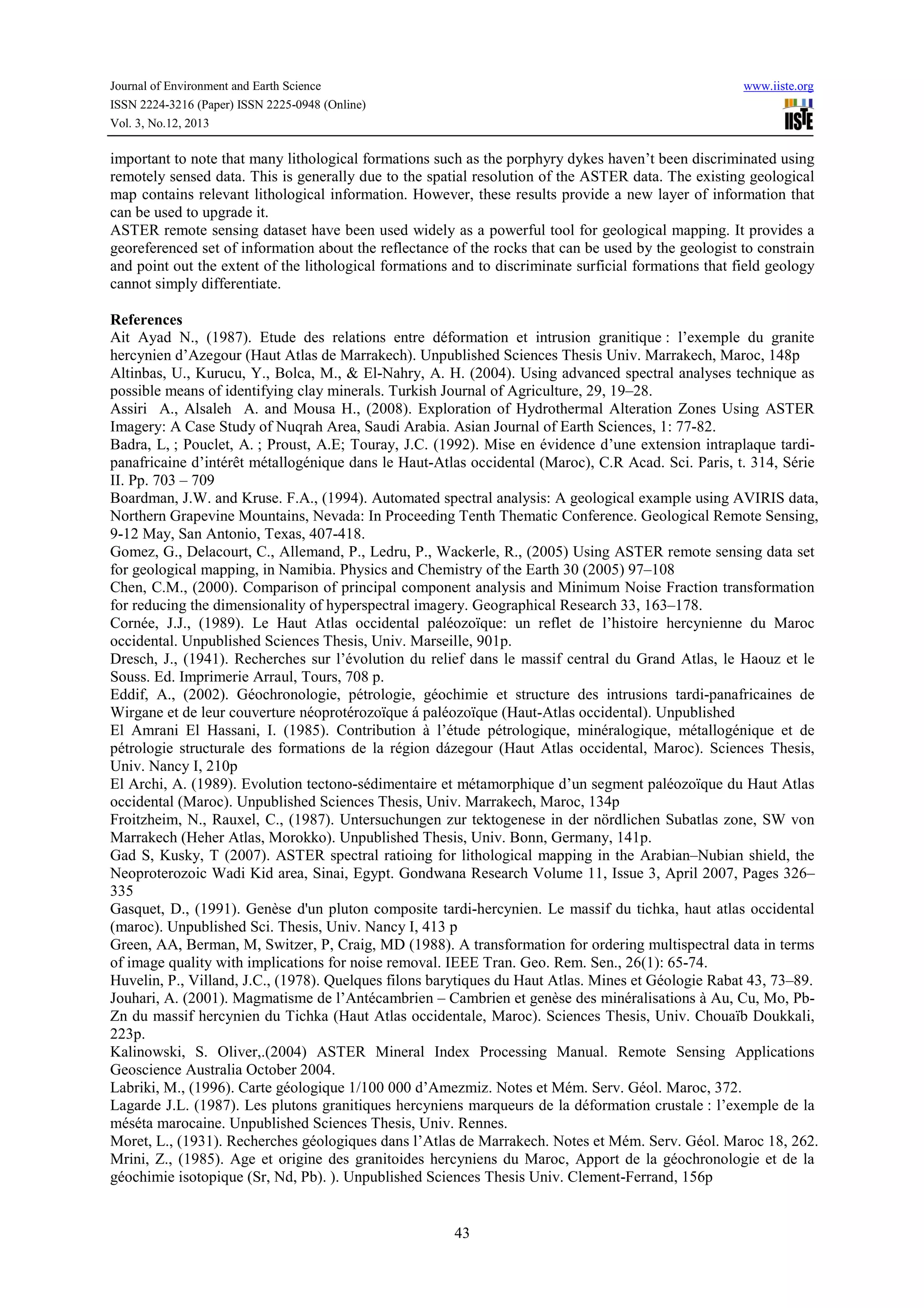
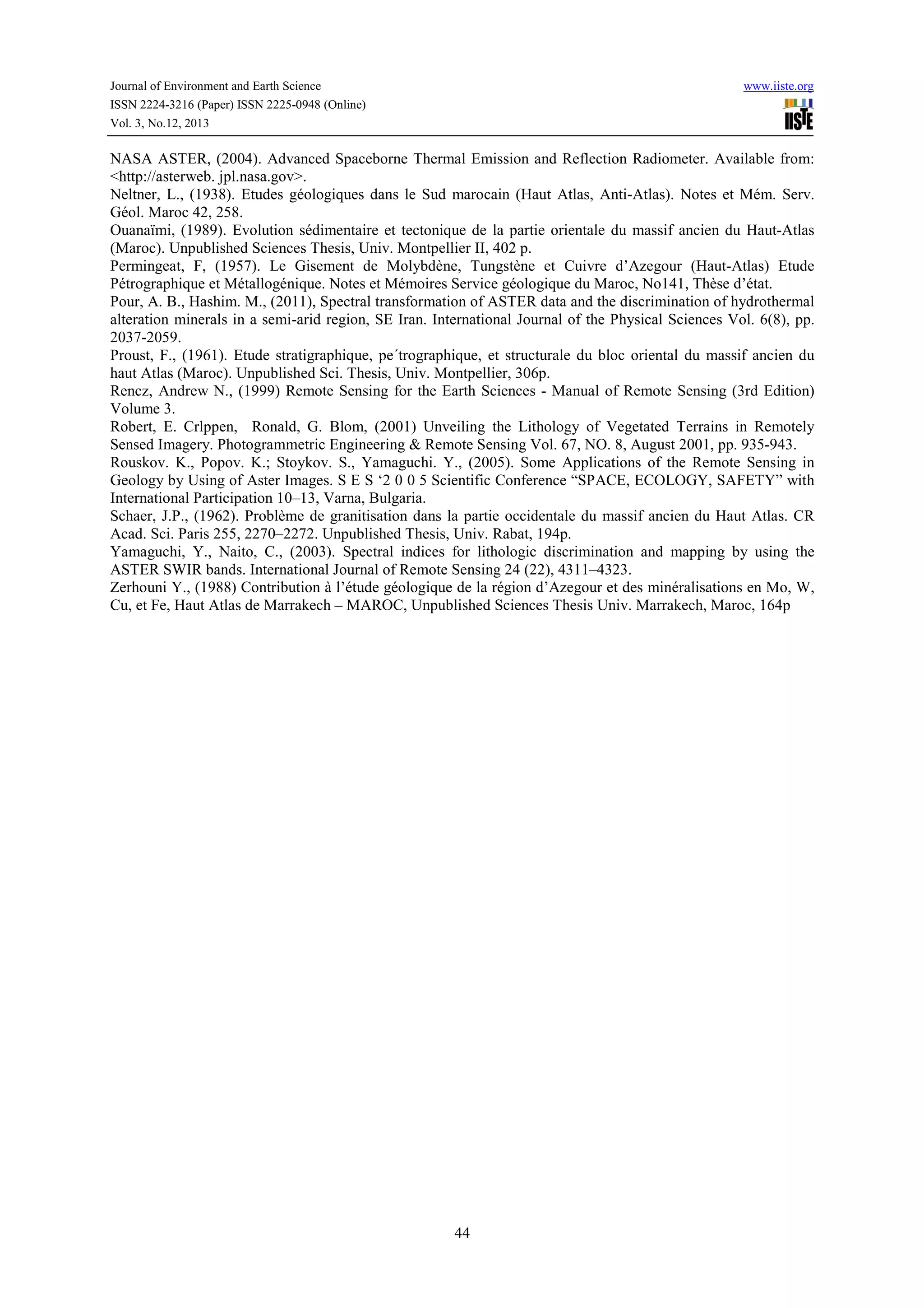
Downloaded 22 times

This document summarizes a study that used ASTER satellite imagery to map lithology in the Azegour area of the Western High Atlas mountains in Morocco. The study utilized several digital image processing techniques on ASTER visible, near-infrared, and shortwave infrared bands to enhance the imagery for lithological discrimination. Principal component analysis and minimum noise fraction transformation were applied to extract geological information. Comparison to an existing geological map found offsets between lithological boundaries and new textures/contrasts detected within mapped units. The processed ASTER imagery provided additional lithological data that could help upgrade the existing map. Thus, remote sensing was demonstrated to be a useful tool for lithological mapping.


