Downloaded 239 times
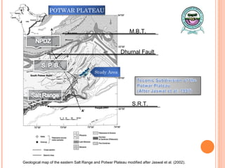
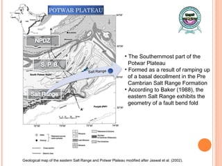
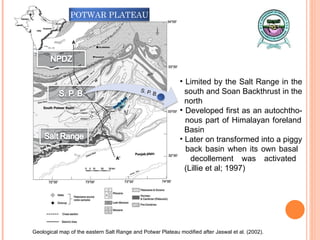
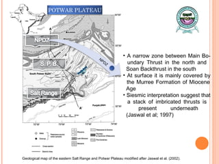
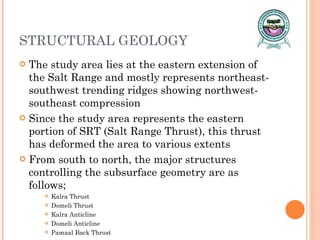
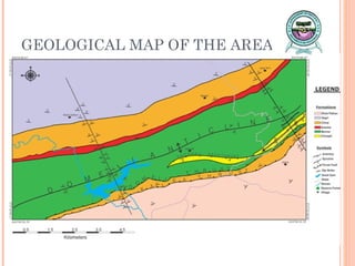
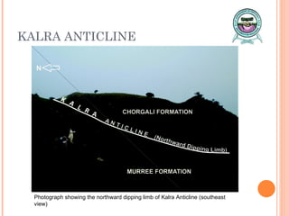
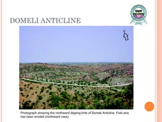


The document presents a structural investigation of the eastern salt range in Punjab, Pakistan, focusing on its geological formations and tectonic history. Utilizing GIS and remote sensing methods, it maps significant geological features, including major thrusts and folds, revealing the area's history of compression and deformation. Key findings include the identification of forethrusts and backthrusts, with implications for understanding the region's tectonic processes and stratigraphic layers.


