The Tampia Hill case study
•
0 likes•206 views

The Tampia Hill gold deposit, is located near the town of Narembeen in the Wheatbelt of Western Australia, 25 km east of Perth. Explaurum held the project from 2014 until the end of 2018 and during this period Kenex provided key services including on-site project management, interpretation of downhole wireline data, building 2D and 3D geological maps, and 3D mineral potential mapping for resource domaining and to help target grade control drilling inside the pit design. Kenex were also involved in the compilation of data over the wider area around Tampia and helping to target exploration using updated geological maps and mineral potential mapping.

Recommended
More Related Content
What's hot
What's hot (20)
Similar to The Tampia Hill case study
Similar to The Tampia Hill case study (20)
More from Kenex Ltd
More from Kenex Ltd (9)
Recently uploaded
Recently uploaded (20)
The Tampia Hill case study
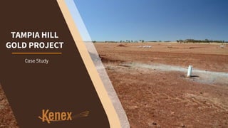
- 1. Case Study TAMPIA HILL GOLD PROJECT
- 2. The Tampia Hill gold deposit, is located near the town of Narembeen in the Wheatbelt of Western Australia, 25 km east of Perth. Explaurum Ltd held the project from 2012 (initially as Auzex Exploration Ltd) until the end of 2018. An overview of the main work undertaken at Tampia by Kenex for Explaurum TAMPIA HILL 2012-2018 EXPLAURUM LTD The Tampia deposit has a 2017 JORC-compliant Indicated Resource of 7.7 Mt @ 1.7 g/t for 420,000 oz and an Inferred Resource of 0.13 Mt @ 1.8 g/t for 7,400 oz for a total of 8.2 Mt @ 1.7 g/t for 460,000 oz. Kenex provided key services including on-site project management, interpretation of downhole wireline data, building 2D and 3D geological maps, and 3D mineral potential mapping for resource domaining. Kenex were also involved in the compilation of data over the wider area around Tampia and helped to target exploration using updated geological maps and mineral potential mapping.
- 3. THE TAMPIA HILL TIMELINE 2012 FIELD WORK AND DRILLING DATABASE MANAGEMENT DOWNHOLE OTV INTERPRETATION GEOLOGICAL MAPPING 3D GEOLOGICAL MAPPING 2D MINERAL POTENTIAL MAPPING 2018 TENEMENT ACQUISITION 3D MINERAL POTENTIAL MAPPING
- 4. FIELDWORK Drilling of the project area commenced in 2014, overseen by geologists from Kenex and RSC. By 2017, Kenex was focussed on modelling as well as OTV data compilation and interpretation. Kenex geologists continued regular site visits to the Tampia project to meet up with the on-site geologists and discuss progress and planning the next steps. Back to Timeline
- 5. TAMPIA HILL DATABASE The Tampia Hill project database began life as a Microsoft Access database in 2014 in order to store both historical geochemistry and drill holes data and new drill hole data from the Explaurum campaigns. A relational database was created, using hole and sample ID as unique identifiers to tie in all datasets generated by the drilling, downhole data acquisition and sample assay processes. Queries were set up to facilitate simple exports for 3D modelling and downhole logging purposes. By 2017, the database management had progressed through an update with RSC and was then managed on site by Explaurum as an SQL based proprietary database with an industry-standard format. Kenex assisted Explaurum to move all the data to the new format and continued to assist with importing, exporting and verifying the data. Design, management, maintenance and migration Back to Timeline
- 6. INTERPRETING DOWNHOLE DATA OTV and physical property logging was interpreted by Kenex during the second drill programme. Downhole logging of density and natural gamma radiation was very helpful for attributing the geology and structural measurements were used to orient the extended drill programmes. DOWNHOLE LOGGING AND OTV INTERPRETATION By combining on-site logging of lithology with data from downhole tools used in the field, the exploration team was able to take a significant step towards a more complete understanding of the geology at Tampia Hill. UNDERSTANDING GEOLOGY As more RC drilling was undertaken, downhole logging and OTV data was collected and interpreted to expand and add detail to the 3D geological model. The structural trends observed were used to plan a resource drilling programme and generate a 3D geological map. PLANNING RESOURCE DRILLING Back to Timeline
- 7. GEOLOGICAL MAPPING Desktop-based When exploration began at Tampia Hill, the geology and structural history were poorly understood, mainly due to farming activity and lack of outcrop. Drilling and geophysical methods were vital for the interpretation of the underlying lithology, and structures have also provided critical information about the general geology and mineralisation of the area. Remapping the geology over the wider area around the Tampia prospect using newly acquired high resolution gravity and magnetic data was critical to enable effective targeting of the mineralisation at Tampia. Back to Timeline
- 8. 3D GEOLOGICAL MAPPING Regional 3D structural modelling was undertaken, based on the regional geological map, regional geophysical data, as well as exploration RC drilling and downhole logging at prospects identified by the 2D mineral potential map. The 2D and 3D geology maps were continuously updated as new data was collected and used to guide active and future drilling. Back to Timeline
- 9. Back to Timeline 2D MINERAL POTENTIAL MAPPING LOOKING FOR GOLD OCCURRENCES SIMILAR TO TAMPIA IN THE AREA Kenex led the search for potential targets around the greater Tampia area, using geophysical surveys, satellite and exploration data to update the regional geological map. 2D mineral potential modelling was also undertaken over the larger exploration area. The resulting mineral potential map confirms that the gravity data not only provides critical geological data, but also allows identification of high priority targets for future exploration using spatial data modelling techniques. The strong correlation between combined high gravity-low magnetic signatures to known gold mineralisation confirms that gravity can be a robust predictor of gold mineralisation in the Tampia region. The results have highlighted several untested areas with similar gravity signatures and anomalous gold geochemical signatures to that at the Tampia Hill gold deposit.
- 10. 3D MINERAL POTENTIAL MAPPING As 40 x 40 m RC and DD resource drilling progressed over the Tampia Hill prospect, Kenex generated a 3D mineral potential model based on the current 3D geological map and the results of the regional 2D mineral potential mapping. The purpose of this prospect-scale 3D mineral potential model was to assist with the domaining of the resource model. The resource and domain models were further tested with a 10 x 10 m infill drilling programme, which identified that the domain model aids considerably in interpreting continuity of the gold mineralisation. The 3D potential work on domains was not incorporated into the resource estimations due to the takeover of the company in 2018. Back to Timeline
- 11. WWW.KENEX.COM.AU Andrew@Kenex.com.au Creating opportunities in the spatial world