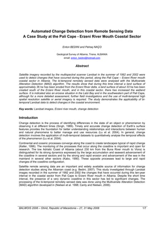
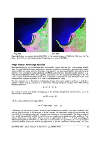
This document summarizes a study that used Landsat satellite imagery from 1992 and 2002 to detect changes along the Pali Cape - Erzeni River mouth coastal sector in Albania. The Multivariate Alteration Detection algorithm was used to analyze the bi-temporal imagery. The results showed that approximately 36 hectares of land was eroded from the Erzeni River delta, around 33 hectares of new land was created south of the river mouth, and wetland area increased. Erosion was also indicated in Lalzi Bay and the southwestern part of Pali Cape. The study demonstrated that bi-temporal Landsat data can be used to detect coastal environmental changes over time.