


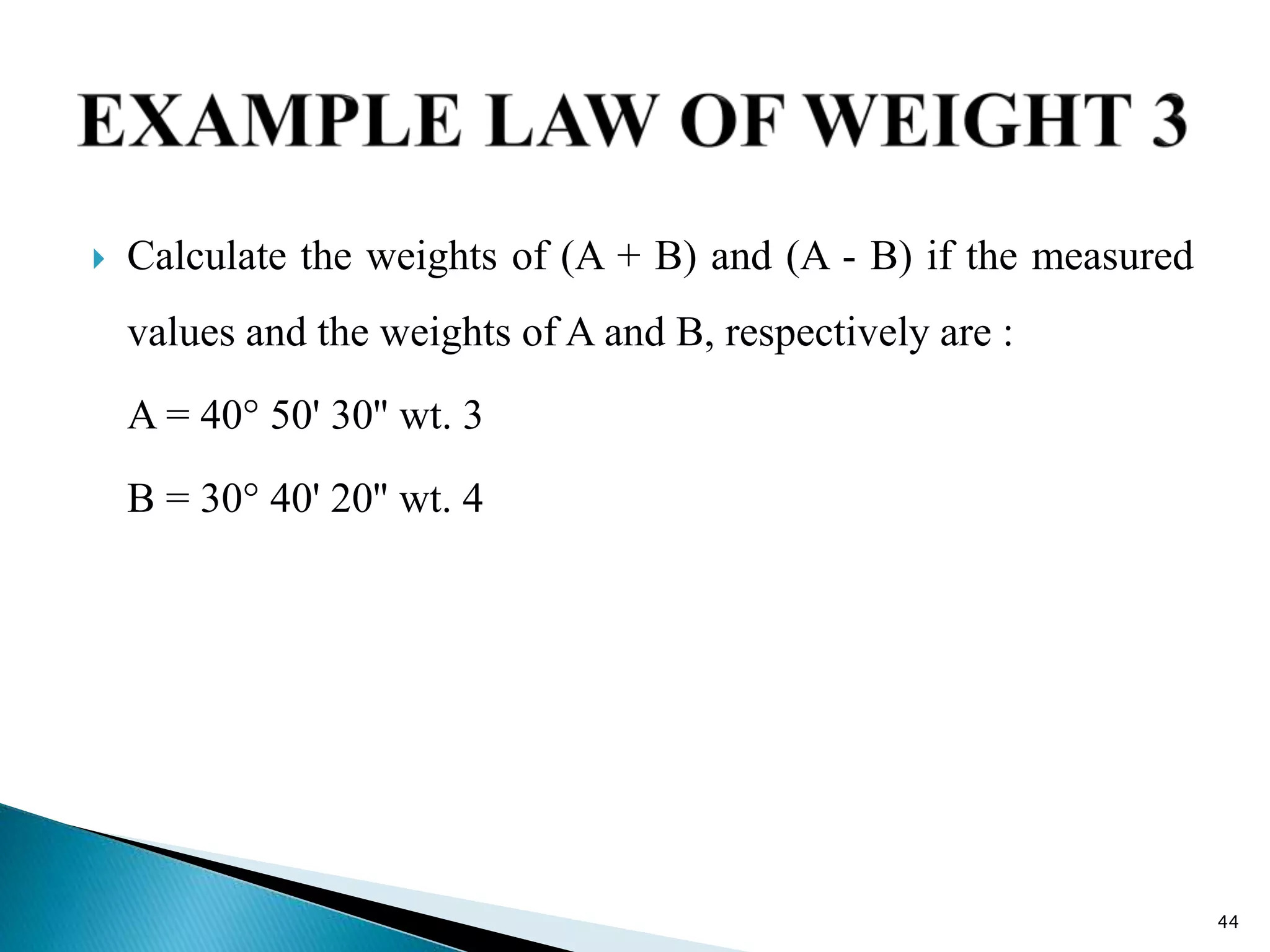
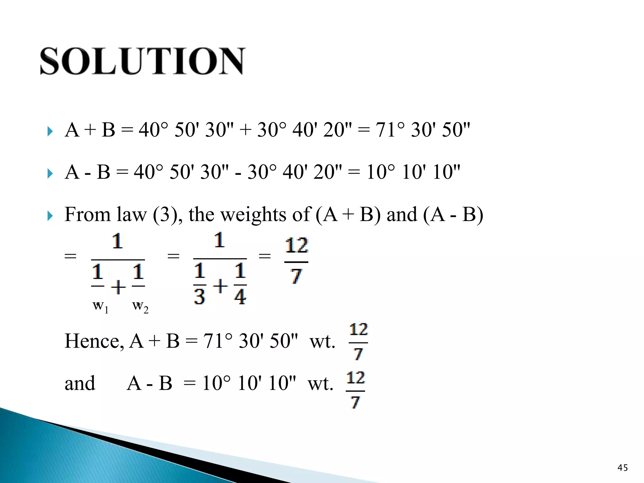


![ Calculate the weight of the equation (A + B) if weight of
(A + B) is . The observed value of (A + B) is 120° 20' 40''
Solution :
As the equation is being multiplied by its own weight, from
rule (7), the weight of { w (A + B) } will be if the w is the
weight of (A + B).
Weight of [ (A + B) = 90° 15' 30'']= =
53](https://image.slidesharecdn.com/8-210408060646/75/8-THEORY-OF-ERRORS-SUR-3140601-GTU-53-2048.jpg)


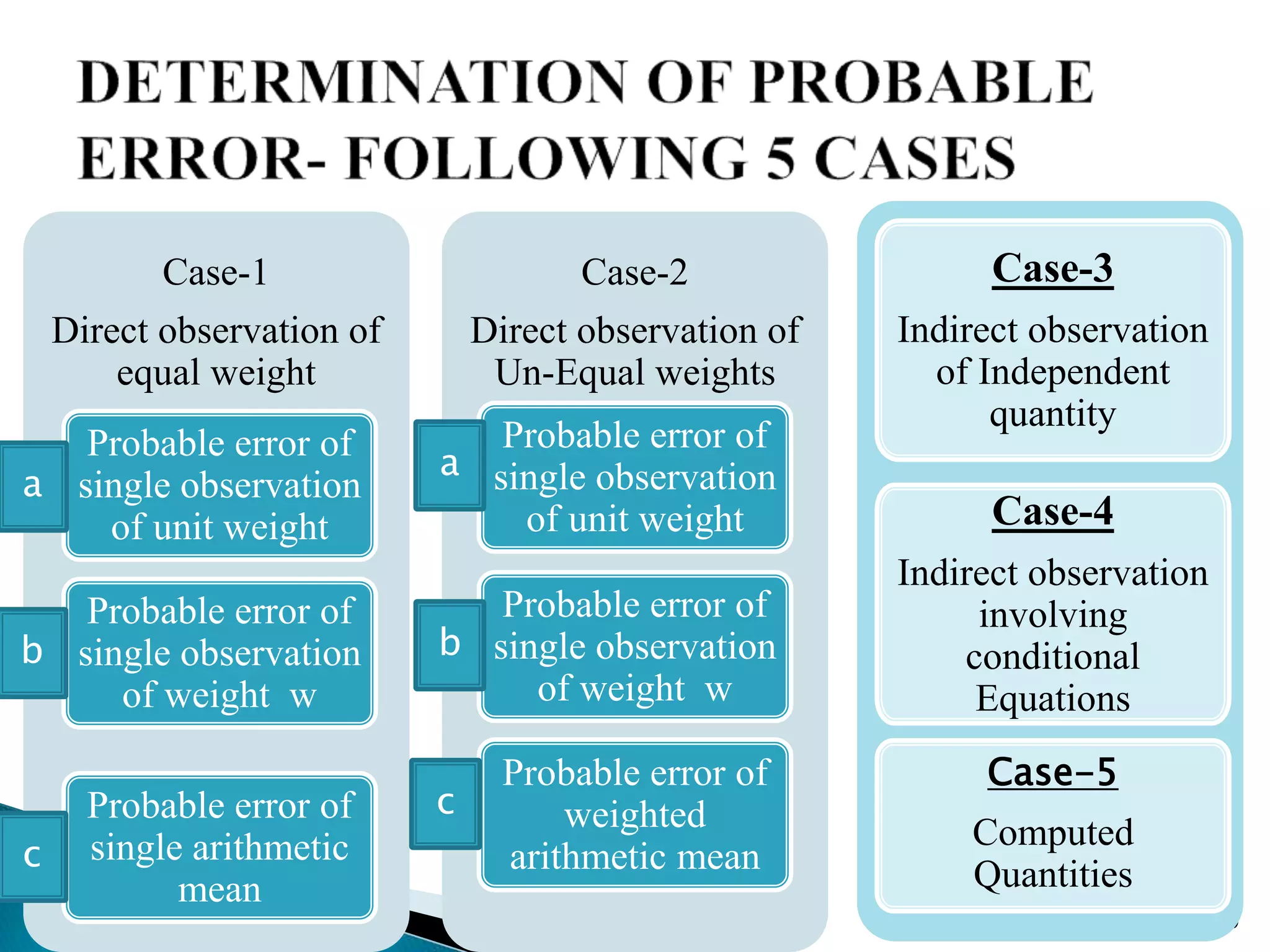
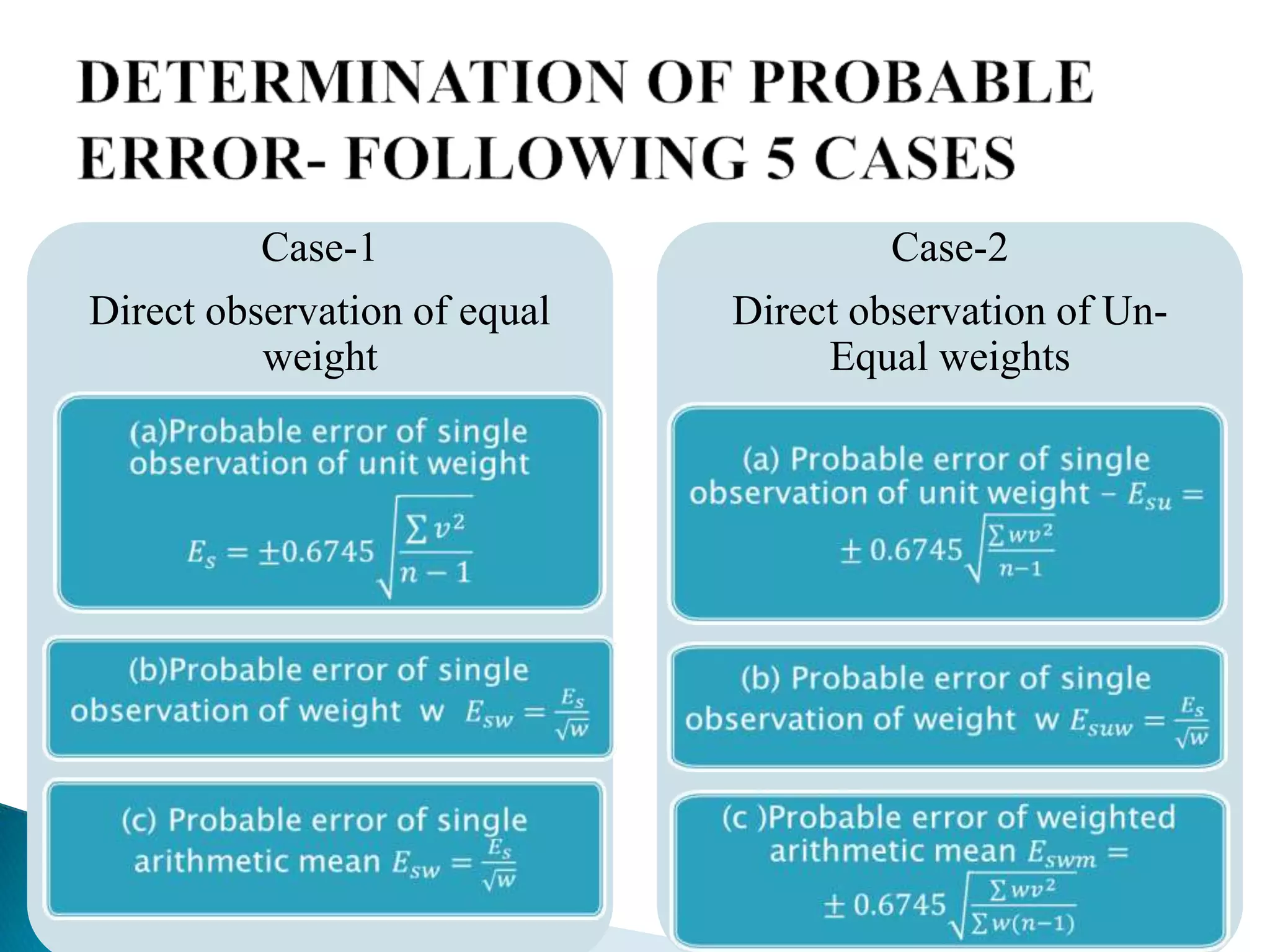
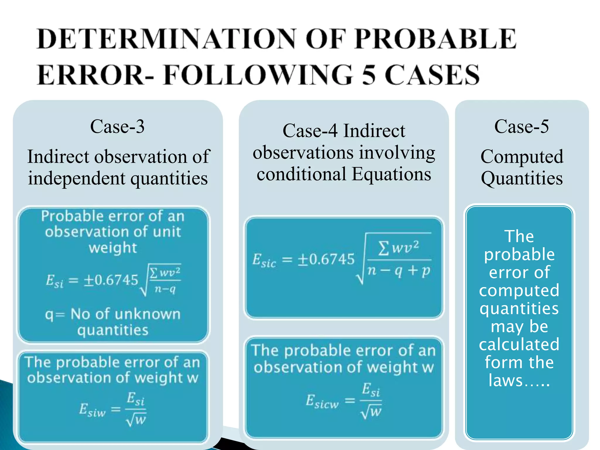
The document outlines the processes and challenges of measuring distances and angles in surveying, highlighting the various types of errors that can occur such as gross, systematic, and accidental errors. It discusses methods for identifying and correcting these errors, the importance of precision, and the principles of probability in error analysis. Additionally, it explains the concept of weights in observations and introduces the method of least squares for determining the most probable values in measurements.