The document provides an introduction to hydrology, including:
- Defining hydrology as the science studying the water cycle and flows between the atmosphere, land, and oceans.
- Describing the key elements of the water cycle, including precipitation, infiltration, evaporation, and the spatial and temporal scales involved.
- Noting that the water cycle sustains life on Earth, shapes its surface, and regulates the climate.
Hydrographs show changes in river discharge over time in response to rainfall. They are constructed by measuring river discharge during and after storms. A typical hydrograph has a rising limb as discharge increases, peaks at maximum discharge, then declines on the recession limb. Analysis of hydrographs can predict flooding and inform flood prevention. Characteristics like basin area, slope, soil, land use, and rainfall patterns influence a hydrograph's shape and timing.
This document provides an overview of engineering hydrology. It discusses key hydrological concepts like the hydrologic cycle, precipitation types, rainfall measurement techniques, analysis of rainfall records, runoff calculations, and abstraction from rainfall through processes like evaporation and infiltration. Specifically, it defines hydrology, describes the major components of the hydrologic cycle, discusses common rainfall measurement gauges and methods to estimate rainfall over a catchment. It also covers factors influencing runoff, empirical runoff calculation formulas like the Rational Method, and the major types of hydrological abstractions.
- A hydrograph shows the rate of water flow over time at a specific point along a river or channel. It is used in sewer system design.
- The main components of a hydrograph are the rising limb, peak discharge, recession limb, lag time, time to peak, and discharge rate.
- A unit hydrograph represents the runoff from 1 unit of effective rainfall over a given watershed's duration. It allows prediction of runoff from different rainfall amounts. Synthetic unit hydrographs use watershed characteristics to model ungauged areas.
This document discusses hydrographs and unit hydrographs. It defines a hydrograph as a graph showing the rate of flow versus time past a specific point in a river. It notes that hydrographs are commonly used in sewerage design. It then describes the components of a hydrograph including the rising limb, recession limb, peak discharge, lag time, and time to peak. Finally, it discusses unit hydrographs, defining a unit hydrograph as the runoff resulting from 1 unit of rainfall excess. It provides examples of deriving unit hydrographs from observed hydrographs and flood hydrographs.
The document discusses hydrographs, which record river discharge over time and show how rivers respond to rainstorms. It defines hydrographs as measuring river discharge through cross-sectional area times mean velocity. There are different types of hydrographs like storm, flood, and annual hydrographs. Analyzing hydrographs helps predict flooding events by finding discharge patterns of drainage basins, which can influence flood prevention measures.
Stream flow representing the runoff phase of the hydrologic cycle is the most important basic data for hydrologic studies. Runoff is generated by rainstorms. Its occurrence and quantity are dependent on the characteristics of the rainfall event, i.e. intensity, duration and distribution. This module highlights about runoff components of the hydrological cycle.
Introduction, hydrologic cycle, climate and water m1Bibhabasu Mohanty
Introduction, Hydrologic cycle, Climate and water availability, Water balances,
Precipitation: Forms, Classification, Variability, Measurement, Data analysis, Evaporation and its measurement, Evapotranspiration and its measurement, Penman Monteith method. Infiltration: Factors affection infiltration, Horton’s equation and Green Ampt method.
Measurement of rainfall is done using rain gauges, which collect precipitation and allow the amount to be measured. Non-recording rain gauges, like the commonly used Symons gauge in India, collect rainfall in a vessel that is read daily to determine the amount of precipitation. Recording rain gauges produce a continuous plot of rainfall over time through mechanisms like tipping buckets, weighing the collected water, or tracking a float level. Proper placement and regular maintenance of rain gauges is important for accurate measurement of precipitation.
The document discusses methods for flood control, including controlling water levels through dams and check dams, building barriers like levees and flood walls, altering river channels by straightening or widening them, controlling land use around rivers, and using floodways. It provides details on reservoirs, levees, and floodways as specific flood control techniques. Levees are described as earthen embankments built between rivers and protected areas to restrict flood water flow, with considerations for their height and freeboard. The Mississippi River levee system is highlighted as one of the largest in the world.
Precipitation occurs when moisture from the atmosphere reaches the Earth's surface. There are several types of precipitation including rain, snow, hail, fog, dew, mist, glaze, rime, and sleet. Precipitation forms through convectional, orographic, and cyclonic/frontal mechanisms. Rainfall and snowfall are most commonly measured using non-recording and recording rain gauges, which collect precipitation and allow measurement of amount, intensity, and duration. Proper siting and placement of rain gauges is important to obtain accurate precipitation measurements.
Hydrological cycle- Meteorological measurements – Requirements, types and forms of Precipitation-Rain Gauges-Spatial analysis of rainfall data using Thiessen and Isohyetal methods Infiltration-Infiltration Index-Interception-Evaporation, Watershed, catchment and basin - Catchment characteristics - factors affecting runoff – Runoff estimation using empirical
Flood control refers to methods used to reduce or prevent flood damage. Some key flood control methods include dams, diversion canals, self-closing flood barriers, river defences, and coastal defences. Dams are designed to control floods by reserving space in reservoirs to store floodwaters. Diversion canals redirect excess water to less impacted areas. Self-closing barriers deploy automatically during floods to protect areas. River defences like levees and weirs hold back high water. Coastal flooding is addressed with structures like sea walls.
This document provides an overview of key concepts in surface water hydrology. It defines surface water hydrology and discusses watersheds, overland flow, rivers, lakes, sediment transport, water measurement, flood events, and the use of GIS mapping. Key terms are defined such as runoff, infiltration, river morphology, lake zones, discharge measurement, flood frequency, and probable maximum precipitation. Diagrams illustrate watersheds, hillslope flow, river cross-sections, lake layers, and more. Equations for rational formula and discharge calculation are also presented.
This document provides an introduction to hydrology. It discusses the hydrologic cycle and its components like evaporation, transpiration, infiltration, etc. It also discusses different types of precipitation like rain, snow, drizzle and methods of precipitation classification. Measurement of rainfall using rain gauges and estimation of rainfall for areas between gauges using methods like arithmetic mean, Thiessen polygon and isohyetal maps are described. Optimum density of rain gauges for different terrains is also mentioned.
The document defines key terms related to watersheds and runoff. It explains that a watershed is an area of land that drains into a common body of water, while a river basin is made up of many watersheds draining into a river and its tributaries. Runoff is defined as the portion of precipitation that flows overland as surface runoff or subsurface flow instead of infiltrating the soil. The factors that affect the amount of runoff are described, including precipitation characteristics, catchment shape and size, topography, geology, meteorology, land use, and storage features.
1. Flooding in India is primarily caused by heavy rainfall during the monsoon season from June to October, which exceeds the capacity of rivers to contain the flows.
2. Structural flood mitigation measures include embankments, levees, flood walls, channel improvements, and diversion works to contain flood waters. Non-structural measures include flood plain zoning, forecasting, and proofing.
3. Flood damage analysis considers both tangible losses that can be estimated monetarily, such as property and crops, as well as intangible losses which are more difficult to value, like loss of life, health impacts, and social effects.
This document discusses various methods of irrigation, including surface irrigation methods like furrow irrigation, contour farming, and flooding methods. It also discusses subsurface irrigation methods like sprinkler irrigation and drip/trickle irrigation. For each method, it describes the basic components and process, as well as advantages and disadvantages. Surface irrigation methods are best suited for row crops, while sprinkler and drip irrigation methods reduce evaporation and allow more precise water and fertilizer application. Drip irrigation in particular minimizes water usage and loss. The document emphasizes matching the appropriate irrigation method to field and crop conditions.
1. Distribution of Runoff
2. Hydrograph Analysis
a) Hydrograph & Unit Hydrograph
b) S - Hydrograph & Synthetic Unit Hydrograph
3. Computation of Design Discharge
a) Rational Formulae
b) SCS Curve Number Method
4. Flood Frequency Analysis
5. Flood Routing
A study confined to the lower tapi basin in Gujarat, India to find out the primary causes for 2006 floods in Surat city. The study involves collection of topographical data from the local geological survey organization, rainfall data from meteorological department of india and the application of HEC-HMS software from US Army corps of engineers to identify the primary cause of the runoff.
- Open channel flow occurs in natural settings like rivers and streams as well as human-made channels. It is characterized by a free surface boundary.
- Flow can be uniform, gradually varied, or rapidly varied depending on changes in depth and velocity over distance. Uniform flow maintains constant depth and velocity.
- Important parameters include the Froude number, specific energy, and wave speed. Hydraulic jumps and critical flow occur when the Froude number is 1.
- Flow is controlled using underflow gates, overflow gates, and weirs. Measurement relies on critical flow assumptions at weirs.
1) A pumping test was conducted where a well was pumped at 2500 m3/day and drawdowns were measured in an observation well 60 m away at various times.
2) The transmissivity and storativity of the confined aquifer were estimated using the Theis and Cooper-Jacob methods in AquiferTest software by analyzing the linear relationship between the logarithm of time and drawdown.
3) The accuracy of the aquifer parameter estimates depends on maintaining a constant pumping rate and measuring drawdowns at appropriate time intervals in multiple observation wells.
This document discusses runoff and provides definitions, processes, types, factors affecting runoff, and methods to estimate runoff. It defines runoff as the portion of precipitation that flows towards rivers and oceans as surface or subsurface flow. The key types of runoff discussed are surface runoff, subsurface/interflow, and baseflow. Factors affecting runoff include precipitation characteristics, catchment characteristics, topography, geology, and storage features. Methods to estimate runoff include direct measurement and indirect methods like empirical formulas, the rational method, and unit hydrograph analysis.
This document provides an overview of hydrology and related concepts. It defines hydrology as the study of water on Earth, describes the hydrologic cycle of evaporation, precipitation, and runoff, and identifies the major sources and components of water. Measurement tools like rain gauges and types of precipitation such as orographic, convective, and cyclonic are explained. Factors affecting rainfall and important hydrologic terminology are also defined.
Hydrology and water management(EVAPORATION & INFILTRATION)...Nasir Uddin
The document discusses evaporation and infiltration, which are major losses from precipitation. It defines evaporation as the process where water is converted from liquid to vapor and returns to the atmosphere. Infiltration is the process where precipitation water seeps into the soil. Several factors affect each process, and various methods are used to measure and estimate evaporation and infiltration rates, including pans, lysimeters, and equations like Horton's equation. The Φ index and W index provide simplified measurements of infiltration rates.
This document discusses techniques for measuring stream flow. There are two main categories of measurement: direct determination using area-velocity methods, dilution techniques, electromagnetic and ultrasonic methods; and indirect determination using hydraulic structures like weirs, flumes and gates or slope-area methods. Velocity is an important aspect measured using current meters, which are the most commonly used instruments. Current meters consist of rotating cups or propellers connected to mechanisms that count revolutions to determine flow velocity. Floating objects can also be used to estimate surface velocities. Accurate stream flow measurement is important for hydrologic studies.
Short power point made by AS/A Level students with the aim of explaining Storm Hydrographs and the foundations of the Drainage Basin Hydrological Cycle.
The document discusses various topics related to freshwater and saltwater habitats on Earth. It describes how fresh water makes up a small percentage of the total water on Earth, found in lakes, ponds, rivers and streams. It also discusses the water cycle, how water is constantly recycled from clouds to ground and back again. Finally, it touches on how human activities like pollution can negatively impact water quality in oceans.
The hydrosphere refers to all the water on, under, and over the surface of the Earth, including oceans, seas, lakes, rivers, groundwater, and water in the atmosphere. It makes up about 0.023% of the Earth's total mass and covers around 70% of the Earth's surface. Water circulates through the hydrosphere in the water cycle, driven by energy from the sun that evaporates water from oceans, rivers, and lakes, where it rises into the atmosphere and condenses to form rain or snow and returns to Earth. The hydrosphere supports all life on Earth and its motion influences climate patterns globally.
The hydrosphere refers to all the water on, under, and over the surface of a planet, including the oceans, seas, lakes, rivers, ice caps, groundwater, and atmospheric water vapor. It makes up about 1% of Earth's total mass and covers about 70% of Earth's surface. The hydrosphere is always in motion through various processes of the water cycle, with water circulating between the oceans, atmosphere, and land through evaporation, condensation, precipitation, and runoff. Water pollution from human and natural sources threatens the hydrosphere by contaminating water bodies.
Mass movement and erosion reshape Earth's surface by transporting weathered materials downhill. Mass movement includes landslides, creep, slumps, earthflows, and mudflows. Climate affects erosion rates - humid regions experience more water erosion, resulting in rounded topography, while dry areas have sharper features. Studying past lahar deposits can help prevent future damage from lahars in communities near volcanoes. Gravity causes downhill movement of material, while friction opposes gravity and holds rocks in place on slopes.
The document summarizes key aspects of Earth's hydrosphere and water pollution. It describes the formation of Earth's hydrosphere through comet and asteroid bombardment. It also discusses the water cycle, distribution of Earth's water in oceans, ice caps, groundwater, and other bodies. Water pollution is introduced as contamination from sources like sewage, fertilizers, and chemicals that affect aquatic life. The causes and types of water pollution like thermal, oil spills, and radioactive pollution are outlined. Overall, the document provides a broad overview of Earth's hydrosphere and the major issues surrounding water pollution.
The document discusses the Earth's hydrosphere and water pollution. It defines the hydrosphere as including all liquid and frozen surface waters, groundwater, and atmospheric water vapor. It notes that the hydrosphere regulates the distribution of fresh water on Earth through the water cycle and purification processes. However, it also discusses how human water pollution activities have seriously impacted the components of the hydrosphere.
The document discusses Earth's hydrosphere and water pollution. It begins by explaining theories about the formation of Earth's hydrosphere and how much of Earth's water originated from comets and asteroids. It then discusses the history of ice ages and the current ice age. It also discusses Europa's subsurface ocean and the water cycle, how water circulates through evaporation and precipitation. It ends by explaining the sources and impacts of water pollution, including groundwater pollution and the causes of water pollution like chemicals, pathogens, and temperature changes.
ES 1010, Earth Science 1 Course Learning Outcomes for.docxaryan532920
ES 1010, Earth Science 1
Course Learning Outcomes for Unit V
Upon completion of this unit, students should be able to:
7. Compare the geography, composition, circulation, and temporal cycles of the oceans.
Reading Assignment
Chapter 9:
Oceans: The Last Frontier
Chapter 10:
The Restless Ocean
Watch the following video:
Williams, C. [IDT-CSU]. (2015, August 7). Coastal processes [Video file]. Retrieved from
https://youtu.be/ZO07SgCFKWs
Click here to access a transcript of the video.
NASA Goddard. (2008, October 24). In the zone. Retrieved from https://youtu.be/lB1FADETAyg
Unit Lesson
It is easy to see why Earth is referred to as the “Blue
Planet”—71% of the Earth’s surface is covered by
oceans and seas. However, less than 5% of our
oceans have been explored (National Oceanic and
Atmospheric Administration [NOAA] 2014). So
essentially, most of our Earth is still unexplored and
largely unknown. We do know that oceans contain the
highest mountains, the deepest trenches, and the
longest mountain ranges. On average, the ocean
depth is about four times the average elevation of
continents. In fact, Lutgens & Tarbuck (2014) state that
if the Earth’s continents were perfectly flat, they would
be completely submerged under more than 2,000
meters of seawater!
Oceanography is the branch of science that studies
the world’s oceans. It includes geology, chemistry,
physics, and biology (Lutgens & Tarbuck, 2014).
Oceanographers started mapping the oceans floors as
early as 1872 by dropping weighted lines down to the
ocean bottom at random points. The use of sound navigation and ranging (sonar) began during World War I
to detect enemy submarines, and was later improved during World War II. Sonar uses the echo of sound
waves to plot the profile of the ocean floor. Satellite radar technology has also contributed to mapping the
ocean floor. Today, we have a fairly good picture of the ocean floor topography.
As we study the ocean floor, we notice three major features: continental margins, basin floors, and mid-
oceanic ridge. The continental margins can be classified as active or passive. Active margins are where the
UNIT V STUDY GUIDE
Oceans
An iceberg captured on camera during a 30-day mission in
2012 to map areas of the Arctic aboard the NOAA Ship
Fairweather (NOAA, 2013).
https://online.columbiasouthern.edu/CSU_Content/courses/General_Studies/ES/ES1010/15N/UnitV_CoastalProcesses.pdf
ES 1010, Earth Science
UNIT x STUDY GUIDE
Title
ocean lithosphere is subducted beneath the continental crust (recall what you learned in Units III and IV).
These are mainly found around the Pacific Ocean. Passive margins are those that are not experiencing plate
tectonic activity and have more stable topography. Basin floors make up about 30% of the Earth’s surface
(Lutgens & Tarbuck, 2014). These areas are between the margins and the mid-ocean ridges and include
deep trenches, under ...
The document discusses Earth's hydrosphere and water pollution. It begins by explaining theories about the formation of Earth's hydrosphere and how much of its water originated from comets and asteroids. It then discusses the history of ice ages and the current ice age. It also describes Europa's subsurface ocean and the possibility of an ocean on Ganymede. The document ends by covering various sources of water pollution including industrial, agricultural, and residential runoff that contaminates water bodies.
The document discusses Earth's hydrosphere and water pollution. It begins by explaining theories about the formation of Earth's hydrosphere and how much of its water originated from comets and asteroids. It then discusses the history of ice ages and the current ice age. It also describes Europa's subsurface ocean and the possibility of an ocean on Ganymede. The document ends by explaining various sources of water pollution including industrial, agricultural, and residential runoff and how this affects both surface and groundwater.
Source and distribution of dissolved radium in the bega riverestuary, southea...trabajomuestreo
This document describes a study of radium isotopes in the Bega River estuary in Australia. Measurements of radium-224, radium-223, radium-226, and radium-228 were made in surface water and sediment porewater to understand the source and distribution of dissolved radium in the estuary. The results show that bottom sediments are a major source of radium to the estuary surface waters, with radium accumulating in porewater and mixing into surface waters via tidal exchange. A model was applied to estimate the daily flux of porewater crossing the sediment-water interface, about 15% of the total estuary volume.
Our environment consists of living and non-living components that interact in complex ways. Humans rely on healthy ecosystems, but our activities have disrupted natural cycles and caused pollution. Key issues include climate change from greenhouse gas emissions, which risks a runaway warming effect. While scientists agree human activity contributes to current warming trends, fully predicting climate impacts remains challenging given its complexity. Maintaining sustainable resource use requires understanding our role within natural systems.
Our environment consists of living and non-living components that interact in complex ways. Humans rely on healthy ecosystems, but our activities have disrupted natural cycles and caused pollution. Key issues include climate change from greenhouse gas emissions, which risks a runaway warming effect. While scientists agree human activity contributes to current warming trends, fully predicting climate impacts remains challenging due to its complexity. Maintaining sustainable resource use requires awareness of our footprint on ecological systems.
The document discusses the hydrosphere and water pollution. It defines the hydrosphere as the liquid water component of Earth, including oceans, seas, lakes, rivers, and streams, which covers 70% of the planet. The hydrosphere is in constant motion due to ocean currents driven by factors like temperature, salinity, and wind energy transfer. The document then discusses how water pollution has increased as the human population has grown and industrialized, threatening the quality of both surface waters and underground aquifers, with over half of Iowa's groundwater wells found contaminated in 1996.
This document discusses how the spectral reflectance of water bodies can provide information about water characteristics and pollutants. Water reflectance is influenced by factors like dissolved materials, suspended sediments, depth, and surface roughness. Different water bodies appear different colors due to these factors, like blue lakes reflecting sky color, green rivers containing algae, and the Red Sea occasionally appearing red from algal blooms. The Seasat satellite used sensors including visible, infrared, and synthetic aperture radar to remotely measure these spectral reflectance properties and monitor ocean conditions over large areas.
36002 Topic SCI 207 Our Dependence upon the EnvironmentNumber.docxrhetttrevannion
36002 Topic: SCI 207 Our Dependence upon the Environment
Number of Pages: 2 (Double Spaced)
Number of sources: 3
Writing Style: APA
Type of document: Essay
Academic Level:Undergraduate
Category: Environmental Issues
Language Style: English (U.S.)
Order Instructions: Attached
Week 1 - Assignment 1
Stream Morphology Laboratory
[WLO: 1] [CLOs: 1, 3, 5]
This lab enables you to construct a physical scale model of a stream system to help you understand how streams and rivers shape the landscape, and how human actions can affect river ecosystems. This lab is done with materials that you will need to supply; the list of items you will need to obtain is in the Stream Morphology Investigation ManualPreview the document.
The Process:
Take the required photos and complete all parts of the assignment (calculations, data tables, etc.). On the “Lab Worksheet,” answer all of the questions in the “Lab Questions” section. Finally, transfer all of your answers and visual elements from the “Lab Worksheet” into the “Lab Report.” You will submit both the “Lab Report” and the “Lab Worksheet” to Waypoint.
The Assignment:
Make sure to complete all of the following items before submission:
Before you begin the assignment, read the Stream Morphology Investigation ManualPreview the document and review The Scientific Method presentation video.
Complete Activity 1 and Activity 2 using the materials that you supply. Photograph each activity following these instructions:
When taking lab photos, you need to include in each image a strip of paper with your name and the date clearly written on it.
Complete all parts of the Week 1 Lab WorksheetPreview the document and answer all of the questions in the “Lab Questions” section.
Transfer your responses to the lab questions and the data tables and your photos from the “Lab Worksheet” into the Lab Report TemplatePreview the document.
Submit your completed “Lab Report” and “Lab Worksheet” through Waypoint.
ENVIRONMENTAL SCIENCE
Stream Morphology
Investigation Manual
STREAM MORPHOLOGY
Table of Contents
2 Overview 2 Outcomes
2 Time Requirements
3 Background
9 Materials
10 Safety
10 Preparation 10 Activity 1
12 Activity 2
13 Submission
13 Disposal and Cleanup
14 Lab Worksheet
18 Lab Questions
Overview
Students will construct a physical scale model of a stream system to help understand how streams and rivers shape the solid earth (i.e., the landscape). Students will perform several experiments
to determine streamflow properties under different conditions. They will apply the scientific method, testing their own scenarios regarding human impacts on river systems.
Outcomes
• Design a stream table model to analyze the different characteristics of streamflow.
• Explain the effects of watersheds on the surrounding environment in terms of the biology, water quality, and economic importance of streams.
• Identify different stream features based on their geological formation due to erosion an.
The document discusses various topics related to water including its composition, the water cycle, ocean topography, ocean currents and tides, and how humans affect water. It notes that water is essential to life, the majority of Earth and the human body is made of water, and water is recycled through evaporation and precipitation. Less than 1% of water on Earth is drinkable.
This document provides an overview of limnology, defining it as the study of inland bodies of water. It discusses the history and definitions of limnology, noting it was born on the shores of Lake Geneva and can be described as "inland oceanography." Limnology has three main branches: physical, biological, and chemical. The document also outlines various facets of limnology including geology, physics/mathematics, chemistry, biology, and its historical and applied aspects.
Thompson Turk - Introduction to Physical Geology.pdfgigiherlangga2
This document provides an overview of the key concepts in geology. It discusses how the Earth appears static but is actually dynamic with slow continental drift and occasional rapid changes from earthquakes and volcanic eruptions. It introduces the concepts of uniformitarianism, where present geological processes can explain past events, and catastrophism, where rare catastrophic events cause rapid changes. It outlines the components of the Earth, including the solid Earth, hydrosphere, atmosphere and biosphere. It also presents the geological time scale which divides Earth's history into standardized eons, eras, periods and epochs based on the evolution of life.
This document discusses the use of satellite soil moisture data for hydrological applications. It summarizes research validating satellite soil moisture products against in situ observations across different scales. It also describes a method called SM2RAIN that estimates rainfall from satellite soil moisture observations by inverting the soil water balance equation. Initial tests of SM2RAIN show good agreement between estimated and observed rainfall.
This contains the lecture about how to read data from the console. And obviously it contains also other information: about UML, about TextIO class and other stuff. See also http://abouthydrology.blogspot.it/2013/07/java-for-hydrologists-101.html for more information and for the other slides
The document discusses a Java program that solves linear equations. It begins by outlining objectives and analyzing the problem of solving for one variable in an equation of the form "ax + b = 0". It then shows the initial coding of a simple program to solve a specific case. The document goes on to discuss improving the program by making it more general and introducing object-oriented programming concepts like classes, methods and information hiding. It provides annotated code and explanations for a class called LinearEquationSolver that takes parameters to solve any linear equation, unless the coefficient of x is 0.
This is the implementation with explanations of a Hello World simple program. It is useful to document keyword and Java modifiers, as well as how to execute a program.
The document provides an introduction to using the Eclipse Java IDE for beginners learning Java. It recommends first understanding basic Java concepts by reading introductory books before using an IDE. It then directs the reader to an external website that provides instructions on installing and using Eclipse's basic features. The document stresses the importance of self-practice and mentions several other tools like Git, Ant, and Maven that programmers should learn but doesn't provide details as the author is also still learning.
The document discusses water and energy budgets. It explains that a budget represents the variation of a given quantity within a control volume over a time interval, and is the algebraic sum of inputs and outputs. It provides examples of water budgets for soil volumes and atmospheric layers, accounting for precipitation, evapotranspiration, runoff and other fluxes. It also discusses the components of an energy budget, including net radiation, heat conduction, heat of vaporization and more.
The document summarizes the activities of the Platform Water Management in the Alps over the past two years and outlines its planned activities for the next period. It discusses workshops held on sediment management, hydropeaking, and hydropower that brought together administrators, practitioners, and stakeholders. It also describes dissemination of guidelines on small hydropower and platform meetings. Going forward, the document outlines three planned workshops on local adaptation to climate change, flood risk prevention, and river management, as well as a conference on water in the Alps. The goals are to address EU directives in an alpine context and local adaptation to climate change.
This document provides an introduction to solar radiation and its role in powering the water cycle. It discusses the composition and structure of the Sun, and how it produces radiation through nuclear fusion. While solar radiation is generally constant, it exhibits variations in the form of solar spots and an 11-year activity cycle. The amount of radiation emitted by any body is determined by the Stefan-Boltzmann law, which relates radiation to the body's temperature and emissivity.
The document discusses the measurement and representation of hydrological quantities. It notes that hydrological data has complex trends that are nonlinear and influenced by many factors. Statistical tools must be used to describe hydrological quantities given their spatiotemporal variability. Examples of typical problems in measuring quantities like precipitation, river flows, and soil moisture are provided.
The document discusses various hydrological measurement quantities and instruments. It describes 8 main hydrological quantities of interest: temperature, humidity, precipitation, radiation, wind, pressure, wetting, and evapotranspiration. It then explains principles and instruments for measuring temperature, humidity, and soil moisture, including thermometers, hygrometers, psychrometers, lysimeters, tensiometers, and instruments measuring electrical conductivity, thermal conductivity, and dielectric constants.
This document discusses peak river flows and flow hydrology. It introduces the concept of a peak flow, shows a graph of discharge over time as an example, and discusses precipitation patterns and the calculation of effective precipitation. It also discusses the instantaneous unit hydrograph method for summing surface runoff over a basin to determine discharge at the basin outlet.
This presentation was provided by Steph Pollock of The American Psychological Association’s Journals Program, and Damita Snow, of The American Society of Civil Engineers (ASCE), for the initial session of NISO's 2024 Training Series "DEIA in the Scholarly Landscape." Session One: 'Setting Expectations: a DEIA Primer,' was held June 6, 2024.
Macroeconomics- Movie Location
This will be used as part of your Personal Professional Portfolio once graded.
Objective:
Prepare a presentation or a paper using research, basic comparative analysis, data organization and application of economic information. You will make an informed assessment of an economic climate outside of the United States to accomplish an entertainment industry objective.
Main Java[All of the Base Concepts}.docxadhitya5119
This is part 1 of my Java Learning Journey. This Contains Custom methods, classes, constructors, packages, multithreading , try- catch block, finally block and more.
MATATAG CURRICULUM: ASSESSING THE READINESS OF ELEM. PUBLIC SCHOOL TEACHERS I...NelTorrente
In this research, it concludes that while the readiness of teachers in Caloocan City to implement the MATATAG Curriculum is generally positive, targeted efforts in professional development, resource distribution, support networks, and comprehensive preparation can address the existing gaps and ensure successful curriculum implementation.
This presentation includes basic of PCOS their pathology and treatment and also Ayurveda correlation of PCOS and Ayurvedic line of treatment mentioned in classics.
How to Manage Your Lost Opportunities in Odoo 17 CRMCeline George
Odoo 17 CRM allows us to track why we lose sales opportunities with "Lost Reasons." This helps analyze our sales process and identify areas for improvement. Here's how to configure lost reasons in Odoo 17 CRM
Thinking of getting a dog? Be aware that breeds like Pit Bulls, Rottweilers, and German Shepherds can be loyal and dangerous. Proper training and socialization are crucial to preventing aggressive behaviors. Ensure safety by understanding their needs and always supervising interactions. Stay safe, and enjoy your furry friends!
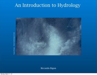
1. An Introduction to Hydrology
Susan Derges - Water hydrological Cycle
Riccardo Rigon
Monday, March 11, 13
2. It begins with a storm …
They were rolls, waves that finished in a puff: known noises,
village things. Everything that we have here is animated, lively,
maybe because the distances are short and fixed as in a theatre.
The downpours were onto the courtyards here around, the
thunder up here above the roofs; I could recognize by ear, a
little further up, the place of the usual God that made storms
when we were children, He too a village character. Here all is
as if intensified, a matter of scale probably, of inner
relationships. The shape of the noises and of these thoughts
(which were, after all, the same thing) seemed to me for a
moment truer than true, but it cannot be recreated with words.
Luigi Meneghello - Incipit of “Libera Nos A Malo”
2
R. Rigon
Monday, March 11, 13
4. Introduction to Hydrology
Objectives
•To explain what hydrology is and what it deals with:
3
R. Rigon
Monday, March 11, 13
5. Introduction to Hydrology
Objectives
•To explain what hydrology is and what it deals with:
•The elements of the water cycle
3
R. Rigon
Monday, March 11, 13
6. Introduction to Hydrology
Objectives
•To explain what hydrology is and what it deals with:
•The elements of the water cycle
•The spatial and temporal scales involved
3
R. Rigon
Monday, March 11, 13
7. Introduction to Hydrology
Objectives
•To explain what hydrology is and what it deals with:
•The elements of the water cycle
•The spatial and temporal scales involved
•The mass and energy balance at a global scale
3
R. Rigon
Monday, March 11, 13
8. Introduction to Hydrology
Objectives
•To explain what hydrology is and what it deals with:
•The elements of the water cycle
•The spatial and temporal scales involved
•The mass and energy balance at a global scale
•The Budyko Curve
3
R. Rigon
Monday, March 11, 13
9. Introduction to Hydrology
The Water Cycle
The water on Earth flows from the atmosphere to the ground. And then
from the rivers to the sea, from where it returns to the atmosphere:
Hydrology is the science that studies these flows, which make up the water
cycle.
4
R. Rigon
Monday, March 11, 13
10. Introduction to Hydrology
The Water Cycle
The flows from the atmosphere to the surface of the Earth are called
precipitations. The water that reaches the ground can infiltrate and flow
within the soil or it can run off on the surface (these are referred to as
horizontal flows).
At the same time, there is evaporation from the soil and water surfaces, and
transpiration from plants and animals (in a word, evapotranspiration).
Infiltration and evaporation constitute the vertical flows.
5
R. Rigon
Monday, March 11, 13
11. Introduction to Hydrology
From where the Earth water arrives ?
During the first seconds after the Big Bang, hydrogen and Helium were
created. Accordingly to the actual cosmogenetic theories oxygen was
formed a little later. However, it is the third element more diffuse in the
universe.
Ball, P., 1999
6
R. Rigon
Monday, March 11, 13
12. Introduction to Hydrology
From where the Earth water arrives ?
If you consider that Helium is very much not reactive could not not a real
surprise that an element built on Hydrogen and Oxygen is abundant on the
Earth.
Ball, P., 1999
7
R. Rigon
Monday, March 11, 13
13. How much ?
Distribution of Water on Earth
Saline groundwater & lakes
Fresh
Oceans 3%
2%
95%
8
K. Caylor
Monday, March 11, 13
14. How much ?
Distribution of Water on Earth
Ice & Snow
Saline groundwater & lakes
Groundwater
Fresh
Surface Water
Oceans 3%
2%
30%
70%
95%
0.34%
9
K. Caylor
Monday, March 11, 13
15. How much ?
Distribution of Water on Earth
Ice & Snow
Saline groundwater & lakes
Groundwater
Fresh
Surface Water
Oceans 3%
2% Surface water
30%
is only 0.34%
of all fresh
70%
95% water
0.34%
10
K. Caylor
Monday, March 11, 13
16. How much ?
Distribution of Water on Earth
Ice & Snow Soil
Saline groundwater & lakes
Groundwater
Fresh
Surface Water
moisture
Oceans 3% Ice 14%
2%
&
Snow
30%
Lakes,
70%
95% Wetlands, & Rivers
86%
0.34%
11
K. Caylor
Monday, March 11, 13
17. How much ?
Distribution of Water on Earth
Ice & Snow Soil
Saline groundwater & lakes
Groundwater
Fresh
Surface Water
moisture
Oceans 3% Ice 14%
2%
&
Snow
30%
Lakes,
70%
95% Wetlands, & Rivers
86%
0.34%
Soil moisture is 0.001% of all water.
Provides for all agricultural food production and
sustains all terrestrial ecosystems 12
K. Caylor
Monday, March 11, 13
18. How much ?
The Water Cycle
Collocation Area covered Volume % % of fresh
[106 km2 ] [106 km3 ] water
Oceans 361.300 1.338 96.5 -
Groundwater 134.8 23.4 1.7 -
Fresh grundwater 10.530 0.76 30.1
Soil humidity 82 0.0165 0.001 0.05
Perennial ice and snow 16.2275 24.0641 1.74 68.7
Antarctic 13.980 21.600 1.56 61.7
Greenland 1.8024 2.340 0.17 6.68
Arctic islands 0.2261 0.0835 0.006 0.24
Mountain areas 0.224 0.0406 0.003 0.12
Permafrost 21 0.3 0.022 0.86
Water in lakes 2.0587 0.1764 0.013 -
Fresh water in lakes 1.2364 0.091 0.007 0.26
Salt water in lakes 0.8223 0.0854 0.006 -
Lagoons and swamps 2.682.6 0.01147 0.0002 0.006
Rivers 148.8 0.00212 0.0002 0.0006
Water in living beings 510 0.0012 0.0.0001 0.0003
Water in the atmosphere 510 0.0129 0.001 0.04
Water total 510 1385.98561 100 -
Fresh water total 148.8 35.02921 2.53 100
Data from:Global Change in the Geosphere-Biosphere, NRC, 1986, Shiklomanov and
Skolov (1983).
You can see also:
Oki et al., 2001; Shiklomanov, I. A., 2000; Vorosmarty et al., 2000; Hanasaki et al., 2006
13
R. Rigon
Monday, March 11, 13
19. Introduction to Hydrology
The Water Cycle
sustains Life on Earth
shapes the surface of the Earth
regulates the climate
The engine of the Water Cycle is composed of: solar radiation, which causes
gradients in temperature, pressure, and density, and the phase changes of water in
the atmosphere and within the soil; the force of gravity; surface tensions; and
electrochemical forces.
14
R. Rigon
Monday, March 11, 13
20. Hower ...
Looking to our neighbors
Venus Earth Mars
No one has very much oxygen and water
15
A. Kleidon
Monday, March 11, 13
21. However...
Looking to our neighbors
Venus Earth Mars
96.5% CO2 78 % N2 93.5% CO2
3.5% N2 31% O2 2.7% N2
16
A. Kleidon
Monday, March 11, 13
22. Does life influences the Hydrological Cycle ?
Is therefore the actual
composition of
atmpsphere due to the
presence of life ?
Figure 1 The effect of life on the Earth’s
atmosphere.
Lenton, T., 1998
a, Atmospheric compositions of Earth, Mars
and Venus
(excluding water vapour and noble gases).
b, Estimated fluxes of gases at the Earth’s
surface in teramoles
(1012 moles) per year,
with (pre-industrial) life and without life.
17
A. Kleidon
Monday, March 11, 13
23. Does life influences the Hydrological Cycle ?
Oxygen concentration Earth before present
Holland, 2006
Time before present (Gyears)
18
A. Kleidon
Monday, March 11, 13
24. Does life influences the Hydrological Cycle ?
CO2 atmospheric concentration before present
19
A. Kleidon
Monday, March 11, 13
25. Does life influences the Hydrological Cycle ?
Therefore
We can conjecture that, maybe, is also true the reverse (water maintains life)
•but the hydrological cycle, se we see it, could also be the product of the
presence of life on Earth
20
R. Rigon
Monday, March 11, 13
27. Introduction to Hydrology
The good old hydrological cycle
Oki and Kanae, 2006
22
R. Rigon
Monday, March 11, 13
28. RFWR
A relevant aspect
Is that just part of the whole water can be utilized by humans and
ecosystems. This part is usually named
•Renewable Freshwater resources (RFWR)
Is there enough RFWR ?
23
R. Rigon
Monday, March 11, 13
29. RFWR
The good old hydrological cycle
Oki and Kanae, 2006
24
R. Rigon
Monday, March 11, 13
30. RFWR
The good old hydrological cycle
Oki and Kanae, 2006
25
R. Rigon
Monday, March 11, 13
31. RFWR
The good old hydrological cycle
Oki and Kanae, 2006
La maggior parte della RFWR è costituita della portata dei fiumi
26
R. Rigon
Monday, March 11, 13
32. RFWR
The good old hydrological cycle
Oki and Kanae, 2006
27
R. Rigon
Monday, March 11, 13
33. RFWR
Blue Water
Green Water
White Water
Blue Water: surface water and groundwater
Green Water: soil water, available for plants
White Water: just atmospheric water
28
R. Rigon
Monday, March 11, 13
34. RFWR
Aeschbach-Hertig and Gleeson, 2012
29
R. Rigon
Monday, March 11, 13
35. Introduction to Hydrology
Compartment Volume % Source Incoming Emission Outgoing
Flow Flow
Oceans 1338 96.51 P 4581 E 5051
3242 3612
3853 4243
R 471
372
403
Atmosphere 0.013 0.001 ET 5771 P 5771
from the landmasses 721
622 992
713 1113
from the oceans 5051
3612 3242
4243 3853
Landmasses 48 3.46 P 1191 ET 721
992 622
1113 712
R 471
372
403
Global water flows (1-Shiklomanov and Sokolov,1983 ; 2- Peixoto e Kettani, 1973 3- Baumgartner e Reichel, 1975.
The volumes are in millions of km cubed and the flows are in millions of km cubed per year. P = Precipitations; R =
Surface runoff; E =evaporation ; ET = evapotranspiration
30
R. Rigon
Monday, March 11, 13
36. Extreme Events
Looking to the mean hydrological budgets
is not just the only wat
Extreme events matter
31
R. Rigon
Monday, March 11, 13
38. Spatial and Temporal Scales
Cycles ?
Peixoto-Oort, 1992; Mitchell, 1974
33
R. Rigon
Monday, March 11, 13
39. Il mezzo è il messaggio
Burri-Untitled 1952
Riccardo Rigon
Monday, March 11, 13
40. The medium is the message
The water cycle is not only defined by the presence of water and its flows, but
also by the media on which, or through which, these water flows take place:
•the atmosphere
•vegetation
•the ground surface
•soils
•aquifers
35
R. Rigon
Monday, March 11, 13
41. The medium is the message
The atnospheric boundary Layer
36
R. Rigon
Monday, March 11, 13
42. The medium is the message
Vegetation
37
R. Rigon
Monday, March 11, 13
43. The medium is the message
The terrain surface
38
R. Rigon
Monday, March 11, 13
44. The medium is the message
Soils
O horizon
O horizon
A horizon
real soil
A horizon
B horizon layer
real soil
layer
B horizon
C horizon
C horizon
unconsolidated rock
Bedrock BedRock
39
R. Rigon
Monday, March 11, 13
45. The medium is the message
Below the soils
40
R. Rigon
Monday, March 11, 13
46. The medium is the message
Aquifers
http://www.wec.ufl.edu/extension/gc/harmony/images/aquifer.gif
41
R. Rigon
Monday, March 11, 13
47. Hydrological information
a classical view
La Scuola di Atene, Raffaello
Riccardo Rigon
Monday, March 11, 13
48. The global hydrological cycle
Distribution of Mean Annual Precipitation
Da Dingman, 1994
43
R. Rigon
Monday, March 11, 13
49. The global hydrological cycle
Precipitation Patterns
from Dingman, 1994
44
R. Rigon
Monday, March 11, 13
50. The global hydrological cycle
Areas Seasonally Covered by Snow
from Dingman, 1994
45
R. Rigon
Monday, March 11, 13
51. The global hydrological cycle
The Largest Rivers on Earth
from Dingman, 1994
46
R. Rigon
Monday, March 11, 13
52. The global hydrological cycle
the thousand longest rivers on earth
From the work "the thousand rivers” (i mille fiumi) by Arrigo Boetti and Anna-marie Sauzeau-Boetti
classification by order of magnitude is the most common method for classifying information relative to a certain category, in the case of rivers, size can be
understood to the power of one, two, or three, that is, it can be expressed in km, km2, or m3 (length, catchment area, or discharge), the length criterion is the most
arbitrary and naive but still the most widespread, and yet it is impossible to measure the length of a river for the thousand and more perplexities that its fluid nature
brings up (because of its meanders and its passage through lakes, because of its ramifications around islands or its movements in the delta areas, because of
man’s intervention along its course, because of the elusive boundaries between fresh water and salt water...) many rivers have never been measured because
their banks and waters are inaccessible, even the water spirits sympathise at times with the flora and the fauna in order to keep men away, as a consequence
some rivers flow without name, unnamed because of their untouched nature, or unnamable because of human aversion (some months ago a pilot flying low over
the brazilian forest discovered a “new” tributary of the amazon river). other rivers cannot be measured, instead, because they have a name, a casual name given
to them by men (a single name along its entire course when the river, navigable, becomes means of human communication; different names when the river,
formidable, visits isolated human groups); now the entity of a river can be established either with reference to its name (trail of the human adventure), or with
reference to its hydrographic integrity (the adventure of the water from the remotest source point to the sea, independently of the names assigned to the various
stretches), the problem is that the two adventures rarely coincide, usually the adventure of the explorer is against the current, starting from the sea; the adventure
of the water, on the other hand, finishes there, the explorer going upstream must play heads or tails at every fork, because upstream of every confluence
everything rarefies: the water, sometimes the air, but always one’s certainty, while the river that descends towards the sea gradually condenses its waters and the
certainty of its inevitable path, who can say whether it is better to follow man or the water? the water, say the modern geographers, objective and humble, and so
the begin to recompose the identity of the rivers, an example: the mississippi of new orleans is not the extension of the mississippi that rises from lake itasca in
minnesota, as they teach at school, but of a stream that rises in western montana with the name jefferson red rock and then becomes the mississippi-missouri in st
louis, the number of kilometres upstream is greater on the missouri side, but in fact this “scientific” method is applied only to the large and prestigious rivers, those
likely to compete for records of length, the methodological rethinking is not wasted on minor rivers (less than 800km) which continue to be called, and measured,
only according to their given name, even if, where there are two source course (with two other given names), the longer of the two could be rightly included in the
main course, the current classification reflects this double standard, this follows the laws of water and the laws of men, because that is how the relevant
information is given, in short, it reflects the biased game of information rather than the fluid life of water, this classification was began in 1970 and ended in 1973,
some data were transcribed from famous publications, numerous data were elaborated from material supplied non-european geographic institution, governments,
universities, private research centres, and individual accademics from all over the world, this convergence of documentation constitutes the the substance and the
meaning of the work, the innumerable asterisks contained in these thousand record cards pose innumerable doubts and contrast with the rigid classification
method, the partialness of the existing information, the linguistic problems associated with their identity, and the irremediably elusive nature of water all mean that
this classification, like all those that proceeded it or that will follow, will always be provisional and illusionary
Anne-marie Sauzeau-Boetti
(TN the text is published without capital letters) 47
R. Rigon
Monday, March 11, 13
59. The global hydrological cycle
Is it possible to close the terrestrial water
budget with satellite measures ?
T O P E X /
TRMM/CMORPH CERES/MODIS/
P O SE ID O N/ GRACE
AIRS Land
PERSIAN, GPM J A S O N ,
Flux
SWOT
Next future (2016)
Now it is not. However in the future .....
Wood et al., Closing the Terrestrial water Budget from satellite Remote sensing, GRL, 2009
54
Marco Mancini
Monday, March 11, 13
60. The global hydrological cycle
Global Digital Terrain Data
The elevation data resulting from the SRTM are probably the best known global
dataset Rabus et al. 2003.
http://www,analist.net
The area covered by the mission goes from 60° North to 58° South. The data was
obtained with an X-band radar (NASA and MIL, that covers 100% of the area) and by
a C-band radar (DLR and ASI) that covers 40%.
55
T. Hengl
Monday, March 11, 13
61. The global hydrological cycle
Global Digital Terrain Data
The DLR and ASI data, nonpublic, would be available with a resolution of about
30m (1 arcsec). A model of the Earth’s surface, ETOPO1 Global Relief Model (which
includes bathymetry data) is available with a resolution of 1km and can be
http://www,analist.net
downloaded from NOAA's National Geophysical Data Center (Amante and Eakins,
2008). Global DEM’s, at various resolutions, from 1km to 2.5, 5, and 10 arcminutes,
are available at the worldclim website. The SRTM DEM at 90m resolution can be
obtained from CGIAR - Consortium for Spatial Information. In June 2009 a DEM
based on the ASTER satellite (GDEM) survey with a 30m resolution was produced.
The GDEM was obtained by stereoscopic correlation of 1.3 million optical ASTER
images, that cover about 98% of the Earth’s surface. The images can be downloaded
from NASA's EOS data archive or from Japan's Ground Data System.
56
T. Hengl
Monday, March 11, 13
62. The global hydrological cycle
Global Water Resources
The most thorough global inventory of water resources is the Global Lakes and
Wetlands Database (GLWD), which includes lakes, catchment areas, rivers and various
wetlands. The map is in raster format with pixels at 30-arcsec resolution (Lehner and
Doll, 2004). Vector images of the Earth’s catchments and similar vector data can be
obtained from RS GIS Unit of the International Water Management Institute (IWMI).
http://www,analist.net
57
T. Hengl
Monday, March 11, 13
63. The global hydrological cycle
Climatic Maps
WorldClim.org provides global maps of some 18 bioclimatic parameters derived (with
thin plate smoothing splines) using >15,000 weather stations (Hijmans et al., 2005).
The climatic parameters include: mean, minimum and maximum temperatures,
monthly precipitation and bioclimatic variables. All at ground resolution of 1 km.
http://www,analist.net
Mean annual temperature
58
T. Hengl
Monday, March 11, 13
64. The global hydrological cycle
Climatic Maps
http://www,analist.net
Annual precipitations
59
T. Hengl
Monday, March 11, 13
65. The global hydrological cycle
Climatic Maps
http://www,analist.net
Coefficient of variation of rainfall
60
T. Hengl
Monday, March 11, 13
66. The global hydrological cycle
Geological Maps
Soil maps play an elemental role in Hydrology and Agrometeorology. The
only truly global soil map is that available from USGS Global Soil Regions
with a 60-arcsec resolution (FAO-UNESCO, 2005). Geological maps have now
been integrated by the OneGeology project. The USDA Soil Survey Division
also distributes global maps of wetland areas (which include: upland,
lowland, organic, permafrost and salt affected wetlands). The ISRIC
maintains a global database of soil profiles comprising over 12,000 profiles
with analytic descriptions and the parameters for 50 soil types (Batjes,
http://www,analist.net
2008).
61
T. Hengl
Monday, March 11, 13
67. The global hydrological cycle
Geological Maps
http://www,analist.net
62
T. Hengl
Monday, March 11, 13
68. The global hydrological cycle
Precipitations all over the Earth in real-time
http://sharaku.eorc.jaxa.jp/GSMaP/index.htm
63
R. Rigon
Monday, March 11, 13
69. Other data
Other data on the web
http://abouthydrology.blogspot.it/2012/11/repertorio-nazionale-dei-dati.html
http://abouthydrology.blogspot.it/2012/08/free-cartographic-italian-data-on-web.html
http://nil-pipraen.blogspot.it/2012/04/hydrological-modeling.html
http://www.bafg.de/GRDC/EN/Home/homepage__node.html
http://www.nwl.ac.uk/ih/devel/wmo/hhcdbs.html
64
R. Rigon
Monday, March 11, 13
70. The Global Energy Balance
Jackson Pollock
Riccardo Rigon
Monday, March 11, 13
71. The global energy budget
Initial solar radiation Reflected solar radiation Infrared radiation from Earth
SPACE
ATMOSPHERE
Reflected by
modified after Wallace and Hobbs, 1977
air
Net emission from
CO2, H20
Reflected by
clouds
Absorbed by CO2, O3,
dust
Absorbed by CO2, H20
Absorbed by clouds
Reflected by
Absorbed by Earth’s surface
vegetation <0.2 Heat transfer by Latent heat
Net emission of infrared
(photosintetic (conduction and) transferred
radiation
efficiency) convention by
convention
OCEAN-CONTINENTS
66
R. Rigon
Monday, March 11, 13
72. The global energy budget
Initial solar radiation Reflected solar radiation Infrared radiation from Earth
SPACE
ATMOSPHERE
Reflected by
modified after Wallace and Hobbs, 1977
air
Net emission from
CO2, H20
Reflected by
clouds
Absorbed by CO2, O3,
dust
Absorbed by CO2, H20
Absorbed by clouds
Reflected by
Absorbed by Earth’s surface
vegetation <0.2 Heat transfer by Latent heat
Net emission of infrared
(photosintetic (conduction and) transferred
radiation
efficiency) convention by
convention
OCEAN-CONTINENTS
67
R. Rigon
Monday, March 11, 13
73. The global energy budget
Reflected solar radiation
Of the net short-wave radiation
Infrared radiation from Earth
Initial solar radiation
SPACE
ATMOSPHERE
Reflected by
modified after Wallace and Hobbs, 1977
air
Net emission from
CO2, H20
Reflected by
clouds
Absorbed by CO2, O3,
dust
Absorbed by CO2, H20
Absorbed by clouds
Reflected by
Absorbed by Earth’s surface
vegetation <0.2 Heat transfer by Latent heat
Net emission of infrared
(photosintetic (conduction and) transferred
radiation
efficiency) convention by
convention
OCEAN-CONTINENTS
67
R. Rigon
Monday, March 11, 13
74. The global energy budget
Reflected solar radiation
Of the net short-wave radiation
Infrared radiation from Earth
Initial solar radiation
SPACE
ATMOSPHERE
Reflected by
modified after Wallace and Hobbs, 1977
air
Net emission from
CO2, H20
Reflected by
clouds
Absorbed by CO2, O3,
dust
Absorbed by CO2, H20
Absorbed by clouds
Reflected by
Absorbed by Earth’s surface
vegetation <0.2
on average (spatially heat
Net emission of infrared
Heat transfer by Latent over the
(photosintetic
efficiency)
radiation entire (conduction and) the by
surface of transferred
convention
Earth and
temporally over an entire year)
convention
only 50 % makes it to the
OCEAN-CONTINENTS ground
67
R. Rigon
Monday, March 11, 13
75. The global energy budget
Initial solar radiation Reflected solar radiation Infrared radiation from Earth
SPACE
ATMOSPHERE
Reflected by
modified after Wallace and Hobbs, 1977
air
Net emission from
CO2, H20
Reflected by
clouds
Absorbed by CO2, O3,
dust
Absorbed by CO2, H20
Absorbed by clouds
Reflected by
Absorbed by Earth’s surface
vegetation <0.2 Heat transfer by Latent heat
Net emission of infrared
(photosintetic (conduction and) transferred
radiation
efficiency) convention by
convention
19 + 1 + 30 + 50 = 100
OCEAN-CONTINENTS
(16+3)
68
R. Rigon
Monday, March 11, 13
76. The global energy budget
Initial solar radiation Reflected solar radiation Infrared radiation from Earth
SPACE
ATMOSPHERE 19 % is absorbed by the
Reflected by
atmosphere.
modified after Wallace and Hobbs, 1977
air
Net emission from
CO2, H20
Reflected by
clouds
Absorbed by CO2, O3,
dust
Absorbed by CO2, H20
Absorbed by clouds
Reflected by
Absorbed by Earth’s surface
vegetation <0.2 Heat transfer by Latent heat
Net emission of infrared
(photosintetic (conduction and) transferred
radiation
efficiency) convention by
convention
19 + 1 + 30 + 50 = 100
OCEAN-CONTINENTS
(16+3)
68
R. Rigon
Monday, March 11, 13
77. The global energy budget
Initial solar radiation Reflected solar radiation Infrared radiation from Earth
SPACE
ATMOSPHERE 19 % is absorbed by the
Reflected by
atmosphere.
modified after Wallace and Hobbs, 1977
air
Net emission from
A small percentage (1%) is used
CO , H 0 2 2
Reflected by
clouds
by plants - small percentage
Absorbed by CO2, O3, but substantially important!
dust
Absorbed by CO2, H20
Absorbed by clouds
Reflected by
Absorbed by Earth’s surface
vegetation <0.2 Heat transfer by Latent heat
Net emission of infrared
(photosintetic (conduction and) transferred
radiation
efficiency) convention by
convention
19 + 1 + 30 + 50 = 100
OCEAN-CONTINENTS
(16+3)
68
R. Rigon
Monday, March 11, 13
78. The global energy budget
Initial solar radiation Reflected solar radiation Infrared radiation from Earth
SPACE
ATMOSPHERE 19 % is absorbed by the
Reflected by
atmosphere.
modified after Wallace and Hobbs, 1977
air
Net emission from
A small percentage (1%) is used
CO , H 0 2 2
Reflected by
clouds
by plants - small percentage
Absorbed by CO2, O3, but substantially important!
dust
30% ofby CO , H 0 radiation is, on
Absorbed the 2 2
Absorbed by clouds
average, reflected back towards
Absorbed by
Reflected by
Earth’s surface
space (and makes up the albedo
Net emission of infrared Earth).
of the
vegetation <0.2 Heat transfer by Latent heat
(photosintetic (conduction and) transferred
radiation
efficiency) convention by
convention
19 + 1 + 30 + 50 = 100
OCEAN-CONTINENTS
(16+3)
68
R. Rigon
Monday, March 11, 13
79. The global energy budget
Initial solar radiation Reflected solar radiation Infrared radiation from Earth
SPACE
ATMOSPHERE
Reflected by
modified after Wallace and Hobbs, 1977
air
Net emission from
CO2, H20
Reflected by
clouds
Absorbed by CO2, O3,
dust
Absorbed by CO2, H20
Absorbed by clouds
Reflected by
Absorbed by Earth’s surface
vegetation Heat transfer by Latent heat
Net emission of infrared
(photosintetic (conduction and) transferred
radiation
efficiency) convention by
convention
OCEAN-CONTINENTS
69
R. Rigon
Monday, March 11, 13
80. The global energy budget
Initial solar radiation Reflected solar radiation Infrared radiation from Earth
SPACE
ATMOSPHERE
Reflected by
modified after Wallace and Hobbs, 1977
air
Net emission from
CO2, H20
Reflected by
clouds
Absorbed by CO2, O3,
dust
Absorbed by CO2, H20
Absorbed by clouds
So the 50% that the ground Reflected by
receives is returned to spacesurface
Absorbed by
vegetation
Earth’s
(if Heat transfer by Latent heat
Net emission of infrared
(photosintetic n e r g y
the e balance were (conduction and) transferred
radiation
efficiency) convention by
stationary: in fact climate convention
change is all due to the
imbalance).
OCEAN-CONTINENTS
69
R. Rigon
Monday, March 11, 13
81. The global energy budget
To the 50% that reaches the
ground,Initial solar the 19% that was radiation
add radiation Reflected solar Infrared radiation from Earth
SPACE
absorbed by the atmosphere to
make up the total outgoing
infrared radiation (69%).
ATMOSPHERE
Reflected by
modified after Wallace and Hobbs, 1977
air
Net emission from
CO2, H20
Reflected by
clouds
Absorbed by CO2, O3,
dust
Absorbed by CO2, H20
Absorbed by clouds
So the 50% that the ground Reflected by
receives is returned to spacesurface
Absorbed by
vegetation
Earth’s
(if Heat transfer by Latent heat
Net emission of infrared
(photosintetic n e r g y
the e balance were (conduction and) transferred
radiation
efficiency) convention by
stationary: in fact climate convention
change is all due to the
imbalance).
OCEAN-CONTINENTS
69
R. Rigon
Monday, March 11, 13
82. The global energy budget
To the 50% that reaches the
ground,Initial solar the 19% that was radiation
add radiation Reflected solar Infrared radiation from Earth
SPACE
absorbed by the atmosphere to
make up the total outgoing
infrared radiation (69%).
ATMOSPHERE
Reflected by
modified after Wallace and Hobbs, 1977
air
The 50% from the ground can
be divided into three parts: the Net emission from
CO2, H20
r a d i a t i v e e m i s s i o n Reflectedtby e
of h
clouds
surfacebyof , O , Earth (20%), the
Absorbed CO the
2 3
dust
evapotranspiration flux (23%),
and heat loss by convection
(7%).
Absorbed by CO2, H20
Absorbed by clouds
So the 50% that the ground Reflected by
receives is returned to spacesurface
Absorbed by
vegetation
Earth’s
(if Heat transfer by Latent heat
Net emission of infrared
(photosintetic n e r g y
the e balance were (conduction and) transferred
radiation
efficiency) convention by
stationary: in fact climate convention
change is all due to the
imbalance).
OCEAN-CONTINENTS
69
R. Rigon
Monday, March 11, 13
83. The global enrgy budget
http://www.agu.org/eos_elec/95206e.html
70
R. Rigon
Monday, March 11, 13
84. Lin, B., P. W. Stackhouse Jr., P. Minnis, B. A. Wielicki, Y. Hu, W. Sun, T.-
F. Fan, and L. M. Hinkelman (2008), Assessment of global annual
atmospheric energy balance from satellite observations, J. Geophys.
R. Rigon
Res., 113, D16114, doi:10.1029/2008JD009869
Monday, March 11, 13
The global enrgy budget
Mean Annual Balance of the Oceans
71