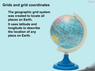
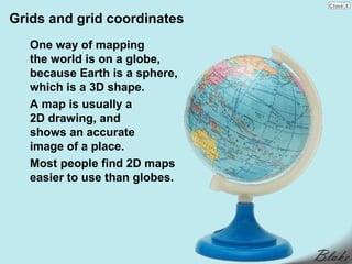
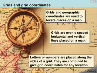
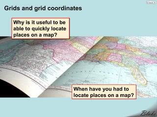
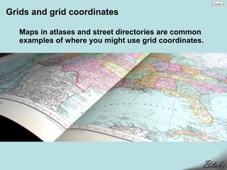
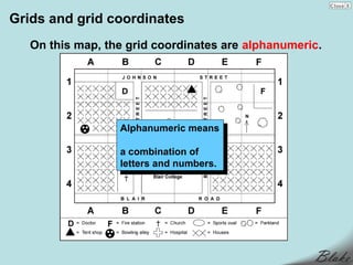
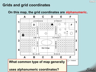
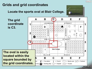
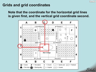
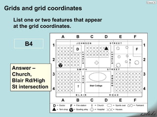
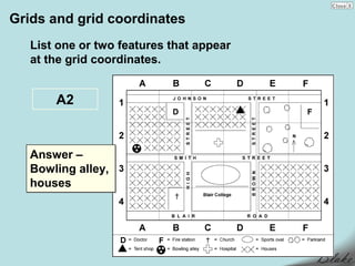
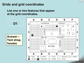
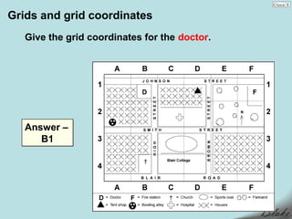
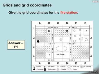
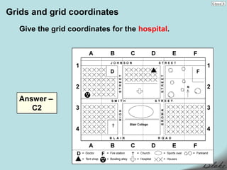
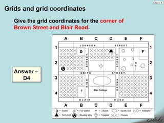
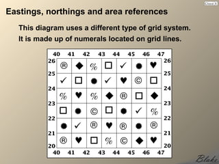
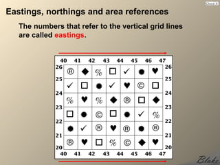
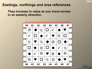
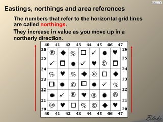
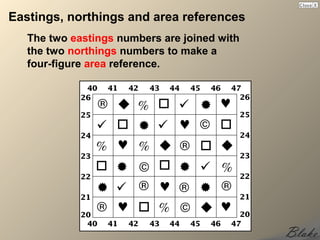
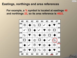
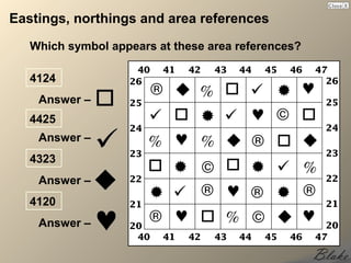
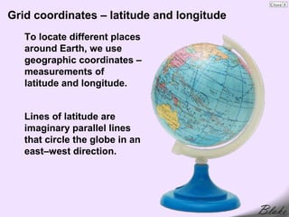
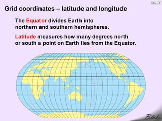
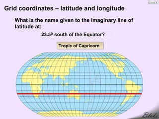
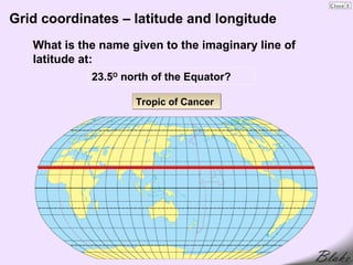
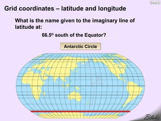
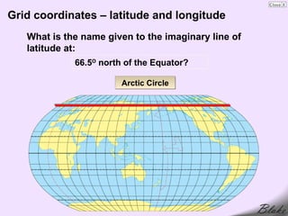
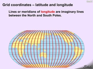
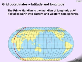
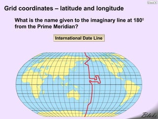
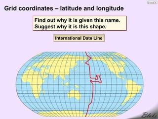
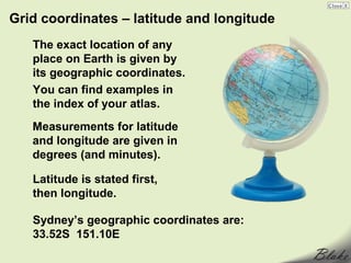
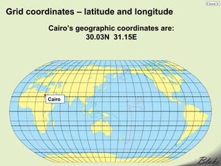
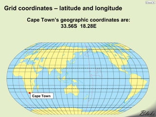
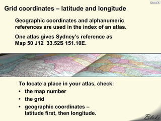
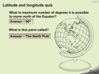
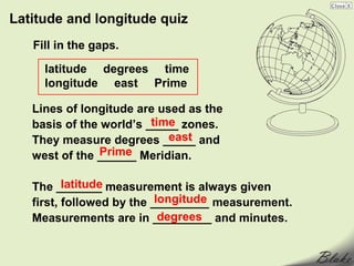
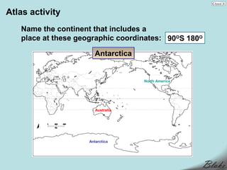
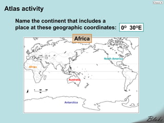
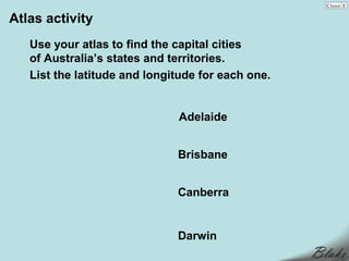
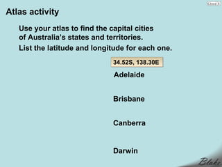
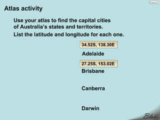
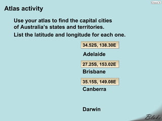
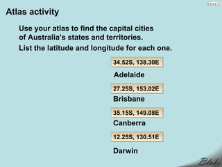
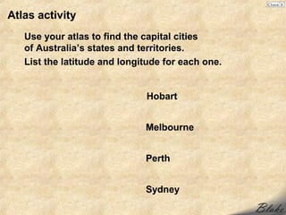
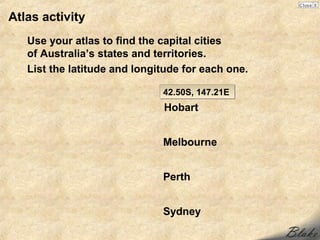
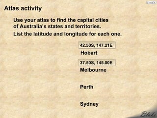
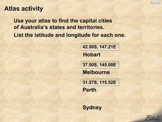
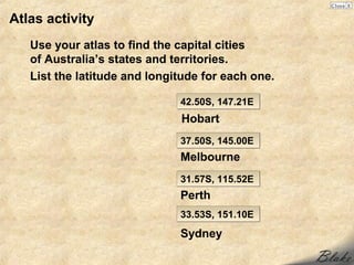
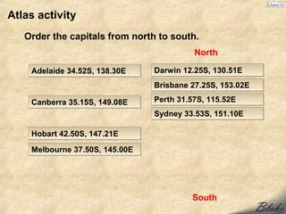
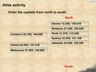
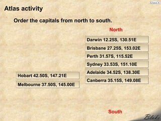
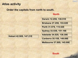
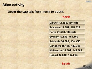
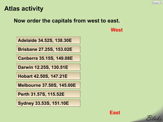
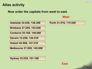
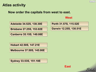
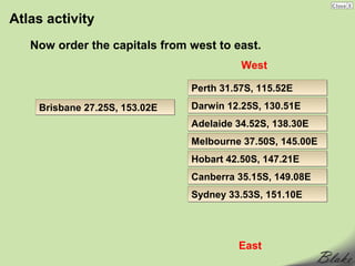
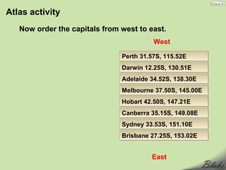
The document provides information about geographic grids and coordinates. It explains that grids and grid coordinates are used to locate places on maps. Grids are evenly spaced horizontal and vertical lines placed on maps. Letters or numbers are placed along the sides of a grid and combined to give grid coordinates for any location. It also discusses latitude and longitude, which are used to describe the exact location of any place on Earth. Measurements of latitude and longitude in degrees are often listed first for latitude then longitude.


![Introto geography[1]](https://cdn.slidesharecdn.com/ss_thumbnails/introtogeography1-130411124640-phpapp02-thumbnail.jpg?width=640&height=640&fit=bounds)


