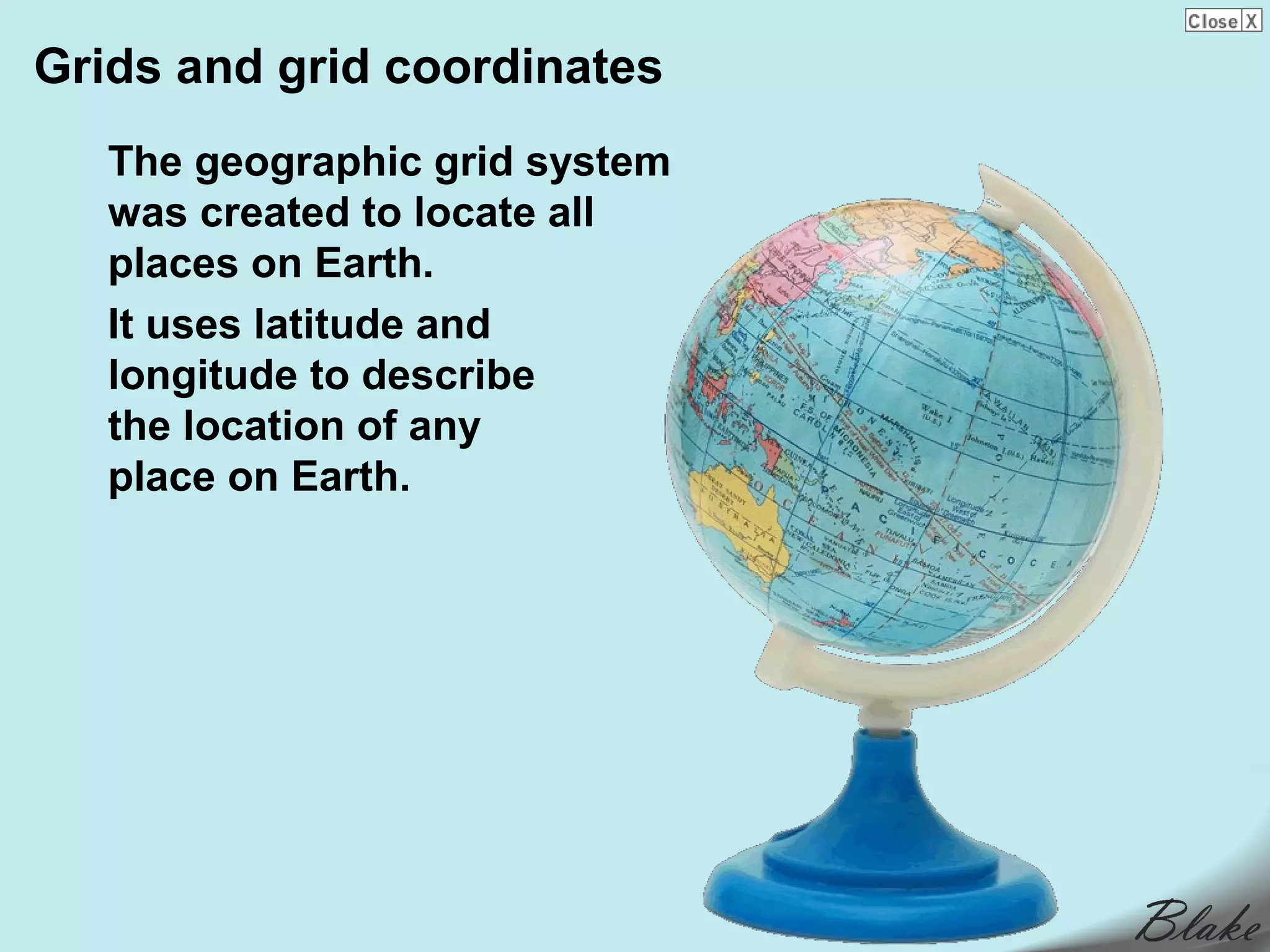
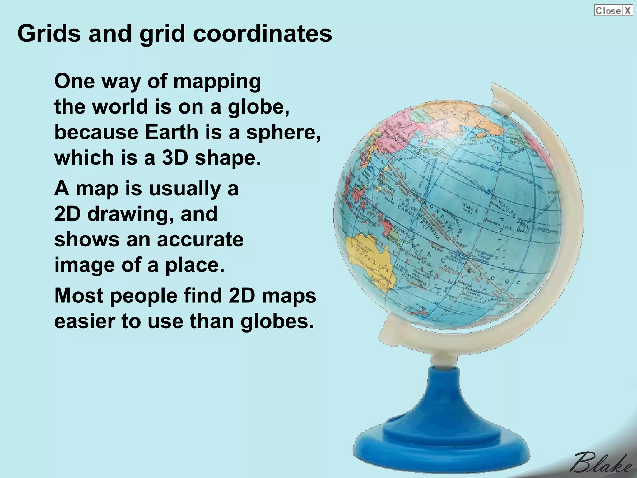
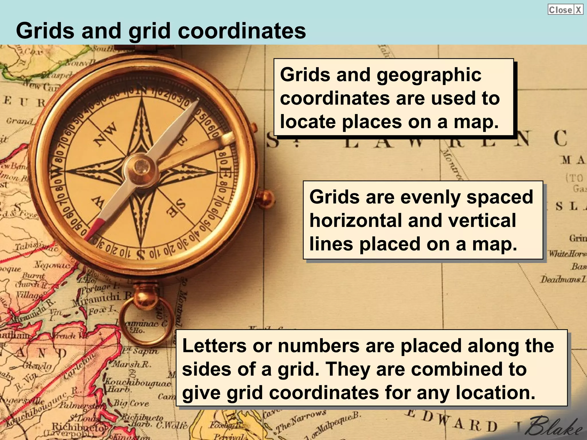
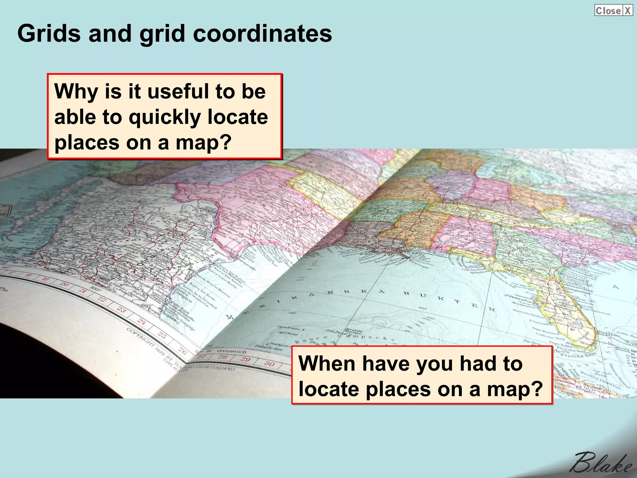
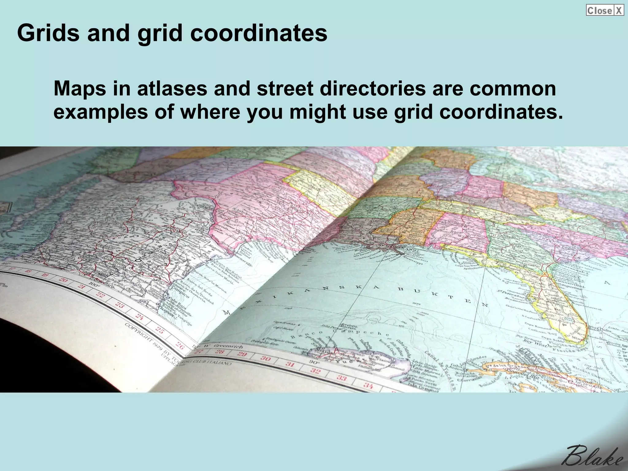
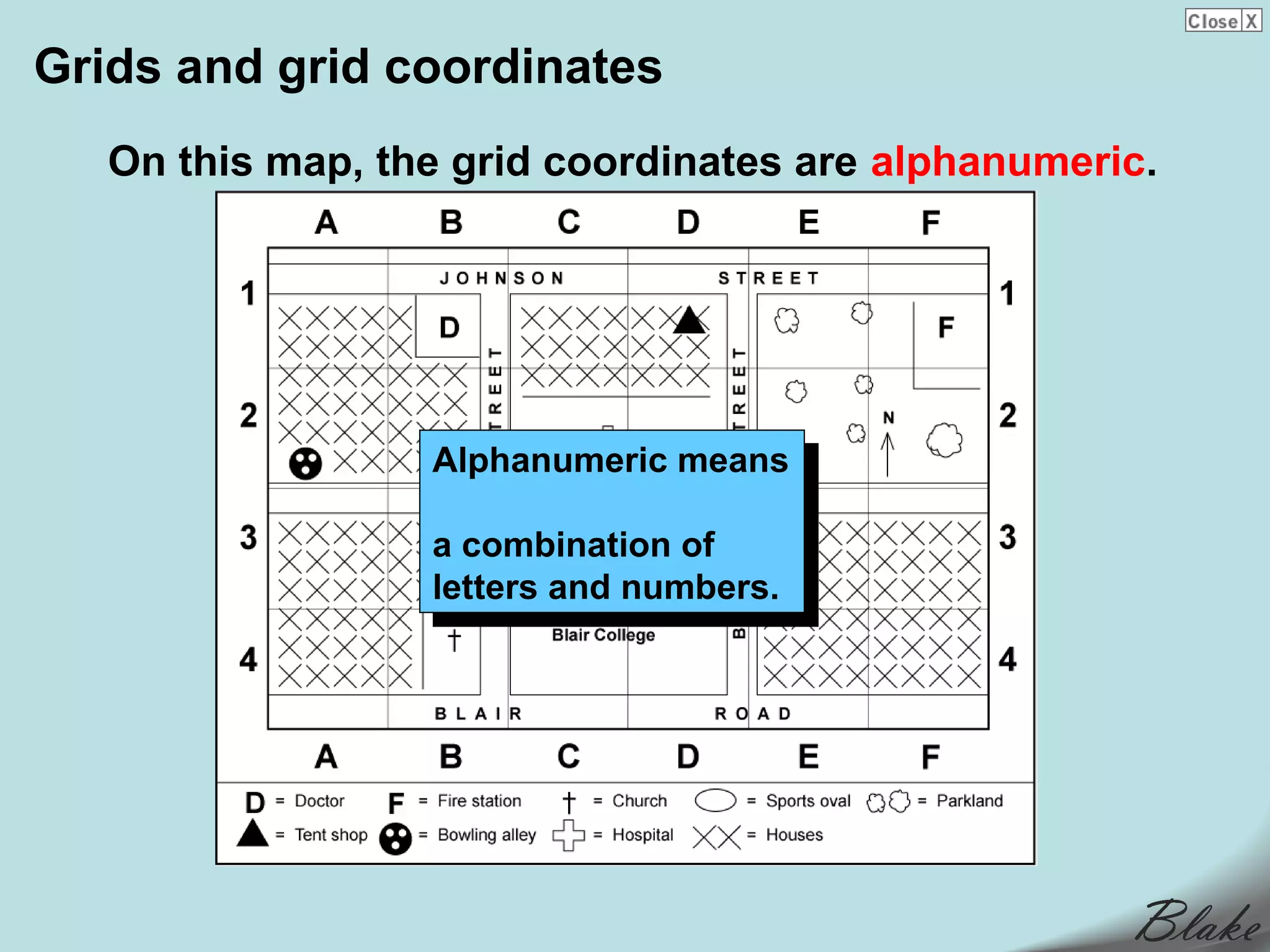
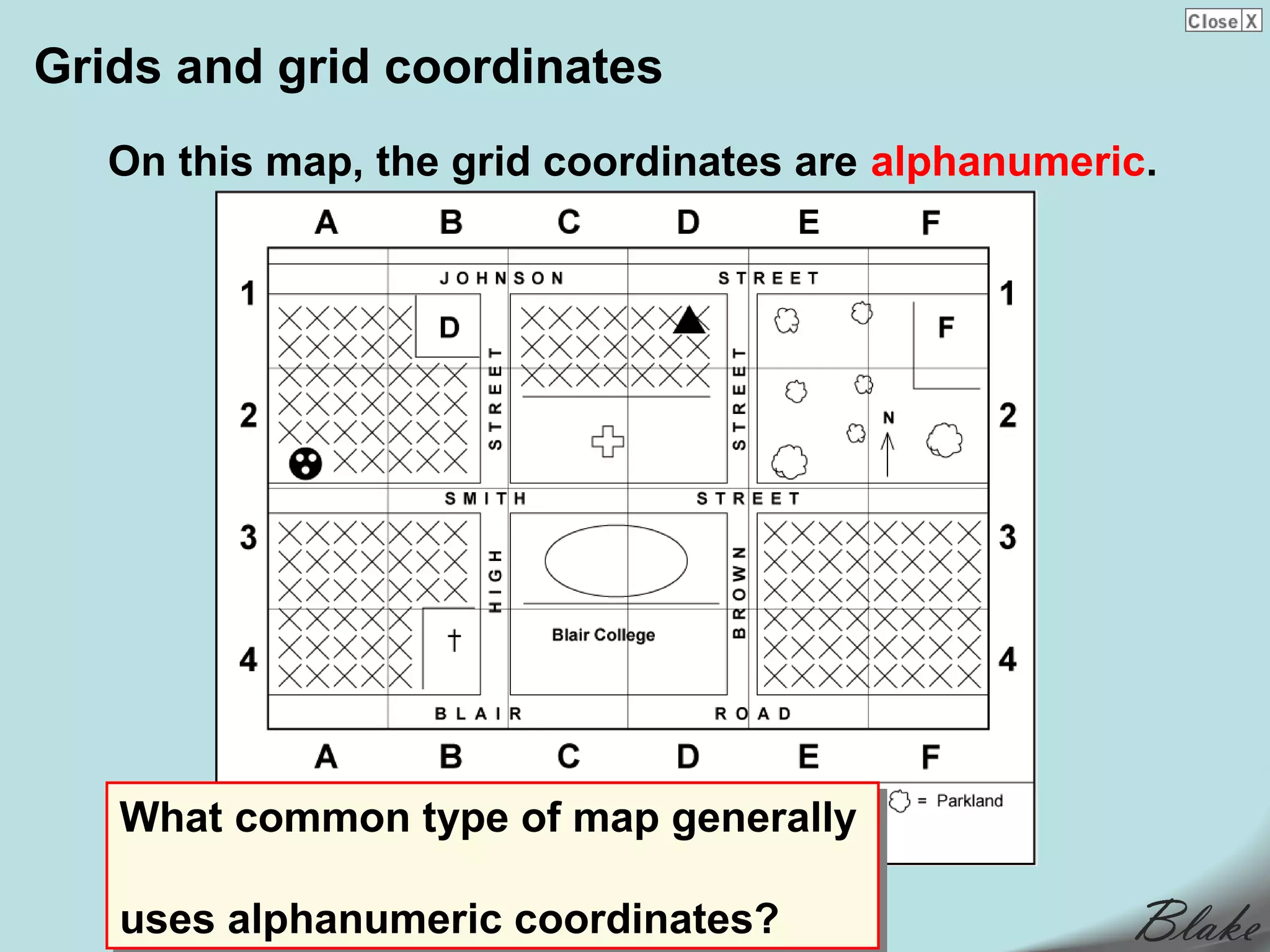
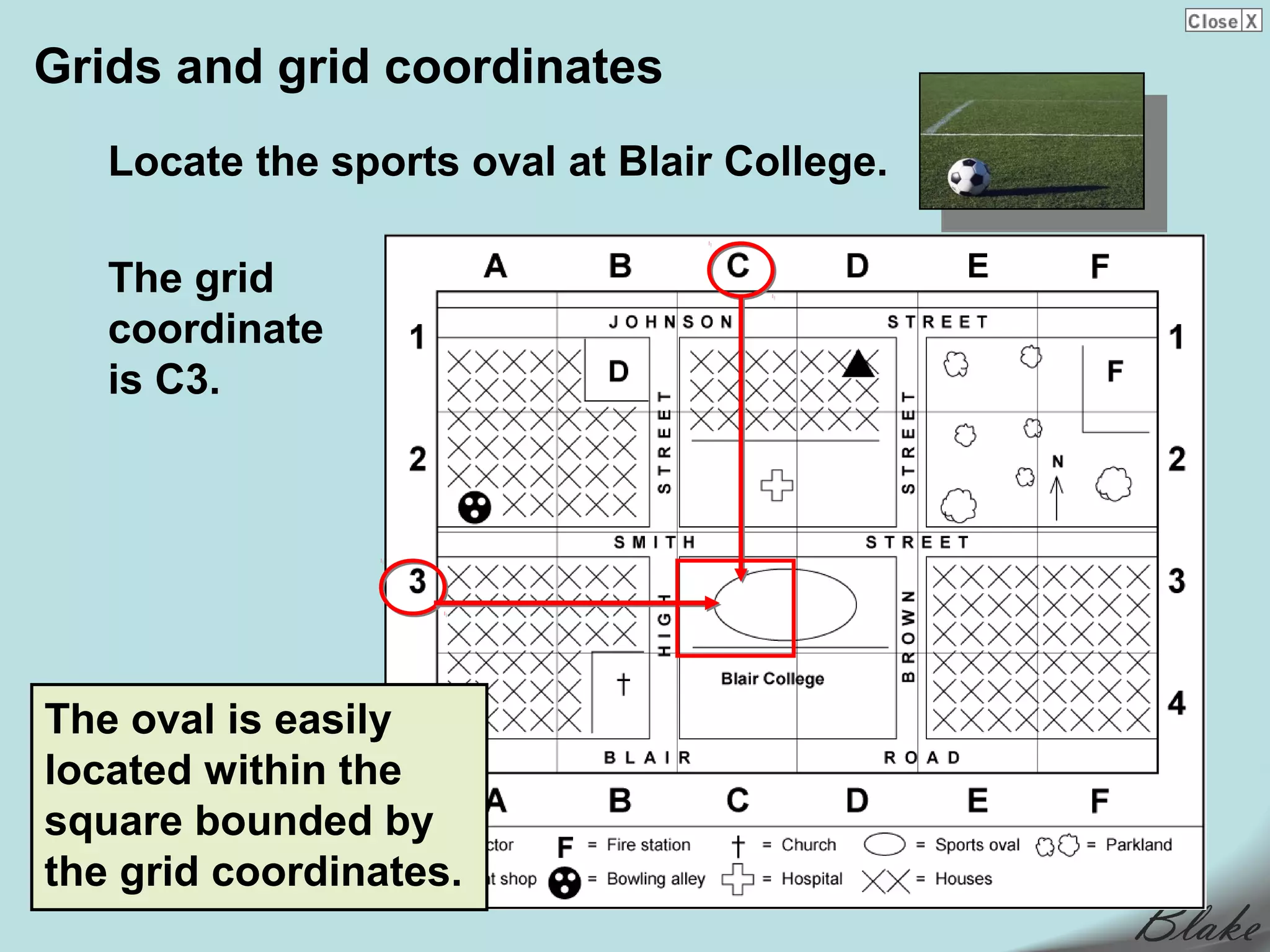
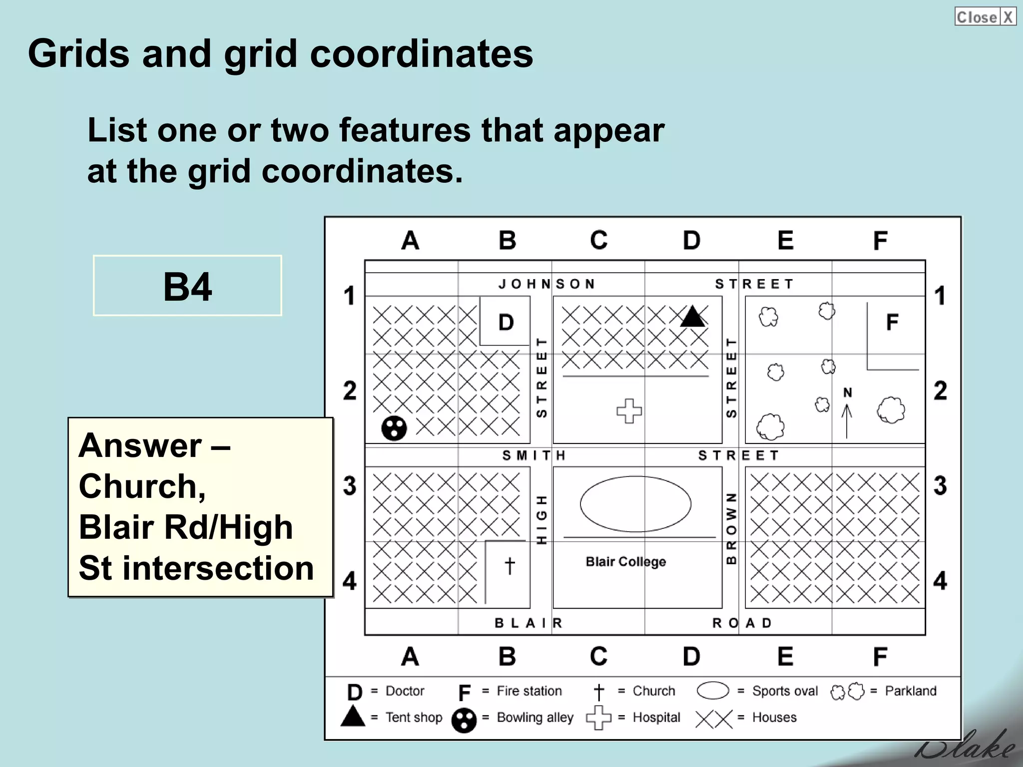
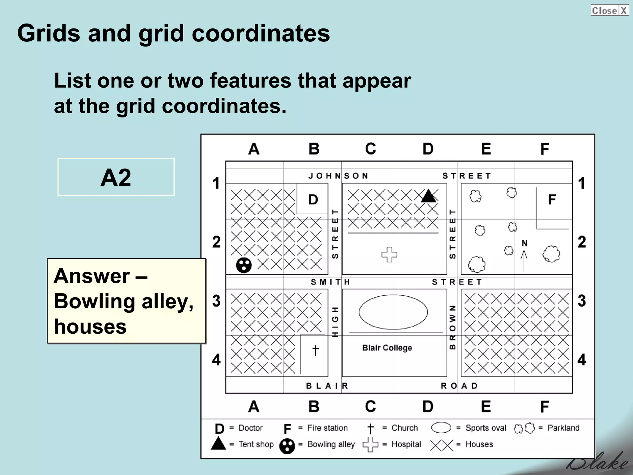
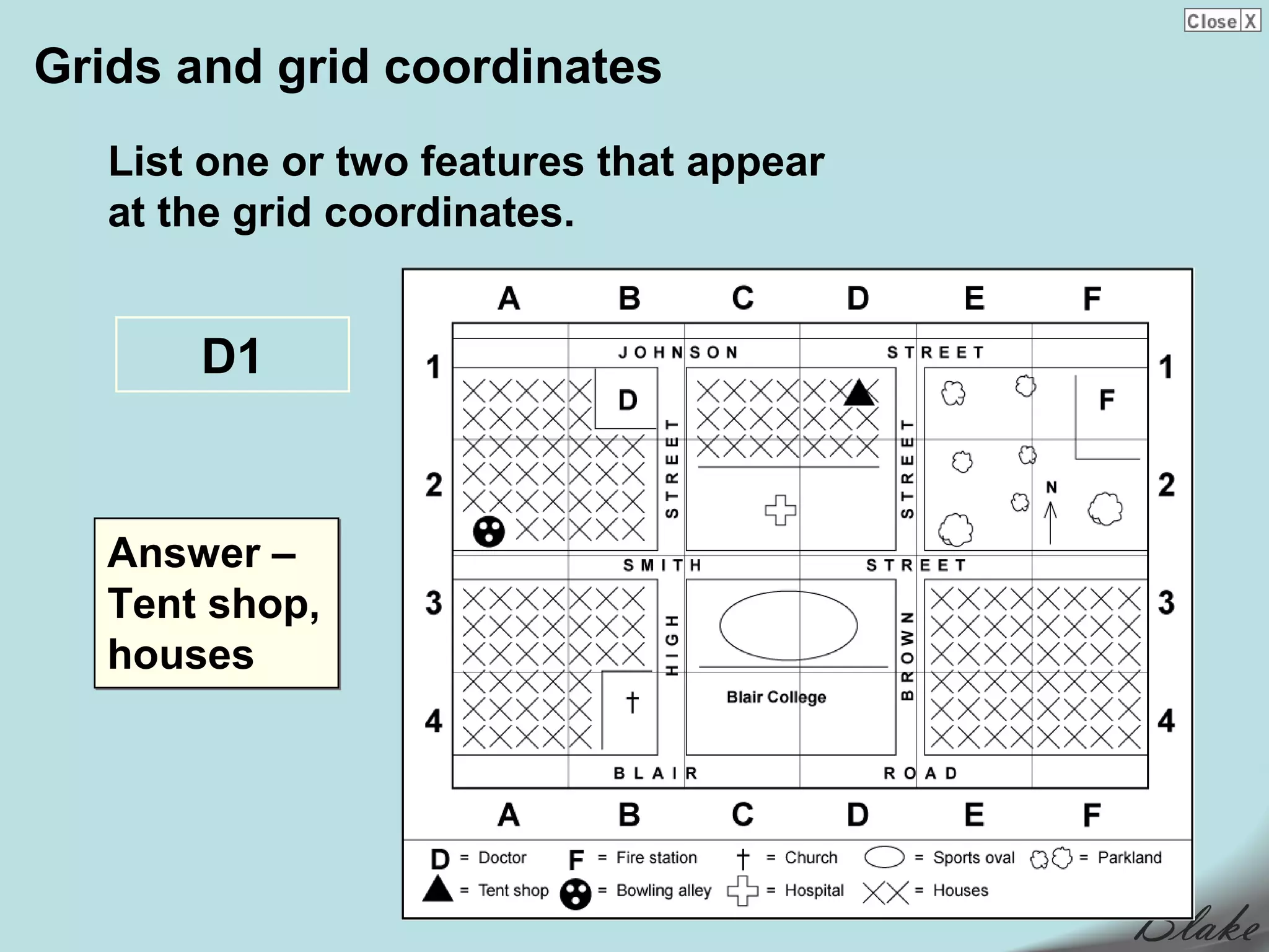
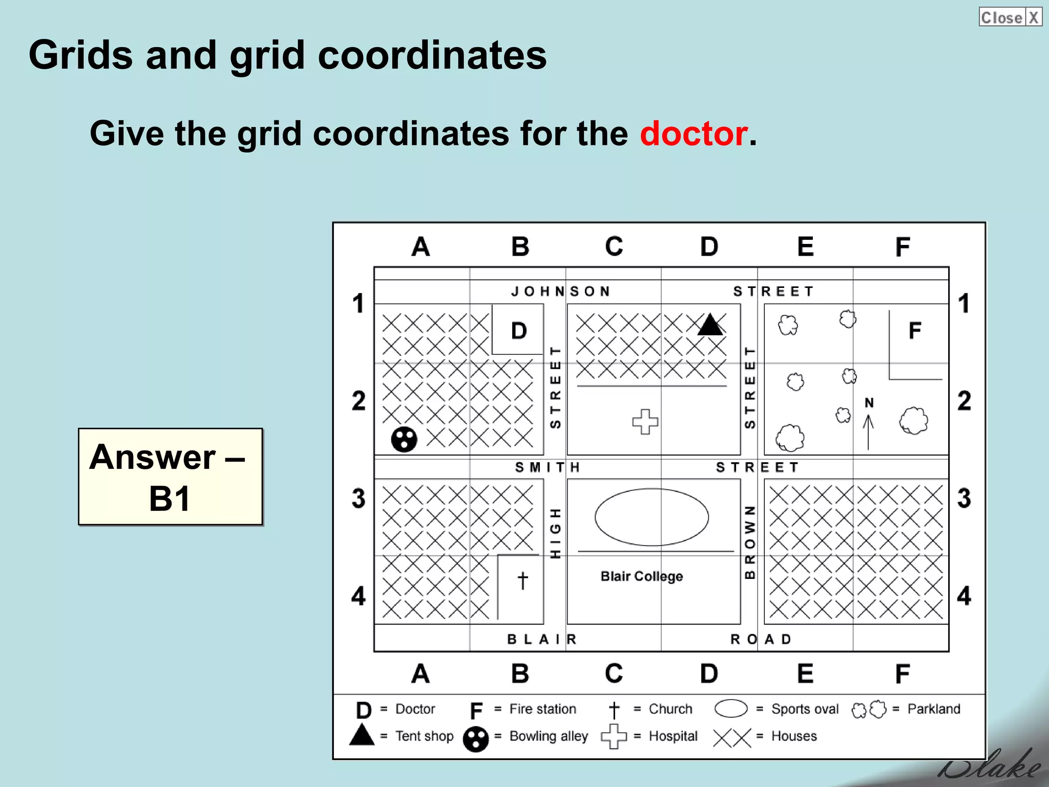
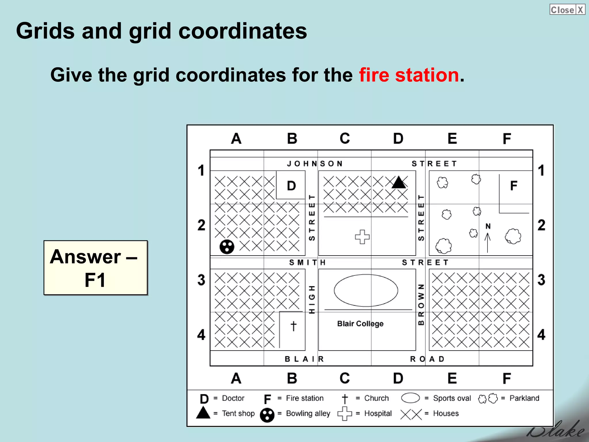
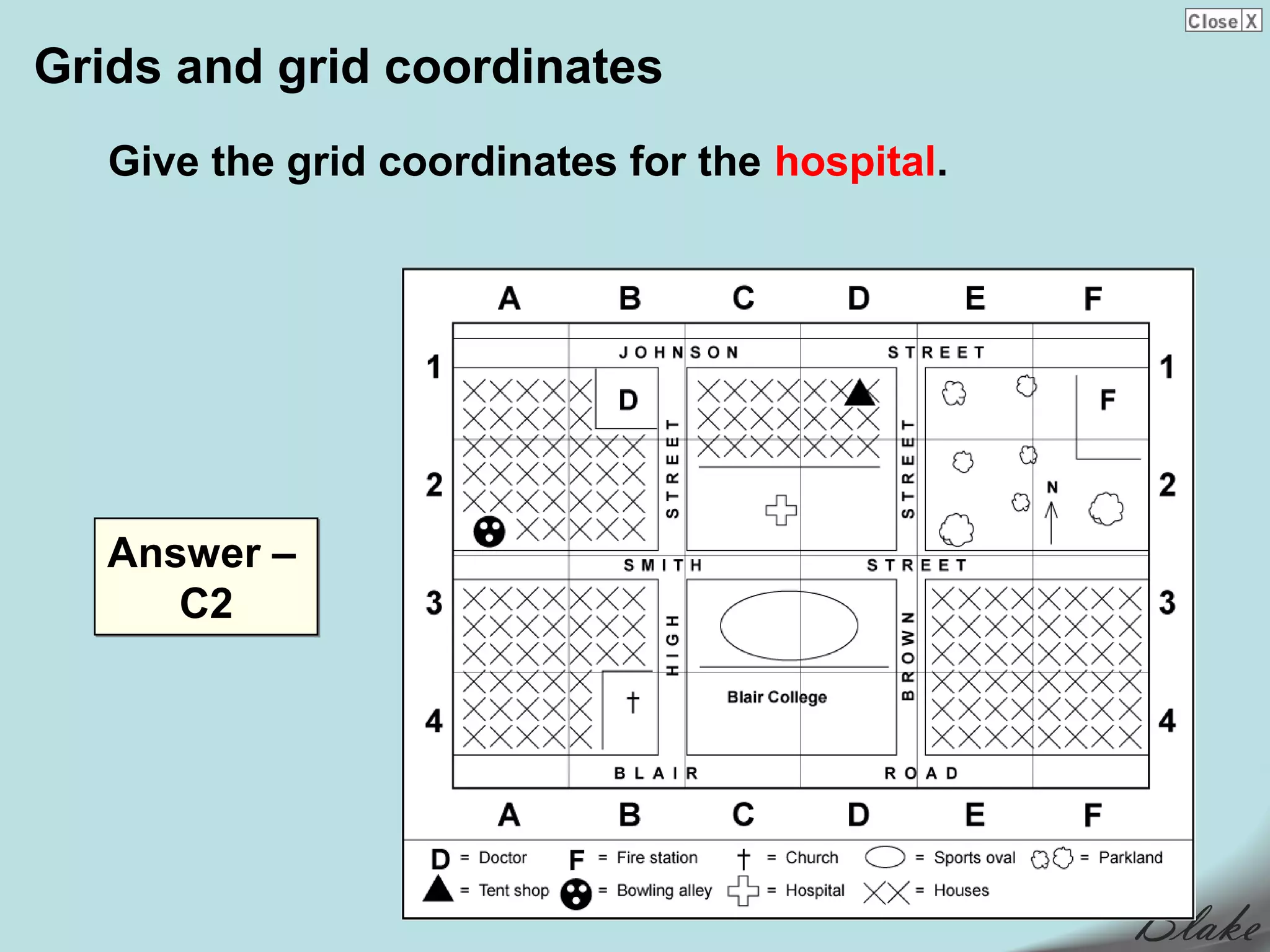
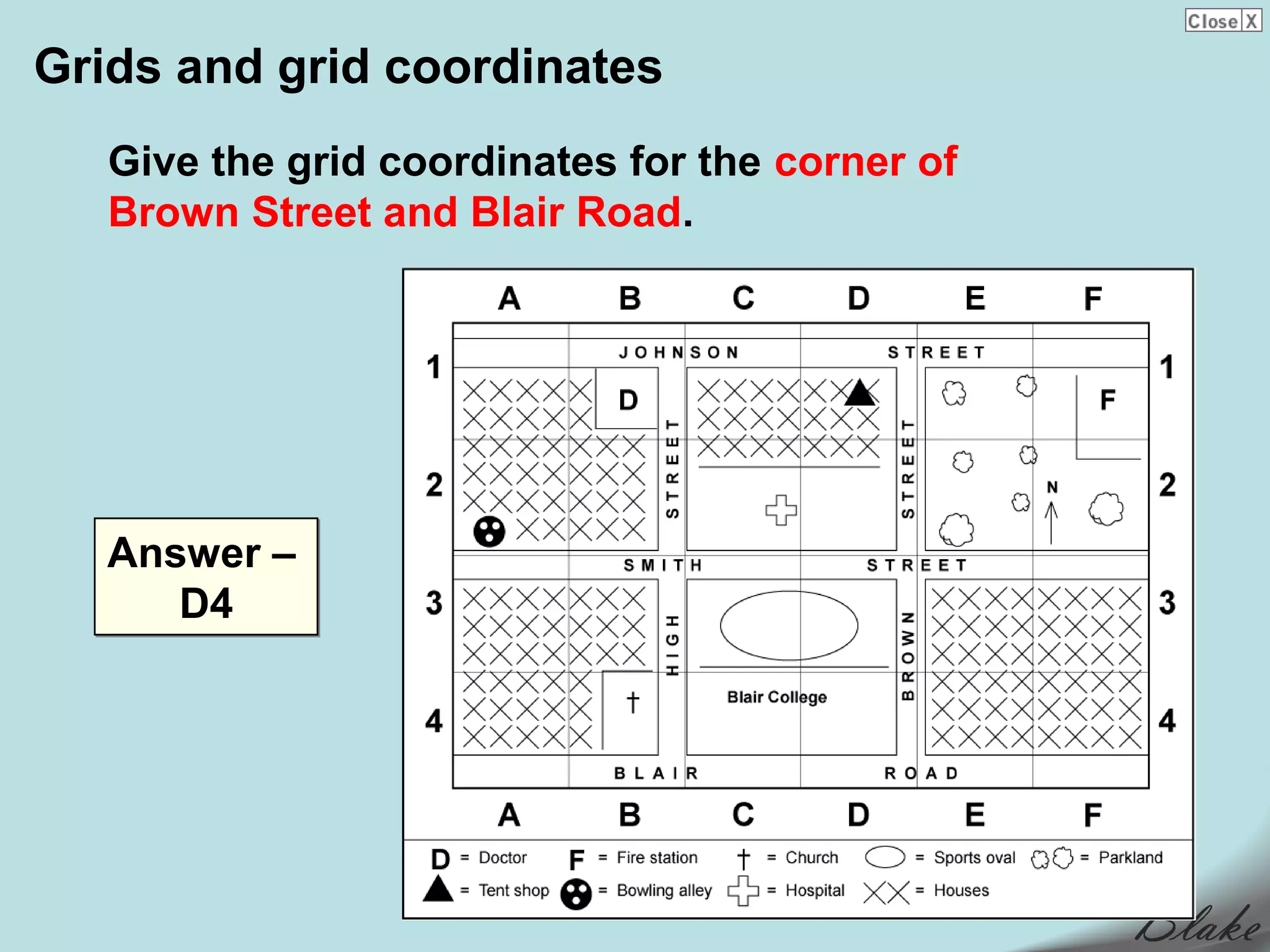
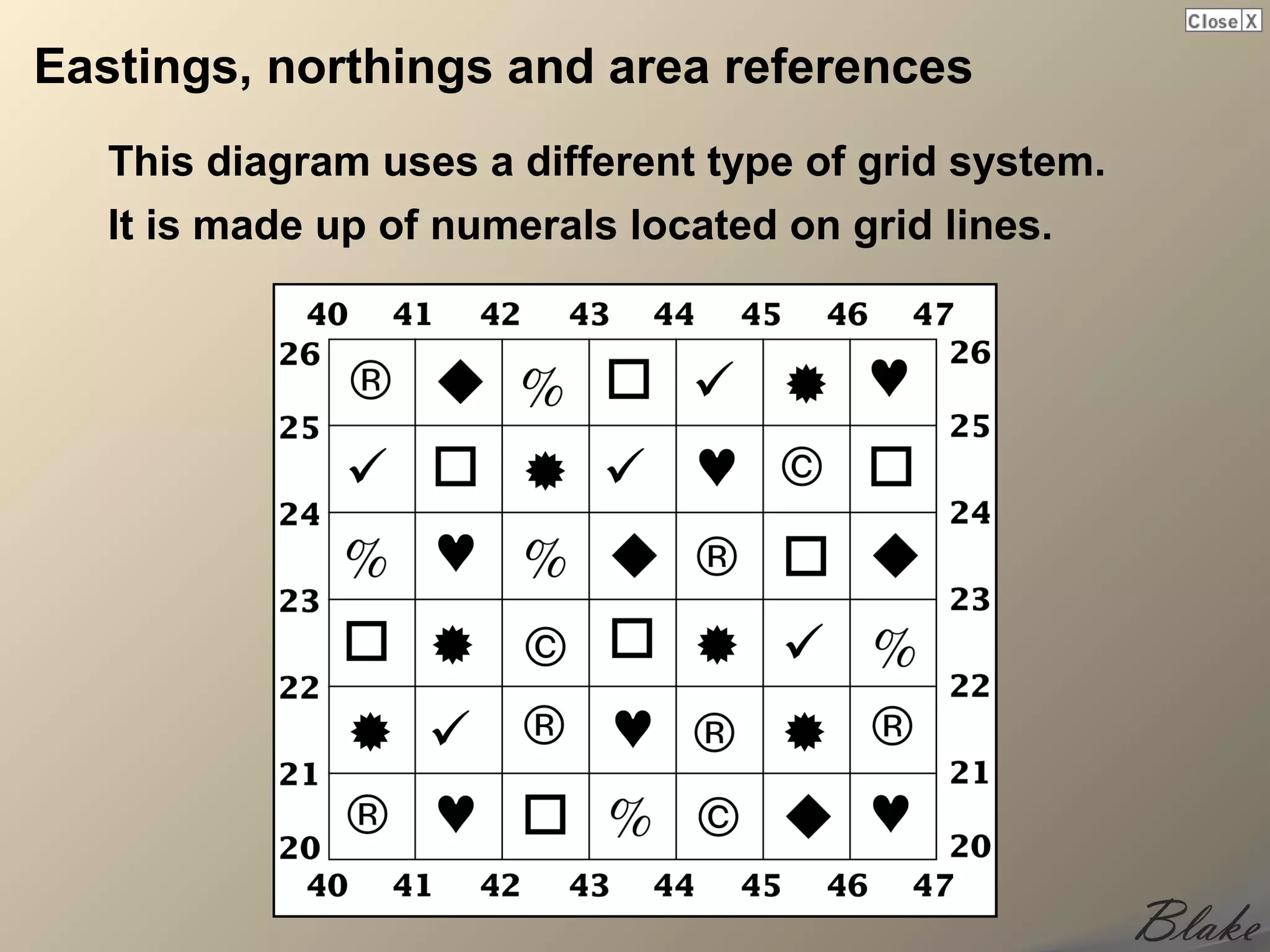
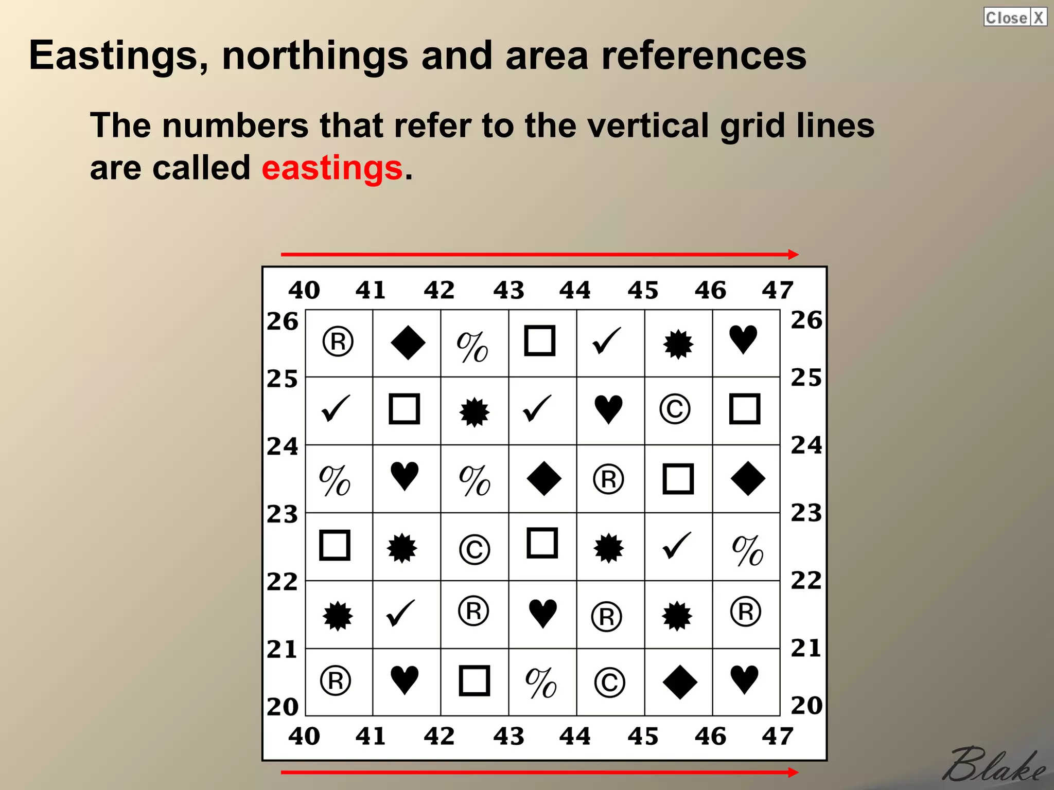
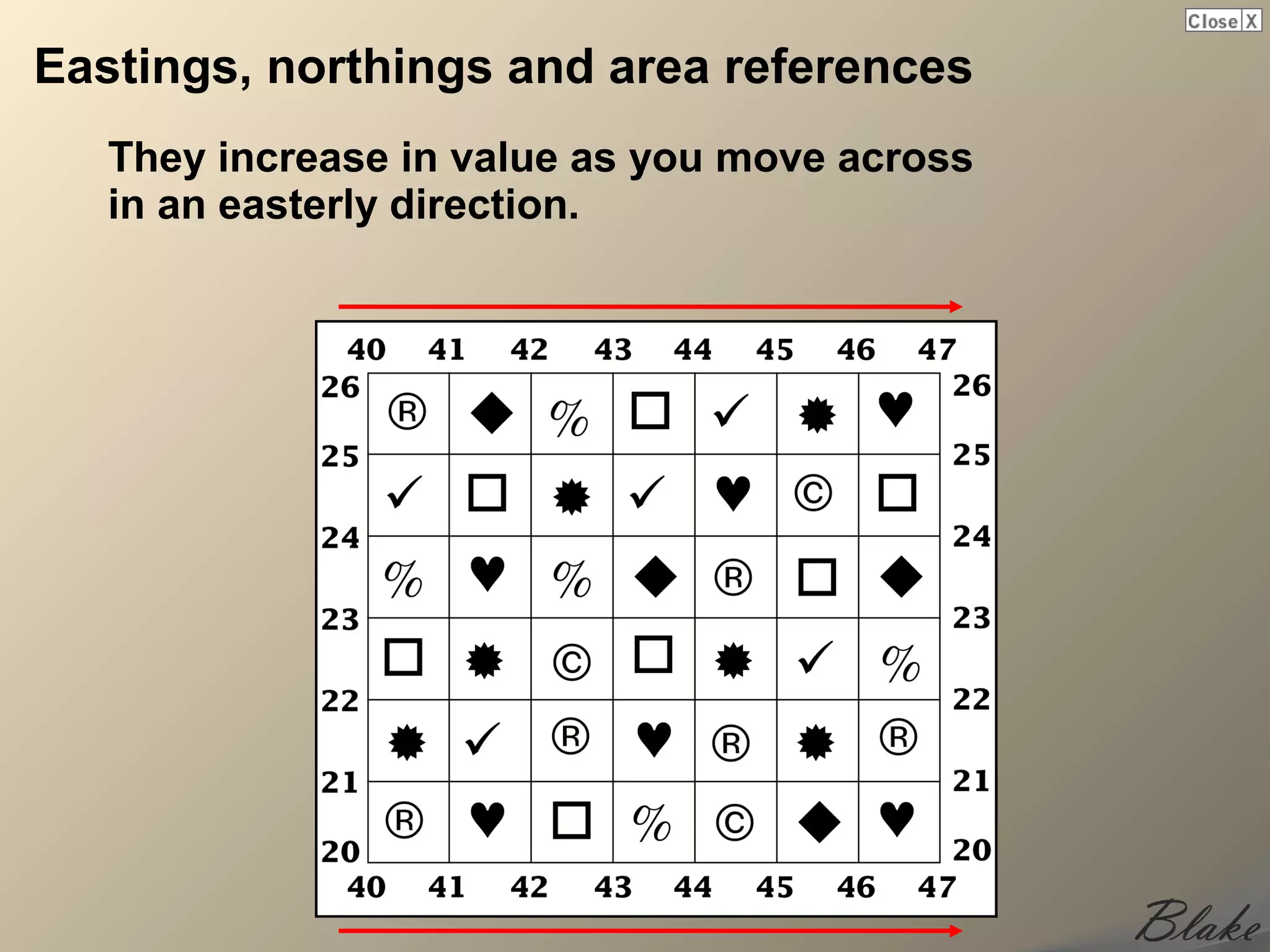
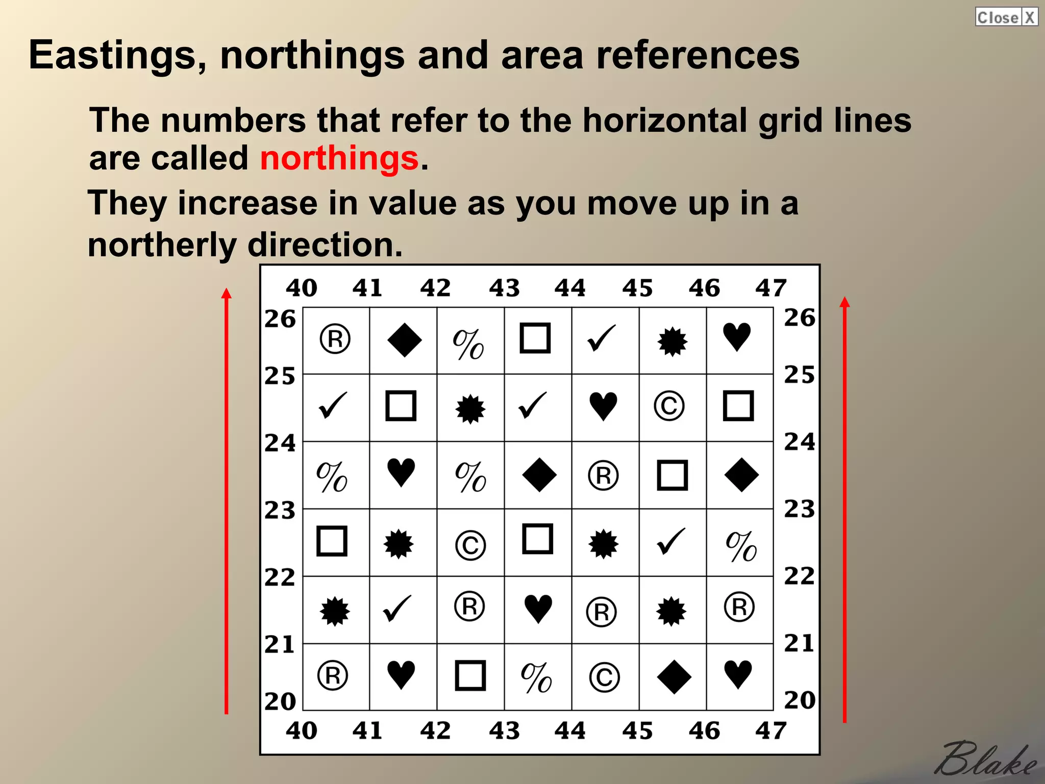
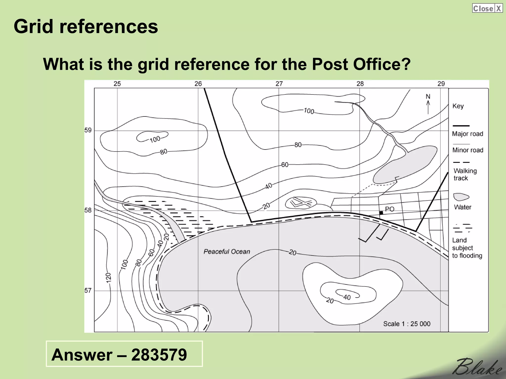
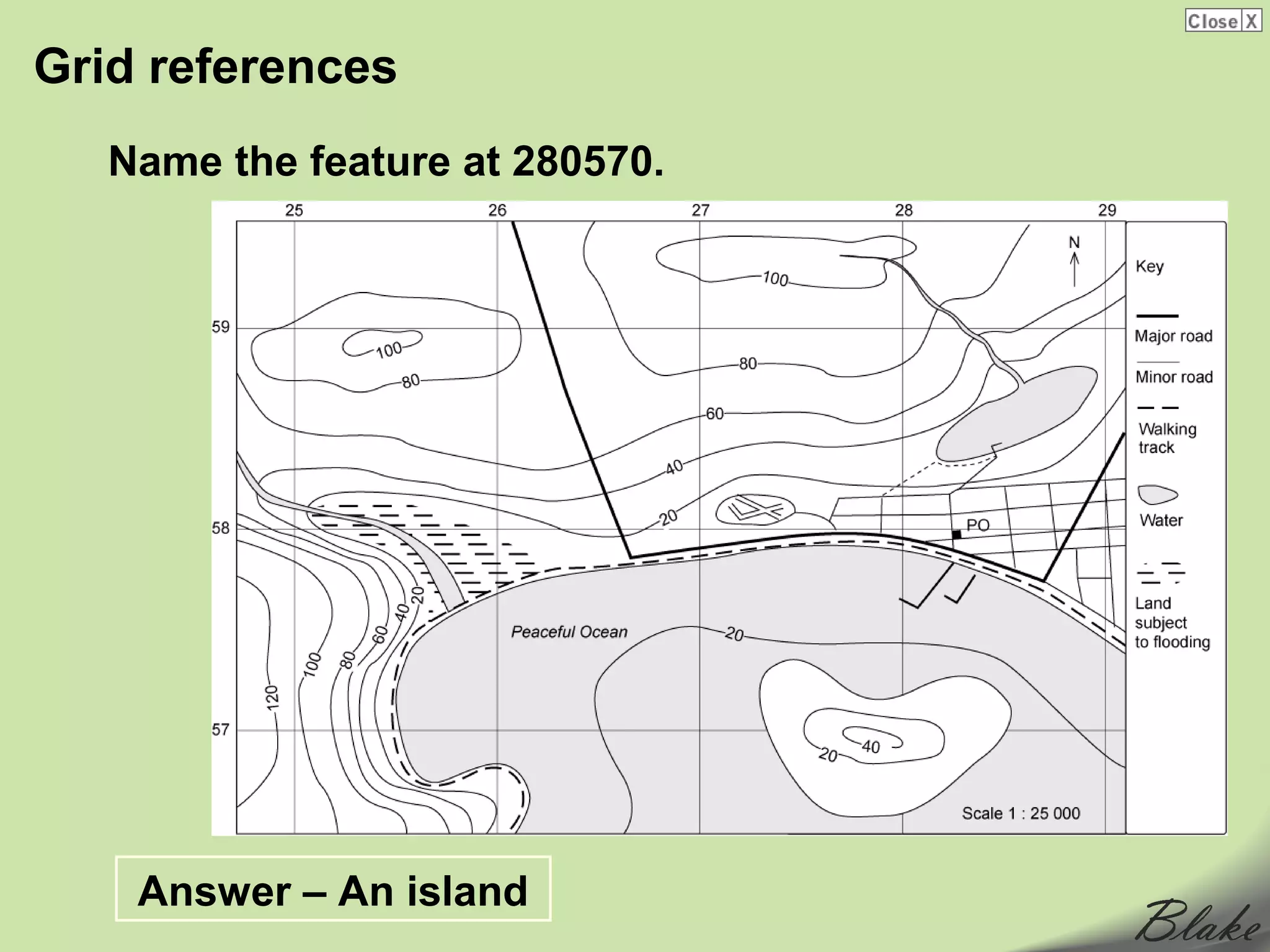
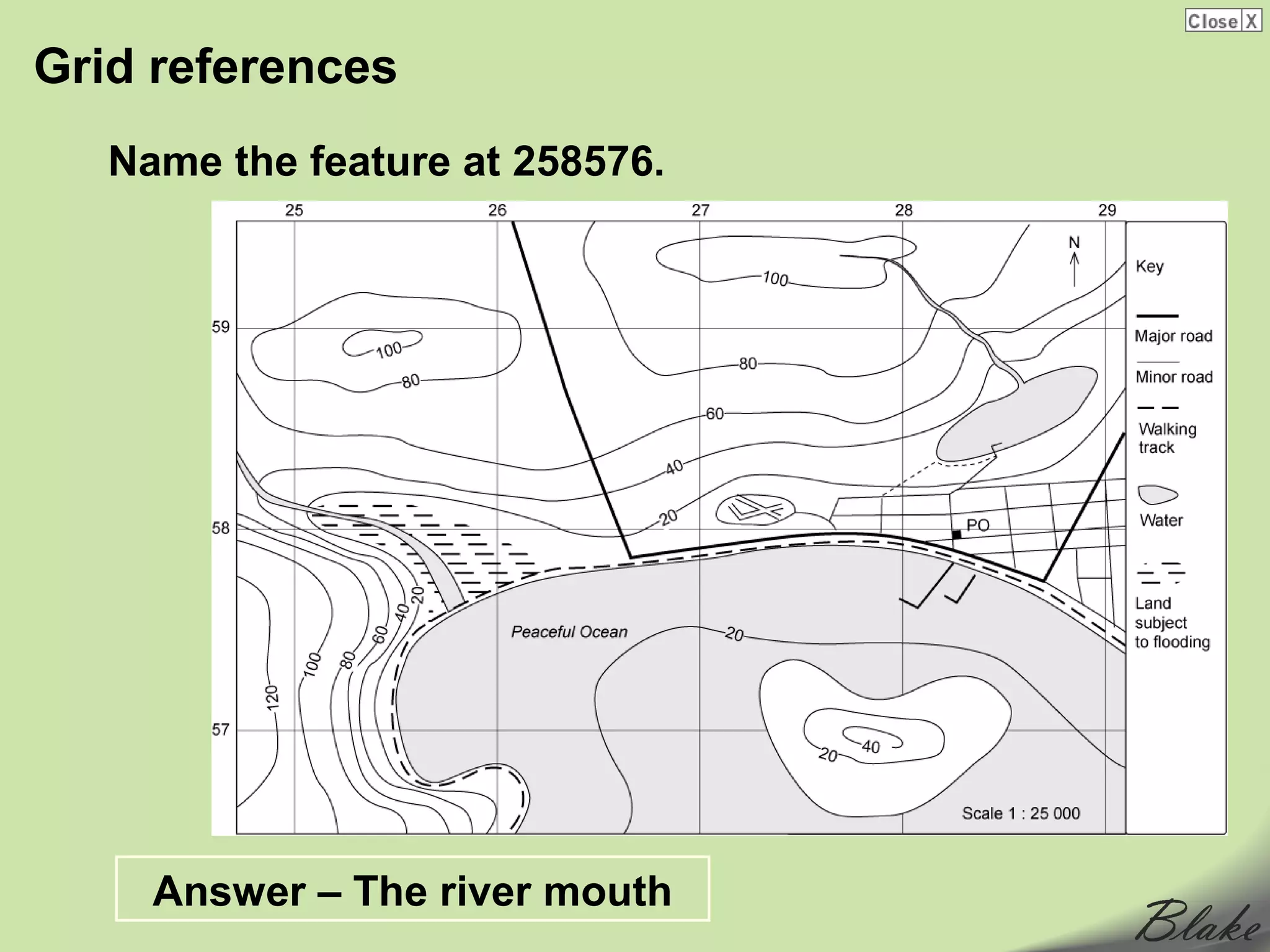
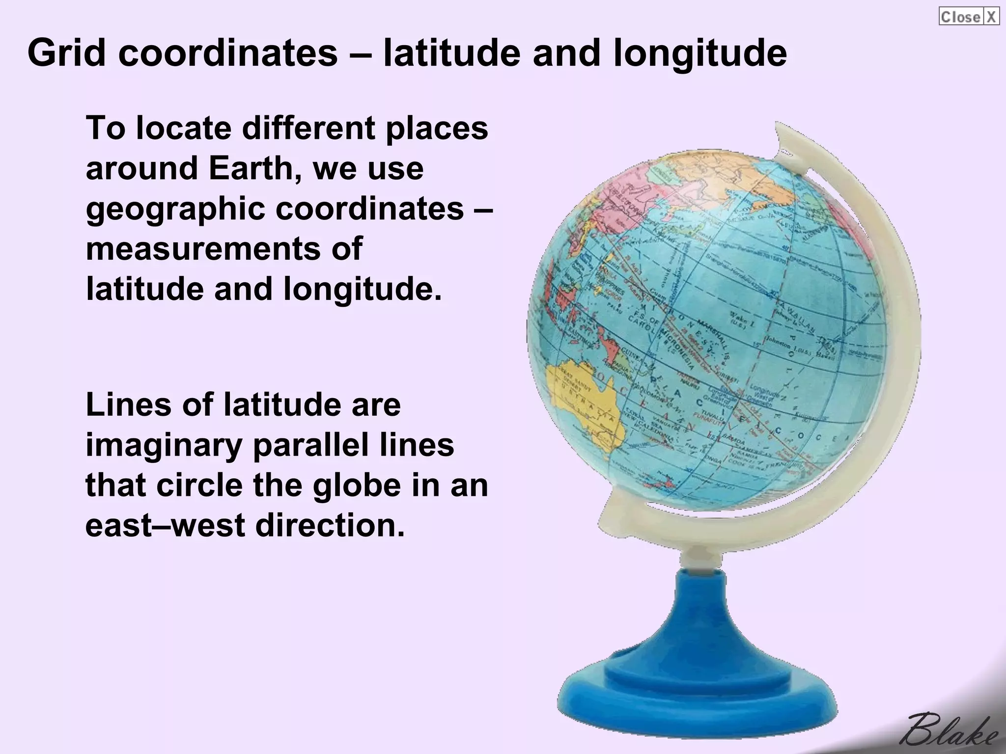
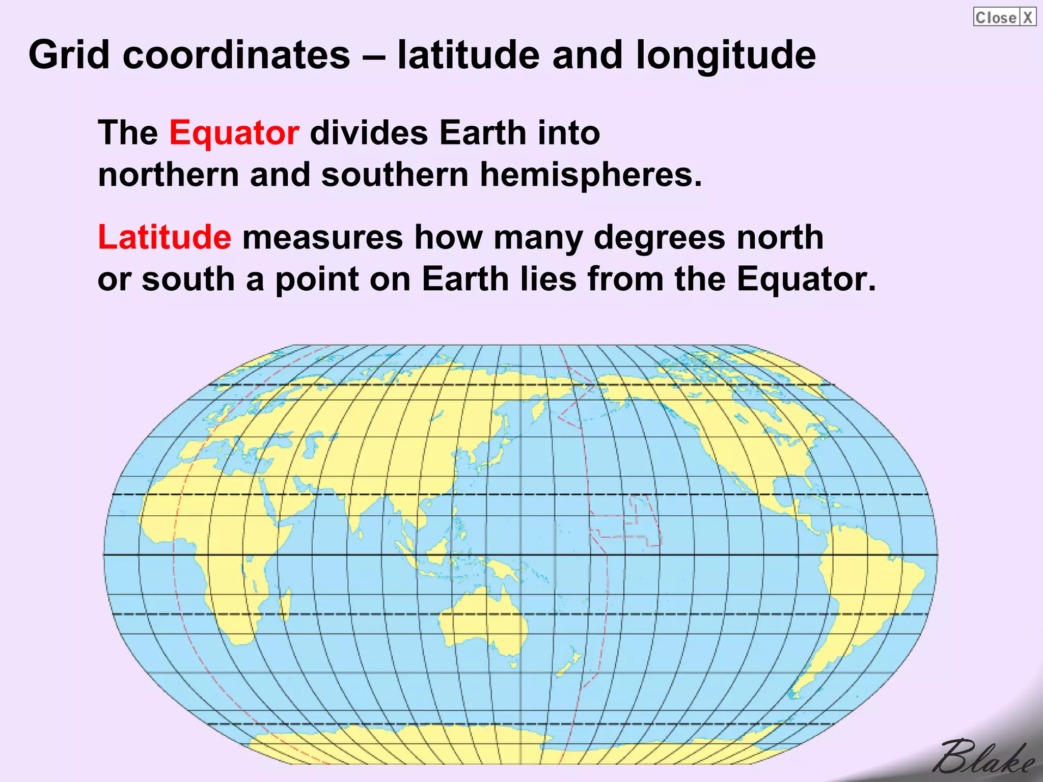
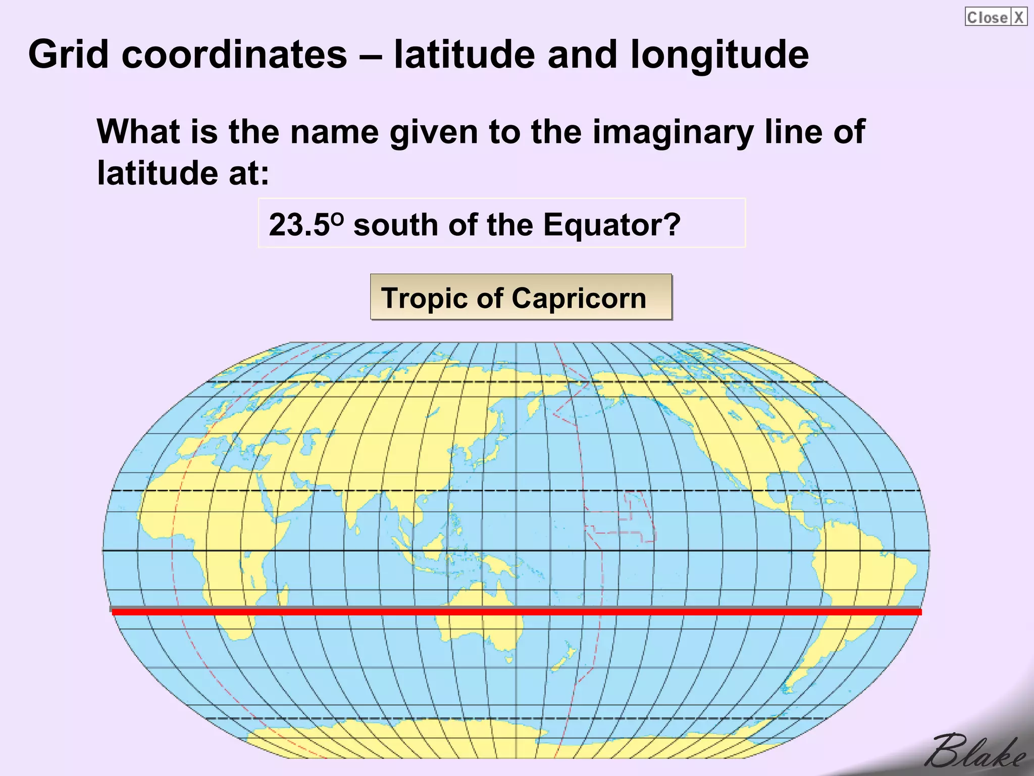
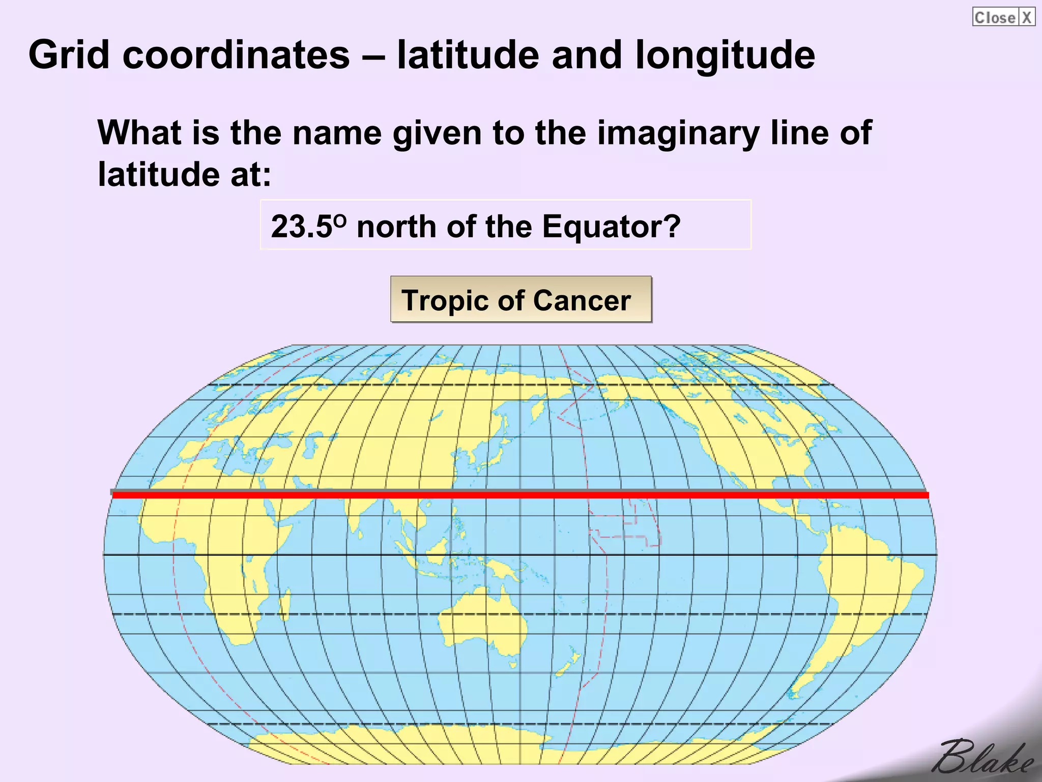
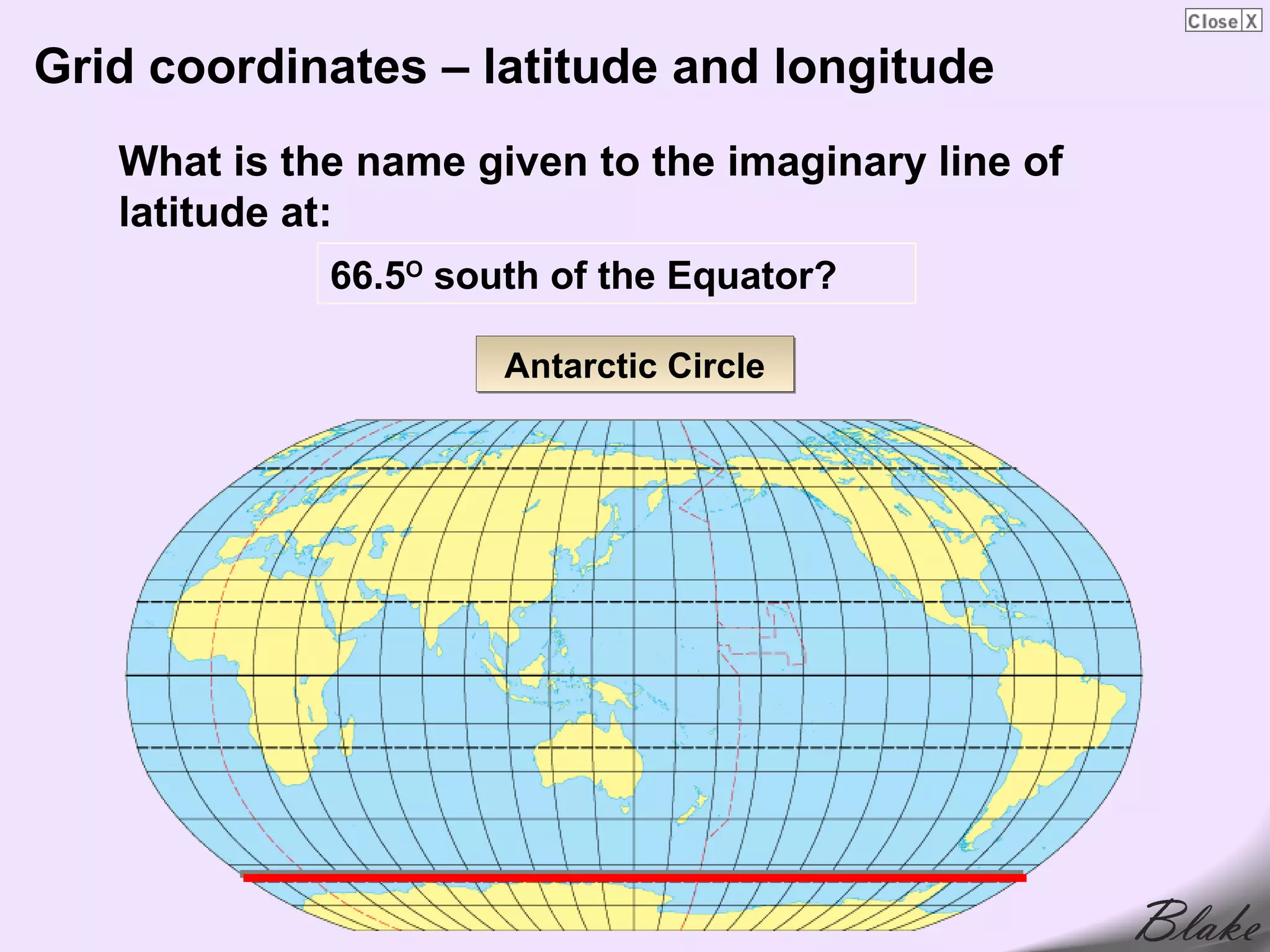
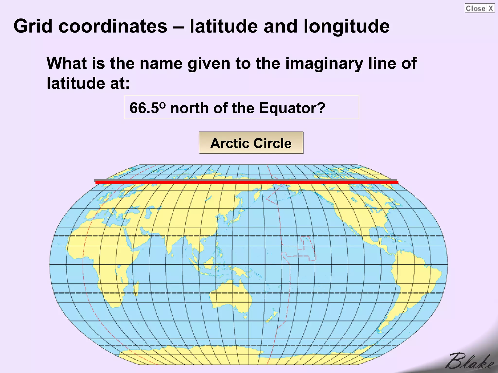
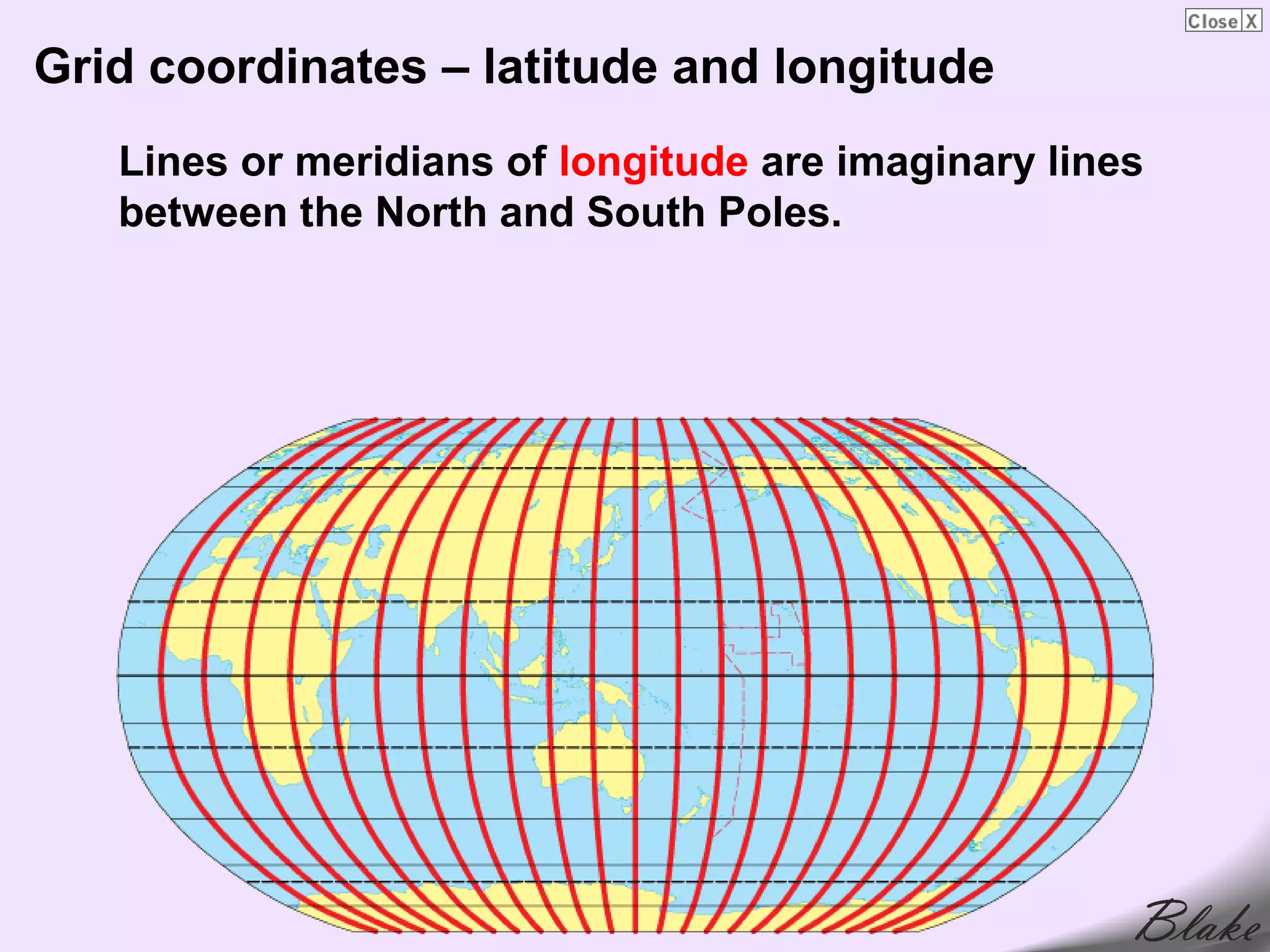
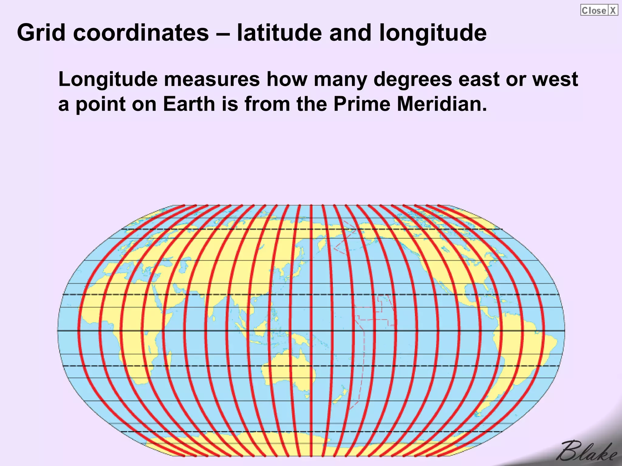
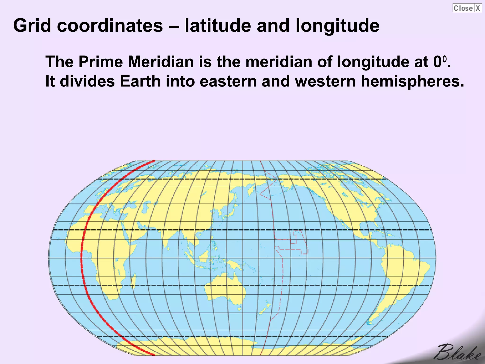
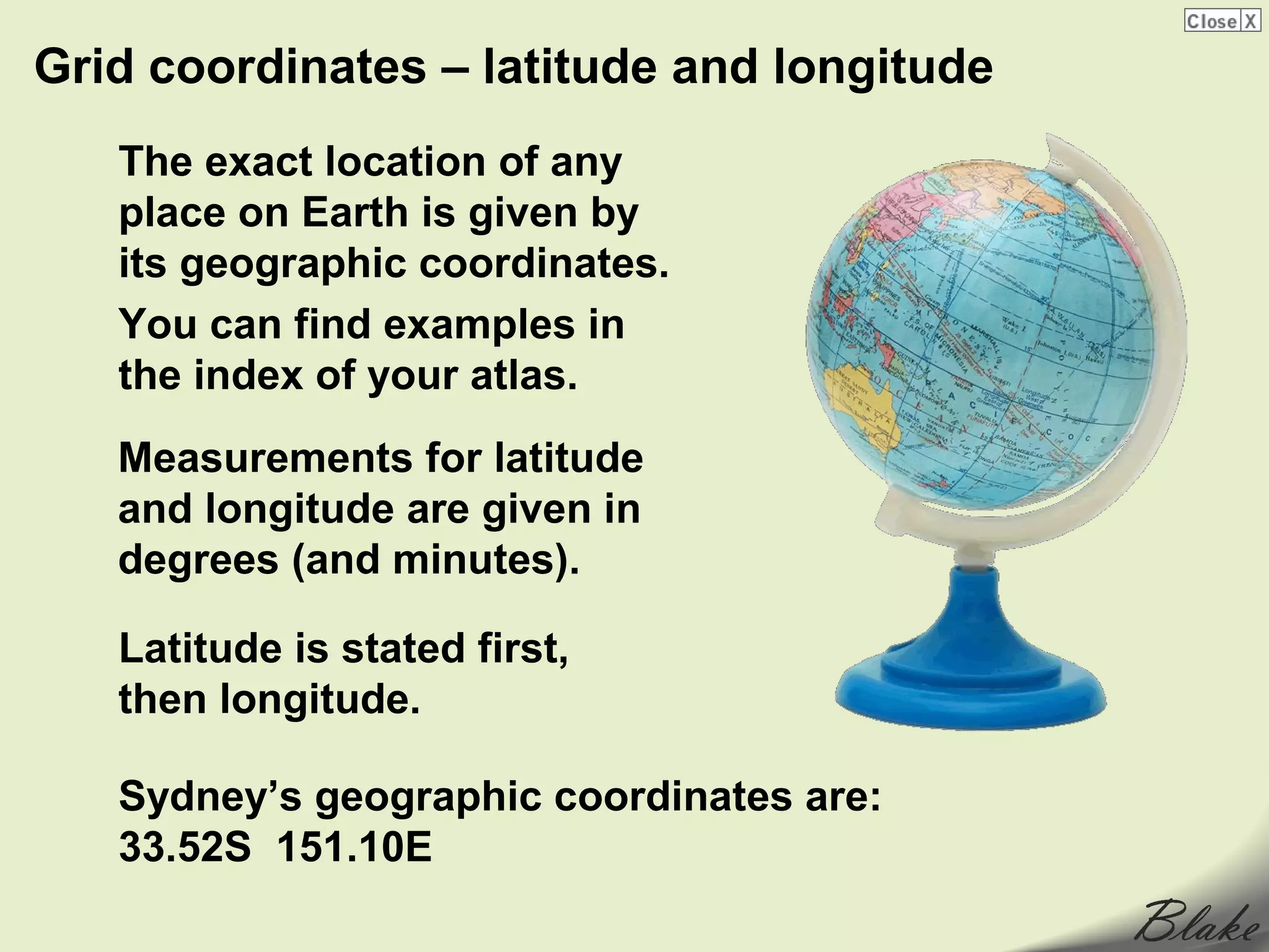
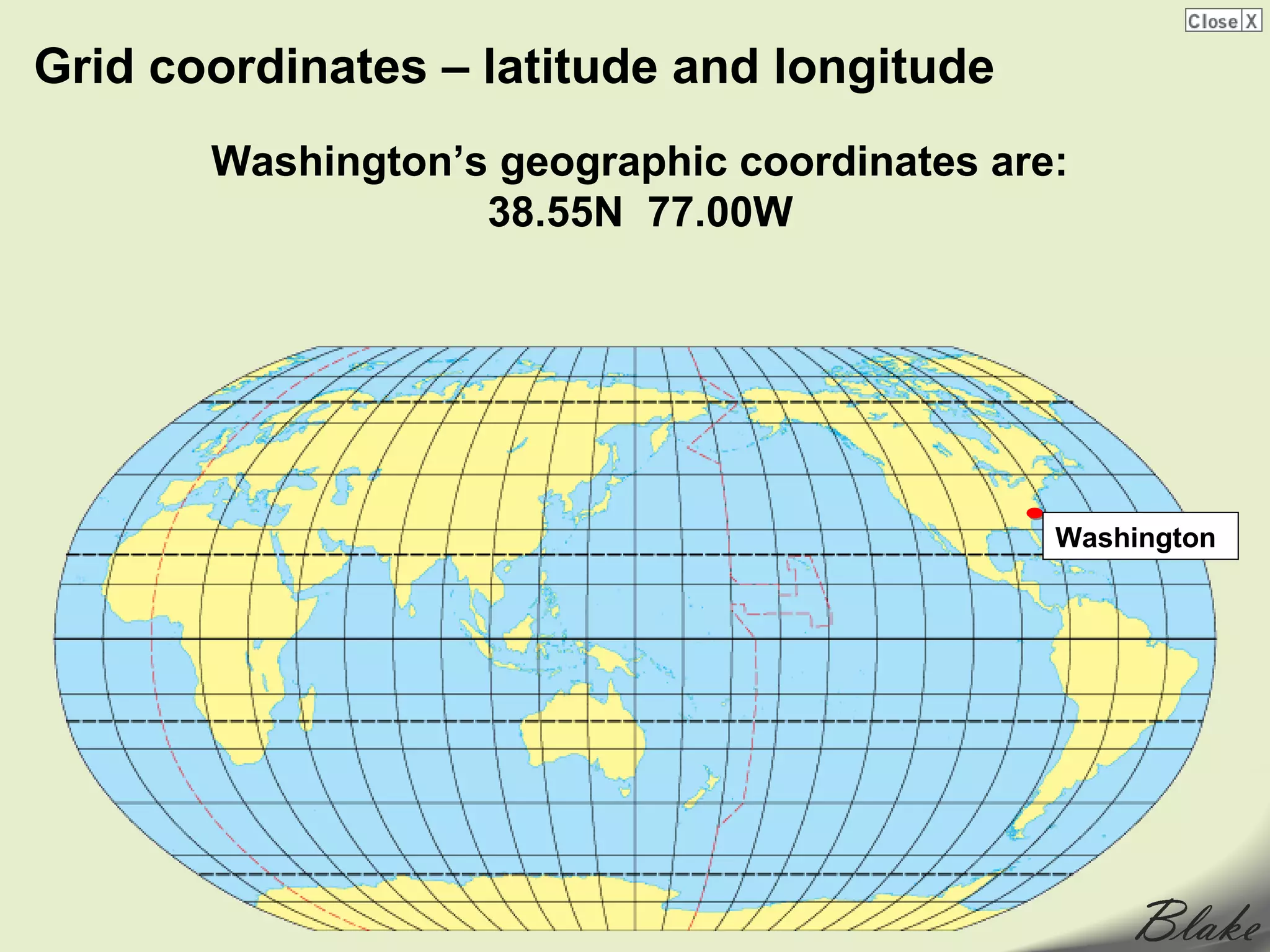
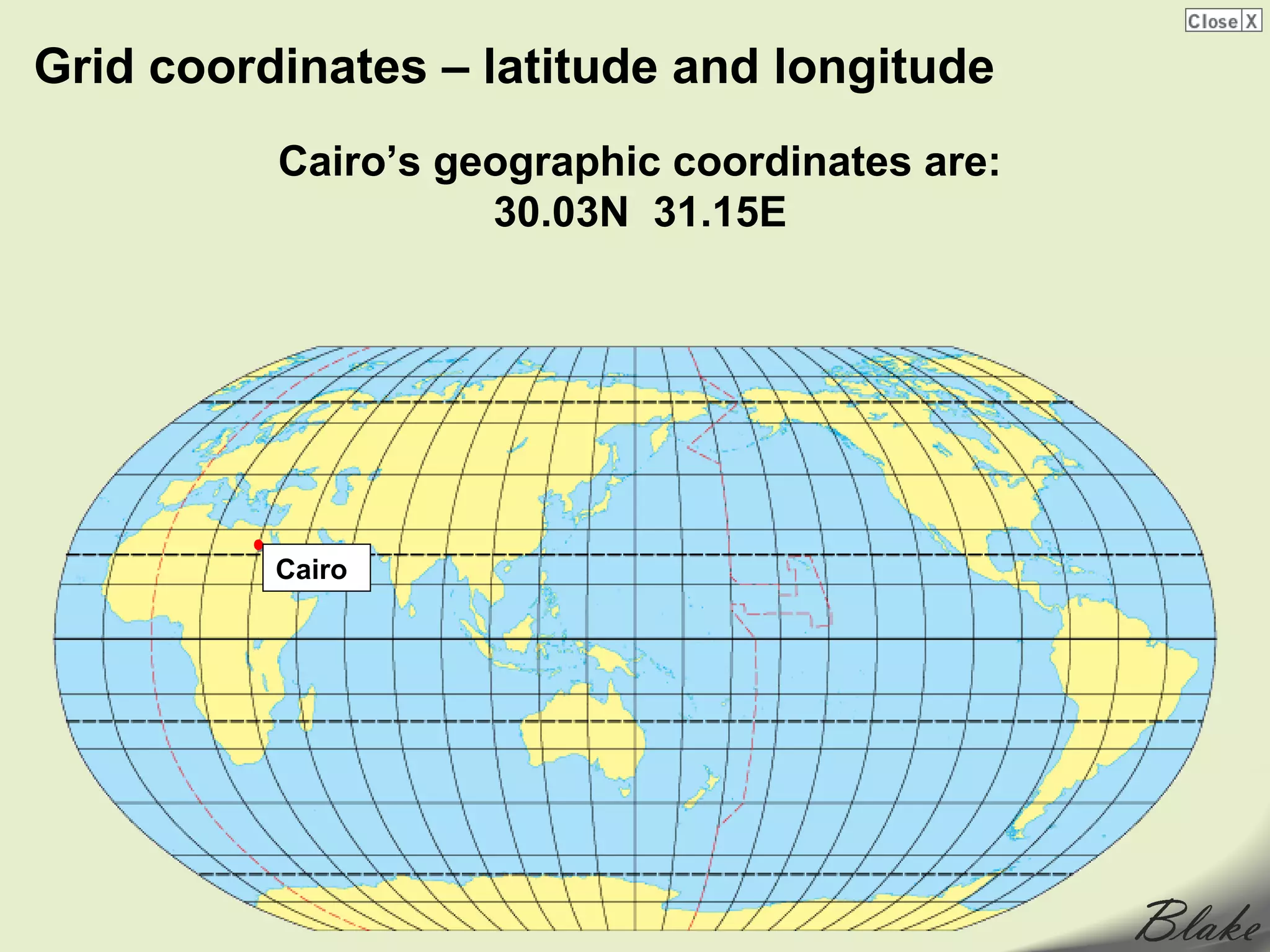
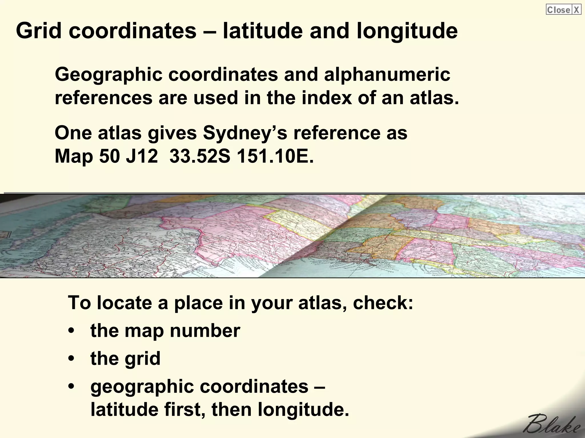
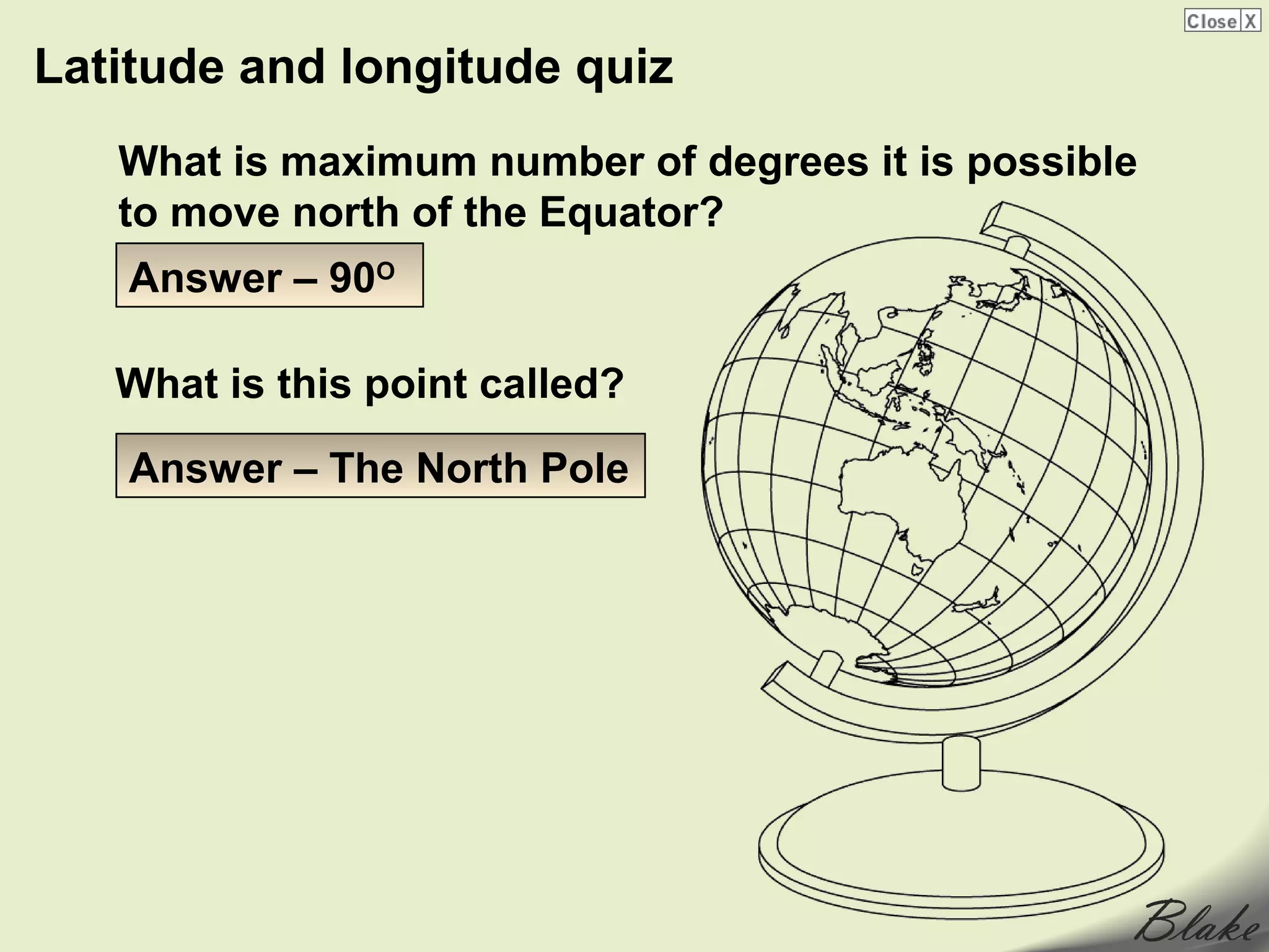
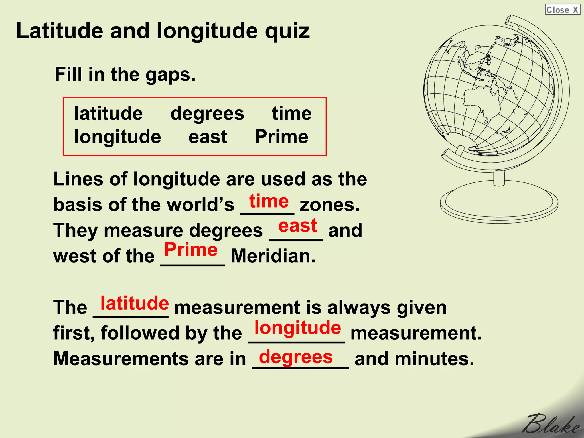
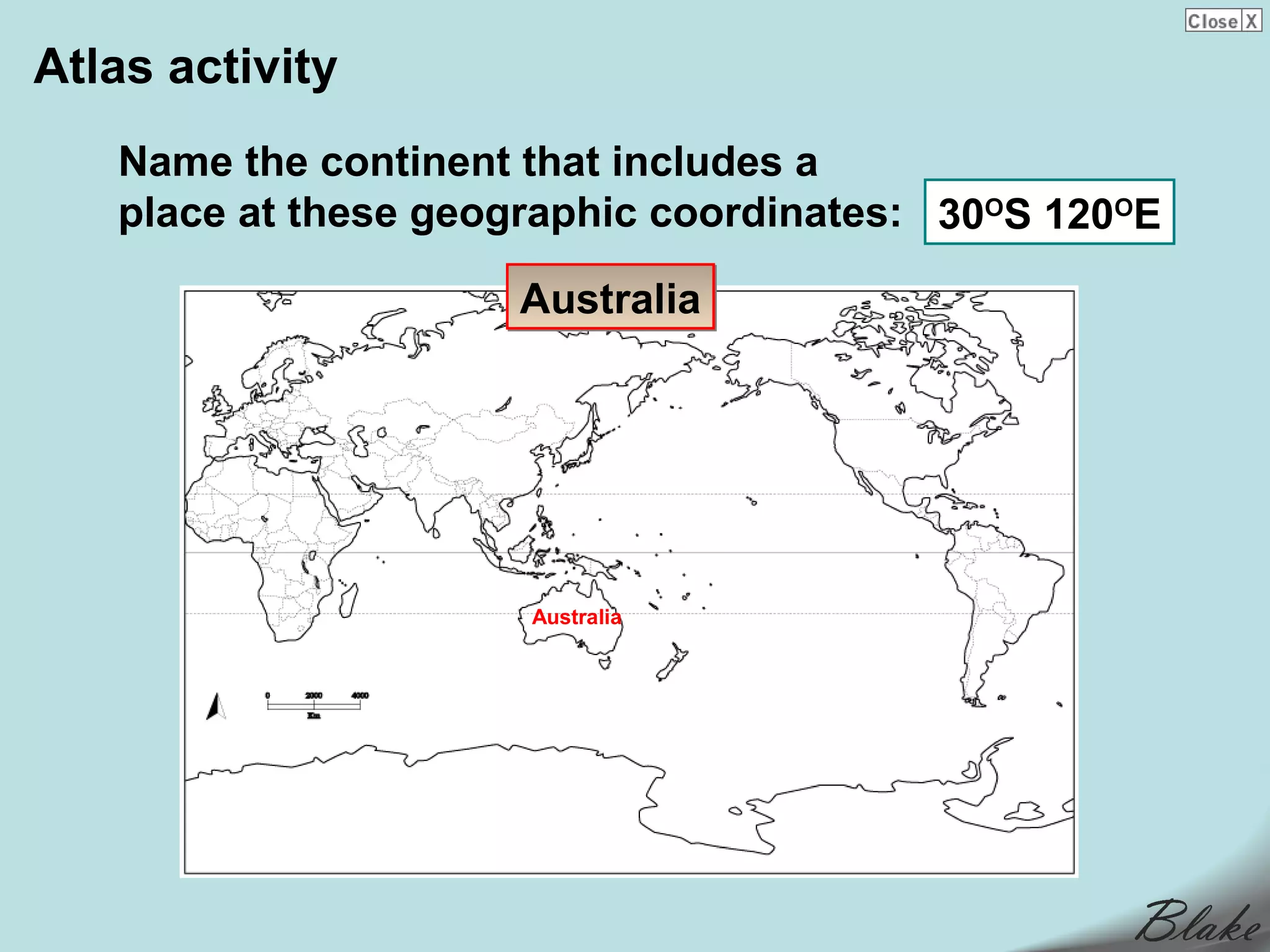
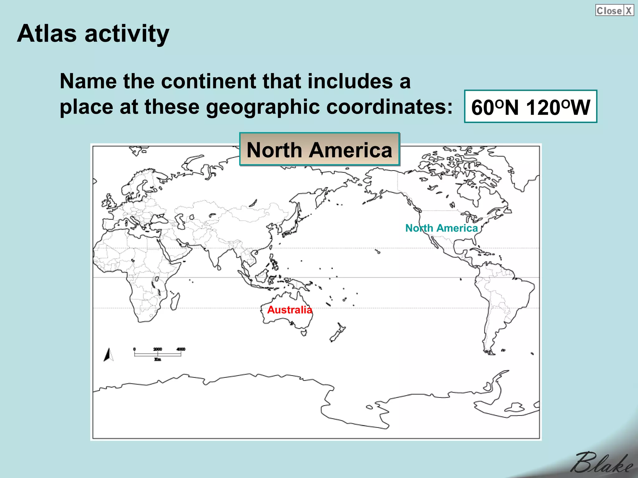
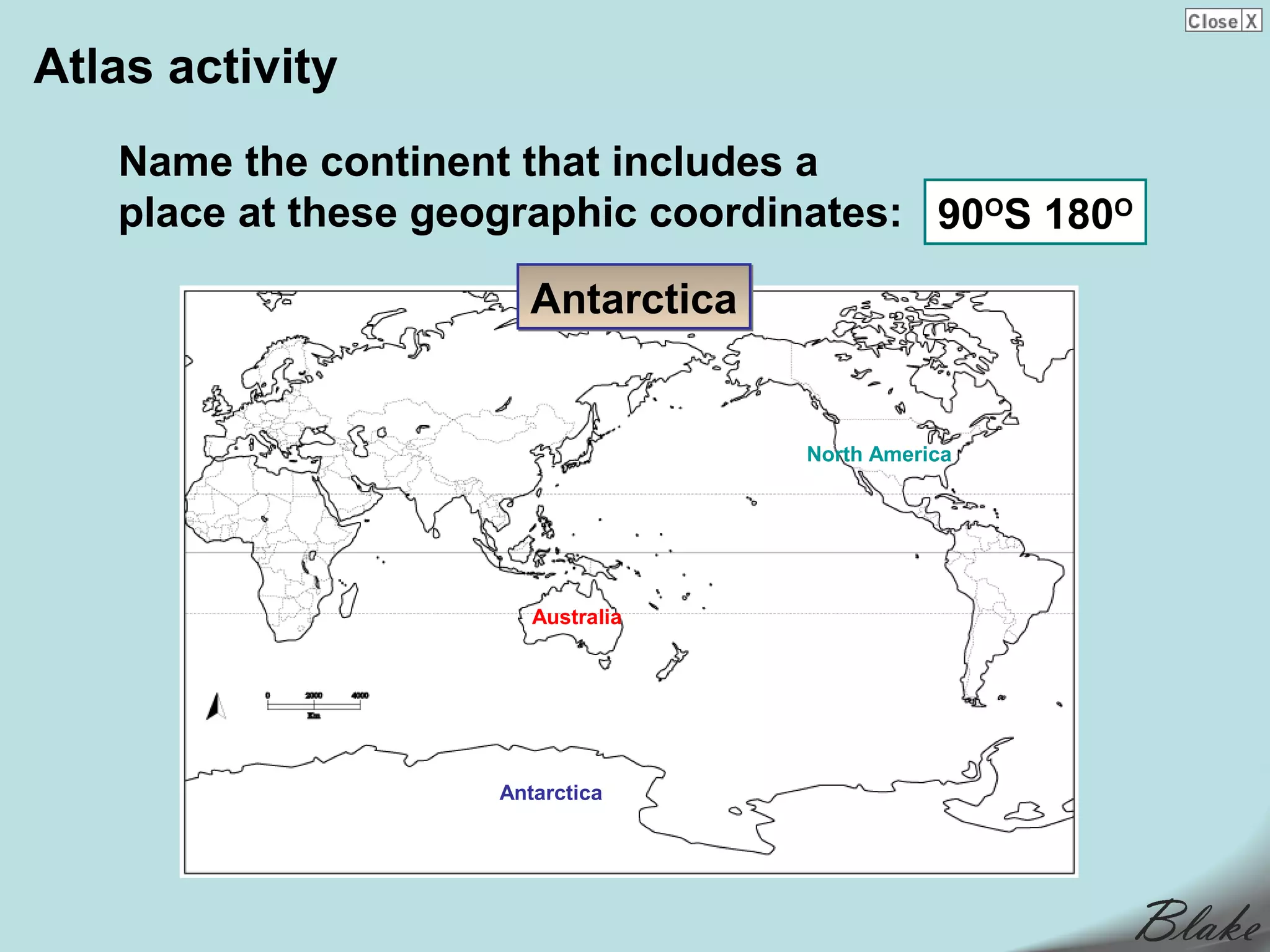
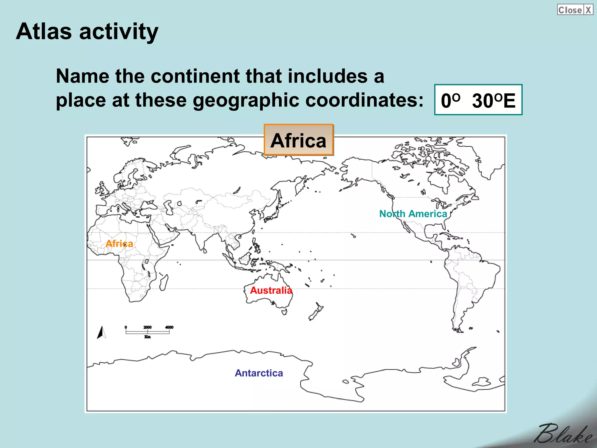
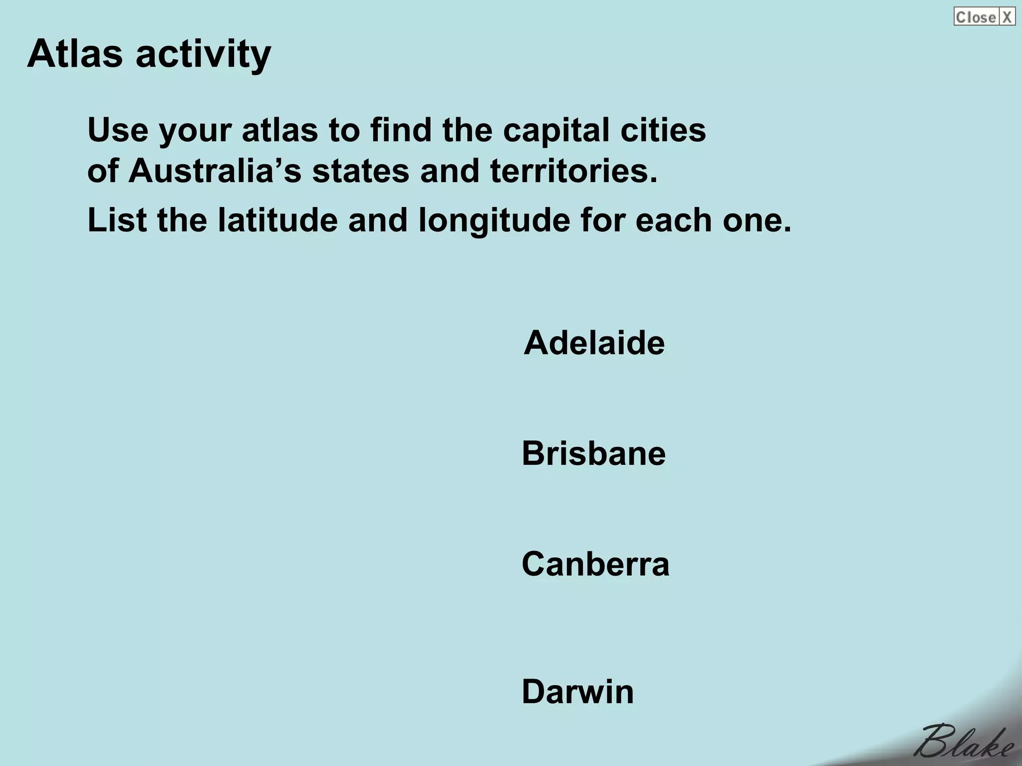
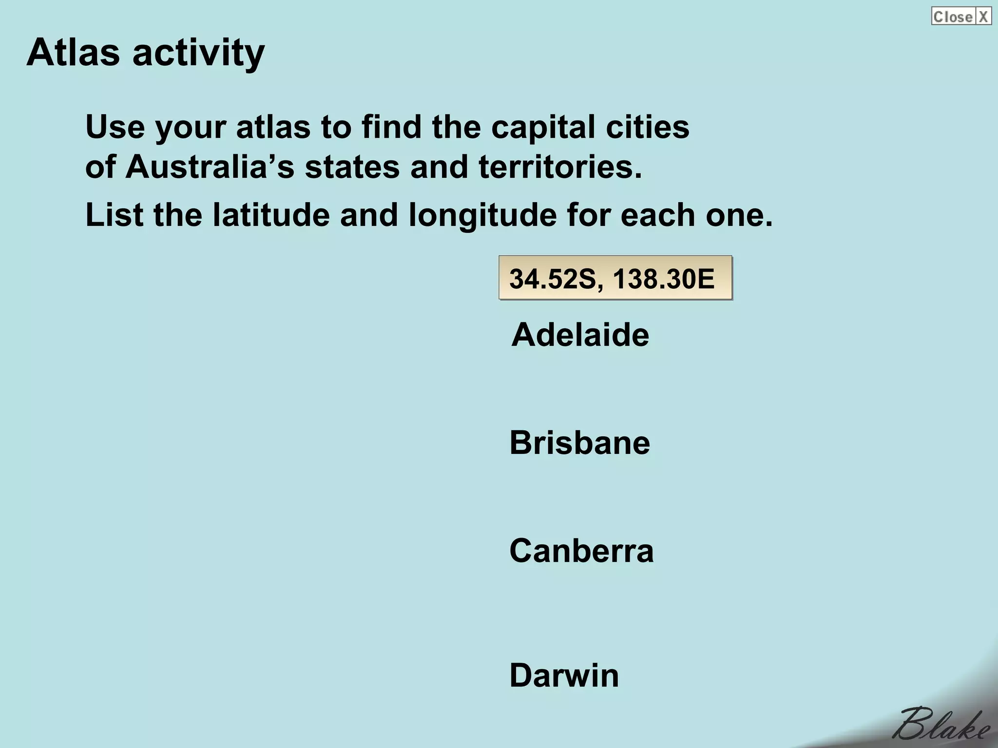
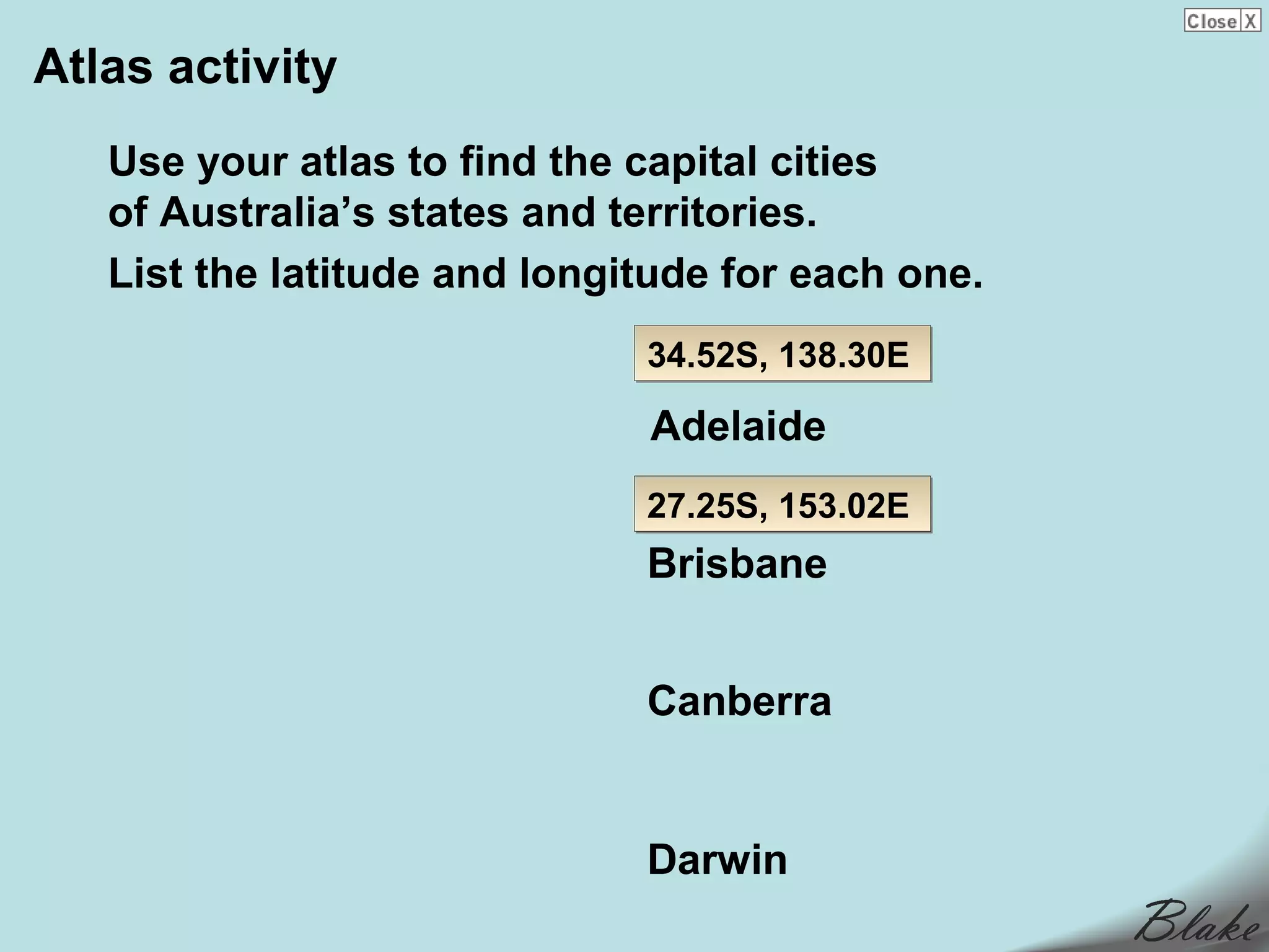
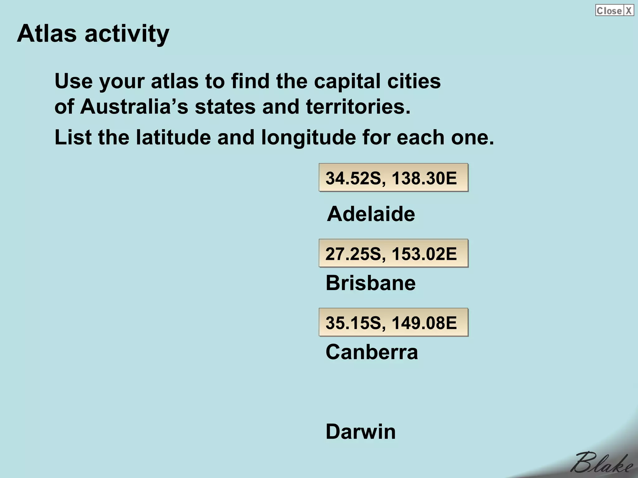
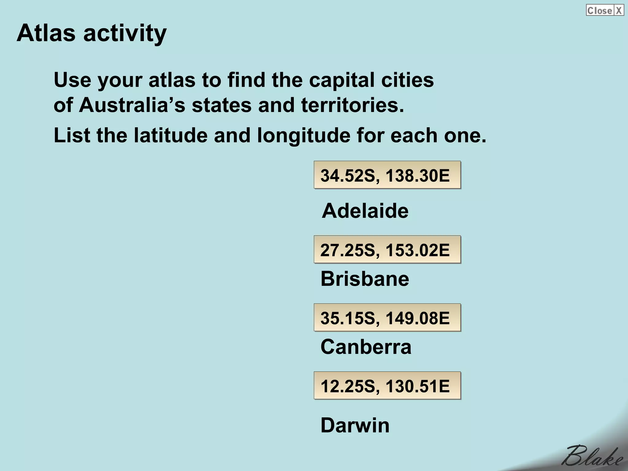
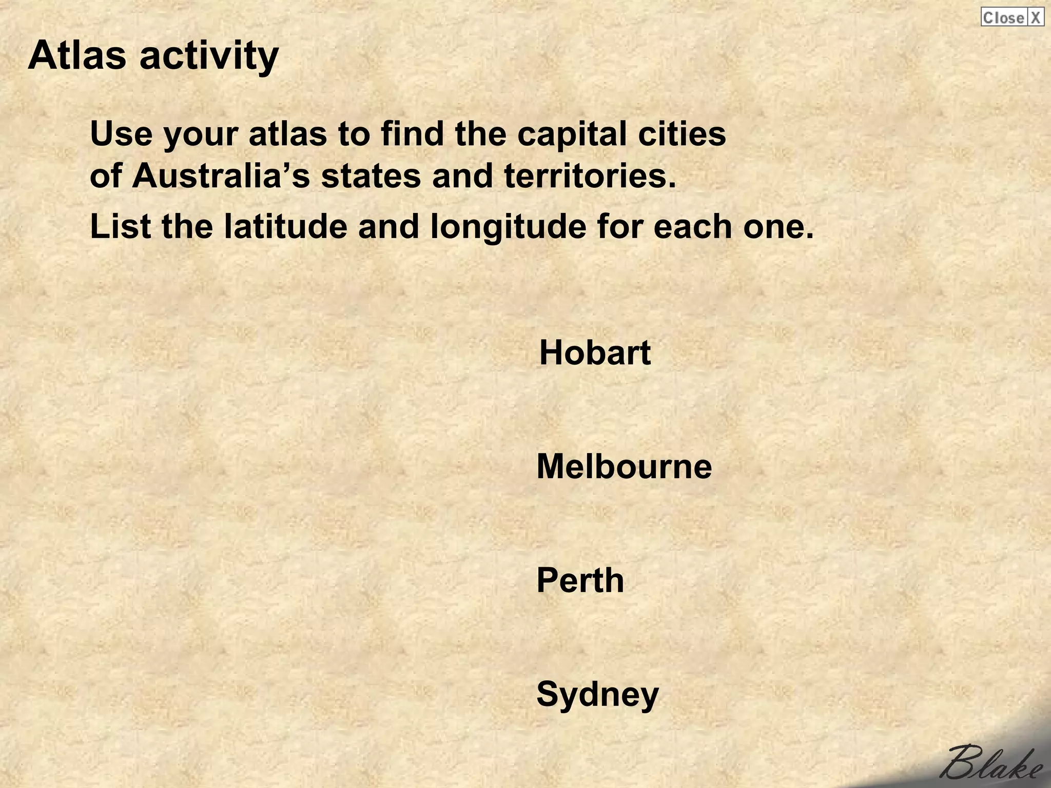
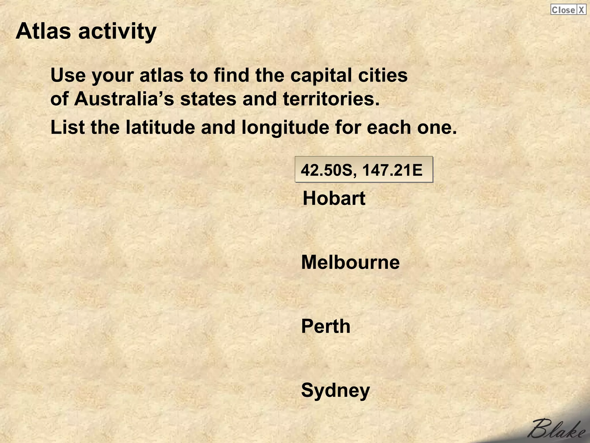
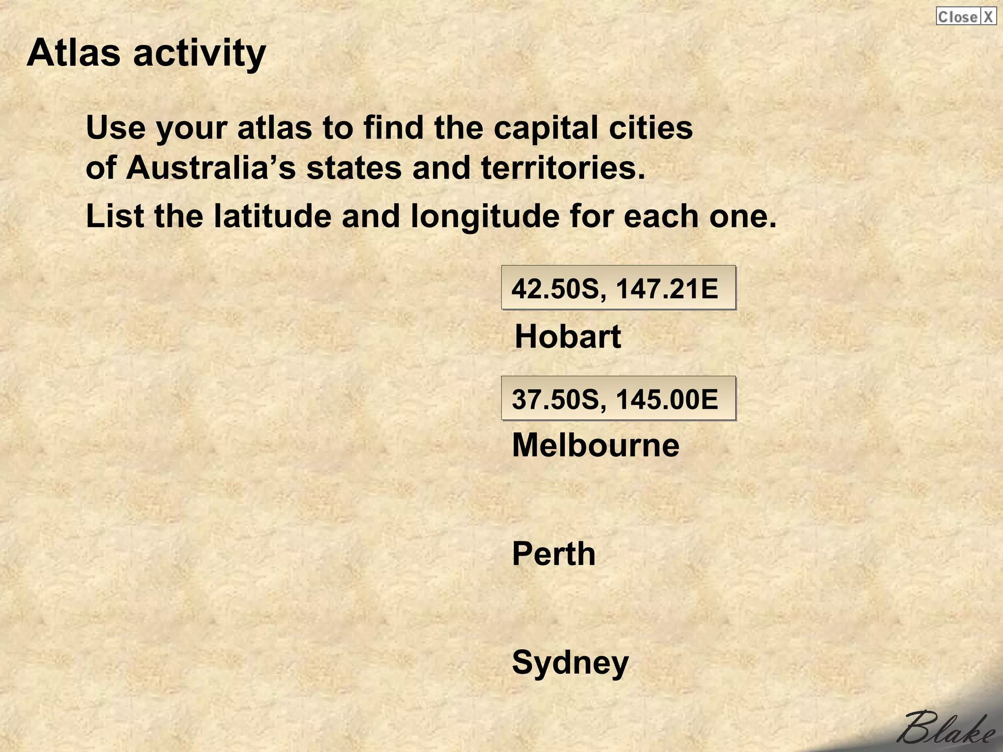
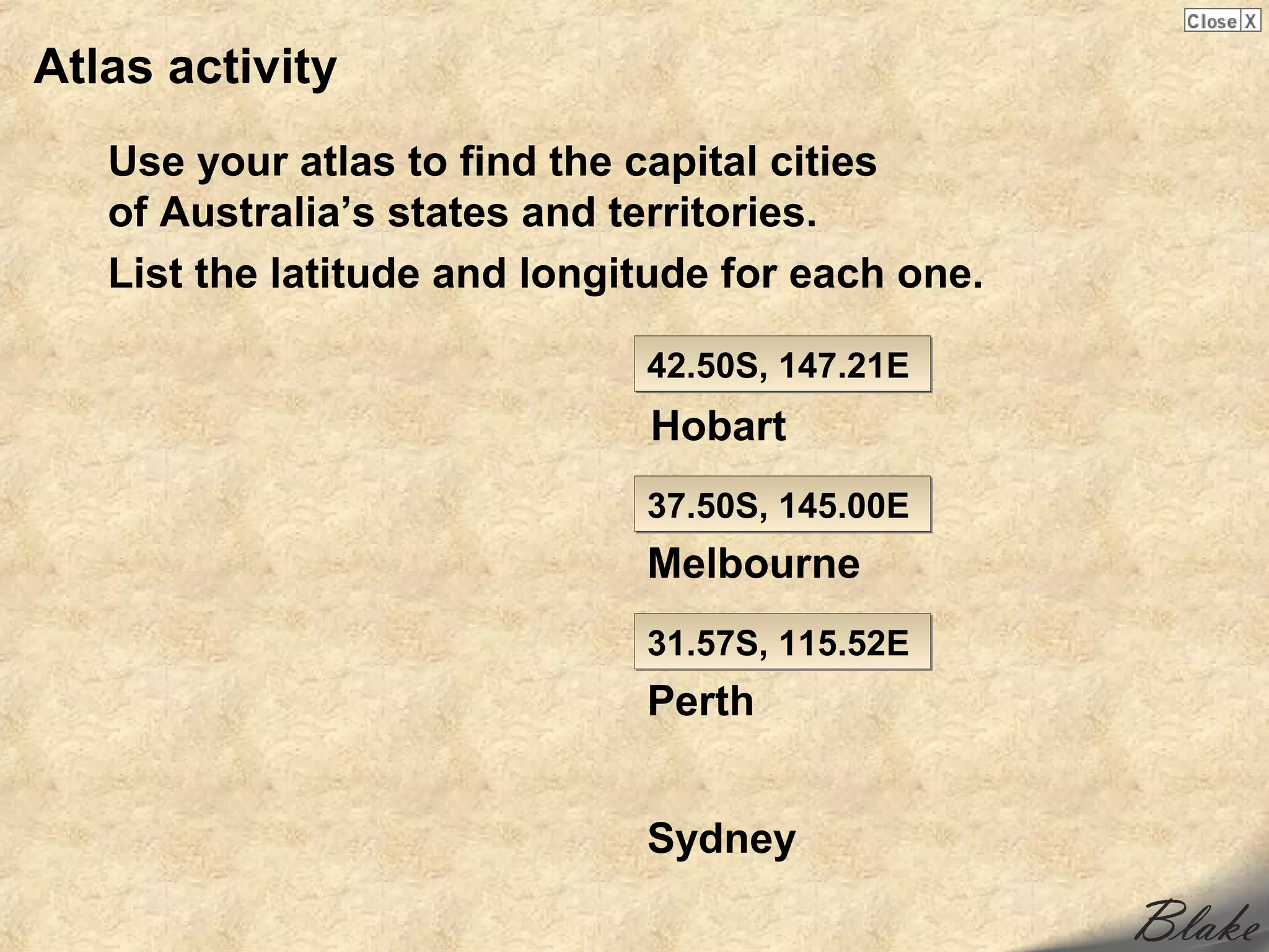
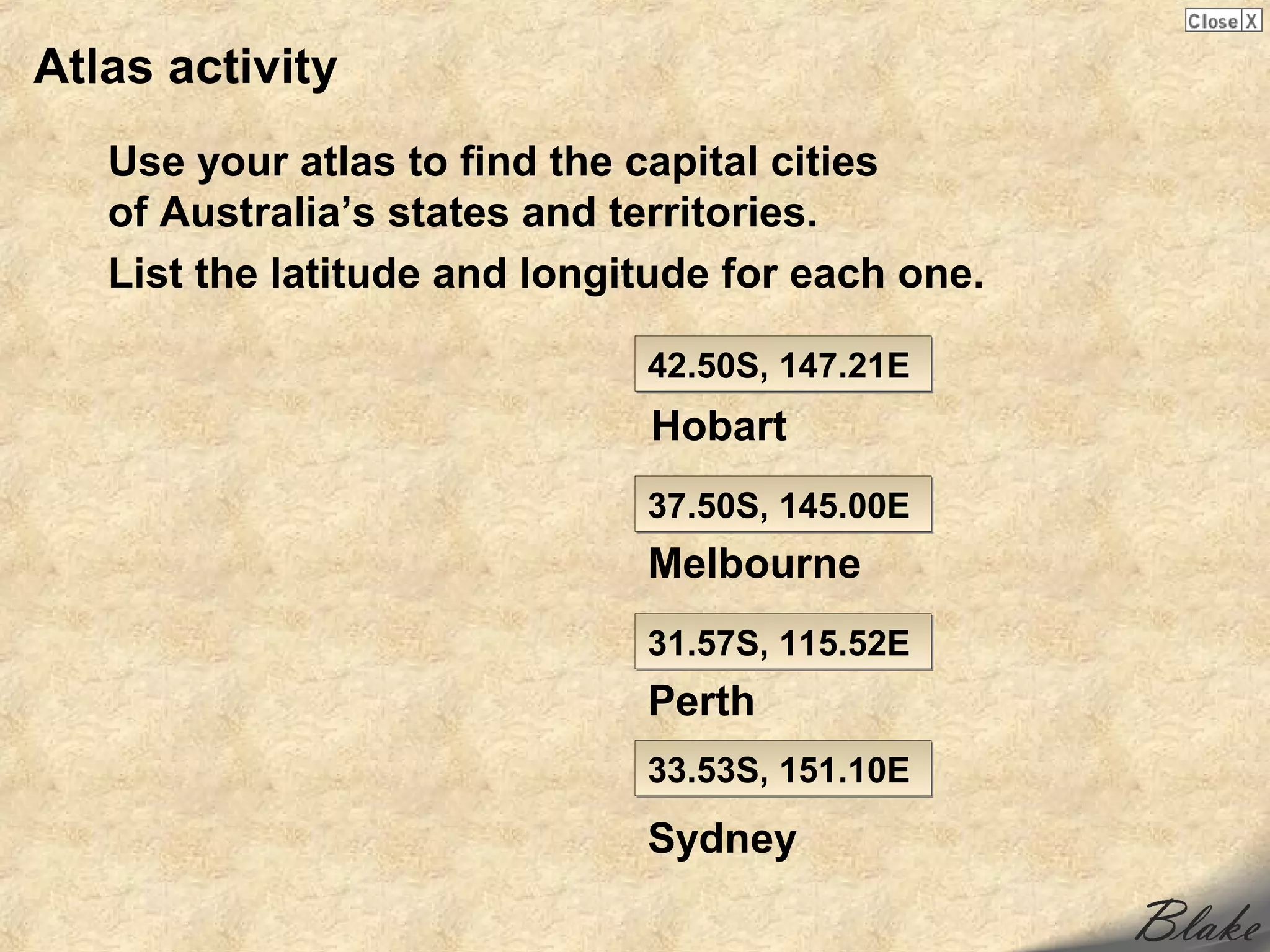
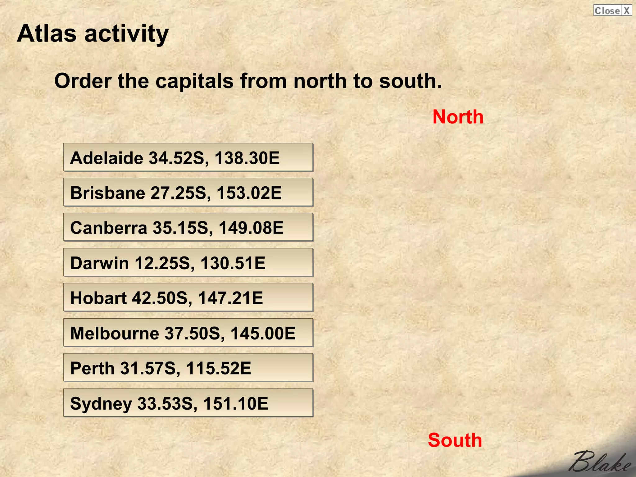
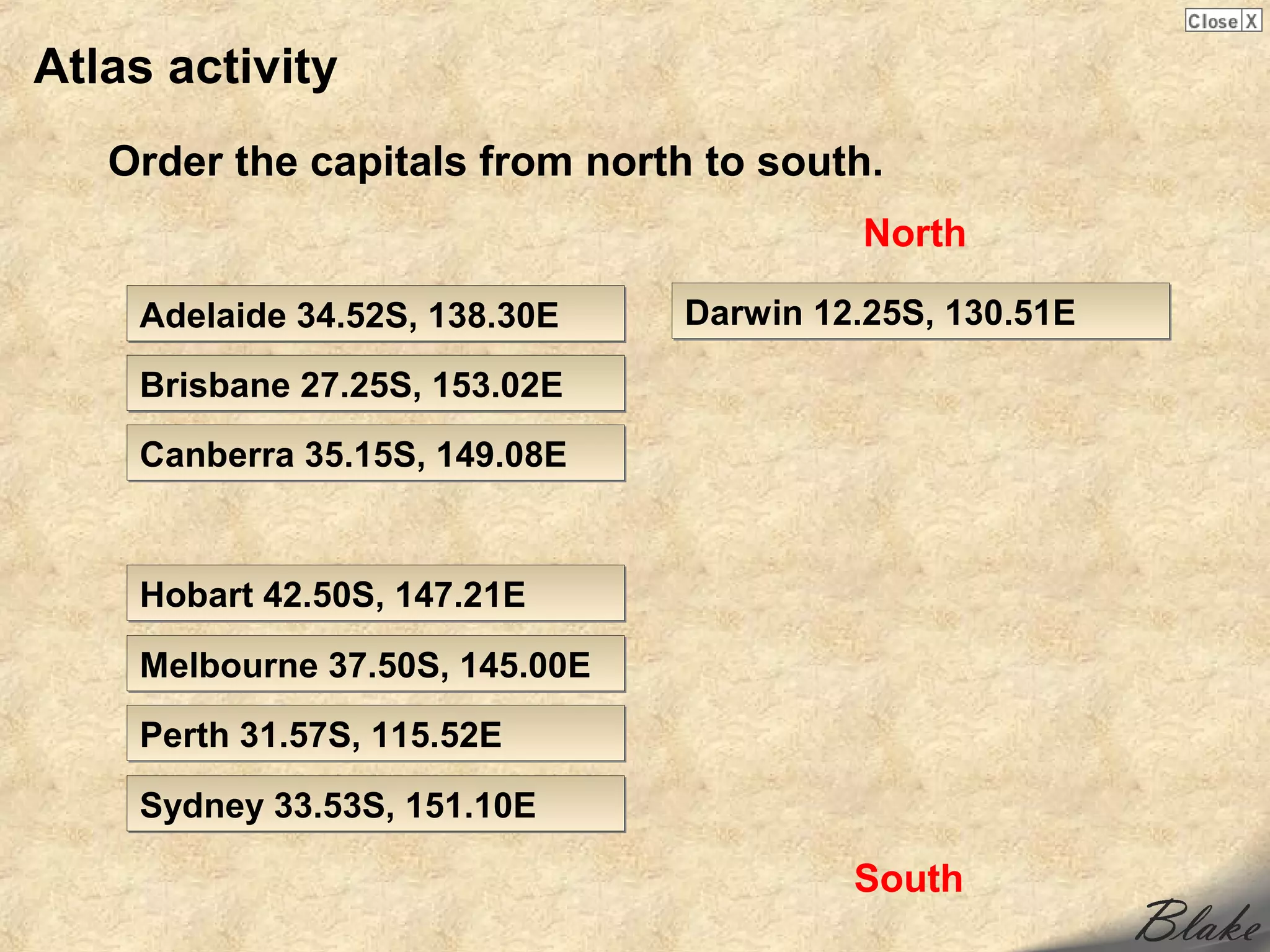
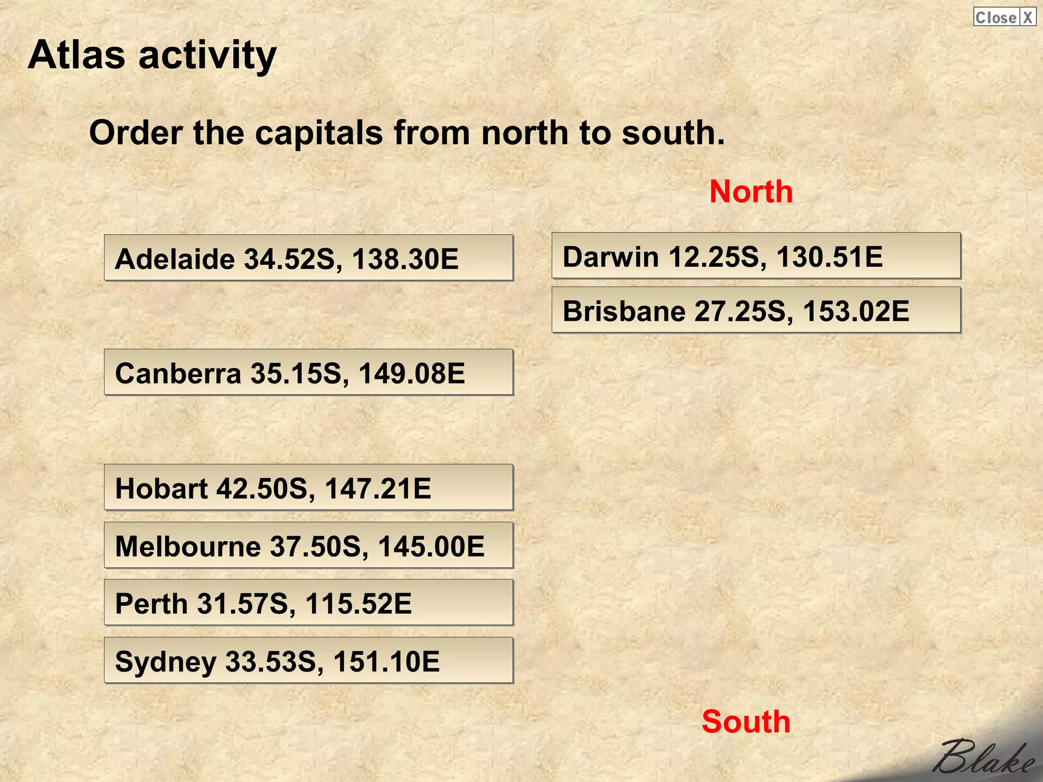
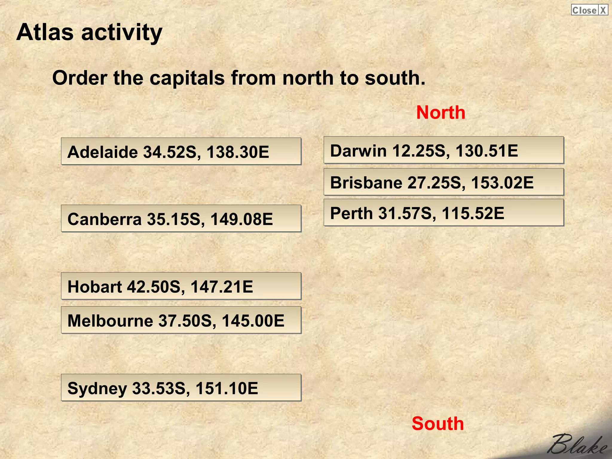
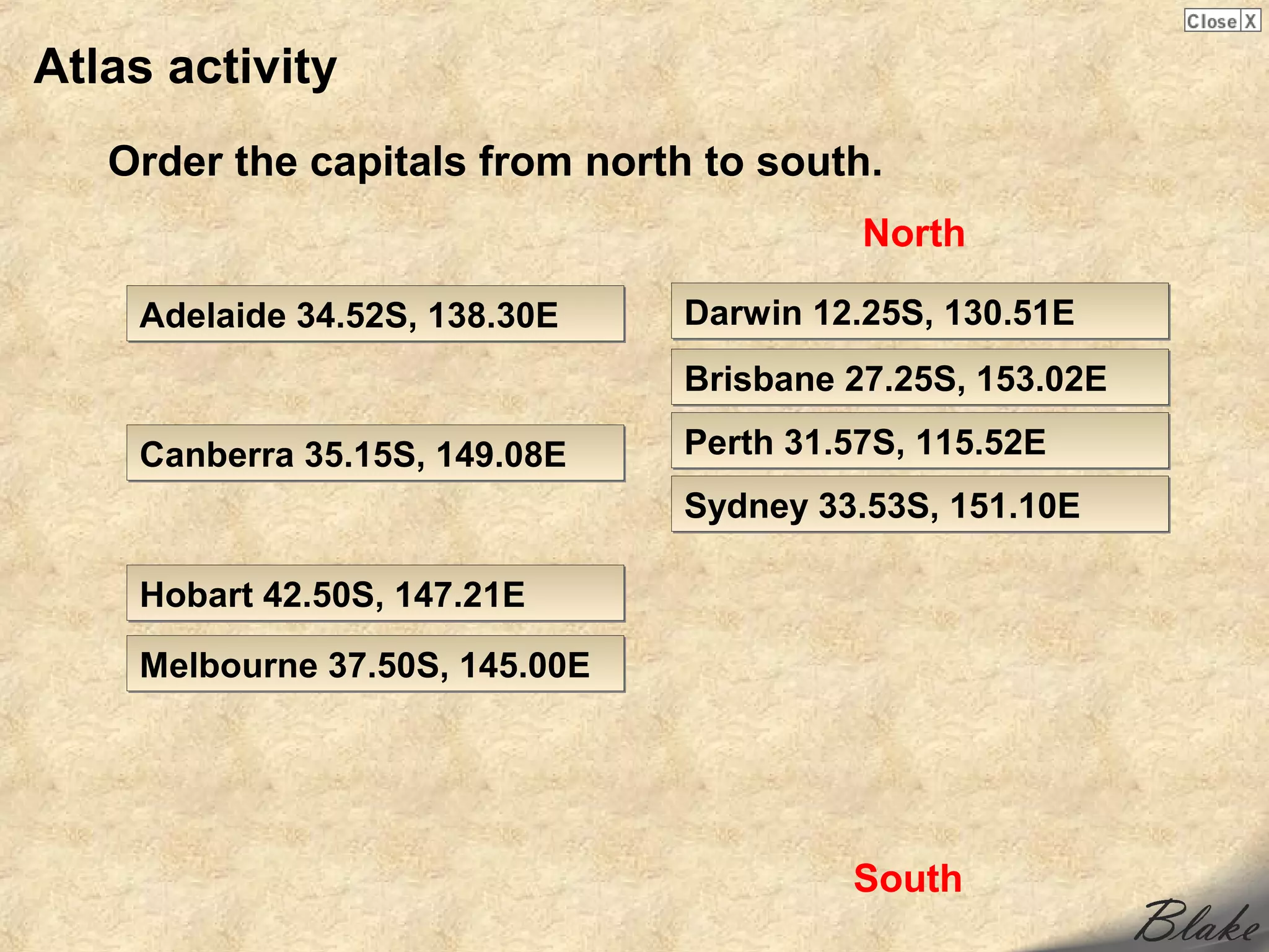
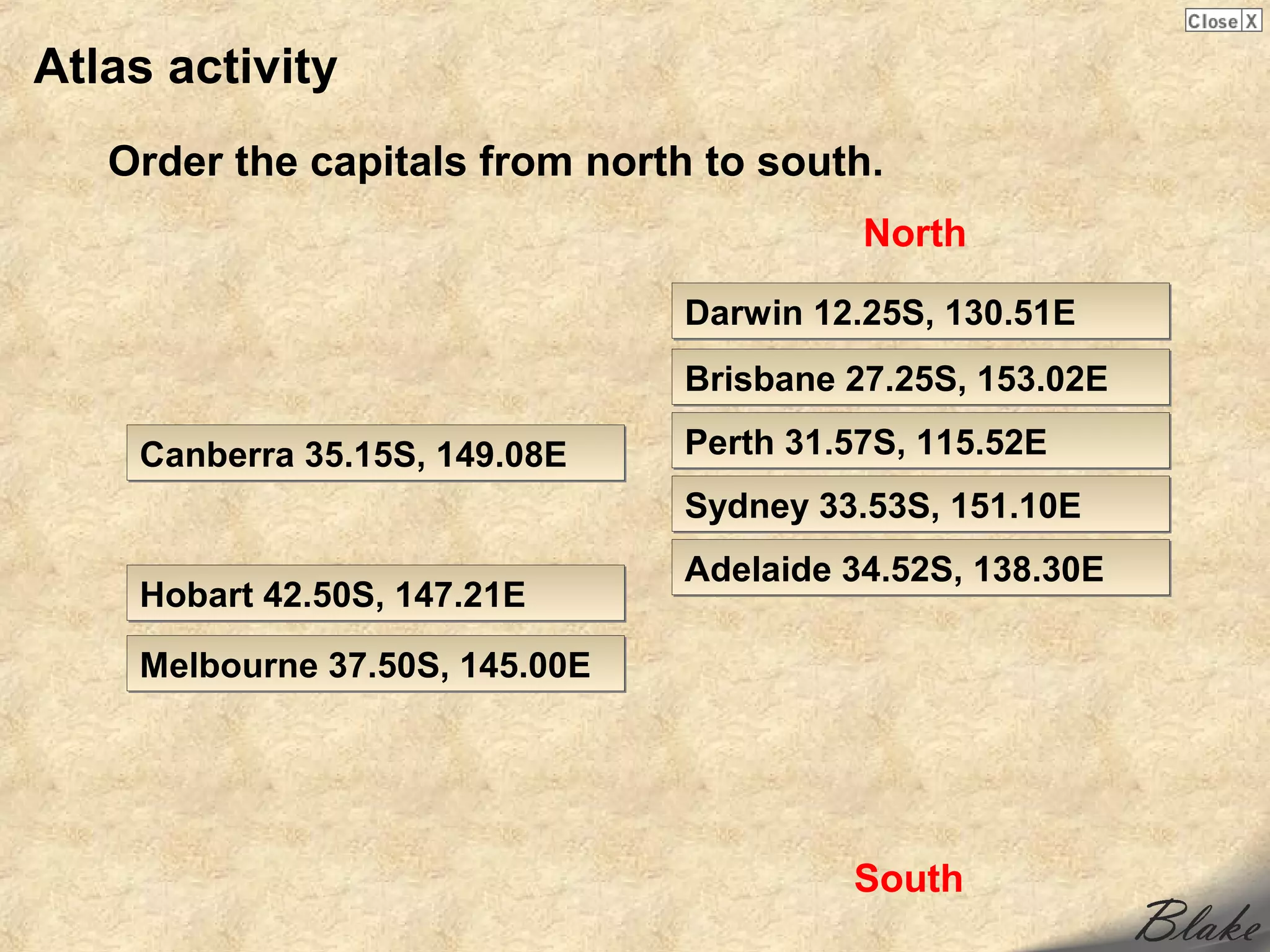
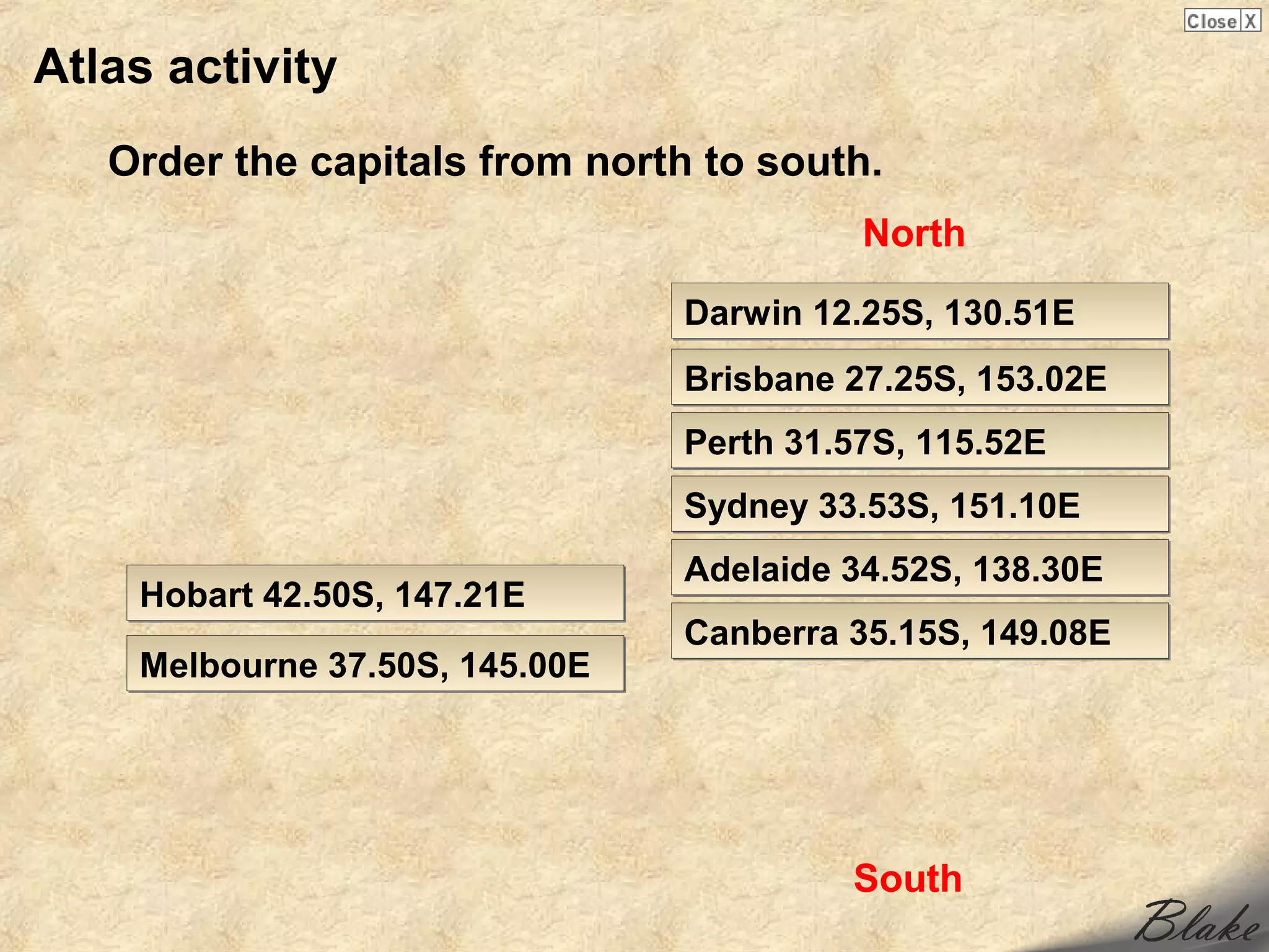
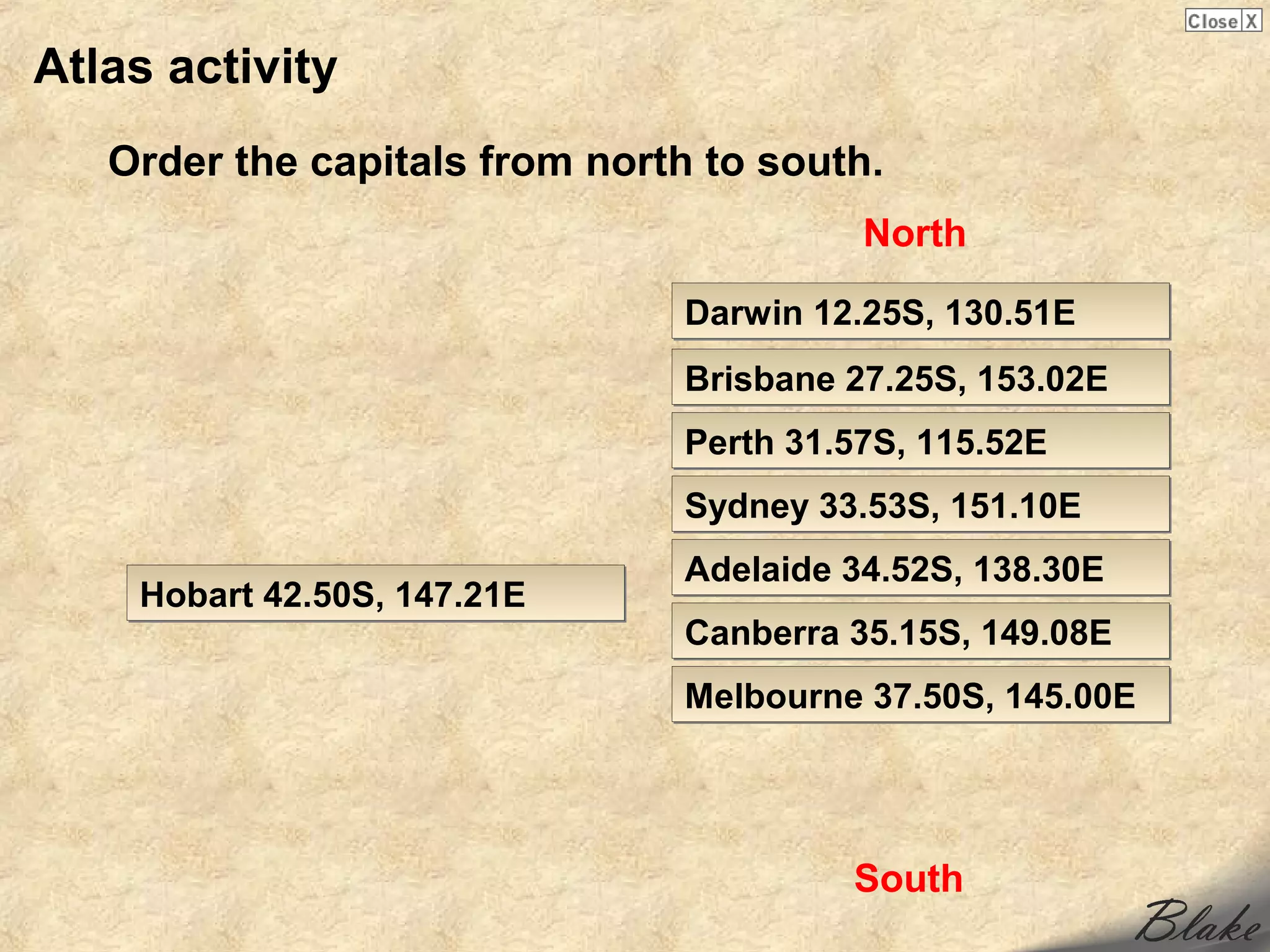
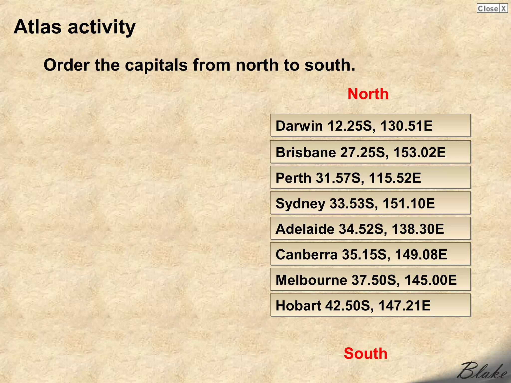
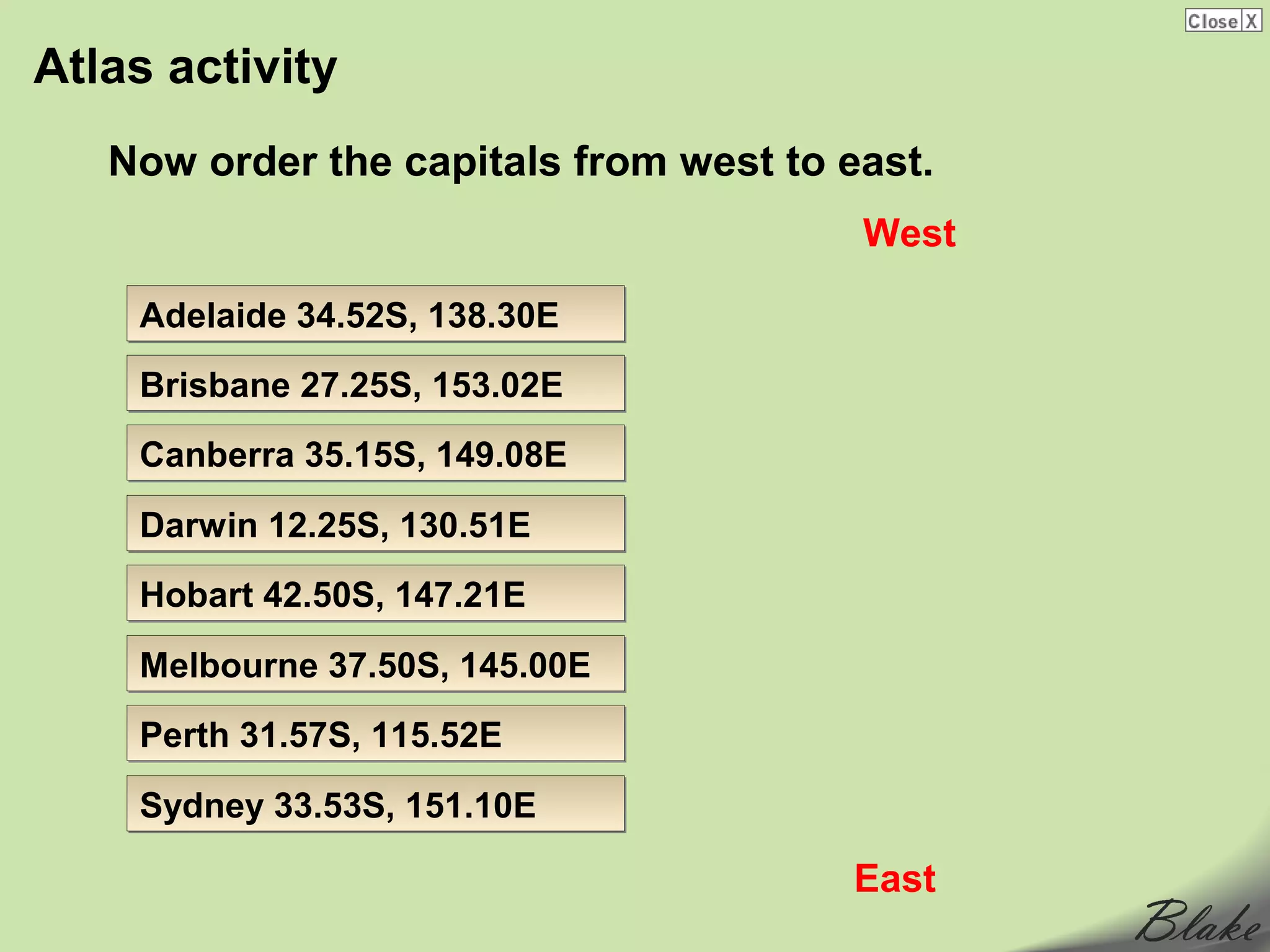
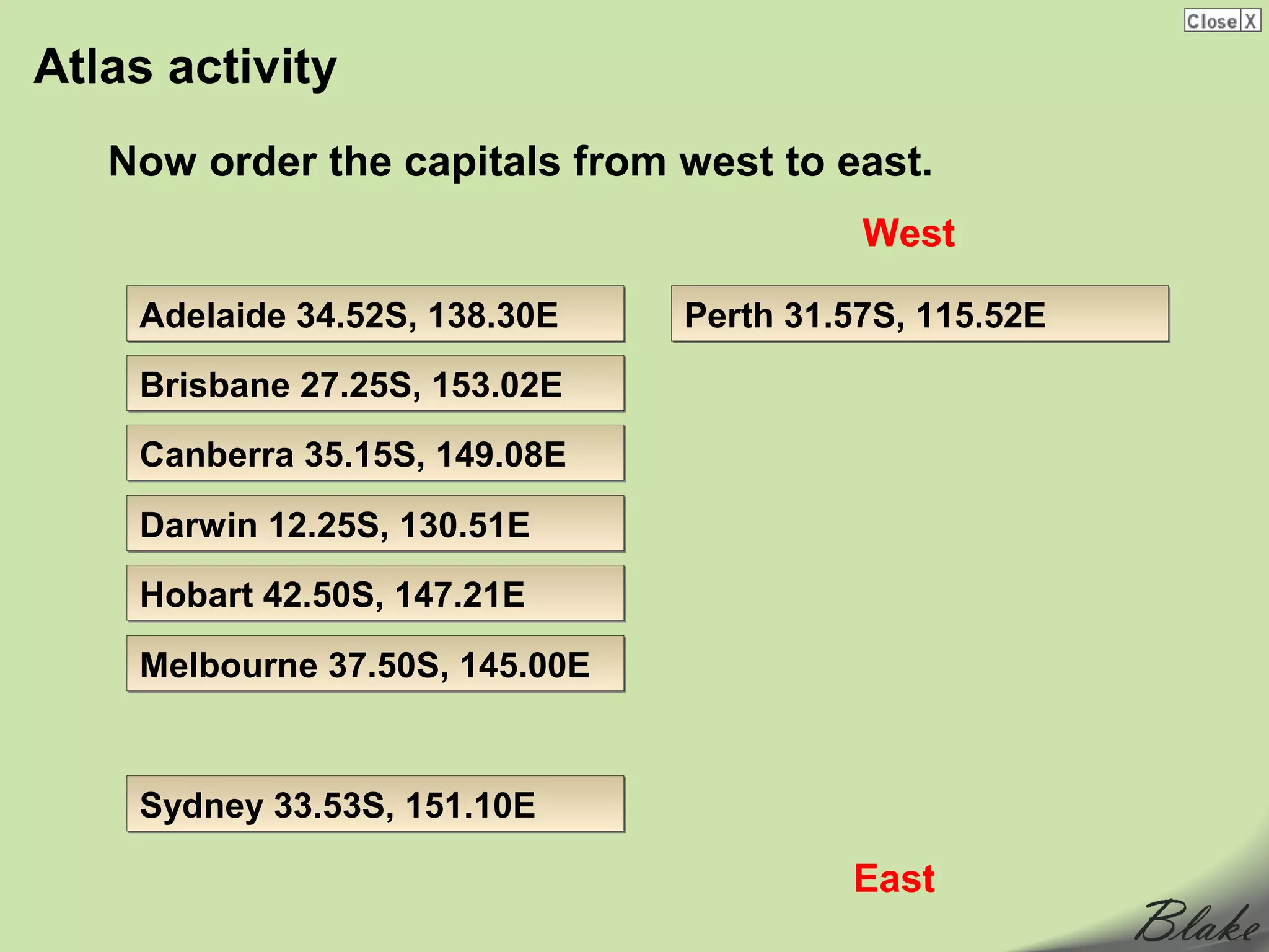
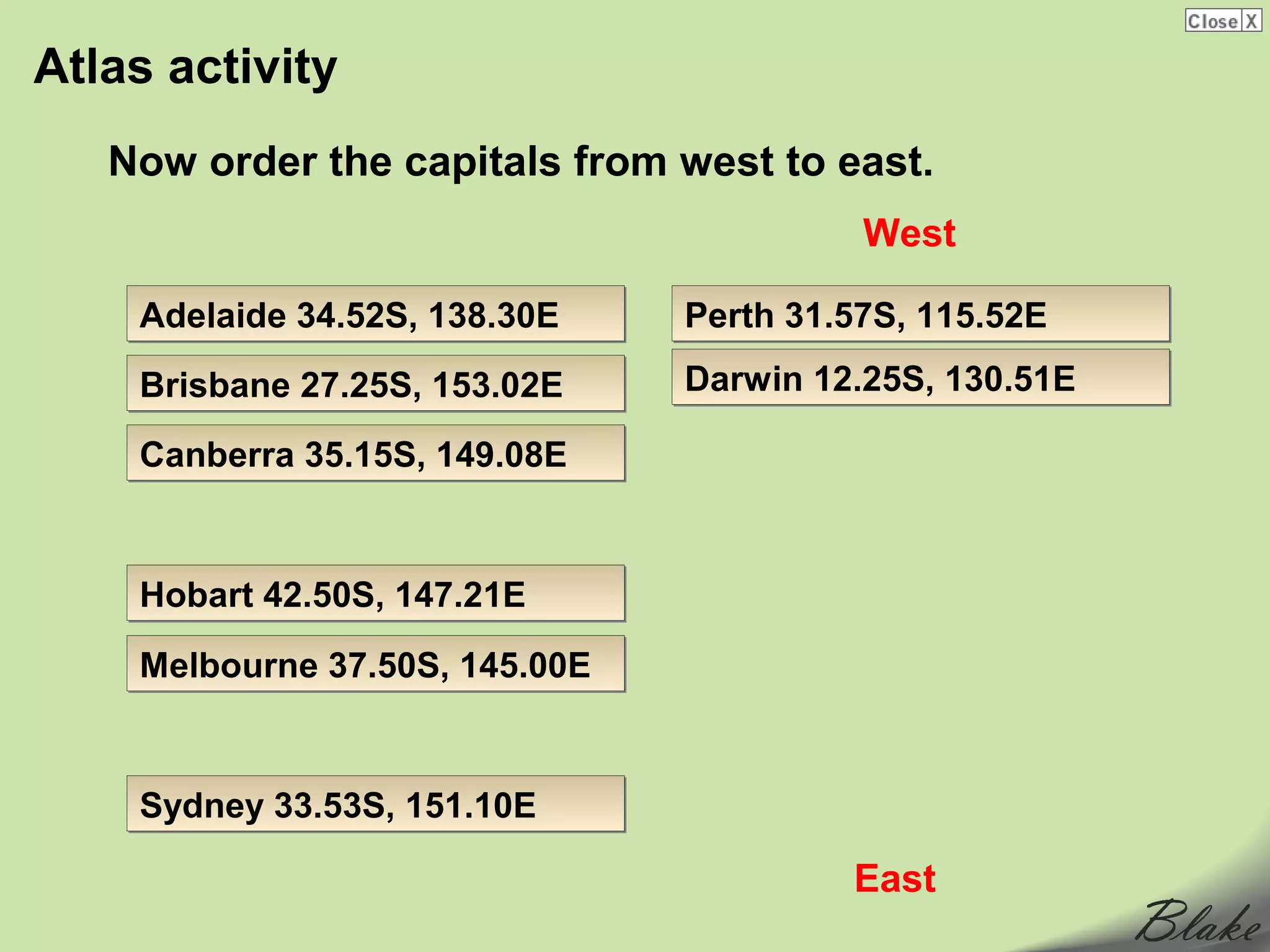
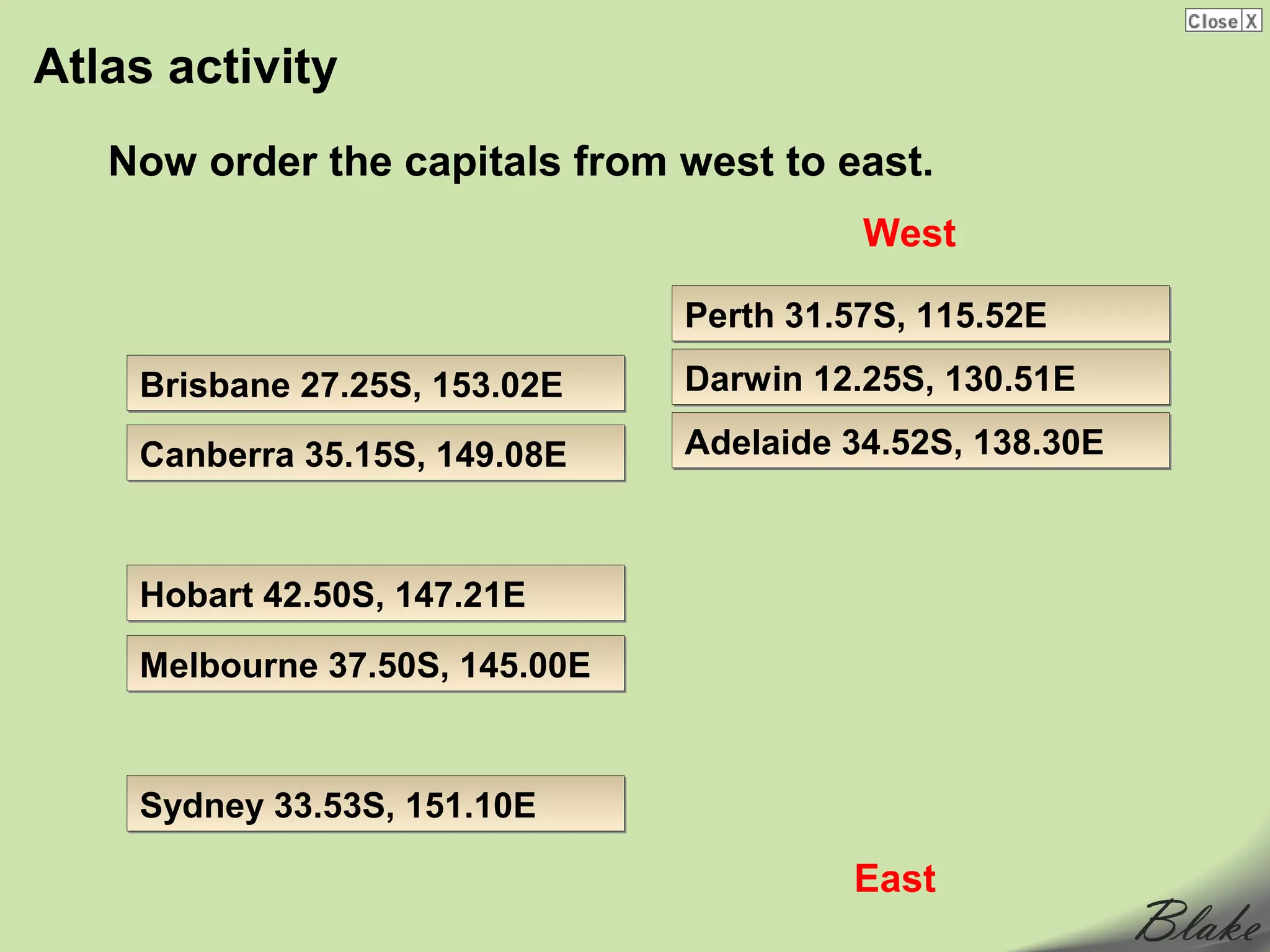
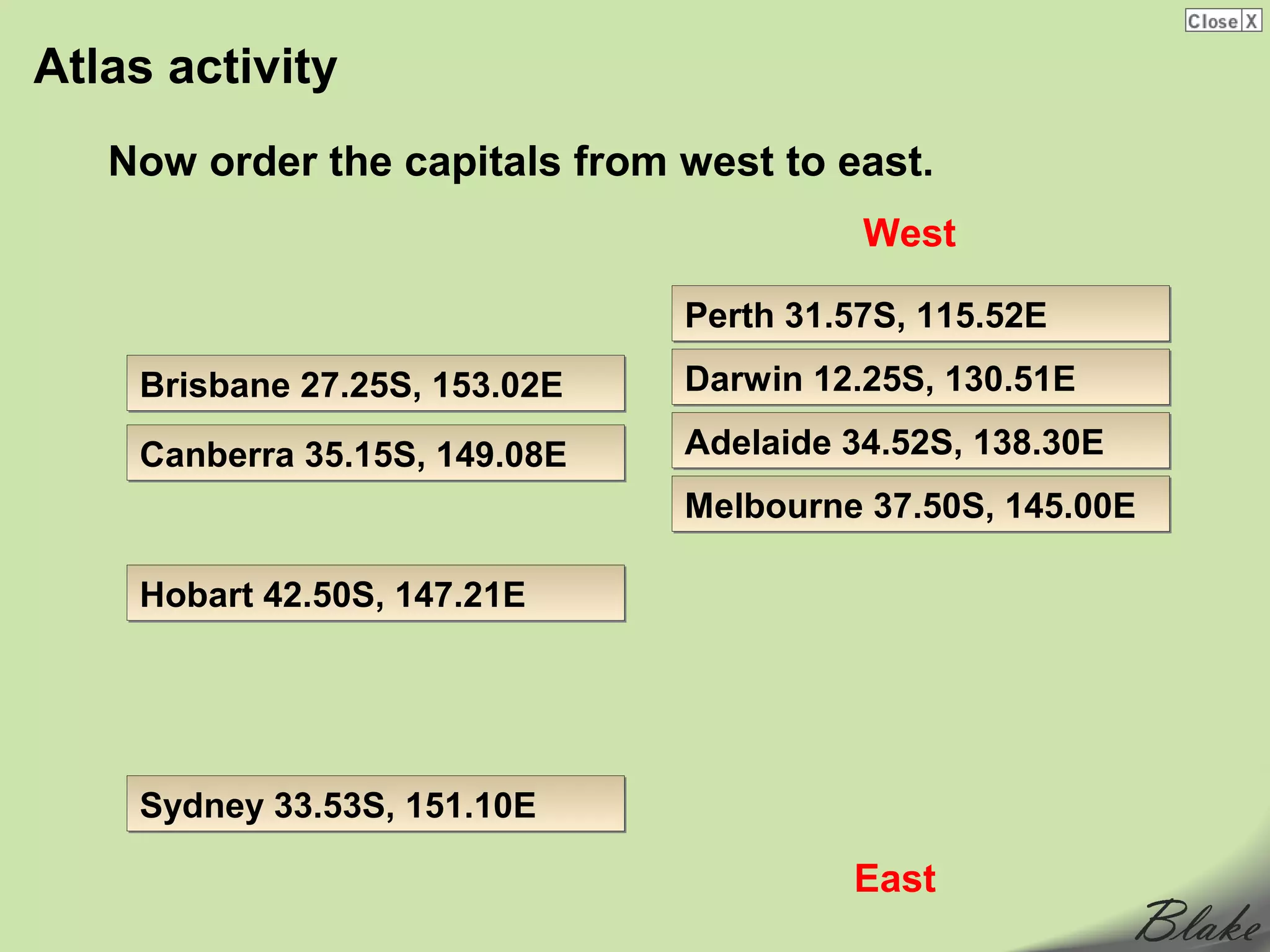
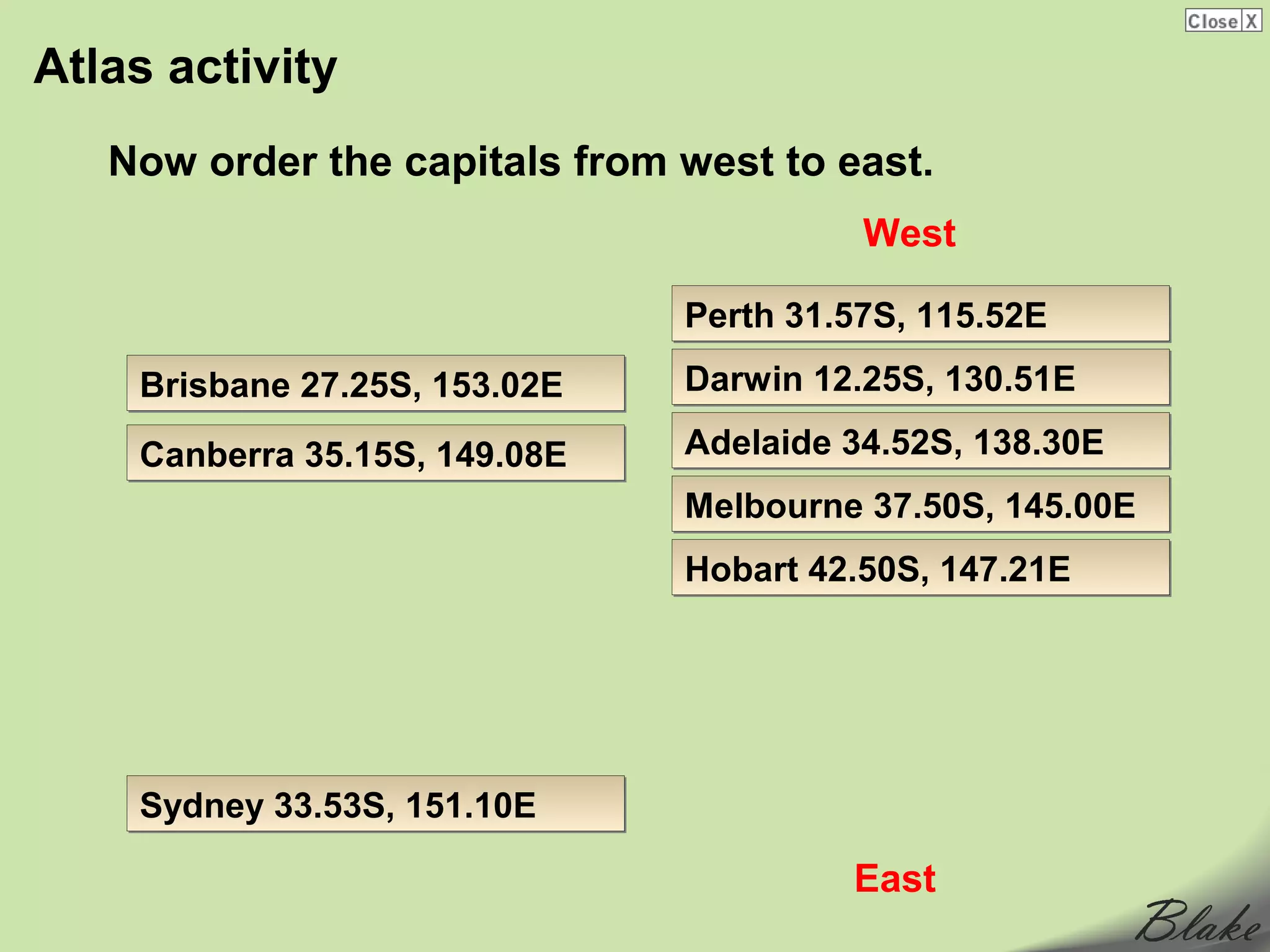
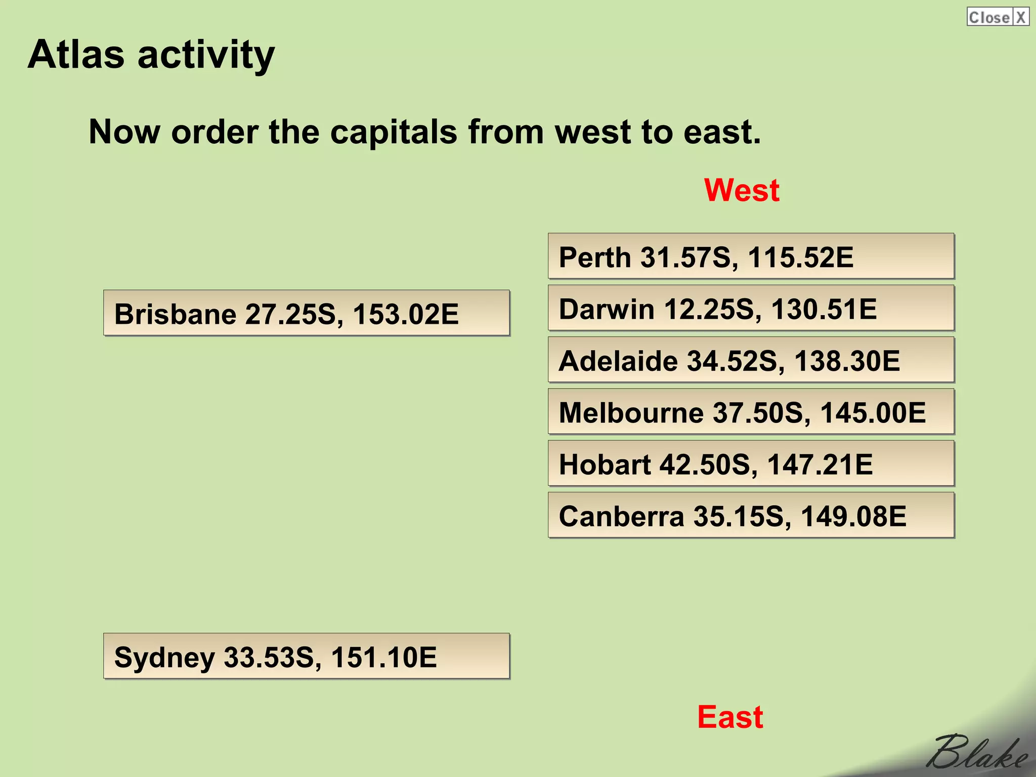
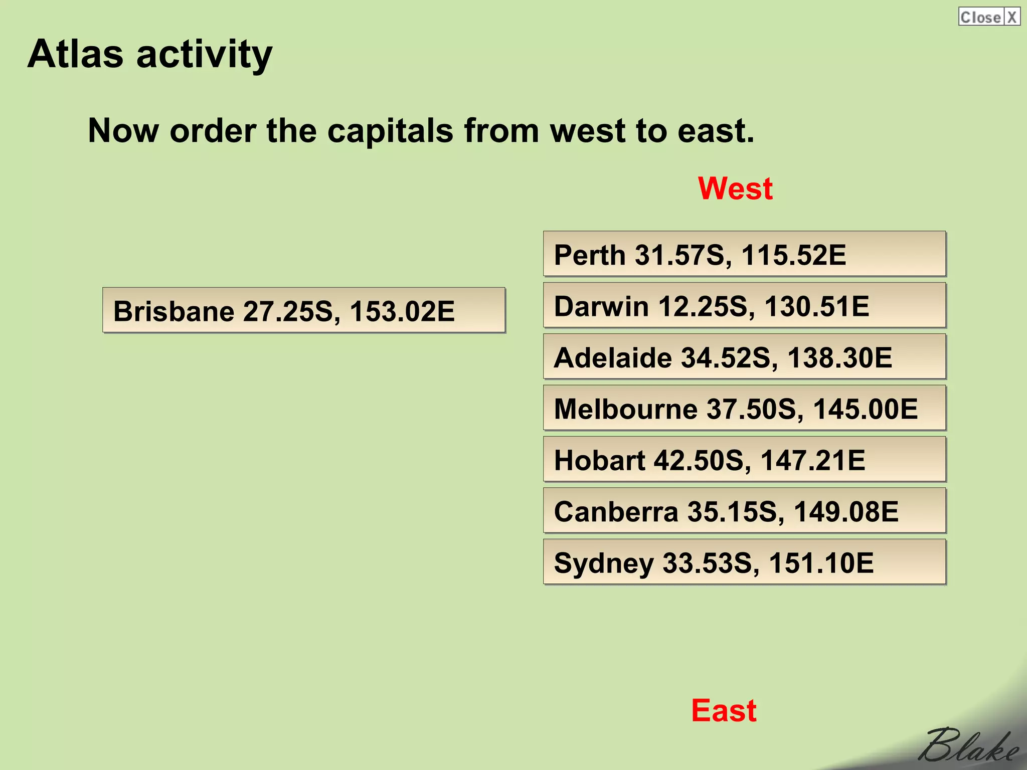
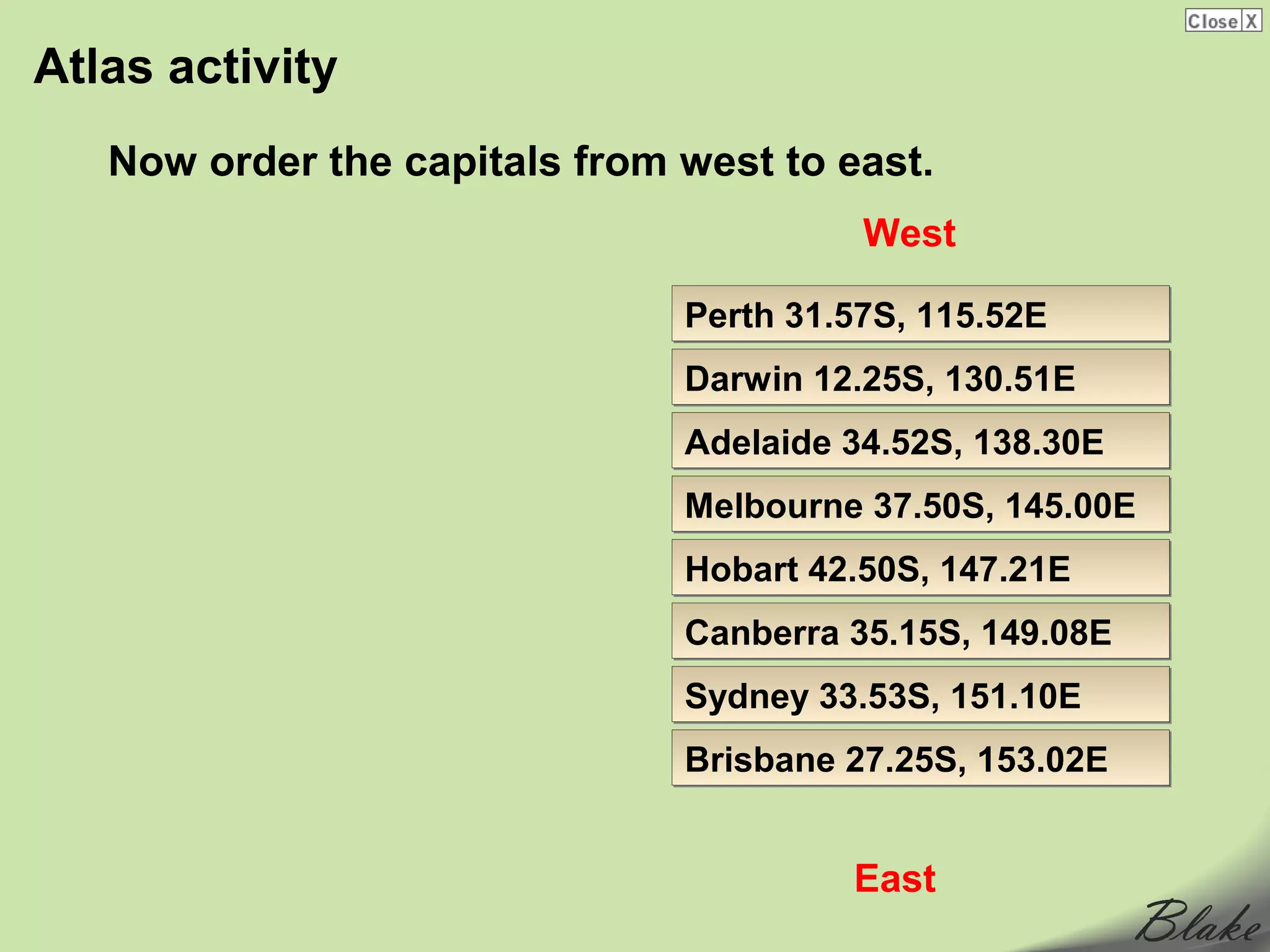
The document provides information about grids and geographic coordinates used to locate places on maps. It explains that grids are evenly spaced horizontal and vertical lines placed on maps. Letters or numbers are placed along the grid lines and combined to give coordinates for any location. It also describes latitude and longitude, which use lines that circle the globe to precisely locate places on Earth. Latitude lines run east-west and measure degrees north and south of the equator, while longitude lines run north-south and measure degrees east and west of the Prime Meridian.


![Introto geography[1]](https://cdn.slidesharecdn.com/ss_thumbnails/introtogeography1-130411124640-phpapp02-thumbnail.jpg?width=640&height=640&fit=bounds)


