Downloaded 9,486 times


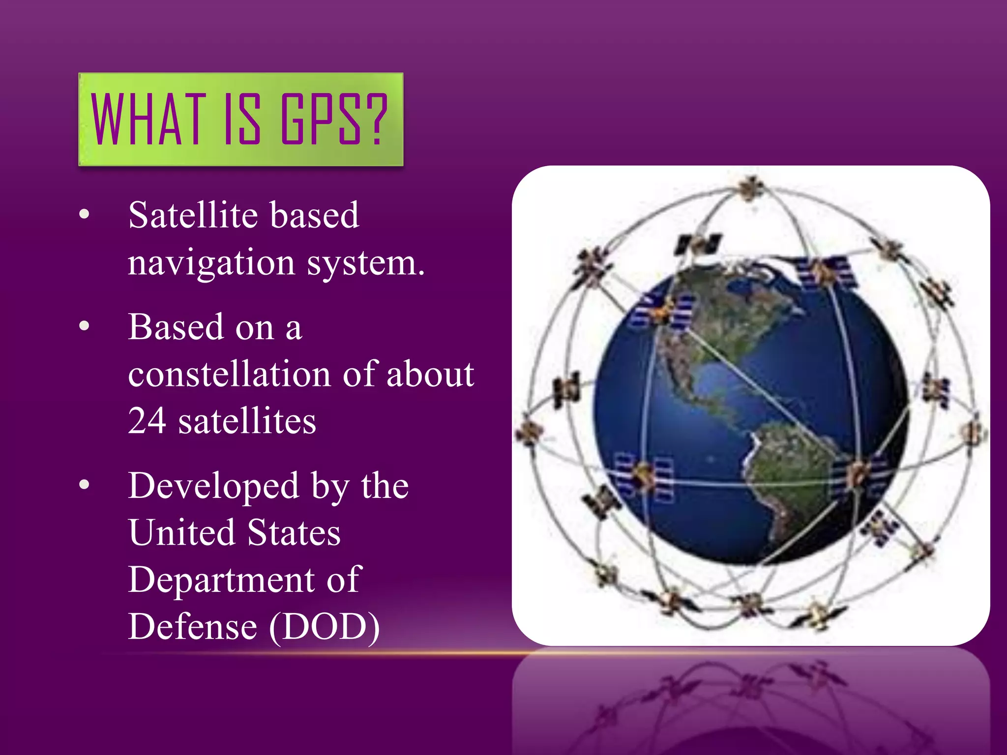
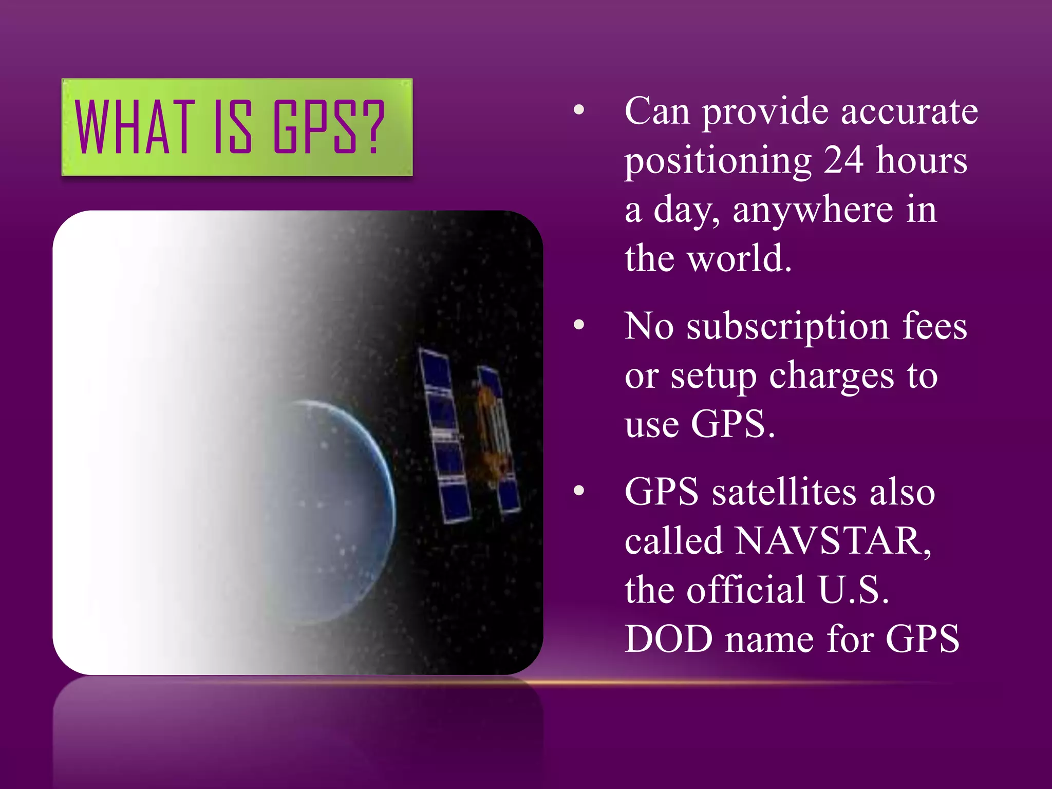
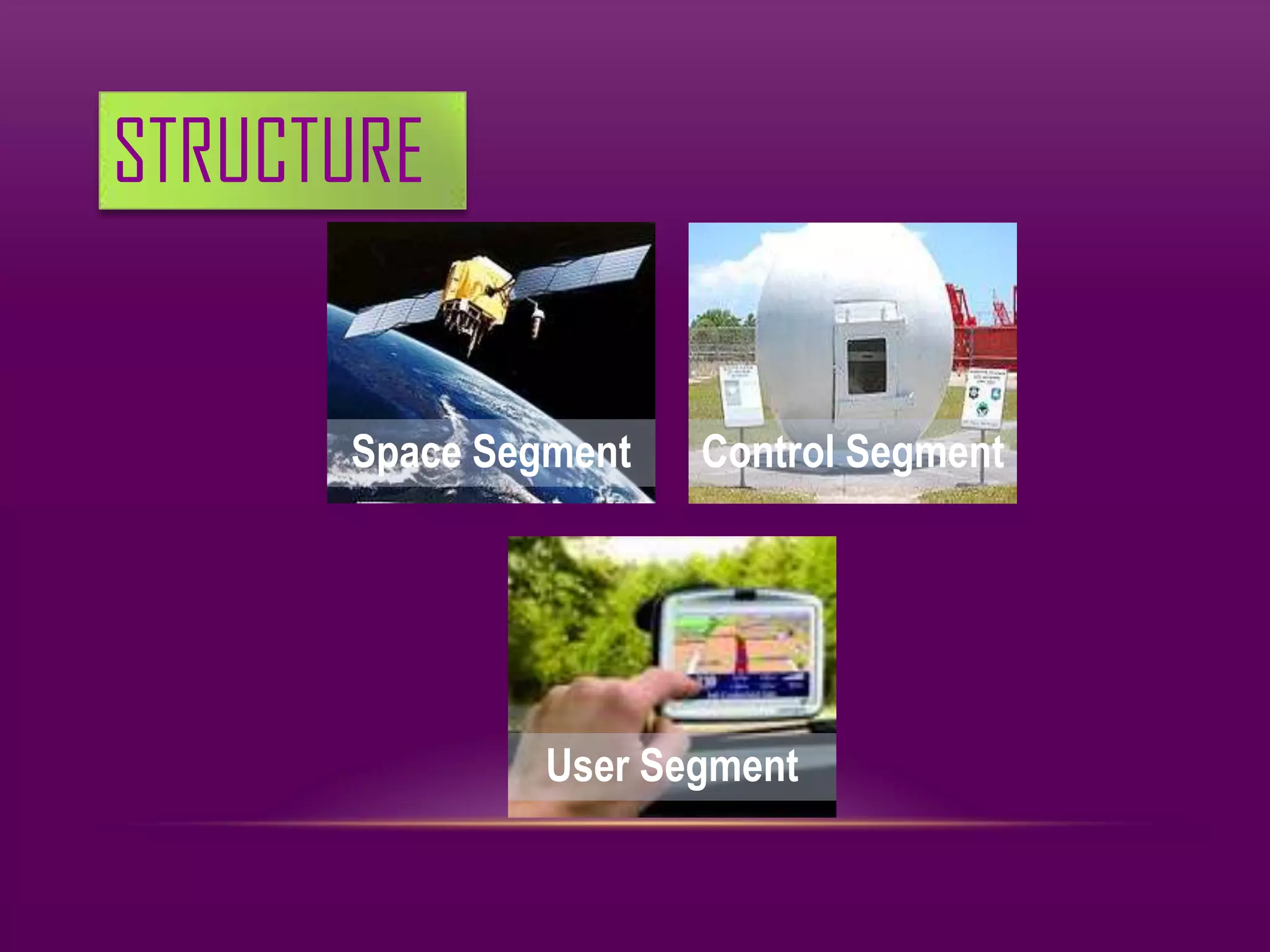
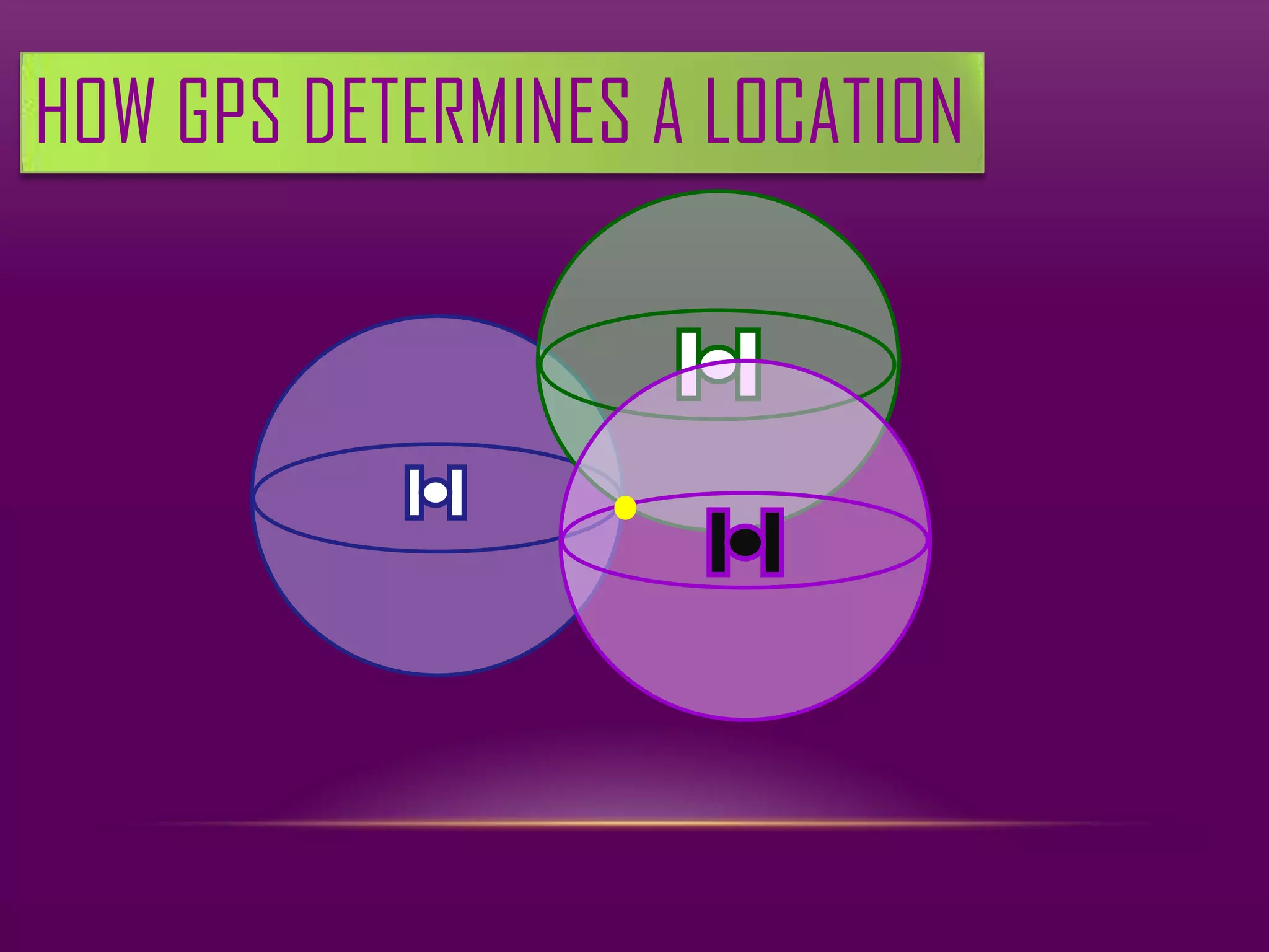
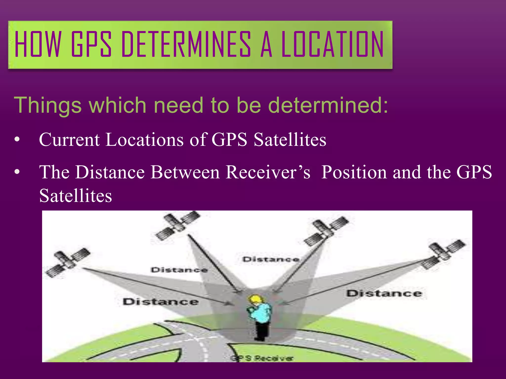
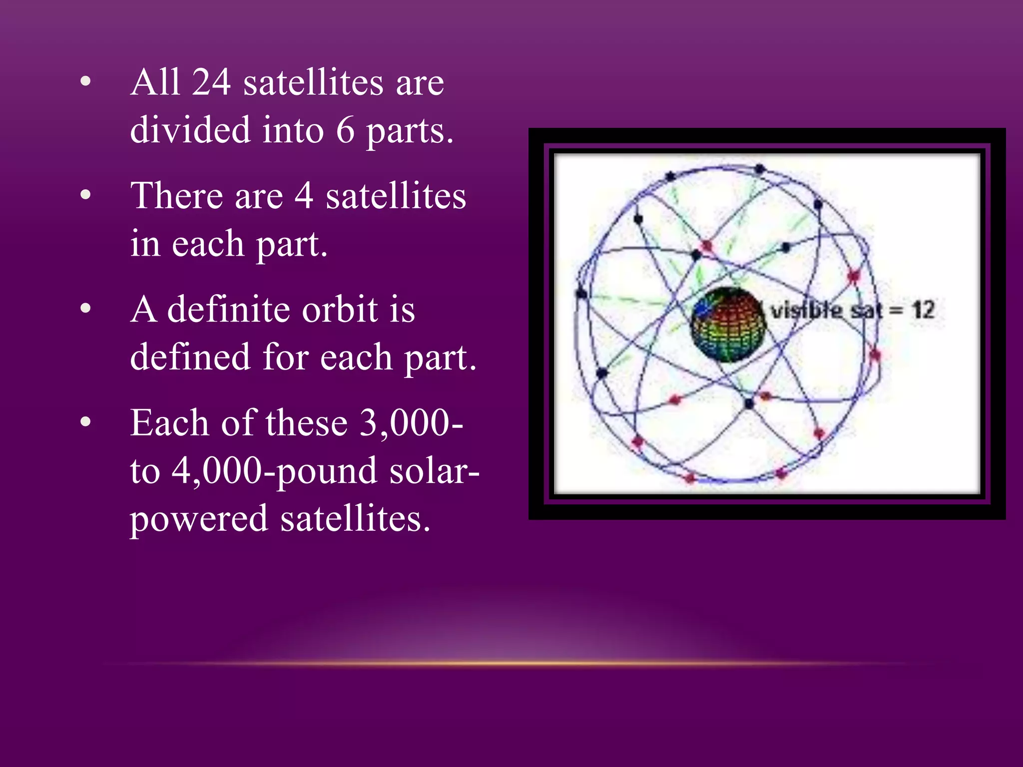
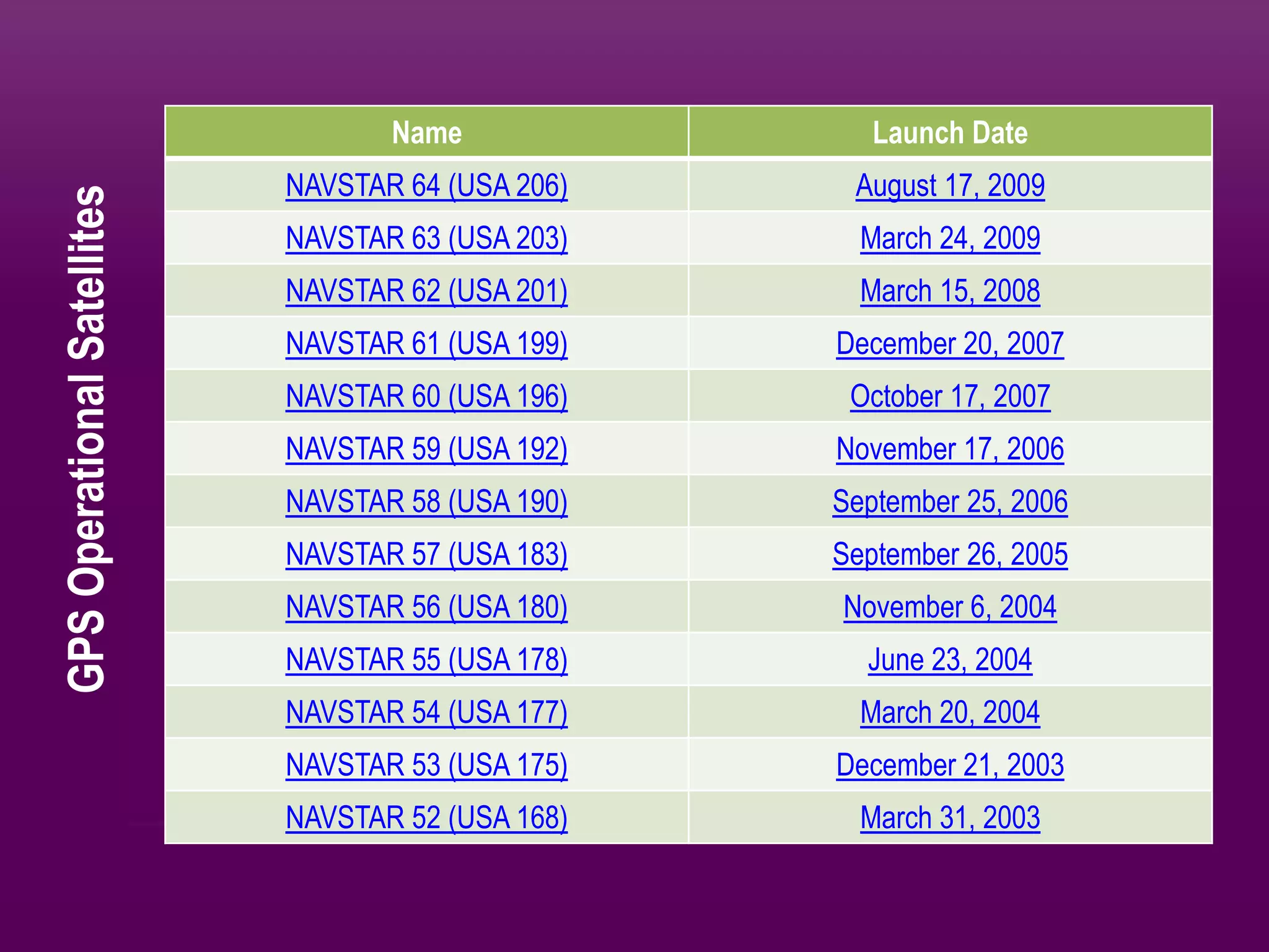
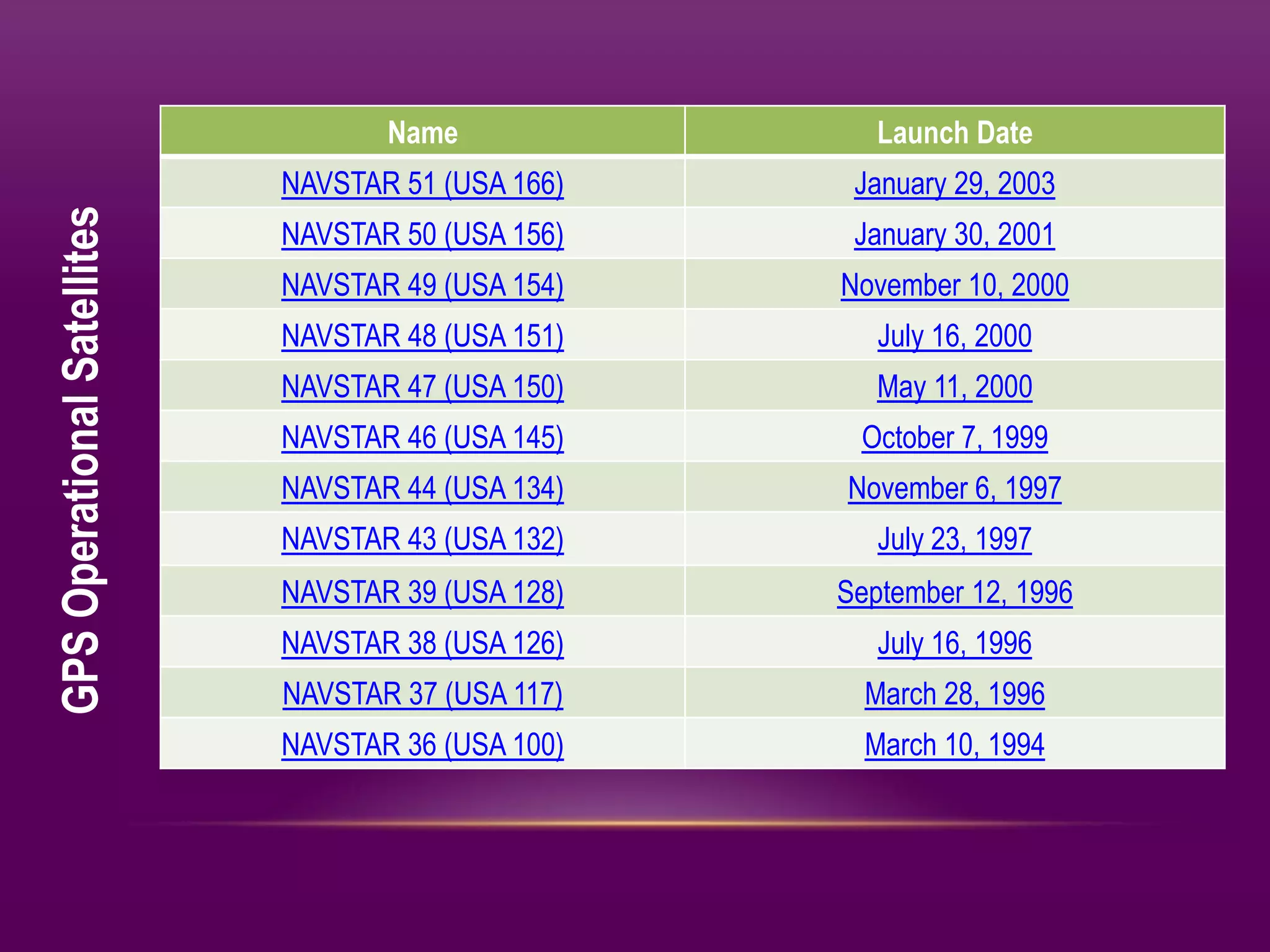


GPS is a satellite-based navigation system consisting of 24 satellites operated by the US Department of Defense. It provides positioning anywhere in the world without subscription fees. GPS determines location by measuring the time it takes signals from satellites to reach a receiver and using that to calculate the distance to the satellites, whose locations are known. Combining distance measurements to multiple satellites triangulates the receiver's position.


!["GPS" Global Positioning System [PDF]](https://cdn.slidesharecdn.com/ss_thumbnails/globalpositioningsystemgpsmainpdf-101105164539-phpapp01-thumbnail.jpg?width=640&height=640&fit=bounds)


