Downloaded 1,155 times


![Planning Scenario for a Major Earthquake
in Ahmedabad City
Anup Karanth [EP 0101]
M 6
M 6.5
M 7
damage area
Location of buildings in groups where there is possibility of maximum
damage to buildings from the scenario earthquake.
EARTH QUAKE](https://image.slidesharecdn.com/iei-lecture-20sept15-150927105120-lva1-app6892/75/Application-of-Remote-Sensing-in-Civil-Engineering-101-2048.jpg)
![Planning Scenario for a Major Earthquake
in Ahmedabad City
Anup Karanth [EP 0101]
Overlap showing the damage buildings for magnitude M7 with the
existing land use](https://image.slidesharecdn.com/iei-lecture-20sept15-150927105120-lva1-app6892/75/Application-of-Remote-Sensing-in-Civil-Engineering-102-2048.jpg)
![Planning Scenario for a Major Earthquake in Ahmedabad City
Anup Karanth [EP 0101]](https://image.slidesharecdn.com/iei-lecture-20sept15-150927105120-lva1-app6892/75/Application-of-Remote-Sensing-in-Civil-Engineering-103-2048.jpg)


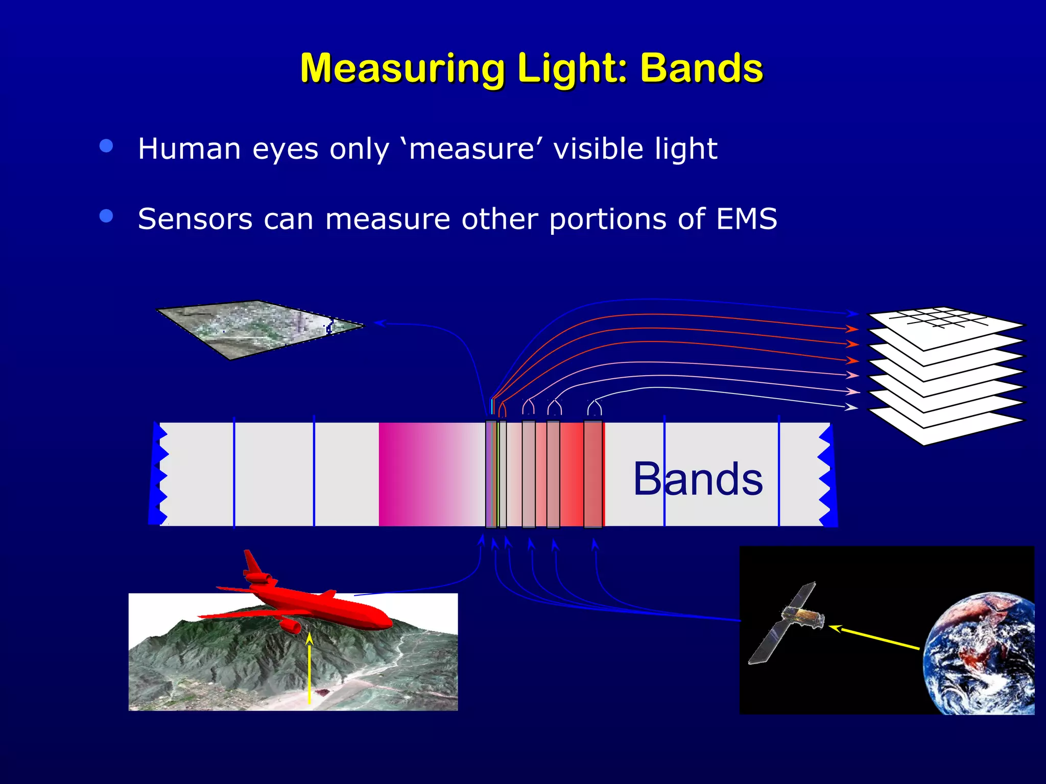
The document discusses remote sensing technology and its applications in civil engineering, particularly in monitoring environmental and cultural resources through satellite imagery and aerial photography. It covers various satellite missions, data collection methods, and the interpretation of remote sensing images for applications like agriculture, disaster assessment, and infrastructure development. Additionally, it includes specific examples of flood vulnerability assessments and urban planning using remote sensing data in Ahmedabad.