Download as PDF, PPTX
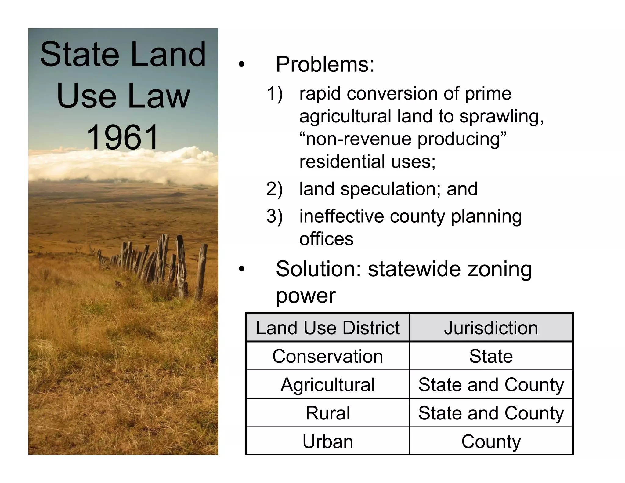
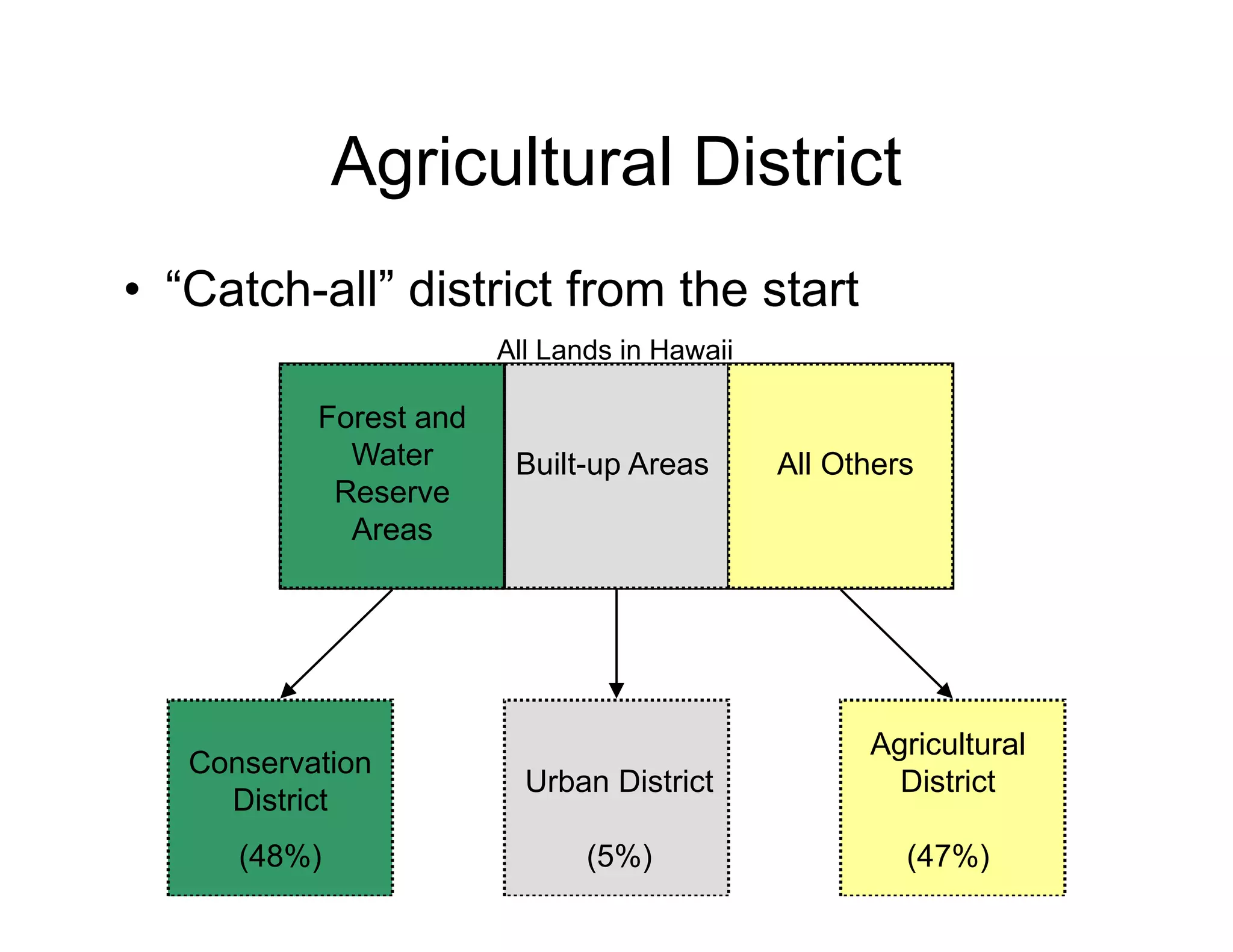

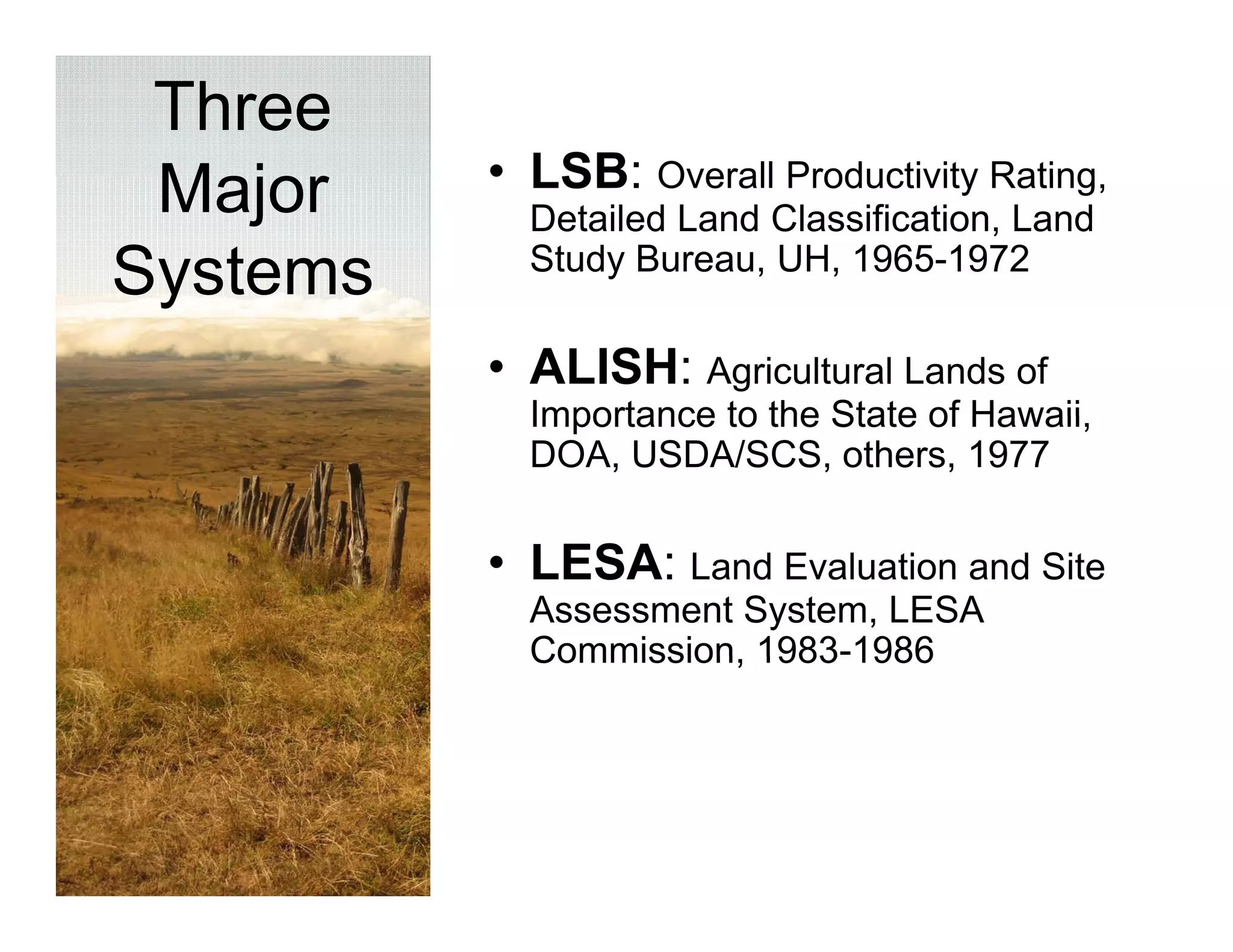
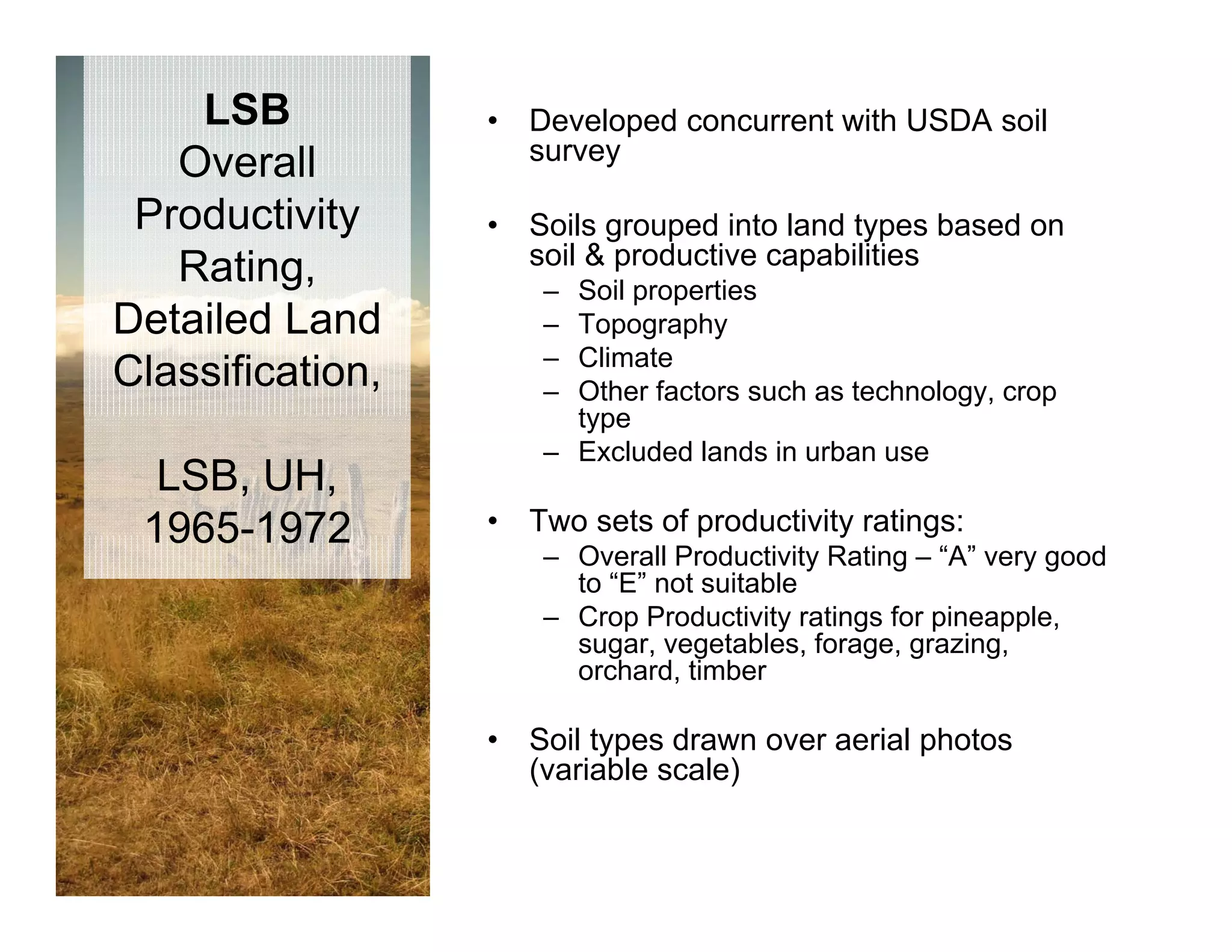
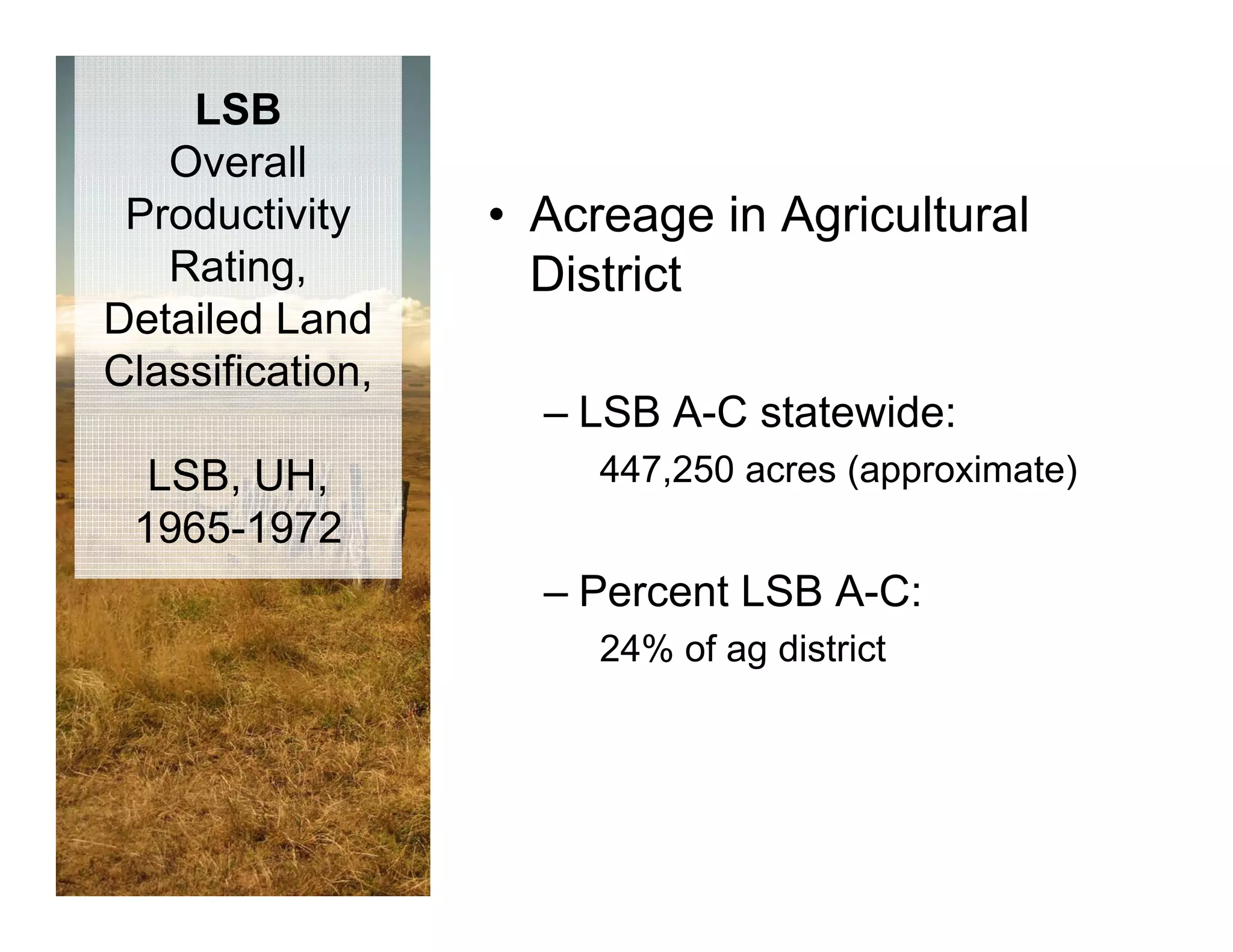
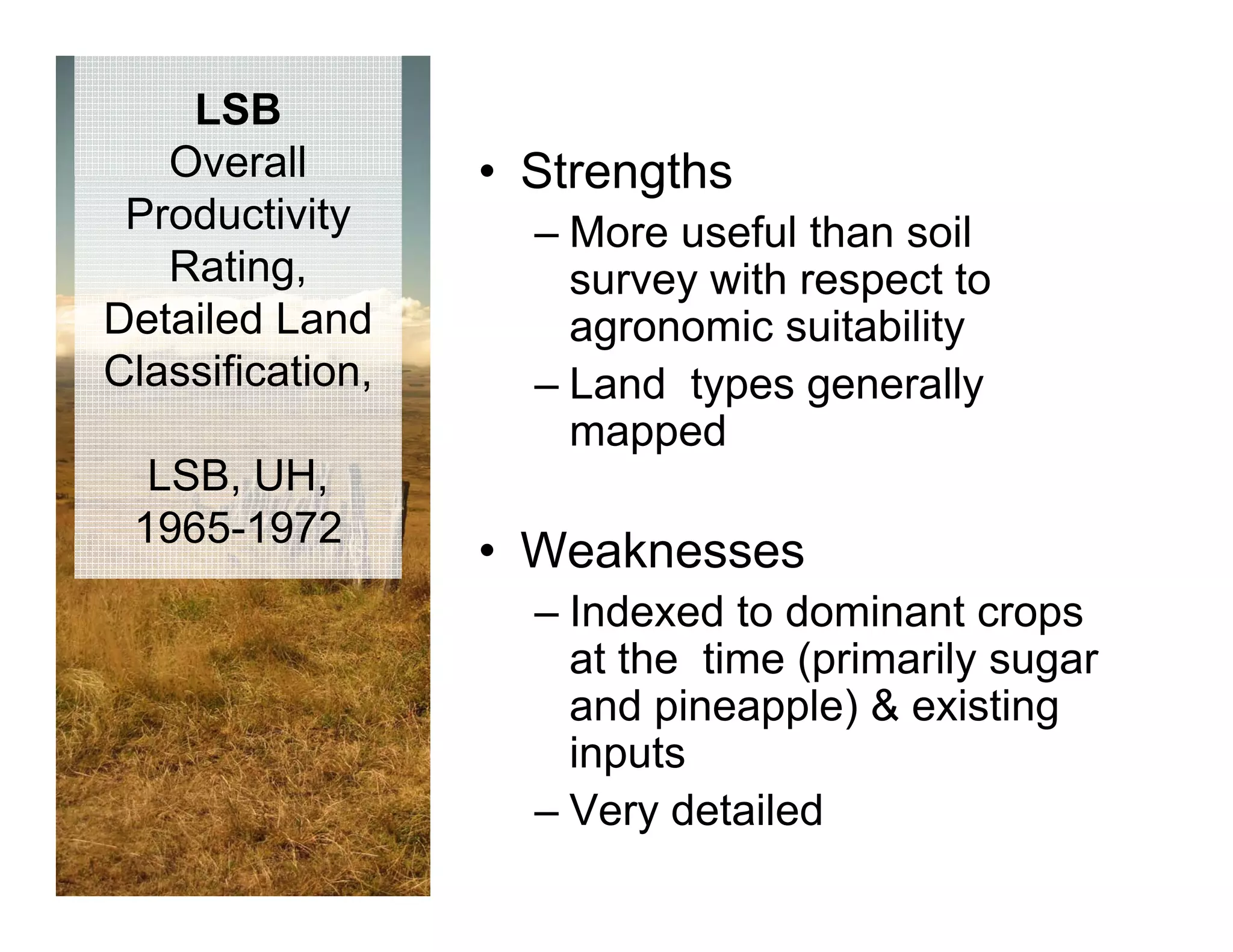
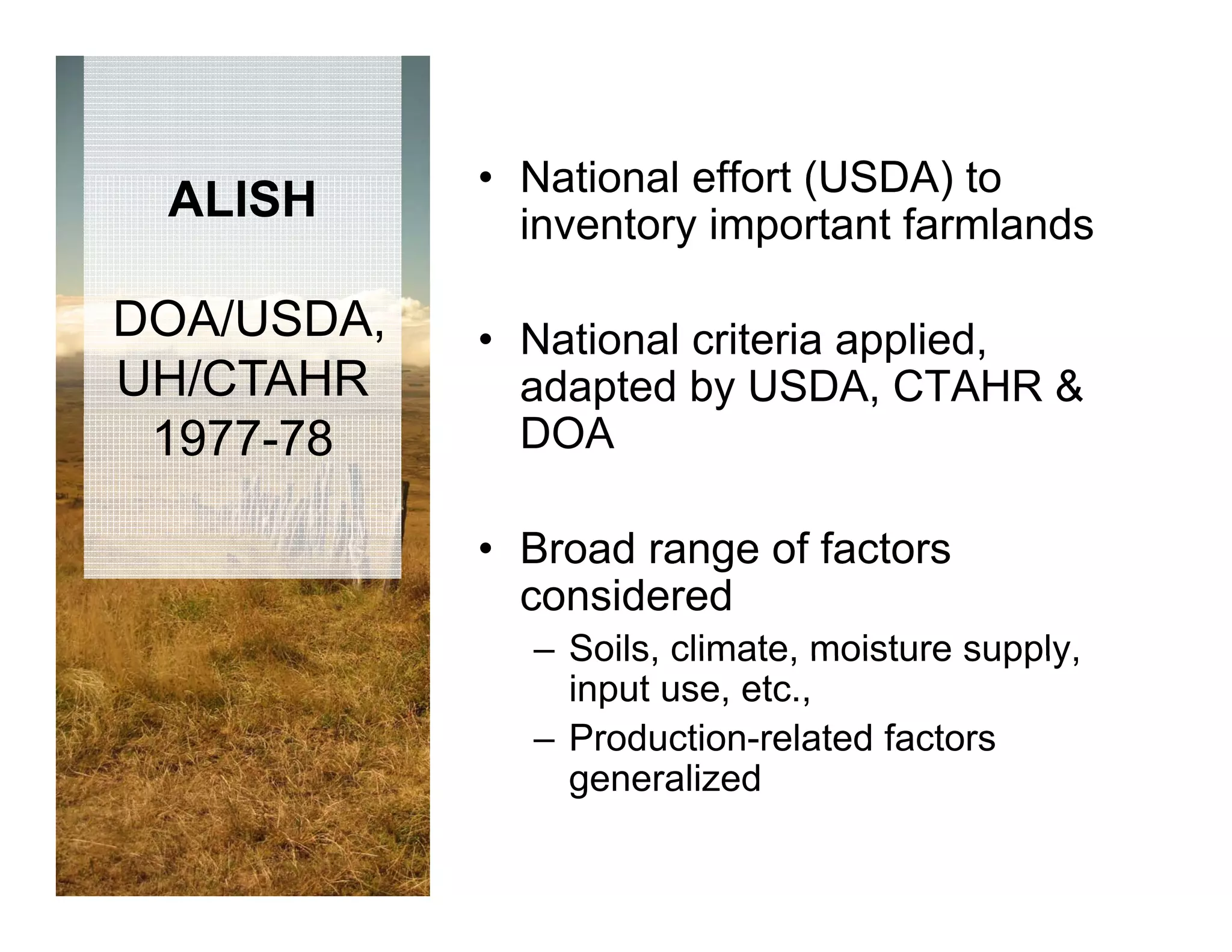
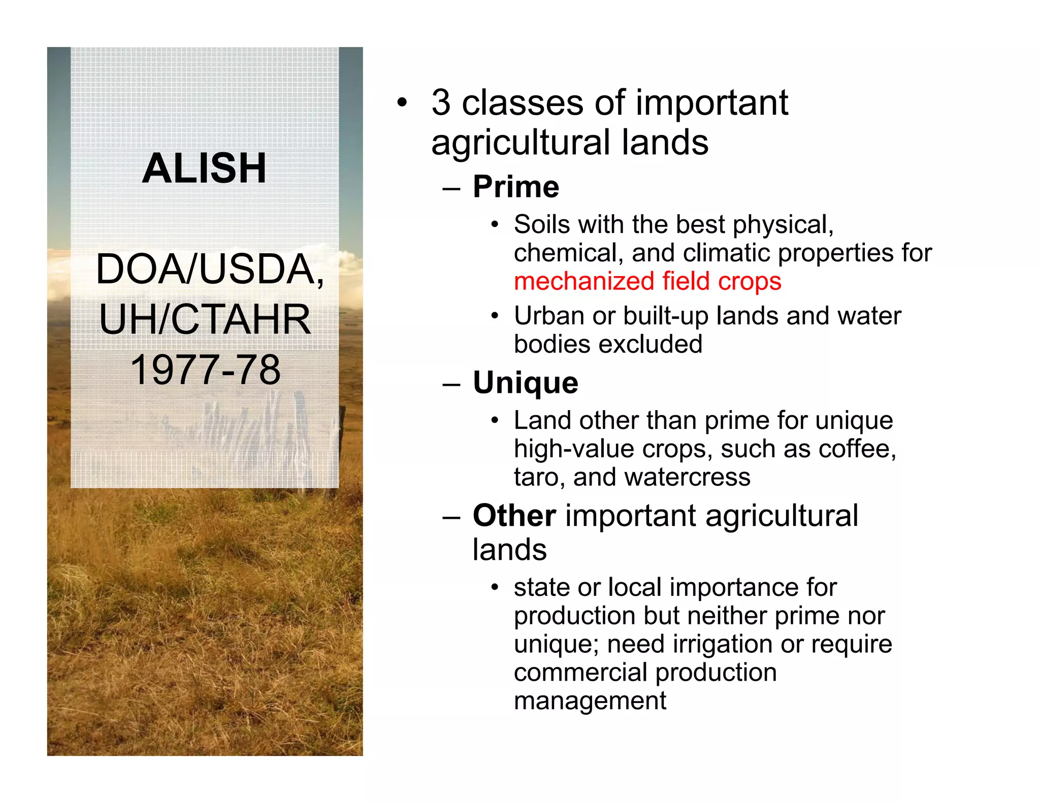
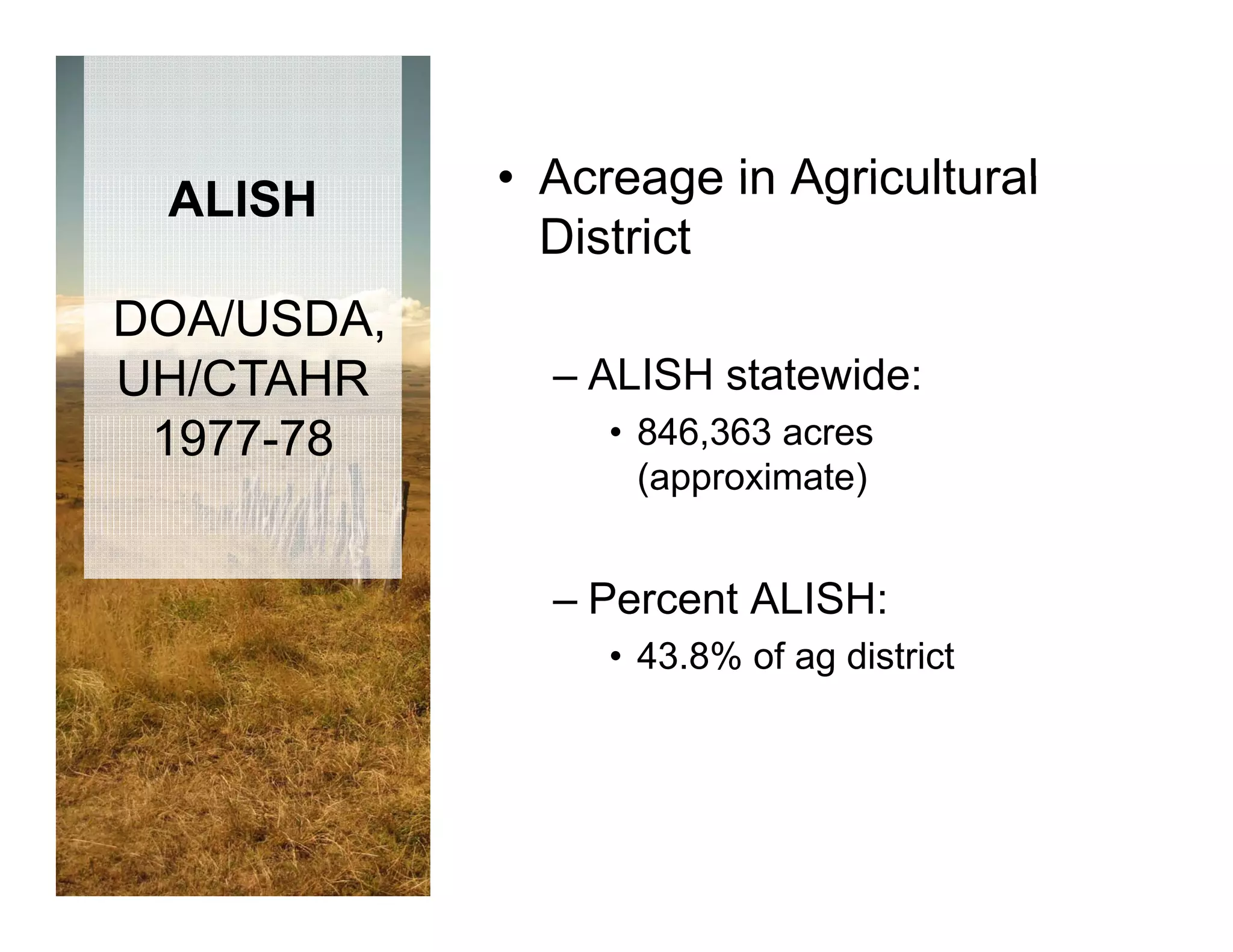
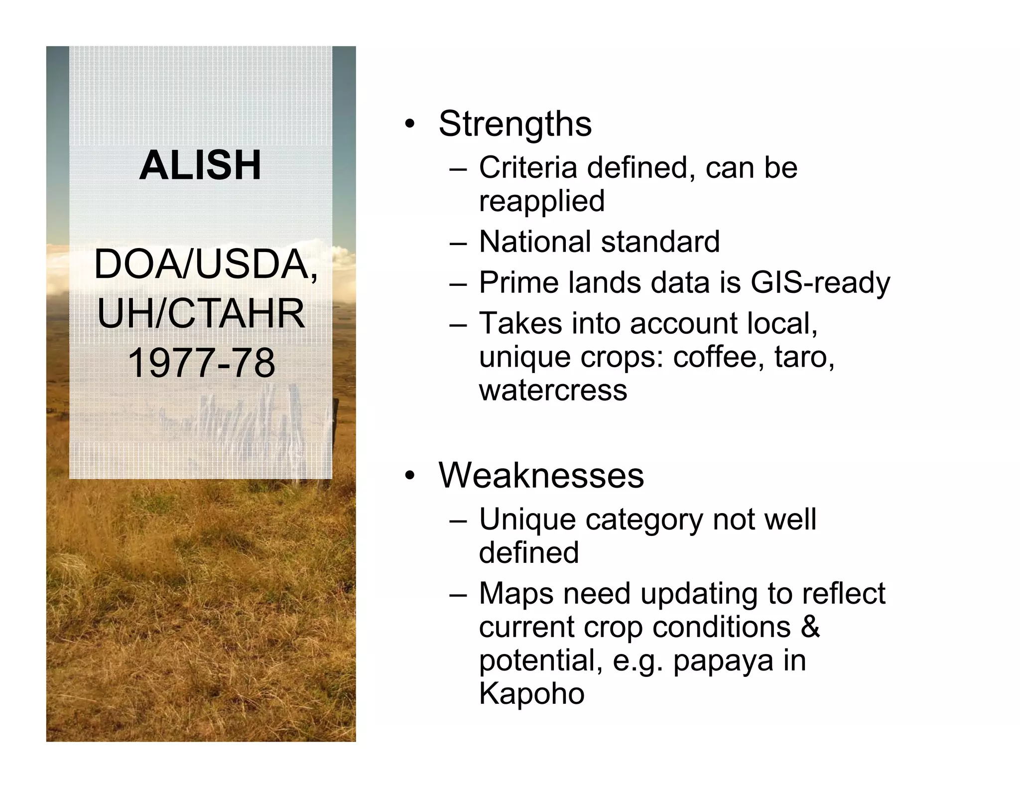
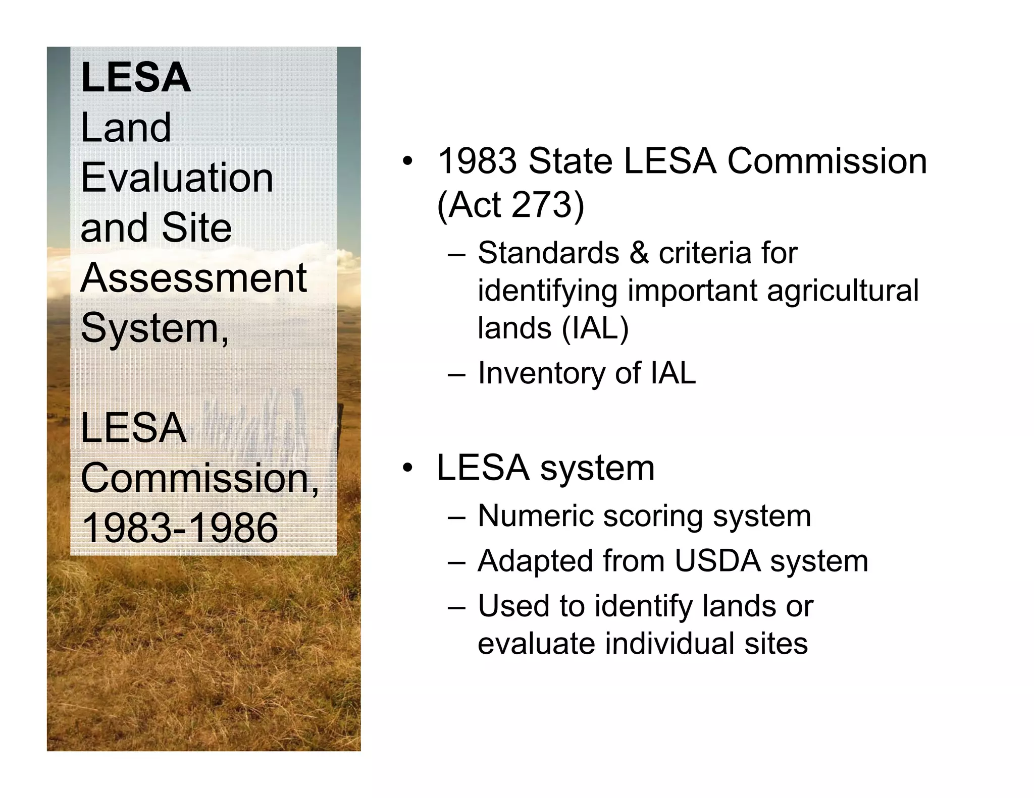
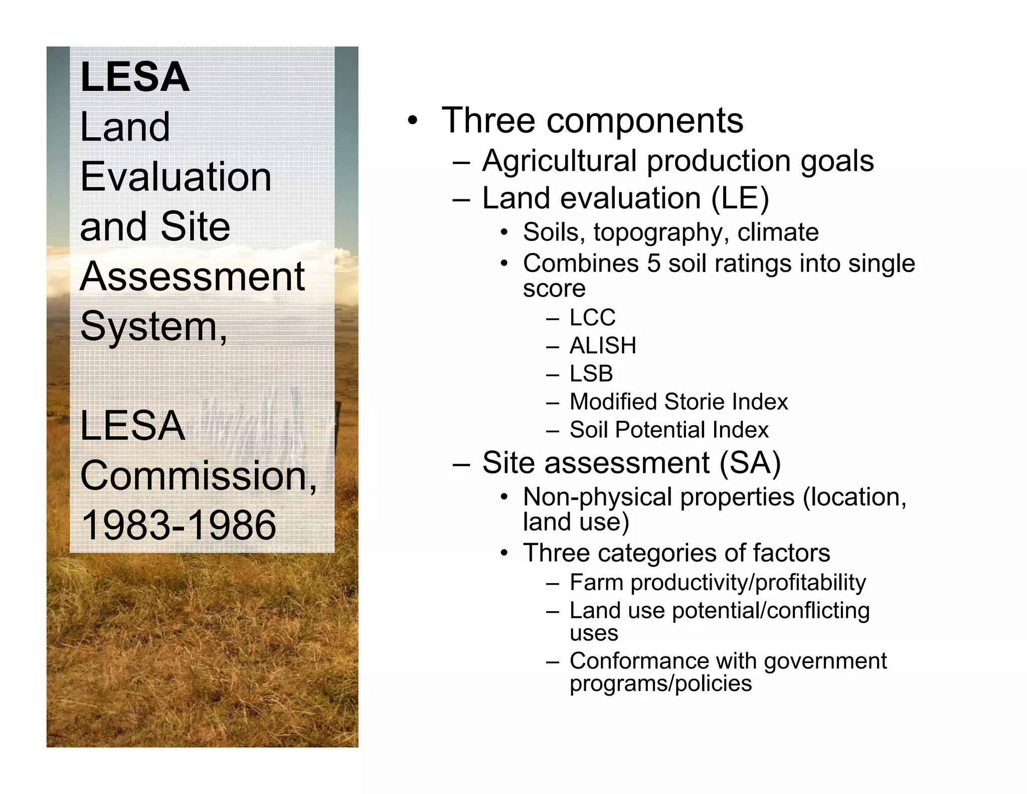
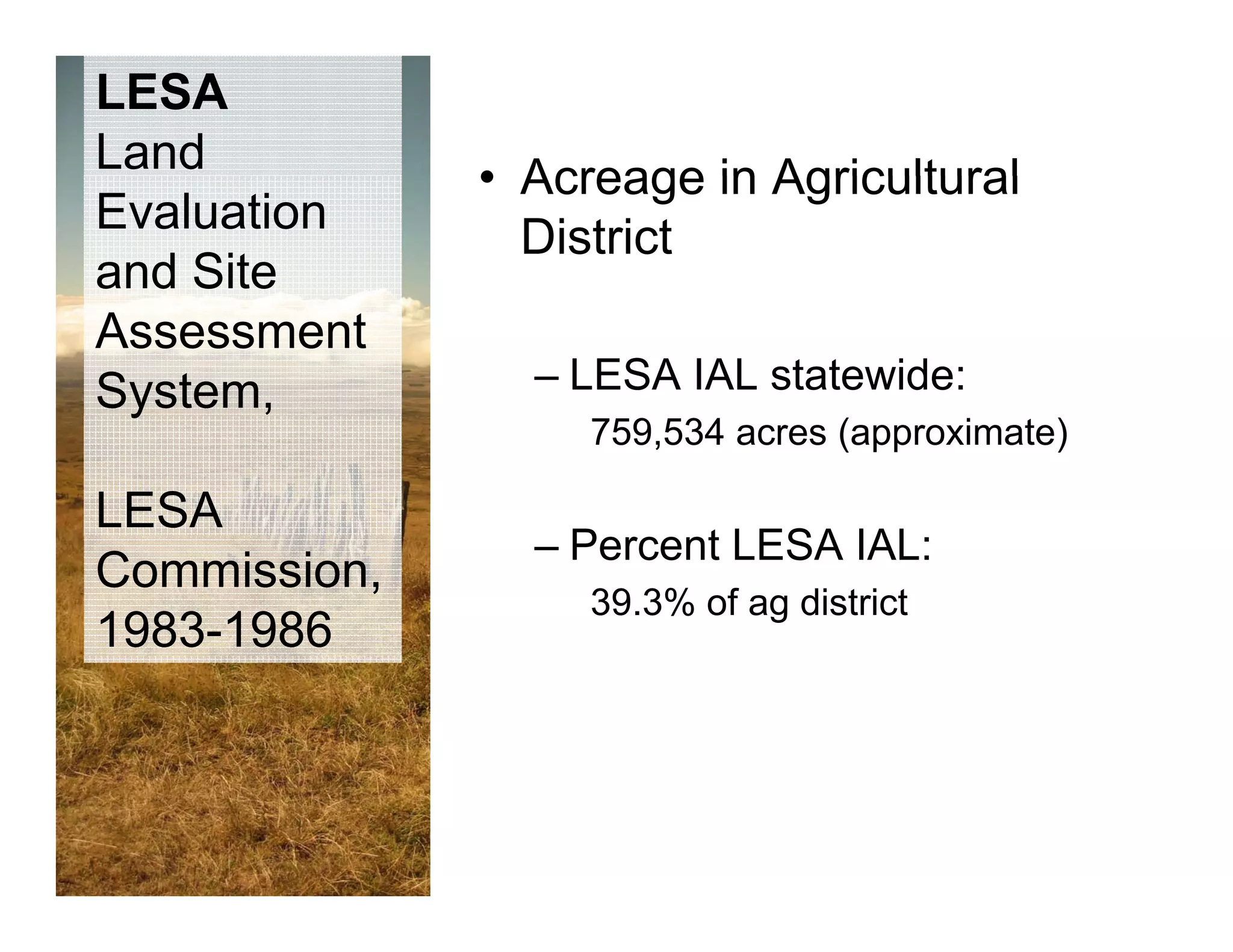
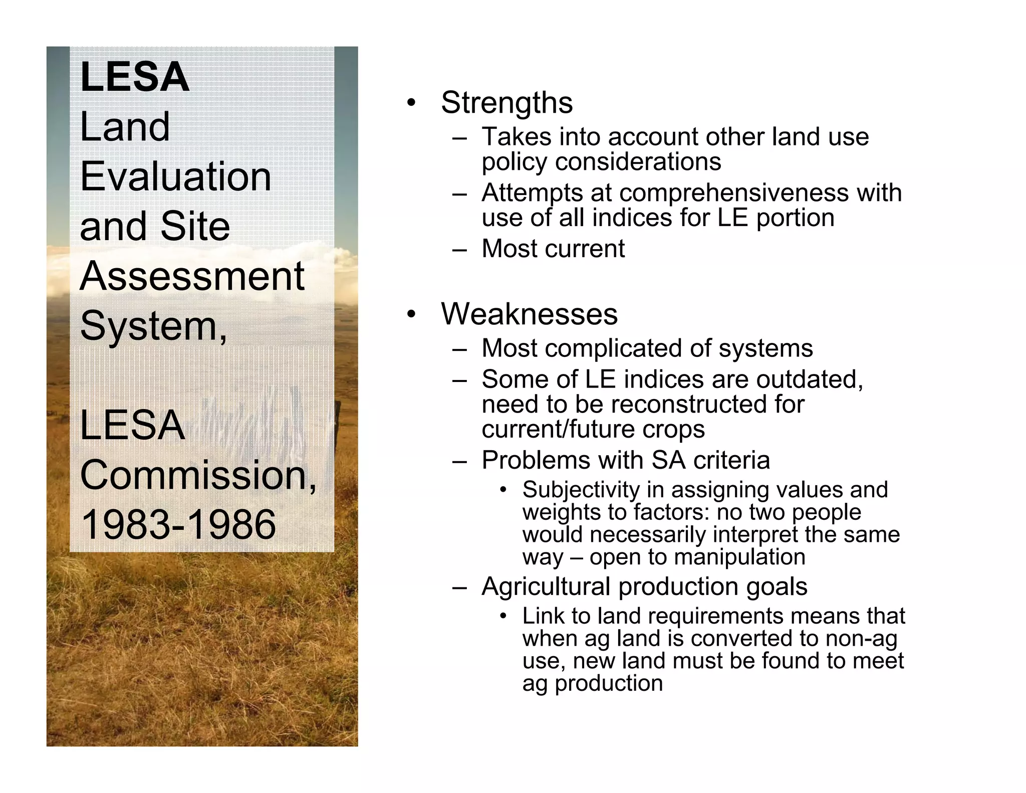

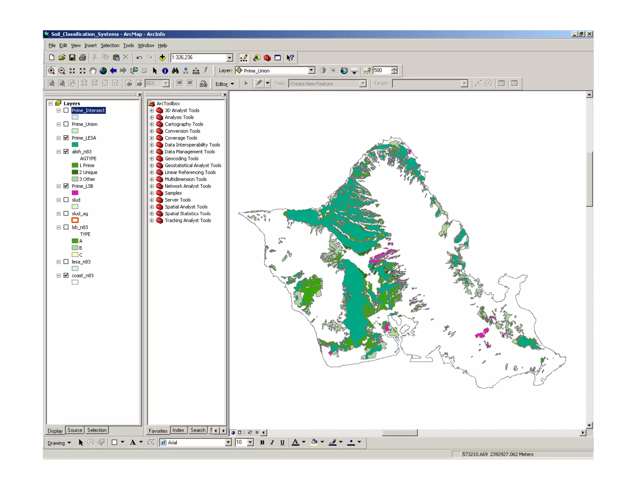
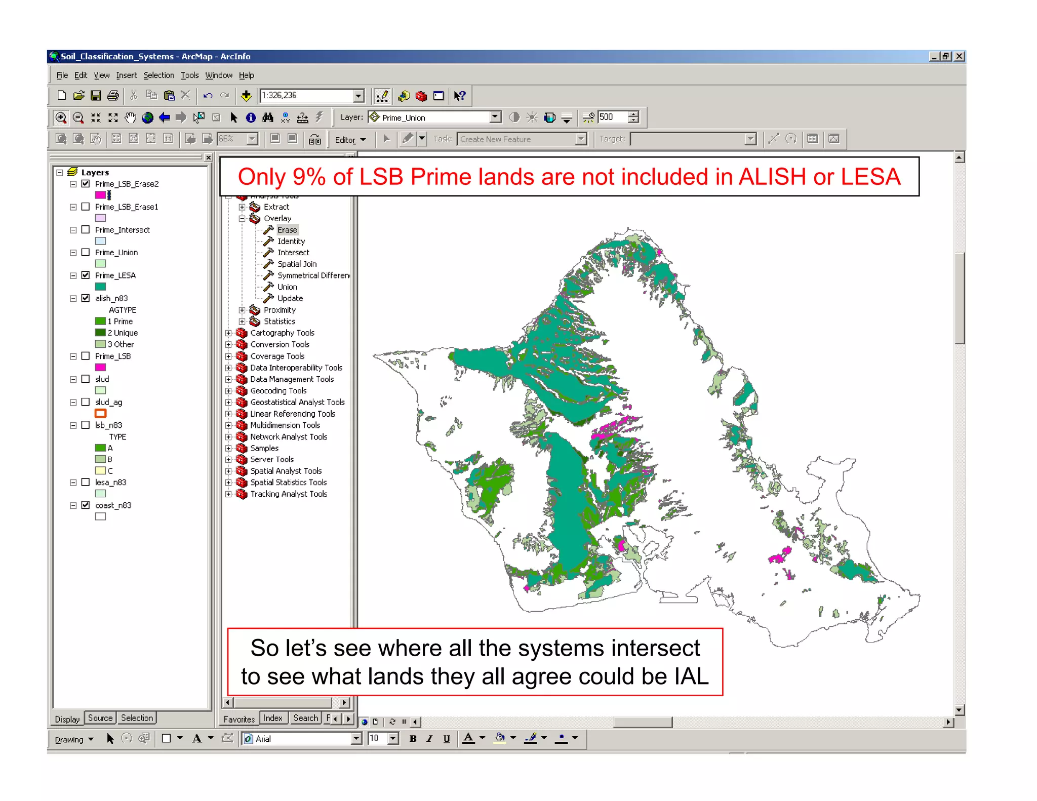
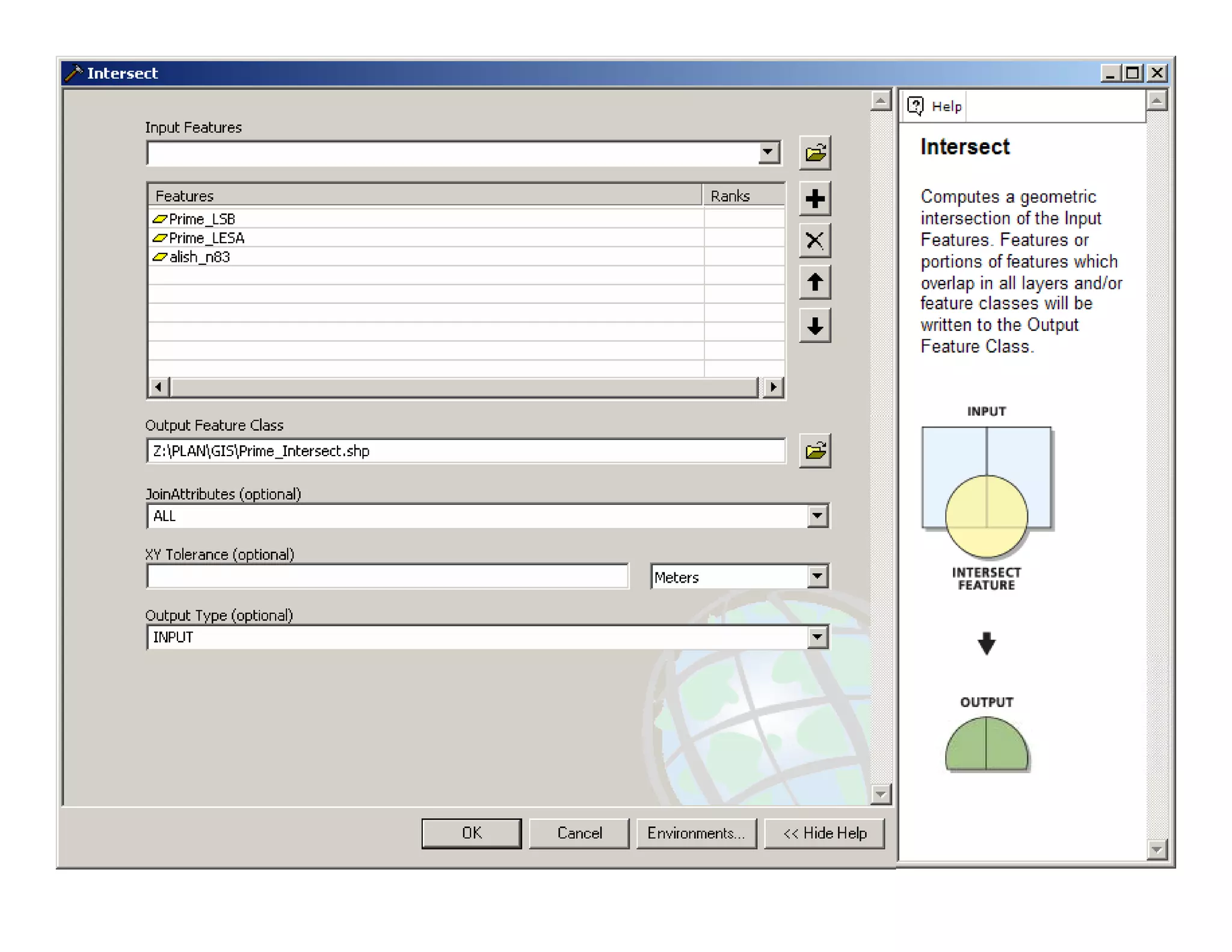

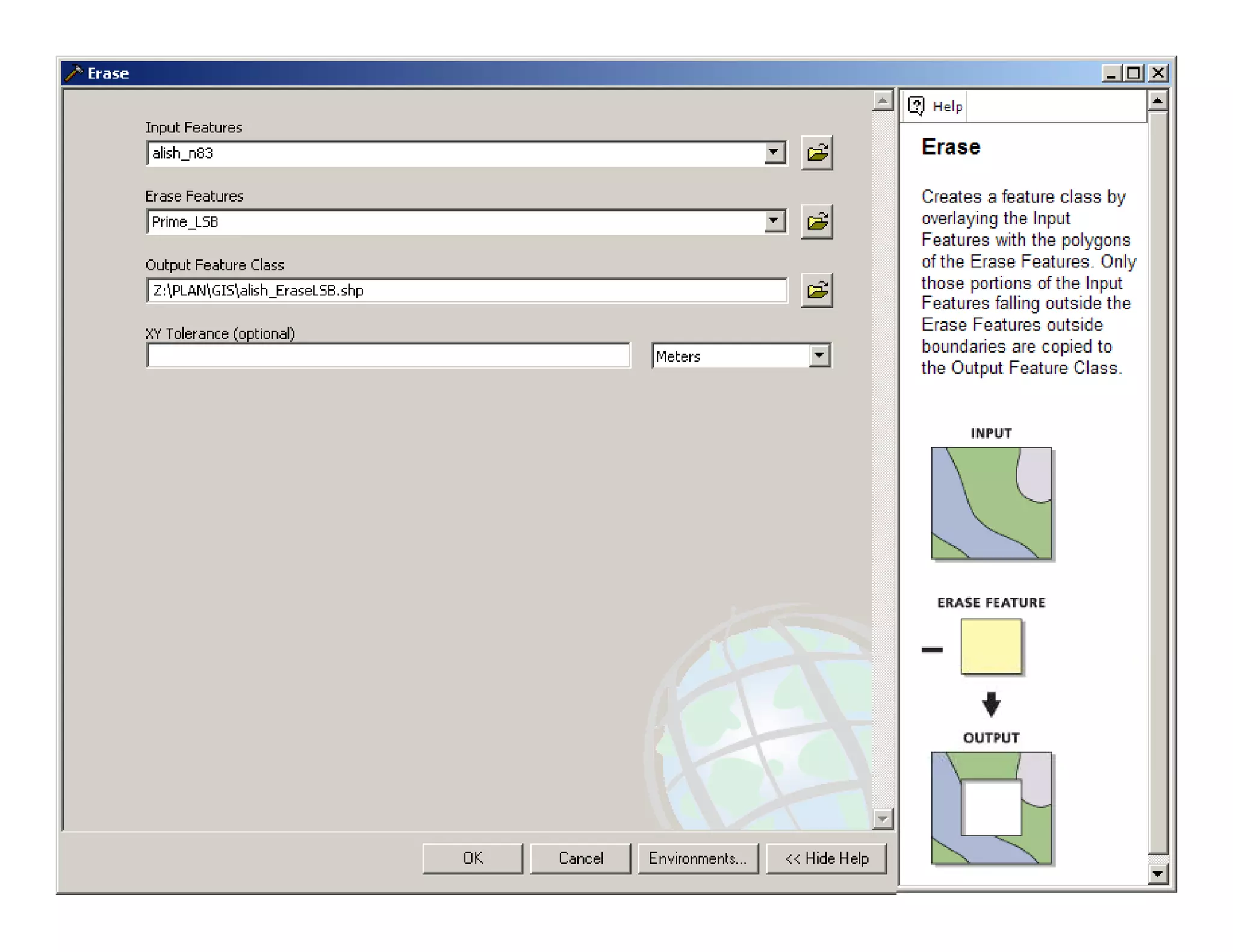
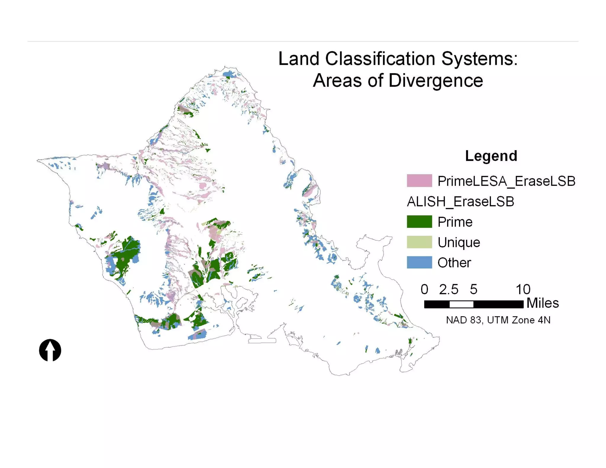
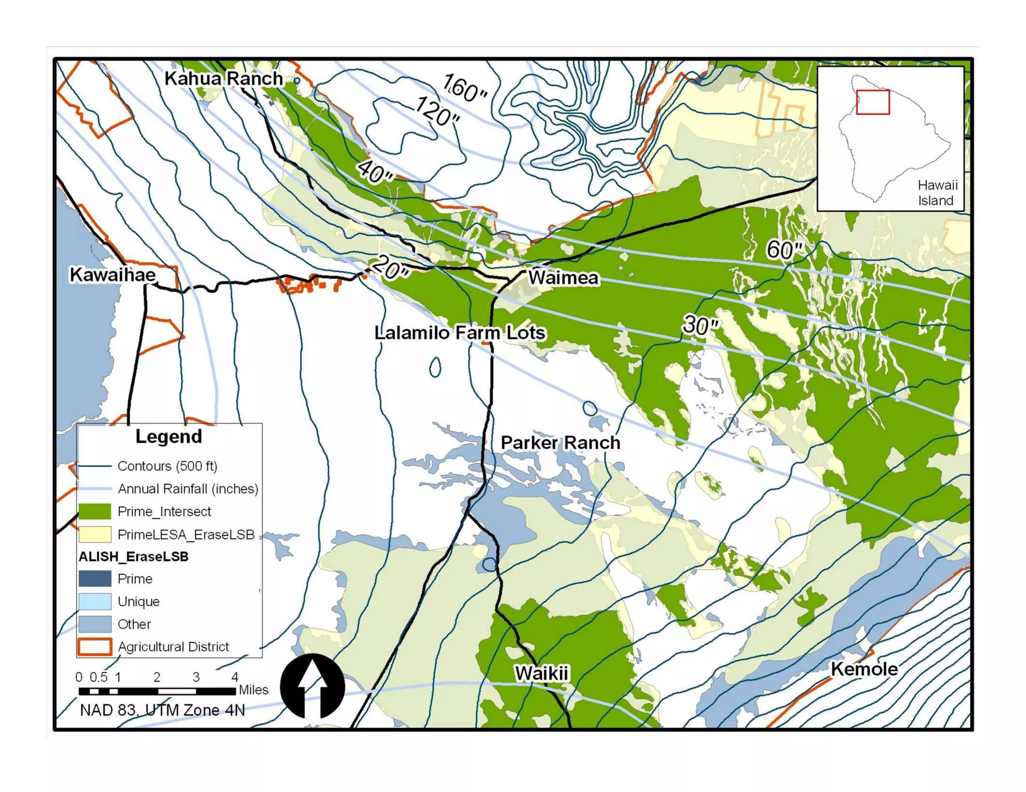

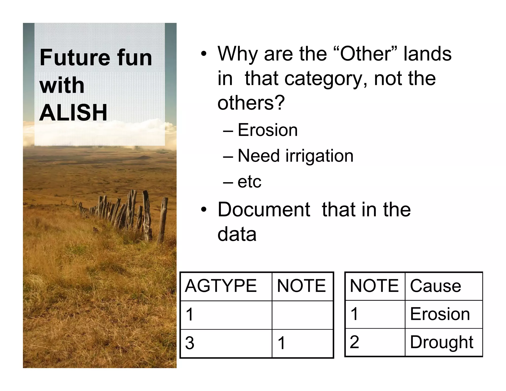

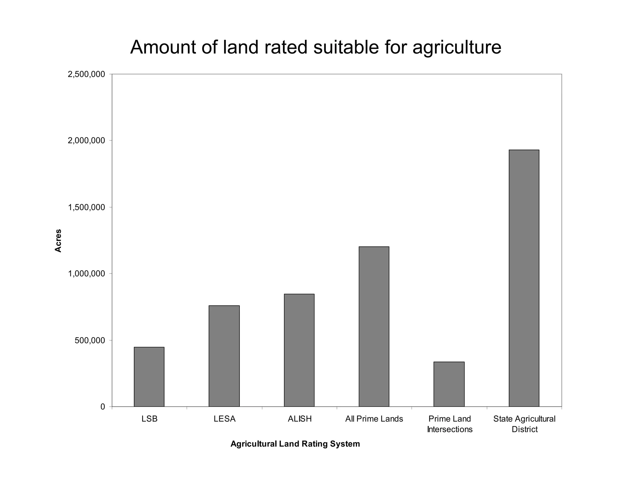
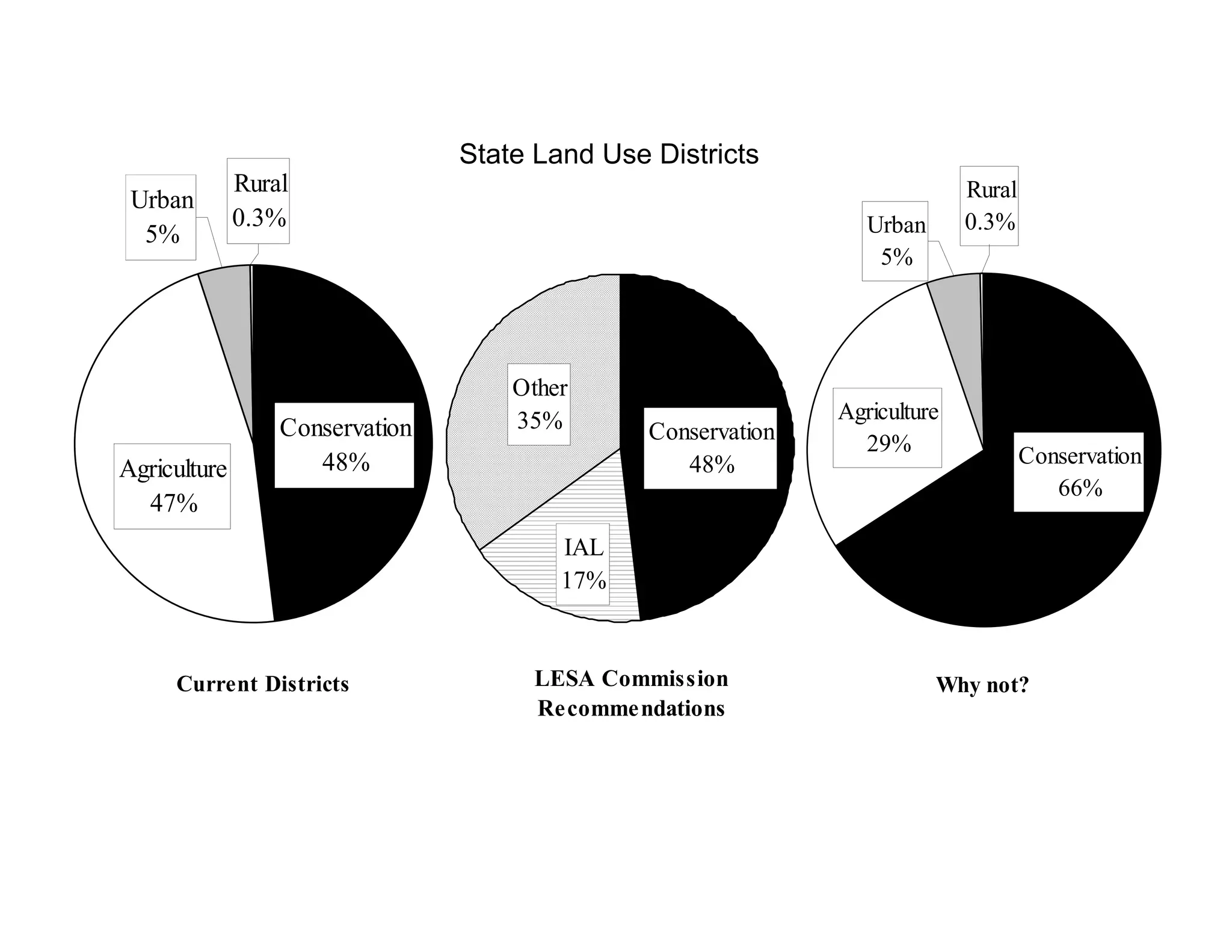

This presentation summarizes three major land classification systems used in Hawaii to identify important agricultural lands: the Land Study Bureau system from 1965-1972, the Agricultural Lands of Importance to the State of Hawaii system from 1977-1978, and the Land Evaluation and Site Assessment system from 1983-1986. It finds that while the systems agree on some lands, they also diverge in their classifications. The presentation compares the acreages identified by each system and notes weaknesses like outdated indices. It aims to have an informed discussion on better aligning the systems to identify critical agricultural lands.