
Download to read offline
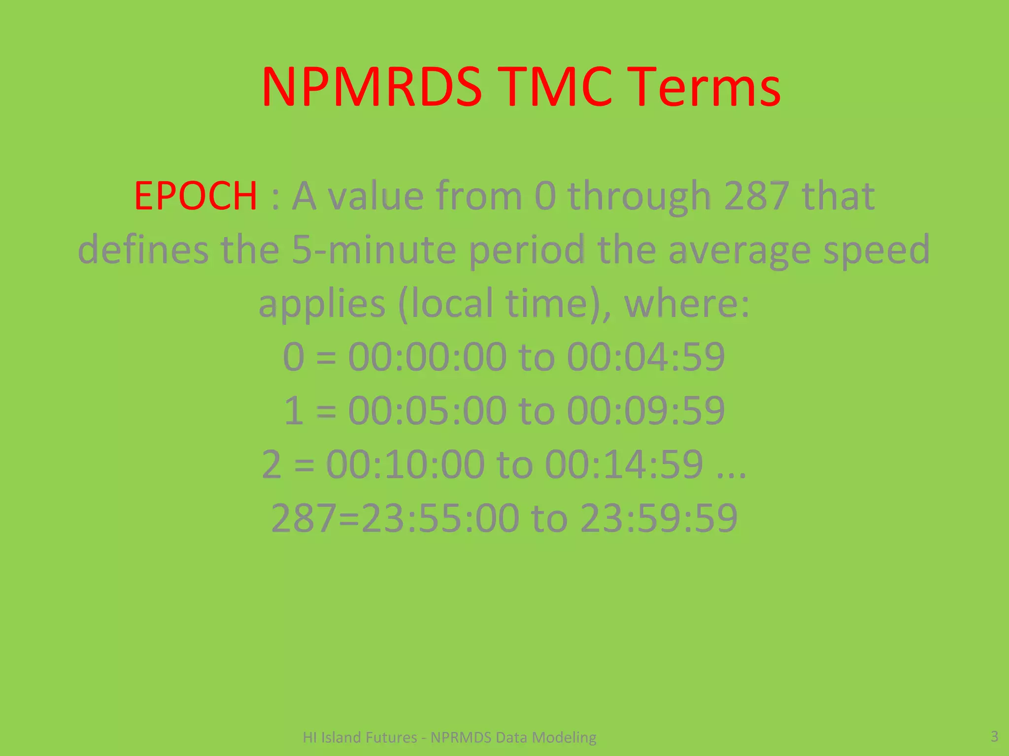
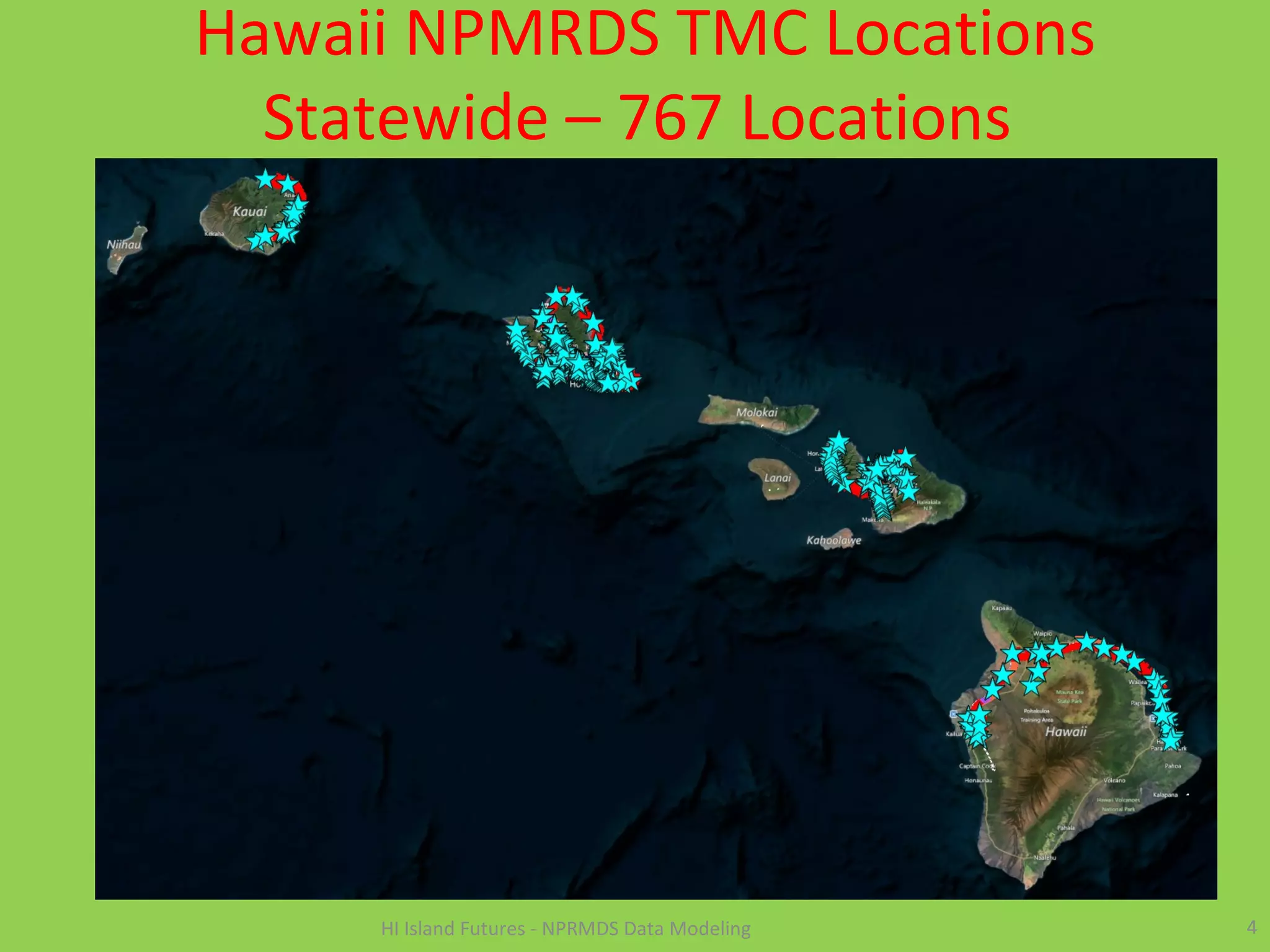
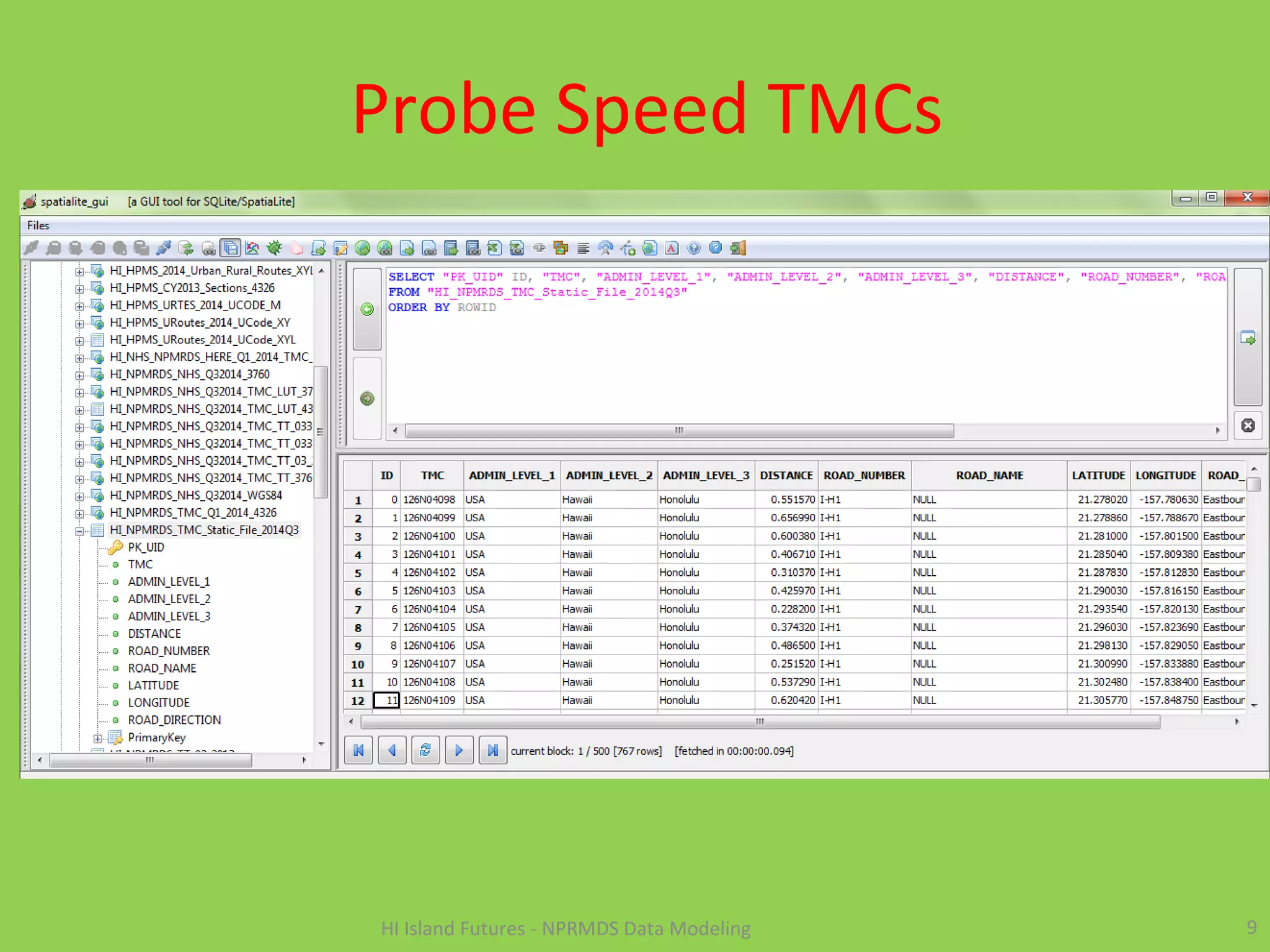
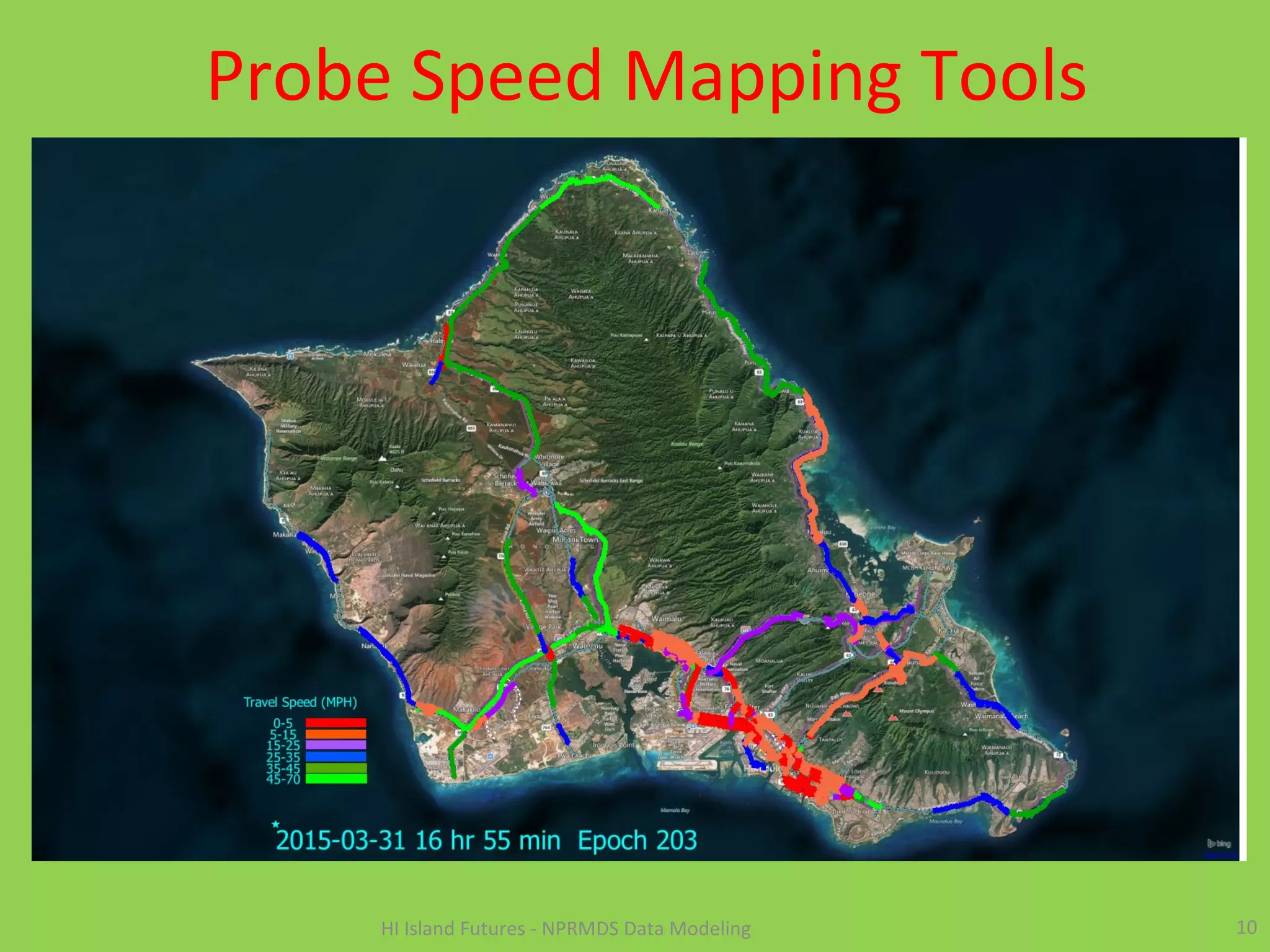
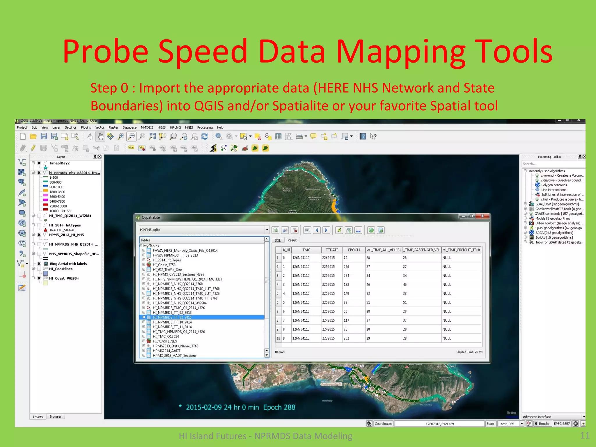
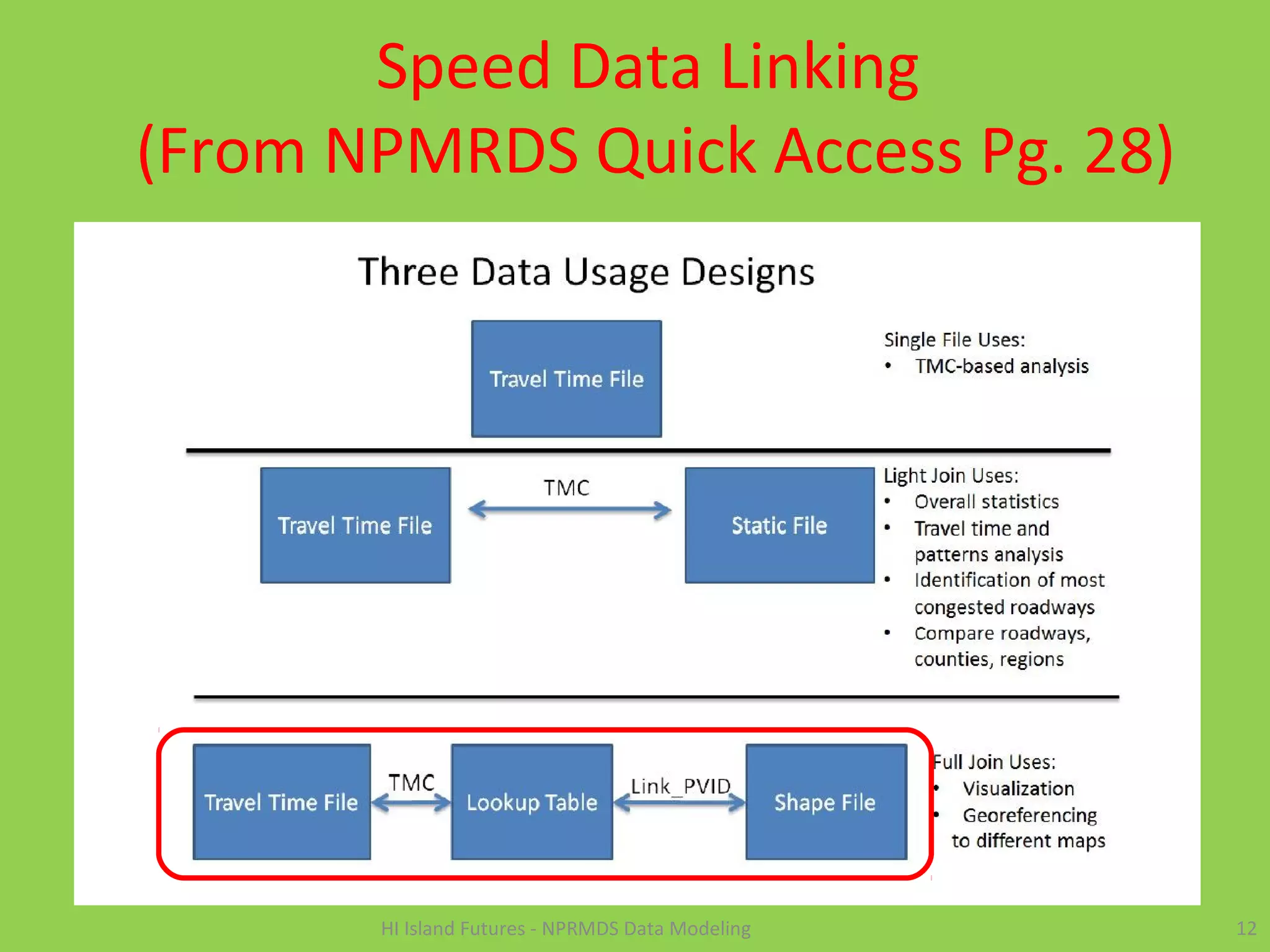
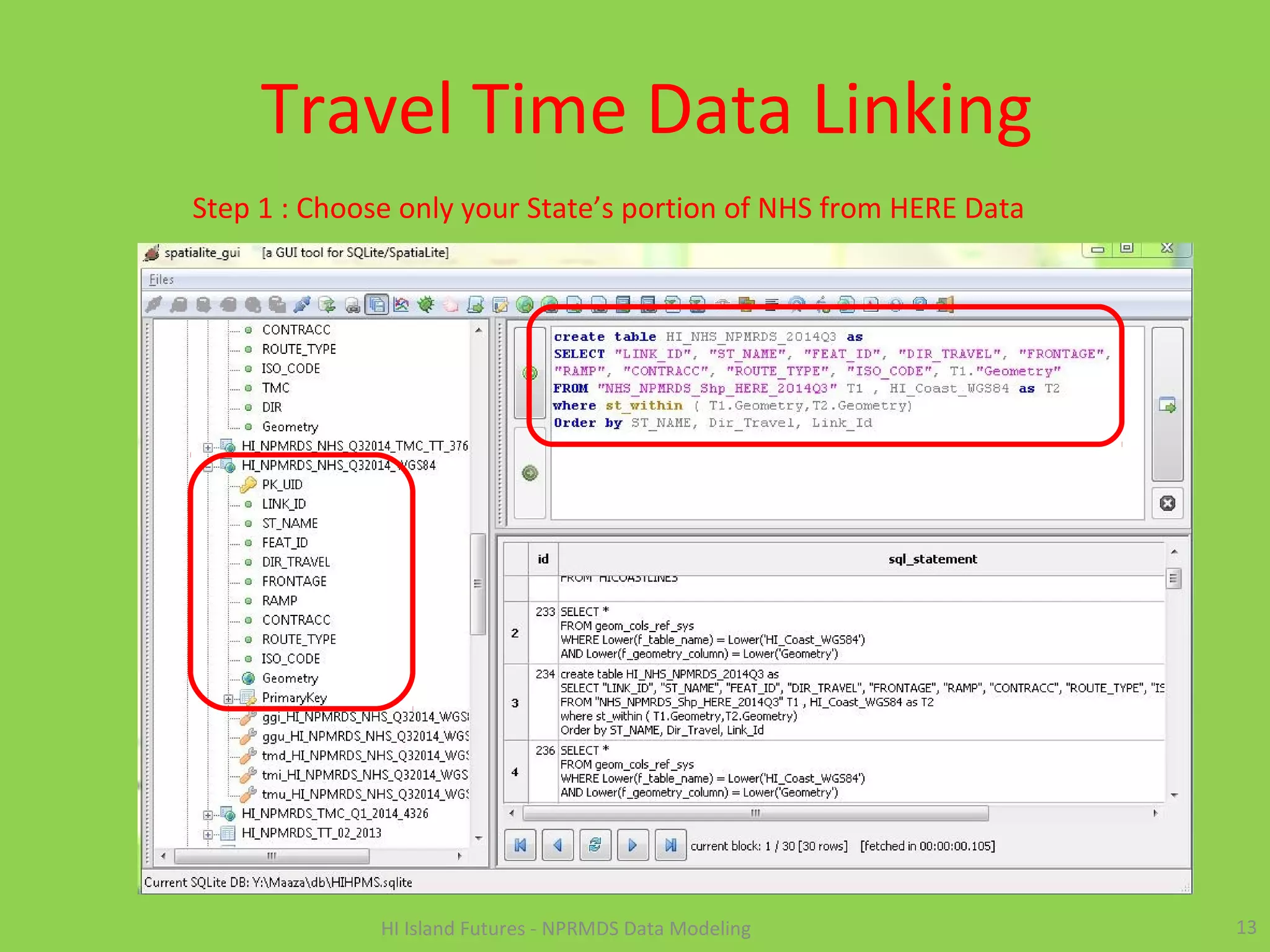
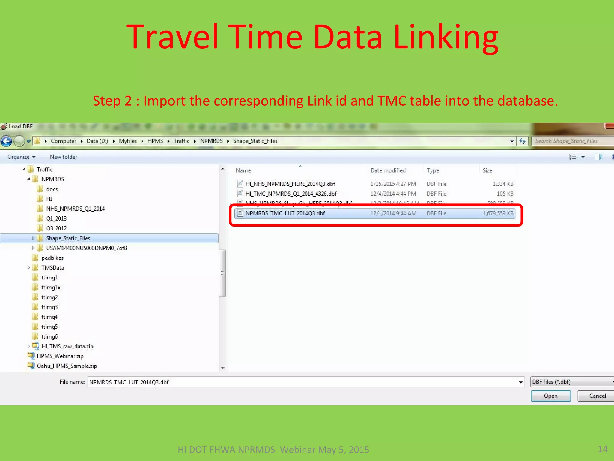
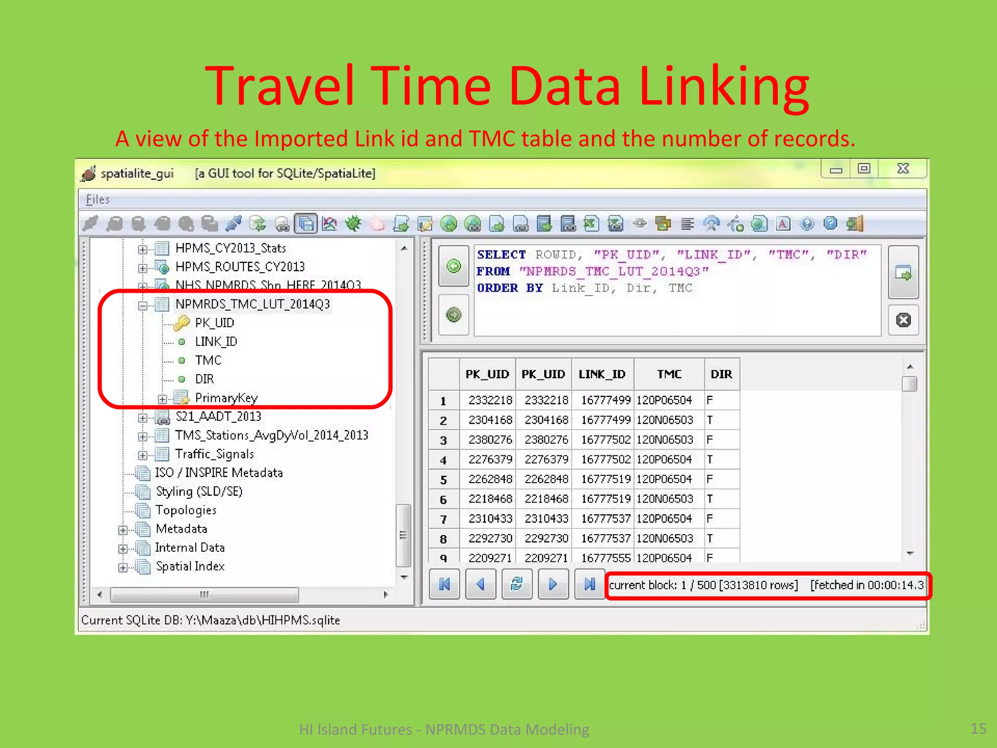


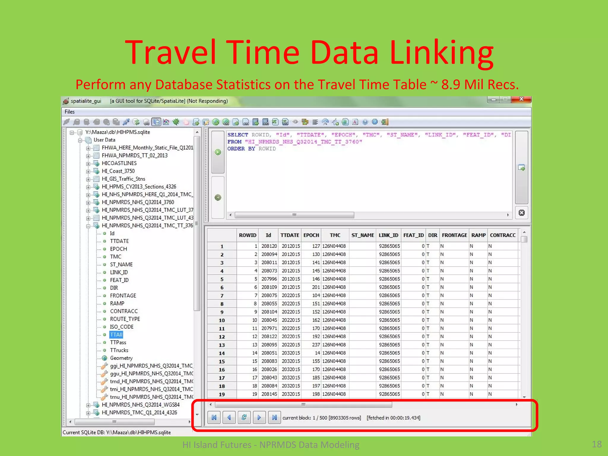


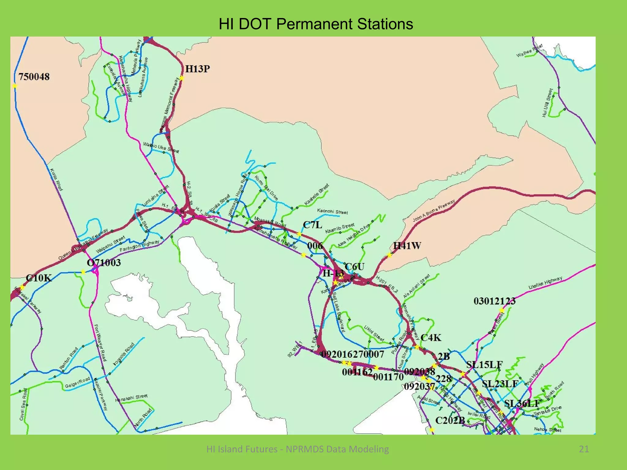
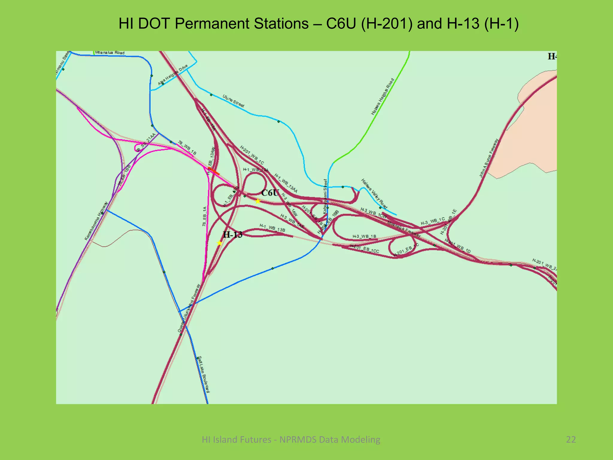
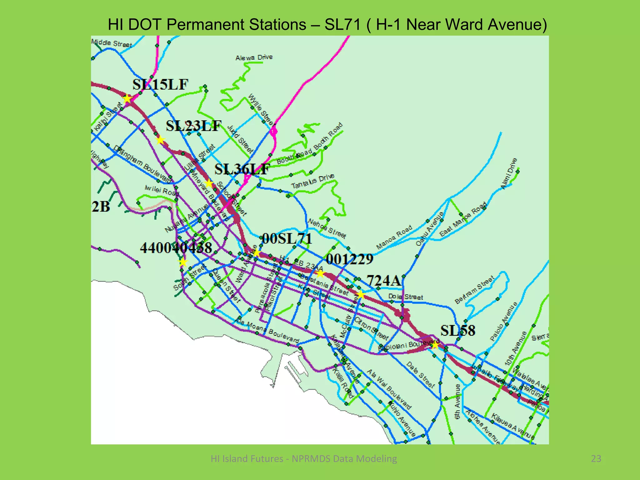
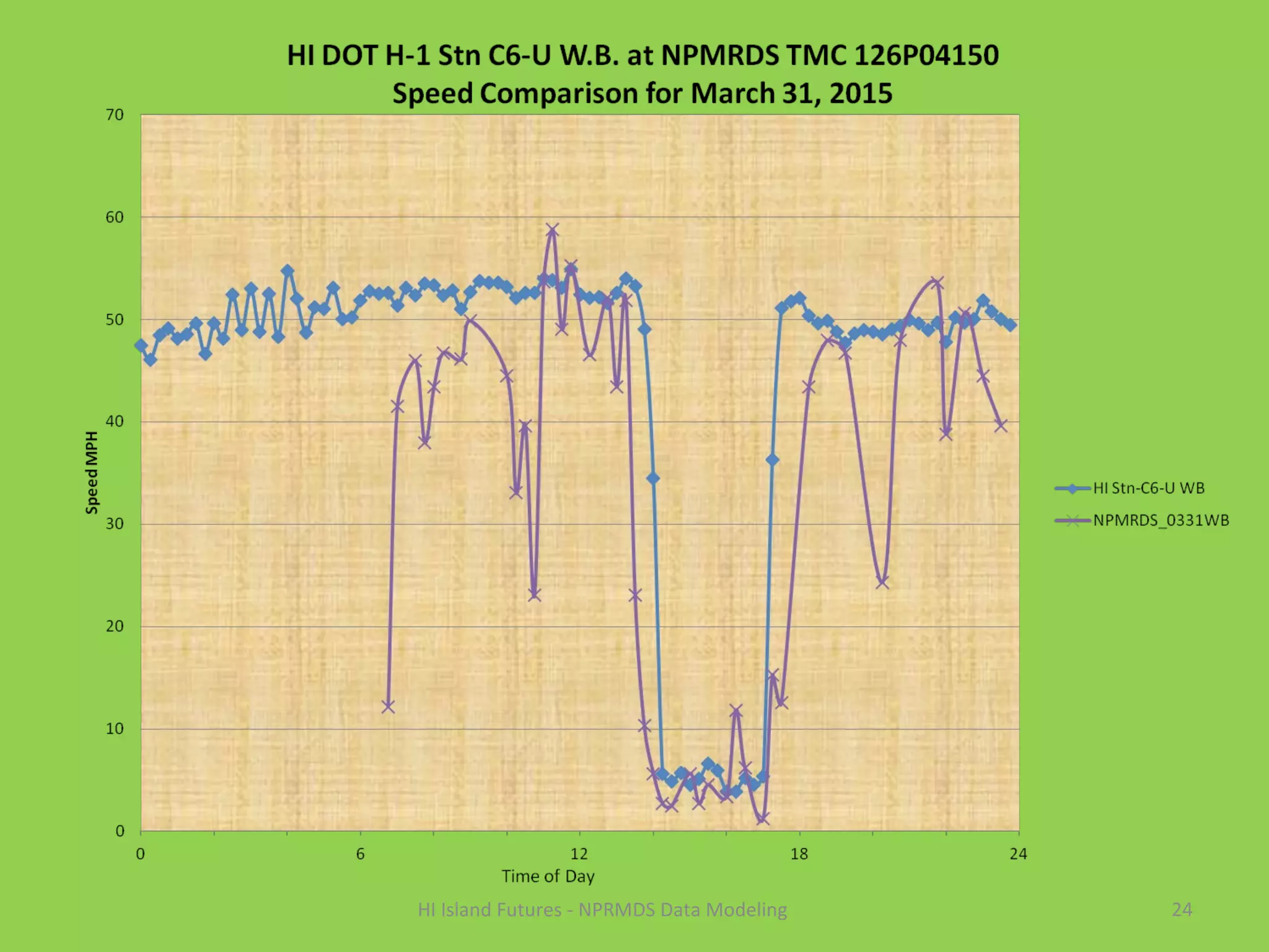
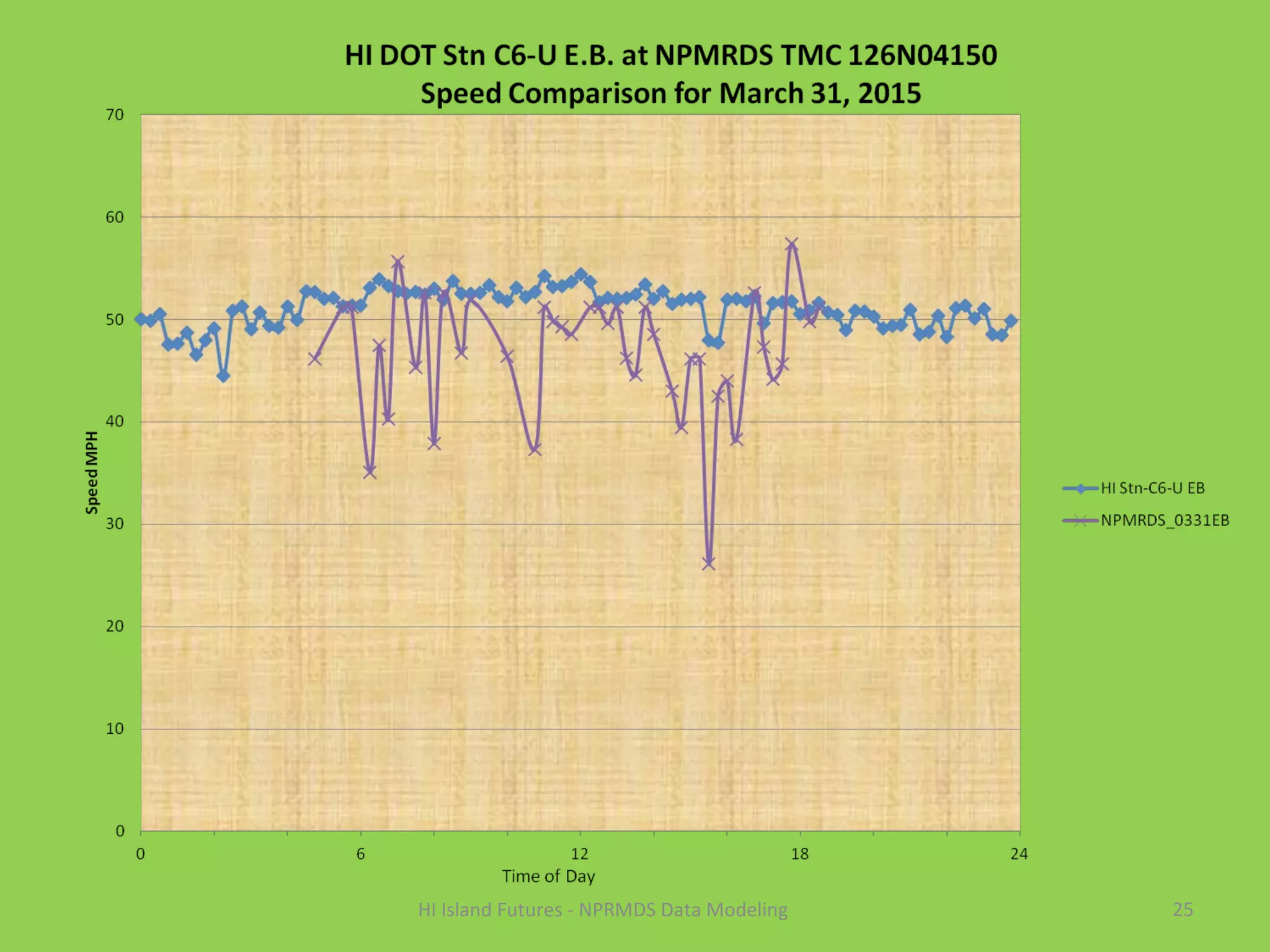
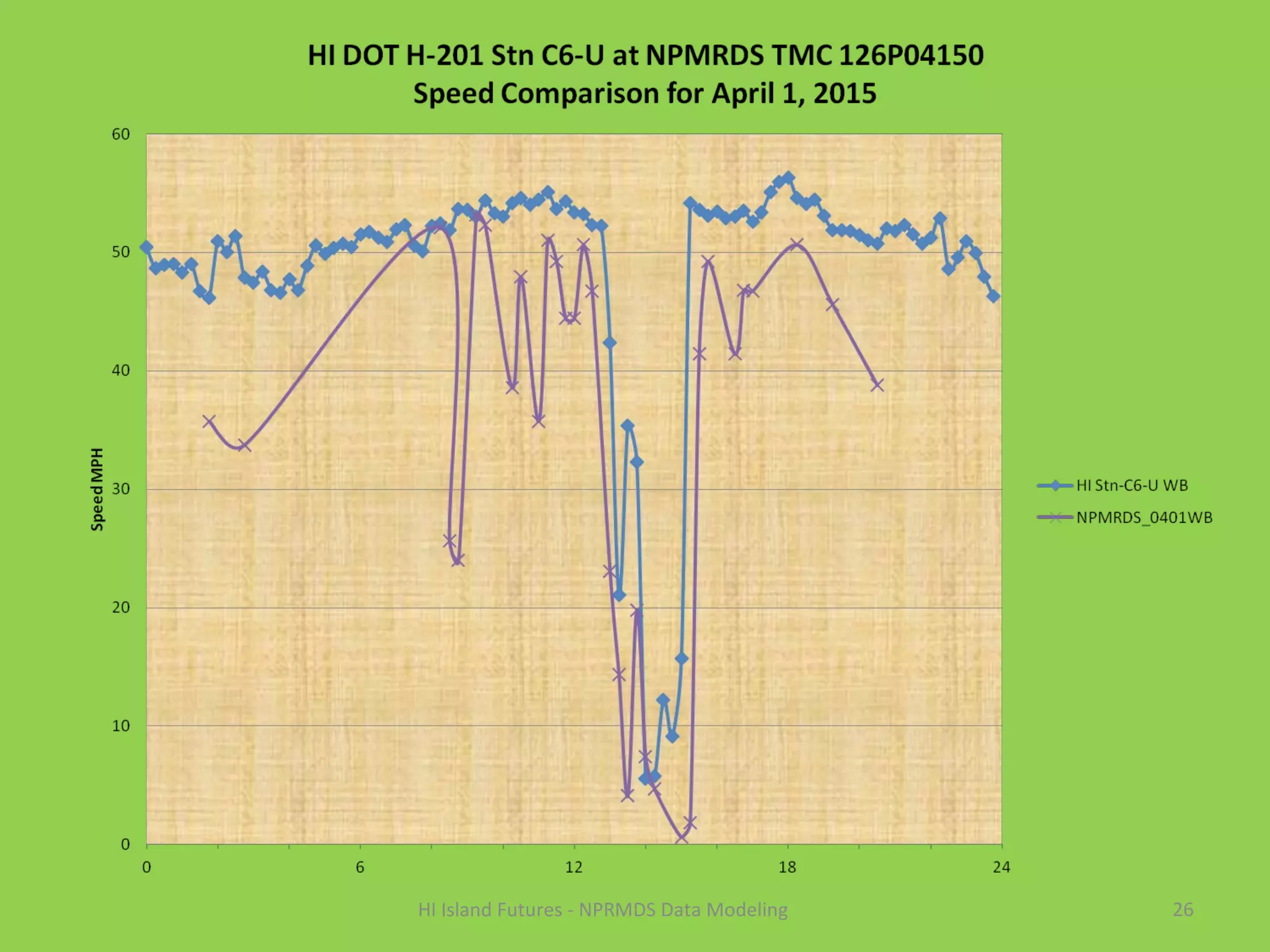
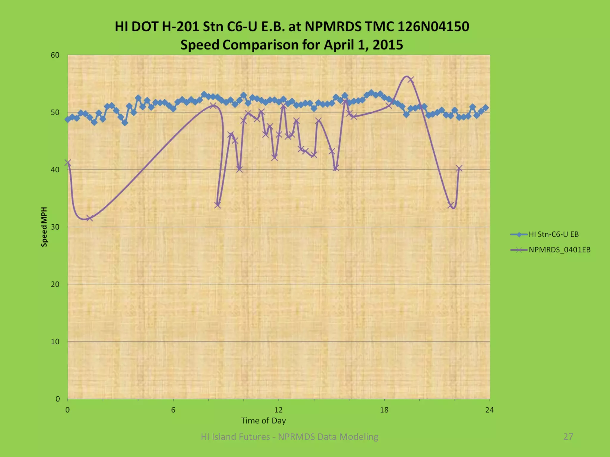
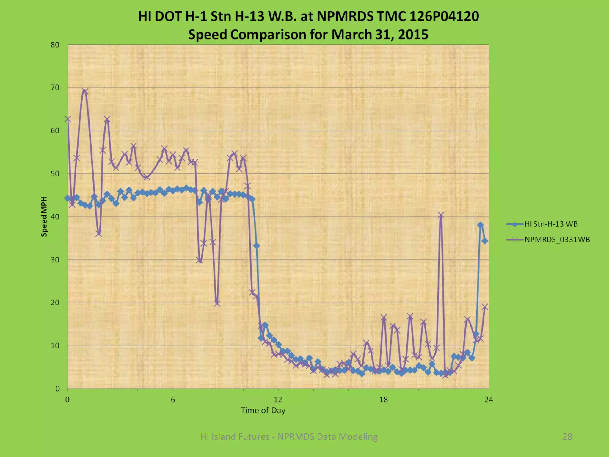
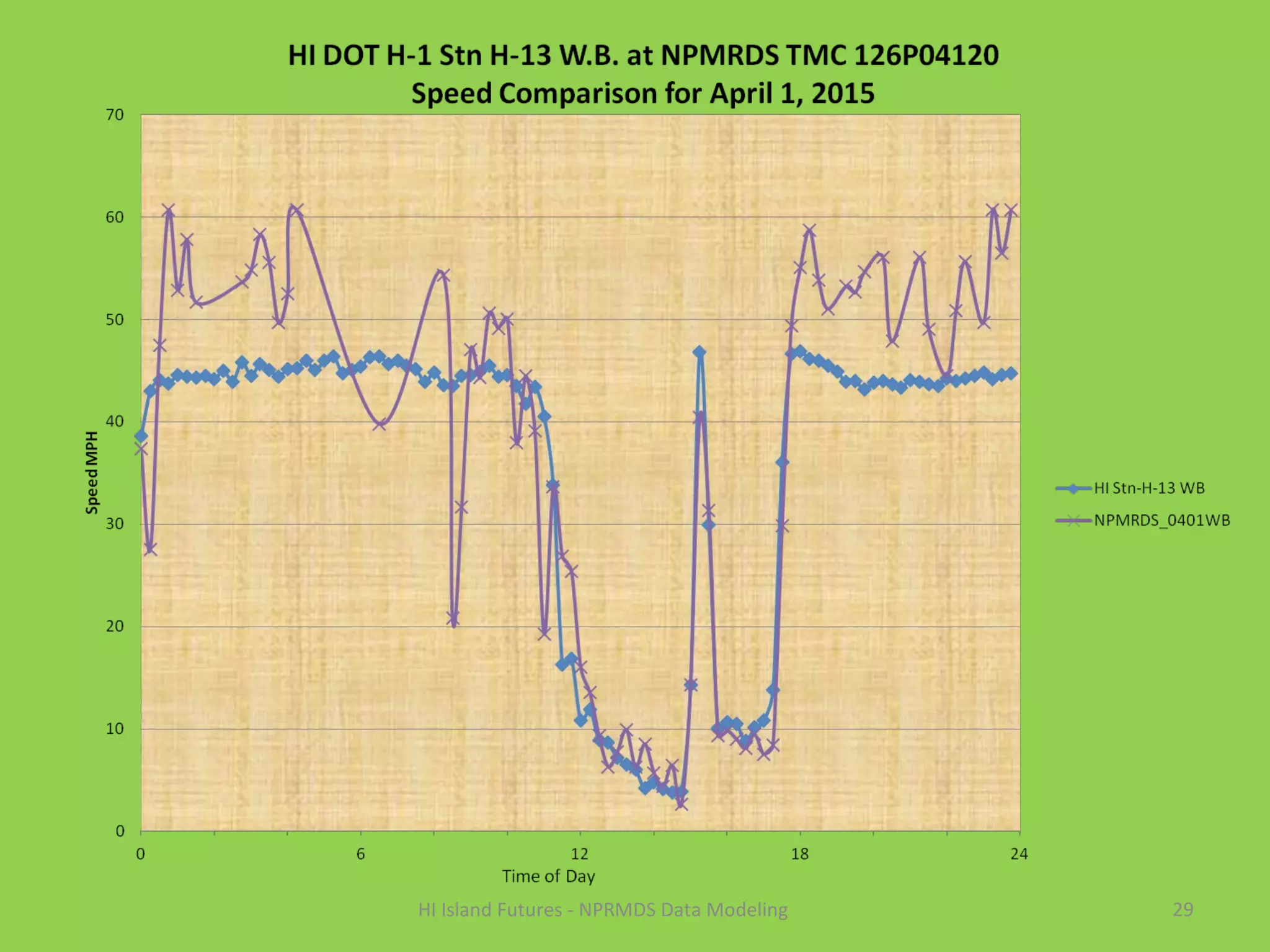
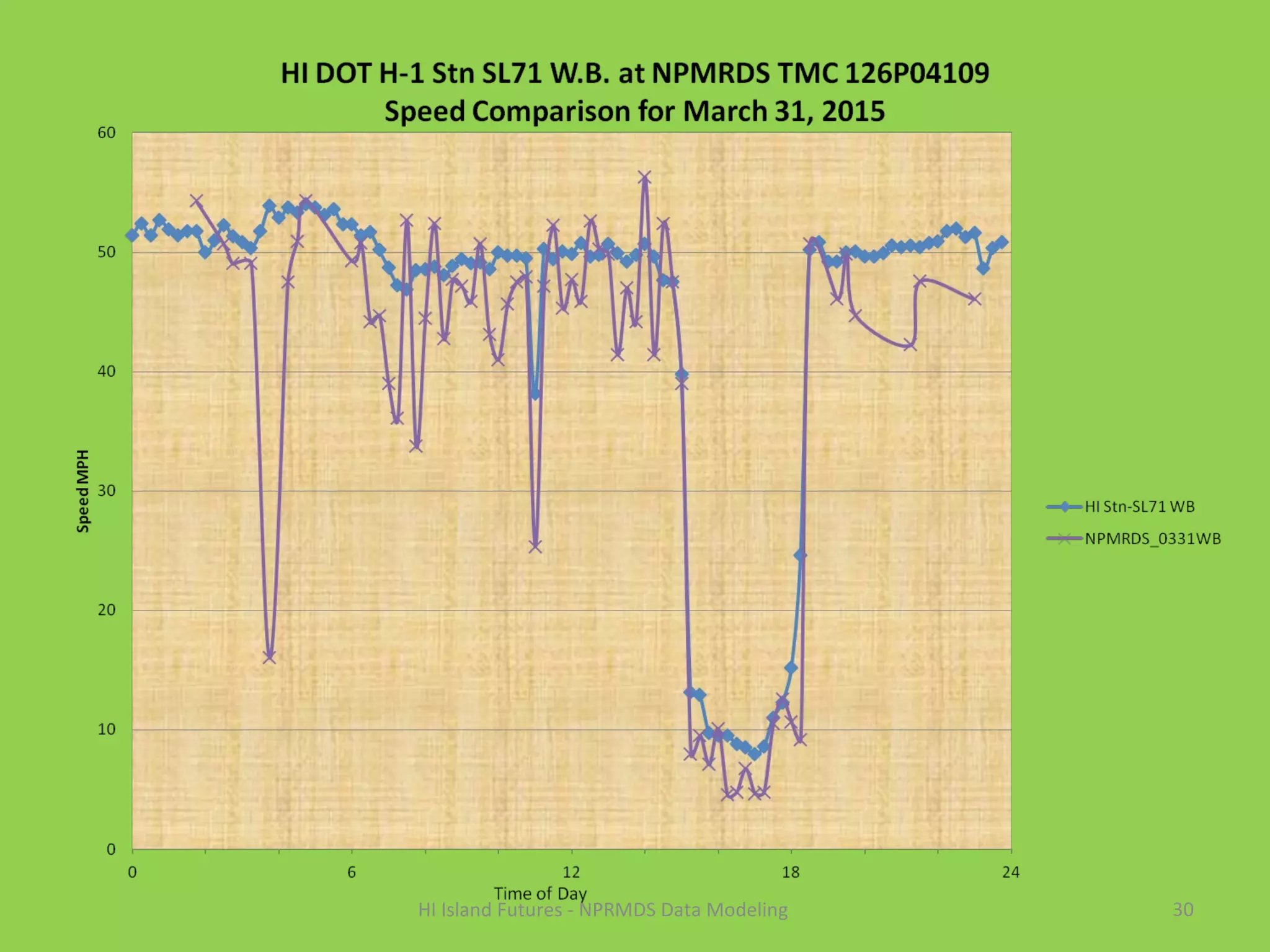
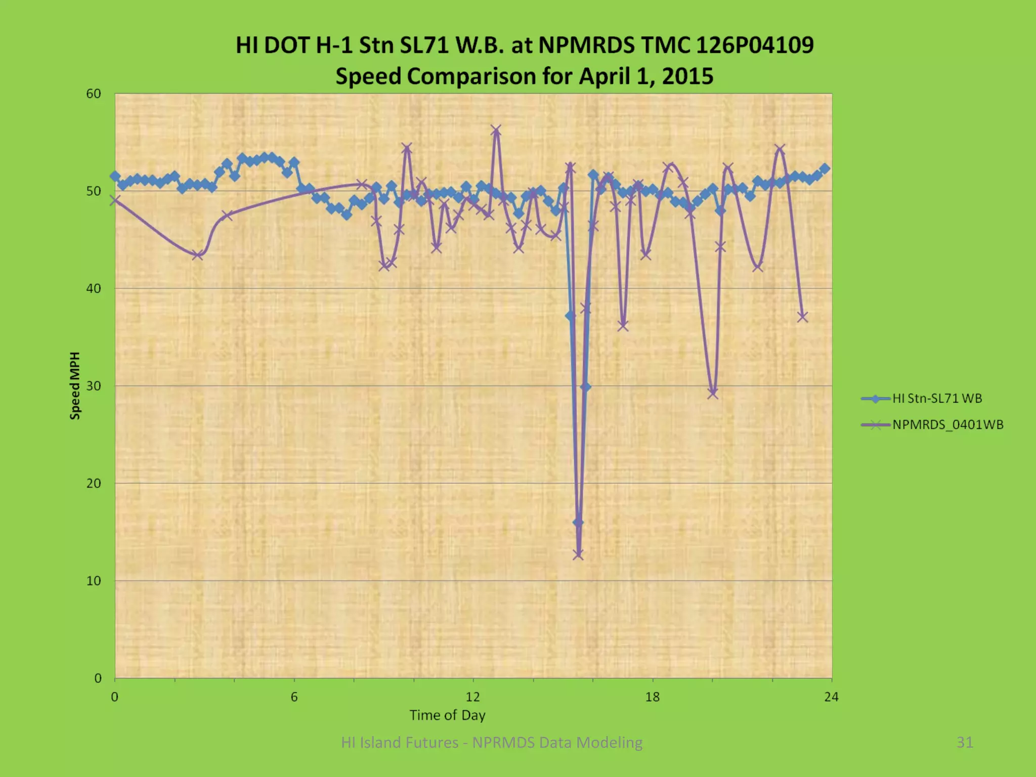
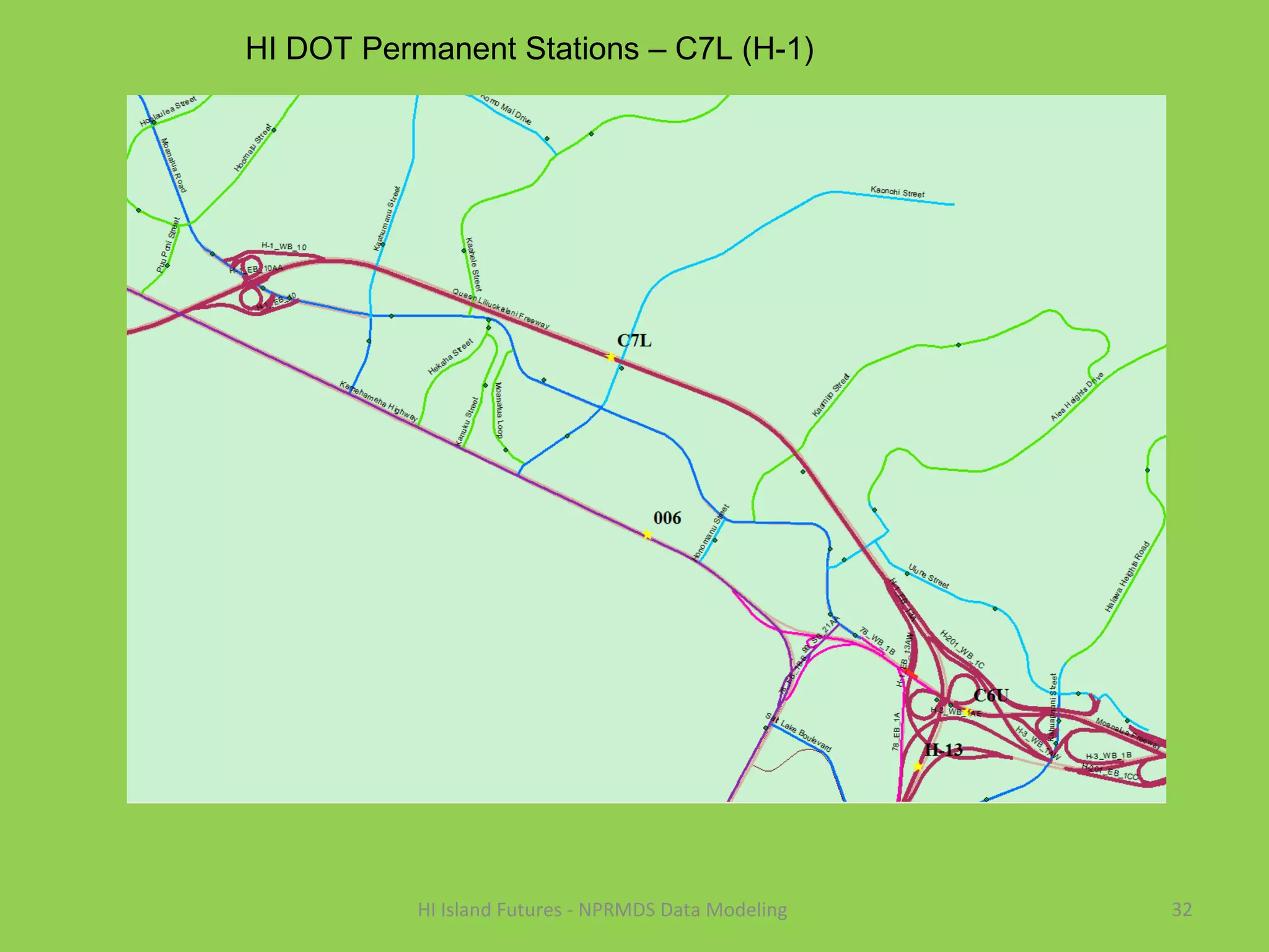
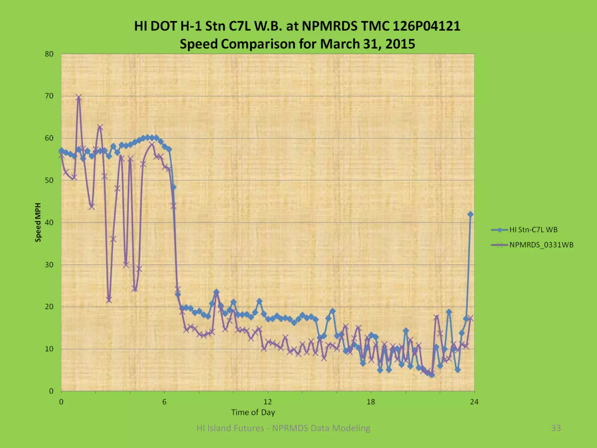
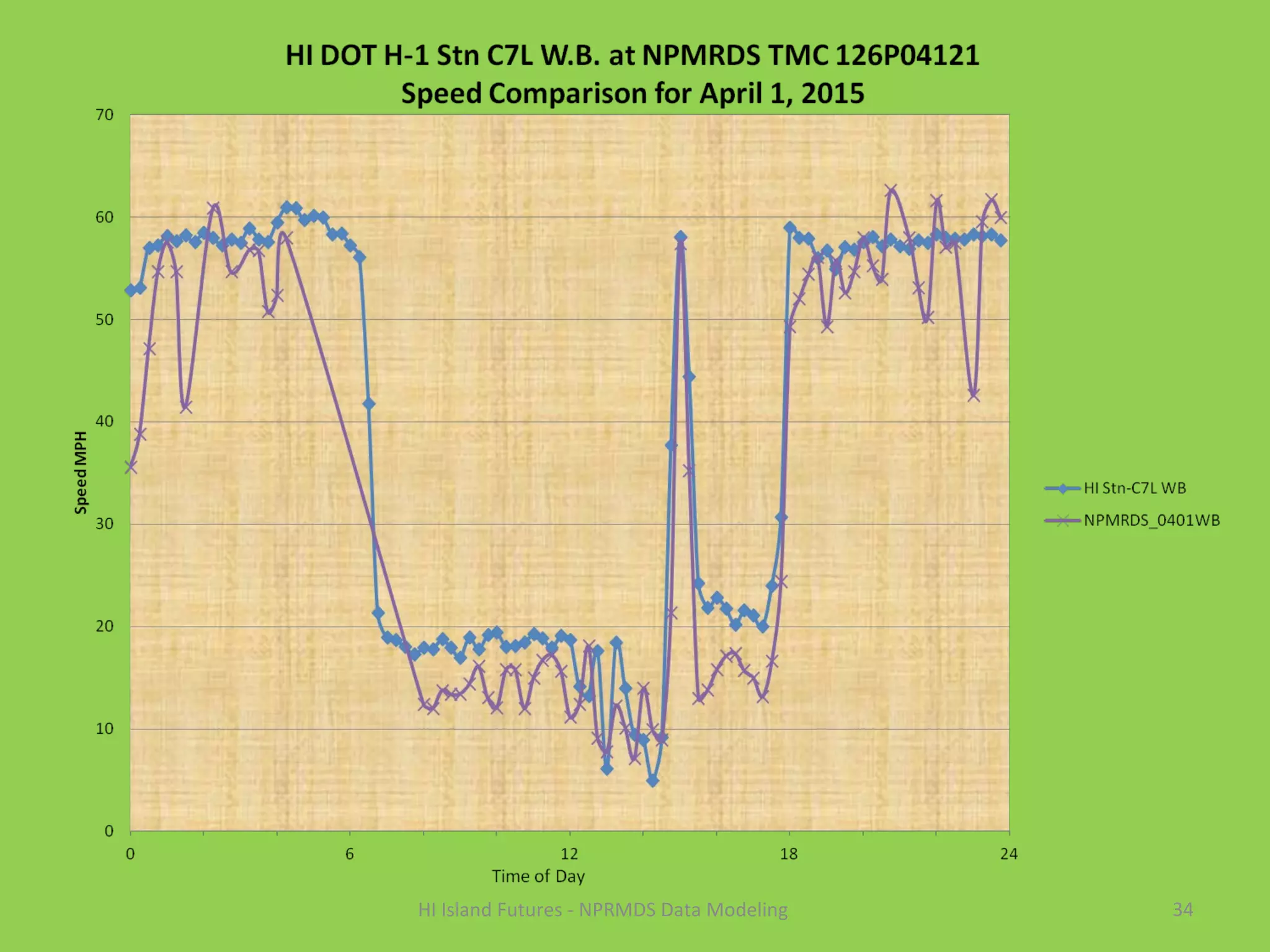
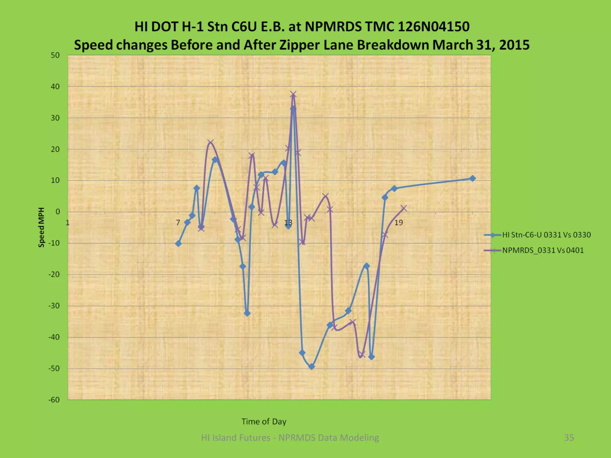
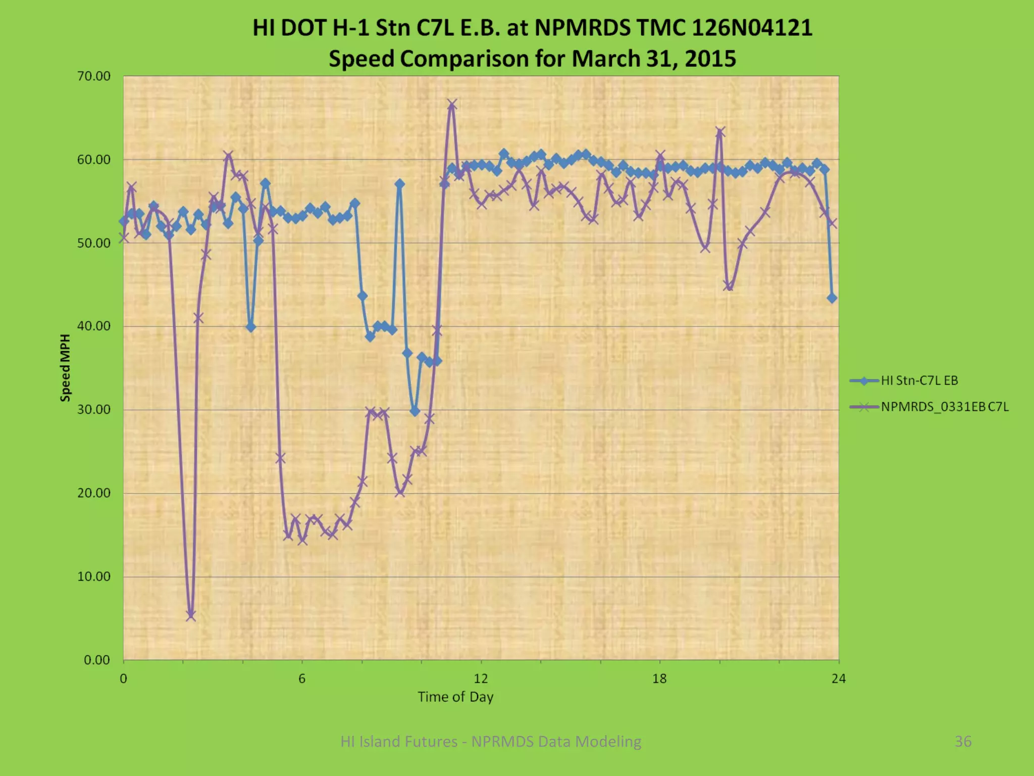
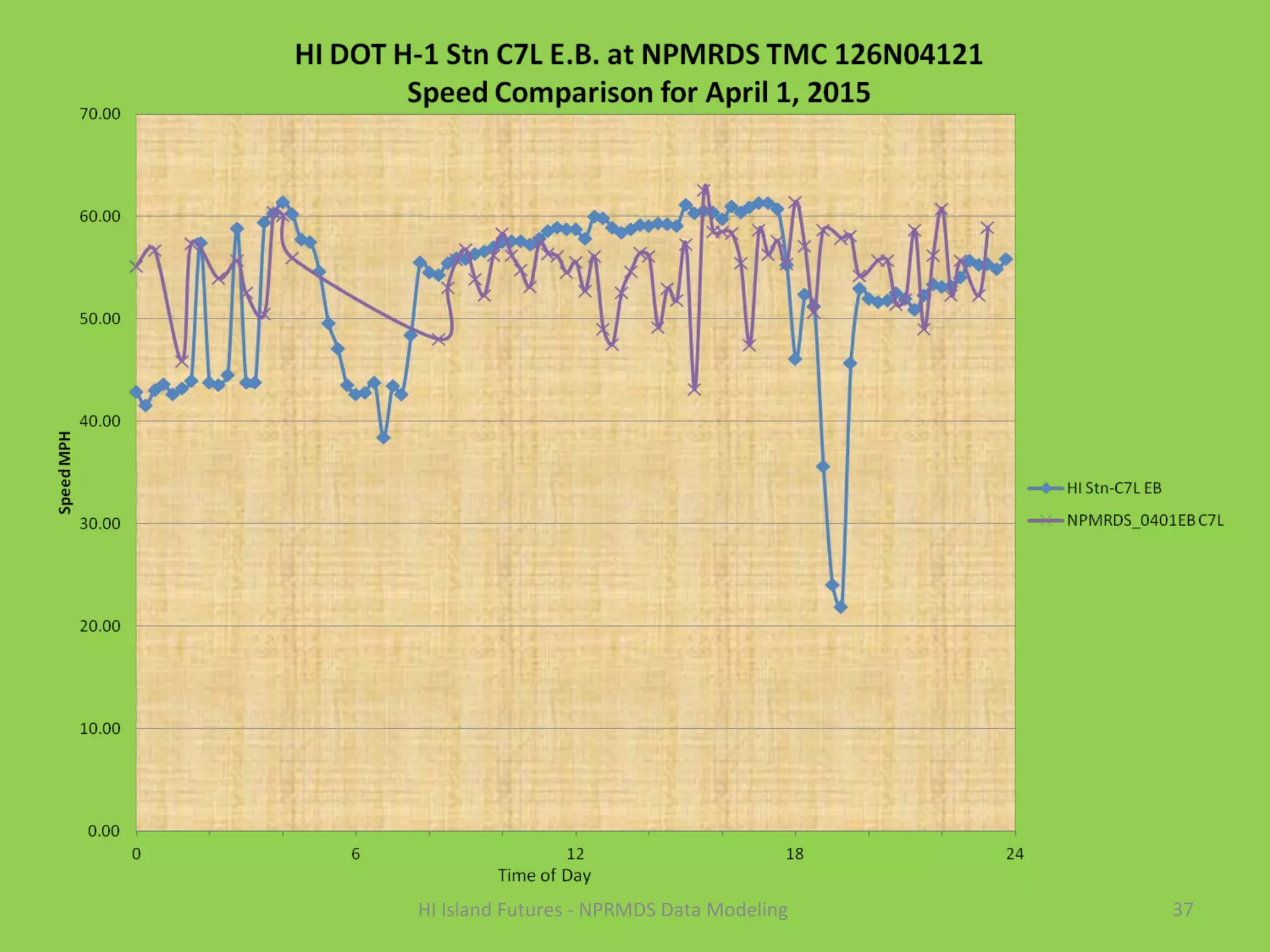
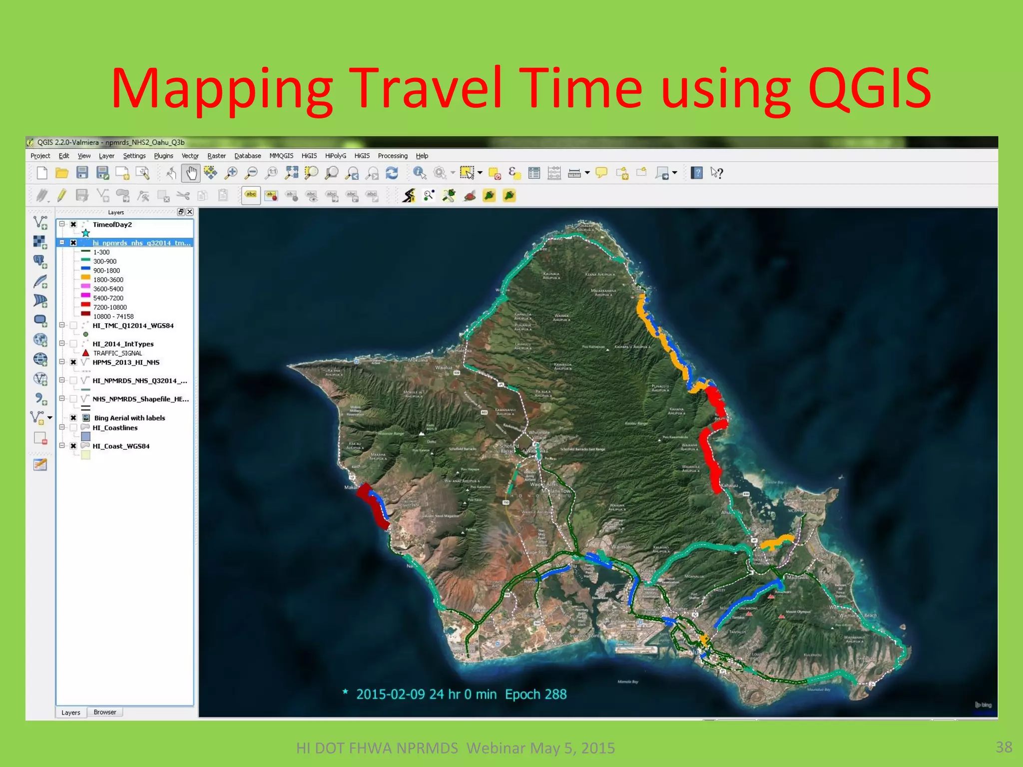


This presentation compares speed data from Hawaii DOT monitoring stations to the National Performance Measurement Research Data Set (NPMRDS) probe data. It finds that the two data sources match fairly well overall but that finer-grained Hawaii DOT data is needed for detailed analysis. The presentation demonstrates how to link NPMRDS travel time data to road network maps using open-source tools and provides examples of mapping and animating travel times using this data to estimate the impacts of traffic events. It concludes that the NPMRDS and Hawaii DOT data can both be used to analyze traffic conditions when combined with open-source spatial analysis tools.


