An Aerial Remote Sensing Platform for High Throughput Phenotyping of Genetic Resources
•Download as PPTX, PDF•
4 likes•3,600 views

Remote sensing –Beyond images Mexico 14-15 December 2013 The workshop was organized by CIMMYT Global Conservation Agriculture Program (GCAP) and funded by the Bill & Melinda Gates Foundation (BMGF), the Mexican Secretariat of Agriculture, Livestock, Rural Development, Fisheries and Food (SAGARPA), the International Maize and Wheat Improvement Center (CIMMYT), CGIAR Research Program on Maize, the Cereal System Initiative for South Asia (CSISA) and the Sustainable Modernization of the Traditional Agriculture (MasAgro)

Recommended
Recommended
More Related Content
What's hot
What's hot (20)
Viewers also liked
Viewers also liked (12)
Similar to An Aerial Remote Sensing Platform for High Throughput Phenotyping of Genetic Resources
Similar to An Aerial Remote Sensing Platform for High Throughput Phenotyping of Genetic Resources (20)
More from CIMMYT
More from CIMMYT (20)
Recently uploaded
Recently uploaded (20)
An Aerial Remote Sensing Platform for High Throughput Phenotyping of Genetic Resources
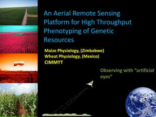
- 1. An Aerial Remote Sensing Platform for High Throughput Phenotyping of Genetic Resources Maize Physiology, (Zimbabwe) Wheat Physiology, (Mexico) CIMMYT Observing with “artificial eyes”
- 2. Remote sensing for field phenotyping at CIMMYT Why do we need remote sensing? • • • • Non-intrusive measurements Coverage of large areas Accessibly Reduce error variance Sensors • • • Ground-based: e.g. Thermal, Hyperspectral, Ground Penetrating Radar Airborne: Thermal, multispectral Space-borne: Multispectral Remote Sensing for field phenotyping CIMMYT 1. Phenotyping: Drought, irrigation, low nitrogen 2. Field variability: 3. Stress Evaluation
- 3. Ground-based Remote Sensing for Field Phenotyping Spectroradiometer IR Thermometer Greenseeker Cossani et al, 2013 Weber et al. 2012; Zia et al. 2012; Cairns et al. 2012
- 4. Problems with hand-held measurements
- 5. Reducing field variability Increasing the “signal to noise” ratio should increase breeding efficiency Current methods to characterise field variability are too slow to be incorporated into the breeding pipeline Weber et al. 2012; Cairns et al. 2013; Prasanna et al. 2013;; Araus and Cairns, 2014
- 7. Airborne Remote Sensing Platform for High Throughput Phenotyping • • • • • • AB1100 helium filled blimp. Tethered. L8.0m, W3.1m. Payload approx 6 kg Max flight height 300 m. Max wind speed 13 m/s. • • • • • Astec Falcon 8, 8-rotar UAV. Remote controlled. 650 g payload. Max flight height approx 130 m. Max wind speed 10 m/s. • • Airelectronics Skywalker Autonomous flying
- 8. Airborne Remote Sensing Platform Platoform Instrument Specifications Helium Blimp Tetracam mini MCA 12 Channel Imaging Spectrometer • Tetracam ACD Light Multispectral Camera • ASTEC Falcon/Skywalker • • Resolution: 1280 x 1024 (1.3 megepixels) Spectral Range: 12 channels between 445-980 nm Resolution: 2048 x 1536 (3.1 megapixels) Spectral Range: 3 bands in Green, Red and NIR FLIR Tau 640 LWIR Uncooled Thermal Imaging Camera • ASTEC Falcon SONY NEX-5N Digital Camera • Resolution: 4588 x 3056 (14 megapixels) Skywalker Miricle 307 KS Thermal Camera • 640x480 detector resolution: (0.3 megapixels) and 25μm pitch KS ASTEC Falcon • Resolution: 640 x 512 (0.3 megapixels) Spectral Range: 7.5-13 μm
- 9. Airborne Remote Sensing Platform Physiological parameter Indices (from skywalker) Plant water use Canopy temperature Canopy conductance Canopy temperature Plant growth (biomass) NDVI Nutrient deficiency Senescence/color Collaboration with Crop Breeding Institute (Zimbabwe), University of Barcelona and CSIC
- 10. Airborne Remote Sensing Platform Field variability assessment: • Priority setting of trials • Incorporating variation into field design Crop status: • NDVI → green biomass → crop senescence • Reflectance → water content → chlorophyll content
- 11. Airborne VS Ground 0.80 0.80 r=-0.86 NDVI GROUND NDVI GROUND r=0.84 0.70 0.60 0.70 0.60 MSAVI BLIMP VS NDVI Ground Drought_1 0.50 0.50 0.60 0.70 NCPI BLIMP VS NDVI Ground Drought_1 0.50 0.10 0.80 0.75 0.30 NDVI BLIMP VS NDVI Ground Irrigation_1 0.70 0.65 0.75 PSND BLIMP VS NDVI Ground Irrigation_1 0.70 0.65 r=-0.91 r=-0.91 0.60 0.20 0.25 0.30 NDVI BLIMP 0.40 NCPI BLIMP NDVI GROUND NDVI GROUND MSAVI BLIMP 0.20 0.35 0.60 0.56 0.61 PSND BLIMP 0.66
- 12. Airborne VS Yield, Biomass NDVI Ground Trial CIMCOG_H_1 CIMCOG_H_2 SEED_SEL DIVERSITY SET FIGS NDVI UAV NDVI GROUND NDVI UAV NDVI GROUND NDVI UAV NDVI GROUND NDVI UAV NDVI GROUND NDVI UAV NDVI GROUND Trial Diversity_Set Thermal Index (UAV) Yield (g/m2) 0.85 0.77 0.63 0.79 0.74 0.67 0.43 0.64 0.63 0.60 0.58 0.89 0.82 0.71 0.90 CT Ground (oC) 0.59 Biomass (g/m2) -0.64 -0.60 -0.73 -0.78 -0.55 0.76 (oC) Yield (g/m2) -0.57 -0.56 CT Ground (oC) CIMCOG_H_1 Thermal Index (UAV) CT Ground Biomass (g/m2) 0.79 0.58 0.72 0.64 0.76 0.66 0.69 0.66 -0.61 -0.74 -0.78 -0.62 -0.67 CIMCOG_H_2 Thermal Index (UAV) 0.73 CT Ground (oC)
- 13. Worldview-2 Satellite Imagery 8 band multispectral imagery + panchromatic image. 770 km altitude. 46 cm panchromatic (single band) spatial resolution + 1.85 cm multispectral spatial resolution Pan-sharpened multispectral WV-2 satellite image. 8.5 x 2.4 m plots Multispectral UAV image
- 14. Worldview-2 Satellite Imagery Pansharpened multispectral image (46 cm spatial resolution) applied to large-plot trial (8.5 x 2.4 m) to derive NDVI. Although at high spatial resolution, still too coarse to be applied to small plots (approx 2m x 0.8 m) UAV Multispectral Camera Satellite Imagery
- 15. Conclusion Airborne remote sensing can be used for non-destructive screening of plant physiological properties over large areas. Enough resolution to obtain information at plot level while being able to measure several hundred plots with one take. Potential to be used as selection tool for breeders (e.g. CT, spectral indices); avoiding time and costs involved with harvesting to increasing breeding efficiency. Yield distribution of 3 years mean drought trials (Cd Obregon, Mexico) 45 40 35 Conventional crosses 25 20 15 Physiological trait crosses 10 5 % of check <1 20 % 11 5% <= <1 15 % 11 0% <= <1 10 % 10 5% <= <1 05 % 10 0% <= <1 00 % 95 % <= <9 5% <= 90 % <= 90 % 0 85 % % 30
- 16. THANKS
Editor's Notes
- talk about the ground based remote sensing work done, CT etc…, say there has been work done to show links with yield and other physiological traitsEVOLUTION
- Error variances are higher than genotypic variances so we areMeasurements of soil conductivity (using an EM38), soil penetration resistance (using a cone penetrometer) and early biomass (using NDVI) have all been used to identify gradients of field variability to help design field maps to allow both high priority experiments to be planted in the most uniform areas and avoid planting experiments over large gradients. Measurements take around 3 hours to 3 days for one block and are just too slow to be implemented within the large maize and wheat breeding programs
- Difficult to apply ground based RS measurements to large trials due to…. ANY PICS FROM LARGE MAIZE TRIALS?
- Airborne platform avoids difficulties associated with groundbased measurements, can make measurements of 100s of plots in one take etc…Skywalker payload?? MAX Height/windspeed??
- cameras
- Priority setting of trials and encorporating into field designDataprocessing after image acquisition will provide indices of crop status. NDVI is a proxy for green biomass and can be used to monitor crop senescence while reflectance can be used to estimate water or chlorophyll content.
- Indices calculated from multispectral camera on blimp against ground NDVI, r is the genetic correlation
- Comparing NDVI/thermal index fromuav with biomass + yield; genetic correlations
- Multispectral images from satellite (top) and UAV (bottom), the satellite image is the pan-sharpened multispectral image of CIMCOG
- Correlations between NDVI from satellite, airborne and ground measurements from CIMCOG trial, plots 8.5 m long. Was not able to retrieval NDVI using satellite image from trials with smaller plots