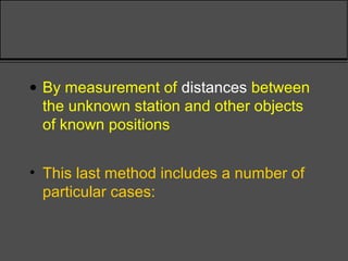
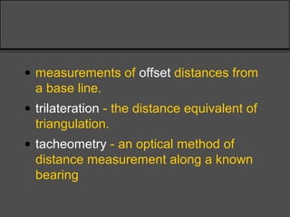
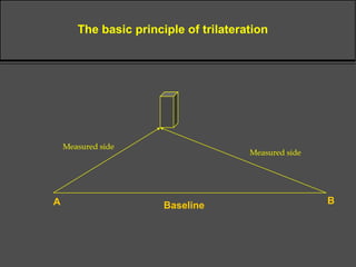
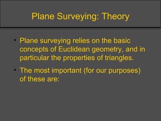
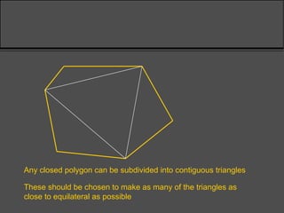
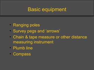
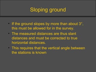
A2.2NP1
Environmental Practical 1
TOPIC 1
TECHNIQUES IN
BASIC SURVEYING
Basic ideas
• Surveying - the creation of a scale representation of
the ground surface - is a basic activity in many areas
of environmental management.
• A survey will be one of of two types:
– Primary survey - to establish the position of objects in three
dimensions when no previous information exists
– Secondary survey - to add extra information to existing
data or to measure changes over an interval of time
Basic ideas
• The task of three dimensional position fixing
is normally broken into two parts:
• Determining plan position
• Determining elevation
Basic ideas
• Each of these determinations may be either:
• absolute - made in terms of a fixed co-ordinate
system
• relative - made in terms of local co-ordinates
which may later be converted to absolute co-
ordinates if required.
• The majority of surveys carried out for
environmental management are thus
secondary relative surveys
Plan Position Fixing
• The plan position of a station can be
established in a number of ways:
• By reference to the apparent positions
of astronomical objects when viewed
from that station
• This method gives the absolute location of
the station in terms of latitude and longitude,
which can be converted to local systems such
as the National Grid.
• By the measurement of the angles between lines
of sight to the unknown station from other known
positions
• By the intersection of lines of sight from the
unknown station to other objects whose positions
are already known
• These two methods both rely on the simple Euclidean
geometry of the plane. (Hence the term plane surveying).
The first procedure is termed triangulation and the
second resection.
BaselineA B
The basic principle of triangulation
Measured angle Measured angle
Unknown position
The basic principle of resection
Measured
angle
Measured
angle
Known position
Known position
Known position
Measured
angle
• By measurement of distances between
the unknown station and other objects
of known positions
• This last method includes a number of
particular cases:
• measurements of offset distances from
a base line.
• trilateration - the distance equivalent of
triangulation.
• tacheometry - an optical method of
distance measurement along a known
bearing
BaselineA B
The basic principle of trilateration
Measured side
Measured side
Plane Surveying: Theory
• Plane surveying relies on the basic
concepts of Euclidean geometry, and in
particular the properties of triangles.
• The most important (for our purposes)
of these are:
Plane Surveying: Theory
• The internal angles of a triangle sum to 180°
• The sides of an equilateral triangle are equal
and the internal angles are all 60°
• The base angles and opposing sides of an
isosceles triangle are equal
60º
60º 60º
The equilateral triangle
All sides equal in length
All angles equal (= 60º)
The isosceles triangle
Two sides equal in length
Two angles equal
a a
Plane Surveying: Theory
• If the respective angles in two triangles are
equal then the triangles are similar and their
sides are all in the same proportion
• If two triangles have two angles and one side
equal (or vice versa) then they are congruent
and all their other respective angles and
sides are equal.
• Two triangles are also congruent if all their
sides are equal.
Similar triangles have corresponding angles equal
but are of differing size
Conguent triangles are identical
• two angles and one side equal
• two sides and one angle equal
• all three sides equal
Plane Surveying: Theory
• Congruent triangles are unique - you cannot
draw two different triangles from the same set
of measurements
• This means that a complete set of survey
data must define the positions of objects
uniquely.
Plane Surveying: Theory
• Any closed polygon can be subdivided into a
series of contiguous triangles
• These properties are repeatedly used in the
procedure of triangulation in which stations
are surveyed in a pattern of contiguous
triangles.
Any closed polygon can be subdivided into contiguous triangles
These should be chosen to make as many of the triangles as
close to equilateral as possible
Plane surveying: practical aspects
• In practice, most plane surveys are carried out
in a straightforward way following an
established sequence:
1. A reconnaisance survey will establish the
dimensions of the area, relative levels,
significant features, accessibility, obstacles etc
Plane surveying: practical aspects
2. Establish an accurate baseline by measurement
from existing survey points, natural features,
buildings etc. If none are available then the baseline
must be fixed by absolute methods.
3. Establish as required any further control points by
triangulation or trilateration from the base-line.
Plane surveying: practical aspects
4. Incorporate detail by tacheometry, traversing, tape &
offset or whatever other method is appropriate.
5. The intermediate stations should where appropriate
be cross-checked with the control points by resection
and all traverses should be closed at a control point.
6. Inaccessible detail should be incorporated by
triangulation or plane tabling from the ends of the
baseline.
Baseline
ILLUSTRATION OF THE USE OF OFFSETS
Plane surveying: practical aspects
7. If a topographic survey is being undertaken, levelling
traverses should be carried out around the survey
stations and the baseline tied to the local benchmark
by a closed traverse.
8. The use of a theodolite or total station will enable
both the position and the elevation of stations to be
found simultaneously by combined tacheometry and
triangulation or by trilateration
THE “CHAIN” SURVEY
How to establish relative plan positions
Chain survey
• Simplest of all survey techniques
• Relies on linear measurements; slopes
>3o
require some adjustment to technique
• Usually requires a clear line of sight
• The triangles used should be equilateral
or approximately so
Terminology
• Trilateration is the measurement of
sides of a triangle
• whereas triangulation refers to the
measurement of the angles of the
triangle
Basic equipment
• Ranging poles
• Survey pegs and ‘arrows’
• Chain & tape measure or other distance
measuring instrument
• Plumb line
• Compass
Chain survey components
• Base line: the longest line
• Chain /survey lines
• Survey stations
• Offset lines
Order of events
• “Range out” survey stations with ranging rods
• Establish base line and measure accurately
• Measure remaining distances between other
survey stations
• Measure offset lines whilst measuring
between survey stations
Sloping ground
• If the ground slopes by more than about 3°,
this must be allowed for in the survey.
• The measured distances are thus slant
distances and must be corrected to true
horizontal distances.
• This requires that the vertical angle between
the stations is known
Ground distance determined
a
h
X
Sloping ground
• For an approximate survey, it may be
sufficient to step up or downhill using a
series of horizontal and vertical lines
• If the drop is measured at the same
time, some estimate of the slope profile
can be obtained
Chain surveying (“stepping”)
w
x
y
z
c
b
a
Sloping ground
• If stepping is not appropriate, more
sophisticated methods must be used to
measure the slant distance and the
vertical angle simultaneously
• Requires optical sighting equipment:
usually either a clinometer, Abney level
or theodolite
Basic levelling in chain surveys
a
h
h
Correcting for horizontal distance:
the “hypotenusal allowance”
a
h
z
correction factor = xy - yz
= xy(1 - cosa)
y
x
LEVELLING
How to destermine relative
elevations
Levelling:
accounting for slopes
Unlike chain surveys, levelling surveys
account directly for slope and
incorporate this data into the whole
measurement exercise
AIMS:
• to determine height differences
between two points
• to determine elevations for sections
• The elevation of a station can be
established by:
• inclined line of sight from chain survey stations
• levelling from another point of known height
• by inclined tacheometry
• Levelling is the more accurate method but is
also the slower. Modern instruments are
capable of cm accuracy under normal
conditions over distances of 100’s metres.
• The keys to successful levelling lie in the
setting up of the instrument, in the closure of
the traverses and in the careful recording
(booking) of the results.
• Inclined tacheometry relies on the combined
measurement, by theodolite, of the slant
distance to the new station and the angle
relative to the horizontal.
• The elevation change and horizontal distance
can then be found by simple trigonometry.
• The accuracy of the method, using normal
instruments, is around 10’s cms in 100’s
metres.
Direct levelling
• Most typical form used
Relies upon:
• a horizontal line of sight, also termed
“the line of collimation”
• a fixed datum level
Measurements to be taken
• Backsight
• Foresight
• Intermediate sights
Booking your results
The “rise and fall” method
• This method records the relative
change in level between successive
stations
• The changes are converted to the
reduced level of each station
• The reduced level is relative to the local
datum
Booking the results
• The method relies on recording your
results in a survey book in a standard
format
• This allows you to check your work and
to identify any errors systematically
Reduced levels
The change of level is 2.312m - 2.533m = -0.221m
2.533m
Datum line: 100.522m
(from OS Benchmark)
2.312 m
The reduced level of point B is 100.301m
B A
The absolute (datum) level of point A is 100.522m
IP 1
Backsight Interm. Foresight Rise Fall R.L. Distance Remarks
2.312 100.522
0.221 100.301
1.2
Rise and fall booking
Point A
Point B
-
2.533
Transfer of level
The new change of level is 1.674m - 1.631m = + 0.043m
1.631m
1.674 m
The absolute level of point C is 100.344m
C B
At the next stage, B becomes the backsight and C is the new foresight
IP 2
Backsight Interm. Foresight Rise Fall R.L. Distance Remarks
2.312 100.522
- 0.221 100.301
1.2
Rise and fall booking (cont)
Point A
Point B
-
2.5331.674
1.631 + 0.043 100.344 Point C
• Continuing this process, suppose we
end up with a set of results as follows:
• This will enable us to check our working
Backsight Interm. Foresight Rise Fall R.L. Distance Remarks
2.312 100.522
- 0.221 100.301
Rise and fall booking (cont)
Point A
Point B
--
2.5331.674
1.631 + 0.043 100.344 Point C2.504
3.010
2.413
0.956
2.016
2.718
--
--
--
--
+ 1.548
+ 0.994
-0.305
101.892
102.886
-- --
--
--
102.581
11.913
9.854
9.854 2.585
- 0.526
- 0.526 102.581
- 100.522
2.059 2.059 2.059 CHECKS
OK
Using an intermediate sight
• Sometimes we wish to include a
specific feature but it is not convenient
to set up a new instrument position for
this
• The solution is to take a sighting onto
the staff when it is placed on this
feature - this is called an intermediate
sight
Intermediate sight
The new change of level is 1.674m - 2.988m = -1.314m
2.988m
The absolute level of the intermediate point C is 98.987m
C B
The intermediate sight is taken at the base of the channel between B and C
IP 2
Intermediate sight 1.674m
Backsight Interm. Foresight Rise Fall R.L. Distance Remarks
2.312 100.522
- 0.221 100.301
1.2
Rise and fall booking
(intermediate sight)
Point A
Point B
-
2.5331.674
1.631 + 0.043 100.344 Point C
2.988 channel-1.314 98.987
Next FS
Optical distance measurement
• It is often convenient to use the levelling
instrument itself to calculate the distance
between the instrument and staff positions
• This is done using the stadia lines that are
visible in the viewfinder
• These are arranged such that the distance to
the staff is 100x the stadia interval that is
read on the staff between the two lines
• This procedure is known as tacheometry
Tacheometry
The viewfinder:
Stadia
lines
Multiply vertical
distance by 100
to obtain
horizontal distance
Inclined tacheometry
• If the ‘level’ can be swung in a vertical
arc, the distance up an inclined sight
line can be obtained.
• If the vertical angle is also measured,
the slant distance can be converted to
give both the change in height and the
true horizontal distance.
Inclined tacheometry
a
Change of height
Tacheometric distance
Measured angle
True horizontal distance
The theodolite
• If such an instrument can also be swung in a
horizontal arc, and the angle of rotation can
be measured, we are able to determine the
angles of the sight lines between stations.
• This allows both trilateration and triangulation
with the same instrument.
• Such a versatile instrument exist and is called
a theodolite.
Summary
• Chain surveys are suited to planimetric
surveys on low slopes. They rely upon
trilateration.
• Levelling is used where terrain is more
uneven. Levelling surveys often use
tacheometry to fix station positions.
• A theodolite survey permits levelling,
tacheometry or triangulation as required.

Week1 introductiontobasicsurveying

  • 1.
    A2.2NP1 Environmental Practical 1 TOPIC1 TECHNIQUES IN BASIC SURVEYING
  • 2.
    Basic ideas • Surveying- the creation of a scale representation of the ground surface - is a basic activity in many areas of environmental management. • A survey will be one of of two types: – Primary survey - to establish the position of objects in three dimensions when no previous information exists – Secondary survey - to add extra information to existing data or to measure changes over an interval of time
  • 3.
    Basic ideas • Thetask of three dimensional position fixing is normally broken into two parts: • Determining plan position • Determining elevation
  • 4.
    Basic ideas • Eachof these determinations may be either: • absolute - made in terms of a fixed co-ordinate system • relative - made in terms of local co-ordinates which may later be converted to absolute co- ordinates if required. • The majority of surveys carried out for environmental management are thus secondary relative surveys
  • 5.
    Plan Position Fixing •The plan position of a station can be established in a number of ways:
  • 6.
    • By referenceto the apparent positions of astronomical objects when viewed from that station • This method gives the absolute location of the station in terms of latitude and longitude, which can be converted to local systems such as the National Grid.
  • 7.
    • By themeasurement of the angles between lines of sight to the unknown station from other known positions • By the intersection of lines of sight from the unknown station to other objects whose positions are already known • These two methods both rely on the simple Euclidean geometry of the plane. (Hence the term plane surveying). The first procedure is termed triangulation and the second resection.
  • 8.
    BaselineA B The basicprinciple of triangulation Measured angle Measured angle
  • 9.
    Unknown position The basicprinciple of resection Measured angle Measured angle Known position Known position Known position Measured angle
  • 10.
    • By measurementof distances between the unknown station and other objects of known positions • This last method includes a number of particular cases:
  • 11.
    • measurements ofoffset distances from a base line. • trilateration - the distance equivalent of triangulation. • tacheometry - an optical method of distance measurement along a known bearing
  • 12.
    BaselineA B The basicprinciple of trilateration Measured side Measured side
  • 13.
    Plane Surveying: Theory •Plane surveying relies on the basic concepts of Euclidean geometry, and in particular the properties of triangles. • The most important (for our purposes) of these are:
  • 14.
    Plane Surveying: Theory •The internal angles of a triangle sum to 180° • The sides of an equilateral triangle are equal and the internal angles are all 60° • The base angles and opposing sides of an isosceles triangle are equal
  • 15.
    60º 60º 60º The equilateraltriangle All sides equal in length All angles equal (= 60º)
  • 16.
    The isosceles triangle Twosides equal in length Two angles equal a a
  • 17.
    Plane Surveying: Theory •If the respective angles in two triangles are equal then the triangles are similar and their sides are all in the same proportion • If two triangles have two angles and one side equal (or vice versa) then they are congruent and all their other respective angles and sides are equal. • Two triangles are also congruent if all their sides are equal.
  • 18.
    Similar triangles havecorresponding angles equal but are of differing size
  • 19.
    Conguent triangles areidentical • two angles and one side equal • two sides and one angle equal • all three sides equal
  • 20.
    Plane Surveying: Theory •Congruent triangles are unique - you cannot draw two different triangles from the same set of measurements • This means that a complete set of survey data must define the positions of objects uniquely.
  • 21.
    Plane Surveying: Theory •Any closed polygon can be subdivided into a series of contiguous triangles • These properties are repeatedly used in the procedure of triangulation in which stations are surveyed in a pattern of contiguous triangles.
  • 22.
    Any closed polygoncan be subdivided into contiguous triangles These should be chosen to make as many of the triangles as close to equilateral as possible
  • 23.
    Plane surveying: practicalaspects • In practice, most plane surveys are carried out in a straightforward way following an established sequence: 1. A reconnaisance survey will establish the dimensions of the area, relative levels, significant features, accessibility, obstacles etc
  • 24.
    Plane surveying: practicalaspects 2. Establish an accurate baseline by measurement from existing survey points, natural features, buildings etc. If none are available then the baseline must be fixed by absolute methods. 3. Establish as required any further control points by triangulation or trilateration from the base-line.
  • 25.
    Plane surveying: practicalaspects 4. Incorporate detail by tacheometry, traversing, tape & offset or whatever other method is appropriate. 5. The intermediate stations should where appropriate be cross-checked with the control points by resection and all traverses should be closed at a control point. 6. Inaccessible detail should be incorporated by triangulation or plane tabling from the ends of the baseline.
  • 26.
  • 27.
    Plane surveying: practicalaspects 7. If a topographic survey is being undertaken, levelling traverses should be carried out around the survey stations and the baseline tied to the local benchmark by a closed traverse. 8. The use of a theodolite or total station will enable both the position and the elevation of stations to be found simultaneously by combined tacheometry and triangulation or by trilateration
  • 28.
    THE “CHAIN” SURVEY Howto establish relative plan positions
  • 29.
    Chain survey • Simplestof all survey techniques • Relies on linear measurements; slopes >3o require some adjustment to technique • Usually requires a clear line of sight • The triangles used should be equilateral or approximately so
  • 30.
    Terminology • Trilateration isthe measurement of sides of a triangle • whereas triangulation refers to the measurement of the angles of the triangle
  • 31.
    Basic equipment • Rangingpoles • Survey pegs and ‘arrows’ • Chain & tape measure or other distance measuring instrument • Plumb line • Compass
  • 32.
    Chain survey components •Base line: the longest line • Chain /survey lines • Survey stations • Offset lines
  • 33.
    Order of events •“Range out” survey stations with ranging rods • Establish base line and measure accurately • Measure remaining distances between other survey stations • Measure offset lines whilst measuring between survey stations
  • 34.
    Sloping ground • Ifthe ground slopes by more than about 3°, this must be allowed for in the survey. • The measured distances are thus slant distances and must be corrected to true horizontal distances. • This requires that the vertical angle between the stations is known
  • 35.
  • 36.
    Sloping ground • Foran approximate survey, it may be sufficient to step up or downhill using a series of horizontal and vertical lines • If the drop is measured at the same time, some estimate of the slope profile can be obtained
  • 37.
  • 38.
    Sloping ground • Ifstepping is not appropriate, more sophisticated methods must be used to measure the slant distance and the vertical angle simultaneously • Requires optical sighting equipment: usually either a clinometer, Abney level or theodolite
  • 39.
    Basic levelling inchain surveys a h h
  • 40.
    Correcting for horizontaldistance: the “hypotenusal allowance” a h z correction factor = xy - yz = xy(1 - cosa) y x
  • 41.
    LEVELLING How to desterminerelative elevations
  • 42.
    Levelling: accounting for slopes Unlikechain surveys, levelling surveys account directly for slope and incorporate this data into the whole measurement exercise AIMS: • to determine height differences between two points • to determine elevations for sections
  • 43.
    • The elevationof a station can be established by: • inclined line of sight from chain survey stations • levelling from another point of known height • by inclined tacheometry
  • 44.
    • Levelling isthe more accurate method but is also the slower. Modern instruments are capable of cm accuracy under normal conditions over distances of 100’s metres. • The keys to successful levelling lie in the setting up of the instrument, in the closure of the traverses and in the careful recording (booking) of the results.
  • 45.
    • Inclined tacheometryrelies on the combined measurement, by theodolite, of the slant distance to the new station and the angle relative to the horizontal. • The elevation change and horizontal distance can then be found by simple trigonometry. • The accuracy of the method, using normal instruments, is around 10’s cms in 100’s metres.
  • 46.
    Direct levelling • Mosttypical form used Relies upon: • a horizontal line of sight, also termed “the line of collimation” • a fixed datum level
  • 47.
    Measurements to betaken • Backsight • Foresight • Intermediate sights
  • 48.
    Booking your results The“rise and fall” method • This method records the relative change in level between successive stations • The changes are converted to the reduced level of each station • The reduced level is relative to the local datum
  • 49.
    Booking the results •The method relies on recording your results in a survey book in a standard format • This allows you to check your work and to identify any errors systematically
  • 50.
    Reduced levels The changeof level is 2.312m - 2.533m = -0.221m 2.533m Datum line: 100.522m (from OS Benchmark) 2.312 m The reduced level of point B is 100.301m B A The absolute (datum) level of point A is 100.522m IP 1
  • 51.
    Backsight Interm. ForesightRise Fall R.L. Distance Remarks 2.312 100.522 0.221 100.301 1.2 Rise and fall booking Point A Point B - 2.533
  • 52.
    Transfer of level Thenew change of level is 1.674m - 1.631m = + 0.043m 1.631m 1.674 m The absolute level of point C is 100.344m C B At the next stage, B becomes the backsight and C is the new foresight IP 2
  • 53.
    Backsight Interm. ForesightRise Fall R.L. Distance Remarks 2.312 100.522 - 0.221 100.301 1.2 Rise and fall booking (cont) Point A Point B - 2.5331.674 1.631 + 0.043 100.344 Point C
  • 54.
    • Continuing thisprocess, suppose we end up with a set of results as follows: • This will enable us to check our working
  • 55.
    Backsight Interm. ForesightRise Fall R.L. Distance Remarks 2.312 100.522 - 0.221 100.301 Rise and fall booking (cont) Point A Point B -- 2.5331.674 1.631 + 0.043 100.344 Point C2.504 3.010 2.413 0.956 2.016 2.718 -- -- -- -- + 1.548 + 0.994 -0.305 101.892 102.886 -- -- -- -- 102.581 11.913 9.854 9.854 2.585 - 0.526 - 0.526 102.581 - 100.522 2.059 2.059 2.059 CHECKS OK
  • 56.
    Using an intermediatesight • Sometimes we wish to include a specific feature but it is not convenient to set up a new instrument position for this • The solution is to take a sighting onto the staff when it is placed on this feature - this is called an intermediate sight
  • 57.
    Intermediate sight The newchange of level is 1.674m - 2.988m = -1.314m 2.988m The absolute level of the intermediate point C is 98.987m C B The intermediate sight is taken at the base of the channel between B and C IP 2 Intermediate sight 1.674m
  • 58.
    Backsight Interm. ForesightRise Fall R.L. Distance Remarks 2.312 100.522 - 0.221 100.301 1.2 Rise and fall booking (intermediate sight) Point A Point B - 2.5331.674 1.631 + 0.043 100.344 Point C 2.988 channel-1.314 98.987 Next FS
  • 59.
    Optical distance measurement •It is often convenient to use the levelling instrument itself to calculate the distance between the instrument and staff positions • This is done using the stadia lines that are visible in the viewfinder • These are arranged such that the distance to the staff is 100x the stadia interval that is read on the staff between the two lines • This procedure is known as tacheometry
  • 60.
  • 61.
    Inclined tacheometry • Ifthe ‘level’ can be swung in a vertical arc, the distance up an inclined sight line can be obtained. • If the vertical angle is also measured, the slant distance can be converted to give both the change in height and the true horizontal distance.
  • 62.
    Inclined tacheometry a Change ofheight Tacheometric distance Measured angle True horizontal distance
  • 63.
    The theodolite • Ifsuch an instrument can also be swung in a horizontal arc, and the angle of rotation can be measured, we are able to determine the angles of the sight lines between stations. • This allows both trilateration and triangulation with the same instrument. • Such a versatile instrument exist and is called a theodolite.
  • 64.
    Summary • Chain surveysare suited to planimetric surveys on low slopes. They rely upon trilateration. • Levelling is used where terrain is more uneven. Levelling surveys often use tacheometry to fix station positions. • A theodolite survey permits levelling, tacheometry or triangulation as required.