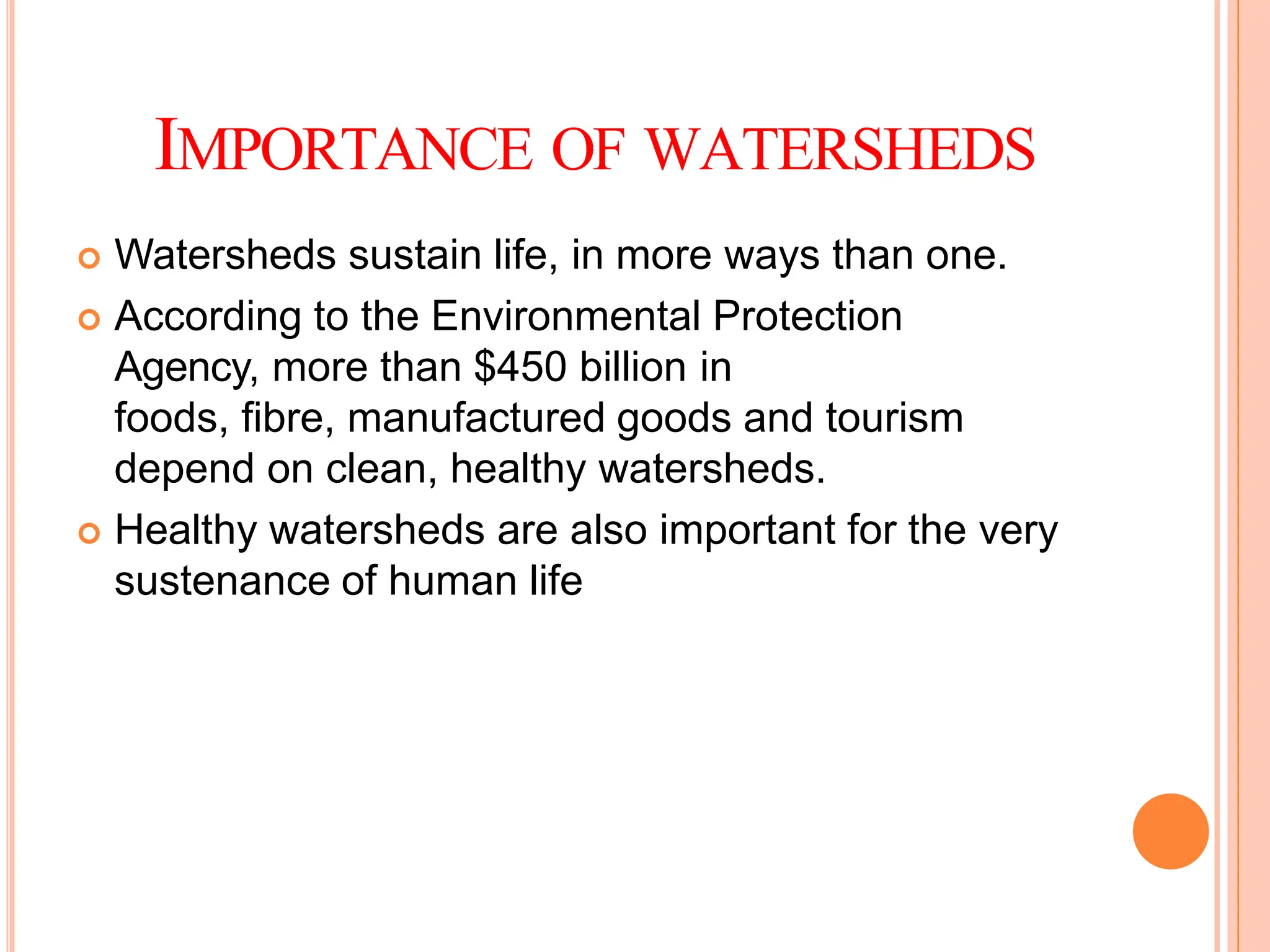
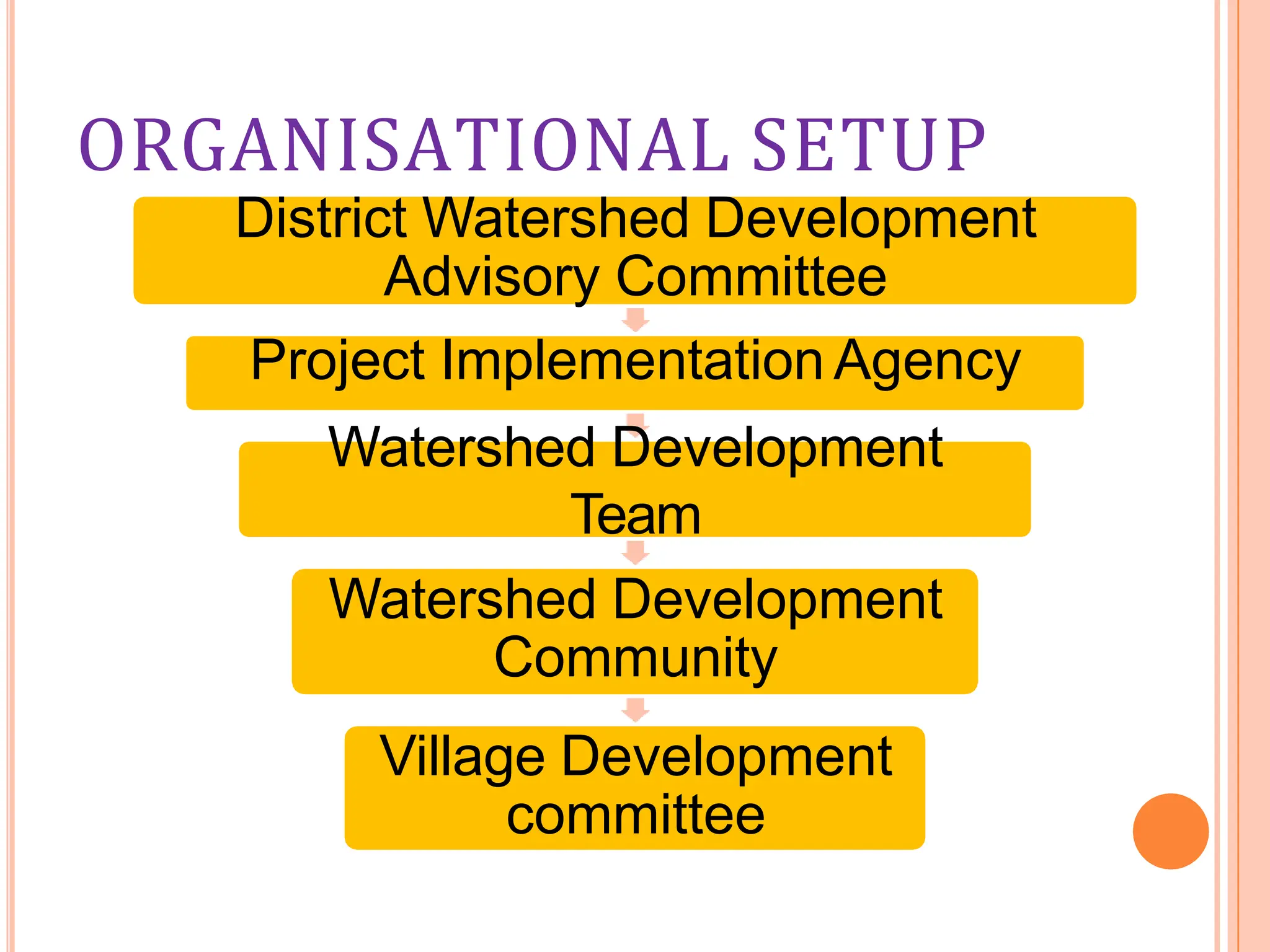
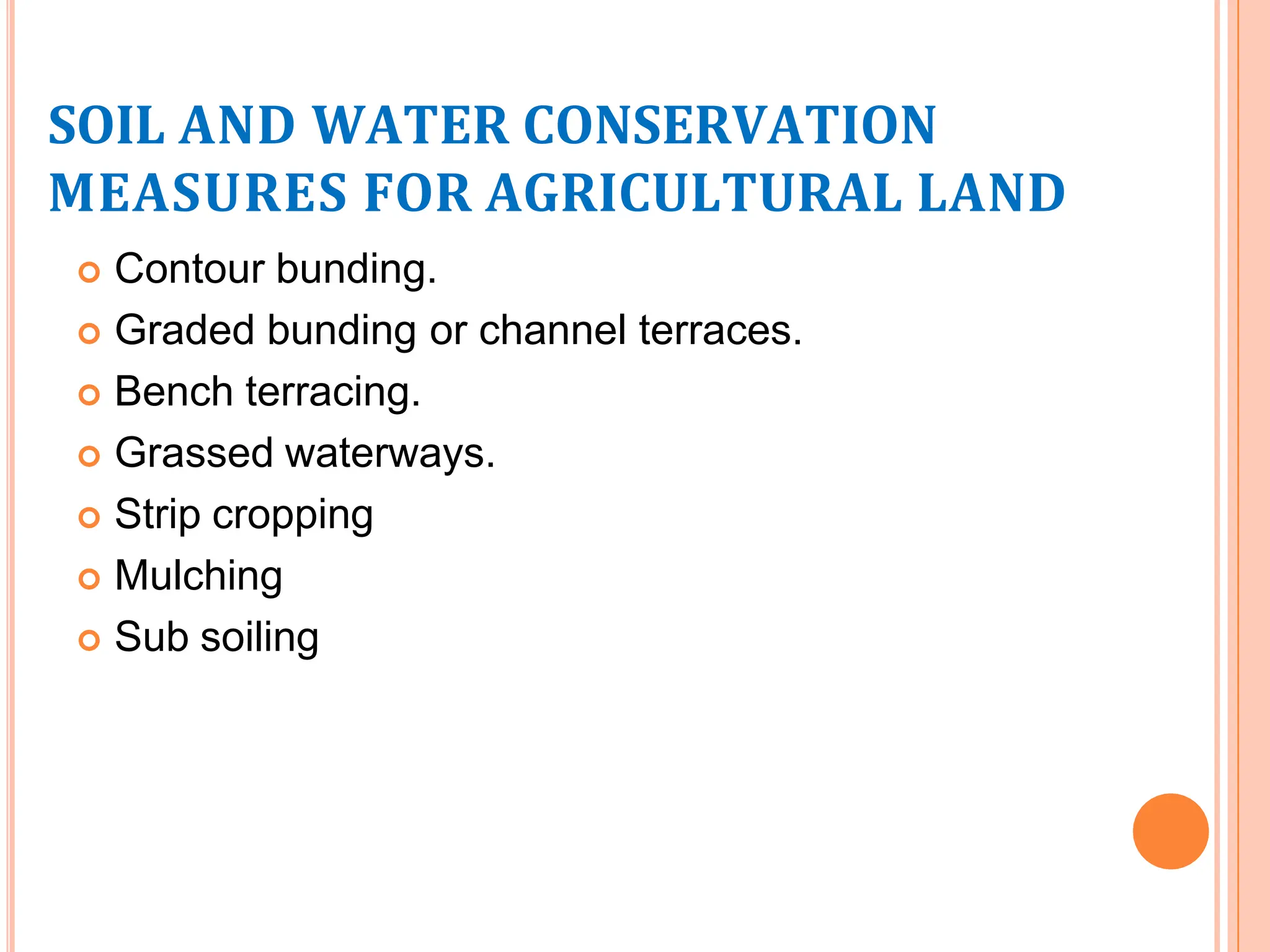
SlideShare a Scribd company logo
1 of 45
WATERSHED
MANAGEMENT AND
DEVELOPMENT
CONTENTS
 Watershed and its importance.
 Watershed management and its objectives and
perspectives.
 Approach for watershed management.
 Geological aspects- natural resources and hazards.
 Watershed and drainage patterns.
 Individual contributions towards watershed.
WATERSHED
 A WATERSHED can be defined as a geo-
hydrological unit that drains to a common point by a
system of drains. All lands on earth are a part of
one watershed or another.
 The words watershed ,catchment ,basin, drainage
area, are synonymous , and in Indian
usage, pertain to an area and not a line.
 The terms micro, mini, sub-watershed or any other
variation of the terms indicate hierarchical division
of the watershed of a stream, river or a drainage
line.
IMPORTANCE OF WATERSHEDS
 Watersheds sustain life, in more ways than one.
 According to the Environmental Protection
Agency, more than $450 billion in
foods, fibre, manufactured goods and tourism
depend on clean, healthy watersheds.
 Healthy watersheds are also important for the very
sustenance of human life
WATERSHED MANAGEMENT
 Watershed management is defined as the process
of formulating and carrying out course of action
involving manipulation of natural, agricultural and
human resources of a watershed to provide
resources that are desired by and are suitable to
the watershed community
 The watershed management and exploitation
should not have any adverse effects on soil and
water resources
 It is an integrated and multidisciplinary approach.
OBJECTIVES OF
WATERSHED MANAGEMENT
 Protecting, conserving and improving the land
resources for efficient and sustained production.
 Protecting and enhancing water
resources, moderating floods, reducing silting up of
tanks/reserviors, increasing irrigation and
conserving rainwater for crops and thus mitigating
droughts
 Utilizing the natural local resources for improving
agriculture and allied occupation of industries so as
to improve socio-economic conditions of local
residents.
PERSPECTIVES OF WATERSHED
DEVELOPMENT
 HYDROLOGICALASPECTS
 ENVIRONMENTALASPECTS
 SOCIO-ECONOMICASPECTS
 FINANCIALASPECTS
 ADMINISTRATIVE AND POLITICALASPECTS
flYDROLOGICAL ASPECTS
 Hydrological behaviour of watershed is influenced
by watershed conditions.
 The watershed treatment and management
practices alter the slope and roughness
characteristics of the watershed management and
tend to reduce the surface flow and the peak flow
 The management practices also reduce the rate
and quantity of the sediment erosion and their
transportation resulting in lower delivery of
sediments into the reservoir
 These measure effects flood control, soil moisture
conservation and land use.
ENVIRONMENTAL ASPECTS
 Development applied locally for developing green
foliage, enriches environment globally in due
course of time.
 The local measure of micro-scale watershed
development would have cumulative effect on
environment when considered on a large basin or a
global scale
 Reduced onsite erosion and enhance in a well
managed watershed also improve the natural
ecosystem
SOCIO-ECONOMIC ASPECTS
 In achieving the true objective of watershed
management, the viewpoint of individuals and
communities, who live in the watershed should be
considered.
 The socio-economic factors also determine the
motivation of farmers to make necessary
investment of labour and capital in watershed
development.
FINANCIAL ASPECTS
 The projects can either be fully funded by
government or NGOs or in case of the development
the participating families may be required to
contribute a predefined percentage of cost for
individual works and for community work.
 The unit cost for watershed development normally
range from Rs. 4500 to Rs. 6000 per hectare
depending on nature and location of the watershed.
ADMINISTRATIVE AND
POLITICAL ASPECTS
 Watershed management requires close
collaboration of various planning and implementing
agencies to achieve full benefits of the programme.
 Planning should only include those
measures/activities which are acceptable politically.
APPROACH FOR
WATERSHED
MANAGEMENT AND
DEVELOPMENT
 People’s participation is the key to watershed
development programmes.
 While the main development activities have to be carried
out by the watershed community itself, the overall
facilitation, coordination and supervision of the whole
programme will be responsibility of a PROJECT
IMPLEMENTATION AGENCY (PIA).
 The whole setup for the watershed management follows
a hierarchical approach.
ORGANISATIONAL SETUP
District Watershed Development
Advisory Committee
Project Implementation Agency
Watershed Development
Team
Watershed Development
Community
Village Development
committee
STEPS FOR PREPARATION OF
INTEGRATED WATERSHED
MANAGEMENT PLAN
Preparation of watershed development plan includes two
main steps:
1. Identification of watershed problems and setting up of
objectives and priorities based on various surveys of
watershed.
2. Formulation of proposed development and
management plan.
GEOLOGICALASPECTS OF
WATERSHED MANAGEMENT AND
DEVELOPMENT
GEOLOGI
-CAL
ASPECTS
NATURAL
RESOURC
ES
SOIL
WATER
NATURAL
HAZARDS
EARTHQUAKES
FLOODS
LANDSLIDES
SOIL
 SOIL PROPERTIES: PHYSICAL
SAND SILT CLAY
POROSITY MOSTLY
LAGRE
PORES
SMALL
PORES
PREDOMINAT
E
SMALL
PORES
PREDOMINAT
E
PERMEABILI
TY
RAPID LOW TO
MODERATE
SLOW
WATER
HOLDING
CAPACITY
LIMITED MEDIUM VERY LARGE
SOIL
PARTICLE
SURFACE
SMALL MEDIUM VERY LAGE
 SOILPROPERTIES:CHEMICAL
pH VARIES FROOM 0 TO 14
(ALKALINE /ACIDIC
/NUETRAL SOILS)
CHEMICALS
AND ELEMENTS
PRESENT
EASILY LEACHED OUT
(Chlorides and Sulphates,
followed by Calcium,
Sodium, Magnesium and
Potassium)
RARELY LEACHED
(Silicates and Oxides of Iron
and Aluminium)
WATER
 In case of water we consider water quantity and
water quality, where water quantity is imp to
prevent floods and water logging, the concept water
quality is important to delineate the uses for which
water can be used from a given watershed.
 WATER PROPERTIES:PHYSICAL
 Formula: H2O
 Density: 1,000.00 kg/m³
 Molar mass: 18.0153 g/mol
 Boiling point: 99.98° C
 Melting point: 0.0° C
 WATER PROPERTIES: CHEMICAL
 Chemically pure water should have only hydrogen
and oxygen.
 The water we use for daily purposes has a variety
of other elements like Iron, Magnesium etc. but
these elements should be under permissible limits
prescribed for any purpose like drinking, agriculture
etc.
 Water should be of neutral pH, but presence of
certain salts may make it acidic or basic.
SOIL AND WATER
CONSERVATION MEASURES FOR
WATERSHED TREATMENT
 Soil and water conservation measures to be employed
depend on the purpose for which the land and water is to
be used. There are two broad categories:
1. SOILAND WATER CONSERVATION MEASURES
FOR AGRICULTURAL LAND.
2. EROSION CONTROL MEASURES FOR NON-
AGRICULTURAL LAND.
SOIL AND WATER CONSERVATION
MEASURES FOR AGRICULTURAL LAND
 Contour bunding.
 Graded bunding or channel terraces.
 Bench terracing.
 Grassed waterways.
 Strip cropping
 Mulching
 Sub soiling
CONTOUR BUNDING
• Contour bunding consists of constructing narrow-based
trapezoidal earthen embankment at intervals along the
contour to impound run off water behind them so that all the
stored water is absorbed gradually into the soil profile for
crop use.
• A series of such bunds divide the area into strips and act as
barrier to the flow of water.
GRADED BUNDING
These are constructed where the excess water is to be
removed safely to avoid water stagnation. In these
water flows in graded channel constructed on the
upstream side of the bunds at non erosive velocities
and is led to safe outlets.
BENCH-TERRACING
• It is practiced on steep hill slopes ranging from
16-33%.
• Bench terracing which involves converting the
original ground into level step like fields
constructed by half cutting and half filling, helps in
considerably reducing the degree of slope
GRASSED WATERWAYS
• These are associated with channel terraces for safe
disposal of concentrated run-off, thereby protecting
the land against rills and gullies.
• A waterway is constructed according to a proper
design and a vegetative cover is established to
protect the channel against erosion because of
concentrated flow.
STRIP CROPPING
• Strip cropping consists of a series of alternate strips
of various types of crops laid out so that all tillage
and crop management practices are performed
across the slope or on the contours.
• Strips of erosion –permitting crops are always
separated by strips of close growing or erosion
resisting crops .
MULCHING
• Mulching of open land surface in a cropped area is
achieved by spreading stubble trash or any vegetation.
• These are used to minimize splash, to prevent soil from
blowing or being washed away, to reduce
evaporation, to increase infiltration, to control weeds, to
improve soil quality and eventually increase crop yield.
SUB-SOILING
• This method consists of breaking with a subsoiler
the hard and impermeable subsoil to conserve
more rain-water by improving physical conditions
of the soil.
EROSION CONTROL MEASURES FOR
NON-AGRICULTURAL LAND
 Contoured and staggered trenches for hill slopes.
 Gully control.
CONTOURED AND STAGGERED TRENCHES
• Suitable erosion control in hills
• Adopted for hill slopes >20%
GULLY CONTROL STRUCTURE
 Gully erosion usually starts as small rills and
then develops into deeper crevices or Ravines
in extreme cases.
 it can be controlled by check dams which may
be permanent, semi-permanent or temporary
 Temporary check dams are usually made up of
brush wood, wire and poles or loose rocks
 Semi-permanent check dams can be earthen
dam, Gabion structure etc.
 Permanent check dams are concrete and
masonry structures
GABION STR WOVEN WIRE
SPILLWAY
NATURAL HAZARDS
 FLOODS.
 EARTHQUAKES.
 LANDSLIDES.
FLOODS
 The management of rainfall and resultant run-off is
very important to control floods and found to
depend on watersheds.
 Due to floods, the plains have become silted with
mud and sand that affect the cultivable
lands, watershed management thus helps to reduce
the rate and quantity of the sediment to be
deposited.
 The excess runoff from streams during monsoon
can be controlled using techniques like check
dams, percolation dams etc.
 This results in mitigation of floods, recharge of
ground water which can be used during times of
drought.
PERCOLATIO
N POND
EARTHQUAKES
 While developing a watershed the zone of hazard in
which the area falls must be kept in mind.
 If lineaments such a folds, faults, joints etc. are
more at a place (where watershed is to be
developed) then the area is more earthquake prone
 The structures developed must be earthquake
resistant if the area is in a hazardous zone.
EARTHQUAKE PREPARATION
 The objective of earthquake engineering is to
foresee the impact of earthquakes on buildings and
other structures and to design such structures to
minimize the risk of damage.
 Existing structures can be modified by seismic
retrofitting to improve their resistance to
earthquakes.
 Emergency management strategies can be
employed by a government or organization to
mitigate risks and prepare for consequences
LANDSLIDES
 A landslide is a geological phenomenon which
includes a wide range of ground movement, such
as rockfalls, deep failure of slopes and
shallow debris flows.
 Although the action of gravity is the primary driving
force for a landslide to occur, there are other
contributing factors affecting the original slope
stability Typically, pre-conditional factors build up
specific sub-surface conditions that make the
area/slope prone to failure, whereas the actual
landslide often requires a trigger before being
released
LANDSLIDE PREVENTION
COUNTER-
MEASURES
MECHANICAL
WORK
REDUCTION
OF PORE
WATER
PRESSURE
INCREASE
SHEAR
STRENGTH OF
SLIDING SURFACE
CONTROL
PREVENTION
OF SOIL
EROSION
REFORM
SLOPE
PILE
PREVENTIVE
WORK
ANCHOR
WATERSHED AND DRAINAGE
PATTERNS
 The drainage patterns have effect on watershed
development as they decide the type of
sedimentation processes the quantity of sediments
and water.
 The drainage patterns also give idea of lithology
and relief, eg. the development of dendritic to sub
dendritic drainage in the watershed indicates the
area of massive rock types, gently sloping to almost
horizontal terrain and low relief
 It has been suggested that the parallel drainage in
Deccan Basalt terrain is initiated due to the step like
nature of the Deccan traps which is joined by
subsequent lateral ravines giving a sub-parallel
pattern (Dhokarikar, 1991)
SINCE EVERYONE IS A PART OF
WATERSHED
 Don’t pour toxic household chemicals down the
drain; take them to a hazardous waste centre
 Recycle yard waste in a compost pile & practice
mulching.
 Adopt your watershed.
T
HANKY
O
U

More Related Content

Similar to Water watershed.pptx

Shankaraiah N:Rural Sociology Record
Shankaraiah N:Rural Sociology RecordShankaraiah N:Rural Sociology Record
Shankaraiah N:Rural Sociology Record
shankaraiah, N
 
INTEGRATED WATERSHED MANAGEMENT by Geetha K.pptx
INTEGRATED WATERSHED MANAGEMENT by Geetha K.pptxINTEGRATED WATERSHED MANAGEMENT by Geetha K.pptx
INTEGRATED WATERSHED MANAGEMENT by Geetha K.pptx
hiiamkmohith
 
Integrated watershed management
Integrated watershed managementIntegrated watershed management
Integrated watershed management
Sorab Sadri
 

Similar to Water watershed.pptx (20)

What is watershed
What is watershedWhat is watershed
What is watershed
 
Akash Kumar ppt.pptx
Akash Kumar ppt.pptxAkash Kumar ppt.pptx
Akash Kumar ppt.pptx
 
Watershed management
Watershed  managementWatershed  management
Watershed management
 
WATERSHED MANAGEMENT - INTRODUCTION
WATERSHED MANAGEMENT - INTRODUCTIONWATERSHED MANAGEMENT - INTRODUCTION
WATERSHED MANAGEMENT - INTRODUCTION
 
Shankaraiah N:Rural Sociology Record
Shankaraiah N:Rural Sociology RecordShankaraiah N:Rural Sociology Record
Shankaraiah N:Rural Sociology Record
 
Watershed management
Watershed managementWatershed management
Watershed management
 
Watershed development for sustainable resource utilization pdf
Watershed development  for sustainable resource utilization  pdfWatershed development  for sustainable resource utilization  pdf
Watershed development for sustainable resource utilization pdf
 
CBD Good Practice Guide Water-powerpoint-en
CBD Good Practice Guide Water-powerpoint-enCBD Good Practice Guide Water-powerpoint-en
CBD Good Practice Guide Water-powerpoint-en
 
Watershed management wre
Watershed management wreWatershed management wre
Watershed management wre
 
cbd-good-practice-guide-water-powerpoint-en.ppt
cbd-good-practice-guide-water-powerpoint-en.pptcbd-good-practice-guide-water-powerpoint-en.ppt
cbd-good-practice-guide-water-powerpoint-en.ppt
 
Groundwater and watershed management
Groundwater and watershed managementGroundwater and watershed management
Groundwater and watershed management
 
Rice production best management practices
Rice production best management practicesRice production best management practices
Rice production best management practices
 
Watershed Management 099
Watershed Management 099Watershed Management 099
Watershed Management 099
 
INTEGRATED WATERSHED MANAGEMENT by Geetha K.pptx
INTEGRATED WATERSHED MANAGEMENT by Geetha K.pptxINTEGRATED WATERSHED MANAGEMENT by Geetha K.pptx
INTEGRATED WATERSHED MANAGEMENT by Geetha K.pptx
 
Watershed Management In India
Watershed Management In IndiaWatershed Management In India
Watershed Management In India
 
Watershed Management In India
Watershed Management In IndiaWatershed Management In India
Watershed Management In India
 
mpdf.pdf
mpdf.pdfmpdf.pdf
mpdf.pdf
 
GWRM-Theory 1.pdf
GWRM-Theory 1.pdfGWRM-Theory 1.pdf
GWRM-Theory 1.pdf
 
Week 4_2: Drainage of Agricultural Land
Week 4_2: Drainage of Agricultural LandWeek 4_2: Drainage of Agricultural Land
Week 4_2: Drainage of Agricultural Land
 
Integrated watershed management
Integrated watershed managementIntegrated watershed management
Integrated watershed management
 

Recently uploaded

Hospital management system project report.pdf
Hospital management system project report.pdfHospital management system project report.pdf
Hospital management system project report.pdf
Kamal Acharya
 
Cara Menggugurkan Sperma Yang Masuk Rahim Biyar Tidak Hamil
Cara Menggugurkan Sperma Yang Masuk Rahim Biyar Tidak HamilCara Menggugurkan Sperma Yang Masuk Rahim Biyar Tidak Hamil
Cara Menggugurkan Sperma Yang Masuk Rahim Biyar Tidak Hamil
Cara Menggugurkan Kandungan 087776558899
 
scipt v1.pptxcxxxxxxxxxxxxxxxxxxxxxxxxxxxxxxxxxxxxxxxxxxxxxxxxxxxxxxxxxxxxxxx...
scipt v1.pptxcxxxxxxxxxxxxxxxxxxxxxxxxxxxxxxxxxxxxxxxxxxxxxxxxxxxxxxxxxxxxxxx...scipt v1.pptxcxxxxxxxxxxxxxxxxxxxxxxxxxxxxxxxxxxxxxxxxxxxxxxxxxxxxxxxxxxxxxxx...
scipt v1.pptxcxxxxxxxxxxxxxxxxxxxxxxxxxxxxxxxxxxxxxxxxxxxxxxxxxxxxxxxxxxxxxxx...
HenryBriggs2
 
Kuwait City MTP kit ((+919101817206)) Buy Abortion Pills Kuwait
Kuwait City MTP kit ((+919101817206)) Buy Abortion Pills KuwaitKuwait City MTP kit ((+919101817206)) Buy Abortion Pills Kuwait
Kuwait City MTP kit ((+919101817206)) Buy Abortion Pills Kuwait
jaanualu31
 
Digital Communication Essentials: DPCM, DM, and ADM .pptx
Digital Communication Essentials: DPCM, DM, and ADM .pptxDigital Communication Essentials: DPCM, DM, and ADM .pptx
Digital Communication Essentials: DPCM, DM, and ADM .pptx
pritamlangde
 

Recently uploaded (20)

Design For Accessibility: Getting it right from the start
Design For Accessibility: Getting it right from the startDesign For Accessibility: Getting it right from the start
Design For Accessibility: Getting it right from the start
 
Unit 4_Part 1 CSE2001 Exception Handling and Function Template and Class Temp...
Unit 4_Part 1 CSE2001 Exception Handling and Function Template and Class Temp...Unit 4_Part 1 CSE2001 Exception Handling and Function Template and Class Temp...
Unit 4_Part 1 CSE2001 Exception Handling and Function Template and Class Temp...
 
Hospital management system project report.pdf
Hospital management system project report.pdfHospital management system project report.pdf
Hospital management system project report.pdf
 
Augmented Reality (AR) with Augin Software.pptx
Augmented Reality (AR) with Augin Software.pptxAugmented Reality (AR) with Augin Software.pptx
Augmented Reality (AR) with Augin Software.pptx
 
Introduction to Geographic Information Systems
Introduction to Geographic Information SystemsIntroduction to Geographic Information Systems
Introduction to Geographic Information Systems
 
Post office management system project ..pdf
Post office management system project ..pdfPost office management system project ..pdf
Post office management system project ..pdf
 
Employee leave management system project.
Employee leave management system project.Employee leave management system project.
Employee leave management system project.
 
Cara Menggugurkan Sperma Yang Masuk Rahim Biyar Tidak Hamil
Cara Menggugurkan Sperma Yang Masuk Rahim Biyar Tidak HamilCara Menggugurkan Sperma Yang Masuk Rahim Biyar Tidak Hamil
Cara Menggugurkan Sperma Yang Masuk Rahim Biyar Tidak Hamil
 
scipt v1.pptxcxxxxxxxxxxxxxxxxxxxxxxxxxxxxxxxxxxxxxxxxxxxxxxxxxxxxxxxxxxxxxxx...
scipt v1.pptxcxxxxxxxxxxxxxxxxxxxxxxxxxxxxxxxxxxxxxxxxxxxxxxxxxxxxxxxxxxxxxxx...scipt v1.pptxcxxxxxxxxxxxxxxxxxxxxxxxxxxxxxxxxxxxxxxxxxxxxxxxxxxxxxxxxxxxxxxx...
scipt v1.pptxcxxxxxxxxxxxxxxxxxxxxxxxxxxxxxxxxxxxxxxxxxxxxxxxxxxxxxxxxxxxxxxx...
 
COST-EFFETIVE and Energy Efficient BUILDINGS ptx
COST-EFFETIVE  and Energy Efficient BUILDINGS ptxCOST-EFFETIVE  and Energy Efficient BUILDINGS ptx
COST-EFFETIVE and Energy Efficient BUILDINGS ptx
 
Memory Interfacing of 8086 with DMA 8257
Memory Interfacing of 8086 with DMA 8257Memory Interfacing of 8086 with DMA 8257
Memory Interfacing of 8086 with DMA 8257
 
Kuwait City MTP kit ((+919101817206)) Buy Abortion Pills Kuwait
Kuwait City MTP kit ((+919101817206)) Buy Abortion Pills KuwaitKuwait City MTP kit ((+919101817206)) Buy Abortion Pills Kuwait
Kuwait City MTP kit ((+919101817206)) Buy Abortion Pills Kuwait
 
School management system project Report.pdf
School management system project Report.pdfSchool management system project Report.pdf
School management system project Report.pdf
 
Ground Improvement Technique: Earth Reinforcement
Ground Improvement Technique: Earth ReinforcementGround Improvement Technique: Earth Reinforcement
Ground Improvement Technique: Earth Reinforcement
 
HOA1&2 - Module 3 - PREHISTORCI ARCHITECTURE OF KERALA.pptx
HOA1&2 - Module 3 - PREHISTORCI ARCHITECTURE OF KERALA.pptxHOA1&2 - Module 3 - PREHISTORCI ARCHITECTURE OF KERALA.pptx
HOA1&2 - Module 3 - PREHISTORCI ARCHITECTURE OF KERALA.pptx
 
8086 Microprocessor Architecture: 16-bit microprocessor
8086 Microprocessor Architecture: 16-bit microprocessor8086 Microprocessor Architecture: 16-bit microprocessor
8086 Microprocessor Architecture: 16-bit microprocessor
 
S1S2 B.Arch MGU - HOA1&2 Module 3 -Temple Architecture of Kerala.pptx
S1S2 B.Arch MGU - HOA1&2 Module 3 -Temple Architecture of Kerala.pptxS1S2 B.Arch MGU - HOA1&2 Module 3 -Temple Architecture of Kerala.pptx
S1S2 B.Arch MGU - HOA1&2 Module 3 -Temple Architecture of Kerala.pptx
 
Digital Communication Essentials: DPCM, DM, and ADM .pptx
Digital Communication Essentials: DPCM, DM, and ADM .pptxDigital Communication Essentials: DPCM, DM, and ADM .pptx
Digital Communication Essentials: DPCM, DM, and ADM .pptx
 
8th International Conference on Soft Computing, Mathematics and Control (SMC ...
8th International Conference on Soft Computing, Mathematics and Control (SMC ...8th International Conference on Soft Computing, Mathematics and Control (SMC ...
8th International Conference on Soft Computing, Mathematics and Control (SMC ...
 
fitting shop and tools used in fitting shop .ppt
fitting shop and tools used in fitting shop .pptfitting shop and tools used in fitting shop .ppt
fitting shop and tools used in fitting shop .ppt
 

Water watershed.pptx

  • 2. CONTENTS  Watershed and its importance.  Watershed management and its objectives and perspectives.  Approach for watershed management.  Geological aspects- natural resources and hazards.  Watershed and drainage patterns.  Individual contributions towards watershed.
  • 3. WATERSHED  A WATERSHED can be defined as a geo- hydrological unit that drains to a common point by a system of drains. All lands on earth are a part of one watershed or another.  The words watershed ,catchment ,basin, drainage area, are synonymous , and in Indian usage, pertain to an area and not a line.  The terms micro, mini, sub-watershed or any other variation of the terms indicate hierarchical division of the watershed of a stream, river or a drainage line.
  • 4. IMPORTANCE OF WATERSHEDS  Watersheds sustain life, in more ways than one.  According to the Environmental Protection Agency, more than $450 billion in foods, fibre, manufactured goods and tourism depend on clean, healthy watersheds.  Healthy watersheds are also important for the very sustenance of human life
  • 5. WATERSHED MANAGEMENT  Watershed management is defined as the process of formulating and carrying out course of action involving manipulation of natural, agricultural and human resources of a watershed to provide resources that are desired by and are suitable to the watershed community  The watershed management and exploitation should not have any adverse effects on soil and water resources  It is an integrated and multidisciplinary approach.
  • 6. OBJECTIVES OF WATERSHED MANAGEMENT  Protecting, conserving and improving the land resources for efficient and sustained production.  Protecting and enhancing water resources, moderating floods, reducing silting up of tanks/reserviors, increasing irrigation and conserving rainwater for crops and thus mitigating droughts  Utilizing the natural local resources for improving agriculture and allied occupation of industries so as to improve socio-economic conditions of local residents.
  • 7. PERSPECTIVES OF WATERSHED DEVELOPMENT  HYDROLOGICALASPECTS  ENVIRONMENTALASPECTS  SOCIO-ECONOMICASPECTS  FINANCIALASPECTS  ADMINISTRATIVE AND POLITICALASPECTS
  • 8. flYDROLOGICAL ASPECTS  Hydrological behaviour of watershed is influenced by watershed conditions.  The watershed treatment and management practices alter the slope and roughness characteristics of the watershed management and tend to reduce the surface flow and the peak flow  The management practices also reduce the rate and quantity of the sediment erosion and their transportation resulting in lower delivery of sediments into the reservoir  These measure effects flood control, soil moisture conservation and land use.
  • 9. ENVIRONMENTAL ASPECTS  Development applied locally for developing green foliage, enriches environment globally in due course of time.  The local measure of micro-scale watershed development would have cumulative effect on environment when considered on a large basin or a global scale  Reduced onsite erosion and enhance in a well managed watershed also improve the natural ecosystem
  • 10. SOCIO-ECONOMIC ASPECTS  In achieving the true objective of watershed management, the viewpoint of individuals and communities, who live in the watershed should be considered.  The socio-economic factors also determine the motivation of farmers to make necessary investment of labour and capital in watershed development.
  • 11. FINANCIAL ASPECTS  The projects can either be fully funded by government or NGOs or in case of the development the participating families may be required to contribute a predefined percentage of cost for individual works and for community work.  The unit cost for watershed development normally range from Rs. 4500 to Rs. 6000 per hectare depending on nature and location of the watershed.
  • 12. ADMINISTRATIVE AND POLITICAL ASPECTS  Watershed management requires close collaboration of various planning and implementing agencies to achieve full benefits of the programme.  Planning should only include those measures/activities which are acceptable politically.
  • 13. APPROACH FOR WATERSHED MANAGEMENT AND DEVELOPMENT  People’s participation is the key to watershed development programmes.  While the main development activities have to be carried out by the watershed community itself, the overall facilitation, coordination and supervision of the whole programme will be responsibility of a PROJECT IMPLEMENTATION AGENCY (PIA).  The whole setup for the watershed management follows a hierarchical approach.
  • 14. ORGANISATIONAL SETUP District Watershed Development Advisory Committee Project Implementation Agency Watershed Development Team Watershed Development Community Village Development committee
  • 15. STEPS FOR PREPARATION OF INTEGRATED WATERSHED MANAGEMENT PLAN Preparation of watershed development plan includes two main steps: 1. Identification of watershed problems and setting up of objectives and priorities based on various surveys of watershed. 2. Formulation of proposed development and management plan.
  • 16. GEOLOGICALASPECTS OF WATERSHED MANAGEMENT AND DEVELOPMENT GEOLOGI -CAL ASPECTS NATURAL RESOURC ES SOIL WATER NATURAL HAZARDS EARTHQUAKES FLOODS LANDSLIDES
  • 17. SOIL  SOIL PROPERTIES: PHYSICAL SAND SILT CLAY POROSITY MOSTLY LAGRE PORES SMALL PORES PREDOMINAT E SMALL PORES PREDOMINAT E PERMEABILI TY RAPID LOW TO MODERATE SLOW WATER HOLDING CAPACITY LIMITED MEDIUM VERY LARGE SOIL PARTICLE SURFACE SMALL MEDIUM VERY LAGE
  • 18.  SOILPROPERTIES:CHEMICAL pH VARIES FROOM 0 TO 14 (ALKALINE /ACIDIC /NUETRAL SOILS) CHEMICALS AND ELEMENTS PRESENT EASILY LEACHED OUT (Chlorides and Sulphates, followed by Calcium, Sodium, Magnesium and Potassium) RARELY LEACHED (Silicates and Oxides of Iron and Aluminium)
  • 19. WATER  In case of water we consider water quantity and water quality, where water quantity is imp to prevent floods and water logging, the concept water quality is important to delineate the uses for which water can be used from a given watershed.
  • 20.  WATER PROPERTIES:PHYSICAL  Formula: H2O  Density: 1,000.00 kg/m³  Molar mass: 18.0153 g/mol  Boiling point: 99.98° C  Melting point: 0.0° C
  • 21.  WATER PROPERTIES: CHEMICAL  Chemically pure water should have only hydrogen and oxygen.  The water we use for daily purposes has a variety of other elements like Iron, Magnesium etc. but these elements should be under permissible limits prescribed for any purpose like drinking, agriculture etc.  Water should be of neutral pH, but presence of certain salts may make it acidic or basic.
  • 22. SOIL AND WATER CONSERVATION MEASURES FOR WATERSHED TREATMENT  Soil and water conservation measures to be employed depend on the purpose for which the land and water is to be used. There are two broad categories: 1. SOILAND WATER CONSERVATION MEASURES FOR AGRICULTURAL LAND. 2. EROSION CONTROL MEASURES FOR NON- AGRICULTURAL LAND.
  • 23. SOIL AND WATER CONSERVATION MEASURES FOR AGRICULTURAL LAND  Contour bunding.  Graded bunding or channel terraces.  Bench terracing.  Grassed waterways.  Strip cropping  Mulching  Sub soiling
  • 24. CONTOUR BUNDING • Contour bunding consists of constructing narrow-based trapezoidal earthen embankment at intervals along the contour to impound run off water behind them so that all the stored water is absorbed gradually into the soil profile for crop use. • A series of such bunds divide the area into strips and act as barrier to the flow of water.
  • 25. GRADED BUNDING These are constructed where the excess water is to be removed safely to avoid water stagnation. In these water flows in graded channel constructed on the upstream side of the bunds at non erosive velocities and is led to safe outlets.
  • 26. BENCH-TERRACING • It is practiced on steep hill slopes ranging from 16-33%. • Bench terracing which involves converting the original ground into level step like fields constructed by half cutting and half filling, helps in considerably reducing the degree of slope
  • 27. GRASSED WATERWAYS • These are associated with channel terraces for safe disposal of concentrated run-off, thereby protecting the land against rills and gullies. • A waterway is constructed according to a proper design and a vegetative cover is established to protect the channel against erosion because of concentrated flow.
  • 28. STRIP CROPPING • Strip cropping consists of a series of alternate strips of various types of crops laid out so that all tillage and crop management practices are performed across the slope or on the contours. • Strips of erosion –permitting crops are always separated by strips of close growing or erosion resisting crops .
  • 29. MULCHING • Mulching of open land surface in a cropped area is achieved by spreading stubble trash or any vegetation. • These are used to minimize splash, to prevent soil from blowing or being washed away, to reduce evaporation, to increase infiltration, to control weeds, to improve soil quality and eventually increase crop yield.
  • 30. SUB-SOILING • This method consists of breaking with a subsoiler the hard and impermeable subsoil to conserve more rain-water by improving physical conditions of the soil.
  • 31. EROSION CONTROL MEASURES FOR NON-AGRICULTURAL LAND  Contoured and staggered trenches for hill slopes.  Gully control.
  • 32. CONTOURED AND STAGGERED TRENCHES • Suitable erosion control in hills • Adopted for hill slopes >20%
  • 33. GULLY CONTROL STRUCTURE  Gully erosion usually starts as small rills and then develops into deeper crevices or Ravines in extreme cases.  it can be controlled by check dams which may be permanent, semi-permanent or temporary  Temporary check dams are usually made up of brush wood, wire and poles or loose rocks  Semi-permanent check dams can be earthen dam, Gabion structure etc.  Permanent check dams are concrete and masonry structures
  • 34. GABION STR WOVEN WIRE SPILLWAY
  • 35. NATURAL HAZARDS  FLOODS.  EARTHQUAKES.  LANDSLIDES.
  • 36. FLOODS  The management of rainfall and resultant run-off is very important to control floods and found to depend on watersheds.  Due to floods, the plains have become silted with mud and sand that affect the cultivable lands, watershed management thus helps to reduce the rate and quantity of the sediment to be deposited.  The excess runoff from streams during monsoon can be controlled using techniques like check dams, percolation dams etc.  This results in mitigation of floods, recharge of ground water which can be used during times of drought.
  • 38. EARTHQUAKES  While developing a watershed the zone of hazard in which the area falls must be kept in mind.  If lineaments such a folds, faults, joints etc. are more at a place (where watershed is to be developed) then the area is more earthquake prone  The structures developed must be earthquake resistant if the area is in a hazardous zone.
  • 39.
  • 40. EARTHQUAKE PREPARATION  The objective of earthquake engineering is to foresee the impact of earthquakes on buildings and other structures and to design such structures to minimize the risk of damage.  Existing structures can be modified by seismic retrofitting to improve their resistance to earthquakes.  Emergency management strategies can be employed by a government or organization to mitigate risks and prepare for consequences
  • 41. LANDSLIDES  A landslide is a geological phenomenon which includes a wide range of ground movement, such as rockfalls, deep failure of slopes and shallow debris flows.  Although the action of gravity is the primary driving force for a landslide to occur, there are other contributing factors affecting the original slope stability Typically, pre-conditional factors build up specific sub-surface conditions that make the area/slope prone to failure, whereas the actual landslide often requires a trigger before being released
  • 42. LANDSLIDE PREVENTION COUNTER- MEASURES MECHANICAL WORK REDUCTION OF PORE WATER PRESSURE INCREASE SHEAR STRENGTH OF SLIDING SURFACE CONTROL PREVENTION OF SOIL EROSION REFORM SLOPE PILE PREVENTIVE WORK ANCHOR
  • 43. WATERSHED AND DRAINAGE PATTERNS  The drainage patterns have effect on watershed development as they decide the type of sedimentation processes the quantity of sediments and water.  The drainage patterns also give idea of lithology and relief, eg. the development of dendritic to sub dendritic drainage in the watershed indicates the area of massive rock types, gently sloping to almost horizontal terrain and low relief  It has been suggested that the parallel drainage in Deccan Basalt terrain is initiated due to the step like nature of the Deccan traps which is joined by subsequent lateral ravines giving a sub-parallel pattern (Dhokarikar, 1991)
  • 44. SINCE EVERYONE IS A PART OF WATERSHED  Don’t pour toxic household chemicals down the drain; take them to a hazardous waste centre  Recycle yard waste in a compost pile & practice mulching.  Adopt your watershed.