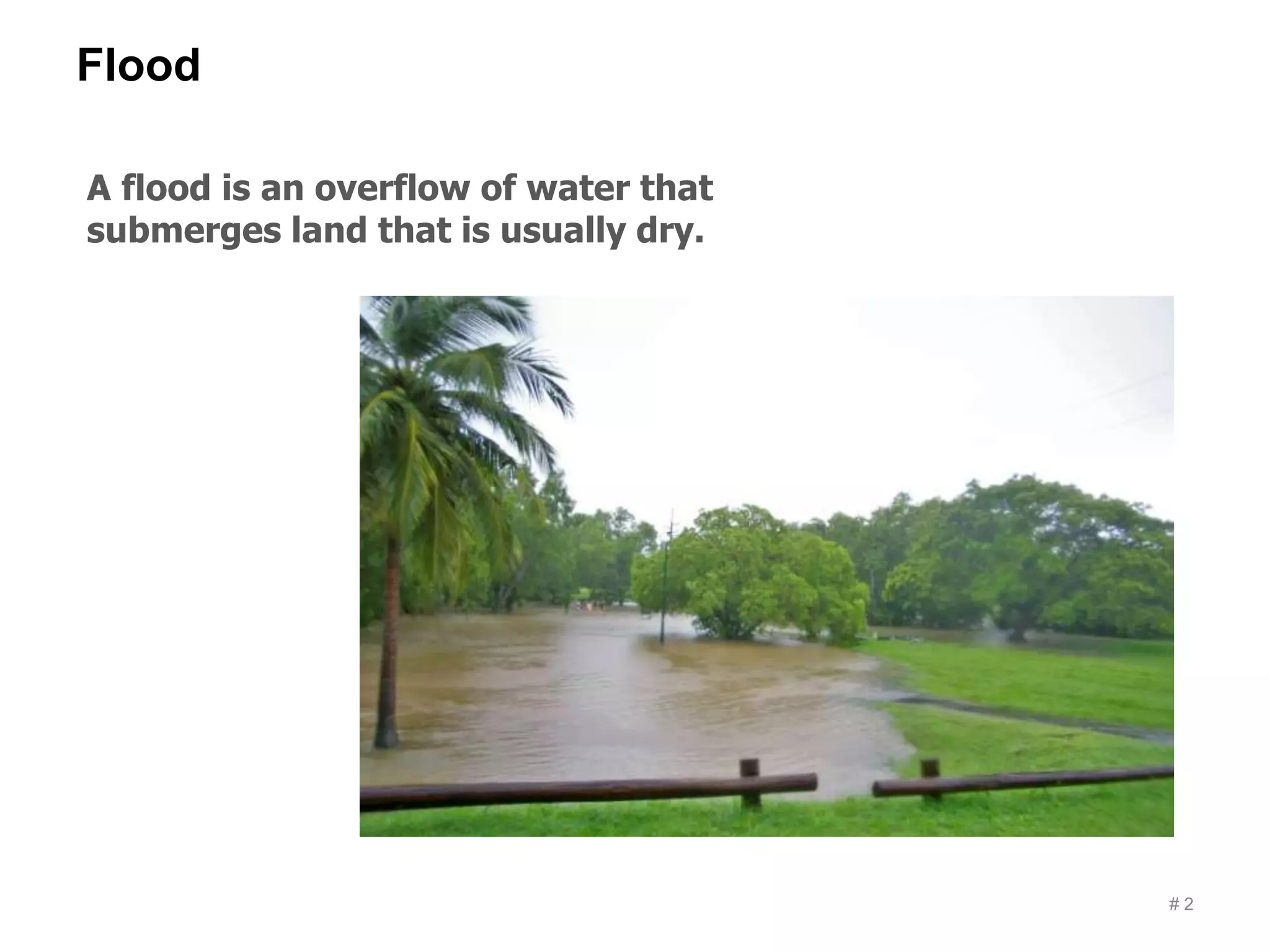
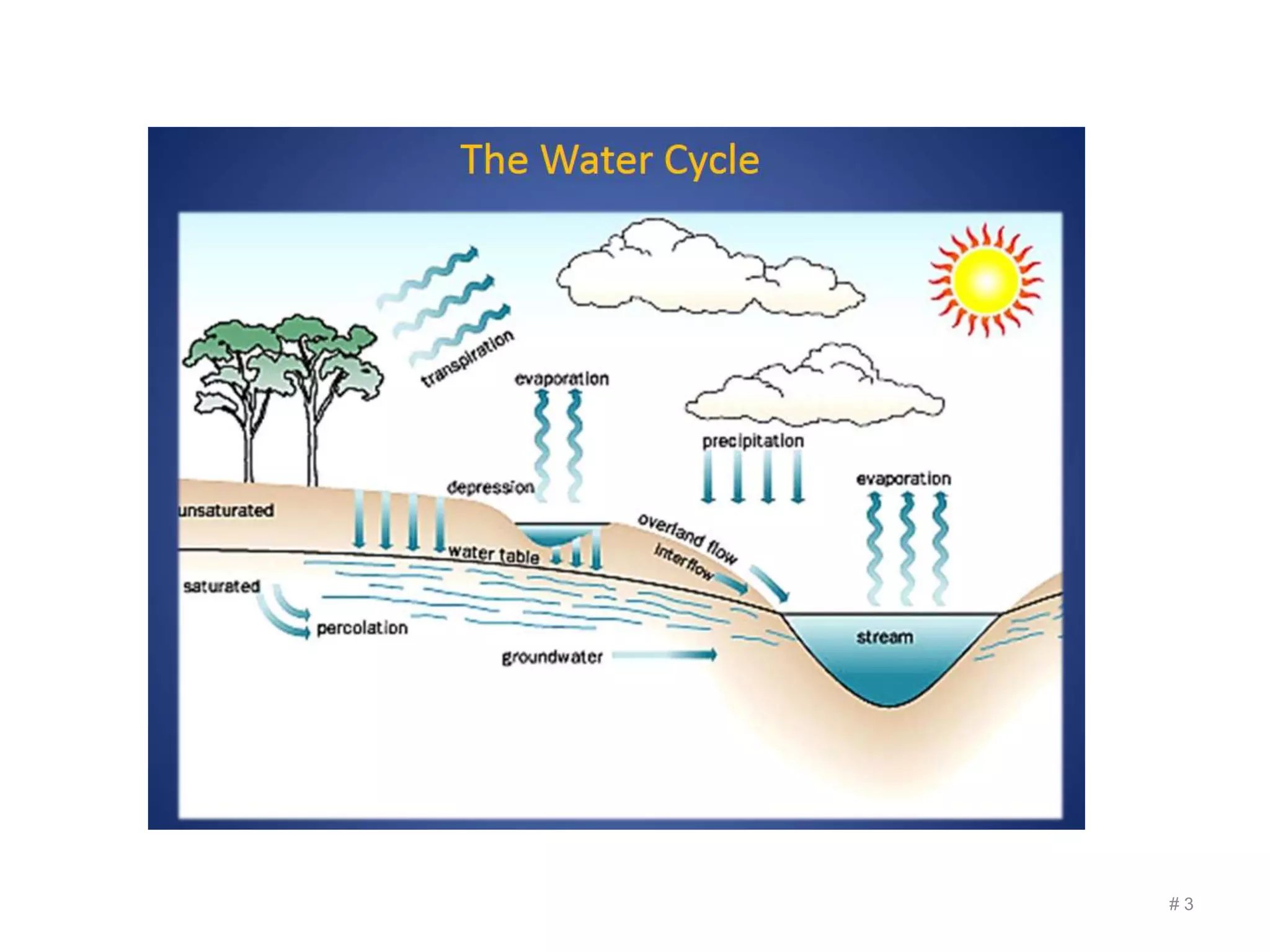
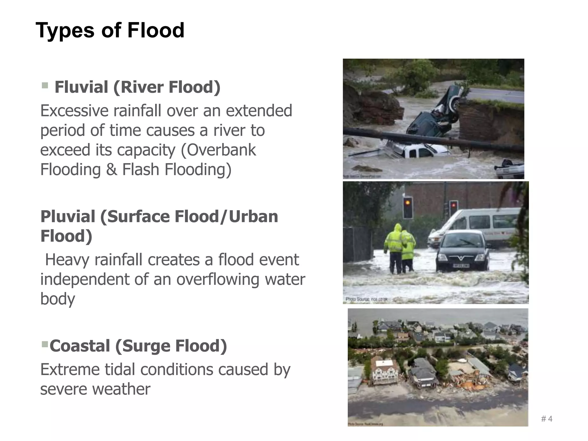
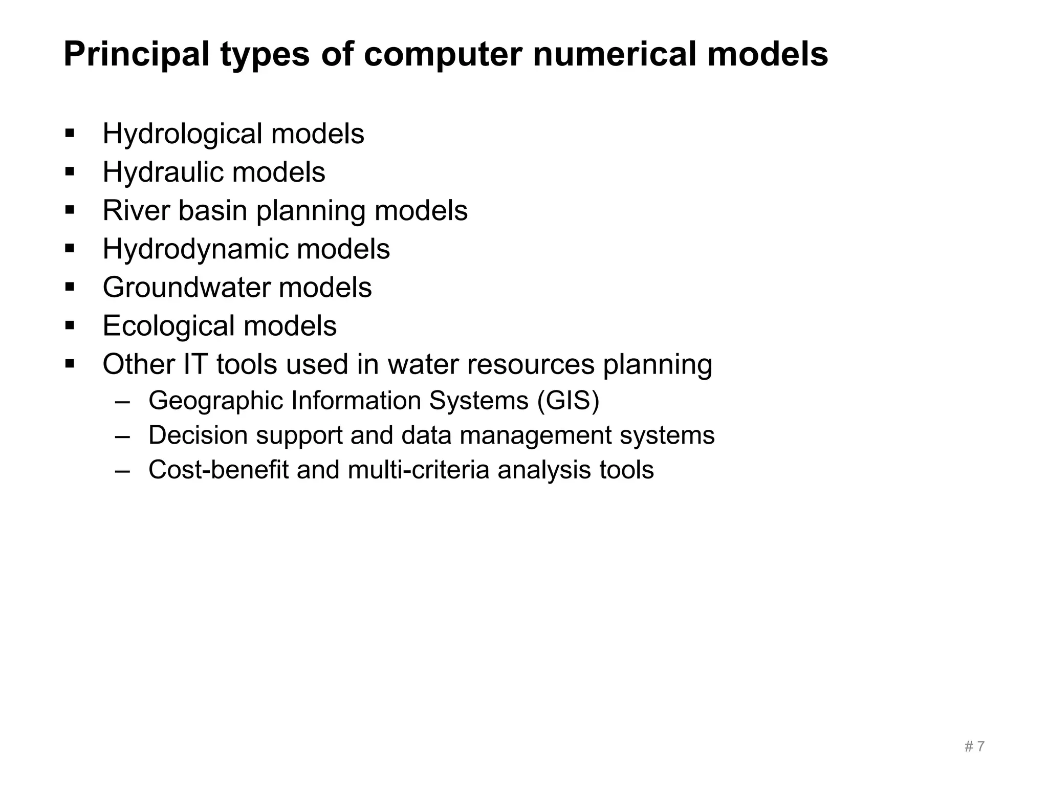
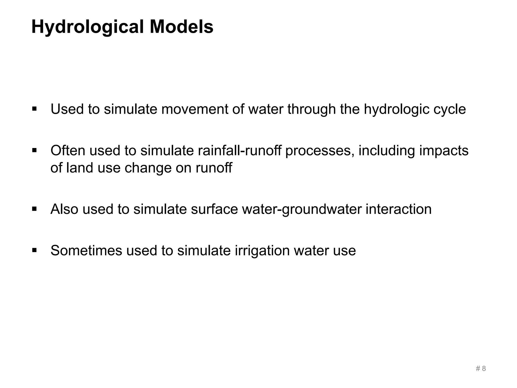
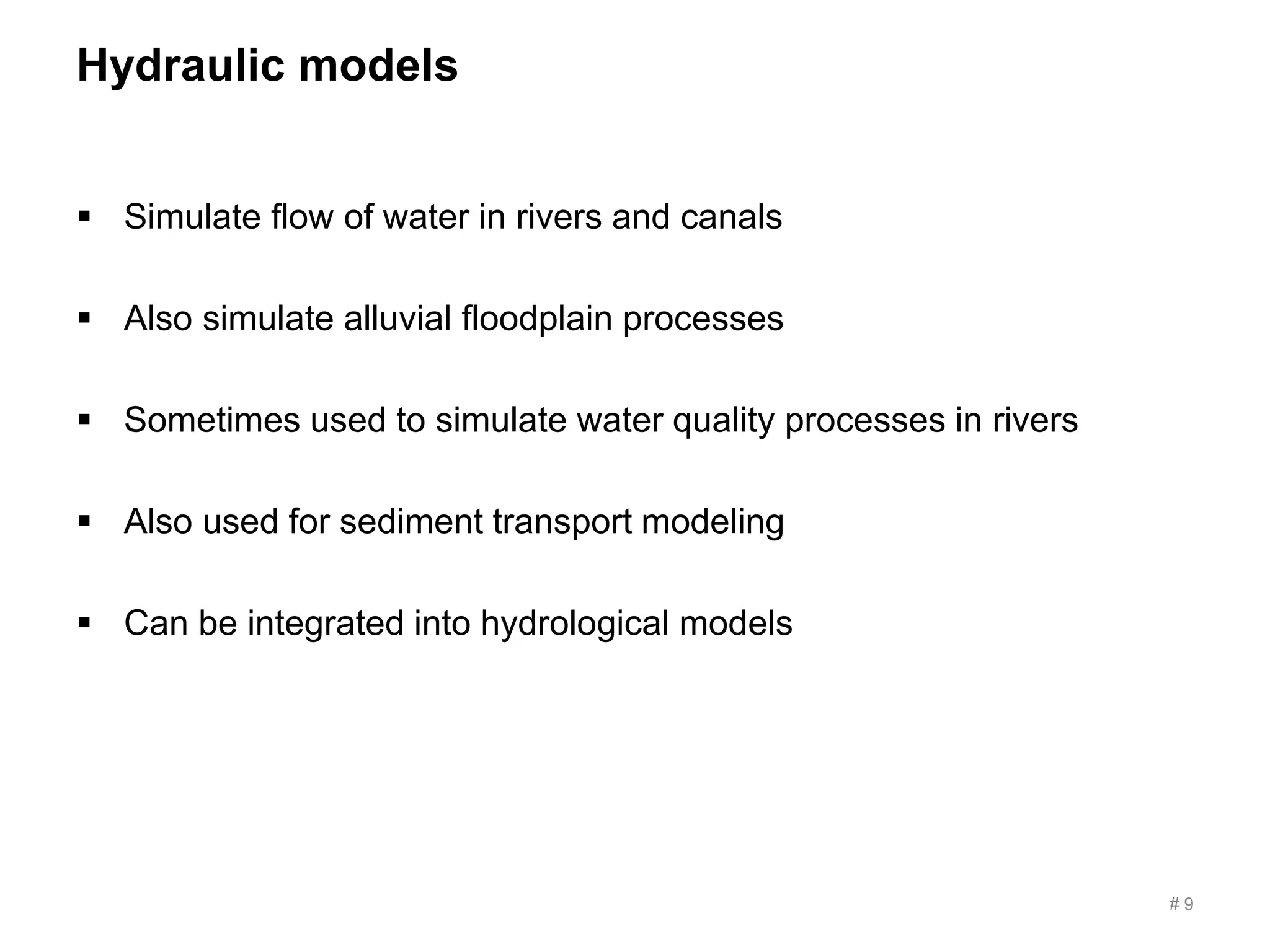
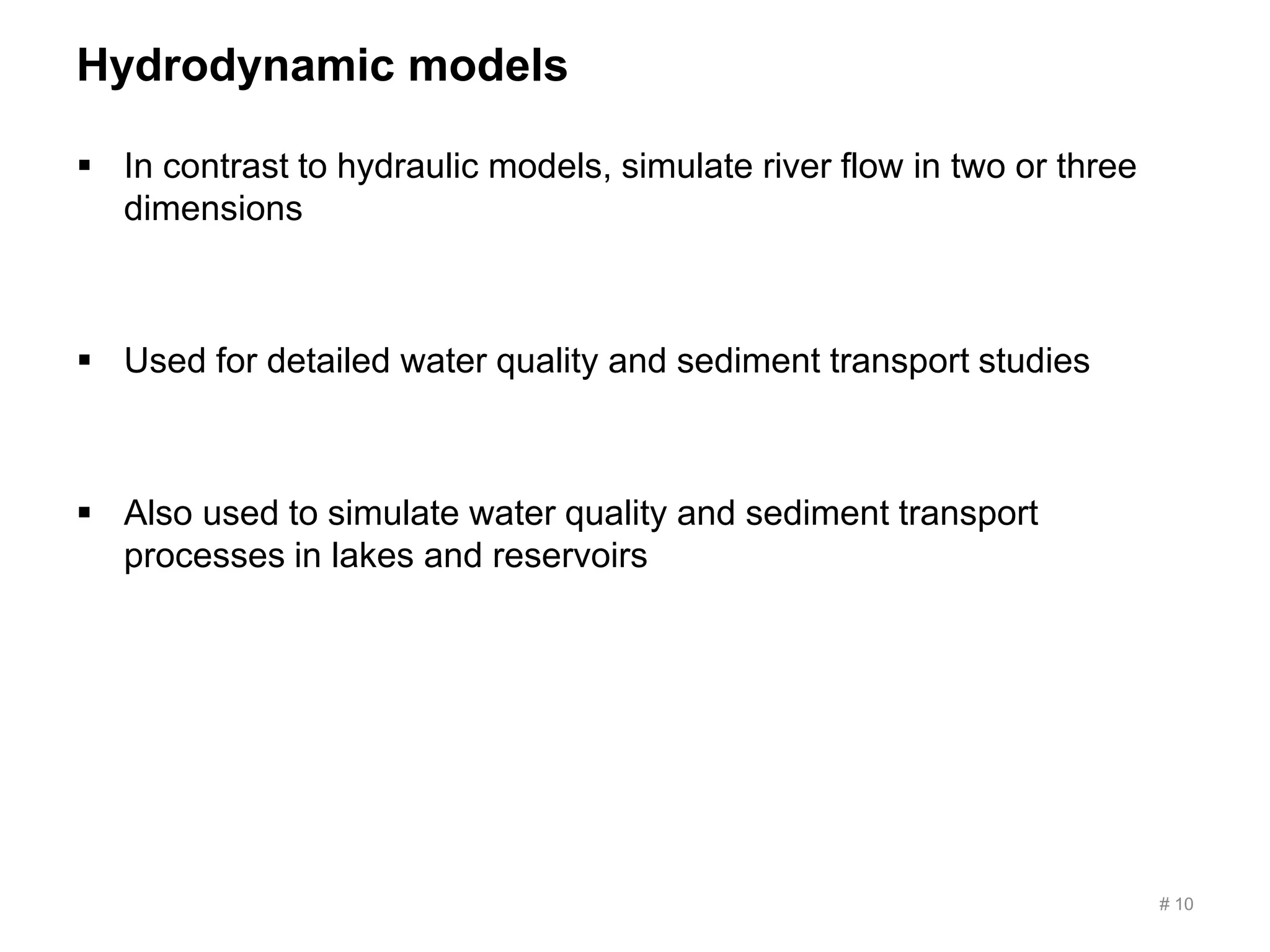
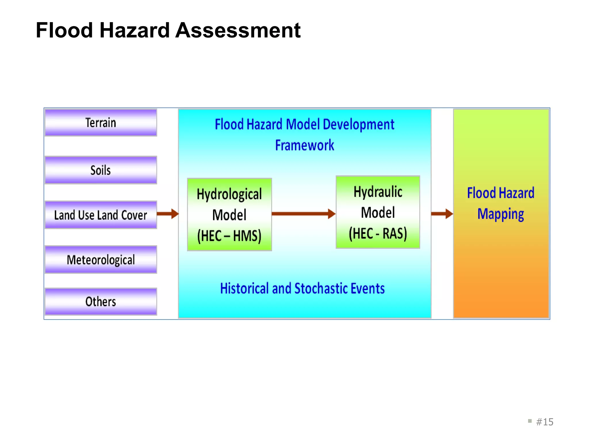
Flood Modeling- An Introduction
Rajesh Kumar Mahana
Flood
# 2
A flood is an overflow of water that
submerges land that is usually dry.
# 3
Types of Flood
# 4
 Fluvial (River Flood)
Excessive rainfall over an extended
period of time causes a river to
exceed its capacity (Overbank
Flooding & Flash Flooding)
Pluvial (Surface Flood/Urban
Flood)
Heavy rainfall creates a flood event
independent of an overflowing water
body
Coastal (Surge Flood)
Extreme tidal conditions caused by
severe weather
Flood Risk Analysis
# 5
 Support design of an insurance scheme
 Simulate historical patterns of floods
 Define flood risk zones
 Define critical rainfall thresholds for floods
 Loss assessment with remote sensing
 Assess agricultural losses
Flood Modelling
# 6
 Support design of an insurance scheme
 Simulate historical patterns of floods
 Define flood risk zones
 Define critical rainfall thresholds for floods
 Loss assessment with remote sensing
 Assess agricultural losses
Principal types of computer numerical models
# 7
 Hydrological models
 Hydraulic models
 River basin planning models
 Hydrodynamic models
 Groundwater models
 Ecological models
 Other IT tools used in water resources planning
– Geographic Information Systems (GIS)
– Decision support and data management systems
– Cost-benefit and multi-criteria analysis tools
Hydrological Models
 Used to simulate movement of water through the hydrologic cycle
 Often used to simulate rainfall-runoff processes, including impacts
of land use change on runoff
 Also used to simulate surface water-groundwater interaction
 Sometimes used to simulate irrigation water use
# 8
Hydraulic models
 Simulate flow of water in rivers and canals
 Also simulate alluvial floodplain processes
 Sometimes used to simulate water quality processes in rivers
 Also used for sediment transport modeling
 Can be integrated into hydrological models
# 9
Hydrodynamic models
 In contrast to hydraulic models, simulate river flow in two or three
dimensions
 Used for detailed water quality and sediment transport studies
 Also used to simulate water quality and sediment transport
processes in lakes and reservoirs
# 10
Decision support and data management systems
 Used to manage data and models
 Can be used in planning applications to develop different scenarios
of future conditions and facilitate comparison of model results
across scenarios
– Useful when there is uncertainty about future conditions
 Can be used in real-time applications as a centralized platform for
automating model runs and data management
# 11
USE OF MODELS
 Planning applications
 Real-time applications
 Planning applications
– Long-term or seasonal time scales
– Used to support decision-making about infrastructure projects,
management policies, etc.
 Real-time applications
– Time scales ranging from minutes to days
– Used to support real-time operation of water management
infrastructure including dams and canals
– Also used to support warning systems, such as flood early-warning
systems
# 12
Flood forecasting
 Real-time forecasts of river flooding are valuable for alerting
affected populations about flood events.
 Hydrological models can be used to forecast runoff if the catchment
area is large and there is a lag between rainfall events and
downstream runoff
 Hydrological models can also be used to forecast runoff in smaller
catchments if precipitation forecasts are available
 Hydraulic models can be used to forecast the extent of the
inundated area if runoff forecasts are available or if there is a lag
between runoff generation and downstream flooding
# 13
Numerical Tools on Flood Modelling
 Open Source :
HEC-HMS, HEC-RAS, HEC-RTS, HEC-SSP, SWAT, ModFlow
 License:
Mike Suite, Deltares, Tuflow
# 14
Flood Hazard Assessment
 #15
Challenges
 Digital Terrain Data
 Hydro-meteorological and streamflow data
 Calibration and Validation
 Computation and Model Choice
 Flood Risk Zoning
– Design of an Insurance Scheme
# 16
# 17

Introduction to flood modelling

  • 1.
    Flood Modeling- AnIntroduction Rajesh Kumar Mahana
  • 2.
    Flood # 2 A floodis an overflow of water that submerges land that is usually dry.
  • 3.
  • 4.
    Types of Flood #4  Fluvial (River Flood) Excessive rainfall over an extended period of time causes a river to exceed its capacity (Overbank Flooding & Flash Flooding) Pluvial (Surface Flood/Urban Flood) Heavy rainfall creates a flood event independent of an overflowing water body Coastal (Surge Flood) Extreme tidal conditions caused by severe weather
  • 5.
    Flood Risk Analysis #5  Support design of an insurance scheme  Simulate historical patterns of floods  Define flood risk zones  Define critical rainfall thresholds for floods  Loss assessment with remote sensing  Assess agricultural losses
  • 6.
    Flood Modelling # 6 Support design of an insurance scheme  Simulate historical patterns of floods  Define flood risk zones  Define critical rainfall thresholds for floods  Loss assessment with remote sensing  Assess agricultural losses
  • 7.
    Principal types ofcomputer numerical models # 7  Hydrological models  Hydraulic models  River basin planning models  Hydrodynamic models  Groundwater models  Ecological models  Other IT tools used in water resources planning – Geographic Information Systems (GIS) – Decision support and data management systems – Cost-benefit and multi-criteria analysis tools
  • 8.
    Hydrological Models  Usedto simulate movement of water through the hydrologic cycle  Often used to simulate rainfall-runoff processes, including impacts of land use change on runoff  Also used to simulate surface water-groundwater interaction  Sometimes used to simulate irrigation water use # 8
  • 9.
    Hydraulic models  Simulateflow of water in rivers and canals  Also simulate alluvial floodplain processes  Sometimes used to simulate water quality processes in rivers  Also used for sediment transport modeling  Can be integrated into hydrological models # 9
  • 10.
    Hydrodynamic models  Incontrast to hydraulic models, simulate river flow in two or three dimensions  Used for detailed water quality and sediment transport studies  Also used to simulate water quality and sediment transport processes in lakes and reservoirs # 10
  • 11.
    Decision support anddata management systems  Used to manage data and models  Can be used in planning applications to develop different scenarios of future conditions and facilitate comparison of model results across scenarios – Useful when there is uncertainty about future conditions  Can be used in real-time applications as a centralized platform for automating model runs and data management # 11
  • 12.
    USE OF MODELS Planning applications  Real-time applications  Planning applications – Long-term or seasonal time scales – Used to support decision-making about infrastructure projects, management policies, etc.  Real-time applications – Time scales ranging from minutes to days – Used to support real-time operation of water management infrastructure including dams and canals – Also used to support warning systems, such as flood early-warning systems # 12
  • 13.
    Flood forecasting  Real-timeforecasts of river flooding are valuable for alerting affected populations about flood events.  Hydrological models can be used to forecast runoff if the catchment area is large and there is a lag between rainfall events and downstream runoff  Hydrological models can also be used to forecast runoff in smaller catchments if precipitation forecasts are available  Hydraulic models can be used to forecast the extent of the inundated area if runoff forecasts are available or if there is a lag between runoff generation and downstream flooding # 13
  • 14.
    Numerical Tools onFlood Modelling  Open Source : HEC-HMS, HEC-RAS, HEC-RTS, HEC-SSP, SWAT, ModFlow  License: Mike Suite, Deltares, Tuflow # 14
  • 15.
  • 16.
    Challenges  Digital TerrainData  Hydro-meteorological and streamflow data  Calibration and Validation  Computation and Model Choice  Flood Risk Zoning – Design of an Insurance Scheme # 16
  • 17.