Tsunami risk assessment and management - case studies from Sri Lanka
•
5 likes•2,538 views

Sam.S.L HETTIARACHCHI, Saman.P SAMARAWICKRAMA, Nimal WIJERATNE University of Moratuwa, Sri Lanka, Democratic Socialist Republic of

Recommended
More Related Content
What's hot
What's hot (20)
More from Global Risk Forum GRFDavos
More from Global Risk Forum GRFDavos (20)
Recently uploaded
Recently uploaded (20)
Tsunami risk assessment and management - case studies from Sri Lanka
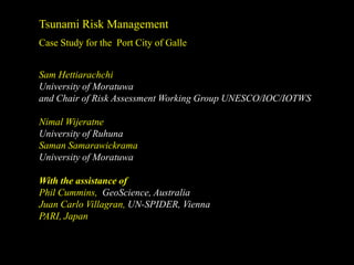
- 1. Tsunami Risk Management Case Study for the Port City of Galle Sam Hettiarachchi University of Moratuwa and Chair of Risk Assessment Working Group UNESCO/IOC/IOTWS Nimal Wijeratne University of Ruhuna Saman Samarawickrama University of Moratuwa With the assistance of Phil Cummins, GeoScience, Australia Juan Carlo Villagran, UN-SPIDER, Vienna PARI, Japan
- 2. Documents from Working Group on Risk Assessment of IOTWS Guideline on Tsunami Risk Assessment and Mitigation for the Indian Ocean Knowing your Tsunami Risk and what to do about it UNESCO/IOC Manual and Guideline 52 June 2009 A Probabilistic Tsunami Hazard Assessment of the Indian Ocean Nations Implemented by Geo Science Australia as an activity of Working Group 3 September 2009
- 3. Approach to Risk Assessment and Mitigation in the coastal zone
- 4. Approach towards Risk Assessment and Mitigation Multi Hazard Coastal Risk Assessment Framework Risk = f (Hazard , Vulnerability ) Risk = f (Hazard , Vulnerability , Capacity) Risk= f (Hazard , Vulnerability , Deficiencies in Preparedness)
- 5. Case Study on Risk Assessment- Port City of Galle Presentation of the selected components of the study 1. Tsunami Impact on the City of Galle 2. Assessment of the Tsunami Hazard and Exposure 3. Assessment of Vulnerability 4. Capacity, Resilience and Preparedness 5. Initial Risk Analysis 6. Information and Maps for the benefit of the community 7. Mitigation
- 6. 1 Tsunami Impact on the City of Galle in the Southern Province N Batticaloa Chilaw 2.3 07 30 00 N 2.0 SCALE 2.7 NOTE : ALL INUNDATION HEIGHTS IN METERS 2.0 10.00 hrs 1 st Wave 13.00 hrs Negombo 2.7 2 nd Wave 3.0 Tsunmai Heights 07 00 00 N Mattakuliya Colombo 11.3 Moratuwa Galle 8.4 10.2 10.3 6.9 09.30 hrs 1 st Wave Kalutara District 06 30 00 N 09.45 hrs 2 nd Wave 8.8 12.20 hrs 3 rd Wave Payagala 4.5 7.0 4.5 6.0 Yala Ahungalla 09.10 hrs 1 st Wave 3.5 Kirinda 09.20 hrs 2 nd Wave Hikkaduwa 4.1 3.7 09.30 hrs 1 st Wave Hambantota Galle 09.45 hrs 2 nd Wave Tangalle 06 00 00 N 12.20 hrs 3 rd Wave Unawatuna 09.20 hrs 1 st Wave Matara 09.45 hrs 2 nd Wave 09.20 hrs 1 st Wave 09.40 hrs 2 nd Wave 79 30 00 E 80 00 00 E 80 30 00 E 81 00 00 E 81 30 00 E 82 00 00 E Assessment tsunami wave heights and inundation from field studies
- 7. Disaster Statistics in the Galle City administrative area due to the Indian Ocean Tsunami 497 residents were killed 89 residents disappeared There is no record on the visitor casualty figures 996 residents were injured 1588 houses were damaged 1272 buildings other than the housing units were damaged 8114 residents were affected (Source: Dept. of Census, Sri Lanka)
- 8. 2 Hazard Analysis Source Exposure Tsunami Hazard Source Exposure Tsunami Hazard Impact on land Hazard impact on land
- 9. Tsunami Tsunami Hazard Exposure Hazard Impact Source on Land Impact Profile for the tsunami MEASUREMENTS MODELLING TOOLS FROM INSTRUMENTS Deterministic FIELD STUDIES and Probabilistic IMAGE ANALYSIS Science of Tsunamis
- 10. Hazard Analysis Impact Profile for the tsunami 80 70 60 Velocity Magnitude 50 40 (cm/s) 30 20 10 0 2/26/04 0:00 12/26/04 6:0012/26/04 12:0012/26/04 18:0012/27/04 0:00 Time Measurements Field studies Satellite Images from instruments of IOT Modelling Tools Deterministic Tsunami Probabilistic Tsunami Hazard Hazard Modelling Modelling (PTHM)
- 11. Tsunami Science Enhanced exposure of the City of Galle Energy concentration at headlands and in bays Bay – increase of speed & height and circulation Historic Dutch Fort West East Headland – concentration of energy and 1 1 2 4 spreading around the headland H 2 / H1 (b1 / b2 ) (h1 / h2 )
- 12. Hazard Map of Inundation Contours based on Field Measurements of IOT Locations of Data Collection for the City of Galle At least one location for each 250m x 250m area; 138 Locations in total; Information on Inundation Depth and Flow Direction after Dr.N.Wijeratne
- 13. Deterministic Tsunami Hazard Modelling Deepwater Modelling, Ne ar-shore and Inundation Modelling (1) To study overall exposure of the island (2) Simulate the IOT and compare with field measurements on height, inundation and run up (3) Simulate potential tsunamis based on ‘Credible Scenarios’ obtained from Geological and Seismic studies of the hazard.
- 14. Project “HyperDEM” Funded by the Italian Government 3-D PERSPECTIVE VIEW OF THE DUTCH FORT IN GALLE DIGITAL DIGITAL SURFACE MODEL TERRAIN MODEL
- 15. Modelling of a ‘ credible scenario’ provides Key Parameters relating to inundation
- 16. Modelling of ‘different credible scenarios’ provide a Data Base of the Key Parameters relating to inundation leading to a clear understanding of hazard and development of ‘critical scenario’ Key Parameters Inundation Height Distribution of Inundation level Velocity of the propagating wave Currents Intrusion length Run-up (where applicable) Flood volume (if possible) IOT
- 17. Hazard Maps of Inundation Contours based on Inundation Modelling of different scenarios IOT Anuga Model (GeoScience-Australia)
- 18. M Dynamic Hazard Map of Inundation of IOT for Galle- PARI, Japan based on Deterministic Tsunami Hazard Modelling
- 19. Probabilistic Tsunami Hazard Modelling Example of Offshore Tsunami Hazard for Sri Lanka Low hazard end-member High hazard end-member For Sri Lanka, the low-hazard and high- hazard maps are very similar in character, with hazard maximum along the east coast and the high hazard case greater than the low by about 30%.
- 20. Probabilistic Tsunami Hazard Modelling Example: Deaggregated Tsunami Hazard for Sri Lanka Deaggregated hazard displays the relative contribution of different sources to the tsunami hazard at a particular location. Low-Hazard Case High-Hazard Case Both Low- and High-hazard cases show that tsunami hazard in Sri Lanka is dominated by events in North-Sumatra/Nicobar Islands. Probably, this means that the 2004 IOT was the ‘worst-case’ scenario for Sri Lanka..
- 21. Risk – Superposition of Hazard and Vulnerability + =
- 22. + Hazard Analysis- Event based = P4
- 23. + Hazard Analysis- Multiple hazard = scenario based P4 P3 P2 P1
- 24. 3 Vulnerability Vulnerability represents the proneness of society and its full structure to be affected by the hazard. Components of Vulnerability (1D approach) 1--Human, Cultural and Psychological 2--Physical/Structural 3--Socio-Economic 4--Environmental 5--Functional 6--Administrative
- 25. Examples of Vulnerable Public Infrastructure and Sectors within the City of Galle • Bus Terminal. • Main Street – commerce. • 4 Schools. • Commerces, Road to Colombo. • Mahamodera hospital • Commerces, Road to Matara. • School of Nursing • Area in front of Post Office. • Train Station • Fishing boat areas (3). • District Admin. Building. • Sambodhi Hospital (for children). • Municipal Council Building. • Fish market, fruit market, vegetable market. after Juan Carlos Villagran
- 26. Vulnerability - The Sector Approach Detailed Approach towards Vulnerability Analysis Geographical Level Dimension r er la nt icu c e a rt National or a p State or lit of Province ci y fa ilit y District or th b a l e ra Municipal he uln Local or V Community Single unit or house Human being Dimension of Sectors Physical re ce n th e e g y F try es ns io ur nc in rg tu al er lin at s io ct us He ul In Ene Functional m ina m du uc at ru fe ric Ho m In ic Li st Ed Co Ag Economic un fra s ic Human condition / Gender Ba m co Administrative le Te Environmental nt f ne n o s po sio The vulnerability of the particular health facility is to be determing via om n C ime the assessment of physical, functional, economic (if private), human D condition / gender; administrative, and environmental components. after Juan Carlos Villagran
- 27. 4 Capacity, Resilience and Preparedness Key Areas -Awareness and Education -Preparedness -Early Warning -Response -Evacuation / Safe Places -Evacuation Structures -Tsunami Resilient Infrastructure Building a Tsunami Resilient Community A community based approach was adopted 28th March 2005- Successful evacuation
- 28. Other information used in the analysis: •Sources of income and household economic level •Condition of the buildings •Profile of the occupants •Condition of the infrastructure facilities etc •Community knowledge base via their participation Community participation in the vulnerability assessment
- 29. 5 Initial Risk Analysis Step 1- Appraoch R= ( Hazard x Vulnerability x Deficiencies in Preparedness) Simplified approach towards Hazard Analysis - based on IOT. Hazard and Vulnerability Vulnerability –Critical parameters used. Assessment •Only the elements that can be easily identifiable, quantifiable and spatially presentable were considered. •Total risk (that the community is exposed) is analyzed as a combination of hazard and vulnerability. Hazard Map + Vulnerability Map = Risk Map
- 30. Step 2- Tsunami Hazard Map Inundation Map -----------> Hazard Map Levels of Tsunami Hazard High Hazard Level – Inundation level above 0.5m with high flow speeds. Medium Hazard Level – Inundation 1m to 2m with low flow speeds. Low Hazard Level – Inundation less than 1m and low flow speeds. Zero Hazard Level – No inundation (no buffer zones are allocated)
- 31. Development of Critical Hazard Scenario Security of People and Infrastructure Inundation Depth :>50 cm Human killed (Velocity is strong ) :>1.0 m Partial damage House :>2-3 m Total damage and :>5.0 m Damage Building
- 32. Inundation Field Studies Mathematical Modelling Map Hazard Map
- 33. Tsunami Hazard Map Hazard in water areas is not assessed.
- 34. Step 3- Vulnerability Assessment/ Levels of Vulnerability Vulnerability Assessment was based on the vulnerability arising due to critical parameters only •Exposure to the hazard •Distance from the sea High Vulnerability •Elevation Medium Vulnerability •Status of infrastructure facilities etc Low Vulnerability •Capacity to evacuate. Zero Vulnerability •Impact on livelihoods,
- 35. Vulnerability Assessment Vulnerability Assessment was based on the vulnerability arising due to the location, infrastructure and livelihood High vulnerability Short distance and direct exposure to the sea, Low elevation, Inability to evacuate quickly, Easily damageable infrastructure facilities etc. Easy disruption to livelihoods, Medium vulnerability Low vulnerability Zero vulnerability Far away from the sea, High elevation, No possibility of isolation during a tsunami, Hazard resistant infrastructure, Livelihoods which may not be effected by the disaster etc.
- 36. Tsunami Vulnerability Map Vulnerability in water areas is not assessed.
- 37. Step 4-Risk Map Hazard Vulnerability Risk 37
- 38. Tsunami Risk Map
- 39. Information and Maps 6 for the benefit of the community Information relevant for disaster risk reduction -Disaster Awareness/ Preparedness Education -Disaster Management Maps • Residents’ Preferred Evacuation Routes and Safe Areas • Information to establish better Evacuation Routes and Safe Areas
- 40. Tsunami Education Programme Preparation of Tsunami Evacuation Plans with the participation of community Typical Tsunami Education Materials on Disaster Awareness and Preparedness
- 41. Risk Management Mitigate the impact Mitigate exposure Promote successful of the hazard and vulnerability evacuation from (Mitigation Options) to the hazard hazard where necessary -Land Use Planning -Early Warning System -Physical (Local and Regional) Interventions -Regulatory interventions (Artificial such as set back of defense -Public Warning System Methods, Natural line Methods and -Evacuation Routes & Structures Hybrid Methods) -Hazard resilient buildings and infrastructure -Community Education, Maps for their benefit and Preparedness
- 42. Tsunami Breakwaters- Integrating Mitigation with port development projects Galle City and the Port Detailed Topographical Data (LiDAR Surveys) Full 3-D reconstruction of the urban area of Galle. In foreview, the Dutch Fort
- 43. Tsunami Breakwaters Two Multi –purpose berths (240 m x 2) to be developed Depth -14 m Integrating Hazard Mitigation Outer breakwater 800 m with port development Inner Breakwater 350 m
- 44. Inun Dept date (m) h d 0.3 Simulated Tsunami Flood Area of Galle Bay for Present Condition
- 45. (m) h Dept d date Inun 0.3 Simulated Tsunami Flood Area of Galle Bay with Galle Port Development
- 47. Advertisement from the Economist
- 48. Managing tsunami risk is certainly a fine art