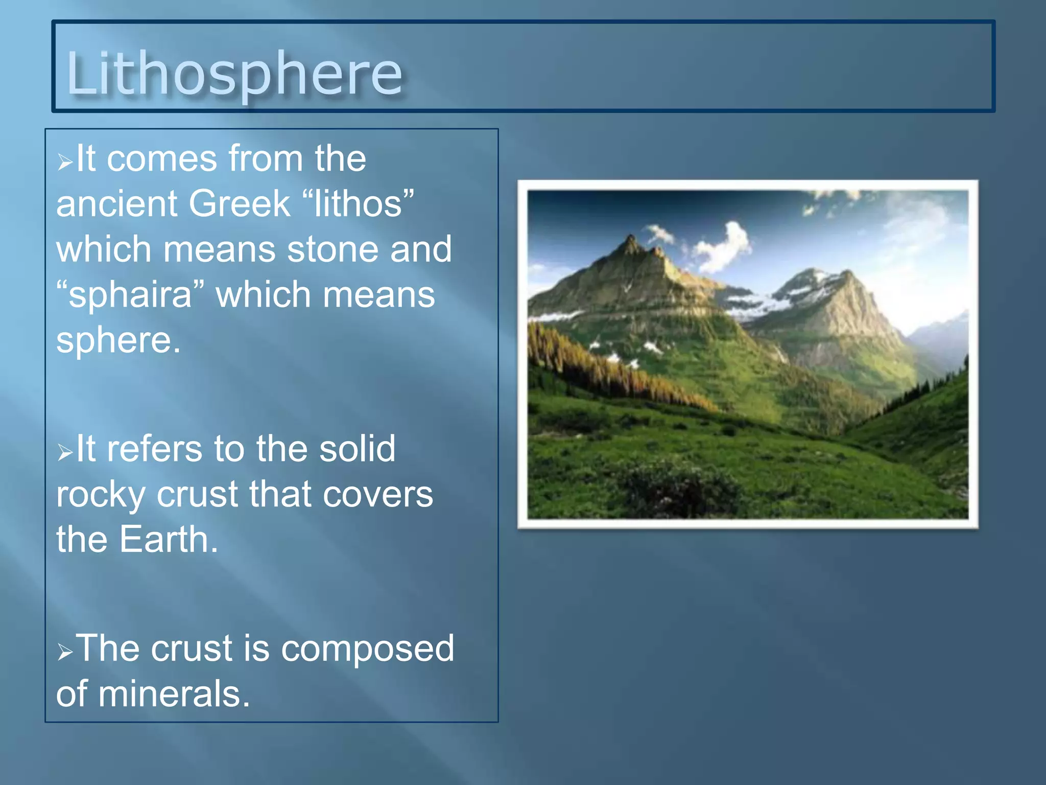
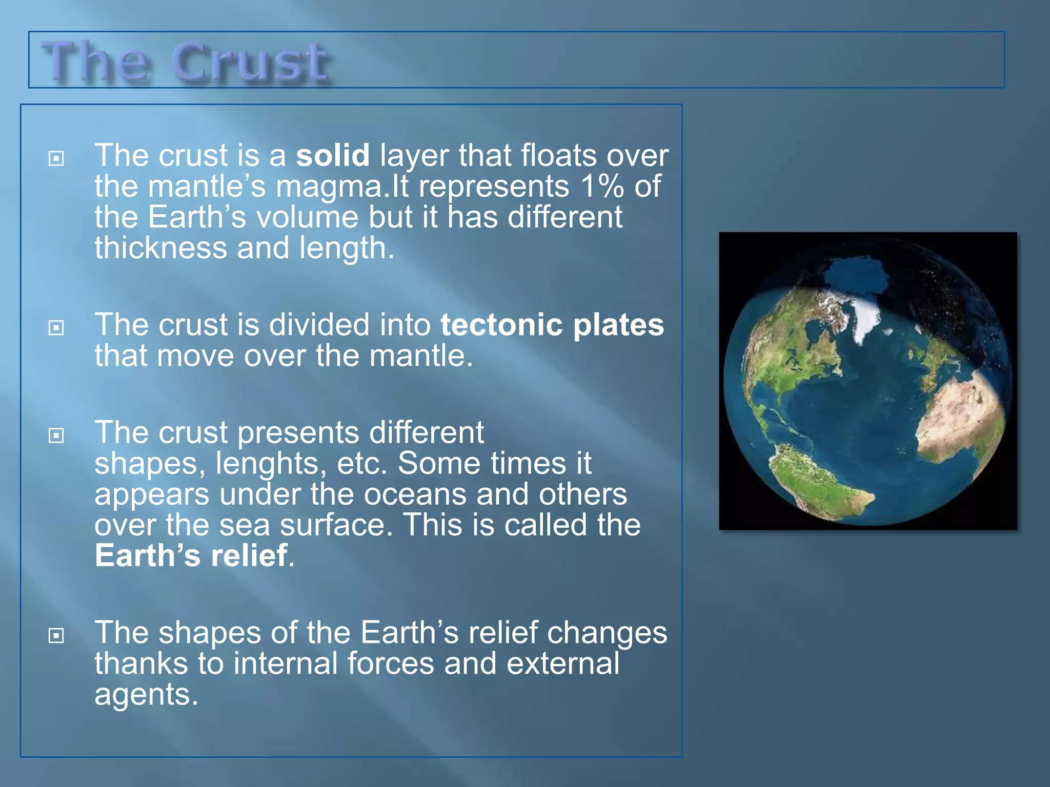
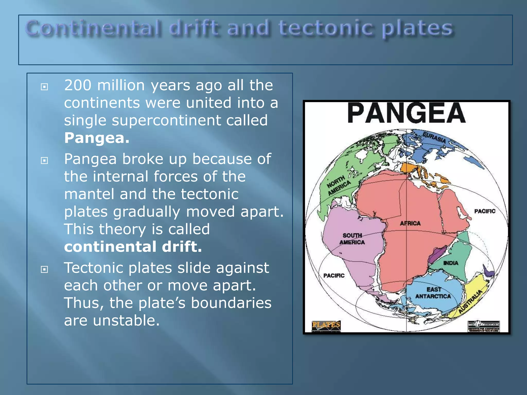
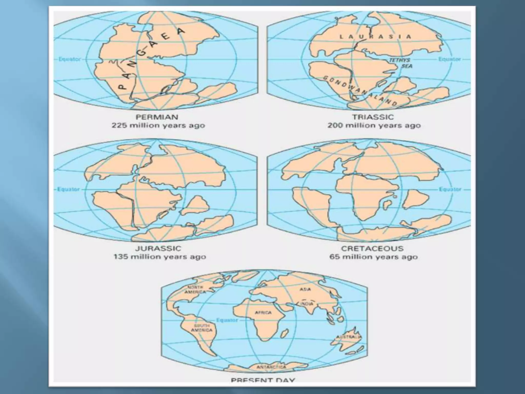
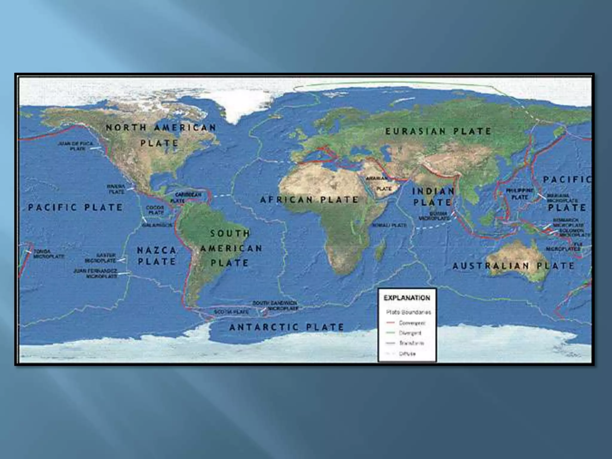
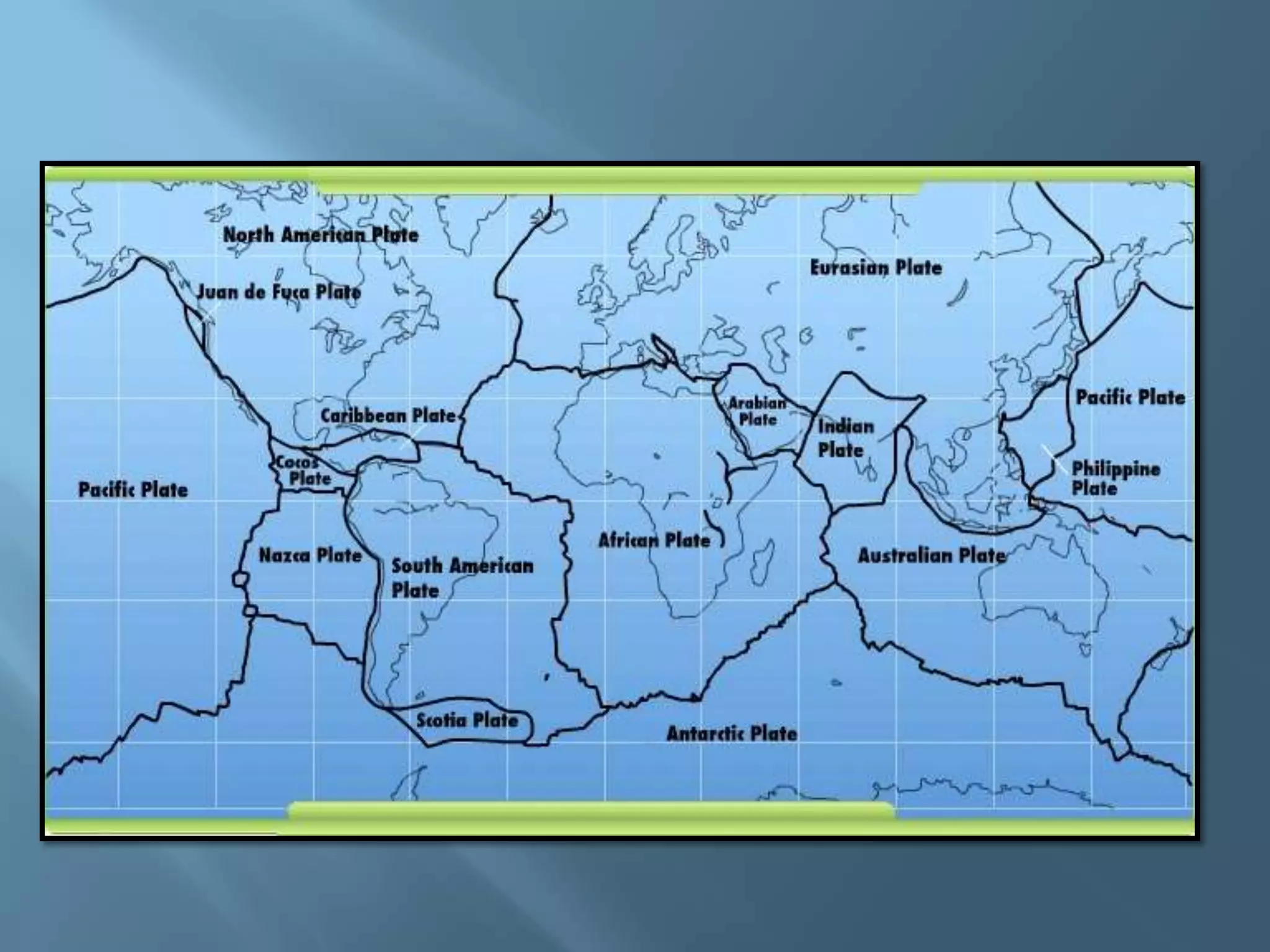
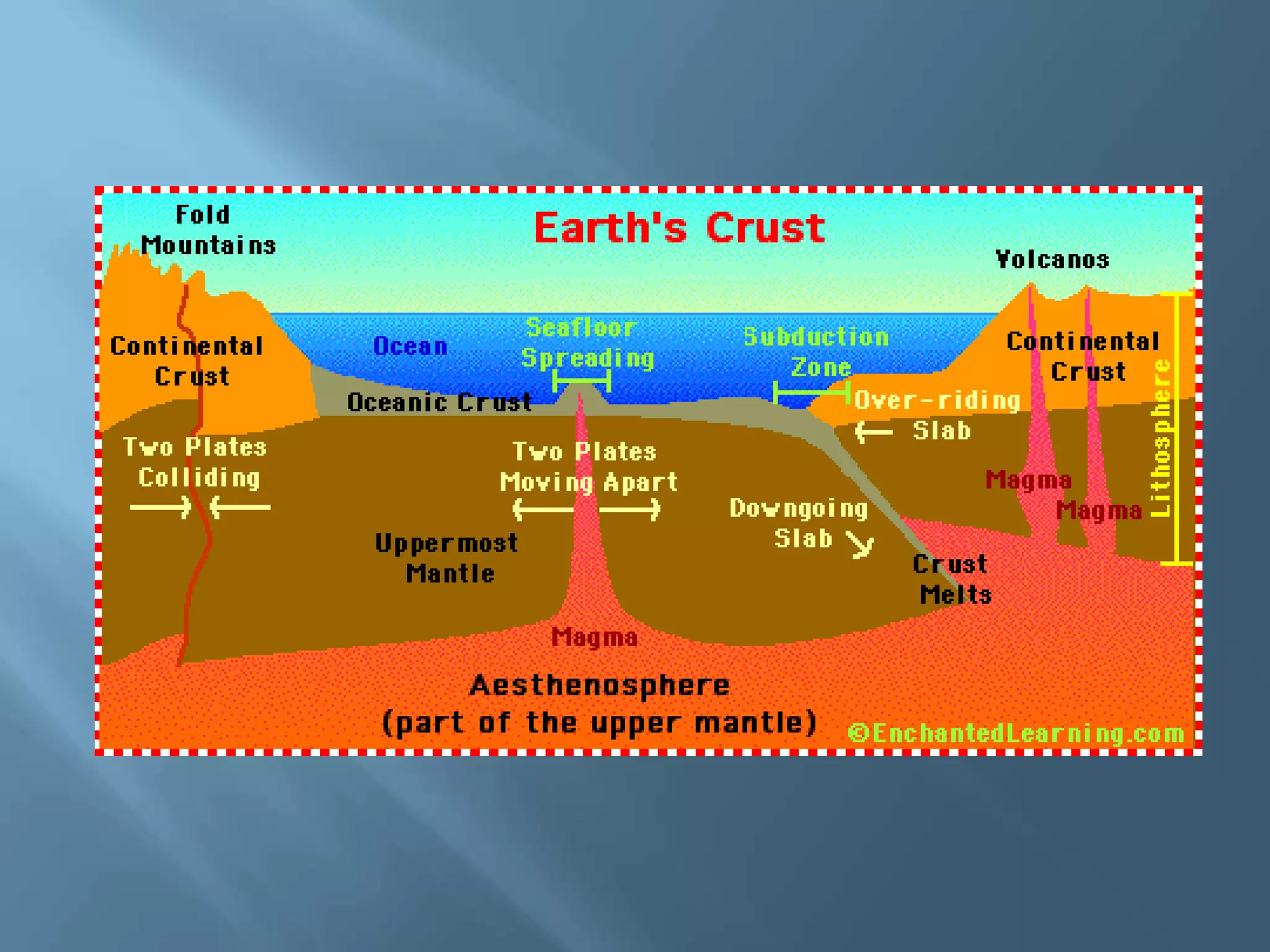
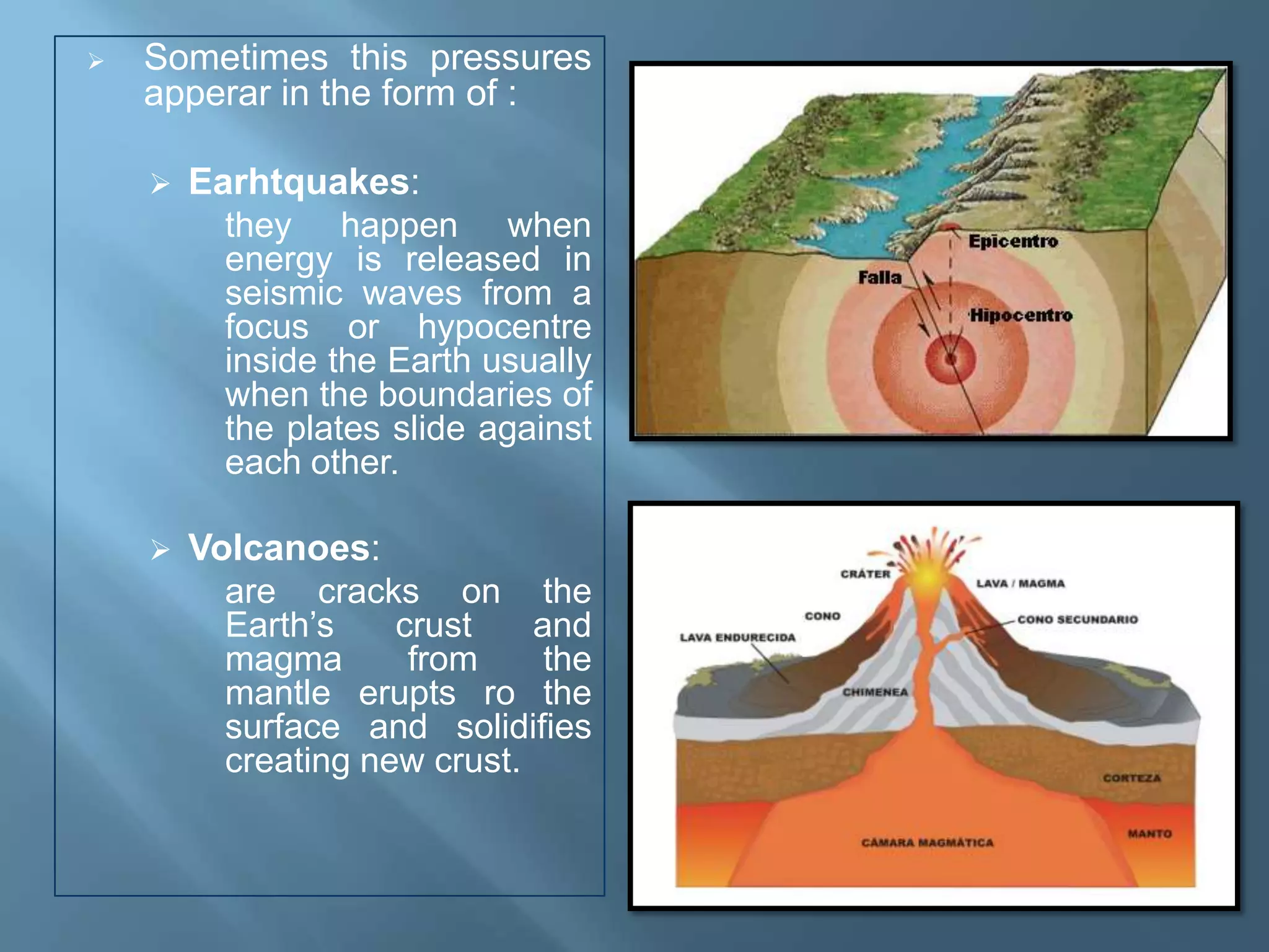
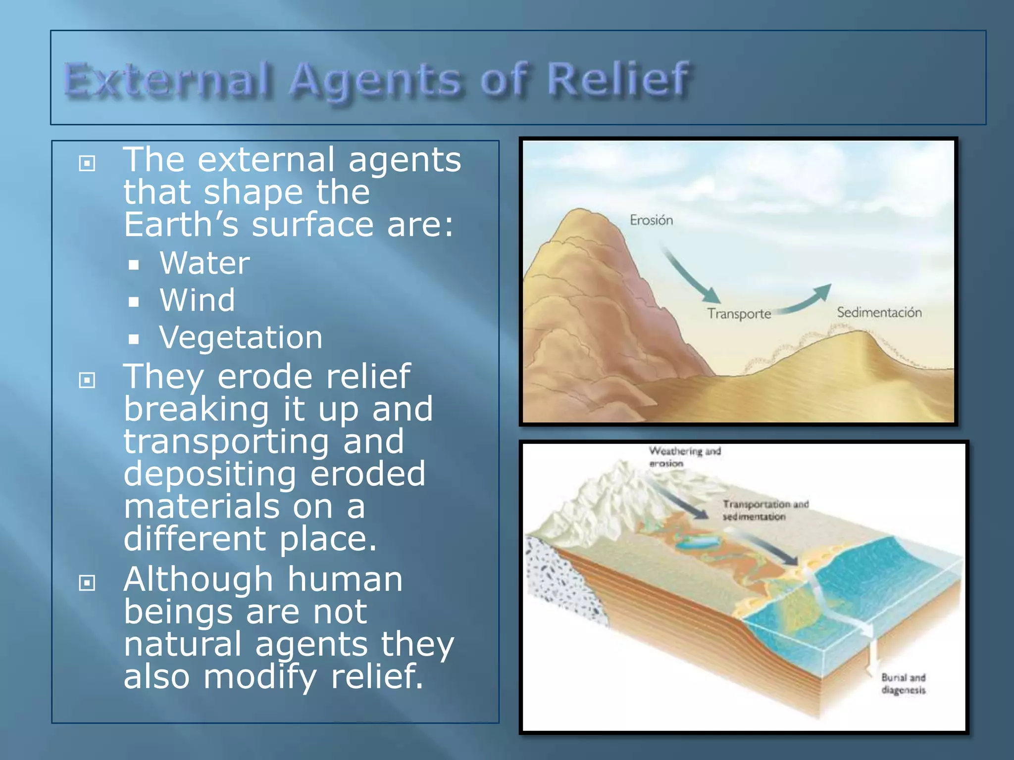
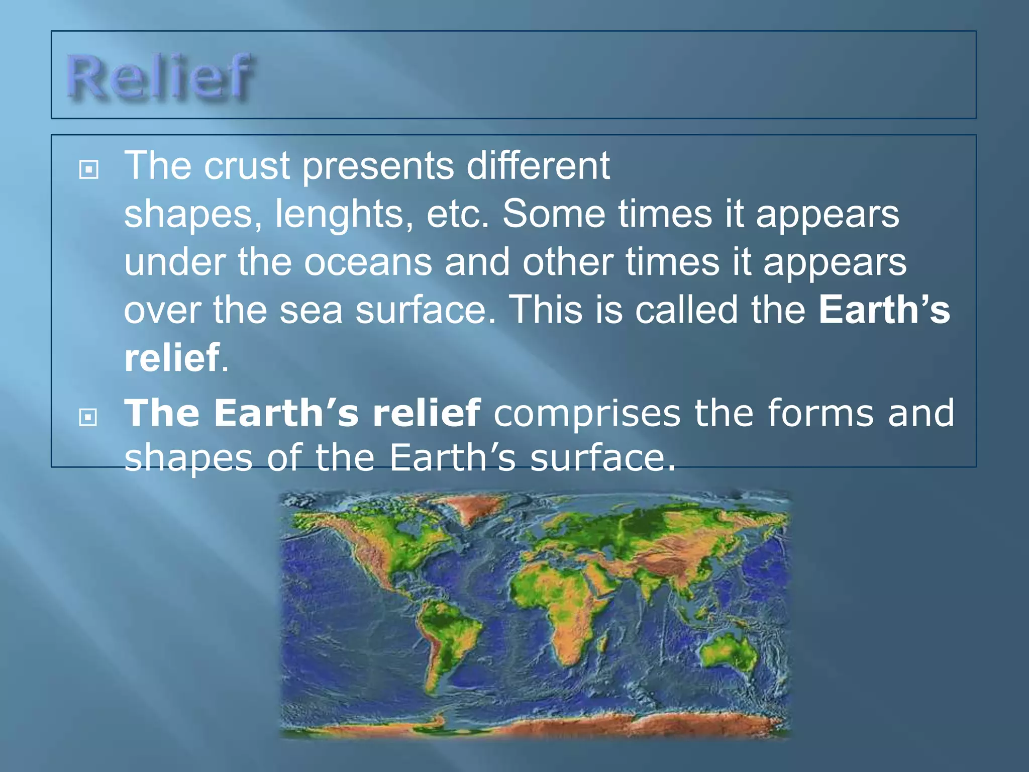
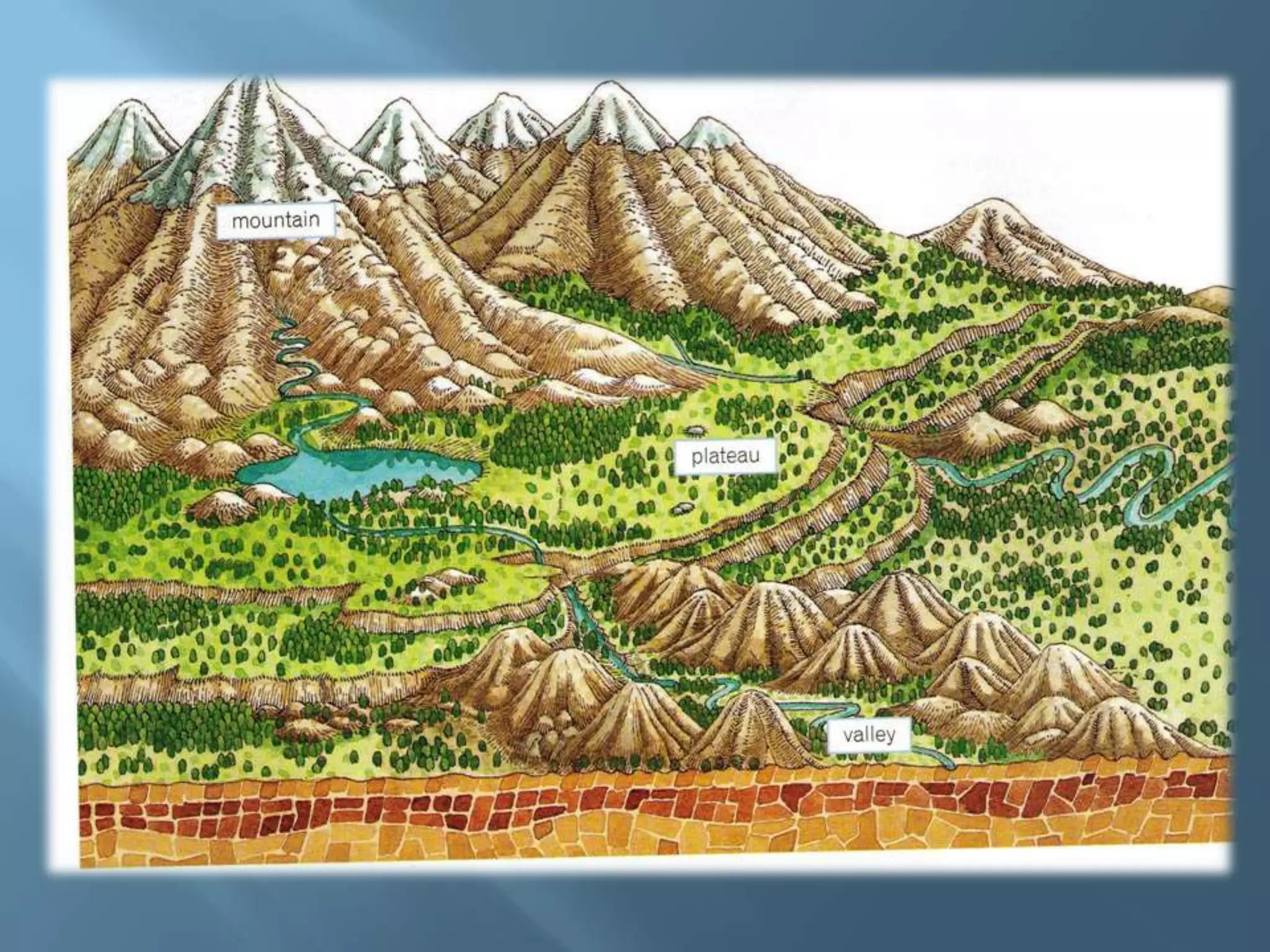
María Jesús Campos
learningfromgeography.wikispaces.com
Lithosphere
Itcomes from the
ancient Greek “lithos”
which means stone and
“sphaira” which means
sphere.

Itrefers to the solid
rocky crust that covers
the Earth.

The  crust is composed
of minerals.
   The crust is a solid layer that floats over
    the mantle’s magma.It represents 1% of
    the Earth’s volume but it has different
    thickness and length.

   The crust is divided into tectonic plates
    that move over the mantle.

   The crust presents different
    shapes, lenghts, etc. Some times it
    appears under the oceans and others
    over the sea surface. This is called the
    Earth’s relief.

   The shapes of the Earth’s relief changes
    thanks to internal forces and external
    agents.
   200 million years ago all the
    continents were united into a
    single supercontinent called
    Pangea.
   Pangea broke up because of
    the internal forces of the
    mantel and the tectonic
    plates gradually moved apart.
    This theory is called
    continental drift.
   Tectonic plates slide against
    each other or move apart.
    Thus, the plate’s boundaries
    are unstable.
    Internal forces and pressures from the mantle causes
    the crust to:

     Fold: are deformations of the Earth’s surface where
      rock layers bend.
     Fault: are breaks in rock layers where the rock is too
      hard to bend.
     Subducts: when one rock layer from a plate sinks
      under the other and its materials melts into the
      mantle’s magma.
   Sometimes this pressures
    apperar in the form of :

       Earhtquakes:
          they happen when
          energy is released in
          seismic waves from a
          focus or hypocentre
          inside the Earth usually
          when the boundaries of
          the plates slide against
          each other.

       Volcanoes:
          are cracks on the
          Earth’s    crust    and
          magma       from     the
          mantle erupts ro the
          surface and solidifies
          creating new crust.
   The external agents
    that shape the
    Earth’s surface are:
       Water
       Wind
       Vegetation
   They erode relief
    breaking it up and
    transporting and
    depositing eroded
    materials on a
    different place.
   Although human
    beings are not
    natural agents they
    also modify relief.
   The crust presents different
    shapes, lenghts, etc. Some times it appears
    under the oceans and other times it appears
    over the sea surface. This is called the Earth’s
    relief.
   The Earth’s relief comprises the forms and
    shapes of the Earth’s surface.
   Sometimes the Earth’s        The North Pole is not a
    crust appears over the        continent because it is
    sea surface and other         formed by frosted
    times under the sea           water.
    surface.
                                 Continents are
   Over the sea surface          separated by oceans or
    there are 6 continents:       seas:
       Africa                       Pacific Ocean
       Europe                       Atlantic Ocean
       América                      Indian Ocean
       Asia                         Artic Ocean
       Oceania                      Antartic Ocean or
       Antarctica                    Southern Ocean
                                     Mediterranean Sea
                                     Read Sea
   Mountains: High                 Valley: elongated lowland
    elevations of the Earth’s        between ranges of
    surface. When they are           mountains or hills.
    grouped together it is
    called range.
                                    Península: land mass
   Plateau: high flat areas         entirely surrounded by
    that are formed from             water except in one part
    eroded mountains.                connected with the
                                     mainland which is called
   Plain: low flat areas.           isthmus.
    Alluvial plains are formed
    by rivers and coastal           Island: a land mass
    plains are near the sea.         entirely surrounded by
                                     water.
   Basins: very low areas
    sometimes below sea             Cape: part of the coast
    level.                           that projects into the sea.
   Gulf: large area of a         Continental slope: the
    sea or ocean partially         descent from the
    enclosed by land.              continental shelf to the
   Bay: small area of a           ocean bottom.
    sea or ocean partially        Abyssal plain: huge
    enclosed by land.              under water plains that
   Ría: long narrow inlet         have an extension
    of the seacoast in             between 3000 and
    which the sea occupies         7000 metres deep.
    the mouth of the river.       Ocean trench: long
   Continental shelf:             valley on the ocean floor
    great underwater               that can have 11000
    plateau which                  metres deep.
    correspondt to the            Ocean ridge:
    border of a continent          underwater mountain
    and is usually less than       ranges.
    400 metres deep.
Created by María Jesús Campos
Chusteacher
Wikiteacher

The Lithosphere

  • 1.
  • 2.
    Lithosphere Itcomes from the ancientGreek “lithos” which means stone and “sphaira” which means sphere. Itrefers to the solid rocky crust that covers the Earth. The crust is composed of minerals.
  • 3.
    The crust is a solid layer that floats over the mantle’s magma.It represents 1% of the Earth’s volume but it has different thickness and length.  The crust is divided into tectonic plates that move over the mantle.  The crust presents different shapes, lenghts, etc. Some times it appears under the oceans and others over the sea surface. This is called the Earth’s relief.  The shapes of the Earth’s relief changes thanks to internal forces and external agents.
  • 4.
    200 million years ago all the continents were united into a single supercontinent called Pangea.  Pangea broke up because of the internal forces of the mantel and the tectonic plates gradually moved apart. This theory is called continental drift.  Tectonic plates slide against each other or move apart. Thus, the plate’s boundaries are unstable.
  • 8.
    Internal forces and pressures from the mantle causes the crust to:  Fold: are deformations of the Earth’s surface where rock layers bend.  Fault: are breaks in rock layers where the rock is too hard to bend.  Subducts: when one rock layer from a plate sinks under the other and its materials melts into the mantle’s magma.
  • 10.
    Sometimes this pressures apperar in the form of :  Earhtquakes: they happen when energy is released in seismic waves from a focus or hypocentre inside the Earth usually when the boundaries of the plates slide against each other.  Volcanoes: are cracks on the Earth’s crust and magma from the mantle erupts ro the surface and solidifies creating new crust.
  • 11.
    The external agents that shape the Earth’s surface are:  Water  Wind  Vegetation  They erode relief breaking it up and transporting and depositing eroded materials on a different place.  Although human beings are not natural agents they also modify relief.
  • 12.
    The crust presents different shapes, lenghts, etc. Some times it appears under the oceans and other times it appears over the sea surface. This is called the Earth’s relief.  The Earth’s relief comprises the forms and shapes of the Earth’s surface.
  • 13.
    Sometimes the Earth’s  The North Pole is not a crust appears over the continent because it is sea surface and other formed by frosted times under the sea water. surface.  Continents are  Over the sea surface separated by oceans or there are 6 continents: seas:  Africa  Pacific Ocean  Europe  Atlantic Ocean  América  Indian Ocean  Asia  Artic Ocean  Oceania  Antartic Ocean or  Antarctica Southern Ocean  Mediterranean Sea  Read Sea
  • 15.
    Mountains: High  Valley: elongated lowland elevations of the Earth’s between ranges of surface. When they are mountains or hills. grouped together it is called range.  Península: land mass  Plateau: high flat areas entirely surrounded by that are formed from water except in one part eroded mountains. connected with the mainland which is called  Plain: low flat areas. isthmus. Alluvial plains are formed by rivers and coastal  Island: a land mass plains are near the sea. entirely surrounded by water.  Basins: very low areas sometimes below sea  Cape: part of the coast level. that projects into the sea.
  • 18.
    Gulf: large area of a  Continental slope: the sea or ocean partially descent from the enclosed by land. continental shelf to the  Bay: small area of a ocean bottom. sea or ocean partially  Abyssal plain: huge enclosed by land. under water plains that  Ría: long narrow inlet have an extension of the seacoast in between 3000 and which the sea occupies 7000 metres deep. the mouth of the river.  Ocean trench: long  Continental shelf: valley on the ocean floor great underwater that can have 11000 plateau which metres deep. correspondt to the  Ocean ridge: border of a continent underwater mountain and is usually less than ranges. 400 metres deep.
  • 20.
    Created by MaríaJesús Campos Chusteacher Wikiteacher