SlideShare a Scribd company logo
Remote Sensing with Multiple
Types of Photographs
Shuntaro Otsubo, Susumu Ogawa, Haruhiro
Hidaka, Tran Thanh Dan, Yoichi Imamura
Nagasaki University
Introduction
Recently, UAV (Unmanned Aerial
Vehicle) technology are developed
rapidly. UAV may work at lower cost
than satellite or aerial photos. The
expansion of research for UAV is
expected. However, the number of
bands for UAV is less than satellite
images. In this study, UAV, a digital
camera, aerial photos, and satellite
data were used in multiple types.
Phantom 4
Objectives
• To get RGB, near infrared, and short infrared
images with high resolution in multiple types
by UAV and a digital camera.
• To obtain NDVI and NDWI images with UAV
and a digital camera. NDWI is a normalized
difference water index.
• To monitor vegetation covers and to make a
land-use map with UAV and a digital camera.
Photographing methods with UAV
• IR72 filter is a band pass filter more than 720
nm. Near infrared photos are taken with UAV
and a digital camera with an IR 72 filter.
Additionally, IR90 filter is a band pass filter
more than 900 nm. Short infrared photos are
taken with UAV and a digital camera with an
IR 90 filter.
IR72 filter
Methods: Paddy field map
• Band 3 distributions were calculated in the survey
field with PhotoScan. Band 3 distribution made
paddy field maps because vegetation absorbed
Band 3, red.
Study area
Onigi paddy fields
NDVI at Onigi village (July 30 2016)
RGB image with UAV
NIR image with UAV NDVI image in Hasami with UAV
Orthogonal images with UAV (left) and
aerial photos (right) at Onigi village
Resolution: 6 cm
Fine resolution DEM at Onigi
Resolution: ~10 cm
NDWI at Onigi village (July 30 2016)
Rice paddy
fields
Detecting a land use map at
Onigi village
Tea
plantations
Rice paddy
fields
Abandoned
Fields
CONCLUSIONS
• RGB, near infrared, and short infrared images were
obtained by a digital camera with band pass filters,
while RGB and near infrared were inquired by UAV
with 6 cm resolution.
• NDVI images were obtained by a digital camera and
UAV with IR72, while NDWI images were estimated
by a digital camera with IR72 and IR90, which
estimates water contents and permeability in soils.
• Vegetation cover was monitored in any time and also
land use map was obtained with fine-resolution DEM.
Thank you for your attention

More Related Content

What's hot

3D remote sensing of mines
3D remote sensing of mines 3D remote sensing of mines
3D remote sensing of mines
CLIC Innovation Ltd
 
MEROPY - How does robotics provide solutions to the constraints of field crop...
MEROPY - How does robotics provide solutions to the constraints of field crop...MEROPY - How does robotics provide solutions to the constraints of field crop...
MEROPY - How does robotics provide solutions to the constraints of field crop...
FIRA / GOFAR
 
Applications of uav and its use cases - Landfill Site Mapping and Glacial Lak...
Applications of uav and its use cases - Landfill Site Mapping and Glacial Lak...Applications of uav and its use cases - Landfill Site Mapping and Glacial Lak...
Applications of uav and its use cases - Landfill Site Mapping and Glacial Lak...
Upendra Oli
 
Ground Penetrating Radar Survey
Ground Penetrating Radar Survey Ground Penetrating Radar Survey
Ground Penetrating Radar Survey
SSudhaVelan
 
CAMS GA Solar Radiation
CAMS GA Solar RadiationCAMS GA Solar Radiation
CAMS GA Solar Radiation
Copernicus ECMWF
 
Gpr application
Gpr applicationGpr application
Gpr application
Vinay c
 
Ground Penetrating Radar : Basic and Applications for Civil Engineering
Ground Penetrating Radar : Basic and Applications for Civil EngineeringGround Penetrating Radar : Basic and Applications for Civil Engineering
Ground Penetrating Radar : Basic and Applications for Civil Engineering
Korea Expressway Corporation
 
Fusion of Multi-Frequency in GPR
Fusion of Multi-Frequency in GPRFusion of Multi-Frequency in GPR
Fusion of Multi-Frequency in GPR
Muddasar Hosane Tanoli
 

What's hot (8)

3D remote sensing of mines
3D remote sensing of mines 3D remote sensing of mines
3D remote sensing of mines
 
MEROPY - How does robotics provide solutions to the constraints of field crop...
MEROPY - How does robotics provide solutions to the constraints of field crop...MEROPY - How does robotics provide solutions to the constraints of field crop...
MEROPY - How does robotics provide solutions to the constraints of field crop...
 
Applications of uav and its use cases - Landfill Site Mapping and Glacial Lak...
Applications of uav and its use cases - Landfill Site Mapping and Glacial Lak...Applications of uav and its use cases - Landfill Site Mapping and Glacial Lak...
Applications of uav and its use cases - Landfill Site Mapping and Glacial Lak...
 
Ground Penetrating Radar Survey
Ground Penetrating Radar Survey Ground Penetrating Radar Survey
Ground Penetrating Radar Survey
 
CAMS GA Solar Radiation
CAMS GA Solar RadiationCAMS GA Solar Radiation
CAMS GA Solar Radiation
 
Gpr application
Gpr applicationGpr application
Gpr application
 
Ground Penetrating Radar : Basic and Applications for Civil Engineering
Ground Penetrating Radar : Basic and Applications for Civil EngineeringGround Penetrating Radar : Basic and Applications for Civil Engineering
Ground Penetrating Radar : Basic and Applications for Civil Engineering
 
Fusion of Multi-Frequency in GPR
Fusion of Multi-Frequency in GPRFusion of Multi-Frequency in GPR
Fusion of Multi-Frequency in GPR
 

Viewers also liked

Satellite Network communication System Overview
Satellite   Network  communication  System OverviewSatellite   Network  communication  System Overview
Satellite Network communication System Overview
Mohamed El sadany
 
Satellite Applications
Satellite ApplicationsSatellite Applications
Satellite Applications
Serhan
 
Airbus - Topology Optimization Methods for Optimal Aircraft Components
Airbus - Topology Optimization Methods for Optimal Aircraft ComponentsAirbus - Topology Optimization Methods for Optimal Aircraft Components
Airbus - Topology Optimization Methods for Optimal Aircraft Components
Altair ProductDesign
 
Uav market opportunity
Uav market opportunityUav market opportunity
Uav market opportunityNiMA Asghari
 
Optical satellite communications
Optical satellite communicationsOptical satellite communications
Optical satellite communicationsIslam Kotb Ismail
 
Drones and their Increasing Number of Applications
Drones and their Increasing Number of ApplicationsDrones and their Increasing Number of Applications
Drones and their Increasing Number of Applications
Jeffrey Funk
 
UAV Presentation
UAV PresentationUAV Presentation
UAV Presentation
Ruyyan
 
Drones: Present & Future
Drones: Present & FutureDrones: Present & Future
Drones: Present & Future
Fresh Digital Group
 
Drone-Unmanned Aerial Vehicle
Drone-Unmanned Aerial VehicleDrone-Unmanned Aerial Vehicle
Drone-Unmanned Aerial Vehicle
shivu1234
 

Viewers also liked (9)

Satellite Network communication System Overview
Satellite   Network  communication  System OverviewSatellite   Network  communication  System Overview
Satellite Network communication System Overview
 
Satellite Applications
Satellite ApplicationsSatellite Applications
Satellite Applications
 
Airbus - Topology Optimization Methods for Optimal Aircraft Components
Airbus - Topology Optimization Methods for Optimal Aircraft ComponentsAirbus - Topology Optimization Methods for Optimal Aircraft Components
Airbus - Topology Optimization Methods for Optimal Aircraft Components
 
Uav market opportunity
Uav market opportunityUav market opportunity
Uav market opportunity
 
Optical satellite communications
Optical satellite communicationsOptical satellite communications
Optical satellite communications
 
Drones and their Increasing Number of Applications
Drones and their Increasing Number of ApplicationsDrones and their Increasing Number of Applications
Drones and their Increasing Number of Applications
 
UAV Presentation
UAV PresentationUAV Presentation
UAV Presentation
 
Drones: Present & Future
Drones: Present & FutureDrones: Present & Future
Drones: Present & Future
 
Drone-Unmanned Aerial Vehicle
Drone-Unmanned Aerial VehicleDrone-Unmanned Aerial Vehicle
Drone-Unmanned Aerial Vehicle
 

Similar to Remote sensing with multiple types of photographs

Stumags
StumagsStumags
Lidar and sensing
Lidar and sensingLidar and sensing
Lidar and sensing
NarayanlalMenariya
 
Surveying Innovations in Quarrying
Surveying Innovations in QuarryingSurveying Innovations in Quarrying
Surveying Innovations in Quarrying
Erik Birzulis
 
Remote sensing technology and applications
Remote  sensing technology and applicationsRemote  sensing technology and applications
Remote sensing technology and applications
Shyam Sundar Roy
 
Radiometric Calibration of Digital Images
Radiometric Calibration of Digital ImagesRadiometric Calibration of Digital Images
Radiometric Calibration of Digital Images
Sean Thibert
 
iaetsd Unmanned aerial vehicle in the field of agriculture
iaetsd Unmanned aerial vehicle in the field of agricultureiaetsd Unmanned aerial vehicle in the field of agriculture
iaetsd Unmanned aerial vehicle in the field of agriculture
Iaetsd Iaetsd
 
Remote Sensing Data Acquisition,Scanning/Imaging systems
Remote Sensing Data Acquisition,Scanning/Imaging systemsRemote Sensing Data Acquisition,Scanning/Imaging systems
Remote Sensing Data Acquisition,Scanning/Imaging systems
daniyal rustam
 
Vegetation cover monitoring
Vegetation cover monitoringVegetation cover monitoring
Vegetation cover monitoring
saman jamil
 
Drones in Agriculture | EquiAgra
Drones in Agriculture | EquiAgra Drones in Agriculture | EquiAgra
Drones in Agriculture | EquiAgra
EquinoxsdronesSEO
 
GNSS Observation (4)
GNSS Observation (4)GNSS Observation (4)
GNSS Observation (4)
NopphawanTamkuan
 
Development of machine vision and laser radar based autonomous vehicle guidan...
Development of machine vision and laser radar based autonomous vehicle guidan...Development of machine vision and laser radar based autonomous vehicle guidan...
Development of machine vision and laser radar based autonomous vehicle guidan...
ravikantghotekar
 
UAV-based remote sensing as a monitoring tool for smallholder cropping systems
UAV-based remote sensing as a monitoring tool for smallholder cropping systemsUAV-based remote sensing as a monitoring tool for smallholder cropping systems
UAV-based remote sensing as a monitoring tool for smallholder cropping systems
International Potato Center/Centro Internacional de la Papa
 
Remote sensing
Remote sensingRemote sensing
Remote sensing
YaminiPurohit1
 
Remote Sensing - Operating Satellites
Remote Sensing -  Operating SatellitesRemote Sensing -  Operating Satellites
Remote Sensing - Operating Satellites
Ahmed Nassar
 
Image classification and land cover mapping
Image classification and land cover mappingImage classification and land cover mapping
Image classification and land cover mapping
Kabir Uddin
 
Lidar
LidarLidar
Remote sensing ang GIS
Remote sensing ang GISRemote sensing ang GIS
Remote sensing ang GIS
Vijayarani31
 
Method for Estimation of Grow Index of Tealeaves Based on Bi-Directional Refl...
Method for Estimation of Grow Index of Tealeaves Based on Bi-Directional Refl...Method for Estimation of Grow Index of Tealeaves Based on Bi-Directional Refl...
Method for Estimation of Grow Index of Tealeaves Based on Bi-Directional Refl...
Waqas Tariq
 
Lidar : light detection and rangeing
Lidar : light detection and rangeingLidar : light detection and rangeing
Lidar : light detection and rangeing
Rahul Bhagore
 

Similar to Remote sensing with multiple types of photographs (20)

Stumags
StumagsStumags
Stumags
 
Lidar and sensing
Lidar and sensingLidar and sensing
Lidar and sensing
 
Surveying Innovations in Quarrying
Surveying Innovations in QuarryingSurveying Innovations in Quarrying
Surveying Innovations in Quarrying
 
Remote sensing technology and applications
Remote  sensing technology and applicationsRemote  sensing technology and applications
Remote sensing technology and applications
 
Radiometric Calibration of Digital Images
Radiometric Calibration of Digital ImagesRadiometric Calibration of Digital Images
Radiometric Calibration of Digital Images
 
iaetsd Unmanned aerial vehicle in the field of agriculture
iaetsd Unmanned aerial vehicle in the field of agricultureiaetsd Unmanned aerial vehicle in the field of agriculture
iaetsd Unmanned aerial vehicle in the field of agriculture
 
Remote Sensing Data Acquisition,Scanning/Imaging systems
Remote Sensing Data Acquisition,Scanning/Imaging systemsRemote Sensing Data Acquisition,Scanning/Imaging systems
Remote Sensing Data Acquisition,Scanning/Imaging systems
 
Vegetation cover monitoring
Vegetation cover monitoringVegetation cover monitoring
Vegetation cover monitoring
 
LIDAR
LIDARLIDAR
LIDAR
 
Drones in Agriculture | EquiAgra
Drones in Agriculture | EquiAgra Drones in Agriculture | EquiAgra
Drones in Agriculture | EquiAgra
 
GNSS Observation (4)
GNSS Observation (4)GNSS Observation (4)
GNSS Observation (4)
 
Development of machine vision and laser radar based autonomous vehicle guidan...
Development of machine vision and laser radar based autonomous vehicle guidan...Development of machine vision and laser radar based autonomous vehicle guidan...
Development of machine vision and laser radar based autonomous vehicle guidan...
 
UAV-based remote sensing as a monitoring tool for smallholder cropping systems
UAV-based remote sensing as a monitoring tool for smallholder cropping systemsUAV-based remote sensing as a monitoring tool for smallholder cropping systems
UAV-based remote sensing as a monitoring tool for smallholder cropping systems
 
Remote sensing
Remote sensingRemote sensing
Remote sensing
 
Remote Sensing - Operating Satellites
Remote Sensing -  Operating SatellitesRemote Sensing -  Operating Satellites
Remote Sensing - Operating Satellites
 
Image classification and land cover mapping
Image classification and land cover mappingImage classification and land cover mapping
Image classification and land cover mapping
 
Lidar
LidarLidar
Lidar
 
Remote sensing ang GIS
Remote sensing ang GISRemote sensing ang GIS
Remote sensing ang GIS
 
Method for Estimation of Grow Index of Tealeaves Based on Bi-Directional Refl...
Method for Estimation of Grow Index of Tealeaves Based on Bi-Directional Refl...Method for Estimation of Grow Index of Tealeaves Based on Bi-Directional Refl...
Method for Estimation of Grow Index of Tealeaves Based on Bi-Directional Refl...
 
Lidar : light detection and rangeing
Lidar : light detection and rangeingLidar : light detection and rangeing
Lidar : light detection and rangeing
 

Recently uploaded

sieving analysis and results interpretation
sieving analysis and results interpretationsieving analysis and results interpretation
sieving analysis and results interpretation
ssuser36d3051
 
一比一原版(Otago毕业证)奥塔哥大学毕业证成绩单如何办理
一比一原版(Otago毕业证)奥塔哥大学毕业证成绩单如何办理一比一原版(Otago毕业证)奥塔哥大学毕业证成绩单如何办理
一比一原版(Otago毕业证)奥塔哥大学毕业证成绩单如何办理
dxobcob
 
一比一原版(UMich毕业证)密歇根大学|安娜堡分校毕业证成绩单专业办理
一比一原版(UMich毕业证)密歇根大学|安娜堡分校毕业证成绩单专业办理一比一原版(UMich毕业证)密歇根大学|安娜堡分校毕业证成绩单专业办理
一比一原版(UMich毕业证)密歇根大学|安娜堡分校毕业证成绩单专业办理
zwunae
 
Nuclear Power Economics and Structuring 2024
Nuclear Power Economics and Structuring 2024Nuclear Power Economics and Structuring 2024
Nuclear Power Economics and Structuring 2024
Massimo Talia
 
Swimming pool mechanical components design.pptx
Swimming pool  mechanical components design.pptxSwimming pool  mechanical components design.pptx
Swimming pool mechanical components design.pptx
yokeleetan1
 
A review on techniques and modelling methodologies used for checking electrom...
A review on techniques and modelling methodologies used for checking electrom...A review on techniques and modelling methodologies used for checking electrom...
A review on techniques and modelling methodologies used for checking electrom...
nooriasukmaningtyas
 
Literature Review Basics and Understanding Reference Management.pptx
Literature Review Basics and Understanding Reference Management.pptxLiterature Review Basics and Understanding Reference Management.pptx
Literature Review Basics and Understanding Reference Management.pptx
Dr Ramhari Poudyal
 
Design and Analysis of Algorithms-DP,Backtracking,Graphs,B&B
Design and Analysis of Algorithms-DP,Backtracking,Graphs,B&BDesign and Analysis of Algorithms-DP,Backtracking,Graphs,B&B
Design and Analysis of Algorithms-DP,Backtracking,Graphs,B&B
Sreedhar Chowdam
 
6th International Conference on Machine Learning & Applications (CMLA 2024)
6th International Conference on Machine Learning & Applications (CMLA 2024)6th International Conference on Machine Learning & Applications (CMLA 2024)
6th International Conference on Machine Learning & Applications (CMLA 2024)
ClaraZara1
 
ACEP Magazine edition 4th launched on 05.06.2024
ACEP Magazine edition 4th launched on 05.06.2024ACEP Magazine edition 4th launched on 05.06.2024
ACEP Magazine edition 4th launched on 05.06.2024
Rahul
 
PPT on GRP pipes manufacturing and testing
PPT on GRP pipes manufacturing and testingPPT on GRP pipes manufacturing and testing
PPT on GRP pipes manufacturing and testing
anoopmanoharan2
 
[JPP-1] - (JEE 3.0) - Kinematics 1D - 14th May..pdf
[JPP-1] - (JEE 3.0) - Kinematics 1D - 14th May..pdf[JPP-1] - (JEE 3.0) - Kinematics 1D - 14th May..pdf
[JPP-1] - (JEE 3.0) - Kinematics 1D - 14th May..pdf
awadeshbabu
 
Tutorial for 16S rRNA Gene Analysis with QIIME2.pdf
Tutorial for 16S rRNA Gene Analysis with QIIME2.pdfTutorial for 16S rRNA Gene Analysis with QIIME2.pdf
Tutorial for 16S rRNA Gene Analysis with QIIME2.pdf
aqil azizi
 
原版制作(unimelb毕业证书)墨尔本大学毕业证Offer一模一样
原版制作(unimelb毕业证书)墨尔本大学毕业证Offer一模一样原版制作(unimelb毕业证书)墨尔本大学毕业证Offer一模一样
原版制作(unimelb毕业证书)墨尔本大学毕业证Offer一模一样
obonagu
 
一比一原版(SFU毕业证)西蒙菲莎大学毕业证成绩单如何办理
一比一原版(SFU毕业证)西蒙菲莎大学毕业证成绩单如何办理一比一原版(SFU毕业证)西蒙菲莎大学毕业证成绩单如何办理
一比一原版(SFU毕业证)西蒙菲莎大学毕业证成绩单如何办理
bakpo1
 
Unbalanced Three Phase Systems and circuits.pptx
Unbalanced Three Phase Systems and circuits.pptxUnbalanced Three Phase Systems and circuits.pptx
Unbalanced Three Phase Systems and circuits.pptx
ChristineTorrepenida1
 
一比一原版(IIT毕业证)伊利诺伊理工大学毕业证成绩单专业办理
一比一原版(IIT毕业证)伊利诺伊理工大学毕业证成绩单专业办理一比一原版(IIT毕业证)伊利诺伊理工大学毕业证成绩单专业办理
一比一原版(IIT毕业证)伊利诺伊理工大学毕业证成绩单专业办理
zwunae
 
digital fundamental by Thomas L.floydl.pdf
digital fundamental by Thomas L.floydl.pdfdigital fundamental by Thomas L.floydl.pdf
digital fundamental by Thomas L.floydl.pdf
drwaing
 
Heap Sort (SS).ppt FOR ENGINEERING GRADUATES, BCA, MCA, MTECH, BSC STUDENTS
Heap Sort (SS).ppt FOR ENGINEERING GRADUATES, BCA, MCA, MTECH, BSC STUDENTSHeap Sort (SS).ppt FOR ENGINEERING GRADUATES, BCA, MCA, MTECH, BSC STUDENTS
Heap Sort (SS).ppt FOR ENGINEERING GRADUATES, BCA, MCA, MTECH, BSC STUDENTS
Soumen Santra
 
Self-Control of Emotions by Slidesgo.pptx
Self-Control of Emotions by Slidesgo.pptxSelf-Control of Emotions by Slidesgo.pptx
Self-Control of Emotions by Slidesgo.pptx
iemerc2024
 

Recently uploaded (20)

sieving analysis and results interpretation
sieving analysis and results interpretationsieving analysis and results interpretation
sieving analysis and results interpretation
 
一比一原版(Otago毕业证)奥塔哥大学毕业证成绩单如何办理
一比一原版(Otago毕业证)奥塔哥大学毕业证成绩单如何办理一比一原版(Otago毕业证)奥塔哥大学毕业证成绩单如何办理
一比一原版(Otago毕业证)奥塔哥大学毕业证成绩单如何办理
 
一比一原版(UMich毕业证)密歇根大学|安娜堡分校毕业证成绩单专业办理
一比一原版(UMich毕业证)密歇根大学|安娜堡分校毕业证成绩单专业办理一比一原版(UMich毕业证)密歇根大学|安娜堡分校毕业证成绩单专业办理
一比一原版(UMich毕业证)密歇根大学|安娜堡分校毕业证成绩单专业办理
 
Nuclear Power Economics and Structuring 2024
Nuclear Power Economics and Structuring 2024Nuclear Power Economics and Structuring 2024
Nuclear Power Economics and Structuring 2024
 
Swimming pool mechanical components design.pptx
Swimming pool  mechanical components design.pptxSwimming pool  mechanical components design.pptx
Swimming pool mechanical components design.pptx
 
A review on techniques and modelling methodologies used for checking electrom...
A review on techniques and modelling methodologies used for checking electrom...A review on techniques and modelling methodologies used for checking electrom...
A review on techniques and modelling methodologies used for checking electrom...
 
Literature Review Basics and Understanding Reference Management.pptx
Literature Review Basics and Understanding Reference Management.pptxLiterature Review Basics and Understanding Reference Management.pptx
Literature Review Basics and Understanding Reference Management.pptx
 
Design and Analysis of Algorithms-DP,Backtracking,Graphs,B&B
Design and Analysis of Algorithms-DP,Backtracking,Graphs,B&BDesign and Analysis of Algorithms-DP,Backtracking,Graphs,B&B
Design and Analysis of Algorithms-DP,Backtracking,Graphs,B&B
 
6th International Conference on Machine Learning & Applications (CMLA 2024)
6th International Conference on Machine Learning & Applications (CMLA 2024)6th International Conference on Machine Learning & Applications (CMLA 2024)
6th International Conference on Machine Learning & Applications (CMLA 2024)
 
ACEP Magazine edition 4th launched on 05.06.2024
ACEP Magazine edition 4th launched on 05.06.2024ACEP Magazine edition 4th launched on 05.06.2024
ACEP Magazine edition 4th launched on 05.06.2024
 
PPT on GRP pipes manufacturing and testing
PPT on GRP pipes manufacturing and testingPPT on GRP pipes manufacturing and testing
PPT on GRP pipes manufacturing and testing
 
[JPP-1] - (JEE 3.0) - Kinematics 1D - 14th May..pdf
[JPP-1] - (JEE 3.0) - Kinematics 1D - 14th May..pdf[JPP-1] - (JEE 3.0) - Kinematics 1D - 14th May..pdf
[JPP-1] - (JEE 3.0) - Kinematics 1D - 14th May..pdf
 
Tutorial for 16S rRNA Gene Analysis with QIIME2.pdf
Tutorial for 16S rRNA Gene Analysis with QIIME2.pdfTutorial for 16S rRNA Gene Analysis with QIIME2.pdf
Tutorial for 16S rRNA Gene Analysis with QIIME2.pdf
 
原版制作(unimelb毕业证书)墨尔本大学毕业证Offer一模一样
原版制作(unimelb毕业证书)墨尔本大学毕业证Offer一模一样原版制作(unimelb毕业证书)墨尔本大学毕业证Offer一模一样
原版制作(unimelb毕业证书)墨尔本大学毕业证Offer一模一样
 
一比一原版(SFU毕业证)西蒙菲莎大学毕业证成绩单如何办理
一比一原版(SFU毕业证)西蒙菲莎大学毕业证成绩单如何办理一比一原版(SFU毕业证)西蒙菲莎大学毕业证成绩单如何办理
一比一原版(SFU毕业证)西蒙菲莎大学毕业证成绩单如何办理
 
Unbalanced Three Phase Systems and circuits.pptx
Unbalanced Three Phase Systems and circuits.pptxUnbalanced Three Phase Systems and circuits.pptx
Unbalanced Three Phase Systems and circuits.pptx
 
一比一原版(IIT毕业证)伊利诺伊理工大学毕业证成绩单专业办理
一比一原版(IIT毕业证)伊利诺伊理工大学毕业证成绩单专业办理一比一原版(IIT毕业证)伊利诺伊理工大学毕业证成绩单专业办理
一比一原版(IIT毕业证)伊利诺伊理工大学毕业证成绩单专业办理
 
digital fundamental by Thomas L.floydl.pdf
digital fundamental by Thomas L.floydl.pdfdigital fundamental by Thomas L.floydl.pdf
digital fundamental by Thomas L.floydl.pdf
 
Heap Sort (SS).ppt FOR ENGINEERING GRADUATES, BCA, MCA, MTECH, BSC STUDENTS
Heap Sort (SS).ppt FOR ENGINEERING GRADUATES, BCA, MCA, MTECH, BSC STUDENTSHeap Sort (SS).ppt FOR ENGINEERING GRADUATES, BCA, MCA, MTECH, BSC STUDENTS
Heap Sort (SS).ppt FOR ENGINEERING GRADUATES, BCA, MCA, MTECH, BSC STUDENTS
 
Self-Control of Emotions by Slidesgo.pptx
Self-Control of Emotions by Slidesgo.pptxSelf-Control of Emotions by Slidesgo.pptx
Self-Control of Emotions by Slidesgo.pptx
 

Remote sensing with multiple types of photographs

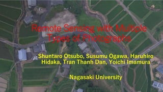
  • 1. Remote Sensing with Multiple Types of Photographs Shuntaro Otsubo, Susumu Ogawa, Haruhiro Hidaka, Tran Thanh Dan, Yoichi Imamura Nagasaki University
  • 2. Introduction Recently, UAV (Unmanned Aerial Vehicle) technology are developed rapidly. UAV may work at lower cost than satellite or aerial photos. The expansion of research for UAV is expected. However, the number of bands for UAV is less than satellite images. In this study, UAV, a digital camera, aerial photos, and satellite data were used in multiple types. Phantom 4
  • 3. Objectives • To get RGB, near infrared, and short infrared images with high resolution in multiple types by UAV and a digital camera. • To obtain NDVI and NDWI images with UAV and a digital camera. NDWI is a normalized difference water index. • To monitor vegetation covers and to make a land-use map with UAV and a digital camera.
  • 4. Photographing methods with UAV • IR72 filter is a band pass filter more than 720 nm. Near infrared photos are taken with UAV and a digital camera with an IR 72 filter. Additionally, IR90 filter is a band pass filter more than 900 nm. Short infrared photos are taken with UAV and a digital camera with an IR 90 filter. IR72 filter
  • 5. Methods: Paddy field map • Band 3 distributions were calculated in the survey field with PhotoScan. Band 3 distribution made paddy field maps because vegetation absorbed Band 3, red.
  • 7. NDVI at Onigi village (July 30 2016)
  • 8. RGB image with UAV NIR image with UAV NDVI image in Hasami with UAV
  • 9. Orthogonal images with UAV (left) and aerial photos (right) at Onigi village Resolution: 6 cm
  • 10. Fine resolution DEM at Onigi Resolution: ~10 cm
  • 11. NDWI at Onigi village (July 30 2016) Rice paddy fields
  • 12. Detecting a land use map at Onigi village Tea plantations Rice paddy fields Abandoned Fields
  • 13. CONCLUSIONS • RGB, near infrared, and short infrared images were obtained by a digital camera with band pass filters, while RGB and near infrared were inquired by UAV with 6 cm resolution. • NDVI images were obtained by a digital camera and UAV with IR72, while NDWI images were estimated by a digital camera with IR72 and IR90, which estimates water contents and permeability in soils. • Vegetation cover was monitored in any time and also land use map was obtained with fine-resolution DEM.
  • 14. Thank you for your attention