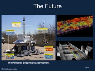
Downloaded 654 times

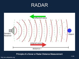
![RADAR
3 Dimensional Radar(TRMM PR)
[Hurricane Sandy, Oct. 28, 2012 at 1725 UTC (1:25 PM EDT)]http://trmm.gsfc.nasa.gov/ 8/45](https://image.slidesharecdn.com/20140417groundpenetratingradarc-1pt1-140417013022-phpapp01/85/Ground-Penetrating-Radar-Basic-and-Applications-for-Civil-Engineering-8-320.jpg)

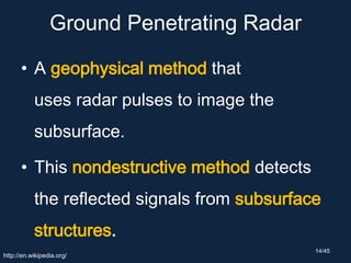

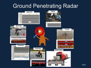


The document discusses ground penetrating radar (GPR), which uses radar pulses to image the subsurface. It explains that GPR can detect objects, material changes, and voids underground. The document then covers GPR principles, data acquisition, analysis, and applications in civil engineering projects like assessing bridge decks, detecting subsidence, and locating cultural artifacts. Examples of current GPR research, equipment, and software are also presented.


