Download as PDF, PPTX

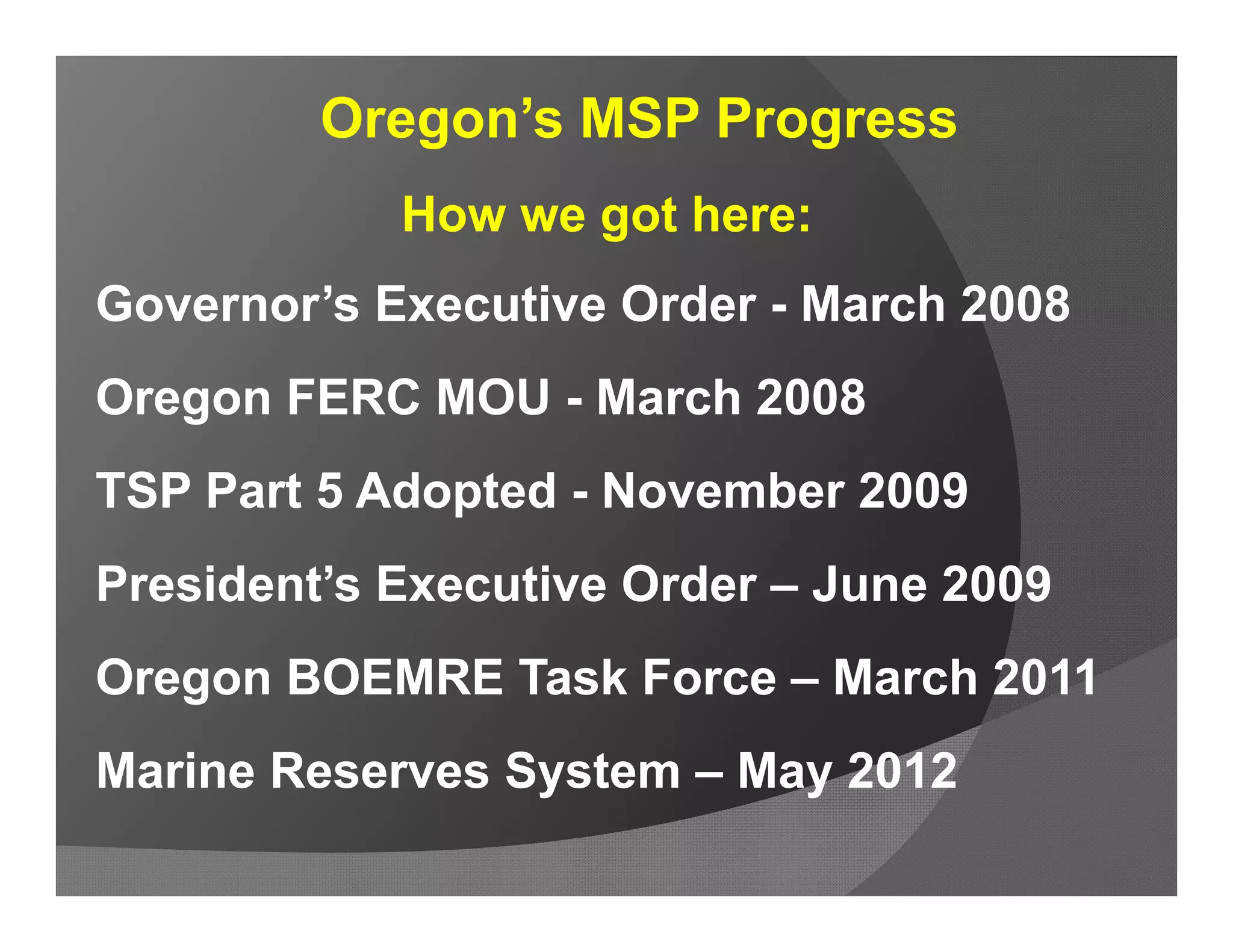
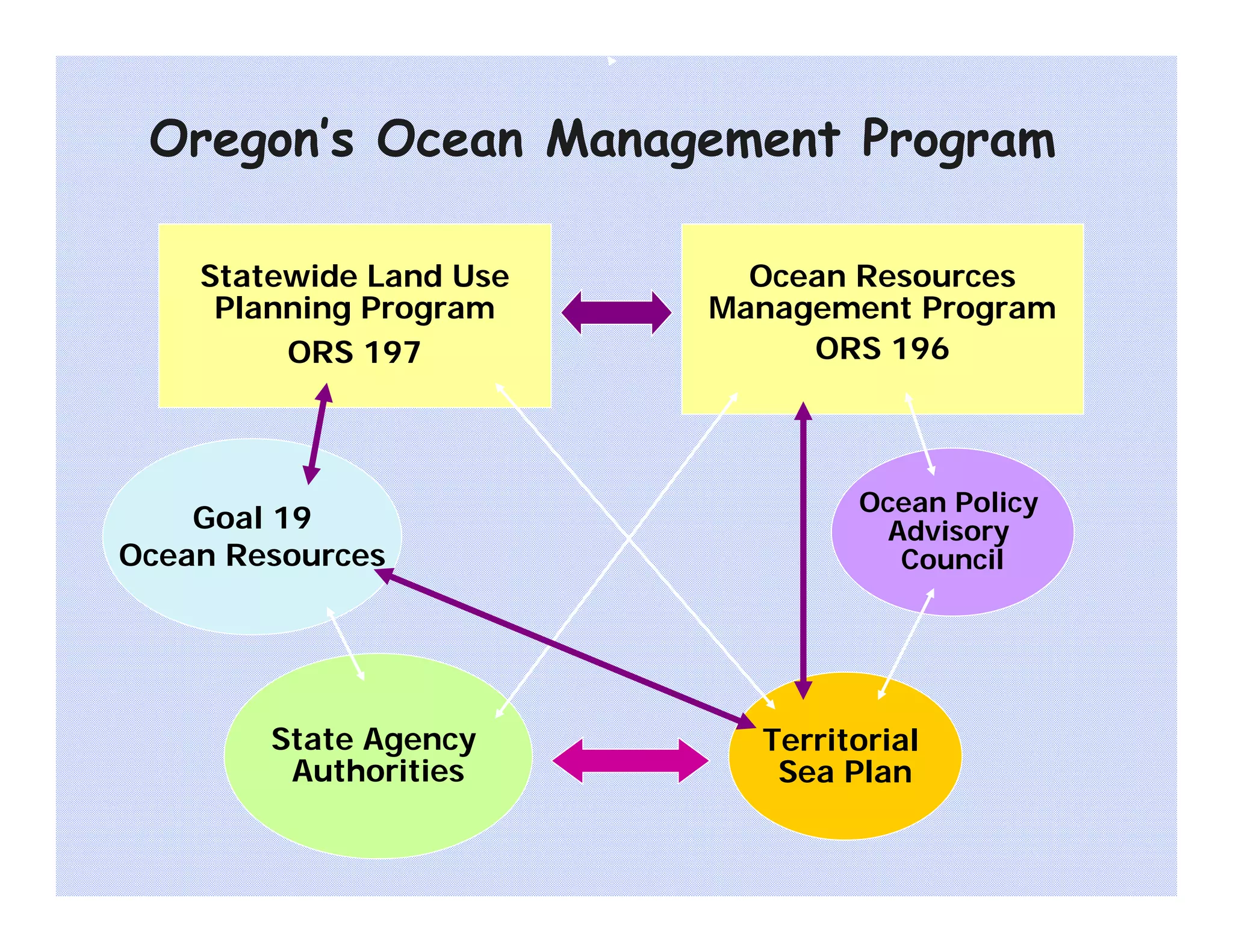
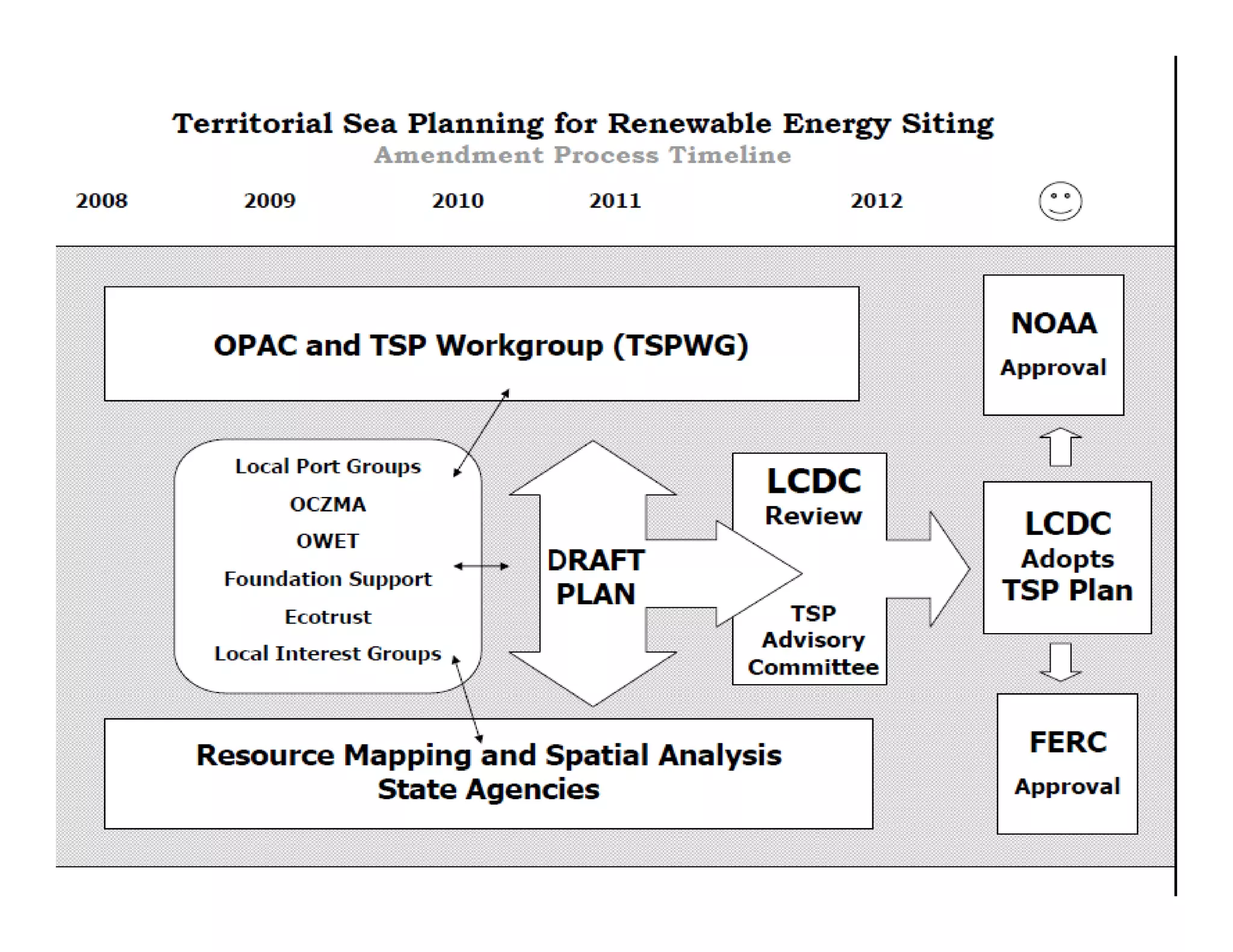
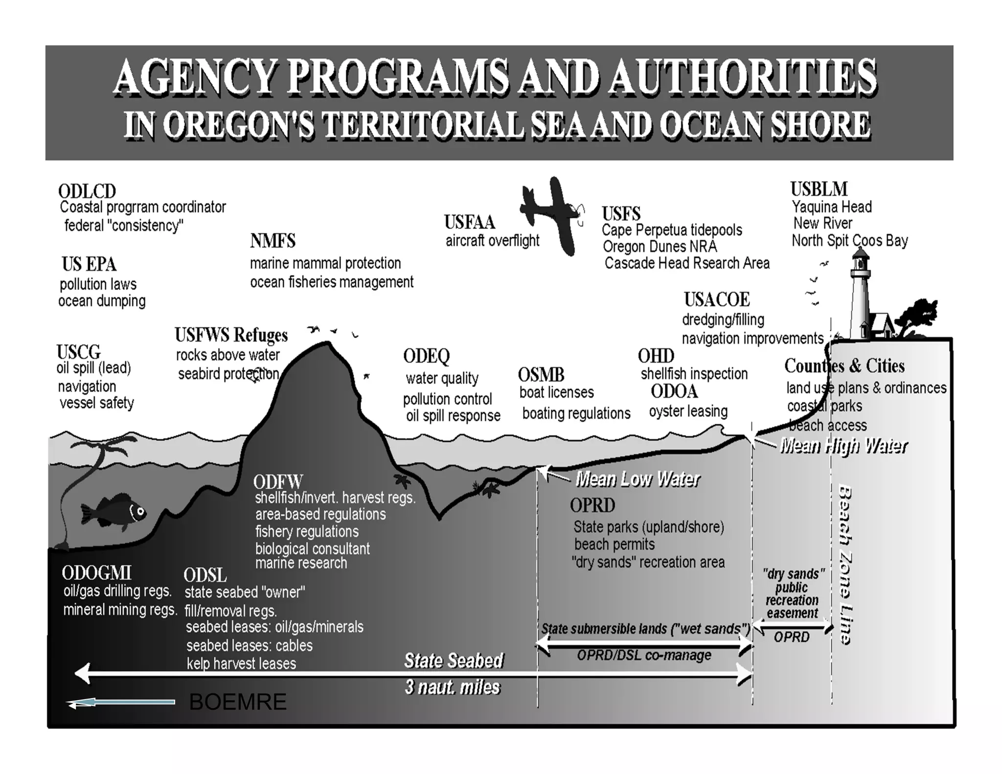
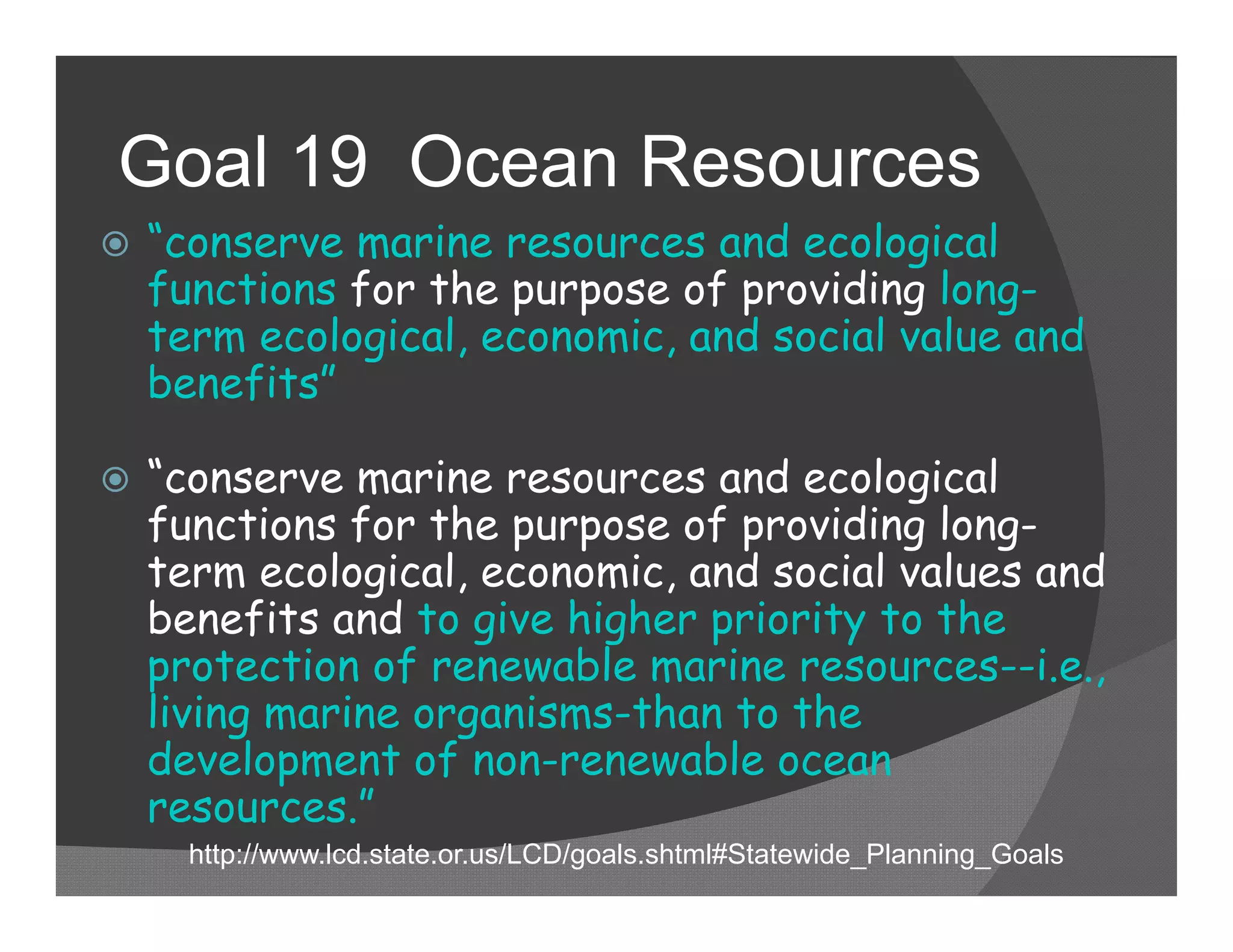
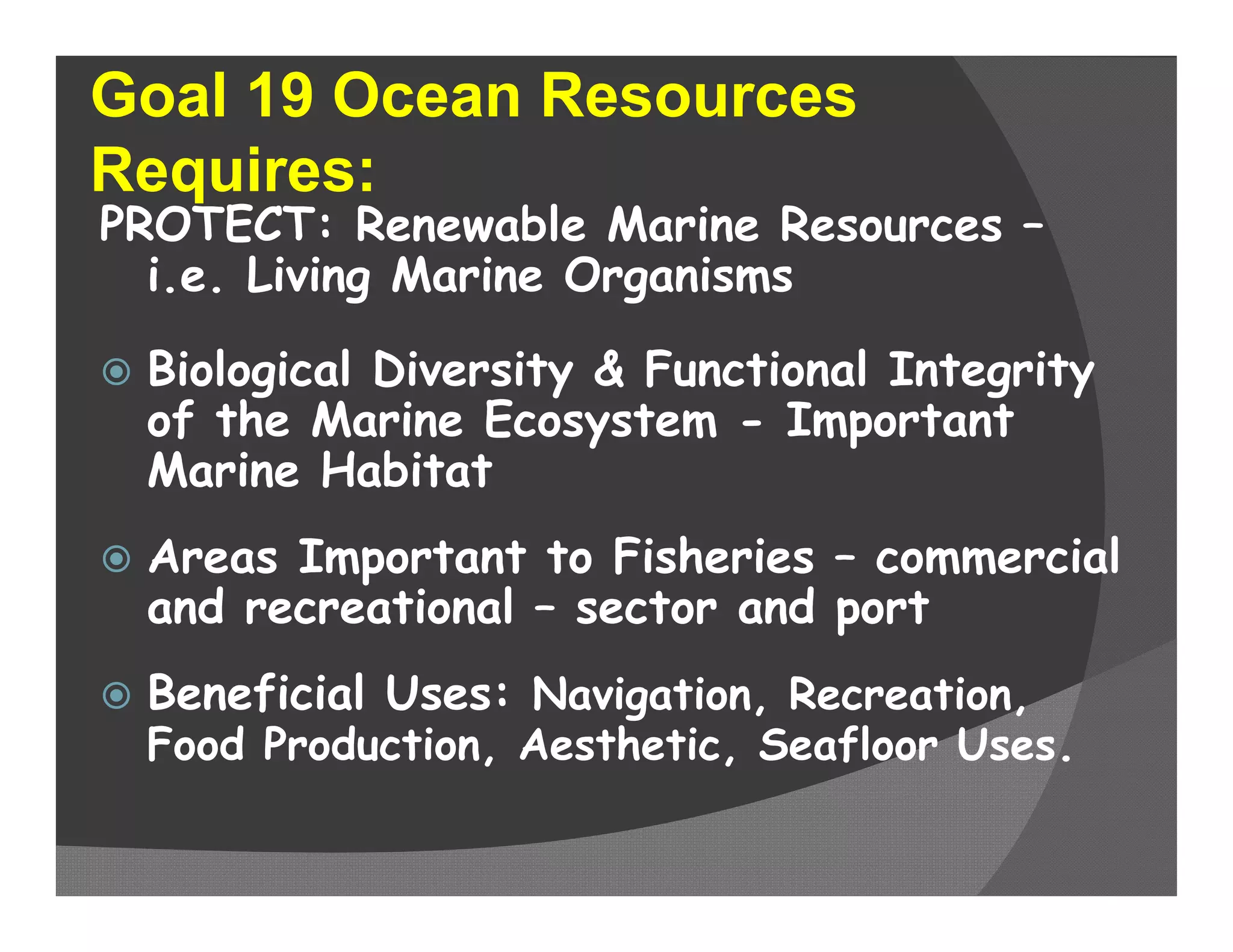
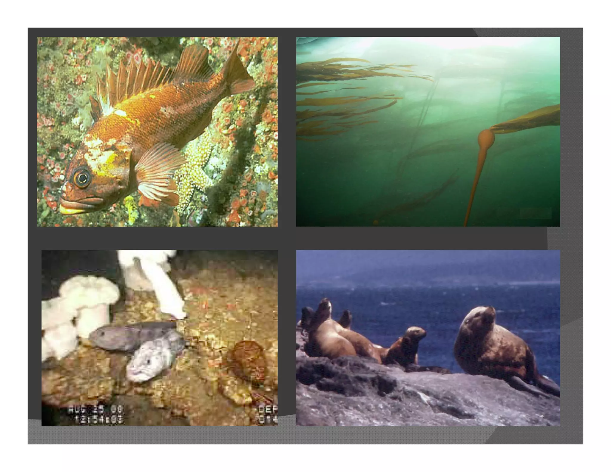
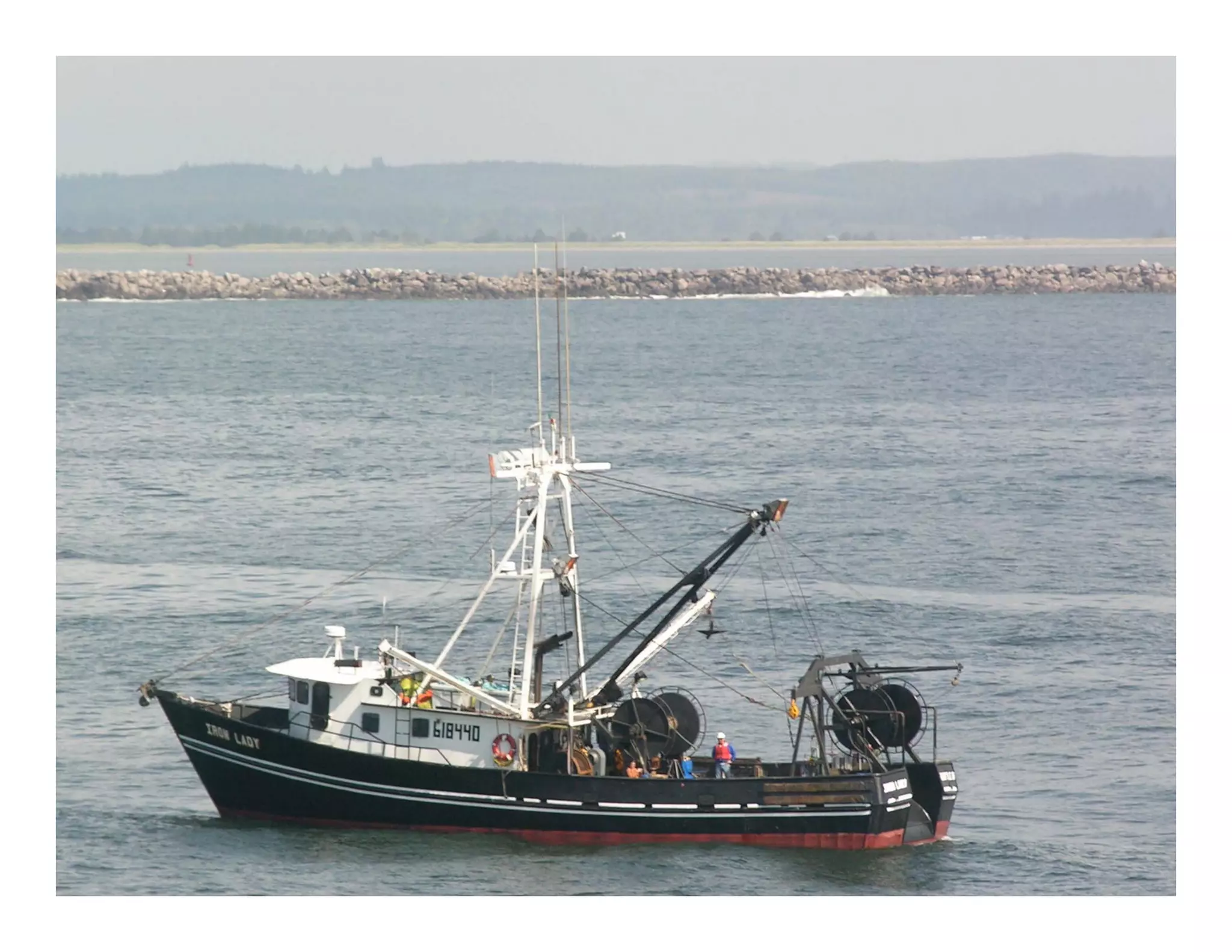


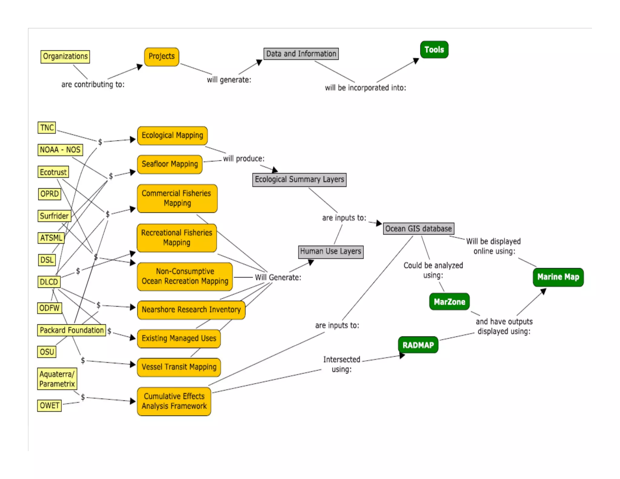
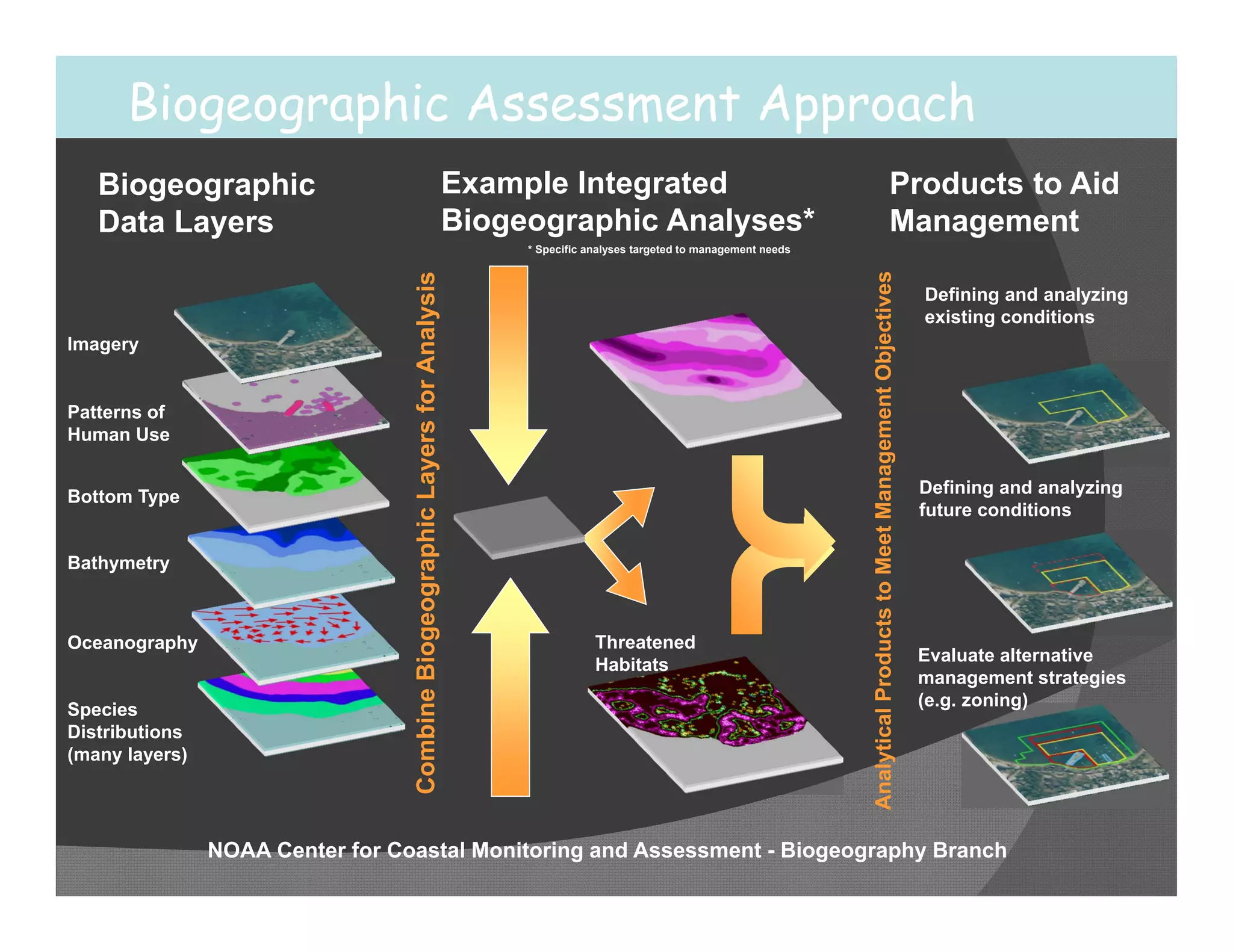
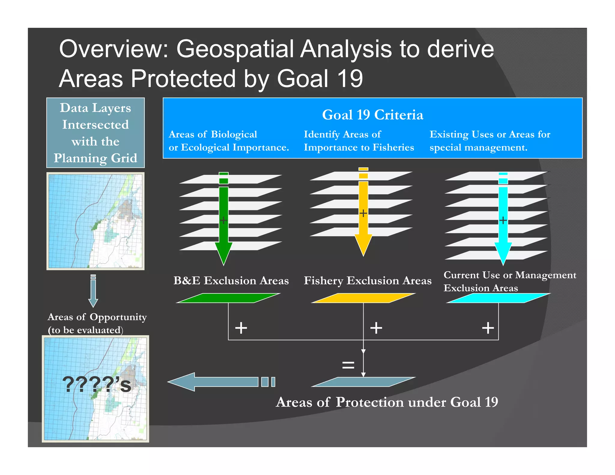
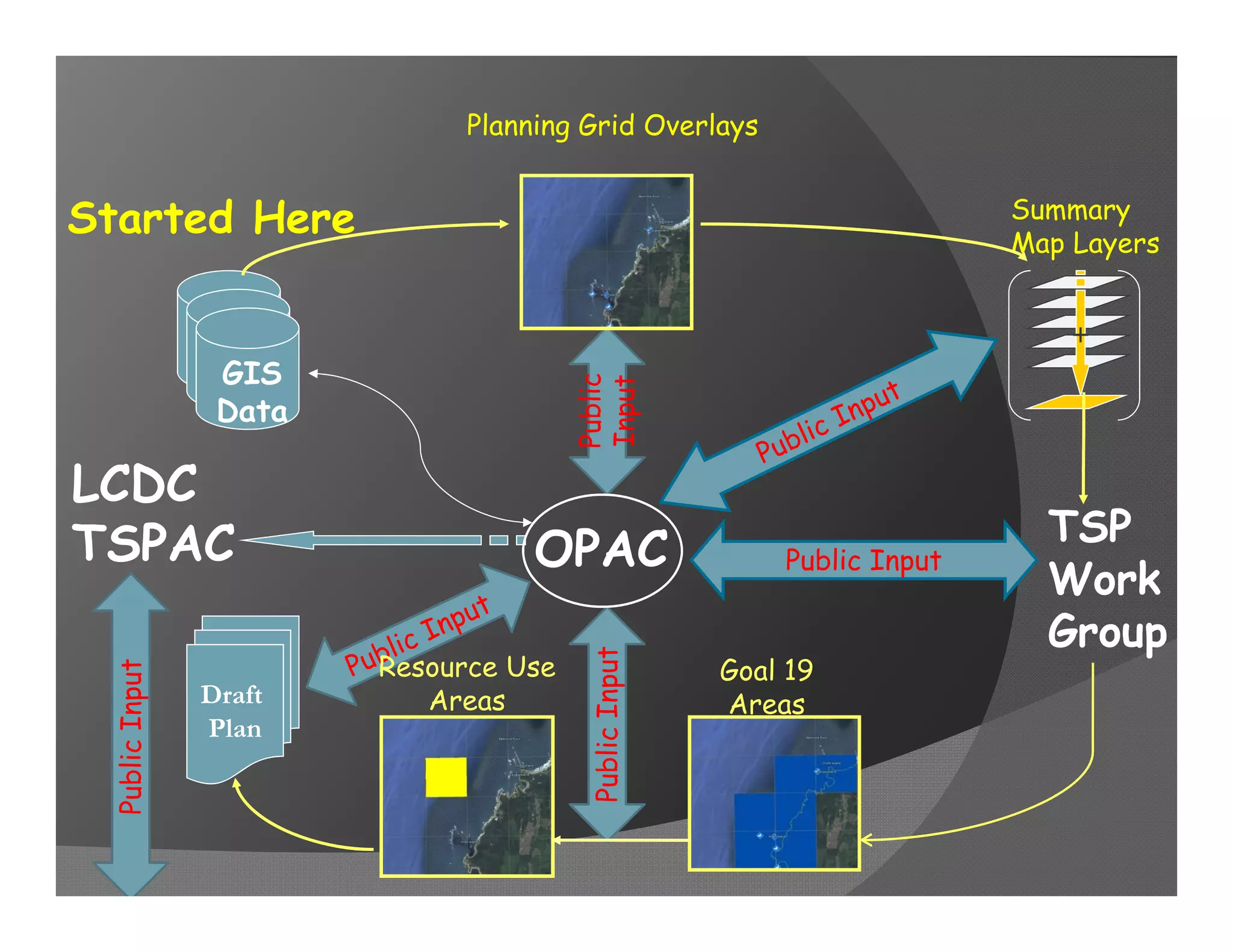
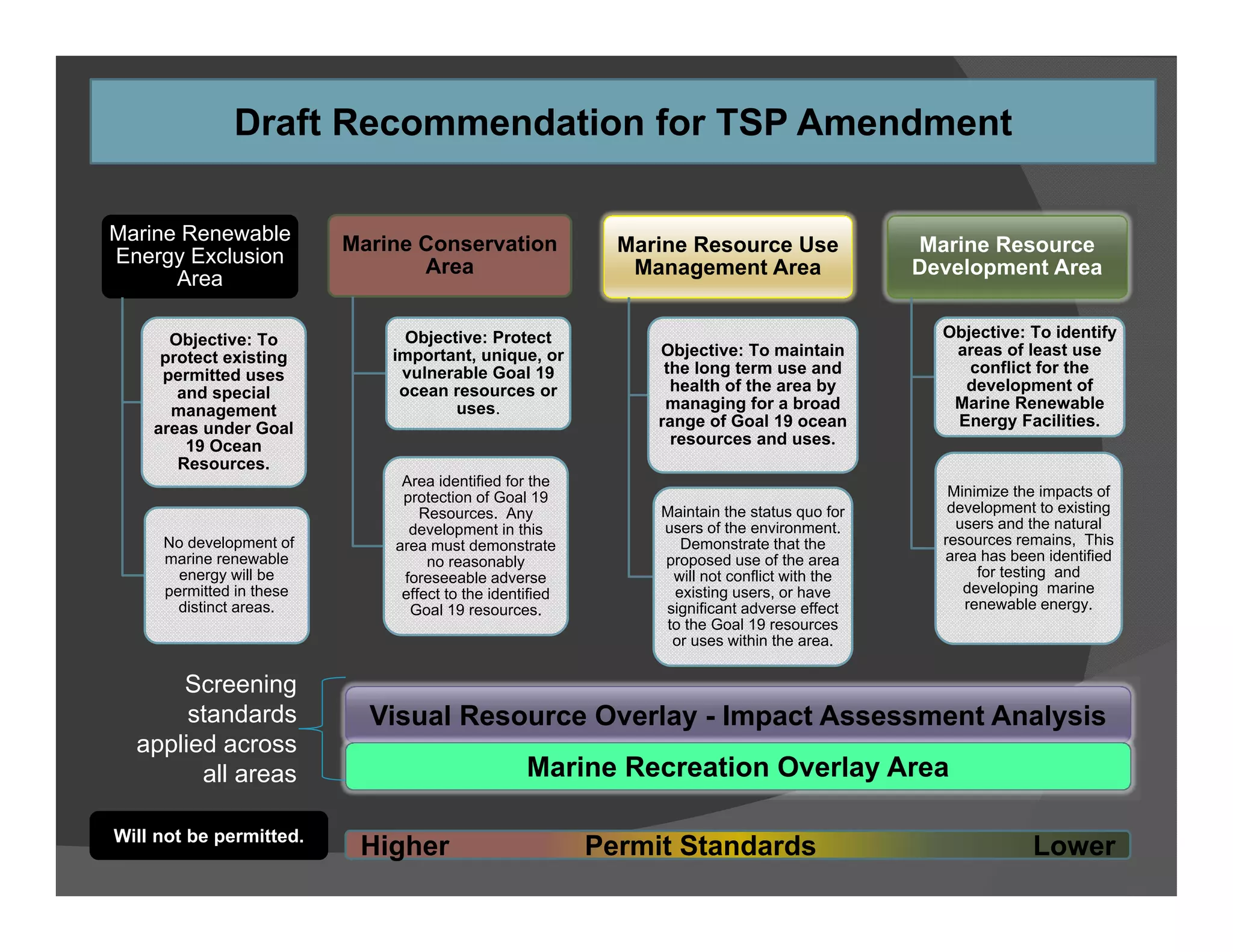
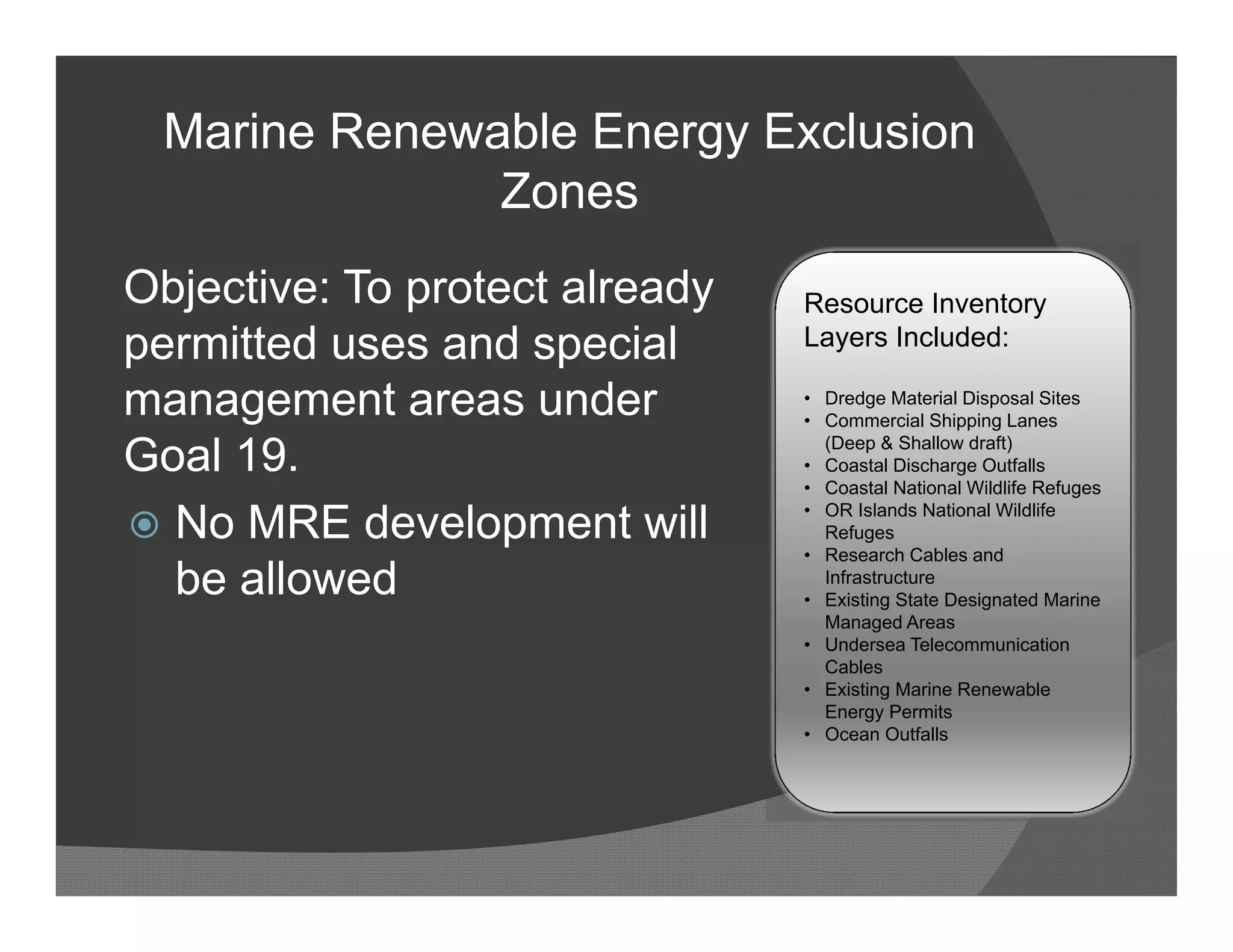

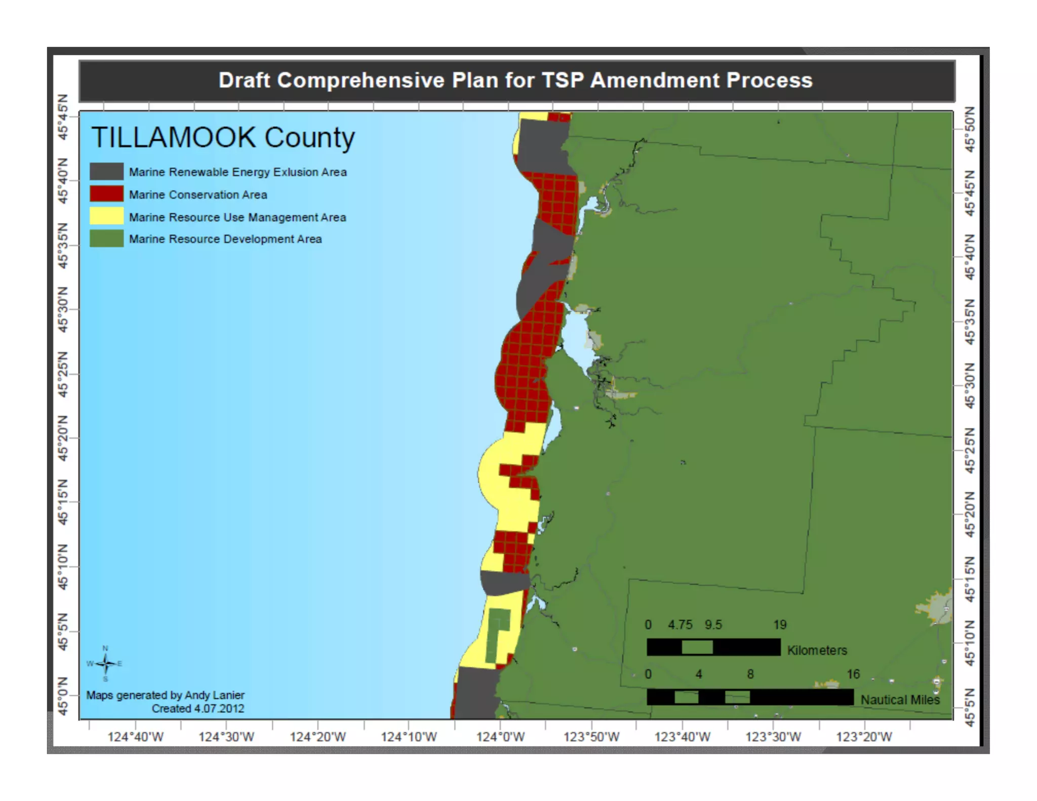
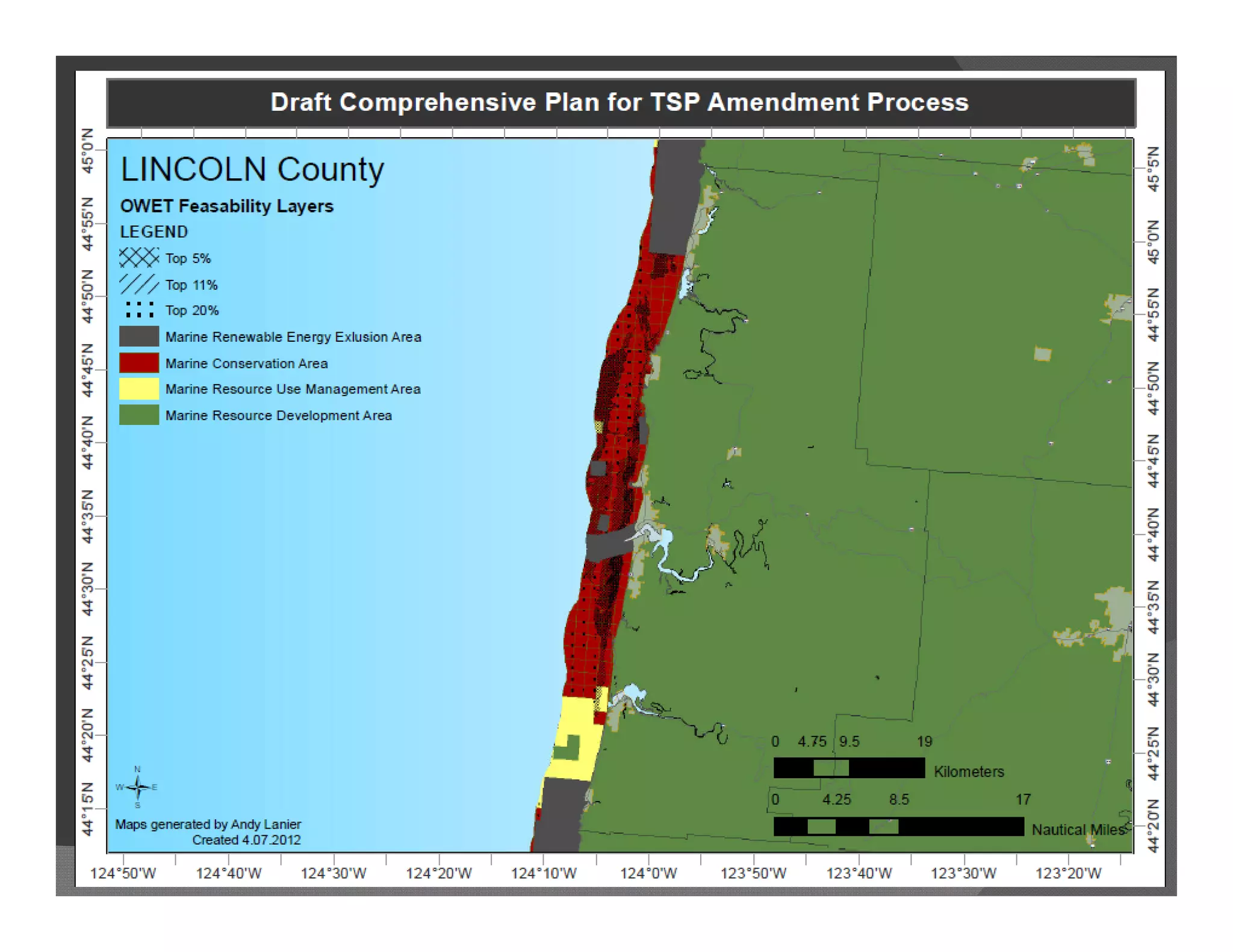
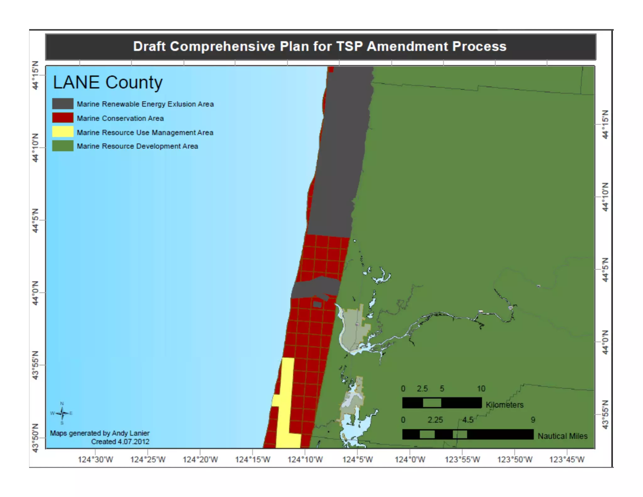
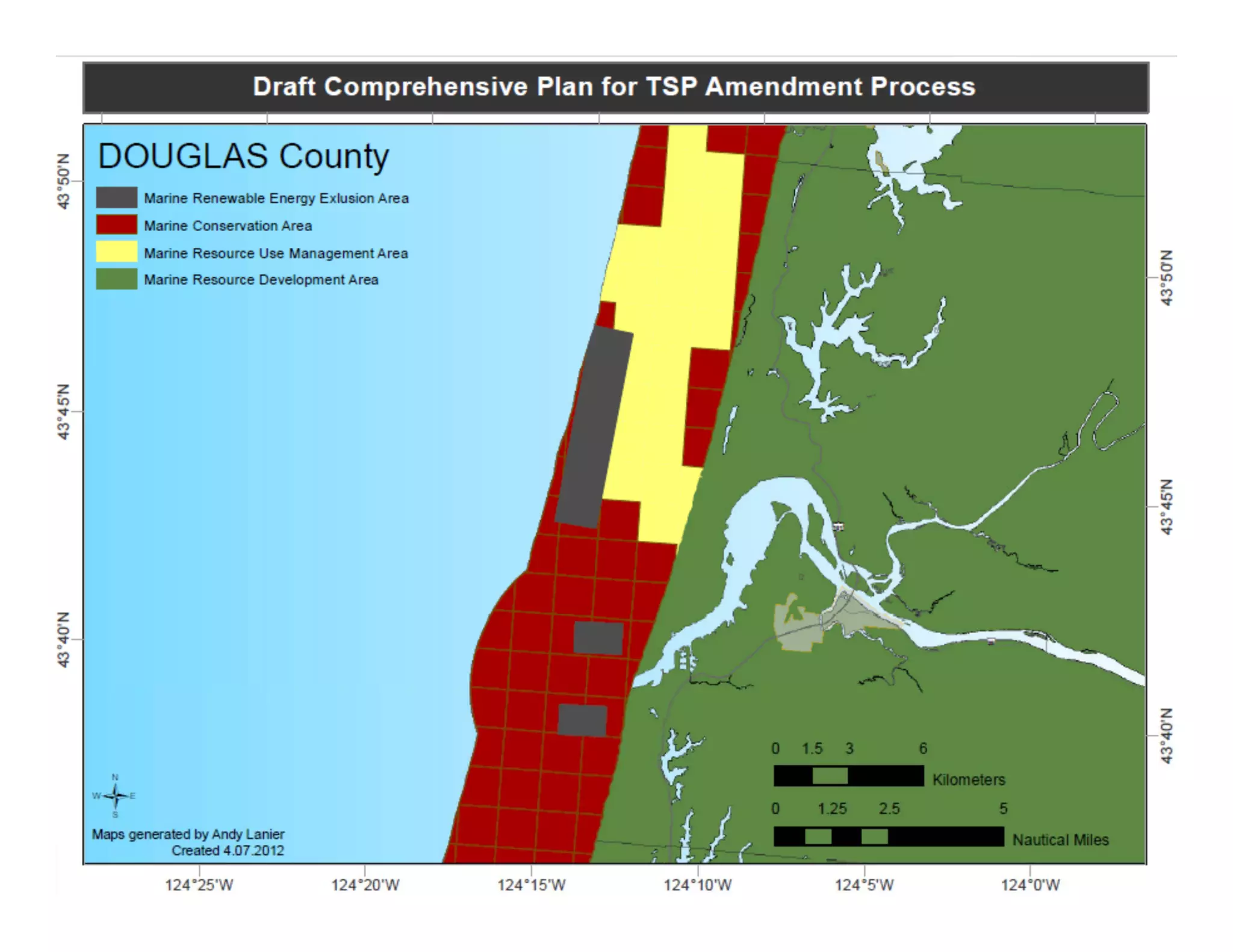
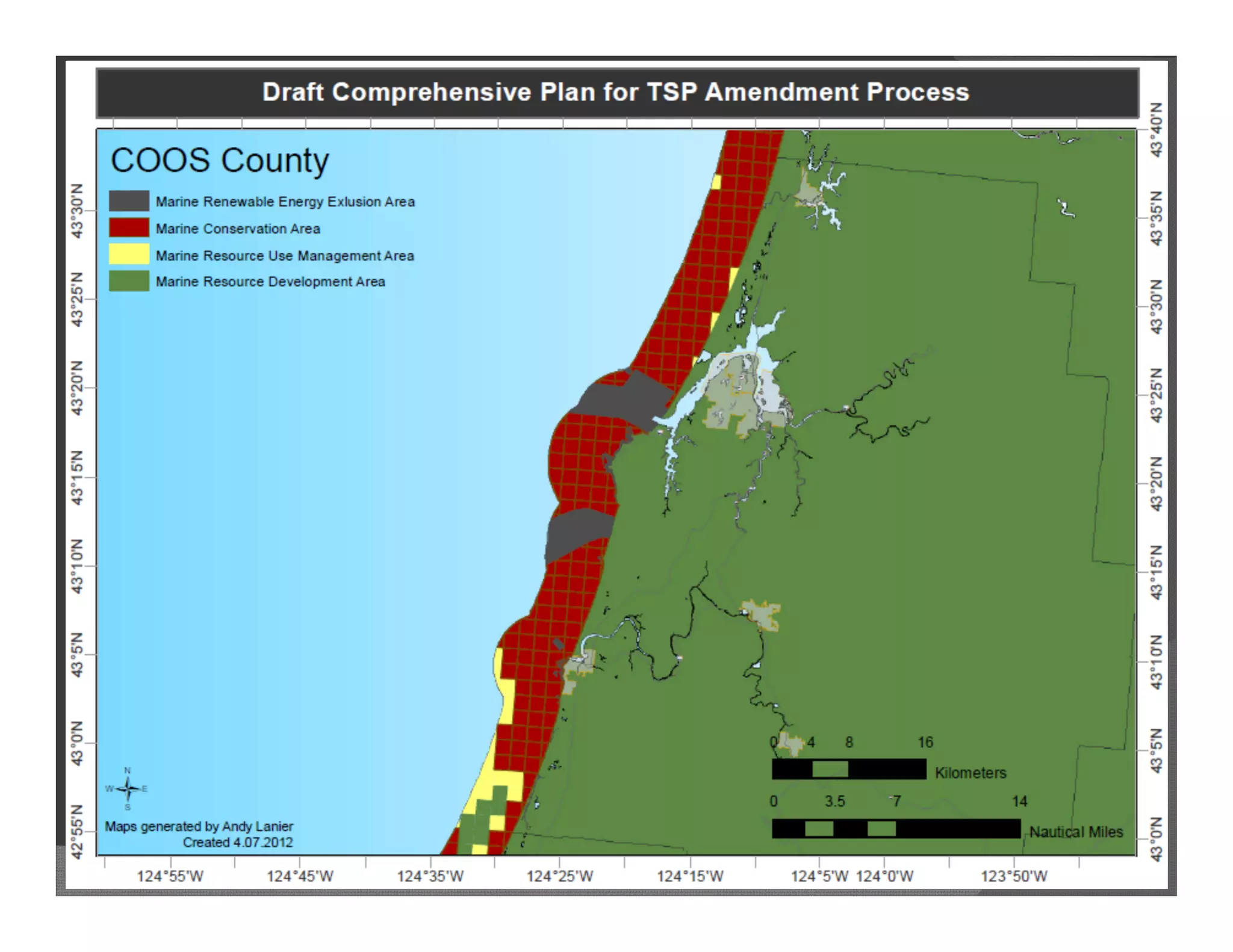
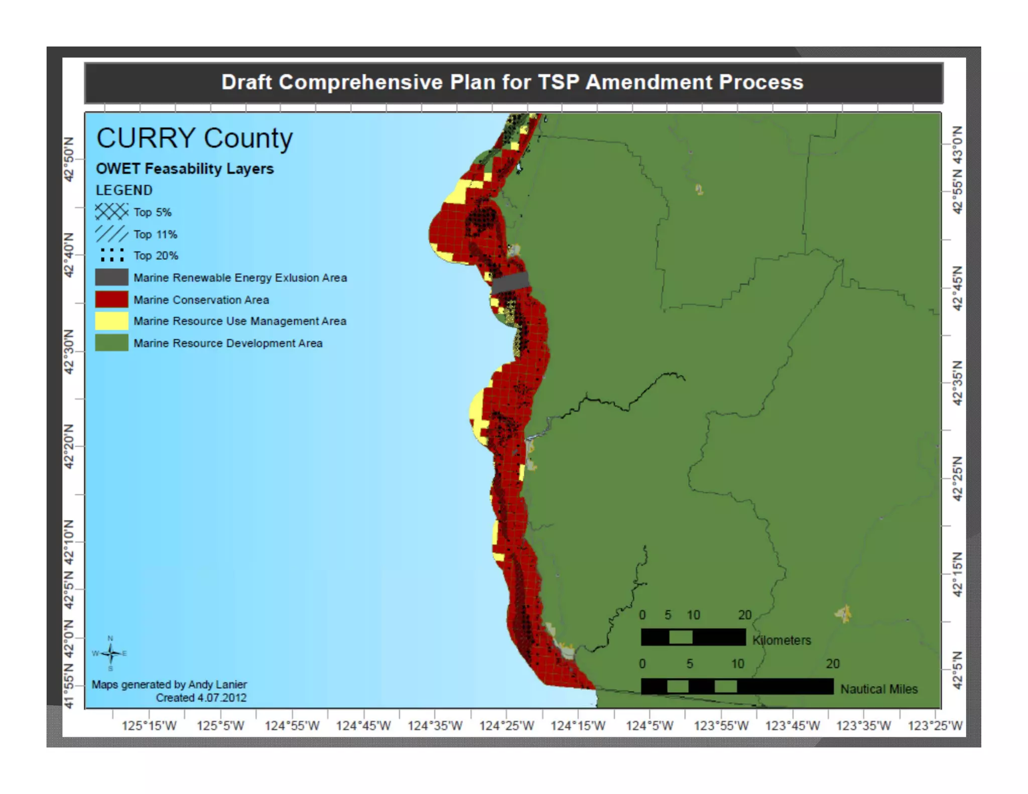


The document provides an overview of Oregon's marine spatial planning process. It discusses how the state developed its ocean management program through various executive orders and legislation over the past decade. Key aspects of the program include protecting renewable ocean resources like living marine organisms as outlined in the statewide planning goal 19, and establishing ocean management goals and authorities through the Ocean Policy Advisory Council and territorial sea plan. The document outlines Oregon's biogeographic assessment approach used to define areas protected by goal 19 and provides examples of spatial analysis tools and products used to aid marine resource management.


![[Day 2] Center Presentation: ICIMOD (1/2)](https://cdn.slidesharecdn.com/ss_thumbnails/cgiar-csi-day2-1apr2009-center-icimod-pt1-090405003340-phpapp02-thumbnail.jpg?width=640&height=640&fit=bounds)


